Arborfield and Newland

Civil Parish in Berkshire

England

Arborfield and Newland

Roundabout on Reading Road, Arborfield Cross
Roundabout on Reading Road, Arborfield Cross Credit: David Howard

Arborfield and Newland is a civil parish situated in the county of Berkshire, England. It is located approximately 5 miles south-east of the town of Reading and covers an area of around 6.5 square miles. The parish is made up of two main settlements, Arborfield and Newland, which are surrounded by picturesque countryside and farmland.

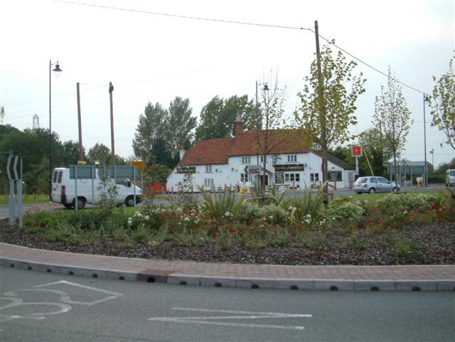
Arborfield, the larger of the two villages, has a rich history that dates back to the medieval period. It is known for its charming thatched cottages, traditional pubs, and the 12th-century Church of St Bartholomew. The village also boasts amenities such as a primary school, village hall, and a range of local shops and services.

Newland, on the other hand, is a smaller village located to the north of Arborfield. It is predominantly residential, with a mix of modern houses and older properties. The village benefits from its proximity to Arborfield, offering residents easy access to its amenities.

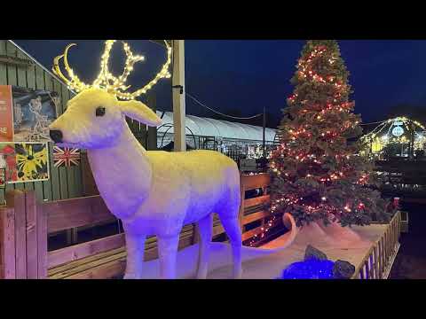
The civil parish of Arborfield and Newland is known for its strong community spirit and active local organizations. It hosts various events throughout the year, including a summer fete and a Christmas market, which bring residents together and foster a sense of belonging.

The area is also surrounded by beautiful countryside, offering plenty of opportunities for outdoor activities such as walking, cycling, and horse riding. Additionally, the nearby Barkham Ride provides a scenic route for nature enthusiasts.

Overall, Arborfield and Newland is a charming civil parish with a rich history, a close-knit community, and access to beautiful countryside, making it an attractive place to live and visit in Berkshire.

If you have any feedback on the listing, please let us know in the comments section below.

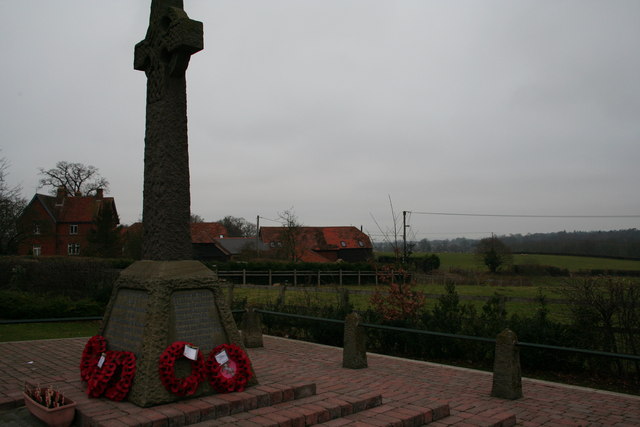
Arborfield and Newland Images

Images are sourced within 2km of 51.40178/-0.909624 or Grid Reference SU7567. Thanks to Geograph Open Source API. All images are credited.

Roundabout on Reading Road, Arborfield Cross
Arborfield Stores Londis stands for London Independent Supermarkets in case anyone wanted to know
Arborfield Stores
Londis stands for London Independent Supermarkets in case anyone wanted to know
Reading Road, Arborfield Cross
Poperinghe Way, Arborfield
Verge on Poperinghe Way, Arborfield
Poperinghe Way, Arborfield
The A327 Arborfield Road
Reading Road, Arborfield
Layby on Reading Road, Arborfield
St Bartholomew, Arborfield: early June 2016
School Road at the junction of Langley Common Road
St Bartholomew, Arborfield: church hall
St Bartholomew, Arborfield: churchyard (i)
St Bartholomew, Arborfield: churchyard (ii)
St Bartholomew, Arborfield: churchyard (iii) Also see <span class="nowrap"><a title="http://www.cwgc.org/find-war-dead/casualty/2436226/HYETT,%20JAMES" rel="nofollow ugc noopener" href="http://www.cwgc.org/find-war-dead/casualty/2436226/HYETT,%20JAMES">Link</a><img style="margin-left:2px;" alt="External link" title="External link - shift click to open in new window" src="https://s1.geograph.org.uk/img/external.png" width="10" height="10"/></span>
St Bartholomew, Arborfield: churchyard (iii)
Also see LinkExternal link
St Bartholomew, Arborfield: churchyard (iv) Also see <span class="nowrap"><a title="http://www.cwgc.org/find-war-dead/casualty/2436227/MEARING,%20WILLIAM%20ALBERT" rel="nofollow ugc noopener" href="http://www.cwgc.org/find-war-dead/casualty/2436227/MEARING,%20WILLIAM%20ALBERT">Link</a><img style="margin-left:2px;" alt="External link" title="External link - shift click to open in new window" src="https://s1.geograph.org.uk/img/external.png" width="10" height="10"/></span>
St Bartholomew, Arborfield: churchyard (iv)
Also see LinkExternal link
St Bartholomew, Arborfield: churchyard (v)
St Bartholomew, Arborfield: churchyard (vi)
Show me another place!

Arborfield and Newland is located at Grid Ref: SU7567 (Lat: 51.40178, Lng: -0.909624)

Unitary Authority: Wokingham

Police Authority: Thames Valley

What 3 Words

///monkey.laying.jubilant. Near Barkham, Berkshire

Related Wikis

Arborfield

Arborfield is a village and former civil parish, now in the parish of Arborfield and Newland, in the Borough of Wokingham, on the A327 road in Berkshire...

Arborfield Cross

Arborfield Cross is a village in the civil parish of Arborfield and Newland in the Borough of Wokingham in the English county of Berkshire. == Location... ==

Arborfield and Newland

Arborfield and Newland is a civil parish in the Wokingham district of Berkshire, England. It had a population of 2,228 according to the 2001 census, increasing...

International Cocoa Quarantine Centre

The International Cocoa Quarantine Centre (ICQC), located in Arborfield, a suburb of Reading, Berkshire, United Kingdom, is an organization aiming to reduce...

Related Videos

Nirvana Spa - Berkshire

Nirvana Spa - How I like to forget about the stresses of life and relax #spa #nirvana #pool #jacuzzi.

Reddam House Berkshire 360 Virtual Tour

Please use the hand to scroll around this amazing 360 degree clip! Also compatible with a virtual reality headset! Reddam House ...

Reddam House Berkshire Ad - nov20

Reddam House Berkshire Ad.

Nearby Amenities

Located within 500m of 51.40178,-0.909624
Crossing
Crossing: unmarked
Kerb: lowered
Tactile Paving: no
Lat/Long: 51.3977903/-0.9071156
Barrier: entrance
Bicycle: no
Foot: yes
Lat/Long: 51.4039284/-0.9117438
Bus Stop
Arborfield Walden Avenue
Naptan AtcoCode: 035077200002
Naptan NaptanCode: wokajtp
Public Transport: platform
Route Ref: 144
Source: survey
Lat/Long: 51.400584/-0.9161619
Bus Stop
Arborfield Walden Avenue
Naptan AtcoCode: 035077200001
Naptan NaptanCode: wokajtm
Public Transport: platform
Route Ref: 144
Source: survey
Lat/Long: 51.4005547/-0.9155465
Barrier: bollard
Bicycle: yes
Foot: yes
Lat/Long: 51.3998303/-0.9135032
Power: tower
Lat/Long: 51.4054997/-0.9088426
Power: tower
Lat/Long: 51.4013257/-0.9093646
Power: tower
Lat/Long: 51.3991682/-0.9090013
Power: tower
Lat/Long: 51.4034862/-0.9088894
Barrier: stile
Lat/Long: 51.3987702/-0.9094325
Bench
Lat/Long: 51.3978302/-0.9063154
Power: pole
Lat/Long: 51.4034709/-0.9159681
Bicycle Bypass Forward: yes
Direction: forward
Traffic Calming: chicane
Lat/Long: 51.3996546/-0.9063308
Waste Basket
Waste: dog_excrement
Lat/Long: 51.3987232/-0.9095146
Bench
Lat/Long: 51.3981177/-0.909441
Bench
Lat/Long: 51.3979586/-0.9104509
Give Way
Lat/Long: 51.4033438/-0.9061347
Bicycle Bypass Backward: yes
Direction: backward
Traffic Calming: chicane
Lat/Long: 51.3988791/-0.9066851
Bicycle Bypass Backward: yes
Direction: backward
Traffic Calming: chicane
Lat/Long: 51.3984025/-0.9083268
Bicycle Bypass Forward: yes
Direction: forward
Traffic Calming: chicane
Lat/Long: 51.3990737/-0.9100501
Bicycle Bypass Backward: yes
Direction: backward
Traffic Calming: chicane
Lat/Long: 51.3995286/-0.9114004
Bicycle Bypass Backward: yes
Direction: backward
Traffic Calming: chicane
Lat/Long: 51.4000778/-0.9139713
Bicycle Bypass Backward: yes
Direction: backward
Traffic Calming: chicane
Lat/Long: 51.4004246/-0.915148
Give Way
Lat/Long: 51.400518/-0.9158139
The data included in this document is from www.openstreetmap.org. The data is made available under ODbL.

Have you been to Arborfield and Newland?

Leave your review of Arborfield and Newland below (or comments, questions and feedback).