Arborfield Park

Downs, Moorland in Berkshire

England

Arborfield Park

Roundabout on Reading Road, Arborfield Cross
Roundabout on Reading Road, Arborfield Cross Credit: David Howard

Arborfield Park, located in Berkshire, England, is a picturesque open space that offers a blend of stunning downs and moorland scenery. Spanning over a vast area, the park is a popular destination for both locals and tourists seeking tranquility and outdoor activities.

The park boasts a diverse landscape, with gently rolling downs and wide expanses of moorland, creating a unique blend of natural beauty. The downs offer panoramic views of the surrounding countryside, with undulating hills and lush greenery as far as the eye can see. Visitors can take leisurely walks or hikes along the well-maintained trails, breathing in the fresh air and enjoying the serene atmosphere.

The moorland area of Arborfield Park is equally captivating, with its wild and rugged charm. It is home to a variety of plant and animal species, making it an ideal spot for nature enthusiasts and wildlife photographers. The moors are adorned with colorful heather and gorse, creating a vibrant and captivating landscape.

For those seeking recreational activities, Arborfield Park offers ample opportunities. There are designated picnic areas where families and friends can enjoy a leisurely meal surrounded by nature. Additionally, the park provides facilities for sports such as football, cricket, and rugby, allowing visitors to engage in friendly matches or simply enjoy a game with friends.

Arborfield Park is a true gem in Berkshire, offering a perfect blend of downs and moorland scenery. With its stunning vistas, diverse flora and fauna, and recreational facilities, it is a haven for nature lovers and outdoor enthusiasts alike. Whether you seek a peaceful walk, a picnic with loved ones, or an active day out, Arborfield Park has something to offer for everyone.

If you have any feedback on the listing, please let us know in the comments section below.

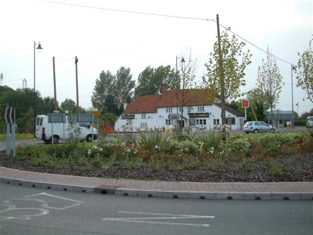
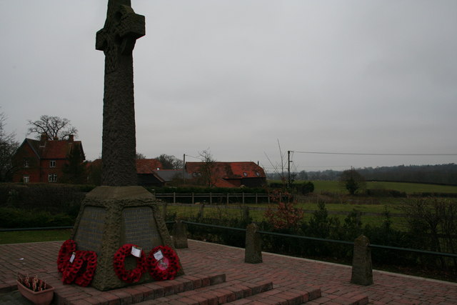
Arborfield Park Images

Images are sourced within 2km of 51.397431/-0.90993392 or Grid Reference SU7567. Thanks to Geograph Open Source API. All images are credited.

Roundabout on Reading Road, Arborfield Cross
Arborfield Stores Londis stands for London Independent Supermarkets in case anyone wanted to know
Arborfield Stores
Londis stands for London Independent Supermarkets in case anyone wanted to know
Reading Road, Arborfield Cross
Poperinghe Way, Arborfield
Verge on Poperinghe Way, Arborfield
Poperinghe Way, Arborfield
The A327 Arborfield Road
Whitehall Drive at the junction of Baird Road
Green by Whitehall Road, Arborfield Garrison
Reading Road, Arborfield
Layby on Reading Road, Arborfield
St Bartholomew, Arborfield: early June 2016
School Road at the junction of Langley Common Road
St Bartholomew, Arborfield: church hall
St Bartholomew, Arborfield: churchyard (i)
St Bartholomew, Arborfield: churchyard (ii)
St Bartholomew, Arborfield: churchyard (iii) Also see <span class="nowrap"><a title="http://www.cwgc.org/find-war-dead/casualty/2436226/HYETT,%20JAMES" rel="nofollow ugc noopener" href="http://www.cwgc.org/find-war-dead/casualty/2436226/HYETT,%20JAMES">Link</a><img style="margin-left:2px;" alt="External link" title="External link - shift click to open in new window" src="https://s1.geograph.org.uk/img/external.png" width="10" height="10"/></span>
St Bartholomew, Arborfield: churchyard (iii)
Also see LinkExternal link
St Bartholomew, Arborfield: churchyard (iv) Also see <span class="nowrap"><a title="http://www.cwgc.org/find-war-dead/casualty/2436227/MEARING,%20WILLIAM%20ALBERT" rel="nofollow ugc noopener" href="http://www.cwgc.org/find-war-dead/casualty/2436227/MEARING,%20WILLIAM%20ALBERT">Link</a><img style="margin-left:2px;" alt="External link" title="External link - shift click to open in new window" src="https://s1.geograph.org.uk/img/external.png" width="10" height="10"/></span>
St Bartholomew, Arborfield: churchyard (iv)
Also see LinkExternal link
Show me another place!

Arborfield Park is located at Grid Ref: SU7567 (Lat: 51.397431, Lng: -0.90993392)

Unitary Authority: Wokingham

Police Authority: Thames Valley

What 3 Words

///treble.proposals.ballpoint. Near Barkham, Berkshire

Related Wikis

Arborfield Cross

Arborfield Cross is a village in the civil parish of Arborfield and Newland in the Borough of Wokingham in the English county of Berkshire. == Location... ==

Arborfield

Arborfield is a village and former civil parish, now in the parish of Arborfield and Newland, in the Borough of Wokingham, on the A327 road in Berkshire...

Arborfield and Newland

Arborfield and Newland is a civil parish in the Wokingham district of Berkshire, England. It had a population of 2,228 according to the 2001 census, increasing...

Hundred of Charlton

Charlton was a hundred in the English county of Berkshire. Like all hundreds, although never abolished, it effectively ceased to function after 1886. Charlton...

Nearby Amenities

Located within 500m of 51.397431,-0.90993392
Crossing
Crossing: unmarked
Kerb: lowered
Tactile Paving: no
Lat/Long: 51.3977903/-0.9071156
Barrier: cycle_barrier
Lat/Long: 51.3963685/-0.9088327
Barrier: cycle_barrier
Lat/Long: 51.3962062/-0.9086535
Crossing
Crossing: unmarked
Kerb: lowered
Sloped Curb: yes
Source: survey
Lat/Long: 51.3964089/-0.9088831
Arborfield
Place: village
Wikidata: Q2753711
Lat/Long: 51.3963375/-0.9054306
Bus Stop
Arborfield Cross / The Swan (nr)
Naptan AtcoCode: 035077220002
Naptan NaptanCode: wokajwa
Public Transport: platform
Route Ref: 144
Source: survey
Lat/Long: 51.3953721/-0.9056884
Post Box
Mapillary: 315843637312161
Post Box Design: type_k
Post Box Type: pillar
Royal Cypher: EIIR
Royal Cypher Wikidata: Q33102113
Survey Date: 2022-03-27
Lat/Long: 51.3954891/-0.9057431
Bus Stop
Arborfield Cross / The Swan (Opp)
Bus: yes
Naptan AtcoCode: 035077220001
Naptan NaptanCode: wokajtw
Public Transport: platform
Route Ref: 144
Source: survey
Lat/Long: 51.3967603/-0.9060451
Barrier: bollard
Bicycle: yes
Bollard: fixed
Colour: brown
Foot: yes
Horse: yes
Material: wood
Motor Vehicle: designated
Width: 2.2
Lat/Long: 51.3998303/-0.9135032
Barrier: bollard
Bicycle: yes
Foot: yes
Horse: yes
Motor Vehicle: designated
Lat/Long: 51.3962122/-0.9095233
Recycling
Location: overground
Recycling Clothes: yes
Recycling Glass: yes
Recycling Type: container
Lat/Long: 51.3968715/-0.90881
Waste Basket
Lat/Long: 51.3968668/-0.9088025
Arborfield & Newland
Information: map
Map Size: region
Map Type: street
Tourism: information
Lat/Long: 51.3968573/-0.9087853
Car Wash
Village Hand Car Wash
Lat/Long: 51.3958638/-0.9056268
Barrier: cycle_barrier
Lat/Long: 51.3957153/-0.9045394
Barrier: cycle_barrier
Lat/Long: 51.3954493/-0.9037166
Barrier: cycle_barrier
Lat/Long: 51.3972354/-0.911798
Waste Basket
Lat/Long: 51.3972703/-0.9117742
Bench
Backrest: no
Colour: brown
Material: wood
Lat/Long: 51.3972165/-0.9116099
Crossing
Crossing: unmarked
Kerb: lowered
Sloped Curb: yes
Source: survey
Lat/Long: 51.3949498/-0.9073292
Power: tower
Lat/Long: 51.4013257/-0.9093646
Power: tower
Lat/Long: 51.3991682/-0.9090013
Power: tower
Lat/Long: 51.3939816/-0.9083853
Power: tower
Lat/Long: 51.3970679/-0.9087775
Crossing
Crossing: unmarked
Kerb: lowered
Sloped Curb: yes
Lat/Long: 51.3961738/-0.9094303
Cafe
Henry Street Garden Centre cafe
Addr City: Reading
Addr Housename: Henry Street Garden Centre
Addr Postcode: RG2 9JY
Addr Street: Swallowfield Road
Addr Suburb: Arborfield
Cuisine: regional;coffee_shop;sandwich;fish_and_chips
Opening Hours: Mo-Sa 09:00-17:30; Su 10:30-16:30
Outdoor Seating: yes
Website: https://www.henrystreet.co.uk/
Wheelchair: yes
Lat/Long: 51.3956621/-0.9136482
Barrier: stile
Lat/Long: 51.3987702/-0.9094325
Bench
Lat/Long: 51.3978302/-0.9063154
Bench
Lat/Long: 51.3976489/-0.9060785
Crossing
Crossing: uncontrolled
Crossing Island: yes
Kerb: lowered
Source: Bing
Lat/Long: 51.3973666/-0.9063863
Crossing
Crossing: unmarked
Kerb: lowered
Source: Bing
Lat/Long: 51.3975377/-0.9060761
Crossing
Crossing: unmarked
Kerb: lowered
Sloped Curb: yes
Source: Bing
Lat/Long: 51.3975265/-0.9068711
Crossing
Crossing: uncontrolled
Crossing Island: yes
Kerb: lowered
Source: Bing
Lat/Long: 51.3973719/-0.9065115
Barrier: kerb
Kerb: lowered
Tactile Paving: yes
Lat/Long: 51.3973484/-0.9063323
Crossing
Crossing: unmarked
Kerb: lowered
Source: Bing
Lat/Long: 51.3973783/-0.9060468
Crossing
Crossing: uncontrolled
Crossing Island: yes
Kerb: lowered
Source: Bing
Lat/Long: 51.3948946/-0.9054457
Traffic Signals
Source: Bing
Traffic Signals Direction: backward
Lat/Long: 51.395015/-0.905481
Traffic Signals
Source: Bing
Traffic Signals Direction: forward
Lat/Long: 51.3950729/-0.9054995
Crossing
Crossing: traffic_signals
Crossing Ref: pelican
Kerb: lowered
Source: seen on journey
Lat/Long: 51.3950449/-0.9054906
Arborfield Cross
Place: locality
Wikidata: Q4784903
Lat/Long: 51.3976172/-0.9065235
Give Way
Direction: forward
Source: Bing
Lat/Long: 51.3947941/-0.9055015
Crossing
Crossing: uncontrolled
Crossing Island: yes
Kerb: lowered
Source: Bing
Lat/Long: 51.3945465/-0.9053676
Bicycle Bypass Forward: yes
Direction: forward
Traffic Calming: chicane
Lat/Long: 51.3996546/-0.9063308
Crossing
Crossing: unmarked
Kerb: lowered
Sloped Curb: yes
Source: Bing
Lat/Long: 51.3965447/-0.9030187
Give Way
Direction: forward
Source: Bing
Lat/Long: 51.3946876/-0.9053373
Public Bookcase
Booth: K6
Disused Amenity: telephone
Man Made: telephone_box
Mapillary: 496069058664405
Public Bookcase Type: phone_box
Survey Date: 2022-03-27
Tourism: information
Lat/Long: 51.3974406/-0.9067166
Bus Stop
British Legion
Lat/Long: 51.394096/-0.905356
Sally Ann’s Hair Salon
Shop: hairdresser
Lat/Long: 51.3965966/-0.9058402
Waste Basket
Waste: dog_excrement
Lat/Long: 51.3987232/-0.9095146
Bench
Lat/Long: 51.3981177/-0.909441
Bench
Lat/Long: 51.3979586/-0.9104509
Direction: 200
Generator Method: photovoltaic
Generator Output Electricity: yes
Generator Solar Modules: 16
Generator Source: solar
Generator Type: solar_photovoltaic_panel
Location: roof
Power: generator
Lat/Long: 51.3972514/-0.9047904
Direction: 240
Generator Method: photovoltaic
Generator Output Electricity: yes
Generator Solar Modules: 11
Generator Source: solar
Generator Type: solar_photovoltaic_panel
Location: roof
Power: generator
Lat/Long: 51.3951105/-0.9071952
Direction: 135
Generator Method: photovoltaic
Generator Output Electricity: yes
Generator Solar Modules: 12
Generator Source: solar
Generator Type: solar_photovoltaic_panel
Location: roof
Power: generator
Lat/Long: 51.3956213/-0.907315
Direction: 165
Generator Method: photovoltaic
Generator Output Electricity: yes
Generator Solar Modules: 16
Generator Source: solar
Generator Type: solar_photovoltaic_panel
Location: roof
Power: generator
Lat/Long: 51.394964/-0.9062727
Entrance: yes
Lat/Long: 51.3955048/-0.9130575
Defibrillator
Defibrillator Location: outside Arborfield Village Hall - down right hand side
Emergency: defibrillator
Lat/Long: 51.3958071/-0.9060281
Slide Deck
Email: lydia@slidedeck.co.uk
Opening Hours: Mo-Fr 09:00-17:00
Phone: +44 118 304 4330
Website: https://www.slidedeck.co.uk
Lat/Long: 51.3960147/-0.9074391
Bicycle Bypass Backward: yes
Direction: backward
Traffic Calming: chicane
Lat/Long: 51.3988791/-0.9066851
Bicycle Bypass Backward: yes
Direction: backward
Traffic Calming: chicane
Lat/Long: 51.3984025/-0.9083268
Bicycle Bypass Forward: yes
Direction: forward
Traffic Calming: chicane
Lat/Long: 51.3990737/-0.9100501
Bicycle Bypass Backward: yes
Direction: backward
Traffic Calming: chicane
Lat/Long: 51.3995286/-0.9114004
Bicycle Bypass Backward: yes
Direction: backward
Traffic Calming: chicane
Lat/Long: 51.4000778/-0.9139713
Bicycle Bypass Backward: yes
Direction: backward
Traffic Calming: chicane
Lat/Long: 51.4004246/-0.915148
Bicycle Bypass Forward: yes
Direction: forward
Traffic Calming: chicane
Lat/Long: 51.3963121/-0.9091084
Barrier: kerb
Kerb: lowered
Tactile Paving: yes
Lat/Long: 51.3973807/-0.9064283
Barrier: kerb
Kerb: lowered
Tactile Paving: yes
Lat/Long: 51.3973809/-0.9064815
Barrier: kerb
Kerb: lowered
Tactile Paving: yes
Lat/Long: 51.3973635/-0.9065394
Barrier: kerb
Kerb: lowered
Tactile Paving: yes
Lat/Long: 51.3973956/-0.9060348
Barrier: kerb
Kerb: lowered
Tactile Paving: yes
Lat/Long: 51.3973594/-0.9060629
Barrier: kerb
Kerb: lowered
Tactile Paving: yes
Lat/Long: 51.3975533/-0.9060751
Barrier: kerb
Kerb: lowered
Tactile Paving: yes
Lat/Long: 51.3975152/-0.9060777
The data included in this document is from www.openstreetmap.org. The data is made available under ODbL.

Have you been to Arborfield Park?

Leave your review of Arborfield Park below (or comments, questions and feedback).