Appletreewick
Civil Parish in Yorkshire Craven
England
Appletreewick

Appletreewick is a charming civil parish located in the Craven district of North Yorkshire, England. Situated in the picturesque Yorkshire Dales National Park, this small village is surrounded by stunning natural beauty and offers a tranquil escape from the bustling city life.
The village is nestled in the valley of the River Wharfe, with rolling hills and lush greenery providing a breathtaking backdrop to the area. Appletreewick is known for its idyllic countryside views, with many walking trails and hiking routes attracting outdoor enthusiasts and nature lovers.
The village itself is home to a close-knit community, with a population of around 140 people. The traditional stone-built houses and charming cottages give Appletreewick a timeless appeal, while the local pub, the Craven Arms, is a popular gathering spot for both locals and visitors.
One of the village's main attractions is the stunning natural landmark, Parcevall Hall Gardens. These beautiful gardens are known for their extensive collection of plants and flowers, offering visitors a peaceful retreat to explore and enjoy.
Appletreewick is also famous for its annual scarecrow festival, where creative and imaginative scarecrows are displayed throughout the village, delighting both children and adults alike.
With its rich history, natural beauty, and friendly community, Appletreewick is a hidden gem in the heart of Yorkshire. Whether you're looking to escape the hustle and bustle of city life or explore the great outdoors, this quaint village has something to offer everyone.
If you have any feedback on the listing, please let us know in the comments section below.
Appletreewick Images
Images are sourced within 2km of 54.069542/-1.892923 or Grid Reference SE0763. Thanks to Geograph Open Source API. All images are credited.


Appletreewick is located at Grid Ref: SE0763 (Lat: 54.069542, Lng: -1.892923)
Division: West Riding
Administrative County: North Yorkshire
District: Craven
Police Authority: North Yorkshire
What 3 Words
///luckier.bits.frightens. Near Grassington, North Yorkshire
Nearby Locations
Related Wikis
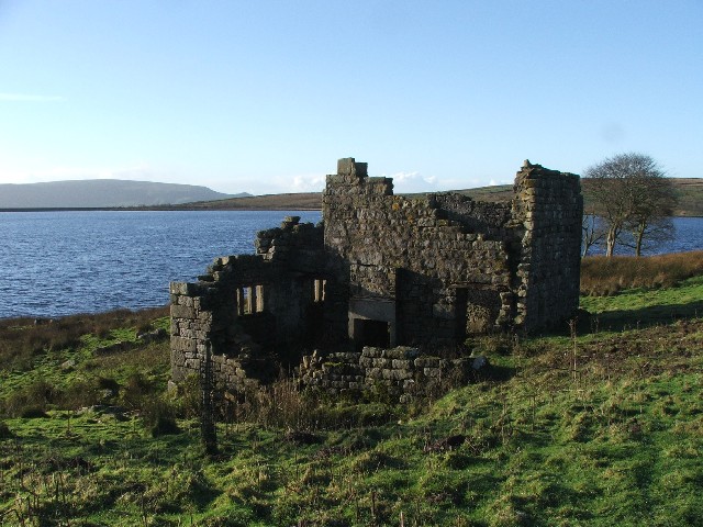
Grimwith Reservoir
Grimwith Reservoir is located in the Yorkshire Dales in North Yorkshire, England. It was originally built by the Bradford Corporation as one of eleven...

Stump Cross Caverns
Stump Cross Caverns is a limestone cave system between Wharfedale and Nidderdale in North Yorkshire, England. == Geography == The caverns at Stump Cross...

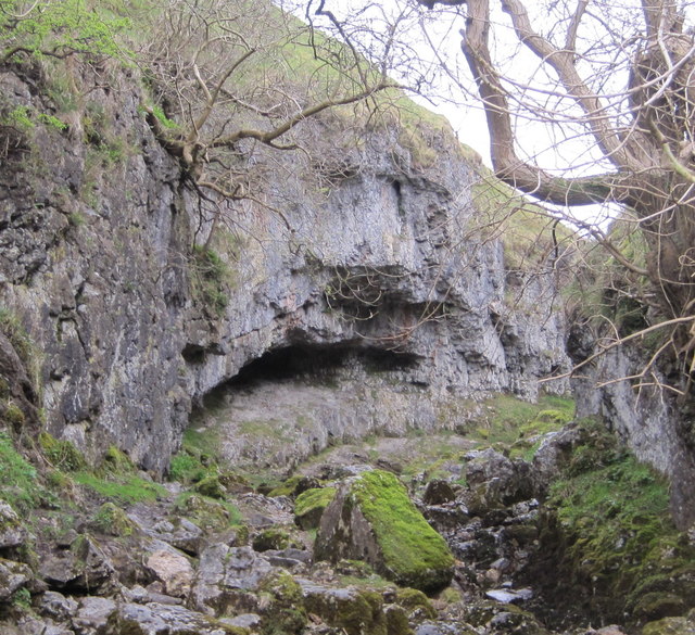
Trollers Gill
Trollers Gill is a limestone gill or gorge in North Yorkshire, England, close to the village of Skyreholme and 4.7 miles (7.5 km) south-east of Grassington...
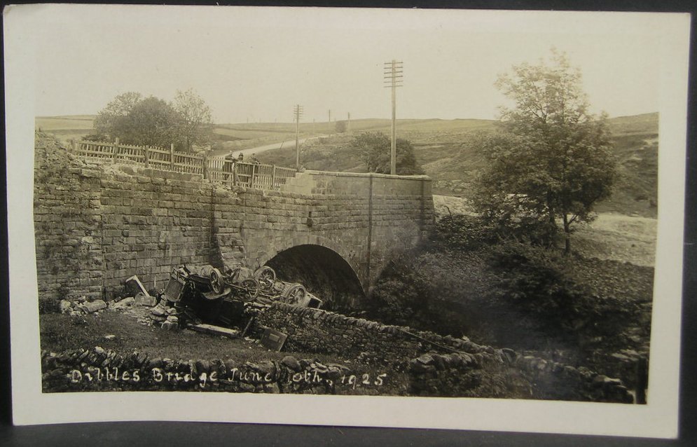
1925 Dibbles Bridge coach crash
On 10 June 1925, a coach crashed at the bottom of a steep hill at Dibbles Bridge, near Hebden in North Yorkshire, England. Seven people were killed and...

1975 Dibbles Bridge coach crash
On 27 May 1975, a coach carrying elderly passengers crashed at the bottom of a steep hill at Dibble's Bridge, near Hebden in North Yorkshire, England....

Parcevall Hall
Parcevall Hall -- also known as Parceval Hall -- and its gardens are located at Skyreholme near Appletreewick village, Wharfedale, North Yorkshire, England...

Skyreholme
Skyreholme is a hamlet in Wharfedale in the Yorkshire Dales, North Yorkshire, England. It lies 1-mile (1.6 km) east of Appletreewick, in the small side...

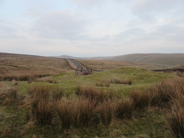
Simon's Seat
Simon's Seat is a peak in the Yorkshire Dales in northern England. It is a prominent outcrop of millstone grit on the eastern side of Wharfedale. Although...
Nearby Amenities
Located within 500m of 54.069542,-1.892923Have you been to Appletreewick?
Leave your review of Appletreewick below (or comments, questions and feedback).