Brick Houses

Settlement in Derbyshire

England

Brick Houses

Beneath November clouds at Totley Bents Another view of "The Cricket Inn".
Beneath November clouds at Totley Bents Credit: Neil Theasby

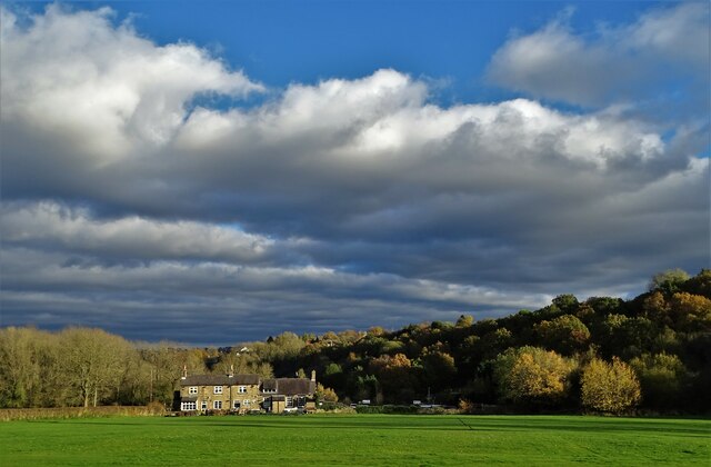
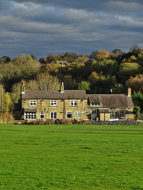
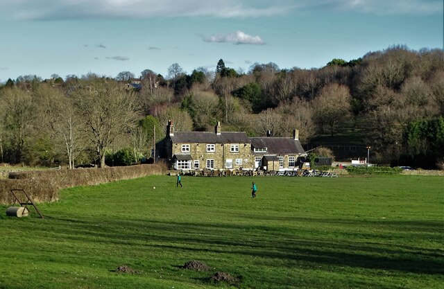
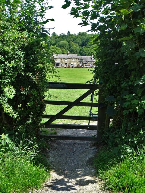
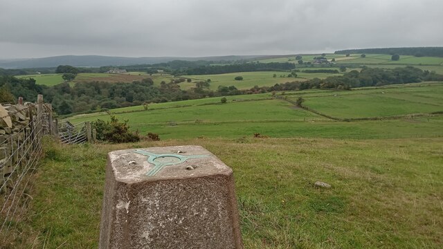
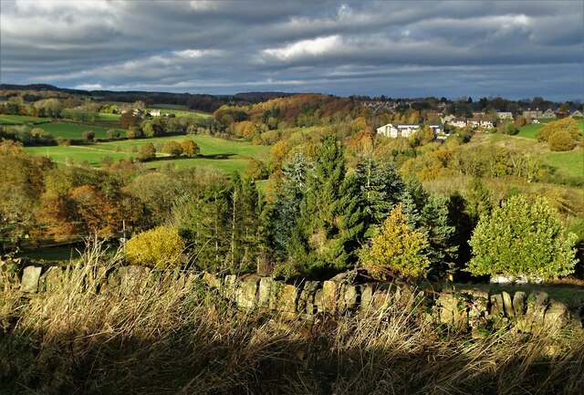
Brick Houses is a quaint village located in Derbyshire, England. Situated amidst the picturesque countryside, this rural settlement offers a charming and tranquil environment for its residents. The village is surrounded by rolling hills, lush green fields, and meandering streams, creating an idyllic setting that attracts visitors from near and far.

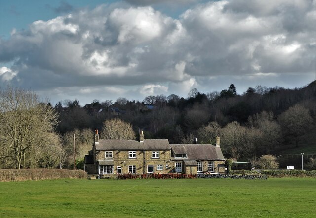
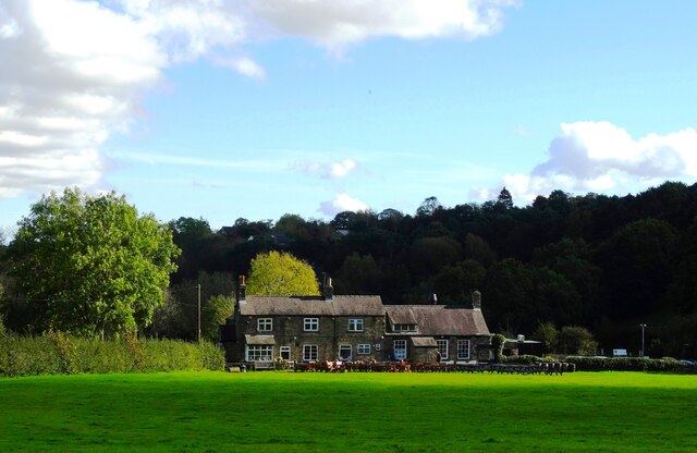
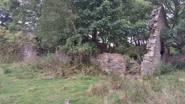
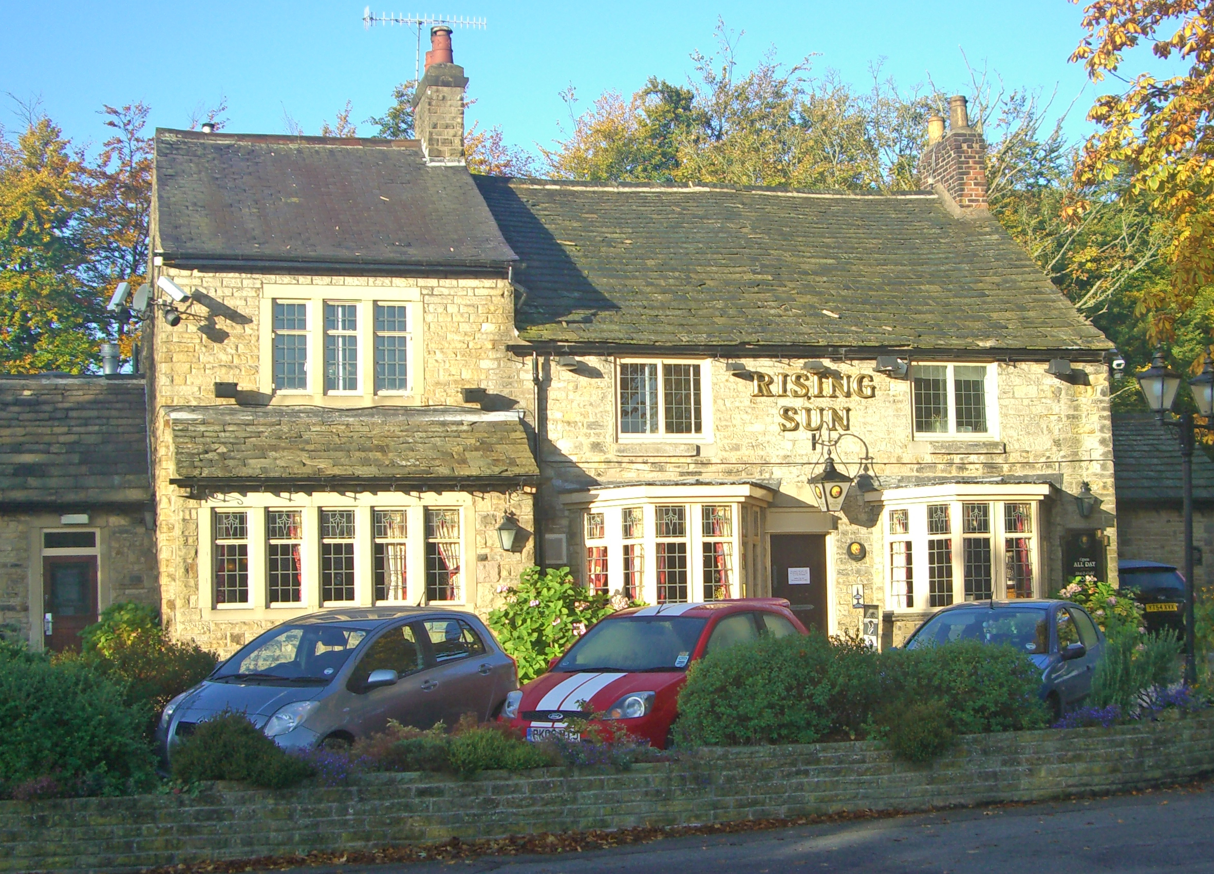
One of the defining features of Brick Houses is its architecture. As the name suggests, the village is known for its abundance of brick houses, which lend a sense of character and warmth to the area. These traditional buildings, with their red bricks and charming façades, contribute to the overall aesthetic appeal of the village.

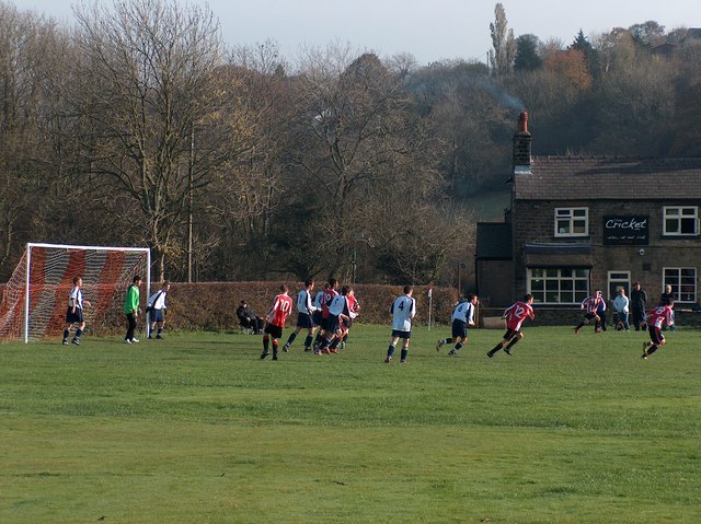
In addition to its architectural beauty, Brick Houses boasts a close-knit community that is known for its hospitality and friendliness. The village has a small but vibrant population, with residents often engaging in activities and events that foster a sense of unity and togetherness. The community is proud of its heritage and takes great care to preserve the village's historical landmarks and traditions.

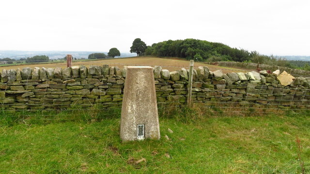
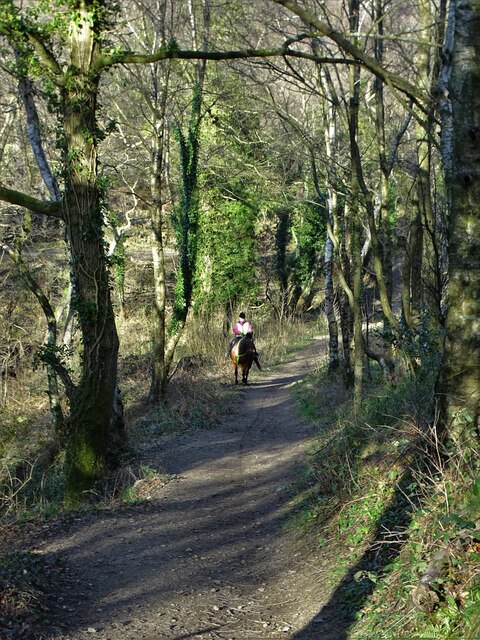
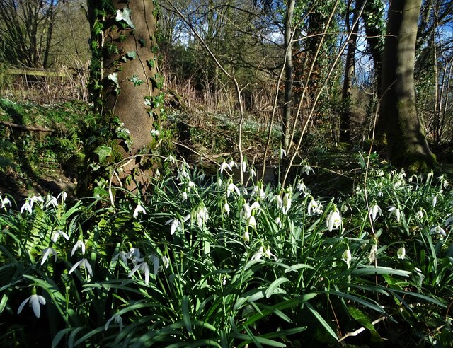
Brick Houses is also blessed with natural beauty, with several walking trails and nature reserves in close proximity. Outdoor enthusiasts can explore the surrounding countryside, taking in the breathtaking views and enjoying the tranquility of the area. The village is also conveniently located near larger towns and cities, providing easy access to amenities and services.

Overall, Brick Houses offers a charming retreat from the hustle and bustle of city life. With its beautiful architecture, close-knit community, and stunning natural surroundings, it is a destination that captures the hearts of both residents and visitors alike.

If you have any feedback on the listing, please let us know in the comments section below.
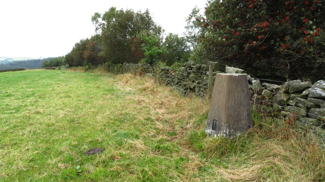
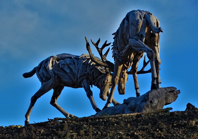
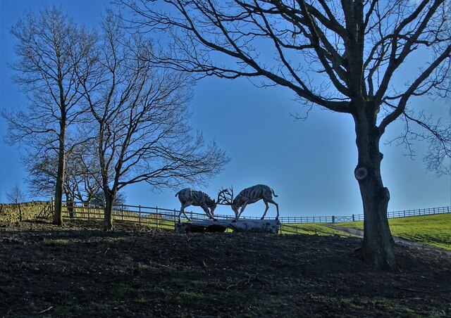
Brick Houses Images

Images are sourced within 2km of 53.333588/-1.547212 or Grid Reference SK3081. Thanks to Geograph Open Source API. All images are credited.

Beneath November clouds at Totley Bents Another view of "The Cricket Inn".
Beneath November clouds at Totley Bents
Another view of "The Cricket Inn".
"The Cricket Inn"  in  Totley Bents On the edge of the city of Sheffield.
"The Cricket Inn" in Totley Bents
On the edge of the city of Sheffield.
"The Cricket Inn", Totley Bents in early springtime Two brothers, still in school uniform, are playing football on the playing-field.
"The Cricket Inn", Totley Bents in early springtime
Two brothers, still in school uniform, are playing football on the playing-field.
Gate to Totley Bents Recreation Ground With "The Cricket Inn" at the other side of the field.
Gate to Totley Bents Recreation Ground
With "The Cricket Inn" at the other side of the field.
"The Cricket Inn" at Totley Bents
Yet another image of "The Cricket Inn" Viewed across the recreation ground at Totley Bents
Yet another image of "The Cricket Inn"
Viewed across the recreation ground at Totley Bents
Sunday Junior Football near The Cricket Inn, Totley.
The Cricket Inn, Totley
A Trig with Neighbours According to this site there are 244,282 grid-squares containing land in Britain.
An accurate figure of the number of trig points still standing, though, isn't so easy to come by. This is mostly because the serious trig-bagging websites include in their lists the sites of now-destroyed ones, and also often list more minor structures involved in triangulation. (Though I'm sure if I got the hang of various filters in the complicated looking searchboxes it could be done). Online articles celebrating Rob Woodall's completion of all Britain's trig points in 2016 put the figure at 6,190.
Since this impressive feat took over a decade though - including a two-year wait for a landowner to grant access to one pillar - it is likely the figure is slightly lower now, due to them being destroyed or moved by landowners (they are not protected structures as a lot of people think), and general effects of the weather.
If 6,190 is taken as the figure, though, it means that there is a trig point for every 39 grid-squares, on average. Which makes this tiny part of Britain something of an anomaly I'm sure. Not only is there a trig point in the grid-square immediately West of this one; there is another two squares South of that one. This means that a 3x2 block contains three trig points. Since none of them sit on particularly difficult terrain, there is the very unusual possibility of visiting three trig points on a leisurely two to three hour circular walk.
This one's official name is 'Ringinglow', and it first got used in calculations in 1948. There is a moderate steady incline from the North, but on the opposite side the field dips down quite steeply.
A Trig with Neighbours
According to this site there are 244,282 grid-squares containing land in Britain. An accurate figure of the number of trig points still standing, though, isn't so easy to come by. This is mostly because the serious trig-bagging websites include in their lists the sites of now-destroyed ones, and also often list more minor structures involved in triangulation. (Though I'm sure if I got the hang of various filters in the complicated looking searchboxes it could be done). Online articles celebrating Rob Woodall's completion of all Britain's trig points in 2016 put the figure at 6,190. Since this impressive feat took over a decade though - including a two-year wait for a landowner to grant access to one pillar - it is likely the figure is slightly lower now, due to them being destroyed or moved by landowners (they are not protected structures as a lot of people think), and general effects of the weather. If 6,190 is taken as the figure, though, it means that there is a trig point for every 39 grid-squares, on average. Which makes this tiny part of Britain something of an anomaly I'm sure. Not only is there a trig point in the grid-square immediately West of this one; there is another two squares South of that one. This means that a 3x2 block contains three trig points. Since none of them sit on particularly difficult terrain, there is the very unusual possibility of visiting three trig points on a leisurely two to three hour circular walk. This one's official name is 'Ringinglow', and it first got used in calculations in 1948. There is a moderate steady incline from the North, but on the opposite side the field dips down quite steeply.
Ruins of Barberfields Copperas Works / Copperas House or Farm This building was rejuvenated once before - hence the title - but it seems unlikely it will be put to any use again. Its original purpose seems to have been as an office, or works building, of a copperas chemical plant - this operated between the 1810s and 1870s. It definitely fell into disrepair shortly thereafter, as it is shown without a roof on a late 19th Century OS map. It then became a farmhouse, which was referred to as both Copperas House and Copperas Farm subsequently, but only as Copperas House on maps. The farm was abandoned in the late 1940s.
Not having a chemistry degree, I have been more than a bit out of my depth researching copperas, which is an actual proper substance (completely unrelated to copper it seems) that I had never heard of! The manufacturing of it, though, was a huge industry in Britain from the 1600s to the late 1800s. It was a used to produce sulphuric acid, which seems even to this day to be something of a wonder chemical. Back then it was mainly used for pen ink, and dying fabric. I can't figure out if it was actually black, or as close as they could get to it, but dark marking was its thing, and it was either used on its own to colour things, or in conjunction with other colours which enabled them to bind to the fabric faster.
The chemical stuff, as previously mentioned, is a bit confusing to the layman, but basically they got poor quality coal (for coal purposes anyway) known as pyrite out of the ground, and chucked it in a pit exposed to the elements for a couple of years. This stuff turned into green crystals when boiled, and when bolied again and then condensed was ready for action. Copperas was the legally required
dye for dark silk in Britain for several hundred years.
Ruins of Barberfields Copperas Works / Copperas House or Farm
This building was rejuvenated once before - hence the title - but it seems unlikely it will be put to any use again. Its original purpose seems to have been as an office, or works building, of a copperas chemical plant - this operated between the 1810s and 1870s. It definitely fell into disrepair shortly thereafter, as it is shown without a roof on a late 19th Century OS map. It then became a farmhouse, which was referred to as both Copperas House and Copperas Farm subsequently, but only as Copperas House on maps. The farm was abandoned in the late 1940s. Not having a chemistry degree, I have been more than a bit out of my depth researching copperas, which is an actual proper substance (completely unrelated to copper it seems) that I had never heard of! The manufacturing of it, though, was a huge industry in Britain from the 1600s to the late 1800s. It was a used to produce sulphuric acid, which seems even to this day to be something of a wonder chemical. Back then it was mainly used for pen ink, and dying fabric. I can't figure out if it was actually black, or as close as they could get to it, but dark marking was its thing, and it was either used on its own to colour things, or in conjunction with other colours which enabled them to bind to the fabric faster. The chemical stuff, as previously mentioned, is a bit confusing to the layman, but basically they got poor quality coal (for coal purposes anyway) known as pyrite out of the ground, and chucked it in a pit exposed to the elements for a couple of years. This stuff turned into green crystals when boiled, and when bolied again and then condensed was ready for action. Copperas was the legally required dye for dark silk in Britain for several hundred years.
Edge of the city An autumn view towards Dore in Sheffield's southern suburbs from Strawberry Lee Lane
Edge of the city
An autumn view towards Dore in Sheffield's southern suburbs from Strawberry Lee Lane
Bear at the bottom of Taylor's Hill I suspect that the rustic model of a bear has been placed here for decorative purposes by the owners of nearby Hallfield Farm.
Bear at the bottom of Taylor's Hill
I suspect that the rustic model of a bear has been placed here for decorative purposes by the owners of nearby Hallfield Farm.
Trig Point above Firs Farm near Ringinglow
Trig Point at northern edge of Blacka Plantation near Dore
Driftwood stags rutting below Taylor's Hill These impressive driftwood statues have been sited near the end of Strawberry Lee Lane by a local landowner.
Driftwood stags rutting below Taylor's Hill
These impressive driftwood statues have been sited near the end of Strawberry Lee Lane by a local landowner.
Rutting stags art installation below Taylor's Hill These driftwood statues of stags in combat has been erected by a wealthy local landowner who lives nearby.
Rutting stags art installation below Taylor's Hill
These driftwood statues of stags in combat has been erected by a wealthy local landowner who lives nearby.
Horse rider on the steep bridleway up to Lenny Hill
Snowdrops by Redcar Brook
Show me another place!

Brick Houses is located at Grid Ref: SK3081 (Lat: 53.333588, Lng: -1.547212)

Unitary Authority: Sheffield

Police Authority: South Yorkshire

What 3 Words

///dated.stands.rents. Near Dronfield, Derbyshire

Related Wikis

Dore, South Yorkshire

Dore is a large village in South Yorkshire, England. The village lies on a hill above the River Sheaf which gave Sheffield its name and, until 1934, was...

Whinfell Quarry Garden

Whinfell Quarry Garden is an early 20th century ornamental garden in Whirlow, Sheffield, built in an old quarry, containing rare trees and including a...

Whirlow Brook Park

Whirlow Brook Park is a landscaped garden of 39 acres in Whirlow, Sheffield, which are open to the public, containing Whirlow Brook Hall. It stretches...

Hollis Hospital

Hollis Hospital is an almshouse dating from 1703 in Sheffield, England. == Thomas Hollis == Thomas Hollis (1634–1718) was apprenticed to a John Ramsker...

Whirlow Hall Farm

Whirlow Hall Farm is a working farm situated on Broad Elms Lane at Whirlow in the City of Sheffield, England. Since 1979 it has been the site of the Whirlow...

Totley Brook

The Totley Brook is a stream in Sheffield, South Yorkshire, England. It rises on a millstone grit ridge some 7 miles (11 km) to the south-west of the centre...

King Ecgbert School

King Ecgbert School is a co-educational secondary school with academy status (age range 11–18) in the village of Dore in the south-west of Sheffield, South...

Whirlow

Whirlow is a suburb of the City of Sheffield in England, it lies 3.7 miles (6 km) south-west of the city centre. The suburb falls within the Dore and Totley...

Nearby Amenities

Located within 500m of 53.333588,-1.547212
Causeway Head Road/Causeway Gardens
Bus: yes
Public Transport: stop_position
Lat/Long: 53.3304975/-1.5428412
Turning Circle
Lat/Long: 53.3301944/-1.5475966
Turning Circle
Lat/Long: 53.3310051/-1.5472736
Post Box
Collection Times: Mo-Fr 09:00; Sa 07:00
Post Box Type: lamp
Ref: S17 305
Royal Cypher: EIIR
Royal Cypher Wikidata: Q33102113
Lat/Long: 53.3330987/-1.5458817
Dore Moor Nursery
Shop: garden_centre
Lat/Long: 53.3331827/-1.5495389
Booth: K6
Removed Amenity: telephone
Lat/Long: 53.333652/-1.5498152
Turning Circle
Lat/Long: 53.3304145/-1.5446444
Turning Circle
Lat/Long: 53.3305162/-1.5437502
Post Box
Collection Times: Mo-Fr 09:00; Sa 07:00
Post Box Type: pillar
Postal Code: S17
Ref: S17 791D
Royal Cypher: EIIR
Royal Cypher Wikidata: Q33102113
Lat/Long: 53.3293552/-1.5457932
Bus Stop
Hathersage Road/Ash House Lane
Bench: no
Bus: yes
Lit: no
Naptan AtcoCode: 370021752
Naptan Bearing: NE
Naptan CommonName: Hathersage Road/Ash House Lane
Naptan Indicator: 21752
Naptan Landmark: Sports Ground
Naptan PlusbusZoneRef: ROTHCEN
Naptan Street: Hathersage Road
Naptan Verified: no
Public Transport: platform
Shelter: no
Source: naptan_import
Tactile Paving: yes
Lat/Long: 53.3361521/-1.542844
Bus Stop
Hathersage Road/Cross Lane
Bus: yes
Naptan AtcoCode: 370021754
Naptan Bearing: SW
Naptan CommonName: Hathersage Road/Cross Lane
Naptan Indicator: 21754
Naptan Landmark: Sports Ground
Naptan PlusbusZoneRef: ROTHCEN
Naptan Street: Hathersage Road
Naptan Verified: no
Public Transport: platform
Source: naptan_import
Lat/Long: 53.335682/-1.5442613
Bus Stop
Hathersage Road/Long Line
Alt Name: Hathersage Road/Long Line
Bus: yes
Departures Board: timetable
Naptan AltCommonName: Hathersage Road/Long Line
Naptan AtcoCode: 370021755
Naptan Bearing: NE
Naptan CommonName: Hathersage Road/Long Line
Naptan Indicator: 21755
Naptan Landmark: Sports Ground
Naptan PlusbusZoneRef: ROTHCEN
Naptan Street: Hathersage Road
Naptan Verified: no
Public Transport: platform
Shelter: yes
Source: naptan_import
Lat/Long: 53.3356812/-1.5448773
Bus Stop
Long Line/Long Line Farm
Alt Name: Long Line/Long Line Farm
Bus: yes
Naptan AltCommonName: Long Line/Long Line Farm
Naptan AtcoCode: 370021756
Naptan Bearing: SE
Naptan CommonName: Long Line/Long Line Farm
Naptan Indicator: 21756
Naptan Landmark: Long Line Farm
Naptan PlusbusZoneRef: ROTHCEN
Naptan Street: Long Line
Naptan Verified: no
Public Transport: platform
Source: naptan_import
Lat/Long: 53.3371453/-1.5484958
Bus Stop
Hathersage Road/Brickhouse Lane
Bus: yes
Naptan AtcoCode: 370023838
Naptan Bearing: W
Naptan CommonName: Hathersage Road/Brickhouse Lane
Naptan Indicator: 23838
Naptan Landmark: 23838
Naptan PlusbusZoneRef: ROTHCEN
Naptan Street: Hathersage Road
Naptan Verified: no
Public Transport: platform
Source: naptan_import
Lat/Long: 53.3336504/-1.5499251
Bus Stop
Hathersage Road/Brickhouse Lane
Bus: yes
Naptan AtcoCode: 370023839
Naptan Bearing: E
Naptan CommonName: Hathersage Road/Brickhouse Lane
Naptan Indicator: 23839
Naptan Landmark: 23839
Naptan PlusbusZoneRef: ROTHCEN
Naptan Street: Hathersage Road
Naptan Verified: no
Public Transport: platform
Source: naptan_import
Lat/Long: 53.3338348/-1.5501977
Bus Stop
Long Line/Hathersage Road
Bus: yes
Naptan AtcoCode: 370026812
Naptan Bearing: N
Naptan BusStopType: CUS
Naptan CommonName: Long Line/Hathersage Road
Naptan Indicator: 26812
Naptan Landmark: LONG LINE FARM
Naptan PlusbusZoneRef: ROTHCEN
Naptan Street: Long Line
Naptan Verified: no
Public Transport: platform
Source: naptan_import
Lat/Long: 53.3370558/-1.5486019
Bus Stop
Causeway Head Road/Causeway Gardens
Alt Name: Causeway Head Road/Causeway Gardens
Bus: yes
Naptan AltCommonName: Causeway Head Road/Causeway Gardens
Naptan AtcoCode: 370021795
Naptan Bearing: NW
Naptan CommonName: Causeway Head Road/Causeway Gardens
Naptan Indicator: 21795
Naptan Landmark: 98/100
Naptan PlusbusZoneRef: ROTHCEN
Naptan Street: Causeway Head Road
Naptan Verified: no
Public Transport: platform
Source: naptan_import
Lat/Long: 53.3304864/-1.542918
Bus Stop
Causeway Head Road/Kerwin Road
Bus: yes
Naptan AtcoCode: 370021796
Naptan Bearing: SE
Naptan CommonName: Causeway Head Road/Kerwin Road
Naptan Indicator: 21796
Naptan Landmark: Opposite 77
Naptan PlusbusZoneRef: ROTHCEN
Naptan Street: Causeway Head Road
Naptan Verified: no
Public Transport: platform
Source: naptan_import
Lat/Long: 53.331436/-1.5434356
Bus Stop
Causeway Head Road/Parkers Lane
Alt Name: Causeway Head Road/Parkers Lane
Bus: yes
Naptan AltCommonName: Causeway Head Road/Parkers Lane
Naptan AtcoCode: 370021797
Naptan Bearing: NW
Naptan CommonName: Causeway Head Road/Parkers Lane
Naptan Indicator: 21797
Naptan Landmark: Opposite Parkers Lane
Naptan PlusbusZoneRef: ROTHCEN
Naptan Street: Causeway Head Road
Naptan Verified: no
Public Transport: platform
Source: naptan_import
Lat/Long: 53.3318259/-1.5443324
Bus Stop
Causeway Head Road/Cross Lane
Alt Name: Causeway Head Road/Cross Lane
Bus: yes
Naptan AltCommonName: Causeway Head Road/Cross Lane
Naptan AtcoCode: 370021798
Naptan Bearing: SE
Naptan CommonName: Causeway Head Road/Cross Lane
Naptan Indicator: 21798
Naptan Landmark: Playing Field
Naptan PlusbusZoneRef: ROTHCEN
Naptan Street: Causeway Head Road
Naptan Verified: no
Public Transport: platform
Source: naptan_import
Lat/Long: 53.3329897/-1.5454162
Bus Stop
Cross Lane/Brickhouse Lane
Bus: yes
Naptan AtcoCode: 370021799
Naptan Bearing: N
Naptan CommonName: Cross Lane/Brickhouse Lane
Naptan Indicator: 21799
Naptan Landmark: Playing Fields
Naptan PlusbusZoneRef: ROTHCEN
Naptan Street: Cross Lane
Naptan Verified: no
Public Transport: platform
Shelter: yes
Source: naptan_import
Lat/Long: 53.333355/-1.5457539
Hathersage Road/Brickhouse Lane
Bus: yes
Public Transport: stop_position
Lat/Long: 53.3337354/-1.5499491
Fountain
Lat/Long: 53.3329248/-1.5496905
Speed Camera
Lat/Long: 53.3355759/-1.545069
Causeway Head
Place: neighbourhood
Lat/Long: 53.3303405/-1.5463299
Barrier: stile
Lat/Long: 53.3370657/-1.5427855
Restaurant
Ego at The Dore Moor Inn
Addr City: Sheffield
Addr Housename: The Dore Moor Inn
Addr Postcode: S17 3AB
Addr Street: Hathersage Road
Cuisine: italian
Note: Hosted by the pub.
Opening Hours: 11:00-22:30
Phone: +44 114 235 3302
Website: https://www.egorestaurants.co.uk
Lat/Long: 53.3339957/-1.5499292
Long Line/Hathersage Road
Bus: yes
Public Transport: stop_position
Lat/Long: 53.3370801/-1.5485684
Long Line/Long Line Farm
Bus: yes
Public Transport: stop_position
Lat/Long: 53.3370855/-1.5485804
Hathersage Road/Long Line
Bus: yes
Public Transport: stop_position
Lat/Long: 53.3356204/-1.5448409
Hathersage Road/Cross Lane
Bus: yes
Public Transport: stop_position
Lat/Long: 53.3357271/-1.544294
Hathersage Road/Ash House Lane
Bus: yes
Public Transport: stop_position
Lat/Long: 53.3361075/-1.5427833
Cross Lane/Brickhouse Lane
Bus: yes
Public Transport: stop_position
Lat/Long: 53.3333536/-1.5456874
Causeway Head Road/Cross Lane
Bus: yes
Public Transport: stop_position
Lat/Long: 53.3329363/-1.5455319
Causeway Head Road/Parkers Lane
Bus: yes
Public Transport: stop_position
Lat/Long: 53.3318928/-1.5441971
Causeway Head Road/Kerwin Road
Bus: yes
Public Transport: stop_position
Lat/Long: 53.3313941/-1.5435381
Hathersage Road/Brickhouse Lane
Bus: yes
Public Transport: stop_position
Lat/Long: 53.333725/-1.5501926
Grit Bin
Operator: Sheffield City Council
Operator Type: government
Operator Wikidata: Q7492609
Seasonal: no
Lat/Long: 53.3302768/-1.54782
The data included in this document is from www.openstreetmap.org. The data is made available under ODbL.

Have you been to Brick Houses?

Leave your review of Brick Houses below (or comments, questions and feedback).