Causeway Head

Settlement in Derbyshire

England

Causeway Head

Beneath November clouds at Totley Bents Another view of "The Cricket Inn".
Beneath November clouds at Totley Bents Credit: Neil Theasby

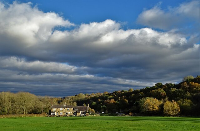
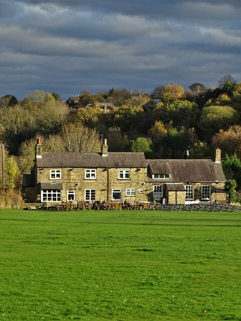
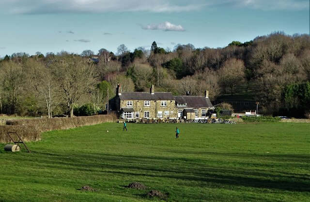
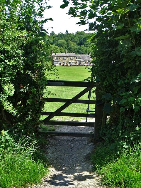
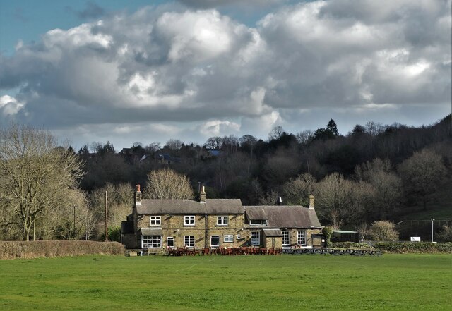
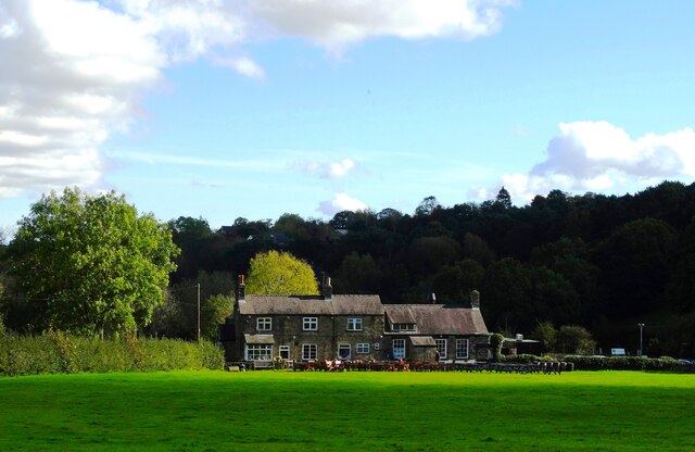
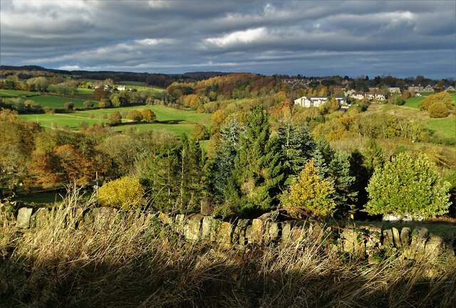
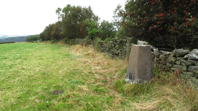
Causeway Head is a small village located in the Derbyshire Dales district of Derbyshire, England. Situated approximately 6 miles northwest of the town of Matlock, it is nestled in the heart of the picturesque Peak District National Park. The village is surrounded by stunning natural beauty, with rolling hills, lush green fields, and a tranquil atmosphere.

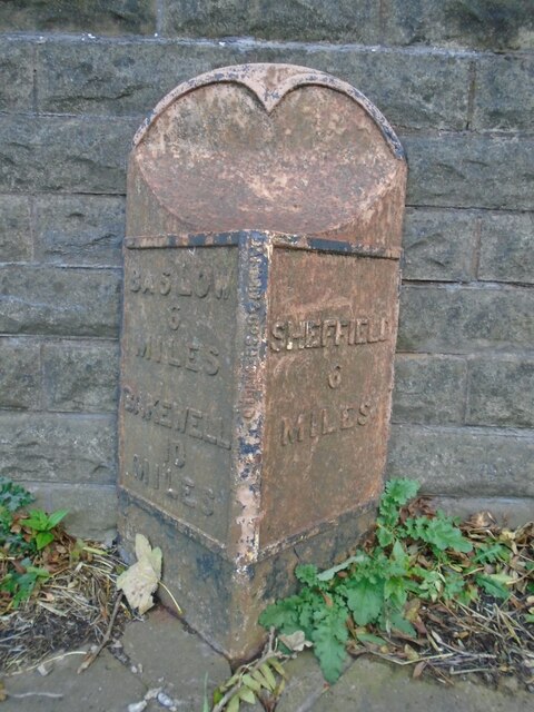
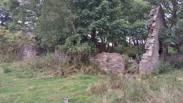
Despite its small size, Causeway Head boasts a rich history. The village is known for its close proximity to the ancient Roman road, Ryknield Street, which once connected the Roman settlements of Derby and Chesterfield. This historical significance is reflected in the village's name, as "Causeway" refers to the raised road that was constructed to cross marshy terrain.

Today, Causeway Head is a peaceful residential community with a tight-knit community spirit. The village retains its rural charm, with a scattering of traditional stone cottages and farmhouses. The surrounding countryside offers ample opportunities for outdoor activities, such as hiking, cycling, and horse riding, attracting nature enthusiasts and adventure seekers.

Although Causeway Head lacks commercial amenities, residents have easy access to nearby towns, such as Matlock and Bakewell, where they can find a range of shops, restaurants, and services. Additionally, the village benefits from excellent transport links, with regular bus services connecting it to surrounding areas.

With its idyllic setting and historical significance, Causeway Head offers a peaceful retreat for those seeking a rural lifestyle in the heart of the stunning Peak District.

If you have any feedback on the listing, please let us know in the comments section below.

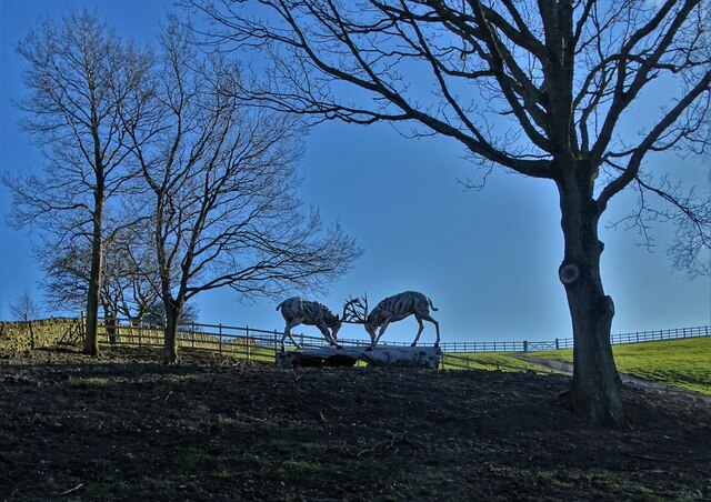
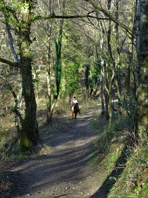
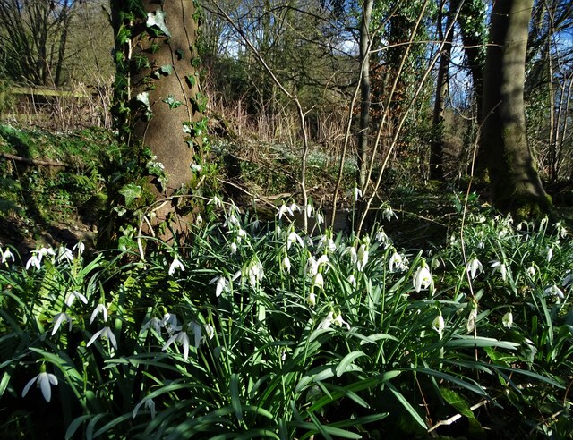
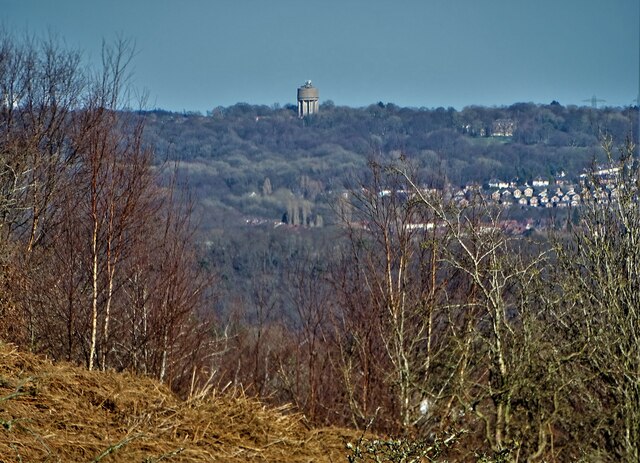
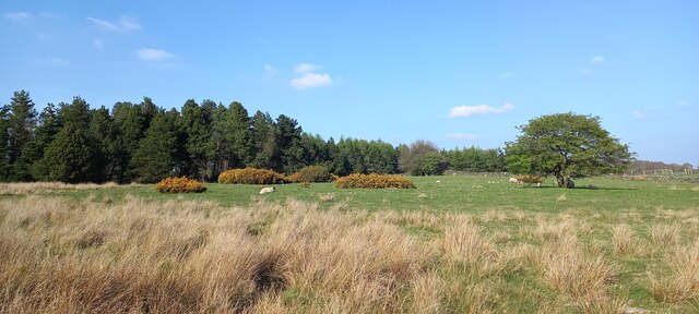
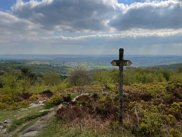
Causeway Head Images

Images are sourced within 2km of 53.330372/-1.5491413 or Grid Reference SK3081. Thanks to Geograph Open Source API. All images are credited.

Beneath November clouds at Totley Bents Another view of "The Cricket Inn".
Beneath November clouds at Totley Bents
Another view of "The Cricket Inn".
"The Cricket Inn"  in  Totley Bents On the edge of the city of Sheffield.
"The Cricket Inn" in Totley Bents
On the edge of the city of Sheffield.
"The Cricket Inn", Totley Bents in early springtime Two brothers, still in school uniform, are playing football on the playing-field.
"The Cricket Inn", Totley Bents in early springtime
Two brothers, still in school uniform, are playing football on the playing-field.
Gate to Totley Bents Recreation Ground With "The Cricket Inn" at the other side of the field.
Gate to Totley Bents Recreation Ground
With "The Cricket Inn" at the other side of the field.
"The Cricket Inn" at Totley Bents
Old milepost On the A621, Baslow Road, Totley this milepost becomes more and more neglected.   It is in a very vulnerable position opposite houses that often have parked cars making the road narrower.   The foundry name is down the front spine DARWIN & CO SHEFFIELD.   Their name is also seen on gully grates and doubtless they cast other products.   There was a Sheffield, Baslow, Owler Bar turnpike that lasted from 1803 to 1880 so this post may date from the middle to late 19C.
Old milepost
On the A621, Baslow Road, Totley this milepost becomes more and more neglected. It is in a very vulnerable position opposite houses that often have parked cars making the road narrower. The foundry name is down the front spine DARWIN & CO SHEFFIELD. Their name is also seen on gully grates and doubtless they cast other products. There was a Sheffield, Baslow, Owler Bar turnpike that lasted from 1803 to 1880 so this post may date from the middle to late 19C.
Yet another image of "The Cricket Inn" Viewed across the recreation ground at Totley Bents
Yet another image of "The Cricket Inn"
Viewed across the recreation ground at Totley Bents
Ruins of Barberfields Copperas Works / Copperas House or Farm This building was rejuvenated once before - hence the title - but it seems unlikely it will be put to any use again. Its original purpose seems to have been as an office, or works building, of a copperas chemical plant - this operated between the 1810s and 1870s. It definitely fell into disrepair shortly thereafter, as it is shown without a roof on a late 19th Century OS map. It then became a farmhouse, which was referred to as both Copperas House and Copperas Farm subsequently, but only as Copperas House on maps. The farm was abandoned in the late 1940s.
Not having a chemistry degree, I have been more than a bit out of my depth researching copperas, which is an actual proper substance (completely unrelated to copper it seems) that I had never heard of! The manufacturing of it, though, was a huge industry in Britain from the 1600s to the late 1800s. It was a used to produce sulphuric acid, which seems even to this day to be something of a wonder chemical. Back then it was mainly used for pen ink, and dying fabric. I can't figure out if it was actually black, or as close as they could get to it, but dark marking was its thing, and it was either used on its own to colour things, or in conjunction with other colours which enabled them to bind to the fabric faster.
The chemical stuff, as previously mentioned, is a bit confusing to the layman, but basically they got poor quality coal (for coal purposes anyway) known as pyrite out of the ground, and chucked it in a pit exposed to the elements for a couple of years. This stuff turned into green crystals when boiled, and when bolied again and then condensed was ready for action. Copperas was the legally required
dye for dark silk in Britain for several hundred years.
Ruins of Barberfields Copperas Works / Copperas House or Farm
This building was rejuvenated once before - hence the title - but it seems unlikely it will be put to any use again. Its original purpose seems to have been as an office, or works building, of a copperas chemical plant - this operated between the 1810s and 1870s. It definitely fell into disrepair shortly thereafter, as it is shown without a roof on a late 19th Century OS map. It then became a farmhouse, which was referred to as both Copperas House and Copperas Farm subsequently, but only as Copperas House on maps. The farm was abandoned in the late 1940s. Not having a chemistry degree, I have been more than a bit out of my depth researching copperas, which is an actual proper substance (completely unrelated to copper it seems) that I had never heard of! The manufacturing of it, though, was a huge industry in Britain from the 1600s to the late 1800s. It was a used to produce sulphuric acid, which seems even to this day to be something of a wonder chemical. Back then it was mainly used for pen ink, and dying fabric. I can't figure out if it was actually black, or as close as they could get to it, but dark marking was its thing, and it was either used on its own to colour things, or in conjunction with other colours which enabled them to bind to the fabric faster. The chemical stuff, as previously mentioned, is a bit confusing to the layman, but basically they got poor quality coal (for coal purposes anyway) known as pyrite out of the ground, and chucked it in a pit exposed to the elements for a couple of years. This stuff turned into green crystals when boiled, and when bolied again and then condensed was ready for action. Copperas was the legally required dye for dark silk in Britain for several hundred years.
Edge of the city An autumn view towards Dore in Sheffield's southern suburbs from Strawberry Lee Lane
Edge of the city
An autumn view towards Dore in Sheffield's southern suburbs from Strawberry Lee Lane
Bear at the bottom of Taylor's Hill I suspect that the rustic model of a bear has been placed here for decorative purposes by the owners of nearby Hallfield Farm.
Bear at the bottom of Taylor's Hill
I suspect that the rustic model of a bear has been placed here for decorative purposes by the owners of nearby Hallfield Farm.
Trig Point at northern edge of Blacka Plantation near Dore
Driftwood stags rutting below Taylor's Hill These impressive driftwood statues have been sited near the end of Strawberry Lee Lane by a local landowner.
Driftwood stags rutting below Taylor's Hill
These impressive driftwood statues have been sited near the end of Strawberry Lee Lane by a local landowner.
Rutting stags art installation below Taylor's Hill These driftwood statues of stags in combat has been erected by a wealthy local landowner who lives nearby.
Rutting stags art installation below Taylor's Hill
These driftwood statues of stags in combat has been erected by a wealthy local landowner who lives nearby.
Horse rider on the steep bridleway up to Lenny Hill
Snowdrops by Redcar Brook
View from Lenny Hill to Norton Water Tower The landmark water tower in the southern suburbs of Sheffield is around five miles away though it seems less because of the camera's zoom facility.
View from Lenny Hill to Norton Water Tower
The landmark water tower in the southern suburbs of Sheffield is around five miles away though it seems less because of the camera's zoom facility.
Fields at Long Line, Dore
Signpost with a view On Blacka Moor overlooking the south western suburbs of Sheffield
Signpost with a view
On Blacka Moor overlooking the south western suburbs of Sheffield
Show me another place!

Causeway Head is located at Grid Ref: SK3081 (Lat: 53.330372, Lng: -1.5491413)

Unitary Authority: Sheffield

Police Authority: South Yorkshire

What 3 Words

///aware.onions.firm. Near Dronfield, Derbyshire

Related Wikis

Dore, South Yorkshire

Dore is a large village in South Yorkshire, England. The village lies on a hill above the River Sheaf which gave Sheffield its name and, until 1934, was...

Totley Brook

The Totley Brook is a stream in Sheffield, South Yorkshire, England. It rises on a millstone grit ridge some 7 miles (11 km) to the south-west of the centre...

King Ecgbert School

King Ecgbert School is a co-educational secondary school with academy status (age range 11–18) in the village of Dore in the south-west of Sheffield, South...

Whinfell Quarry Garden

Whinfell Quarry Garden is an early 20th century ornamental garden in Whirlow, Sheffield, built in an old quarry, containing rare trees and including a...

Nearby Amenities

Located within 500m of 53.330372,-1.5491413
Causeway Head Road/Causeway Gardens
Bus: yes
Public Transport: stop_position
Lat/Long: 53.3304975/-1.5428412
Turning Circle
Lat/Long: 53.3281683/-1.5482672
Turning Circle
Lat/Long: 53.3301944/-1.5475966
Turning Circle
Lat/Long: 53.3310051/-1.5472736
Turning Circle
Lat/Long: 53.3286437/-1.5425834
Turning Circle
Lat/Long: 53.3287779/-1.5439959
Turning Circle
Lat/Long: 53.3280045/-1.5434766
Turning Circle
Lat/Long: 53.3261251/-1.5485585
Post Box
Collection Times: Mo-Fr 09:00; Sa 07:00
Post Box Type: lamp
Ref: S17 305
Royal Cypher: EIIR
Royal Cypher Wikidata: Q33102113
Lat/Long: 53.3330987/-1.5458817
Dore Moor Nursery
Shop: garden_centre
Lat/Long: 53.3331827/-1.5495389
Booth: K6
Removed Amenity: telephone
Lat/Long: 53.333652/-1.5498152
Turning Circle
Lat/Long: 53.3304145/-1.5446444
Turning Circle
Lat/Long: 53.3305162/-1.5437502
Post Box
Collection Times: Mo-Fr 09:00; Sa 07:00
Post Box Type: pillar
Postal Code: S17
Ref: S17 791D
Royal Cypher: EIIR
Royal Cypher Wikidata: Q33102113
Lat/Long: 53.3293552/-1.5457932
Bus Stop
Hathersage Road/Brickhouse Lane
Bus: yes
Naptan AtcoCode: 370023838
Naptan Bearing: W
Naptan CommonName: Hathersage Road/Brickhouse Lane
Naptan Indicator: 23838
Naptan Landmark: 23838
Naptan PlusbusZoneRef: ROTHCEN
Naptan Street: Hathersage Road
Naptan Verified: no
Public Transport: platform
Source: naptan_import
Lat/Long: 53.3336504/-1.5499251
Bus Stop
Hathersage Road/Brickhouse Lane
Bus: yes
Naptan AtcoCode: 370023839
Naptan Bearing: E
Naptan CommonName: Hathersage Road/Brickhouse Lane
Naptan Indicator: 23839
Naptan Landmark: 23839
Naptan PlusbusZoneRef: ROTHCEN
Naptan Street: Hathersage Road
Naptan Verified: no
Public Transport: platform
Source: naptan_import
Lat/Long: 53.3338348/-1.5501977
Bus Stop
Causeway Head Road/Heather Lea Avenue
Bus: yes
Naptan AtcoCode: 370021794
Naptan Bearing: SE
Naptan CommonName: Causeway Head Road/Heather Lea Avenue
Naptan Indicator: 21794
Naptan Landmark: OPPOSITE NO. 65
Naptan PlusbusZoneRef: ROTHCEN
Naptan Street: Causeway Head Road
Naptan Verified: no
Public Transport: platform
Source: naptan_import
Lat/Long: 53.3294526/-1.5419252
Bus Stop
Causeway Head Road/Causeway Gardens
Alt Name: Causeway Head Road/Causeway Gardens
Bus: yes
Naptan AltCommonName: Causeway Head Road/Causeway Gardens
Naptan AtcoCode: 370021795
Naptan Bearing: NW
Naptan CommonName: Causeway Head Road/Causeway Gardens
Naptan Indicator: 21795
Naptan Landmark: 98/100
Naptan PlusbusZoneRef: ROTHCEN
Naptan Street: Causeway Head Road
Naptan Verified: no
Public Transport: platform
Source: naptan_import
Lat/Long: 53.3304864/-1.542918
Bus Stop
Causeway Head Road/Kerwin Road
Bus: yes
Naptan AtcoCode: 370021796
Naptan Bearing: SE
Naptan CommonName: Causeway Head Road/Kerwin Road
Naptan Indicator: 21796
Naptan Landmark: Opposite 77
Naptan PlusbusZoneRef: ROTHCEN
Naptan Street: Causeway Head Road
Naptan Verified: no
Public Transport: platform
Source: naptan_import
Lat/Long: 53.331436/-1.5434356
Bus Stop
Causeway Head Road/Parkers Lane
Alt Name: Causeway Head Road/Parkers Lane
Bus: yes
Naptan AltCommonName: Causeway Head Road/Parkers Lane
Naptan AtcoCode: 370021797
Naptan Bearing: NW
Naptan CommonName: Causeway Head Road/Parkers Lane
Naptan Indicator: 21797
Naptan Landmark: Opposite Parkers Lane
Naptan PlusbusZoneRef: ROTHCEN
Naptan Street: Causeway Head Road
Naptan Verified: no
Public Transport: platform
Source: naptan_import
Lat/Long: 53.3318259/-1.5443324
Bus Stop
Causeway Head Road/Cross Lane
Alt Name: Causeway Head Road/Cross Lane
Bus: yes
Naptan AltCommonName: Causeway Head Road/Cross Lane
Naptan AtcoCode: 370021798
Naptan Bearing: SE
Naptan CommonName: Causeway Head Road/Cross Lane
Naptan Indicator: 21798
Naptan Landmark: Playing Field
Naptan PlusbusZoneRef: ROTHCEN
Naptan Street: Causeway Head Road
Naptan Verified: no
Public Transport: platform
Source: naptan_import
Lat/Long: 53.3329897/-1.5454162
Bus Stop
Cross Lane/Brickhouse Lane
Bus: yes
Naptan AtcoCode: 370021799
Naptan Bearing: N
Naptan CommonName: Cross Lane/Brickhouse Lane
Naptan Indicator: 21799
Naptan Landmark: Playing Fields
Naptan PlusbusZoneRef: ROTHCEN
Naptan Street: Cross Lane
Naptan Verified: no
Public Transport: platform
Shelter: yes
Source: naptan_import
Lat/Long: 53.333355/-1.5457539
Hathersage Road/Brickhouse Lane
Bus: yes
Public Transport: stop_position
Lat/Long: 53.3337354/-1.5499491
Fountain
Lat/Long: 53.3329248/-1.5496905
Causeway Head
Place: neighbourhood
Lat/Long: 53.3303405/-1.5463299
Restaurant
Ego at The Dore Moor Inn
Addr City: Sheffield
Addr Housename: The Dore Moor Inn
Addr Postcode: S17 3AB
Addr Street: Hathersage Road
Cuisine: italian
Note: Hosted by the pub.
Opening Hours: 11:00-22:30
Phone: +44 114 235 3302
Website: https://www.egorestaurants.co.uk
Lat/Long: 53.3339957/-1.5499292
Cross Lane/Brickhouse Lane
Bus: yes
Public Transport: stop_position
Lat/Long: 53.3333536/-1.5456874
Causeway Head Road/Cross Lane
Bus: yes
Public Transport: stop_position
Lat/Long: 53.3329363/-1.5455319
Causeway Head Road/Parkers Lane
Bus: yes
Public Transport: stop_position
Lat/Long: 53.3318928/-1.5441971
Causeway Head Road/Kerwin Road
Bus: yes
Public Transport: stop_position
Lat/Long: 53.3313941/-1.5435381
Causeway Head Road/Heather Lea Avenue
Bus: yes
Public Transport: stop_position
Lat/Long: 53.3294204/-1.5420966
Hathersage Road/Brickhouse Lane
Bus: yes
Public Transport: stop_position
Lat/Long: 53.333725/-1.5501926
Bench
Lat/Long: 53.3275756/-1.5455074
Bench
Lat/Long: 53.3273138/-1.5455206
Grit Bin
Operator: Sheffield City Council
Operator Type: government
Operator Wikidata: Q7492609
Seasonal: no
Lat/Long: 53.3264476/-1.5502177
Grit Bin
Operator: Sheffield City Council
Operator Type: government
Operator Wikidata: Q7492609
Seasonal: no
Lat/Long: 53.3302768/-1.54782
Grit Bin
Operator: Sheffield City Council
Operator Type: government
Operator Wikidata: Q7492609
Seasonal: no
Lat/Long: 53.3280493/-1.5435494
The data included in this document is from www.openstreetmap.org. The data is made available under ODbL.

Have you been to Causeway Head?

Leave your review of Causeway Head below (or comments, questions and feedback).