Alcombe

Settlement in Wiltshire

England

Alcombe

Pastures above the Lid Brook Valley View south of the Bath Road, west of Colerne.
Pastures above the Lid Brook Valley Credit: Jonathan Billinger

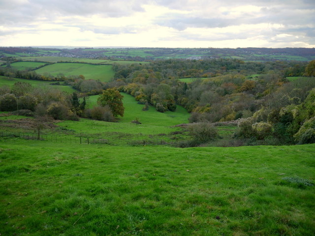
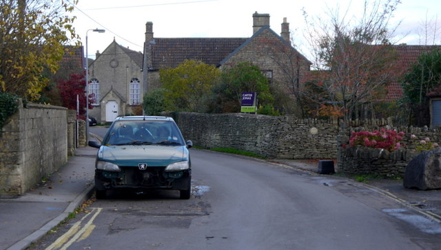
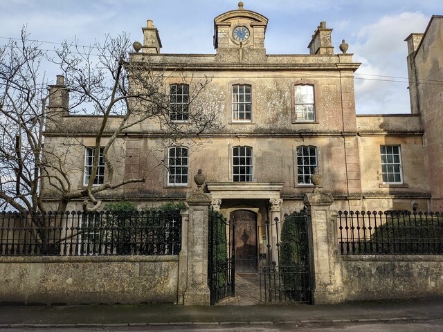
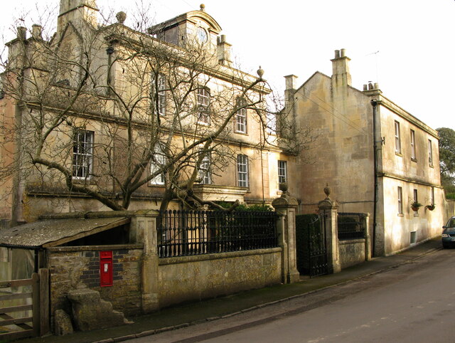
Alcombe is a small village located in the county of Wiltshire, England. Situated approximately 6 miles west of the town of Devizes, Alcombe is nestled in the picturesque countryside, surrounded by rolling hills and lush green fields. The village is part of the civil parish of Alcombe and Rushall.

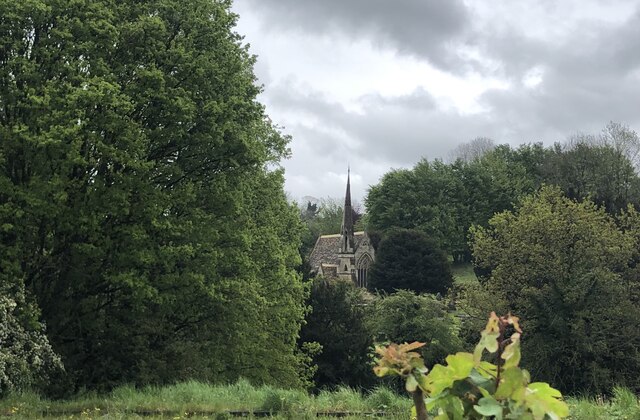
With its origins dating back to medieval times, Alcombe has a rich history that can be seen in its architecture and landmarks. The village is home to St. Mary's Church, a beautiful Grade II listed building that dates back to the 12th century. The church features stunning stained glass windows and intricate stonework, making it a popular attraction for history enthusiasts.

The village itself is relatively small, with a population of around 200 residents. It has a close-knit community feel, and the villagers take great pride in their surroundings. There is a charming village green where locals often gather for community events and activities.

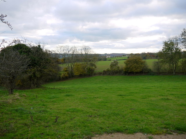
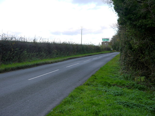
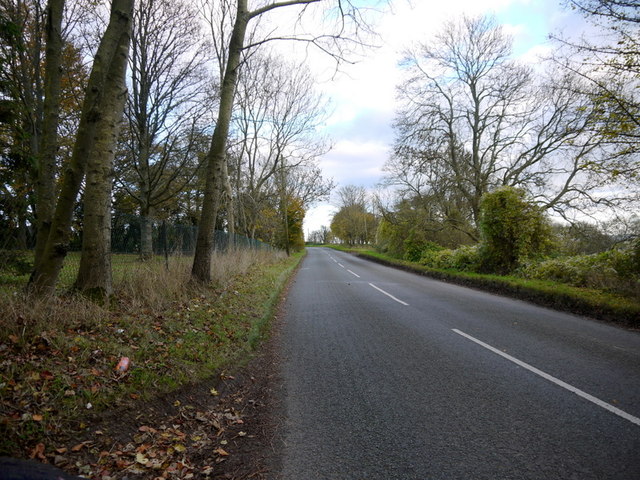
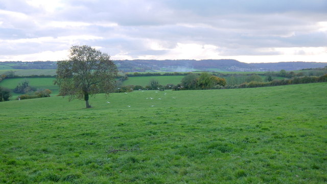
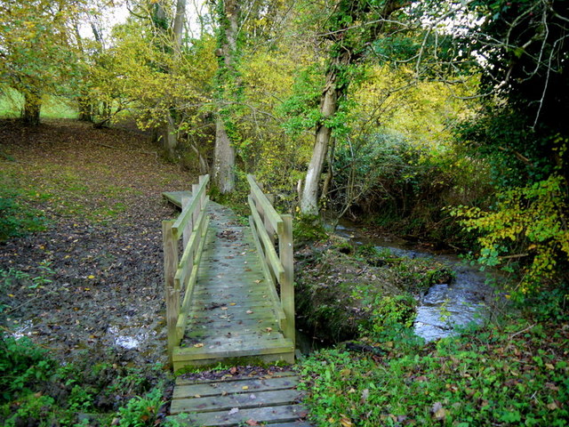
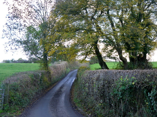
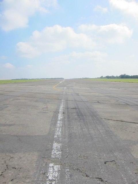
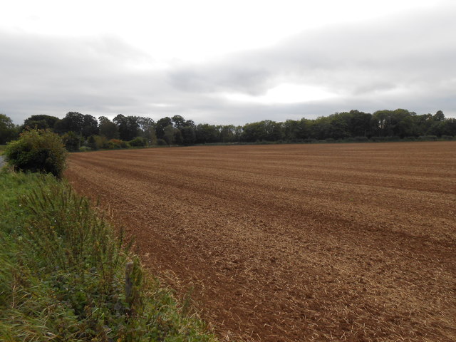
Alcombe is surrounded by idyllic countryside, making it a popular destination for outdoor enthusiasts. There are numerous walking and cycling trails that offer breathtaking views of the surrounding landscape. The nearby Kennet and Avon Canal also provides opportunities for boating and fishing.

Despite its rural location, Alcombe is conveniently located within easy reach of amenities. The town of Devizes is just a short drive away and offers a range of shops, restaurants, and services.

In summary, Alcombe is a picturesque village in Wiltshire, offering a blend of rich history, stunning countryside, and a close-knit community.

If you have any feedback on the listing, please let us know in the comments section below.

Alcombe Images

Images are sourced within 2km of 51.422606/-2.275242 or Grid Reference ST8069. Thanks to Geograph Open Source API. All images are credited.

Pastures above the Lid Brook Valley View south of the Bath Road, west of Colerne.
Pastures above the Lid Brook Valley
View south of the Bath Road, west of Colerne.
Bath Road Heading east towards Colerne.
The control tower for Colerne Airfield can be seen over the hedge, and in the next square north.
Bath Road
Heading east towards Colerne. The control tower for Colerne Airfield can be seen over the hedge, and in the next square north.
Bath Road, Colerne The road grazes the southern edge of the Gridsquare.
looking east towards Colerne.
Bath Road, Colerne
The road grazes the southern edge of the Gridsquare. looking east towards Colerne.
Bowl of landscape Part of the Lid Brook valley to the south of Colerne.
Land-use is mainly pasture and woodland.
Bowl of landscape
Part of the Lid Brook valley to the south of Colerne. Land-use is mainly pasture and woodland.
Seen better days A motor on the Old Bath Road, Colerne.
Seen better days
A motor on the Old Bath Road, Colerne.
View from Tutton Hill Pasture land drops away to the Lid Brook.
The Kingsdown Hill plateau can be seen in the distance.
A small flock of gulls are in the middle distance.
View from Tutton Hill
Pasture land drops away to the Lid Brook. The Kingsdown Hill plateau can be seen in the distance. A small flock of gulls are in the middle distance.
Footbridge over Lid Brook The stream flows left to right; the path ascends Tutton Hill to Colerne.
Footbridge over Lid Brook
The stream flows left to right; the path ascends Tutton Hill to Colerne.
Tutton Hill The lane ascends south out of Lidbrook Bottom towards Box.
Tutton Hill
The lane ascends south out of Lidbrook Bottom towards Box.
The SW end of the main runway on Colerne airfield
Little used hangars on the periphery of Colerne airfield
Fields Near Hunters Hall Hunters Hall now a residence that in earlier times was a working farm is hidden in the trees on the left of the image. The Fosse Way is behind the hedge on the left.
This field has recently been ploughed and seeded and still shows the straw waste from this years crop.
Fields Near Hunters Hall
Hunters Hall now a residence that in earlier times was a working farm is hidden in the trees on the left of the image. The Fosse Way is behind the hedge on the left. This field has recently been ploughed and seeded and still shows the straw waste from this years crop.
Three Shire Stones, 1 Camera is on the Fosse Way (Wiltshire), left of the stones is Somerset and beyond the wall to the right is Gloucestershire.
Three Shire Stones, 1
Camera is on the Fosse Way (Wiltshire), left of the stones is Somerset and beyond the wall to the right is Gloucestershire.
Three Shire Stones, 2 Camera is on the Fosse Way (Wiltshire), left of the stones is Somerset and beyond the wall to the right is Gloucestershire.
Three Shire Stones, 2
Camera is on the Fosse Way (Wiltshire), left of the stones is Somerset and beyond the wall to the right is Gloucestershire.
Ashley Garage This Shell service station <span class="nowrap"><a title="https://find.shell.com/gb/fuel/12449960-ashley-garage" rel="nofollow ugc noopener" href="https://find.shell.com/gb/fuel/12449960-ashley-garage">Link</a><img style="margin-left:2px;" alt="External link" title="External link - shift click to open in new window" src="https://s1.geograph.org.uk/img/external.png" width="10" height="10"/></span> stands on the A4 a little west of Box.  As with all petrol stations in the Bath area, the price of fuel is rather high compared with the going rate in nearby Bristol and Chippenham, which is where canny Bathonians tend to fill up.
Ashley Garage
This Shell service station LinkExternal link stands on the A4 a little west of Box. As with all petrol stations in the Bath area, the price of fuel is rather high compared with the going rate in nearby Bristol and Chippenham, which is where canny Bathonians tend to fill up.
Cemetery Chapel, Box
3 Kingsdown House, Kingsdown, Box Grade II listed early 19th-century house
<span class="nowrap"><a title="https://historicengland.org.uk/listing/the-list/list-entry/1022797" rel="nofollow ugc noopener" href="https://historicengland.org.uk/listing/the-list/list-entry/1022797">Link</a><img style="margin-left:2px;" alt="External link" title="External link - shift click to open in new window" src="https://s1.geograph.org.uk/img/external.png" width="10" height="10"/></span>

From the listing: Built as part of the extensions to the private asylum at Kingsdown House, possibly as a doctor's residence.
3 Kingsdown House, Kingsdown, Box
Grade II listed early 19th-century house LinkExternal link From the listing: Built as part of the extensions to the private asylum at Kingsdown House, possibly as a doctor's residence.
1 Kingsdown House, Kingsdown, Box Grade II listed former lunatic asylum, now house, early 18th century with Victorian embellishment.
<span class="nowrap"><a title="https://historicengland.org.uk/listing/the-list/list-entry/1181591" rel="nofollow ugc noopener" href="https://historicengland.org.uk/listing/the-list/list-entry/1181591">Link</a><img style="margin-left:2px;" alt="External link" title="External link - shift click to open in new window" src="https://s1.geograph.org.uk/img/external.png" width="10" height="10"/></span>

Gate piers and railings, early 19th, also listed.
<span class="nowrap"><a title="https://historicengland.org.uk/listing/the-list/list-entry/1363625" rel="nofollow ugc noopener" href="https://historicengland.org.uk/listing/the-list/list-entry/1363625">Link</a><img style="margin-left:2px;" alt="External link" title="External link - shift click to open in new window" src="https://s1.geograph.org.uk/img/external.png" width="10" height="10"/></span>
1 Kingsdown House, Kingsdown, Box
Grade II listed former lunatic asylum, now house, early 18th century with Victorian embellishment. LinkExternal link Gate piers and railings, early 19th, also listed. LinkExternal link
1 and 2 Kingsdown House, Kingsdown, Box Grade II listed former lunatic asylum, now houses, early 18th century with Victorian embellishment.
<span class="nowrap"><a title="https://historicengland.org.uk/listing/the-list/list-entry/1181591" rel="nofollow ugc noopener" href="https://historicengland.org.uk/listing/the-list/list-entry/1181591">Link</a><img style="margin-left:2px;" alt="External link" title="External link - shift click to open in new window" src="https://s1.geograph.org.uk/img/external.png" width="10" height="10"/></span>

No.1 (left) early 18th century, No. 2 19th century.
1 and 2 Kingsdown House, Kingsdown, Box
Grade II listed former lunatic asylum, now houses, early 18th century with Victorian embellishment. LinkExternal link No.1 (left) early 18th century, No. 2 19th century.
Show me another place!

Alcombe is located at Grid Ref: ST8069 (Lat: 51.422606, Lng: -2.275242)

Unitary Authority: Wiltshire

Police Authority: Wiltshire

What 3 Words

///bells.vague.intrigues. Near Colerne, Wiltshire

Related Wikis

Ditteridge

Ditteridge is a village in the civil parish of Box, Wiltshire, England. It is about 0.8 miles (1.3 km) northwest of Box village and 3.5 miles (6 km) west...

Box railway station

Box railway station served the town of Box in Wiltshire, England. The station was on the main Great Western Railway line from London to Bristol and was...

Ashley, Wiltshire

Ashley is a small village in the civil parish of Box in Wiltshire, England. Its nearest town is Corsham, which lies approximately 3.5 miles (5.6 km) east...

Box (Mill Lane) Halt railway station

Box (Mill Lane) Halt railway station served the town of Box in Wiltshire, England. The station was on the main Great Western Railway line from London to...

Church of St Thomas à Becket, Box

The Church of St. Thomas à Becket is the Church of England parish church of Box, Wiltshire, in south-west England. It is one of a number of churches named...

Real World Records

Real World Records is a British record label specializing in world music. It was founded in 1989 by English musician Peter Gabriel and original members...

Real World Studios

Real World Studios is a residential recording studio complex founded by Peter Gabriel and situated in the old Box Mill building in the village of Box,...

Box Primary School

Box Primary School, also known as Box Church of England Primary School, is a state-run primary school in Box, Wiltshire, England. The current headteacher...

Nearby Amenities

Located within 500m of 51.422606,-2.275242
Barrier: entrance
Lat/Long: 51.4191105/-2.2722151
Barrier: stile
Lat/Long: 51.4196061/-2.2706966
Barrier: stile
Lat/Long: 51.4250474/-2.2716002
Barrier: stile
Lat/Long: 51.4246128/-2.2702594
Barrier: stile
Lat/Long: 51.4240639/-2.273964
Barrier: kissing_gate
Lat/Long: 51.4224777/-2.2756743
The data included in this document is from www.openstreetmap.org. The data is made available under ODbL.

Have you been to Alcombe?

Leave your review of Alcombe below (or comments, questions and feedback).