Wookey Hole

Settlement in Somerset Mendip

England

Wookey Hole

One of the last trains trains to run on the 'Strawberry Line' Pictured at Easton, near Wells, this is one of the last trains to use the line and was pictured after the closure of passenger services in 1965. The picture clearly shows the deep cutting at Easton with the small goods train climbing up the  1 in 237 incline from Westbury Sub Mendip (Lodge Hill station) travelling towards Wells.Parts of the cutting have now been filled in.
One of the last trains trains to run on the 'Strawberry Line' Credit: b Lewis

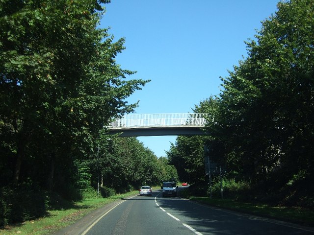
Wookey Hole is a small village located in the Mendip Hills, Somerset, England. It is renowned for its natural caves, archaeological significance, and popular tourist attractions. The village is situated approximately 2 miles west of Wells, a historic cathedral city.

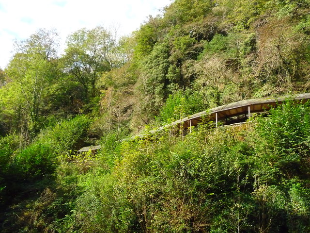
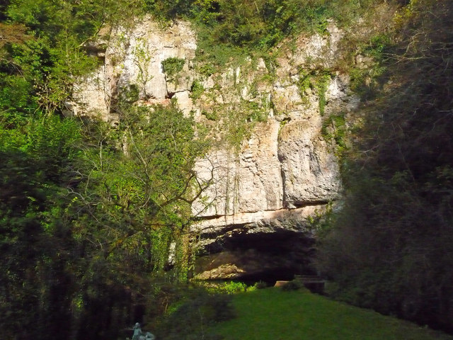
The main attraction of Wookey Hole is its eponymous cave system, which is considered one of the UK's most magnificent underground networks. The caves were formed by the River Axe over millions of years and are adorned with stunning stalagmites and stalactites. Guided tours take visitors through the chambers, showcasing impressive features such as the Witch of Wookey and the Crystal Quest.

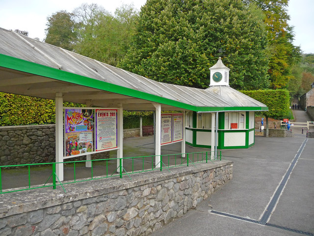
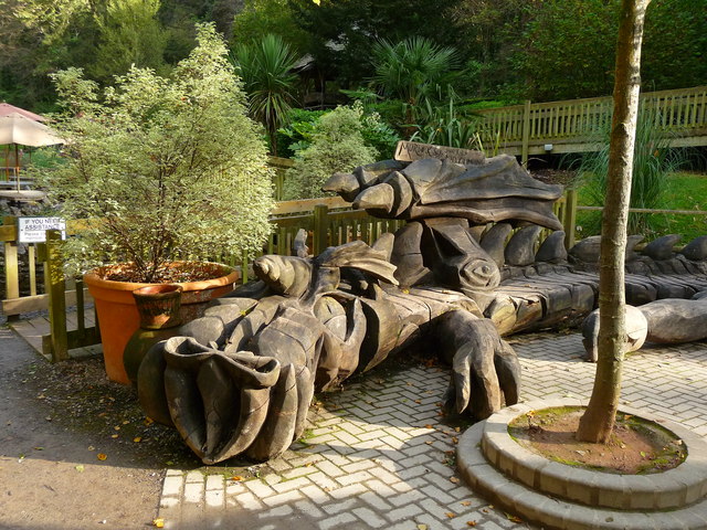
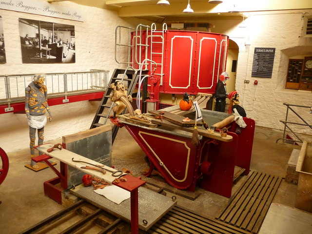
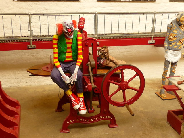
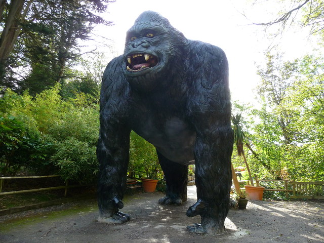
In addition to the caves, Wookey Hole offers a range of family-friendly attractions. The Wookey Hole Caves and Papermill is a popular theme park that includes a 4D cinema, children's play areas, and a Victorian paper mill exhibit. The park also boasts a large and diverse collection of animatronic prehistoric animals.

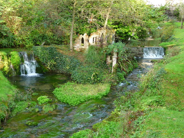
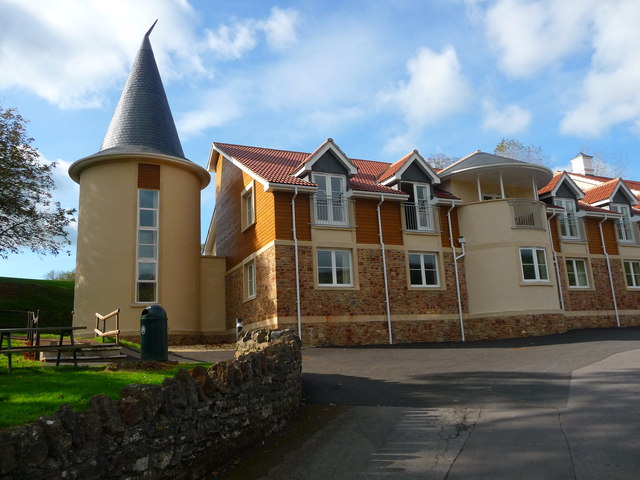
Outside the caves, visitors can explore the picturesque village itself, which features a charming mix of traditional stone houses and thatched cottages. There are also several local pubs, cafes, and shops offering refreshments and souvenirs.

Wookey Hole holds archaeological significance as well, with evidence of human occupation dating back thousands of years. Ancient tools and bones have been discovered in the caves, indicating their use as shelter by early humans.

Overall, Wookey Hole is a unique destination that combines natural beauty, history, and family entertainment, making it a must-visit location for tourists and locals alike.

If you have any feedback on the listing, please let us know in the comments section below.

Wookey Hole Images

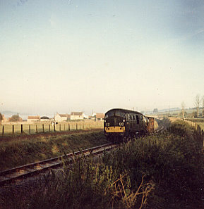
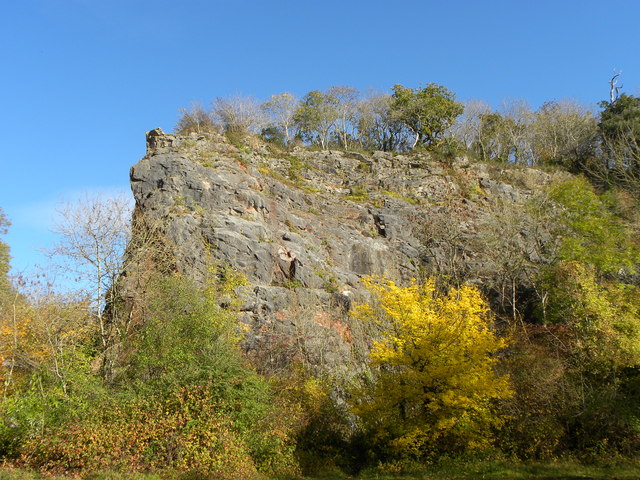
Images are sourced within 2km of 51.223771/-2.6704331 or Grid Reference ST5347. Thanks to Geograph Open Source API. All images are credited.

One of the last trains trains to run on the 'Strawberry Line' Pictured at Easton, near Wells, this is one of the last trains to use the line and was pictured after the closure of passenger services in 1965. The picture clearly shows the deep cutting at Easton with the small goods train climbing up the  1 in 237 incline from Westbury Sub Mendip (Lodge Hill station) travelling towards Wells.Parts of the cutting have now been filled in.
One of the last trains trains to run on the 'Strawberry Line'
Pictured at Easton, near Wells, this is one of the last trains to use the line and was pictured after the closure of passenger services in 1965. The picture clearly shows the deep cutting at Easton with the small goods train climbing up the 1 in 237 incline from Westbury Sub Mendip (Lodge Hill station) travelling towards Wells.Parts of the cutting have now been filled in.
Rocky Outcrop Seen from woods on Milton Hill
Rocky Outcrop
Seen from woods on Milton Hill
Dursdon Drove Dursdon Drove is a 3km (2 miles) track running roughly east/west between two north/south roads. In part, it is fairly well used as the West Mendip Way follows it for 800 metres (half a mile). But it still feels slightly odd, as there is absolutely no continuation at either end, and one wonders how the route originated.
Dursdon Drove
Dursdon Drove is a 3km (2 miles) track running roughly east/west between two north/south roads. In part, it is fairly well used as the West Mendip Way follows it for 800 metres (half a mile). But it still feels slightly odd, as there is absolutely no continuation at either end, and one wonders how the route originated.
Higher Pitts Farm This farm nestles in a slight dip on top of the Mendip Hills.
Higher Pitts Farm
This farm nestles in a slight dip on top of the Mendip Hills.
Charter Way, Wells Part of a modern estate north of the A371, Portway
Charter Way, Wells
Part of a modern estate north of the A371, Portway
Charter Way, Wells Part of a modern estate on the west of Wells
Charter Way, Wells
Part of a modern estate on the west of Wells
Footbridge over A39, Mountery Road
Dursdon Drove Looking East along the drove from the point where the track to Higher Pitts Farm crosses it.
Dursdon Drove
Looking East along the drove from the point where the track to Higher Pitts Farm crosses it.
Dursdon Drove track The track to Higher Pitts Farm joins the Drove from the north, turns east, follows the Drove for 20 metres then turns south off the Drove to continue to the farm.  This view is looking west.
Dursdon Drove track
The track to Higher Pitts Farm joins the Drove from the north, turns east, follows the Drove for 20 metres then turns south off the Drove to continue to the farm. This view is looking west.
Wookey Hole - The Pay Booth A quiet day at Wookey Hole, in the summer this is a very busy place.
Wookey Hole - The Pay Booth
A quiet day at Wookey Hole, in the summer this is a very busy place.
Wookey Hole - Walkway This is the walkway that leads to the entrance of the caves.
Wookey Hole - Walkway
This is the walkway that leads to the entrance of the caves.
Wookey Hole - Here Be Dragons Murdock the dragon made of wood.
Wookey Hole - Here Be Dragons
Murdock the dragon made of wood.
Wookey Hole - Halloween A gruesome halloween display in the papermill.
Wookey Hole - Halloween
A gruesome halloween display in the papermill.
Wookey Hole - Cave Entrance This is where the River Axe leaves the cave complex for the open air.
Wookey Hole - Cave Entrance
This is where the River Axe leaves the cave complex for the open air.
Wookey Hole - Paper Mill Part of the Halloween display in the paper mill.
Wookey Hole - Paper Mill
Part of the Halloween display in the paper mill.
Wookey Hole - Fantasy Garden The mill stream has been used as a background for this fantasy garden.
Wookey Hole - Fantasy Garden
The mill stream has been used as a background for this fantasy garden.
Wookey Hole - Hotel A new hotel on the site of the old outdoor swimming pool.
Wookey Hole - Hotel
A new hotel on the site of the old outdoor swimming pool.
Wookey Hole - King Kong This ape is large enough for an adult to stand underneath its front legs.
Wookey Hole - King Kong
This ape is large enough for an adult to stand underneath its front legs.
Show me another place!

Wookey Hole is located at Grid Ref: ST5347 (Lat: 51.223771, Lng: -2.6704331)

Administrative County: Somerset

District: Mendip

Police Authority: Avon and Somerset

What 3 Words

///starch.amphibian.lunges. Near Wells, Somerset

Related Wikis

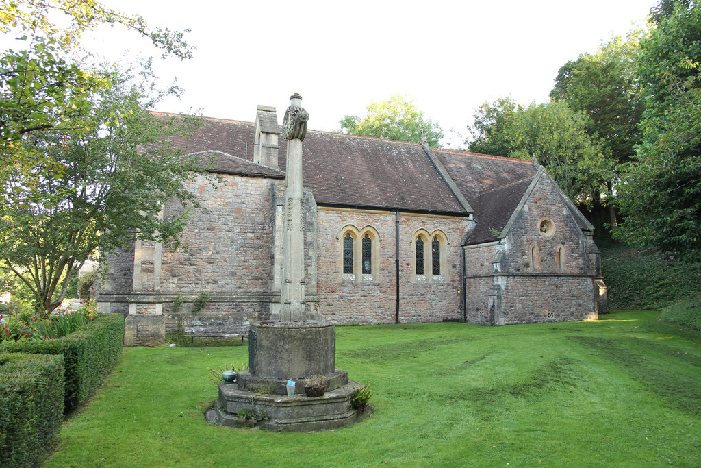
Church of St Mary Magdalene, Wookey Hole

The Church of St Mary Magdalene is a Church of England church in Wookey Hole, Somerset, England, dedicated to Jesus' companion Mary Magdalene. The church...

Wookey Hole

Wookey Hole is a village in Somerset, England. It is the location of the Wookey Hole show caves. == Location == Wookey Hole is located in the civil parish...

Wookey Hole Caves

Wookey Hole Caves () are a series of limestone caverns, a show cave and tourist attraction in the village of Wookey Hole on the southern edge of the Mendip...

St Cuthberts Mill

St Cuthberts Mill is a British paper manufacturing company in Wells, Somerset, that specialises in mould made artists papers. The range includes traditional...

Nearby Amenities

Located within 500m of 51.223771,-2.6704331
Wookey Hole
Place: village
Source: npe
Wikidata: Q3397589
Lat/Long: 51.2262644/-2.6760299
Barrier: kissing_gate
Lat/Long: 51.223425/-2.6703077
Toilets
Lat/Long: 51.2278527/-2.6715946
Dinosaur Valley
Leisure: playground
Lat/Long: 51.2281461/-2.6716356
Tourism: picnic_site
Lat/Long: 51.2247825/-2.6720506
Pub
Wookey Hole Club
Lat/Long: 51.2244663/-2.6708508
Lower Milton
Place: hamlet
Lat/Long: 51.2267091/-2.6650194
Barrier: kissing_gate
Lat/Long: 51.2263967/-2.6708076
Barrier: stile
Lat/Long: 51.2264991/-2.6677847
Bus Stop
Wookey Hole Car Park
Bus: yes
Local Ref: 670
Naptan AtcoCode: 3600SOA56824
Naptan Bearing: NE
Naptan CommonName: Wookey Hole Car Park
Naptan Indicator: NE-bound
Naptan NaptanCode: sotdpmag
Naptan Street: Car Park
Naptan Verified: no
Public Transport: platform
Lat/Long: 51.2258735/-2.6720678
Barrier: bollard
Bicycle: yes
Foot: yes
Lat/Long: 51.2265184/-2.6716827
Leisure: picnic_table
Lat/Long: 51.2266729/-2.6723841
Wookey Hole Gift Shop
Shop: gift
Lat/Long: 51.2269224/-2.6723506
Leisure: picnic_table
Lat/Long: 51.2267947/-2.6717001
Leisure: picnic_table
Lat/Long: 51.226802/-2.6717742
Leisure: picnic_table
Lat/Long: 51.2268058/-2.6718125
Leisure: picnic_table
Lat/Long: 51.2268101/-2.6718556
Leisure: picnic_table
Lat/Long: 51.2268145/-2.6719005
Leisure: picnic_table
Lat/Long: 51.2268183/-2.6719392
Leisure: picnic_table
Lat/Long: 51.2268221/-2.6719776
Leisure: picnic_table
Lat/Long: 51.226826/-2.6720177
Leisure: picnic_table
Lat/Long: 51.2268294/-2.6720519
Leisure: picnic_table
Lat/Long: 51.2268332/-2.6720898
Leisure: picnic_table
Lat/Long: 51.226837/-2.6721292
Leisure: picnic_table
Lat/Long: 51.2268406/-2.6721658
Leisure: picnic_table
Lat/Long: 51.2268451/-2.6722111
Leisure: picnic_table
Lat/Long: 51.2267914/-2.6722714
Leisure: picnic_table
Lat/Long: 51.2267628/-2.6722768
Eborlands Equestrian Centre
Leisure: horse_riding
Sport: equestrian
Lat/Long: 51.2274406/-2.6736474
Post Box
Operator: Royal Mail
Operator Wikidata: Q638098
Post Box Type: lamp
Royal Cypher: EIIR
Royal Cypher Wikidata: Q33102113
Lat/Long: 51.2265436/-2.6728079
Cinema
Wookey Hole 4D Cinema
Lat/Long: 51.227794/-2.6715213
Wookey Hole Indoor Playground
Indoor: yes
Leisure: playground
Lat/Long: 51.227185/-2.6717885
Restaurant
Captain Jacks Restaurant
Lat/Long: 51.2268956/-2.6719492
Paper Making Museum
Tourism: museum
Website: https://www.wookey.co.uk/the-mill/
Lat/Long: 51.2273658/-2.6717054
Ice Cream
Wookey Hole Ice Cream Parlour
Lat/Long: 51.2262344/-2.6726051
Cave Diving Museum
Addr City: wookey Hole
Addr Housename: The Mille
Addr Postcode: BA5 1BB
Addr Street: High Street
Fee: yes
Tourism: museum
Website: https://www.wookey.co.uk/cave-diving-museum/
Wikidata: Q113369742
Lat/Long: 51.2275583/-2.6716053
Restaurant
Witch's Kitchen
Lat/Long: 51.227123/-2.6714688
Public Bookcase
Booth: K6
Covered: booth
Disused Amenity: telephone
Man Made: telephone_box
Public Bookcase Type: phone_box
Lat/Long: 51.2244974/-2.6711
The data included in this document is from www.openstreetmap.org. The data is made available under ODbL.

Have you been to Wookey Hole?

Leave your review of Wookey Hole below (or comments, questions and feedback).