Woodcote

Settlement in Surrey Epsom and Ewell

England

Woodcote

Ashtead - Craddocks Avenue Residential road near Ashtead Station.
Ashtead - Craddocks Avenue Credit: James Emmans

Woodcote is a residential area located in the borough of Epsom and Ewell in Surrey, England. Situated approximately 17 miles southwest of central London, it is a predominantly suburban area known for its leafy streets and tranquil atmosphere.

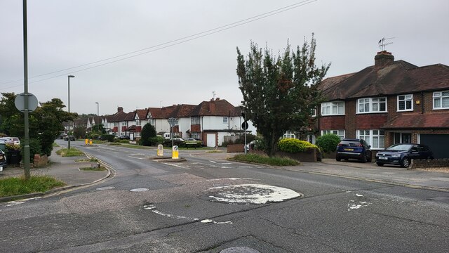
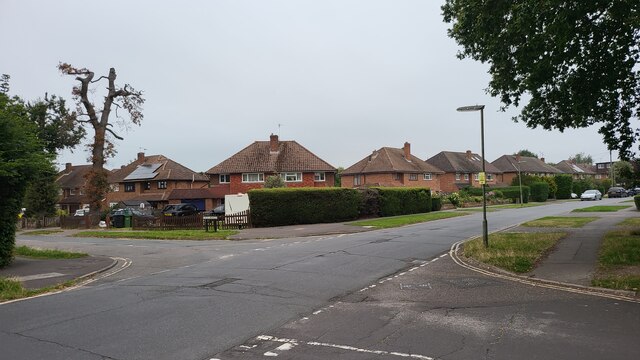
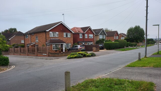
The area is characterized by a mix of architectural styles, with a range of housing options available including detached houses, semi-detached properties, and bungalows. Many of the homes in Woodcote were built in the mid-20th century, but there are also some older properties and more modern developments.

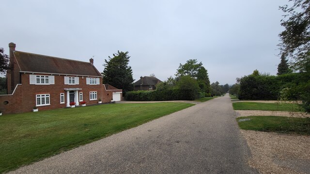
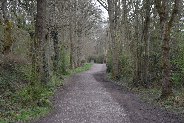
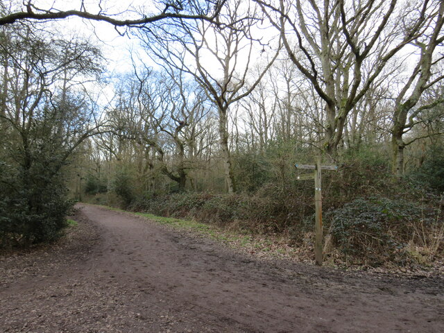
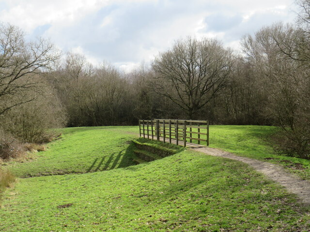
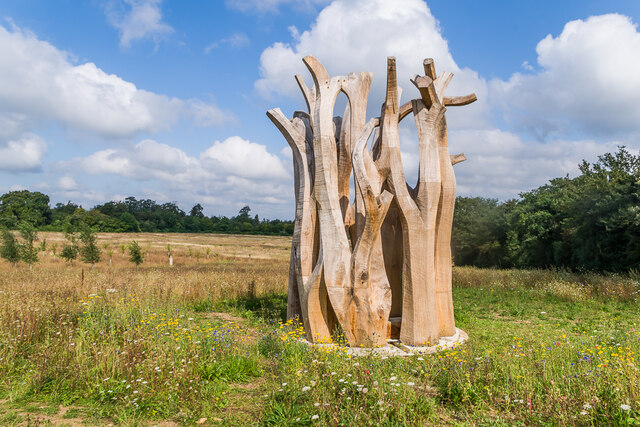
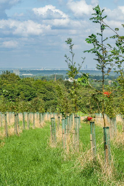
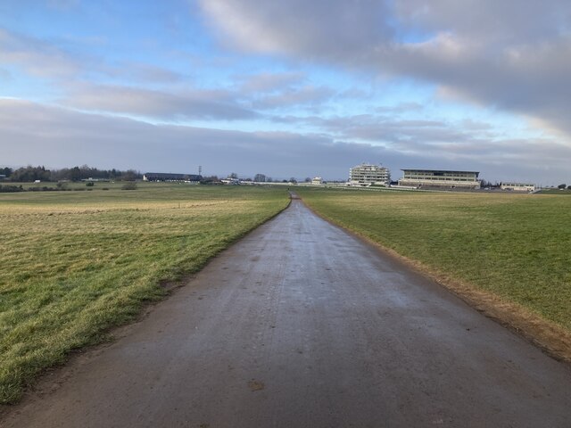
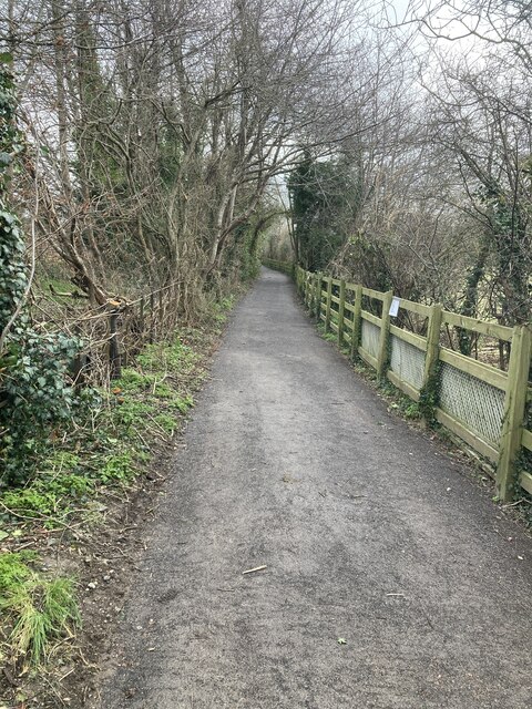
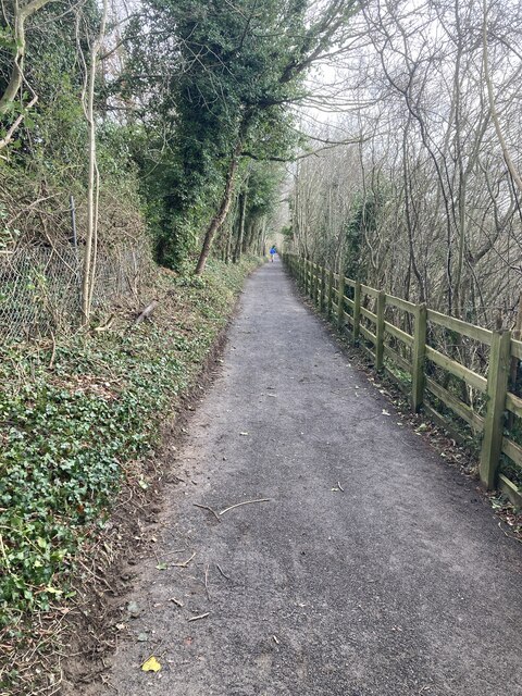
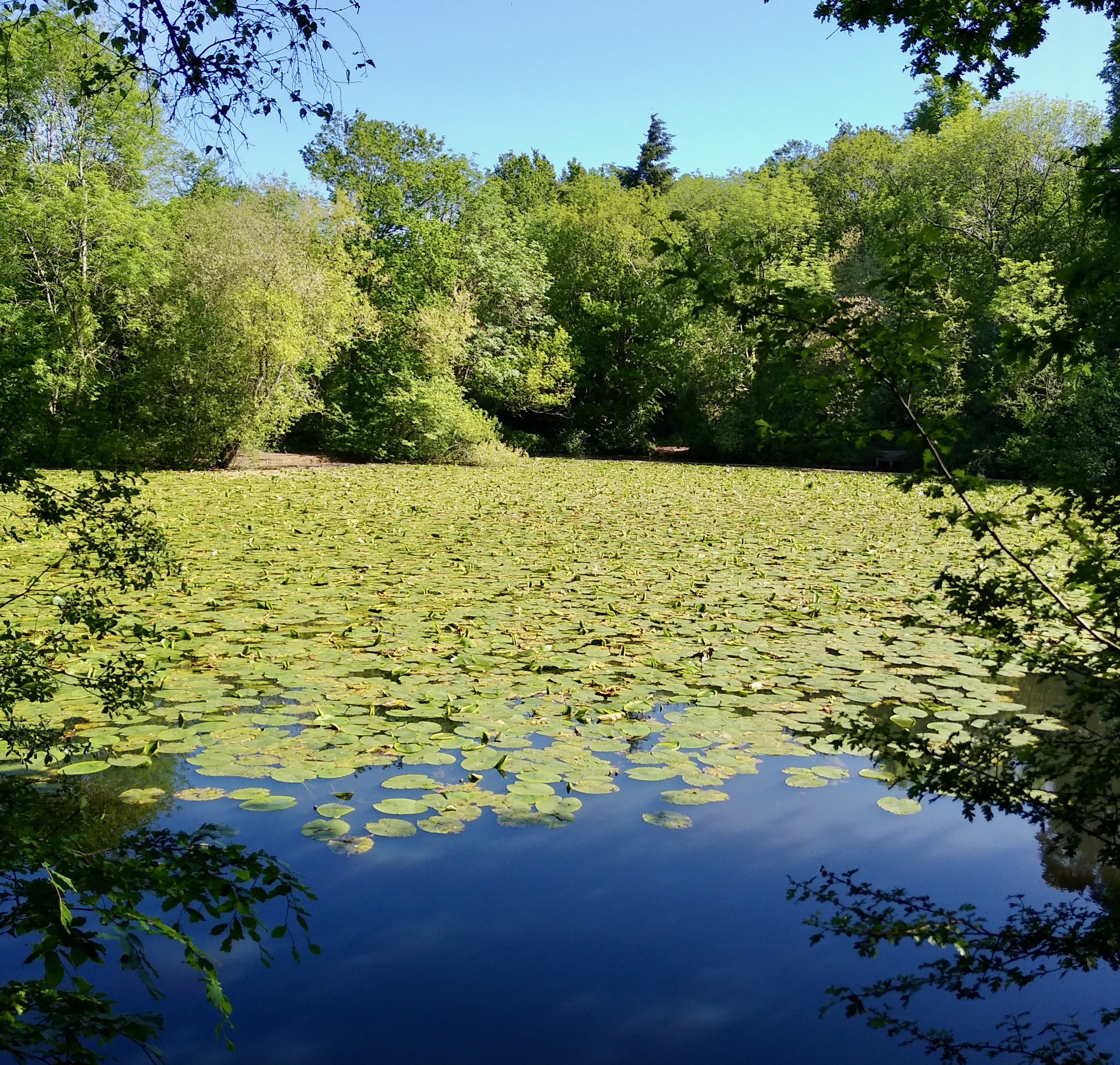
Woodcote is surrounded by green spaces, offering residents ample opportunities for outdoor activities and recreation. Epsom Common, a large nature reserve, is located nearby and provides walking trails, woodland areas, and open spaces for picnics and leisurely strolls. The area is also within close proximity to the North Downs, an Area of Outstanding Natural Beauty, which is ideal for hiking and enjoying the scenic countryside.

For those seeking amenities, Woodcote is conveniently located near the town of Epsom, which offers a wide range of shops, supermarkets, restaurants, and leisure facilities. There are also several highly regarded schools in the area, making Woodcote an attractive place for families.

Transport links in Woodcote are excellent, with regular train services from nearby Epsom station to London Waterloo and Victoria, providing easy access to the capital. The area is also well-connected by road, with the A24 and M25 motorway within close proximity.

Overall, Woodcote offers a peaceful and picturesque setting with easy access to both countryside and city amenities, making it an appealing place to live.

If you have any feedback on the listing, please let us know in the comments section below.

Woodcote Images

Images are sourced within 2km of 51.317723/-0.276563 or Grid Reference TQ2059. Thanks to Geograph Open Source API. All images are credited.

Ashtead - Craddocks Avenue Residential road near Ashtead Station.
Ashtead - Craddocks Avenue
Residential road near Ashtead Station.
Bramley Way Junction with Cray Avenue and Berry Meade.
Bramley Way
Junction with Cray Avenue and Berry Meade.
Bramley Way junction with Stonny Croft
Ralliwood Road Residential estate with private roads and public footpaths. The Thames Down Link national trail passes the north end of this road. The 15 mile trail links the Thames path national trail to the North Downs Way national path.
Ralliwood Road
Residential estate with private roads and public footpaths. The Thames Down Link national trail passes the north end of this road. The 15 mile trail links the Thames path national trail to the North Downs Way national path.
Cycle route along the edge of Newton Wood
Path near Ashtead A path leading onto Ashtead Common, in Surrey.

This image was taken during the month of February.  Trees were bare for the winter season.
Path near Ashtead
A path leading onto Ashtead Common, in Surrey. This image was taken during the month of February. Trees were bare for the winter season.
Path over The Rye Brook on Ashtead Common A path on Ashtead Common, crossing The Rye Brook, which flows beneath through a duct.

This image was taken during the month of February.  Trees were bare for the winter season.
Path over The Rye Brook on Ashtead Common
A path on Ashtead Common, crossing The Rye Brook, which flows beneath through a duct. This image was taken during the month of February. Trees were bare for the winter season.
Witness Oak sculpture by sculptor John Merrill at Langley Vale Wood, the largest of four First World War Centenary woods developed by the Woodland Trust.  Inscribed inside it are extracts from 7 poems by World War I poets.  In the background is one of the statues forming part of Patrick Wall's Regiment of Trees.
Witness
Oak sculpture by sculptor John Merrill at Langley Vale Wood, the largest of four First World War Centenary woods developed by the Woodland Trust. Inscribed inside it are extracts from 7 poems by World War I poets. In the background is one of the statues forming part of Patrick Wall's Regiment of Trees.
Witness Oak sculpture by sculptor John Merrill at Langley Vale Wood, the largest of four First World War centenary woods developed by the Woodland Trust.  Inscribed inside it are extracts from 7 poems by World War I poets.
Witness
Oak sculpture by sculptor John Merrill at Langley Vale Wood, the largest of four First World War centenary woods developed by the Woodland Trust. Inscribed inside it are extracts from 7 poems by World War I poets.
The Regiment of Trees A group of 12 statues by Patrick Wall in Langley Vale Wood, the largest of four First World War centenary woods developed by the Woodland Trust.  The artwork commemorates the inspection of troops on Epsom Downs  by Lord Kitchener in January 1915.  In the background is John Merrill's sculpture Witness (see <a href="https://www.geograph.org.uk/photo/6945200">TQ2057 : Witness</a>).
The Regiment of Trees
A group of 12 statues by Patrick Wall in Langley Vale Wood, the largest of four First World War centenary woods developed by the Woodland Trust. The artwork commemorates the inspection of troops on Epsom Downs by Lord Kitchener in January 1915. In the background is John Merrill's sculpture Witness (see TQ2057 : Witness).
The Regiment of Trees One of a group of 12 statues by Patrick Wall in Langley Vale Wood, the largest of four First World War centenary woods developed by the Woodland Trust.  The artwork commemorates the inspection of troops on Epsom Downs by Lord Kitchener in January 1915.  In the background is John Merrill's sculpture Witness (see <a href="https://www.geograph.org.uk/photo/6945200">TQ2057 : Witness</a>).
The Regiment of Trees
One of a group of 12 statues by Patrick Wall in Langley Vale Wood, the largest of four First World War centenary woods developed by the Woodland Trust. The artwork commemorates the inspection of troops on Epsom Downs by Lord Kitchener in January 1915. In the background is John Merrill's sculpture Witness (see TQ2057 : Witness).
Langley Vale Wood A section of Langley Vale Wood, the largest of four First World War centenary woods developed by the Woodland Trust, with the Queen's Stand and Duchess's Stand of Epsom Downs Racecourse in the background.
Langley Vale Wood
A section of Langley Vale Wood, the largest of four First World War centenary woods developed by the Woodland Trust, with the Queen's Stand and Duchess's Stand of Epsom Downs Racecourse in the background.
Langley Vale Wood A section of Langley Vale Wood, the largest of four First World War centenary woods developed by the Woodland Trust, with distant views of Tolworth Tower, Wembley Stadium and One West Point in Acton.
Langley Vale Wood
A section of Langley Vale Wood, the largest of four First World War centenary woods developed by the Woodland Trust, with distant views of Tolworth Tower, Wembley Stadium and One West Point in Acton.
Epsom Downs Racecourse Looking across Langley Vale to the Queen's Stand and Duchess's Stand of Epsom Downs Racecourse.
Epsom Downs Racecourse
Looking across Langley Vale to the Queen's Stand and Duchess's Stand of Epsom Downs Racecourse.
Walton Road towards the grand stands View along Walton Road, just north of the crossing of the back of the racecourse, towards the Queen's Stand and the Duchess Stand.  Just ahead is the Middle Hill Canter, one of the training gallops on the downs, which (when in use) cross over Walton Road.
Walton Road towards the grand stands
View along Walton Road, just north of the crossing of the back of the racecourse, towards the Queen's Stand and the Duchess Stand. Just ahead is the Middle Hill Canter, one of the training gallops on the downs, which (when in use) cross over Walton Road.
Bottom of Rifle Butts Alley Looking up Rifle Butts Alley from near the catch-pit <a href="https://www.geograph.org.uk/photo/3747533">TQ2159 : Rifle Butts Alley (3): the sump</a>, following the improvement works in early 2022. The path has now been restored to its original width between the fence and the railings on the left-hand side.
Bottom of Rifle Butts Alley
Looking up Rifle Butts Alley from near the catch-pit TQ2159 : Rifle Butts Alley (3): the sump, following the improvement works in early 2022. The path has now been restored to its original width between the fence and the railings on the left-hand side.
Rifle Butts Alley (half way up) Half way up Rifle Butts Alley, following the improvement works in early 2022. For a comparison with pre-2022, see <a href="https://www.geograph.org.uk/photo/5904959">TQ2159 : Rifle Butts Alley</a>.
Rifle Butts Alley (half way up)
Half way up Rifle Butts Alley, following the improvement works in early 2022. For a comparison with pre-2022, see TQ2159 : Rifle Butts Alley.
Show me another place!

Woodcote is located at Grid Ref: TQ2059 (Lat: 51.317723, Lng: -0.276563)

Administrative County: Surrey

District: Epsom and Ewell

Police Authority: Surrey

What 3 Words

///looked.sheep.cakes. Near Epsom, Surrey

Related Wikis

Woodcote Park

Woodcote Park is a Grade II* listed stately home and estate of about 350 acres (1.4 km2; 0.5 sq mi) near Epsom, Surrey, England, currently owned by the...
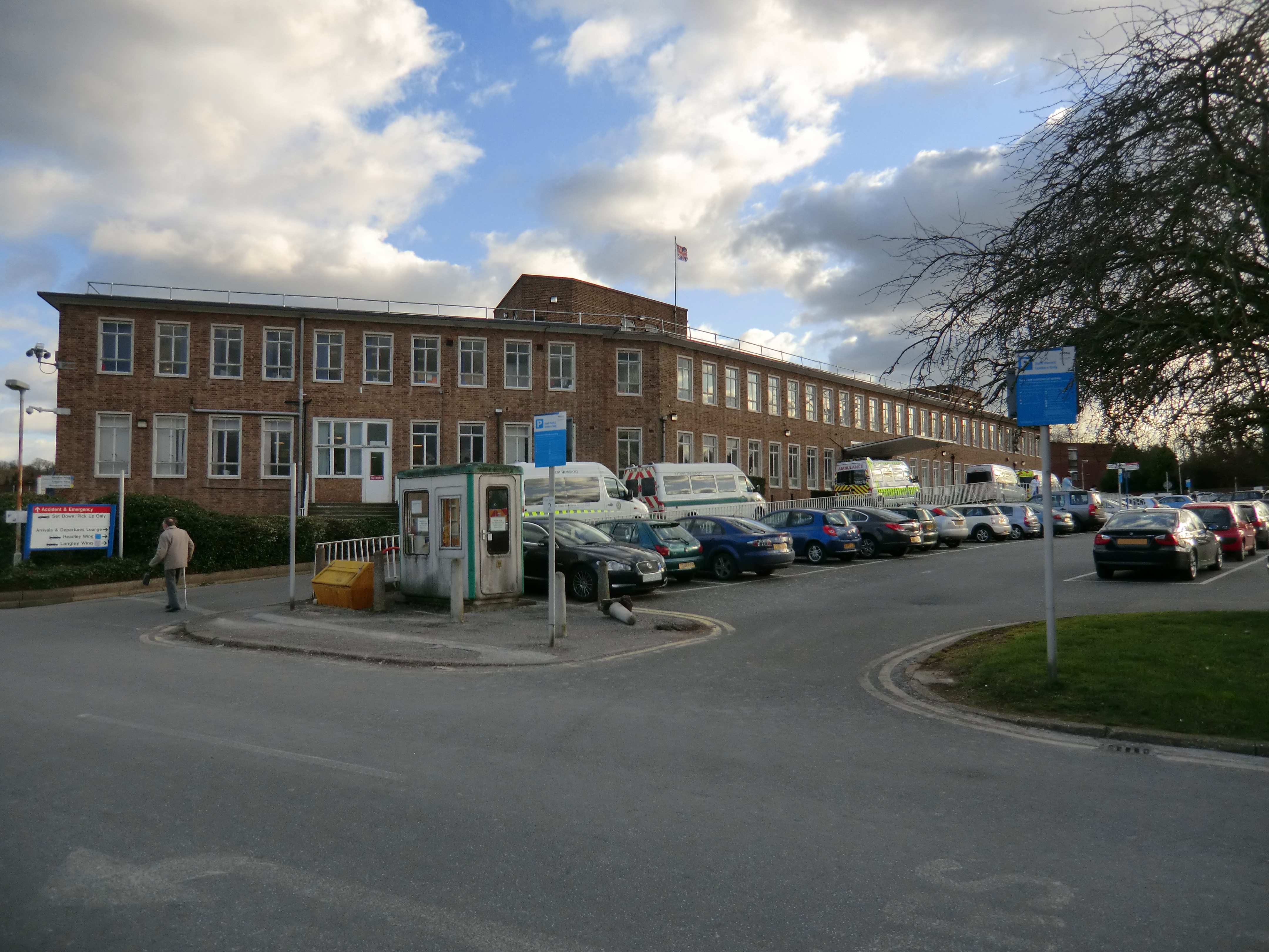
Epsom Hospital

Epsom Hospital is a teaching hospital in Epsom, Surrey, England. The hospital is situated on Dorking Road 1 kilometre (0.62 mi) south east of the centre...

Ashtead Park

Ashtead Park is a 24.2-hectare (60-acre) Local Nature Reserve in Ashtead in Surrey. It is owned by Mole Valley District Council. It contains several important...

Rosebery School for Girls

Rosebery School is an all-girls school located in Epsom, Surrey. It consists of a lower school for those aged between 11 and 16, and a sixth form for those...

Epsom Down

Epsom Down in the southern town outlands of Epsom was used as a venue for two first-class cricket matches between 1816 and 1819. Both were between the...

City of London Freemen's School

City of London Freemen's School (CLFS) is a co-educational private school for day and boarding pupils, located at Ashtead Park in Surrey, England. It is...

Epsom (UK Parliament constituency)

Epsom was a borough constituency represented in the House of Commons of the Parliament of the United Kingdom. It elected one Member of Parliament (MP)...

Epsom and Ewell (UK Parliament constituency)

Epsom and Ewell is a constituency in Surrey represented in the House of Commons of the UK Parliament since 2001 by Chris Grayling, a Conservative. �...

Related Videos

⁴ᴷ EPSOM Walking Tour, Surrey ENGLAND 🇬🇧 GB

It is warm Friday afternoon, 13th of August 2021. Let's take a walk together around Epsom Thank you to my father for sharing ...

Hiking around Epsom Downs, Surrey with the GoPro Hero 7 Black

Went for a very nice 10KM hike around the beautiful Surrey Countryside, starting and finishing at Epsom Downs Race Course.

Nearby Amenities

Located within 500m of 51.317723,-0.276563
Bus Stop
Flintstones
Bus: yes
Naptan AtcoCode: 40004406006A
Naptan Bearing: S
Naptan CommonName: Flintstones
Naptan Indicator: adj
Naptan Landmark: Flintstones
Naptan NaptanCode: surajgpa
Naptan Street: Wilmerhatch Lane
Naptan Verified: no
Public Transport: platform
Source: naptan_import
Lat/Long: 51.3157007/-0.2797052
Bus Stop
Flintstones
Bus: yes
Naptan AtcoCode: 40004406006B
Naptan Bearing: N
Naptan CommonName: Flintstones
Naptan Indicator: Opp
Naptan Landmark: Flintstones
Naptan NaptanCode: surajgpd
Naptan Street: Wilmerhatch Lane
Naptan Verified: no
Public Transport: platform
Source: naptan_import
Lat/Long: 51.3153602/-0.2799478
Bus Stop
RAC Club
Bus: yes
Naptan AtcoCode: 40004406007A
Naptan Bearing: S
Naptan CommonName: RAC Club
Naptan Indicator: Just Before
Naptan Landmark: RAC Club
Naptan NaptanCode: surajgpg
Naptan Street: Wilmerhatch Lane
Naptan Verified: no
Public Transport: platform
Source: naptan_import
Lat/Long: 51.3181328/-0.2782713
Bus Stop
RAC Club
Bus: yes
Naptan AtcoCode: 40004406007B
Naptan Bearing: N
Naptan CommonName: RAC Club
Naptan Indicator: Just after
Naptan Landmark: RAC Club
Naptan NaptanCode: surajgpj
Naptan Street: Wilmerhatch Lane
Naptan Verified: no
Public Transport: platform
Source: naptan_import
Lat/Long: 51.3178798/-0.2786784
Bus Stop
Woodcote Side
Bus: yes
Naptan AtcoCode: 40004406008A
Naptan Bearing: S
Naptan BusStopType: CUS
Naptan CommonName: Woodcote Side
Naptan Indicator: Just after
Naptan Landmark: Woodcote Side
Naptan NaptanCode: surgpwgp
Naptan Street: Wilmerhatch Lane
Naptan Verified: no
Public Transport: platform
Source: naptan_import
Lat/Long: 51.3194982/-0.2777778
Bus Stop
Woodcote Side
Bus: yes
Naptan AtcoCode: 40004406008B
Naptan Bearing: N
Naptan CommonName: Woodcote Side
Naptan Indicator: Just Before
Naptan Landmark: Woodcote Side
Naptan NaptanCode: surajgpm
Naptan Street: Wilmerhatch Lane
Naptan Verified: no
Public Transport: platform
Source: naptan_import
Lat/Long: 51.3194311/-0.2779283
Bus Stop
Woodcote Side
Naptan AtcoCode: 40004406164A
Naptan Bearing: E
Naptan CommonName: Woodcote Park Road
Naptan Indicator: Just Before
Naptan Landmark: Woodcote Park Road
Naptan NaptanCode: surgmwmd
Naptan Street: Woodcote Side
Naptan Verified: no
Public Transport: platform
Ref: 49555
Source: naptan_import
Lat/Long: 51.3211913/-0.2784751
Post Box
Drive Through: no
Operator: Royal Mail
Ref: KT18 194
Lat/Long: 51.3190801/-0.2708931
Post Box
Drive Through: no
Operator: Royal Mail
Ref: KT18 160
Lat/Long: 51.3213122/-0.2779811
Post Box
Drive Through: no
Operator: Royal Mail
Ref: KT18 205
Lat/Long: 51.3189719/-0.2761979
Golf: pin
Lat/Long: 51.3149589/-0.2743916
Golf: pin
Lat/Long: 51.3135273/-0.2758792
Golf: pin
Lat/Long: 51.3136887/-0.2740021
Golf: pin
Lat/Long: 51.3155768/-0.2719288
Golf: pin
Lat/Long: 51.317952/-0.2720826
Golf: pin
Lat/Long: 51.3173226/-0.2715418
Woodcote
Place: suburb
Lat/Long: 51.321622/-0.2765649
Colour: red and white
Marker: aerial
Material: plastic
Utility: gas
Lat/Long: 51.3183755/-0.2773424
Colour: yellow
Marker: post
Material: plastic
Utility: gas
Lat/Long: 51.3183792/-0.2773545
Colour: yellow
Marker: post
Material: plastic
Utility: gas
Lat/Long: 51.3183838/-0.2773521
Colour: white
Description: tall post with yellow pitched hat
Marker: aerial
Utility: gas
Lat/Long: 51.3186792/-0.2781792
Colour: white
Description: tall post with yellow pitched hat
Marker: aerial
Utility: yes
Lat/Long: 51.3186366/-0.2781904
The data included in this document is from www.openstreetmap.org. The data is made available under ODbL.

Have you been to Woodcote?

Leave your review of Woodcote below (or comments, questions and feedback).