Wombridge

Settlement in Shropshire

England

Wombridge

New Yard, St Georges The OS benchmark cut into the former New Yard Engineering Works in St. Georges, Telford. It was levelled in 1961 and last verified by the OS in 1985. It is recorded as being 141.37-metres above the Ordnance Datum at Newlyn
New Yard, St Georges Credit: Anthony Rowley

Wombridge is a small village located in the county of Shropshire, England. Situated approximately 3 miles northwest of Telford town center, it falls within the borough of Telford and Wrekin. The village is surrounded by picturesque countryside, featuring rolling hills and farmland.

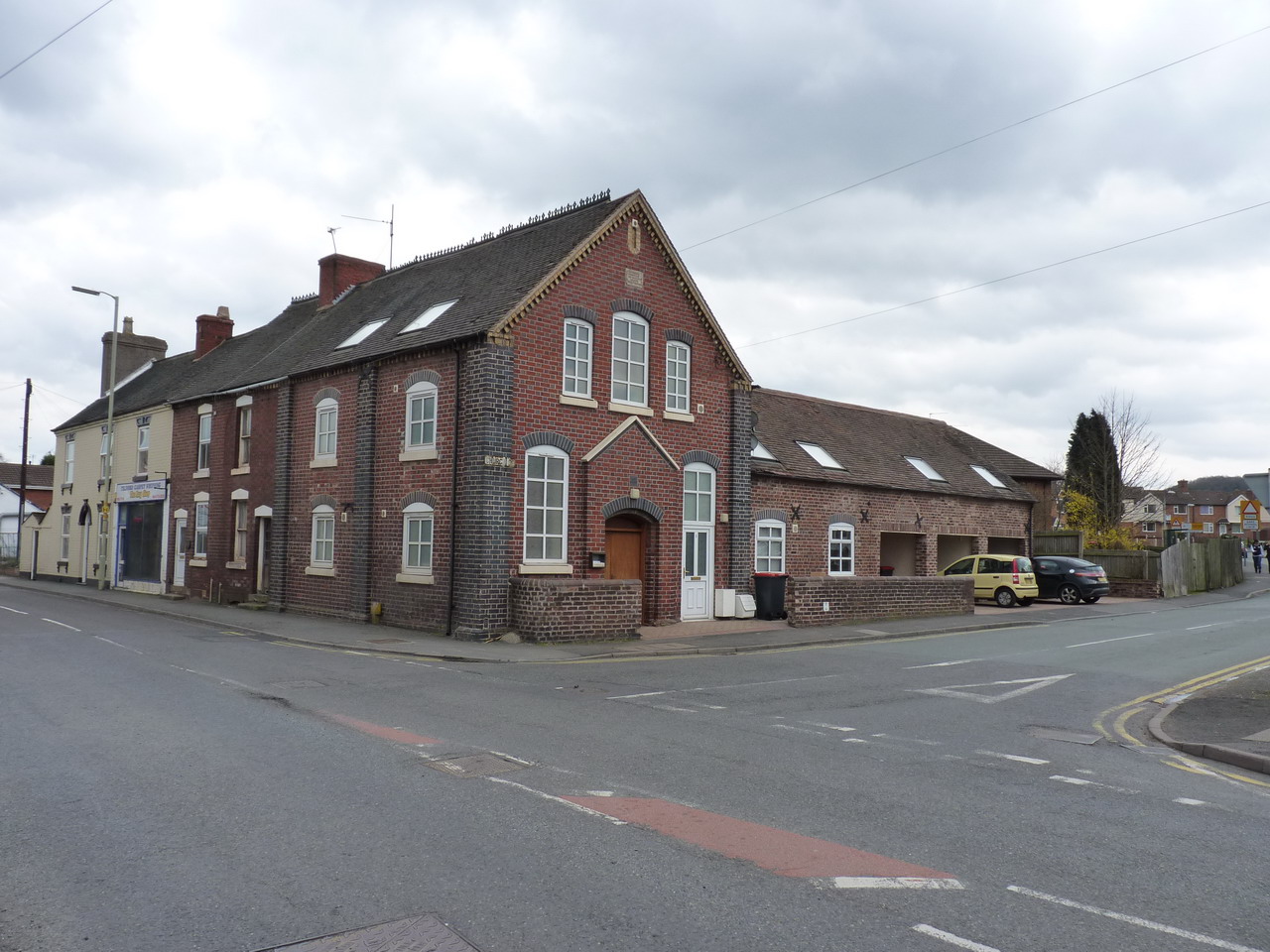
With a population of around 1,500 residents, Wombridge retains a close-knit community atmosphere. The village is primarily residential, characterized by a mix of detached houses, cottages, and some modern developments. The architecture reflects the area's heritage, with several historic buildings that have been well-preserved.

Wombridge benefits from a range of local amenities, including a primary school, a community center, and a village hall. There is also a local convenience store for daily essentials. For recreational activities, residents can enjoy the nearby Wombridge Canal, which offers pleasant walks and opportunities for boating and fishing.

Transport links in Wombridge are convenient, with regular bus services connecting the village to Telford town center and other nearby areas. The village is also located close to major road networks, including the M54 motorway, providing easy access to other parts of Shropshire and the wider West Midlands region.

Overall, Wombridge provides a peaceful and rural lifestyle, while still benefiting from its proximity to the amenities and employment opportunities of nearby Telford.

If you have any feedback on the listing, please let us know in the comments section below.
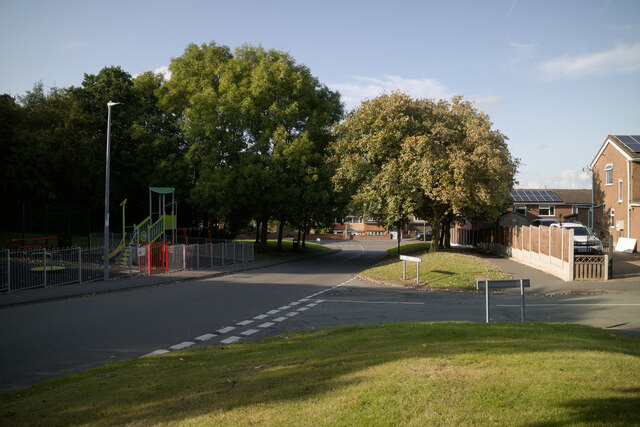
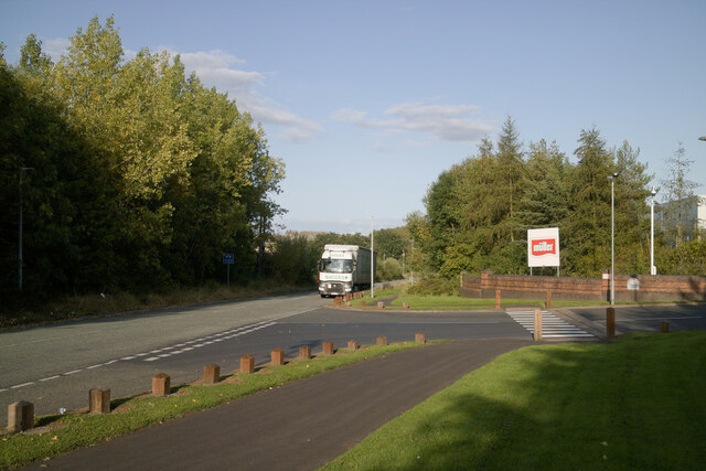
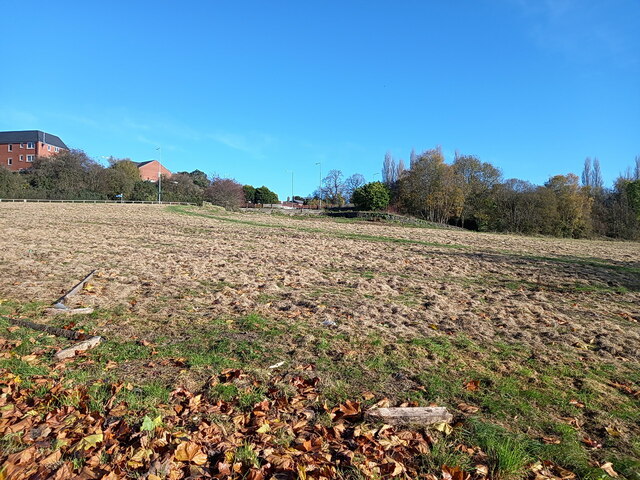
Wombridge Images

Images are sourced within 2km of 52.70153/-2.456365 or Grid Reference SJ6911. Thanks to Geograph Open Source API. All images are credited.

New Yard, St Georges The OS benchmark cut into the former New Yard Engineering Works in St. Georges, Telford. It was levelled in 1961 and last verified by the OS in 1985. It is recorded as being 141.37-metres above the Ordnance Datum at Newlyn
New Yard, St Georges
The OS benchmark cut into the former New Yard Engineering Works in St. Georges, Telford. It was levelled in 1961 and last verified by the OS in 1985. It is recorded as being 141.37-metres above the Ordnance Datum at Newlyn
Old Boundary Marker On Lodge Road, St George's Estate Boundary Marker against the front garden wall of Rose Cottage on the west side of Lodge Road at its junction with School Street in St George's. St. Georges and Priorslee parish.
 
The stone marked the boundary between two plots of land - 315 and 309 - that, in the 19C were leased from Lord Stafford to John Horton and company, which later became the Lilleshall Company. Plot 309 incorporated part of the Pain's Lane racecourse and its grandstand.

Milestone Society National ID: SA_STGPRI01em
Old Boundary Marker On Lodge Road, St George's
Estate Boundary Marker against the front garden wall of Rose Cottage on the west side of Lodge Road at its junction with School Street in St George's. St. Georges and Priorslee parish. The stone marked the boundary between two plots of land - 315 and 309 - that, in the 19C were leased from Lord Stafford to John Horton and company, which later became the Lilleshall Company. Plot 309 incorporated part of the Pain's Lane racecourse and its grandstand. Milestone Society National ID: SA_STGPRI01em
A peek round the back of the Aldi store HGV access to the rear of the supermarket and the adjoining home improvements store (Aldi and Wickes respectively) which now occupy the land on Snedshill that was once home to the Lilleshall Company.
A peek round the back of the Aldi store
HGV access to the rear of the supermarket and the adjoining home improvements store (Aldi and Wickes respectively) which now occupy the land on Snedshill that was once home to the Lilleshall Company.
Marrion's Hill approaching West Street Viewed from the junction with Hill Crest Road.
Marrion's Hill approaching West Street
Viewed from the junction with Hill Crest Road.
Granville Road, Donnington Wood The entrance to the Muller factory is on the right.
Granville Road, Donnington Wood
The entrance to the Muller factory is on the right.
Asda petrol station, Wrockwardine Wood Way
Pearson Road - Office units in Central Park The area now occupied by the Central Park business estate was formerly the Snedshill steelworks, part of the Lilleshall Company's operations. By the mid '70s my recollection is that the steelworks had shut, although many of the buildings were still there, and one shed was occupied by 'The Maggot Factory' which used dead farm animals to breed maggots for angling on an industrial scale; it had a very distinctive aroma, but sold maggots by the gallon for pennies if you had the constitution to walk in and just ask.
Pearson Road - Office units in Central Park
The area now occupied by the Central Park business estate was formerly the Snedshill steelworks, part of the Lilleshall Company's operations. By the mid '70s my recollection is that the steelworks had shut, although many of the buildings were still there, and one shed was occupied by 'The Maggot Factory' which used dead farm animals to breed maggots for angling on an industrial scale; it had a very distinctive aroma, but sold maggots by the gallon for pennies if you had the constitution to walk in and just ask.
Open ground south of Holyhead Road, Snedshill The area now occupied by the Central Park business estate was formerly the Snedshill steelworks, part of the Lilleshall Company's operations, and the older maps show this land occupied by coke ovens, furnaces, chimneys and travelling cranes. All removed during the 1970s as part of the work to develop Telford as a New Town.
Open ground south of Holyhead Road, Snedshill
The area now occupied by the Central Park business estate was formerly the Snedshill steelworks, part of the Lilleshall Company's operations, and the older maps show this land occupied by coke ovens, furnaces, chimneys and travelling cranes. All removed during the 1970s as part of the work to develop Telford as a New Town.
Ordnance Survey Cut Mark This OS cut mark can be found on No71 Wrekin Drive. It marks a point 82.921m above mean sea level.
Ordnance Survey Cut Mark
This OS cut mark can be found on No71 Wrekin Drive. It marks a point 82.921m above mean sea level.
Ordnance Survey Cut Mark This OS cut mark can be found on No1 St Georges Road. It marks a point 95.330m above mean sea level.
Ordnance Survey Cut Mark
This OS cut mark can be found on No1 St Georges Road. It marks a point 95.330m above mean sea level.
The White Horse
The White Horse
New Aldi Supermarket and Wickes DIY stores, Snedshill, Telford The development at Holyhead Road, Snedshill, Telford is now complete and the stores are open for business.  16 April 2011.

Original Lilleshall Co. factory. <a title="https://www.geograph.org.uk/photo/2024941" href="https://www.geograph.org.uk/photo/2024941">Link</a>
Fire ravaged ruins. <a title="https://www.geograph.org.uk/photo/2028184" href="https://www.geograph.org.uk/photo/2028184">Link</a>
Cleared site. <a title="https://www.geograph.org.uk/photo/2028197" href="https://www.geograph.org.uk/photo/2028197">Link</a>
Start of development. <a title="https://www.geograph.org.uk/photo/2028204" href="https://www.geograph.org.uk/photo/2028204">Link</a>
New buildings.  <a title="https://www.geograph.org.uk/photo/2250149" href="https://www.geograph.org.uk/photo/2250149">Link</a>
New Aldi Supermarket and Wickes DIY stores, Snedshill, Telford
The development at Holyhead Road, Snedshill, Telford is now complete and the stores are open for business. 16 April 2011. Original Lilleshall Co. factory. Link Fire ravaged ruins. Link Cleared site. Link Start of development. Link New buildings. Link
OS benchmark - St George's church tower A well-preserved OS cutmark just to the right of the main entrance to <a href="https://www.geograph.org.uk/photo/372892">SJ7010 : St George's Church, St George's</a>; originally levelled at 172.186m above Ordnance Datum Newlyn.
OS benchmark - St George's church tower
A well-preserved OS cutmark just to the right of the main entrance to SJ7010 : St George's Church, St George's; originally levelled at 172.186m above Ordnance Datum Newlyn.
OS benchmark and bolt - Snedshill, St Peter's church An OS cutmark and bolt from the 1st Primary Levelling of the country between 1840 - 1860; this mark was levelled at 561' 2" above Ordnance Datum Liverpool. It lies on the wall just to the right of the entrance to <a href="https://www.geograph.org.uk/photo/858270">SJ7010 : St Peter's Church, Priorslee</a>
OS benchmark and bolt - Snedshill, St Peter's church
An OS cutmark and bolt from the 1st Primary Levelling of the country between 1840 - 1860; this mark was levelled at 561' 2" above Ordnance Datum Liverpool. It lies on the wall just to the right of the entrance to SJ7010 : St Peter's Church, Priorslee
OS benchmark - St George's, 102 Freeston Avenue An OS cutmark in the brickwork at the side of 102 Freeston Avenue; originally levelled in 1985 at 170.31m above Ordnance Datum Newlyn.
OS benchmark - St George's, 102 Freeston Avenue
An OS cutmark in the brickwork at the side of 102 Freeston Avenue; originally levelled in 1985 at 170.31m above Ordnance Datum Newlyn.
OS benchmark - Snedshill, no 1 Furnace Lane An OS cutmark in the brickwork at the side of no 1 Furnace Lane; originally levelled in 1985 at 173.277m above Ordnance Datum Newlyn.
OS benchmark - Snedshill, no 1 Furnace Lane
An OS cutmark in the brickwork at the side of no 1 Furnace Lane; originally levelled in 1985 at 173.277m above Ordnance Datum Newlyn.
OS benchmark - St George's, 16 The Grove Estate An OS cutmark at the front of no 16, The Grove; originally levelled in 1985 at 168.506m above Ordnance Datum Newlyn.
OS benchmark - St George's, 16 The Grove Estate
An OS cutmark at the front of no 16, The Grove; originally levelled in 1985 at 168.506m above Ordnance Datum Newlyn.
OS benchmark - St George's, Mayfield An OS cutmark in the brickwork of an outbuilding of 'Mayfield House' on London Road; originally levelled in 1985 at 163.061m above Ordnance Datum Newlyn.
OS benchmark - St George's, Mayfield
An OS cutmark in the brickwork of an outbuilding of 'Mayfield House' on London Road; originally levelled in 1985 at 163.061m above Ordnance Datum Newlyn.
Show me another place!

Wombridge is located at Grid Ref: SJ6911 (Lat: 52.70153, Lng: -2.456365)

Unitary Authority: Telford and Wrekin

Police Authority: West Mercia

What 3 Words

///infuses.snuggled.haircuts. Near Oakengates, Shropshire

Related Wikis

Wombridge Priory

Wombridge Priory was a small Augustinian monastery in Shropshire. Established in the early 12th century, it was supported by a network of minor nobility...

Telford Priory School

Telford Priory School is a coeducational secondary school located in the Wrockwardine Wood area of Telford in Shropshire, England. The school opened in...

Wrockwardine Wood

Wrockwardine Wood (pronounced "Rock-war-dine") was originally a detached piece of woodland, then a township, formerly belonging to the manor and parish...

Wellington Amateurs F.C.

Wellington Amateurs Football Club is an English football club from Wellington, Shropshire but currently located in Telford. The club plays in the West...

Oakengates

Oakengates is a constituent town of Telford and a civil parish in the borough of Telford and Wrekin, Shropshire, England. The towns parish population was...

Oakengates Market Street railway station

Oakengates Market Street railway station was a station in Oakengates, Shropshire, England. The station was opened in 1860 and closed in 1952. The station...

Oakengates railway station

Oakengates railway station serves the town of Oakengates, Telford and Wrekin, Shropshire, England. It has two platforms. Rail services are primarily provided...

Trench, Telford

Trench is a suburb of the new town of Telford in the borough of Telford and Wrekin and ceremonial county of Shropshire, England, on the north side of the...

Nearby Amenities

Located within 500m of 52.70153,-2.456365
Motorway Junction
Wombridge Interchange
Lat/Long: 52.702312/-2.4563374
Created By: Merkaartor 0.12
Lat/Long: 52.7025769/-2.461248
Created By: Merkaartor 0.12
Lat/Long: 52.705073/-2.4559378
Traffic Signals
Lat/Long: 52.7050175/-2.4533982
Barrier: cycle_barrier
Bicycle: yes
Foot: yes
Lat/Long: 52.7017153/-2.4538456
Barrier: cycle_barrier
Bicycle: yes
Foot: yes
Lat/Long: 52.7031525/-2.4570672
Give Way
Source: bing
Lat/Long: 52.6989937/-2.4611666
Turning Circle
Lat/Long: 52.6987701/-2.4513272
Turning Circle
Lat/Long: 52.6998525/-2.4524591
Turning Circle
Turning Circle: hammer
Lat/Long: 52.6976697/-2.4574734
Traffic Calming: hump
Lat/Long: 52.6984168/-2.4563641
Turning Circle
Turning Circle: circle
Lat/Long: 52.6994453/-2.4588731
Crossing
Crossing: unmarked
Crossing Island: yes
Crossing Markings: no
Tactile Paving: yes
Lat/Long: 52.7053207/-2.4532627
Give Way
Source: bing
Lat/Long: 52.6986371/-2.4604983
BMX track
Leisure: park
Lat/Long: 52.7017145/-2.4612535
Leisure: pitch
Sport: skateboard
Lat/Long: 52.7014143/-2.4606448
Barrier: cycle_barrier
Lat/Long: 52.7032023/-2.451358
Give Way
Direction: backward
Lat/Long: 52.7036099/-2.4526065
Barrier: cycle_barrier
Cycle Barrier: triple
Foot: yes
Lat/Long: 52.7025798/-2.4513136
Crossing
Lat/Long: 52.7049247/-2.4551903
Generator Method: photovoltaic
Generator Output Electricity: yes
Generator Source: solar
Generator Type: solar_photovoltaic_panel
Location: roof
Power: generator
Lat/Long: 52.6976599/-2.4550742
Generator Method: photovoltaic
Generator Output Electricity: yes
Generator Source: solar
Generator Type: solar_photovoltaic_panel
Location: roof
Power: generator
Lat/Long: 52.6981589/-2.4530062
Generator Method: photovoltaic
Generator Output Electricity: yes
Generator Source: solar
Generator Type: solar_photovoltaic_panel
Location: roof
Power: generator
Lat/Long: 52.6982028/-2.4530411
Generator Method: photovoltaic
Generator Output Electricity: yes
Generator Source: solar
Generator Type: solar_photovoltaic_panel
Location: roof
Power: generator
Lat/Long: 52.6984011/-2.4539691
Generator Method: photovoltaic
Generator Output Electricity: yes
Generator Source: solar
Generator Type: solar_photovoltaic_panel
Location: roof
Power: generator
Lat/Long: 52.6984628/-2.4540228
Generator Method: photovoltaic
Generator Output Electricity: yes
Generator Source: solar
Generator Type: solar_photovoltaic_panel
Location: roof
Power: generator
Lat/Long: 52.6985116/-2.4540496
Generator Method: photovoltaic
Generator Output Electricity: yes
Generator Source: solar
Generator Type: solar_photovoltaic_panel
Location: roof
Power: generator
Lat/Long: 52.6999745/-2.45619
Generator Method: photovoltaic
Generator Output Electricity: yes
Generator Source: solar
Generator Type: solar_photovoltaic_panel
Location: roof
Power: generator
Lat/Long: 52.6992089/-2.4567318
Generator Method: photovoltaic
Generator Output Electricity: yes
Generator Source: solar
Generator Type: solar_photovoltaic_panel
Location: roof
Power: generator
Lat/Long: 52.6992024/-2.4568069
Generator Method: photovoltaic
Generator Output Electricity: yes
Generator Source: solar
Generator Type: solar_photovoltaic_panel
Location: roof
Power: generator
Lat/Long: 52.7006441/-2.4588776
Generator Method: photovoltaic
Generator Output Electricity: yes
Generator Source: solar
Generator Type: solar_photovoltaic_panel
Location: roof
Power: generator
Lat/Long: 52.7009611/-2.4586228
Generator Method: photovoltaic
Generator Output Electricity: yes
Generator Source: solar
Generator Type: solar_photovoltaic_panel
Location: roof
Power: generator
Lat/Long: 52.7009838/-2.4585289
Generator Method: photovoltaic
Generator Output Electricity: yes
Generator Source: solar
Generator Type: solar_photovoltaic_panel
Location: roof
Power: generator
Lat/Long: 52.6985132/-2.4576625
Generator Method: photovoltaic
Generator Output Electricity: yes
Generator Source: solar
Generator Type: solar_photovoltaic_panel
Location: roof
Power: generator
Lat/Long: 52.698523/-2.457861
Generator Method: photovoltaic
Generator Output Electricity: yes
Generator Source: solar
Generator Type: solar_photovoltaic_panel
Location: roof
Power: generator
Lat/Long: 52.6977753/-2.4572012
Generator Method: photovoltaic
Generator Output Electricity: yes
Generator Source: solar
Generator Type: solar_photovoltaic_panel
Location: roof
Power: generator
Lat/Long: 52.697468/-2.4568418
Generator Method: photovoltaic
Generator Output Electricity: yes
Generator Source: solar
Generator Type: solar_photovoltaic_panel
Location: roof
Power: generator
Lat/Long: 52.6973754/-2.4548462
Generator Method: photovoltaic
Generator Output Electricity: yes
Generator Source: solar
Generator Type: solar_photovoltaic_panel
Location: roof
Power: generator
Lat/Long: 52.7037046/-2.4511313
Barrier: cycle_barrier
Cycle Barrier: tilted
Lat/Long: 52.7012874/-2.4540119
Barrier: cycle_barrier
Cycle Barrier: tilted
Lat/Long: 52.7024213/-2.4569716
Crossing
Button Operated: yes
Crossing: traffic_signals
Crossing Island: yes
Crossing Markings: dots
Tactile Paving: yes
Lat/Long: 52.7050674/-2.4537347
Cycleway: asl
Direction: forward
Lat/Long: 52.7050785/-2.45381
Cycleway: asl
Direction: forward
Lat/Long: 52.7050909/-2.4533654
Cycleway: asl
Direction: backward
Lat/Long: 52.7049831/-2.4532627
Give Way
Direction: backward
Lat/Long: 52.6976887/-2.4564833
Barrier: cycle_barrier
Lat/Long: 52.7030853/-2.4513467
Clock
Faces: 4
Support: tower
Lat/Long: 52.7026668/-2.4512429
Barrier: horse_stile
Lat/Long: 52.7012875/-2.4540218
The data included in this document is from www.openstreetmap.org. The data is made available under ODbL.

Have you been to Wombridge?

Leave your review of Wombridge below (or comments, questions and feedback).