Wombourne

Settlement in Staffordshire South Staffordshire

England

Wombourne

Wombourne Institute The 1863 Institute in Church Road stands next to St Benedict Church overlooking the Staffordshire Village Green.
Wombourne Institute Credit: Gordon Griffiths

Wombourne is a picturesque village located in the South Staffordshire district of Staffordshire, England. Situated approximately 6 miles south-west of Wolverhampton, Wombourne is known for its scenic countryside, charming village center, and rich history.

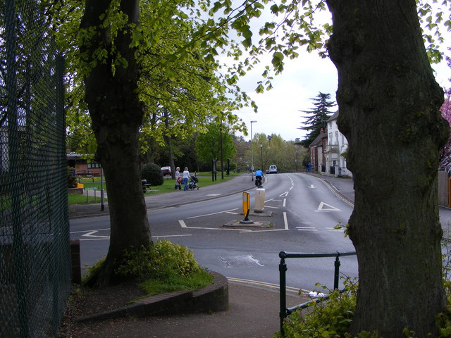
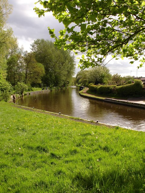
Surrounded by rolling hills and green fields, Wombourne offers a peaceful and idyllic setting for its residents. The village is characterized by its traditional cottages, elegant Georgian and Victorian houses, and well-manicured gardens. The Wombrook, a small stream that runs through the village, adds to the overall charm and beauty of the area.

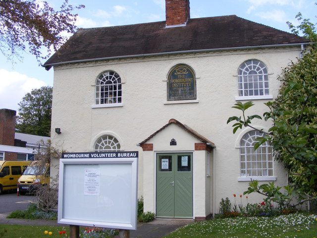
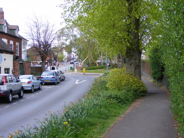
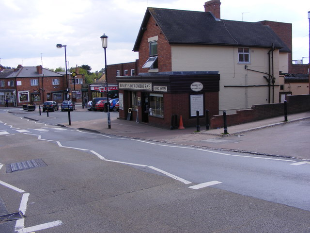
Wombourne boasts a thriving community with a range of amenities and services. The village center is home to a variety of independent shops, boutiques, cafes, and restaurants, providing residents and visitors with a unique shopping and dining experience. The local library, post office, and several medical facilities cater to the daily needs of the community.

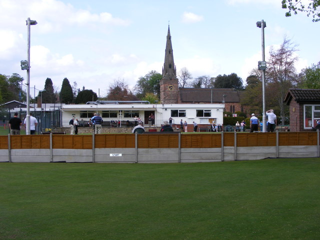
For outdoor enthusiasts, Wombourne offers an abundance of recreational opportunities. The nearby Wombourne Leisure Centre provides facilities for swimming, fitness, and sports activities. The village also benefits from numerous green spaces and parks, including the renowned Himley Hall and Park, which offers stunning landscapes and a tranquil lake.

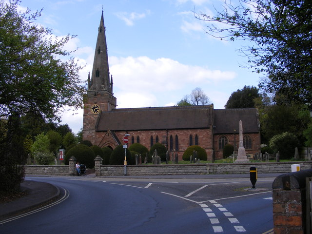
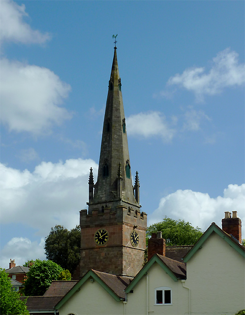
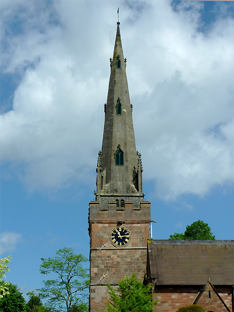
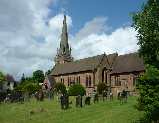
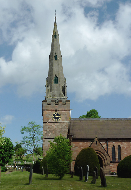
Wombourne's rich history is evident through its notable landmarks and historical sites. St. Benedict Biscop Church, a Grade I listed building, stands proudly in the heart of the village, showcasing beautiful architecture and a rich heritage. The South Staffordshire Railway Walk, a former railway line, offers a pleasant stroll through the countryside, allowing visitors to appreciate the village's industrial past.

Overall, Wombourne, Staffordshire, presents a unique blend of natural beauty, community spirit, and historical significance, making it a desirable place to live and visit.

If you have any feedback on the listing, please let us know in the comments section below.

Wombourne Images

Images are sourced within 2km of 52.531213/-2.200733 or Grid Reference SO8692. Thanks to Geograph Open Source API. All images are credited.

Wombourne Institute The 1863 Institute in Church Road stands next to St Benedict Church overlooking the Staffordshire Village Green.
Wombourne Institute
The 1863 Institute in Church Road stands next to St Benedict Church overlooking the Staffordshire Village Green.
Wombourne Church The St Benedict Biscop Church stands in Church Road overlooking the Village Green.
Wombourne Church
The St Benedict Biscop Church stands in Church Road overlooking the Village Green.
Green on the Green Wombourne Bowls Club stands on the Staffordshire Village Green, with St Benedict's Church in the background.
Green on the Green
Wombourne Bowls Club stands on the Staffordshire Village Green, with St Benedict's Church in the background.
Wombourne Path The view up Maypole Street alongside the Staffordshire Village Green.
Wombourne Path
The view up Maypole Street alongside the Staffordshire Village Green.
Wombourne Butchers The view of Boxley's of Wombourne in Windmill Bank near the Staffordshire Village Green.
Wombourne Butchers
The view of Boxley's of Wombourne in Windmill Bank near the Staffordshire Village Green.
Maypole and Street The view in Maypole Street Wombourne near the Staffordshire Village Green.
Maypole and Street
The view in Maypole Street Wombourne near the Staffordshire Village Green.
Wombourne View The view of Gravel Hill from the corner of the Staffordshire Village Green.
Wombourne View
The view of Gravel Hill from the corner of the Staffordshire Village Green.
The spire of St Benedict Biscop Church at Wombourne, Staffordshire In 1840 nearly all the then existing medieval church was demolished. The 14th century tower with its recessed stone spire was retained. The 1840 rebuild was itself taken down, and the present fine structure replaced it in 1867 - again retaining the original 14th century tower and spire.
The spire of St Benedict Biscop Church at Wombourne, Staffordshire
In 1840 nearly all the then existing medieval church was demolished. The 14th century tower with its recessed stone spire was retained. The 1840 rebuild was itself taken down, and the present fine structure replaced it in 1867 - again retaining the original 14th century tower and spire.
St Benedict Biscop Church in Wombourne, Staffordshire In 1840 nearly all the then existing medieval church was demolished. The 14th century tower with its recessed stone spire was retained. The 1840 rebuild was itself taken down, and the present fine structure replaced it in 1867 - again retaining the original 14th century tower and spire.
St Benedict Biscop Church in Wombourne, Staffordshire
In 1840 nearly all the then existing medieval church was demolished. The 14th century tower with its recessed stone spire was retained. The 1840 rebuild was itself taken down, and the present fine structure replaced it in 1867 - again retaining the original 14th century tower and spire.
St Benedict Biscop Church in Wombourne, Staffordshire In 1840 nearly all the then existing medieval church was demolished. The 14th century tower with its recessed stone spire was retained. The 1840 rebuild was itself taken down, and the present fine structure replaced it in 1867 - again retaining the original 14th century tower and spire.

<span class="nowrap"><a title="http://www.stbenedictbiscop.org.uk/" rel="nofollow ugc noopener" href="http://www.stbenedictbiscop.org.uk/">Link</a><img style="margin-left:2px;" alt="External link" title="External link - shift click to open in new window" src="https://s1.geograph.org.uk/img/external.png" width="10" height="10"/></span>
St Benedict Biscop Church in Wombourne, Staffordshire
In 1840 nearly all the then existing medieval church was demolished. The 14th century tower with its recessed stone spire was retained. The 1840 rebuild was itself taken down, and the present fine structure replaced it in 1867 - again retaining the original 14th century tower and spire. LinkExternal link
St Benedict's Church clock in Wombourne, Staffordshire The tower was originally built in the 14th century and has structural strengthening ironware showing here, as well as a gargoyle.

In 1840 nearly all the then existing medieval church was demolished. The tower with its recessed stone spire was retained. The 1840 rebuild was itself taken down, and the present fine structure replaced it in 1867 - again retaining the 14th century tower and spire.
St Benedict's Church clock in Wombourne, Staffordshire
The tower was originally built in the 14th century and has structural strengthening ironware showing here, as well as a gargoyle. In 1840 nearly all the then existing medieval church was demolished. The tower with its recessed stone spire was retained. The 1840 rebuild was itself taken down, and the present fine structure replaced it in 1867 - again retaining the 14th century tower and spire.
War memorial in St Benedict's churchyard in Wombourne, Staffordshire The inscription reads:

TO
THE GLORY OF GOD
AND IN MEMORY OF
THE MEN OF WOMBOURN
WHO GAVE THEIR LIVES
FOR THEIR COUNTRY
IN THE GREAT WAR
1914-1919
1939-1945
War memorial in St Benedict's churchyard in Wombourne, Staffordshire
The inscription reads: TO THE GLORY OF GOD AND IN MEMORY OF THE MEN OF WOMBOURN WHO GAVE THEIR LIVES FOR THEIR COUNTRY IN THE GREAT WAR 1914-1919 1939-1945
Bratch Locks Plaque recording the refurbishment of the locks
Bratch Locks
Plaque recording the refurbishment of the locks
Below Bratch Locks
Below Bratch Locks
Griffiths Drive The view of the Close off Sytch Lane, Wombourne.
Griffiths Drive
The view of the Close off Sytch Lane, Wombourne.
Sytch Lane Cemetery Entrance The view of the entrance to the Wombourne Cemetery which opened in December 2009.
Sytch Lane Cemetery Entrance
The view of the entrance to the Wombourne Cemetery which opened in December 2009.
Wombourne Cemetery The view of Sytch Lane Cemetery which opened in December 2009.
Wombourne Cemetery
The view of Sytch Lane Cemetery which opened in December 2009.
Show me another place!

Wombourne is located at Grid Ref: SO8692 (Lat: 52.531213, Lng: -2.200733)

Administrative County: Staffordshire

District: South Staffordshire

Police Authority: Staffordshire

What 3 Words

///stone.itself.teams. Near Wombourn, Staffordshire

Related Wikis

Wombourne High School

Wombourne High School (formerly Ounsdale High School) is a coeducational secondary school and sixth form located in Wombourne, Staffordshire, England....

Wom Brook

The Wom Brook is a stream in South Staffordshire, England. It flows through the large village of Wombourne, and has played an important part in its industrial...

Wombourne

Wombourne is a large village and civil parish located in the district of South Staffordshire, in the county of Staffordshire, England. It is 4 miles (6...
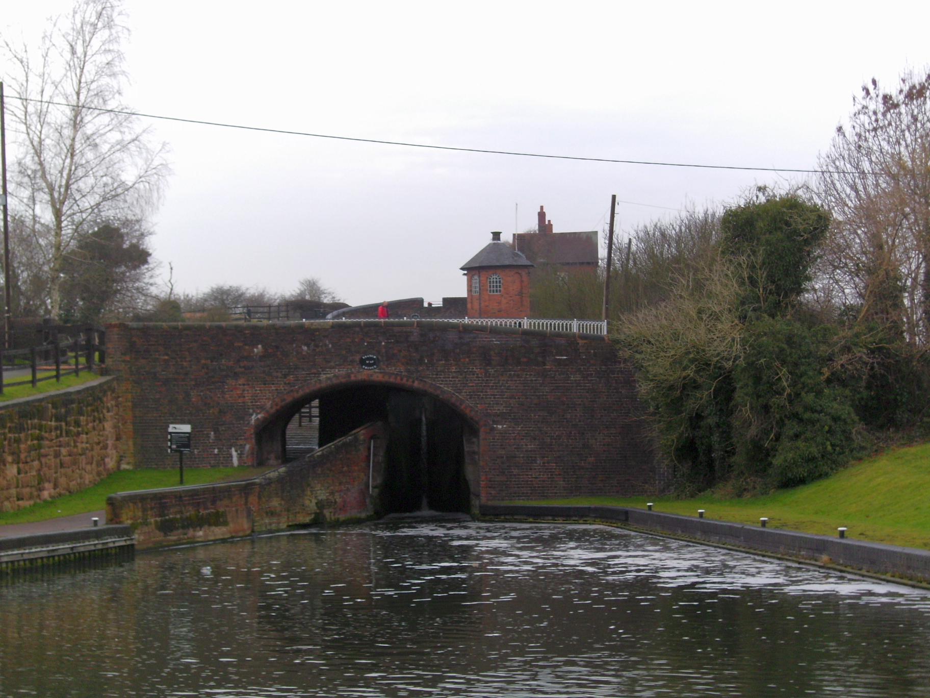
Bratch

The Bratch is an area of Wombourne in South Staffordshire, England, noted for its industrial heritage and more recently as a way station for walkers, riders...

Nearby Amenities

Located within 500m of 52.531213,-2.200733
Traffic Signals
Source: visual survey; bing
Lat/Long: 52.5355994/-2.2011285
Crossing
Crossing: uncontrolled
Lat/Long: 52.5335679/-2.1946836
Bus Stop
Windsor Road
Bus: yes
Naptan AtcoCode: 3800C610400
Naptan Bearing: NE
Naptan CommonName: Windsor Road
Naptan Indicator: Opp
Naptan Landmark: Windsor Road
Naptan Street: Planks Lane
Naptan Verified: no
Public Transport: platform
Source: naptan_import
Lat/Long: 52.5332207/-2.1963824
Bus Stop
Windsor Road
Bus: yes
Naptan AtcoCode: 3800C610401
Naptan Bearing: SW
Naptan CommonName: Windsor Road
Naptan Indicator: Adj
Naptan Landmark: Windsor Road
Naptan Street: Planks Lane
Naptan Verified: no
Public Transport: platform
Source: naptan_import
Lat/Long: 52.5333922/-2.1953044
Bus Stop
Marlburn Way
Bus: yes
Naptan AtcoCode: 3800C612801
Naptan Bearing: SE
Naptan CommonName: Marlburn Way
Naptan Indicator: Adj
Naptan Landmark: Marlburn Way
Naptan Street: Millfields Way
Naptan Verified: no
Public Transport: platform
Source: naptan_import
Lat/Long: 52.5311698/-2.2043205
Bus Stop
Crane Hollow
Bus: yes
Naptan AtcoCode: 3800C623001
Naptan Bearing: SW
Naptan BusStopType: CUS
Naptan CommonName: Crane Hollow
Naptan Indicator: Adj
Naptan Landmark: Crane Hollow
Naptan Street: Millfields Way
Naptan Verified: no
Public Transport: platform
Source: naptan_import
Lat/Long: 52.529276/-2.2057991
Bus Stop
Crane Hollow
Bus: yes
Naptan AtcoCode: 3800C623002
Naptan Bearing: NE
Naptan CommonName: Crane Hollow
Naptan Indicator: Opp
Naptan Landmark: Crane Hollow
Naptan Street: Millfields Way
Naptan Verified: no
Public Transport: platform
Source: naptan_import
Lat/Long: 52.5293746/-2.2059469
Bus Stop
Ambulance Station
Bus: yes
Naptan AtcoCode: 3800C623601
Naptan Bearing: SE
Naptan CommonName: Ambulance Station
Naptan Indicator: Adj
Naptan Landmark: Ambulance Station
Naptan Street: Giggety Lane
Naptan Verified: no
Public Transport: platform
Source: naptan_import
Lat/Long: 52.5302119/-2.2000101
Bus Stop
Ambulance Station
Bus: yes
Naptan AtcoCode: 3800C623602
Naptan Bearing: NW
Naptan CommonName: Ambulance Station
Naptan Indicator: Opp
Naptan Landmark: Ambulance Station
Naptan Street: Giggetty Ln
Naptan Verified: no
Public Transport: platform
Source: naptan_import
Lat/Long: 52.5298948/-2.1998584
Bus Stop
Lindale Drive
Bus: yes
Naptan AtcoCode: 3800C623701
Naptan Bearing: NE
Naptan CommonName: Giggety Lane
Naptan Indicator: Adj
Naptan Landmark: Giggety Lane (N)
Naptan Street: Planks Lane
Naptan Verified: no
Public Transport: platform
Source: naptan_import
Lat/Long: 52.5314425/-2.2006201
Bus Stop
Lindale Drive
Bus: yes
Naptan AtcoCode: 3800C623702
Naptan Bearing: SW
Naptan CommonName: Giggety Lane
Naptan Indicator: Adj
Naptan Landmark: Giggety Lane (S)
Naptan Street: Planks Lane
Naptan Verified: no
Public Transport: platform
Source: naptan_import
Lat/Long: 52.5313167/-2.20059
Bus Stop
Van Diemans Road
Bus: yes
Naptan AtcoCode: 3800C624401
Naptan Bearing: SW
Naptan CommonName: Giggetty Lane
Naptan Indicator: Adj
Naptan Landmark: Giggetty Lane
Naptan Street: Brickbridge Lane
Naptan Verified: no
Public Transport: platform
Source: naptan_import
Lat/Long: 52.5289171/-2.2001074
Bus Stop
Van Diemans Road
Bus: yes
Naptan AtcoCode: 3800C624402
Naptan Bearing: NE
Naptan CommonName: Van Diemans Road
Naptan Indicator: Opp
Naptan Landmark: Van Diemans Rd
Naptan Street: Brickbridge Ln
Naptan Verified: no
Public Transport: platform
Source: naptan_import
Lat/Long: 52.5288615/-2.2005896
Power Historic: tower
Source: OS 1:25k
Lat/Long: 52.5282514/-2.1966831
Power Historic: tower
Source: OS 1:25k
Lat/Long: 52.5338893/-2.1960513
Power: tower
Source: bing
Lat/Long: 52.5312402/-2.2068941
Power: tower
Source: bing
Lat/Long: 52.5283061/-2.2059045
Power: tower
Source: bing
Lat/Long: 52.530909/-2.2072144
Power: tower
Source: bing
Lat/Long: 52.5284262/-2.2064274
Source: Bing; OpenData_Street_View
Lat/Long: 52.5278891/-2.2038179
Turning Circle
Lat/Long: 52.5329755/-2.2032467
Turning Circle
Source: bing
Lat/Long: 52.530626/-2.2031181
Barrier: cycle_barrier
Lat/Long: 52.5316075/-2.200252
Turning Circle
Lat/Long: 52.5348987/-2.2000545
Fire Station
Wombourne Fire Station
Lat/Long: 52.5307266/-2.2002469
Shop: alcohol
Lat/Long: 52.5332585/-2.1952184
Gary Lees
Shop: hairdresser
Lat/Long: 52.5332487/-2.1953257
Removed Amenity: telephone
Lat/Long: 52.5327615/-2.2058235
Shop: convenience
Lat/Long: 52.5279079/-2.2001305
Post Box
Lat/Long: 52.532586/-2.1982637
Traffic Signals
Source: visual survey; bing
Lat/Long: 52.5356705/-2.2003976
Traffic Calming: cushion
Lat/Long: 52.5314226/-2.2005547
Traffic Calming: cushion
Lat/Long: 52.531881/-2.2000231
Crossing
Crossing: uncontrolled
Crossing Ref: zebra
Lat/Long: 52.5322837/-2.1993386
Traffic Calming: cushion
Lat/Long: 52.5325745/-2.198731
Traffic Calming: cushion
Lat/Long: 52.5329437/-2.1973912
Traffic Calming: cushion
Lat/Long: 52.5331478/-2.1964768
Traffic Calming: cushion
Lat/Long: 52.5332683/-2.1959626
Turning Circle
Source: bing
Lat/Long: 52.5333028/-2.1996112
Generator Method: photovoltaic
Generator Output Electricity: yes
Generator Source: solar
Generator Type: solar_photovoltaic_panel
Power: generator
Lat/Long: 52.5318058/-2.2018214
Generator Method: photovoltaic
Generator Output Electricity: yes
Generator Source: solar
Generator Type: solar_photovoltaic_panel
Power: generator
Lat/Long: 52.5324919/-2.2060579
Generator Method: photovoltaic
Generator Output Electricity: yes
Generator Source: solar
Generator Type: solar_photovoltaic_panel
Power: generator
Lat/Long: 52.5334888/-2.2030431
Advertising: board
Support: poles
Lat/Long: 52.5327759/-2.2057206
Generator Method: photovoltaic
Generator Output Electricity: yes
Generator Source: solar
Generator Type: solar_photovoltaic_panel
Location: roof
Power: generator
Lat/Long: 52.5334374/-2.2033905
Generator Method: photovoltaic
Generator Output Electricity: yes
Generator Source: solar
Generator Type: solar_photovoltaic_panel
Location: roof
Power: generator
Lat/Long: 52.5322219/-2.2009537
Generator Method: photovoltaic
Generator Output Electricity: yes
Generator Source: solar
Generator Type: solar_photovoltaic_panel
Location: roof
Power: generator
Lat/Long: 52.5331177/-2.1940711
Generator Method: photovoltaic
Generator Output Electricity: yes
Generator Source: solar
Generator Type: solar_photovoltaic_panel
Location: roof
Power: generator
Lat/Long: 52.5288688/-2.2064656
Generator Method: photovoltaic
Generator Output Electricity: yes
Generator Source: solar
Generator Type: solar_photovoltaic_panel
Location: roof
Power: generator
Lat/Long: 52.5299996/-2.2047973
Generator Method: photovoltaic
Generator Output Electricity: yes
Generator Source: solar
Generator Type: solar_photovoltaic_panel
Location: roof
Power: generator
Lat/Long: 52.5286909/-2.2001034
Wombourne ford
Ford: yes
Lat/Long: 52.5320342/-2.2011471
The data included in this document is from www.openstreetmap.org. The data is made available under ODbL.

Have you been to Wombourne?

Leave your review of Wombourne below (or comments, questions and feedback).