Oakengates

Civil Parish in Shropshire

England

Oakengates

New Yard, St Georges The OS benchmark cut into the former New Yard Engineering Works in St. Georges, Telford. It was levelled in 1961 and last verified by the OS in 1985. It is recorded as being 141.37-metres above the Ordnance Datum at Newlyn
New Yard, St Georges Credit: Anthony Rowley

Oakengates is a civil parish located in the borough of Telford and Wrekin, in the county of Shropshire, England. Situated approximately 2 miles east of Telford town center, Oakengates is a bustling urban area with a rich history and a vibrant community.

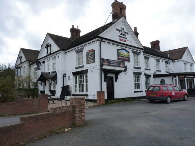
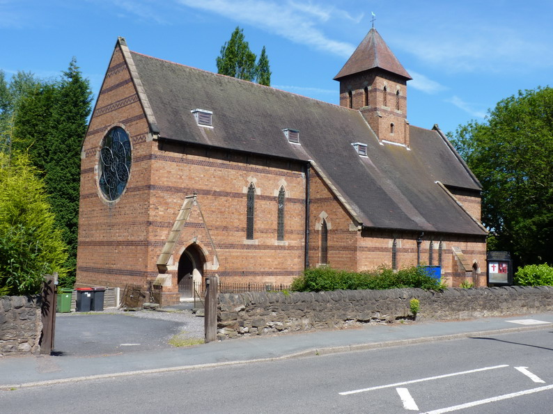
The town is known for its industrial heritage, particularly in the iron and coal industries. In the 19th century, Oakengates was a major center for iron production and coal mining, contributing significantly to the growth and development of the region. Today, remnants of this industrial past can still be seen in the form of historic buildings and structures.

Oakengates offers a range of amenities and services to its residents and visitors. The town center is home to a variety of shops, restaurants, and entertainment venues, including a popular theater. The Oakengates Theatre is a cultural hub, hosting a diverse range of performances, including plays, musicals, and comedy shows.

The community in Oakengates is active and vibrant, with numerous local clubs and organizations catering to a range of interests and hobbies. The town also hosts regular events and festivals, such as the Oakengates Carnival, which brings the community together in celebration.

Surrounded by picturesque countryside, Oakengates also provides easy access to outdoor recreational activities. The nearby Telford Town Park offers beautiful green spaces, walking trails, and a lake, providing a peaceful escape from the urban environment.

Overall, Oakengates is a lively and diverse town with a rich history, offering a range of amenities, cultural activities, and natural beauty for residents and visitors to enjoy.

If you have any feedback on the listing, please let us know in the comments section below.
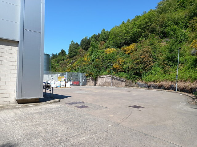
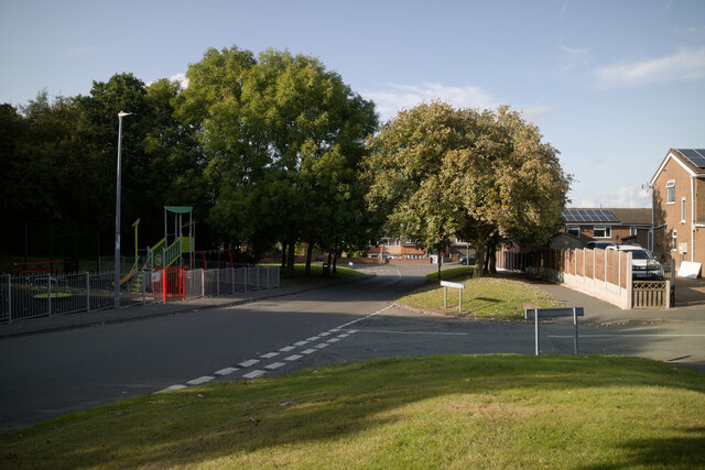
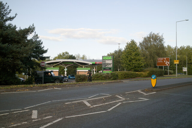
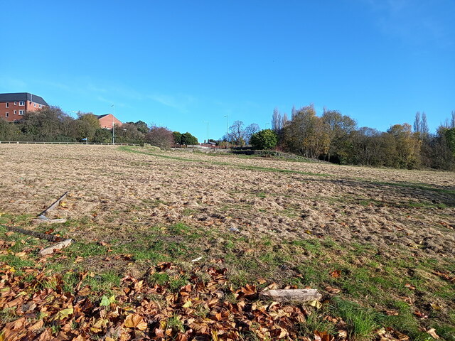
Oakengates Images

Images are sourced within 2km of 52.696196/-2.454623 or Grid Reference SJ6911. Thanks to Geograph Open Source API. All images are credited.

New Yard, St Georges The OS benchmark cut into the former New Yard Engineering Works in St. Georges, Telford. It was levelled in 1961 and last verified by the OS in 1985. It is recorded as being 141.37-metres above the Ordnance Datum at Newlyn
New Yard, St Georges
The OS benchmark cut into the former New Yard Engineering Works in St. Georges, Telford. It was levelled in 1961 and last verified by the OS in 1985. It is recorded as being 141.37-metres above the Ordnance Datum at Newlyn
Old Boundary Marker On Lodge Road, St George's Estate Boundary Marker against the front garden wall of Rose Cottage on the west side of Lodge Road at its junction with School Street in St George's. St. Georges and Priorslee parish.
 
The stone marked the boundary between two plots of land - 315 and 309 - that, in the 19C were leased from Lord Stafford to John Horton and company, which later became the Lilleshall Company. Plot 309 incorporated part of the Pain's Lane racecourse and its grandstand.

Milestone Society National ID: SA_STGPRI01em
Old Boundary Marker On Lodge Road, St George's
Estate Boundary Marker against the front garden wall of Rose Cottage on the west side of Lodge Road at its junction with School Street in St George's. St. Georges and Priorslee parish. The stone marked the boundary between two plots of land - 315 and 309 - that, in the 19C were leased from Lord Stafford to John Horton and company, which later became the Lilleshall Company. Plot 309 incorporated part of the Pain's Lane racecourse and its grandstand. Milestone Society National ID: SA_STGPRI01em
A peek round the back of the Aldi store HGV access to the rear of the supermarket and the adjoining home improvements store (Aldi and Wickes respectively) which now occupy the land on Snedshill that was once home to the Lilleshall Company.
A peek round the back of the Aldi store
HGV access to the rear of the supermarket and the adjoining home improvements store (Aldi and Wickes respectively) which now occupy the land on Snedshill that was once home to the Lilleshall Company.
Marrion's Hill approaching West Street Viewed from the junction with Hill Crest Road.
Marrion's Hill approaching West Street
Viewed from the junction with Hill Crest Road.
Asda petrol station, Wrockwardine Wood Way
Pearson Road - Office units in Central Park The area now occupied by the Central Park business estate was formerly the Snedshill steelworks, part of the Lilleshall Company's operations. By the mid '70s my recollection is that the steelworks had shut, although many of the buildings were still there, and one shed was occupied by 'The Maggot Factory' which used dead farm animals to breed maggots for angling on an industrial scale; it had a very distinctive aroma, but sold maggots by the gallon for pennies if you had the constitution to walk in and just ask.
Pearson Road - Office units in Central Park
The area now occupied by the Central Park business estate was formerly the Snedshill steelworks, part of the Lilleshall Company's operations. By the mid '70s my recollection is that the steelworks had shut, although many of the buildings were still there, and one shed was occupied by 'The Maggot Factory' which used dead farm animals to breed maggots for angling on an industrial scale; it had a very distinctive aroma, but sold maggots by the gallon for pennies if you had the constitution to walk in and just ask.
Open ground south of Holyhead Road, Snedshill The area now occupied by the Central Park business estate was formerly the Snedshill steelworks, part of the Lilleshall Company's operations, and the older maps show this land occupied by coke ovens, furnaces, chimneys and travelling cranes. All removed during the 1970s as part of the work to develop Telford as a New Town.
Open ground south of Holyhead Road, Snedshill
The area now occupied by the Central Park business estate was formerly the Snedshill steelworks, part of the Lilleshall Company's operations, and the older maps show this land occupied by coke ovens, furnaces, chimneys and travelling cranes. All removed during the 1970s as part of the work to develop Telford as a New Town.
The White Horse
The White Horse
New Aldi Supermarket and Wickes DIY stores, Snedshill, Telford The development at Holyhead Road, Snedshill, Telford is now complete and the stores are open for business.  16 April 2011.

Original Lilleshall Co. factory. <a title="https://www.geograph.org.uk/photo/2024941" href="https://www.geograph.org.uk/photo/2024941">Link</a>
Fire ravaged ruins. <a title="https://www.geograph.org.uk/photo/2028184" href="https://www.geograph.org.uk/photo/2028184">Link</a>
Cleared site. <a title="https://www.geograph.org.uk/photo/2028197" href="https://www.geograph.org.uk/photo/2028197">Link</a>
Start of development. <a title="https://www.geograph.org.uk/photo/2028204" href="https://www.geograph.org.uk/photo/2028204">Link</a>
New buildings.  <a title="https://www.geograph.org.uk/photo/2250149" href="https://www.geograph.org.uk/photo/2250149">Link</a>
New Aldi Supermarket and Wickes DIY stores, Snedshill, Telford
The development at Holyhead Road, Snedshill, Telford is now complete and the stores are open for business. 16 April 2011. Original Lilleshall Co. factory. Link Fire ravaged ruins. Link Cleared site. Link Start of development. Link New buildings. Link
OS benchmark - St George's, Limekiln Bank A fading OS cutmark in a sandstone wall on Limekiln Bank; originally levelled at 181.284m above Ordnance Datum Newlyn.
OS benchmark - St George's, Limekiln Bank
A fading OS cutmark in a sandstone wall on Limekiln Bank; originally levelled at 181.284m above Ordnance Datum Newlyn.
OS benchmark - St George's church tower A well-preserved OS cutmark just to the right of the main entrance to <a href="https://www.geograph.org.uk/photo/372892">SJ7010 : St George's Church, St George's</a>; originally levelled at 172.186m above Ordnance Datum Newlyn.
OS benchmark - St George's church tower
A well-preserved OS cutmark just to the right of the main entrance to SJ7010 : St George's Church, St George's; originally levelled at 172.186m above Ordnance Datum Newlyn.
OS benchmark and bolt - Snedshill, St Peter's church An OS cutmark and bolt from the 1st Primary Levelling of the country between 1840 - 1860; this mark was levelled at 561' 2" above Ordnance Datum Liverpool. It lies on the wall just to the right of the entrance to <a href="https://www.geograph.org.uk/photo/858270">SJ7010 : St Peter's Church, Priorslee</a>
OS benchmark and bolt - Snedshill, St Peter's church
An OS cutmark and bolt from the 1st Primary Levelling of the country between 1840 - 1860; this mark was levelled at 561' 2" above Ordnance Datum Liverpool. It lies on the wall just to the right of the entrance to SJ7010 : St Peter's Church, Priorslee
OS benchmark - St George's, 102 Freeston Avenue An OS cutmark in the brickwork at the side of 102 Freeston Avenue; originally levelled in 1985 at 170.31m above Ordnance Datum Newlyn.
OS benchmark - St George's, 102 Freeston Avenue
An OS cutmark in the brickwork at the side of 102 Freeston Avenue; originally levelled in 1985 at 170.31m above Ordnance Datum Newlyn.
OS benchmark - Snedshill, no 1 Furnace Lane An OS cutmark in the brickwork at the side of no 1 Furnace Lane; originally levelled in 1985 at 173.277m above Ordnance Datum Newlyn.
OS benchmark - Snedshill, no 1 Furnace Lane
An OS cutmark in the brickwork at the side of no 1 Furnace Lane; originally levelled in 1985 at 173.277m above Ordnance Datum Newlyn.
OS benchmark - St George's, 16 The Grove Estate An OS cutmark at the front of no 16, The Grove; originally levelled in 1985 at 168.506m above Ordnance Datum Newlyn.
OS benchmark - St George's, 16 The Grove Estate
An OS cutmark at the front of no 16, The Grove; originally levelled in 1985 at 168.506m above Ordnance Datum Newlyn.
OS benchmark - St George's, Mayfield An OS cutmark in the brickwork of an outbuilding of 'Mayfield House' on London Road; originally levelled in 1985 at 163.061m above Ordnance Datum Newlyn.
OS benchmark - St George's, Mayfield
An OS cutmark in the brickwork of an outbuilding of 'Mayfield House' on London Road; originally levelled in 1985 at 163.061m above Ordnance Datum Newlyn.
OS benchmark - Oakengates, Station Hill An OS cutmark in a stone wall on the N side of the steep Station Hill; originally levelled in 1960 at 147.25m above Ordnance Datum Newlyn.
OS benchmark - Oakengates, Station Hill
An OS cutmark in a stone wall on the N side of the steep Station Hill; originally levelled in 1960 at 147.25m above Ordnance Datum Newlyn.
OS benchmark - Oakengates, 68 The Nabb An OS cutmark on the brickwork of no68 The Nabb (Diamond Row); originally levelled in 1961 at 145.62m above Ordnance Datum Newlyn.
OS benchmark - Oakengates, 68 The Nabb
An OS cutmark on the brickwork of no68 The Nabb (Diamond Row); originally levelled in 1961 at 145.62m above Ordnance Datum Newlyn.
Show me another place!

Oakengates is located at Grid Ref: SJ6911 (Lat: 52.696196, Lng: -2.454623)

Unitary Authority: Telford and Wrekin

Police Authority: West Mercia

What 3 Words

///present.plug.fastening. Near Oakengates, Shropshire

Related Wikis

Oakengates

Oakengates is a constituent town of Telford and a civil parish in the borough of Telford and Wrekin, Shropshire, England. The towns parish population was...

Wellington Amateurs F.C.

Wellington Amateurs Football Club is an English football club from Wellington, Shropshire but currently located in Telford. The club plays in the West...

Oakengates Market Street railway station

Oakengates Market Street railway station was a station in Oakengates, Shropshire, England. The station was opened in 1860 and closed in 1952. The station...

Oakengates railway station

Oakengates railway station serves the town of Oakengates, Telford and Wrekin, Shropshire, England. It has two platforms. Rail services are primarily provided...

Wombridge Priory

Wombridge Priory was a small Augustinian monastery in Shropshire. Established in the early 12th century, it was supported by a network of minor nobility...

Telford Priory School

Telford Priory School is a coeducational secondary school located in the Wrockwardine Wood area of Telford in Shropshire, England. The school opened in...

Wrockwardine Wood

Wrockwardine Wood (pronounced "Rock-war-dine") was originally a detached piece of woodland, then a township, formerly belonging to the manor and parish...

New Hadley Halt railway station

New Hadley Halt was a minor station between Oakengates and Wellington on the former Great Western Railway's London Paddington to Birkenhead via Birmingham...

Nearby Amenities

Located within 500m of 52.696196,-2.454623
Oakengates
Is In: Shropshire, England
Is In Country: United Kingdom
Is In County: Shropshire
Is In Nation: England
Place: town
Population: 8517
Wikidata: Q2183778
Wikipedia: en:Oakengates
Lat/Long: 52.6952242/-2.4520711
Mini Roundabout
Lat/Long: 52.6953959/-2.4485265
Crossing
Crossing: uncontrolled
Source: bing
Lat/Long: 52.6950815/-2.4537975
Mini Roundabout
Source: bing
Lat/Long: 52.6950038/-2.4523449
Crossing
Crossing: zebra
Crossing Island: yes
Tactile Paving: yes
Lat/Long: 52.6949383/-2.452176
Crossing
Crossing: uncontrolled
Source: bing
Lat/Long: 52.6951907/-2.4570751
Post Office
Oakengates Post Office
Addr City: Telford
Addr Postcode: TF2 6EP
Addr Suburb: Oakengates
Brand: Post Office
Brand Wikidata: Q1783168
Contact Website: https://www.postoffice.co.uk/branch-finder/4326415/oakengates
Ref Pol Id: 15003
Lat/Long: 52.6956909/-2.4501538
Mini Roundabout
Direction: clockwise
Lat/Long: 52.6966812/-2.4501969
Crossing
Check Date Crossing: 2021-07-11
Crossing: uncontrolled
Tactile Paving: yes
Lat/Long: 52.6951918/-2.4522936
Turning Circle
Lat/Long: 52.6987701/-2.4513272
Turning Circle
Lat/Long: 52.6998525/-2.4524591
Turning Circle
Turning Circle: hammer
Lat/Long: 52.6976697/-2.4574734
Traffic Calming: hump
Lat/Long: 52.6984168/-2.4563641
Turning Circle
Turning Circle: circle
Lat/Long: 52.6994453/-2.4588731
Fast Food
Golden Fryer
Cuisine: fish_and_chips
Lat/Long: 52.695565/-2.452532
Give Way
Source: bing
Lat/Long: 52.6935456/-2.4487397
Crossing
Crossing: traffic_signals
Source: survey
Lat/Long: 52.6940904/-2.450033
Give Way
Source: bing
Lat/Long: 52.6949417/-2.4520229
Crossing
Crossing: marked
Crossing Island: yes
Tactile Paving: yes
Lat/Long: 52.6956078/-2.4488012
Man Made: surveillance
Source: survey
Lat/Long: 52.6958014/-2.4513429
Bus Station
Oakengates Bus Station
Bus: yes
Internet Access: no
Internet Access Fee: no
Naptan AtcoCode: 359GOAKNGTS
Operator: Arriva
Public Transport: station
Lat/Long: 52.6958988/-2.4497651
Crossing
Crossing: zebra
Source: bing
Tactile Paving: yes
Traffic Calming: table
Lat/Long: 52.6966112/-2.4519296
Man Made: surveillance
Lat/Long: 52.6934419/-2.4502489
Give Way
Source: bing
Lat/Long: 52.6951706/-2.4544061
Give Way
Source: bing
Lat/Long: 52.6986371/-2.4604983
Bus Stop
Oakengates Bus Station
Bench: yes
Bus: yes
Network: Arriva
Network Wikidata: Q680991
Network Wikipedia: en:Arriva
Operator: Arriva
Public Transport: platform
Ref: A
Route Ref: 44;114;822
Shelter: yes
Source: bing
Lat/Long: 52.695992/-2.449761
Bus Stop
Oakengates Bus Station
Bench: yes
Bus: yes
Network: Arriva
Network Wikidata: Q680991
Network Wikipedia: en:Arriva
Operator: Arriva
Public Transport: platform
Ref: B
Route Ref: 24;55;481
Shelter: yes
Source: bing
Lat/Long: 52.6959118/-2.4498888
Pharmacy
Lloyds Pharmacy
Brand: Lloyds Pharmacy
Brand Wikidata: Q6662870
Brand Wikipedia: en:LloydsPharmacy
Healthcare: pharmacy
Lat/Long: 52.6935724/-2.4496078
Man Made: tower
Source: survey
Tower Type: communication
Lat/Long: 52.6932597/-2.450522
Bicycle Parking
Capacity: 8
Source: survey
Lat/Long: 52.6934317/-2.4503263
Entrance: main
Lat/Long: 52.6957614/-2.4502204
Atm
Source: survey
Lat/Long: 52.6957775/-2.4501895
Post Box
Post Box Apertures: 2
Post Box Type: pillar
Ref: TF2 263;TF2 264
Royal Cypher: EIIR
Royal Cypher Wikidata: Q33102113
Lat/Long: 52.6958129/-2.4501769
Clock
Lat/Long: 52.6949409/-2.4517329
Bicycle Parking
Bicycle Parking: stands
Capacity: 4
Covered: no
Source: survey
Lat/Long: 52.6949495/-2.4518052
Entrance: main
Lat/Long: 52.6955665/-2.4510677
Source: survey
Tourism: artwork
Lat/Long: 52.6956225/-2.4511583
Bus Stop
Bus: yes
Public Transport: platform
Source: survey
Lat/Long: 52.6945303/-2.4512699
Bus Stop
Bus: yes
Public Transport: platform
Source: survey
Lat/Long: 52.6945871/-2.4512251
Bench
Material: metal
Shape: circular
Lat/Long: 52.6955114/-2.4511494
Bench
Backrest: no
Source: survey
Lat/Long: 52.6957738/-2.4514697
Bicycle Parking
Source: survey
Lat/Long: 52.6958085/-2.4514638
Christine's Florist
Shop: florist
Lat/Long: 52.6951984/-2.4501634
Fast Food
Fish Inn
Lat/Long: 52.6951666/-2.4495864
Giles
Shop: optician
Lat/Long: 52.6949399/-2.4515263
Restaurant
Golden Star
Cuisine: chinese
Lat/Long: 52.6945734/-2.4500071
Nutcrackers
Shop: hairdresser
Source: survey
Lat/Long: 52.695132/-2.4509683
Premier
Addr City: Telford
Addr Housenumber: 9
Addr Postcode: TF2 6AA
Addr Street: Oxford Street
Addr Suburb: Oakengates
Brand: Premier
Brand Wikidata: Q7240340
Brand Wikipedia: en:Premier Stores
Fhrs Id: 729232
Shop: convenience
Source Addr: FHRS Open Data
Lat/Long: 52.6945144/-2.4500333
Cafe
Siunshine Café
Lat/Long: 52.6955712/-2.4504833
Gill Brothers Off-licence
Addr City: Telford
Addr Housenumber: 38
Addr Postcode: TF2 6DU
Addr Street: Market Street
Addr Suburb: Oakengates
Fhrs Id: 559874
Shop: alcohol
Source Addr: FHRS Open Data
Lat/Long: 52.6949585/-2.4498581
Jessica's Salon
Shop: hairdresser
Lat/Long: 52.6951462/-2.4499005
Fast Food
Kebab Ye
Addr City: Telford
Addr Housenumber: 1
Addr Postcode: TF2 6EJ
Addr Street: Market Street
Addr Suburb: Oakengates
Fhrs Id: 250085
Source Addr: FHRS Open Data
Lat/Long: 52.6951444/-2.449953
Fast Food
TFC
Addr City: Telford
Addr Housenumber: 36
Addr Postcode: TF2 6DU
Addr Street: Market Street
Addr Suburb: Oakengates
Fhrs Id: 1208653
Source Addr: FHRS Open Data
Lat/Long: 52.6949572/-2.4499267
Nightclub
The Duke Box
Lat/Long: 52.6951537/-2.4497339
Cafe
The Filling Station
Addr City: Telford
Addr Housenumber: 3
Addr Postcode: TF2 6EJ
Addr Street: Market Street
Addr Suburb: Oakengates
Fhrs Id: 249299
Source Addr: FHRS Open Data
Lat/Long: 52.695148/-2.4498508
The Game Cave
Addr City: Telford
Addr Postcode: TF2 6EJ
Addr Street: Market Street
Addr Suburb: Oakengates
Fhrs Id: 1255777
Shop: video_games
Source Addr: FHRS Open Data
Lat/Long: 52.6951511/-2.4497967
Tristans
Shop: estate_agent
Lat/Long: 52.6952064/-2.4500436
Fast Food
Easy Happy Chinese Takeaway
Addr City: Telford
Addr Housenumber: 50
Addr Postcode: TF2 6DU
Addr Street: Market Street
Addr Suburb: Oakengates
Fhrs Id: 1069239
Source Addr: FHRS Open Data
Lat/Long: 52.6951869/-2.449073
Ebony & Ivory
Shop: hairdresser
Lat/Long: 52.6952085/-2.4490299
Just Jackie Florist
Shop: florist
Lat/Long: 52.6951125/-2.4492473
Fast Food
Momma's
Addr City: Telford
Addr Housenumber: 63
Addr Postcode: TF2 6EA
Addr Street: Market Street
Addr Suburb: Oakengates
Fhrs Id: 249785
Source Addr: FHRS Open Data
Lat/Long: 52.6951579/-2.4496578
Talking Horse Tattoo Studio
Shop: yes
Lat/Long: 52.6950909/-2.4493167
Clinic
Back to Health
Healthcare: clinic
Lat/Long: 52.6954425/-2.4489255
Heartland Accountants
Office: yes
Lat/Long: 52.6954279/-2.4489777
Helping Hands Domiciliary Care Services
Office: yes
Lat/Long: 52.695461/-2.4488699
J T Hair Therapy
Shop: hairdresser
Lat/Long: 52.6952438/-2.4489672
Life through the Lens
Shop: yes
Lat/Long: 52.695302/-2.448868
Veterinary
Medivet
Phone: +441952270115
Lat/Long: 52.6953678/-2.449123
Peace Hair & Cosmetic Products
Shop: beauty
Lat/Long: 52.6952652/-2.4489211
Unique
Shop: hairdresser
Lat/Long: 52.6953217/-2.4488211
W Owen
Shop: video
Lat/Long: 52.6953478/-2.4487703
Man Made: surveillance
Lat/Long: 52.6953077/-2.4489077
Check Date: 2015-07-05
Disused Shop: yes
Lat/Long: 52.6953186/-2.4492449
All Floors'n'Rugs
Shop: carpet
Lat/Long: 52.6951593/-2.451478
British Red Cross
Brand: British Red Cross
Brand Wikidata: Q4970966
Brand Wikipedia: en:British Red Cross
Shop: charity
Lat/Long: 52.6954964/-2.4506149
Caroline's Wedding Studio
Shop: clothes
Lat/Long: 52.6952504/-2.4510162
Cashino Gaming
Leisure: adult_gaming_centre
Lat/Long: 52.6957584/-2.4505808
Celebrations
Shop: yes
Lat/Long: 52.6957387/-2.4506412
Fast Food
Efe's Kebab
Addr City: Telford
Addr Housenumber: 4
Addr Postcode: TF2 6EP
Addr Street: Limes Walk
Addr Suburb: Oakengates
Fhrs Id: 552017
Source Addr: FHRS Open Data
Lat/Long: 52.6953471/-2.4508272
Gary's Choice Meats
Shop: butcher
Lat/Long: 52.6951537/-2.4505312
Fast Food
Golden Spoon
Addr City: Telford
Addr Housenumber: 18
Addr Postcode: TF2 6EP
Addr Street: Limes Walk
Addr Suburb: Oakengates
Cuisine: chinese
Fhrs Id: 897318
Source Addr: FHRS Open Data
Lat/Long: 52.6955406/-2.4505452
Heavenly Quest
Shop: yes
Lat/Long: 52.6952936/-2.4510302
Hilbrae Rescue Kennels
Shop: charity
Lat/Long: 52.6953058/-2.4508194
Fast Food
J D's Fish Bar
Addr City: Telford
Addr Housenumber: 43
Addr Postcode: TF2 6EL
Addr Street: Market Street
Addr Suburb: Oakengates
Fhrs Id: 249425
Source Addr: FHRS Open Data
Lat/Long: 52.6951405/-2.4506567
Pharmacy
Kitching's Chemist
Addr City: Telford
Addr Housenumber: 23-25
Addr Postcode: TF2 6EP
Addr Street: Limes Walk
Dispensing: yes
Drive Through: no
Healthcare: pharmacy
Opening Hours: Mo-Fr 08:30-17:30; Sa 8:30-14:30
Phone: +44 1952612964
Website: https://kitchingschemist.co.uk/
Lat/Long: 52.6958476/-2.4504661
Pet Spot
Shop: pet
Lat/Long: 52.6951527/-2.4505901
Proactive Personnel
Office: yes
Lat/Long: 52.6954542/-2.4507373
Severn Hospice
Shop: charity
Lat/Long: 52.6951386/-2.4507249
Some'Ink Different
Shop: tattoo
Lat/Long: 52.6955988/-2.4504258
The Ex-Catalogue Furniture Shop
Shop: furniture
Lat/Long: 52.6951612/-2.4513772
The ExtraCare Charitable Trust
Shop: charity
Lat/Long: 52.6951386/-2.4508024
Clock
Source: survey
Lat/Long: 52.6950823/-2.4515818
Note: Dream Kitchens
Shop: yes
Lat/Long: 52.6951377/-2.4510797
Note: Value Newsagent
Shop: newsagent
Lat/Long: 52.6951424/-2.4512161
Cafe
Source: survey
Lat/Long: 52.6952203/-2.4515957
Honecharm
Shop: curtain
Lat/Long: 52.6952372/-2.4524712
Jenaire Hair Studio
Shop: hairdresser
Lat/Long: 52.6953772/-2.4524991
Vape N Quit
Shop: yes
Lat/Long: 52.6953283/-2.4524929
Shop: yes
Lat/Long: 52.6952739/-2.452479
Pub
Coalport Tavern
Lat/Long: 52.6952076/-2.4538246
Oakengates Angling Centre
Shop: yes
Lat/Long: 52.695497/-2.4525242
Cafe
The Vintage Tea Room
Addr City: Telford
Addr Housenumber: 9
Addr Postcode: TF2 6ER
Addr Street: New Street
Addr Suburb: Oakengates
Fhrs Id: 1286747
Source Addr: FHRS Open Data
Lat/Long: 52.6954307/-2.4525083
Veterinary
Value Pet Care
Lat/Long: 52.6967423/-2.4515277
Oakengates
Naptan AtcoCode: 9100OAKNGTS
Network: National Rail
Network Website: https://www.nationalrail.co.uk/stations/okn/
Network Wikidata: Q26334
Public Transport: station
Railway: station
Ref Crs: OKN
Wikidata: Q2384836
Wikipedia: en:Oakengates railway station
Lat/Long: 52.6930906/-2.450188
Mini Roundabout
Lat/Long: 52.6935515/-2.4501256
Crossing
Crossing: zebra
Tactile Paving: yes
Traffic Calming: table
Lat/Long: 52.6965393/-2.4500396
Give Way
Direction: forward
Lat/Long: 52.6967174/-2.4508697
Give Way
Direction: forward
Lat/Long: 52.6966692/-2.4508854
Generator Method: photovoltaic
Generator Output Electricity: yes
Generator Source: solar
Generator Type: solar_photovoltaic_panel
Location: roof
Power: generator
Lat/Long: 52.6934367/-2.4531189
Generator Method: photovoltaic
Generator Output Electricity: yes
Generator Source: solar
Generator Type: solar_photovoltaic_panel
Location: roof
Power: generator
Lat/Long: 52.6934253/-2.4530223
Generator Method: photovoltaic
Generator Output Electricity: yes
Generator Source: solar
Generator Type: solar_photovoltaic_panel
Location: roof
Power: generator
Lat/Long: 52.6976599/-2.4550742
Generator Method: photovoltaic
Generator Output Electricity: yes
Generator Source: solar
Generator Type: solar_photovoltaic_panel
Location: roof
Power: generator
Lat/Long: 52.6981589/-2.4530062
Generator Method: photovoltaic
Generator Output Electricity: yes
Generator Source: solar
Generator Type: solar_photovoltaic_panel
Location: roof
Power: generator
Lat/Long: 52.6982028/-2.4530411
Generator Method: photovoltaic
Generator Output Electricity: yes
Generator Source: solar
Generator Type: solar_photovoltaic_panel
Location: roof
Power: generator
Lat/Long: 52.6984011/-2.4539691
Generator Method: photovoltaic
Generator Output Electricity: yes
Generator Source: solar
Generator Type: solar_photovoltaic_panel
Location: roof
Power: generator
Lat/Long: 52.6984628/-2.4540228
Generator Method: photovoltaic
Generator Output Electricity: yes
Generator Source: solar
Generator Type: solar_photovoltaic_panel
Location: roof
Power: generator
Lat/Long: 52.6985116/-2.4540496
Generator Method: photovoltaic
Generator Output Electricity: yes
Generator Source: solar
Generator Type: solar_photovoltaic_panel
Location: roof
Power: generator
Lat/Long: 52.6999745/-2.45619
Generator Method: photovoltaic
Generator Output Electricity: yes
Generator Source: solar
Generator Type: solar_photovoltaic_panel
Location: roof
Power: generator
Lat/Long: 52.6992089/-2.4567318
Generator Method: photovoltaic
Generator Output Electricity: yes
Generator Source: solar
Generator Type: solar_photovoltaic_panel
Location: roof
Power: generator
Lat/Long: 52.6992024/-2.4568069
Generator Method: photovoltaic
Generator Output Electricity: yes
Generator Source: solar
Generator Type: solar_photovoltaic_panel
Location: roof
Power: generator
Lat/Long: 52.6985132/-2.4576625
Generator Method: photovoltaic
Generator Output Electricity: yes
Generator Source: solar
Generator Type: solar_photovoltaic_panel
Location: roof
Power: generator
Lat/Long: 52.698523/-2.457861
Generator Method: photovoltaic
Generator Output Electricity: yes
Generator Source: solar
Generator Type: solar_photovoltaic_panel
Location: roof
Power: generator
Lat/Long: 52.6977753/-2.4572012
Generator Method: photovoltaic
Generator Output Electricity: yes
Generator Source: solar
Generator Type: solar_photovoltaic_panel
Location: roof
Power: generator
Lat/Long: 52.697468/-2.4568418
Generator Method: photovoltaic
Generator Output Electricity: yes
Generator Source: solar
Generator Type: solar_photovoltaic_panel
Location: roof
Power: generator
Lat/Long: 52.6973754/-2.4548462
Oakengates Market Street
Abandoned Railway: station
Railway: site
Wikidata: Q28970421
Wikipedia: en:Oakengates Market Street railway station
Lat/Long: 52.695362/-2.4482592
Give Way
Direction: forward
Lat/Long: 52.6957032/-2.4493963
Give Way
Direction: forward
Lat/Long: 52.6963116/-2.4498362
Give Way
Direction: forward
Lat/Long: 52.6942807/-2.4489873
Give Way
Direction: forward
Lat/Long: 52.6946622/-2.4487761
Give Way
Direction: backward
Lat/Long: 52.6976887/-2.4564833
The data included in this document is from www.openstreetmap.org. The data is made available under ODbL.

Have you been to Oakengates?

Leave your review of Oakengates below (or comments, questions and feedback).