Airor
Settlement in Inverness-shire
Scotland
Airor
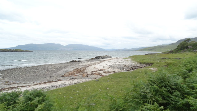
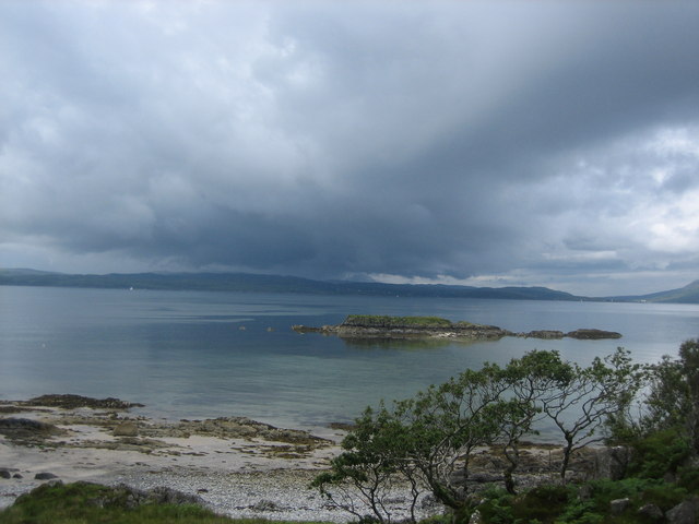
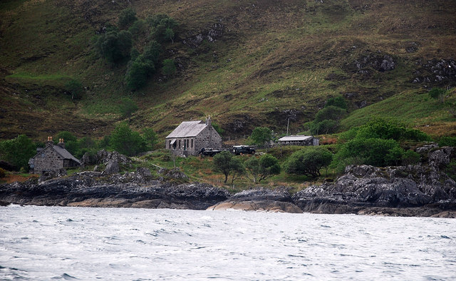
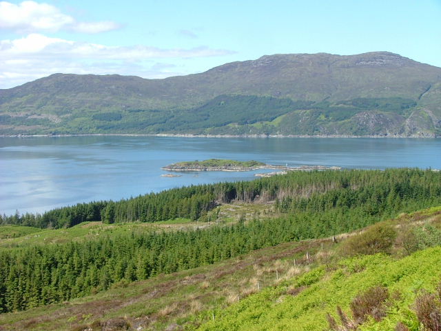
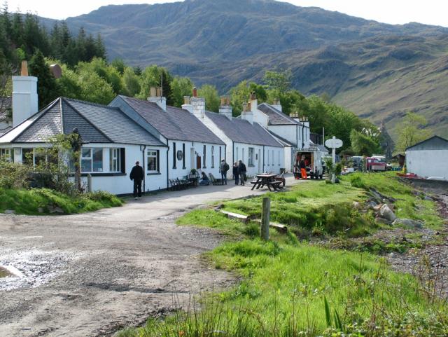
Airor is a small rural community located in Inverness-shire, Scotland. Situated on the western coast of the Scottish Highlands, it is nestled in a picturesque setting with stunning views of the surrounding mountains and the sea. The village is sparsely populated, with only a handful of permanent residents.
The main industry in Airor is fishing, with a long history of local fishermen venturing out into the nearby waters to catch fish such as salmon, trout, and herring. The community has a small harbor where fishing boats can be seen returning with their day's catch. Fishing remains a significant part of the local economy, providing employment opportunities and contributing to the coastal heritage of the area.
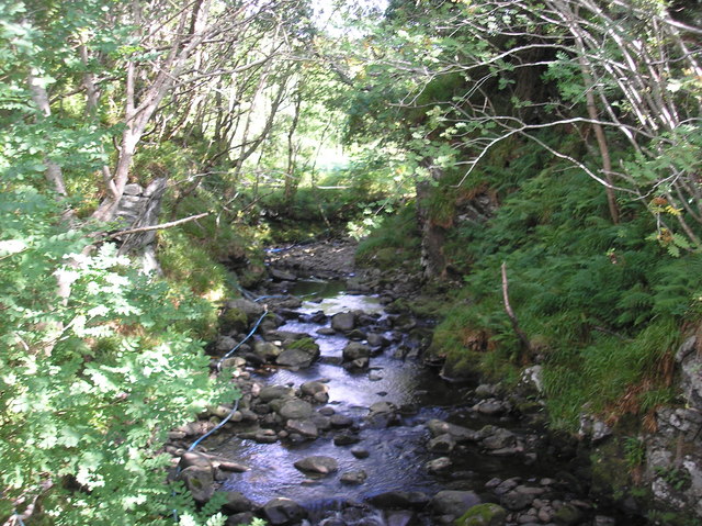
Airor is also known for its natural beauty and outdoor recreational activities. The region offers ample opportunities for hiking, cycling, and wildlife spotting. The nearby mountains attract climbers and mountaineers from far and wide, while the coastline provides stunning walks along the rugged cliffs and sandy beaches.
The village has limited amenities, with a small general store that caters to the basic needs of the residents and visitors. However, for more extensive shopping and entertainment options, the nearby town of Mallaig is easily accessible.
Overall, Airor is a peaceful and idyllic village that offers a tranquil retreat from the bustling cities. Its natural beauty, fishing heritage, and outdoor activities make it an attractive destination for those seeking a quiet and scenic getaway in the Scottish Highlands.
If you have any feedback on the listing, please let us know in the comments section below.
Airor Images
Images are sourced within 2km of 57.083432/-5.765038 or Grid Reference NG7105. Thanks to Geograph Open Source API. All images are credited.


Airor is located at Grid Ref: NG7105 (Lat: 57.083432, Lng: -5.765038)
Unitary Authority: Highland
Police Authority: Highlands and Islands
What 3 Words
///slogged.rekindle.tram. Near Armadale, Highland
Nearby Locations
Related Wikis

Airor
Airor is a hamlet in the peninsula of Knoydart, Lochaber, Highland, on the west coast of Scotland. It is situated on the north-west coast of Knoydart,...
Sound of Sleat
The Sound of Sleat is a narrow sea channel off the western coast of Scotland. It divides the Sleat peninsula on the south-east side of the Isle of Skye...

Sandaig Bay
Sandaig Bay is a coastal embayment, on a chord of 2.04 kilometres (1 mile 471 yards), on a 194° orientation, located on the northwestern end of the sea...
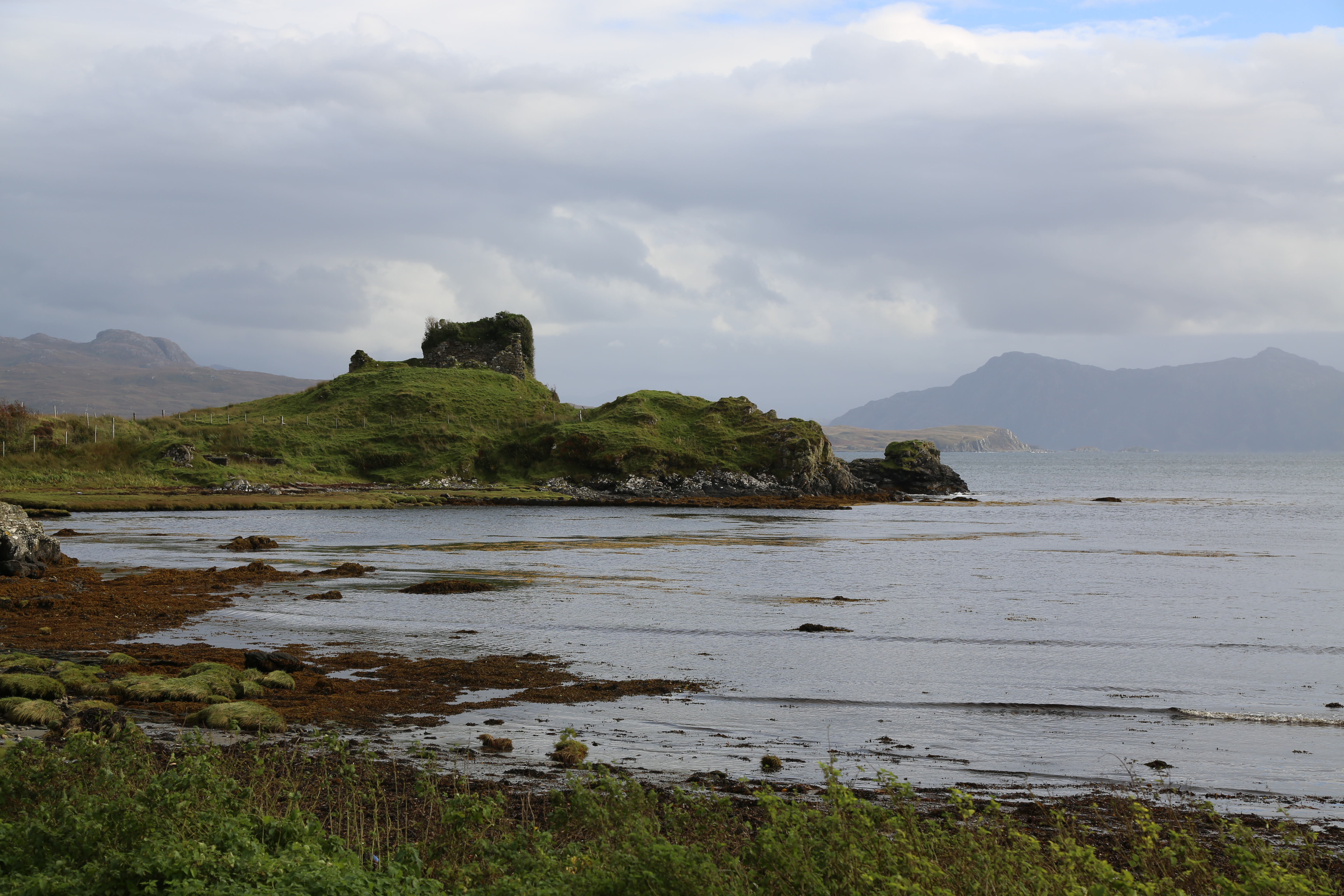
Knock Castle (Isle of Skye)
Knock Castle, also known as Caisteal Chamuis (Castle Camus) is a former stronghold of the MacDonalds. It lies on the east coast of Sleat, approximately...
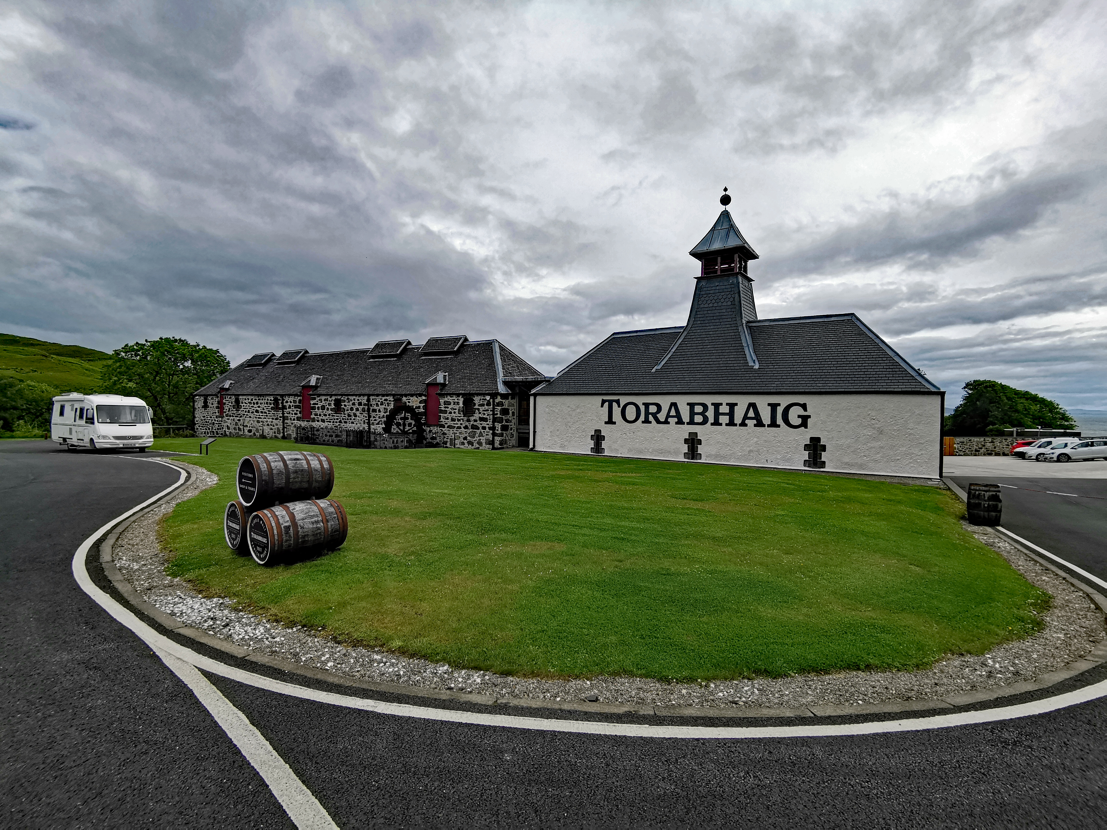
Torabhaig distillery
Torabhaig distillery is a Scotch whisky distillery in Teangue on the Isle of Skye. The distillery is the second ever licensed distillery on Skye and the...
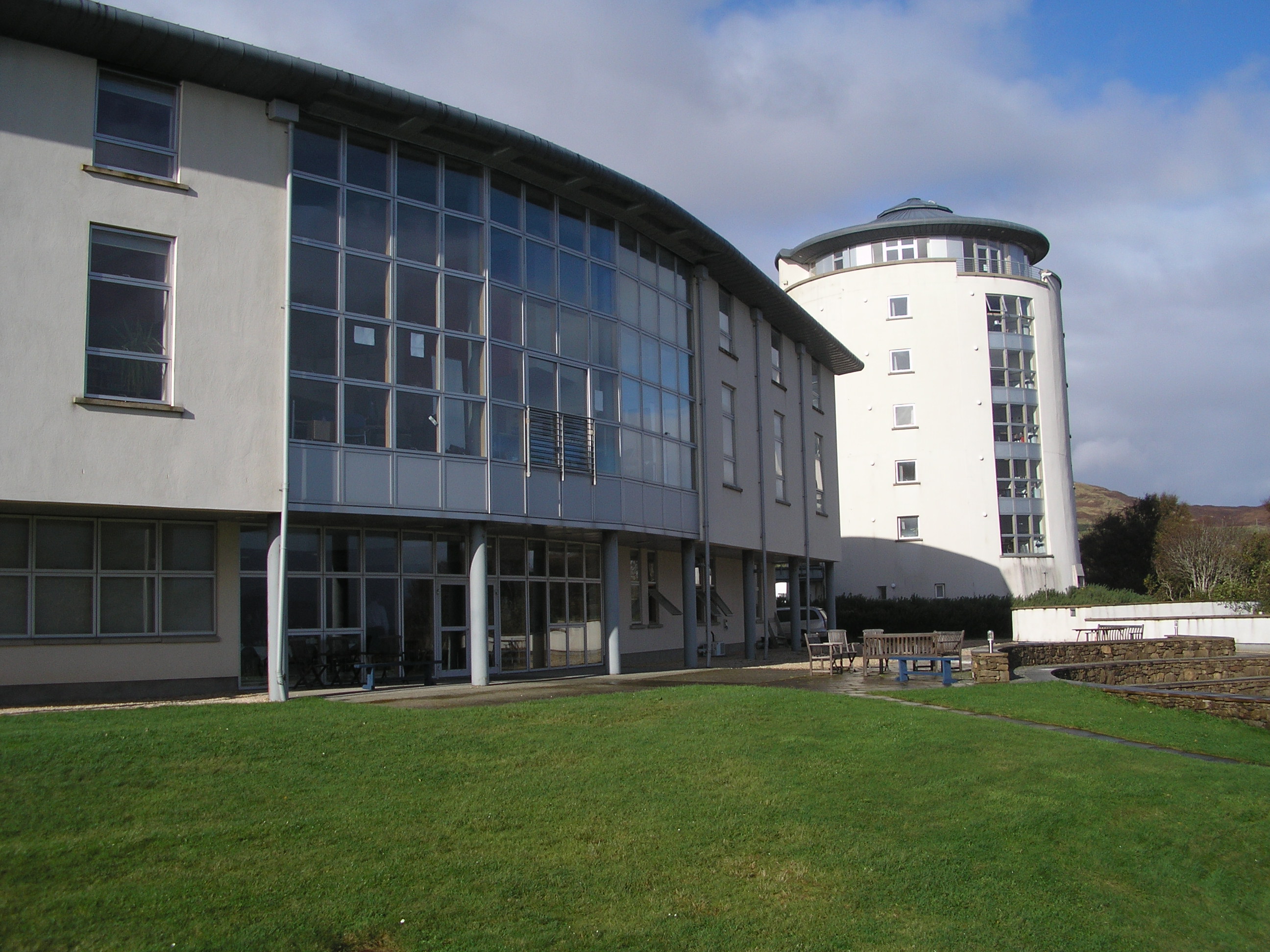
Sabhal Mòr Ostaig
Sabhal Mòr Ostaig ([ˌs̪ɔɫ̪ ˌmoɾ ˈɔs̪t̪ɪkʲ]) (Great Barn of Ostaig) is a public higher education college situated in the Sleat peninsula in the south of...

Bun-sgoil Shlèite
Bun-sgoil Shlèite is a primary school on the Sleat peninsula of the island of Skye in Scotland. It is Scotland's only Gaelic Medium School with an English...
Knoydart
Knoydart (Scottish Gaelic: Cnòideart) is a peninsula in Lochaber, Highland, on the west coast of Scotland. Knoydart is sandwiched between Lochs Nevis...
Nearby Amenities
Located within 500m of 57.083432,-5.765038Have you been to Airor?
Leave your review of Airor below (or comments, questions and feedback).