Airor Bay

Bay in Inverness-shire

Scotland

Airor Bay

Shore at Samadalan, Knoydart
Shore at Samadalan, Knoydart Credit: Colin Park

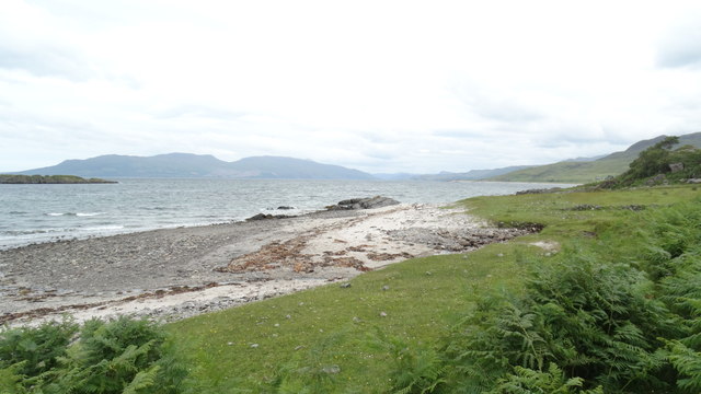
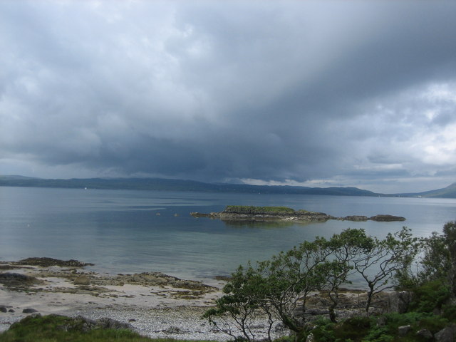
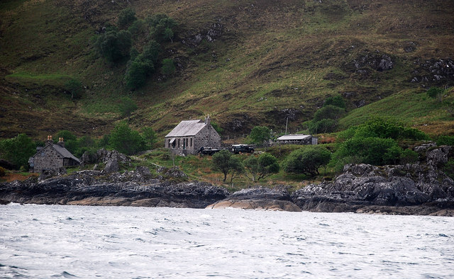
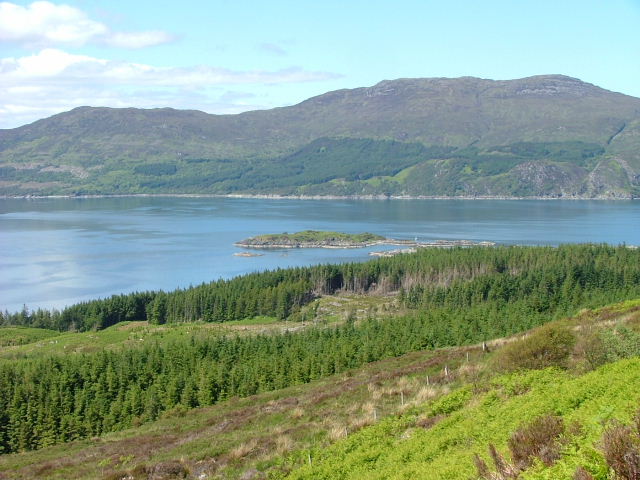
Airor Bay is a picturesque coastal inlet located in the remote and rugged region of Inverness-shire, Scotland. Surrounded by towering cliffs and lush greenery, the bay offers stunning views of the surrounding landscape and the crystal-clear waters of the Atlantic Ocean.

The bay is known for its tranquil and secluded atmosphere, making it a popular destination for those seeking a peaceful retreat away from the hustle and bustle of city life. The area is teeming with wildlife, including seals, otters, and a variety of seabirds, making it a haven for nature lovers and wildlife enthusiasts.

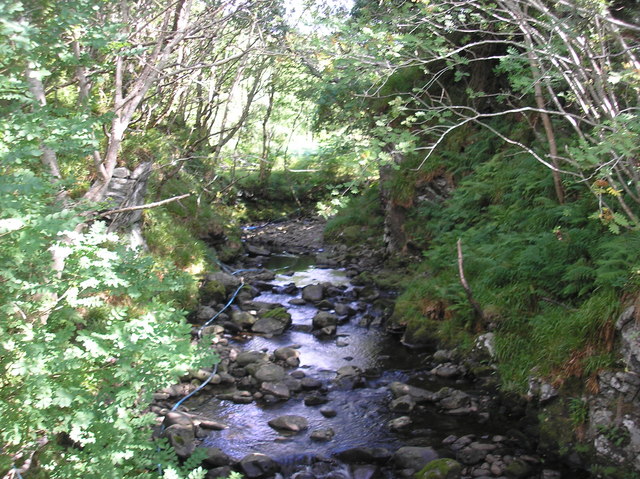
Visitors to Airor Bay can enjoy a range of outdoor activities, such as hiking, birdwatching, and kayaking. The bay is also a great spot for fishing, with plenty of opportunities to catch a variety of fish species.

Overall, Airor Bay is a hidden gem in Inverness-shire, offering visitors a chance to immerse themselves in the beauty of the Scottish coastline and experience the peace and tranquility of this remote and unspoiled corner of the country.

If you have any feedback on the listing, please let us know in the comments section below.

Airor Bay Images

Images are sourced within 2km of 57.083212/-5.7680444 or Grid Reference NG7105. Thanks to Geograph Open Source API. All images are credited.

Shore at Samadalan, Knoydart
Airor Bay, Knoydart
Airor Bay, Knoydart
The Road's End Cafe, Airor, Knoydart A unexpected place to stop for a hot midday lunch.
The Road's End Cafe, Airor, Knoydart
A unexpected place to stop for a hot midday lunch.
Track through Airor, Knoydart
Moorland on Geàrr-leathad, Knoydart
Road to Airor, Knoydart
Coastline near Joiner's Cottage, near Airor, Knoydart Coastal scene and view, Skye in background.
Coastline near Joiner's Cottage, near Airor, Knoydart
Coastal scene and view, Skye in background.
Hillside above Loch Coire a Phuill
Eilean Shamadalain Rain approaching across the Sound of Sleat.
Eilean Shamadalain
Rain approaching across the Sound of Sleat.
On the road to Airor View taken looking North towards the Isle of Skye
On the road to Airor
View taken looking North towards the Isle of Skye
Small Burn The path here crosses a small burn, water pipes for the house are visible here.
Small Burn
The path here crosses a small burn, water pipes for the house are visible here.
Quiet Cove There is a house being built/added to up the sloped path and this cove seems to be used as a landing stage for building materials.
Quiet Cove
There is a house being built/added to up the sloped path and this cove seems to be used as a landing stage for building materials.
Rough Coastline The Doune to Airor coastline is awkward to access but is seen to advantage from the seaward side.
Rough Coastline
The Doune to Airor coastline is awkward to access but is seen to advantage from the seaward side.
Airor Township Knoydart has but one surfaced road some 10 km from Inverie to Airor, so this is the end of the line.
Airor Township
Knoydart has but one surfaced road some 10 km from Inverie to Airor, so this is the end of the line.
Airor hamlet, Knoydart Faraway from civilisation, and with no roads into the peninsula, many settlements around the Knoydart shores rely on boats from Mallaig to bring in supplies. However, for those that choose to live in this remote and beautiful part of Scotland, life is slow, uncomplicated but nonetheless pleasurable.
Airor hamlet, Knoydart
Faraway from civilisation, and with no roads into the peninsula, many settlements around the Knoydart shores rely on boats from Mallaig to bring in supplies. However, for those that choose to live in this remote and beautiful part of Scotland, life is slow, uncomplicated but nonetheless pleasurable.
Shed beside the road to Airor A shed stands beside the Inverie to Airor road at the head of the footpath down to Joiner's Cottage.  The Sleat peninsula on the Isle of Skye can be seen beyond the Sound.
Shed beside the road to Airor
A shed stands beside the Inverie to Airor road at the head of the footpath down to Joiner's Cottage. The Sleat peninsula on the Isle of Skye can be seen beyond the Sound.
Airor Bay and jetty Airor Island in the middle distance.
Airor Bay and jetty
Airor Island in the middle distance.
Airor Bay Boats hauled up at Airor Bay.
Airor Bay
Boats hauled up at Airor Bay.
Show me another place!

Airor Bay is located at Grid Ref: NG7105 (Lat: 57.083212, Lng: -5.7680444)

Unitary Authority: Highland

Police Authority: Highlands and Islands

What 3 Words

///bothered.bonus.reprints. Near Armadale, Highland

Related Wikis

Airor

Airor is a hamlet in the peninsula of Knoydart, Lochaber, Highland, on the west coast of Scotland. It is situated on the north-west coast of Knoydart,...

Sound of Sleat

The Sound of Sleat is a narrow sea channel off the western coast of Scotland. It divides the Sleat peninsula on the south-east side of the Isle of Skye...

Sandaig Bay

Sandaig Bay is a coastal embayment, on a chord of 2.04 kilometres (1 mile 471 yards), on a 194° orientation, located on the northwestern end of the sea...

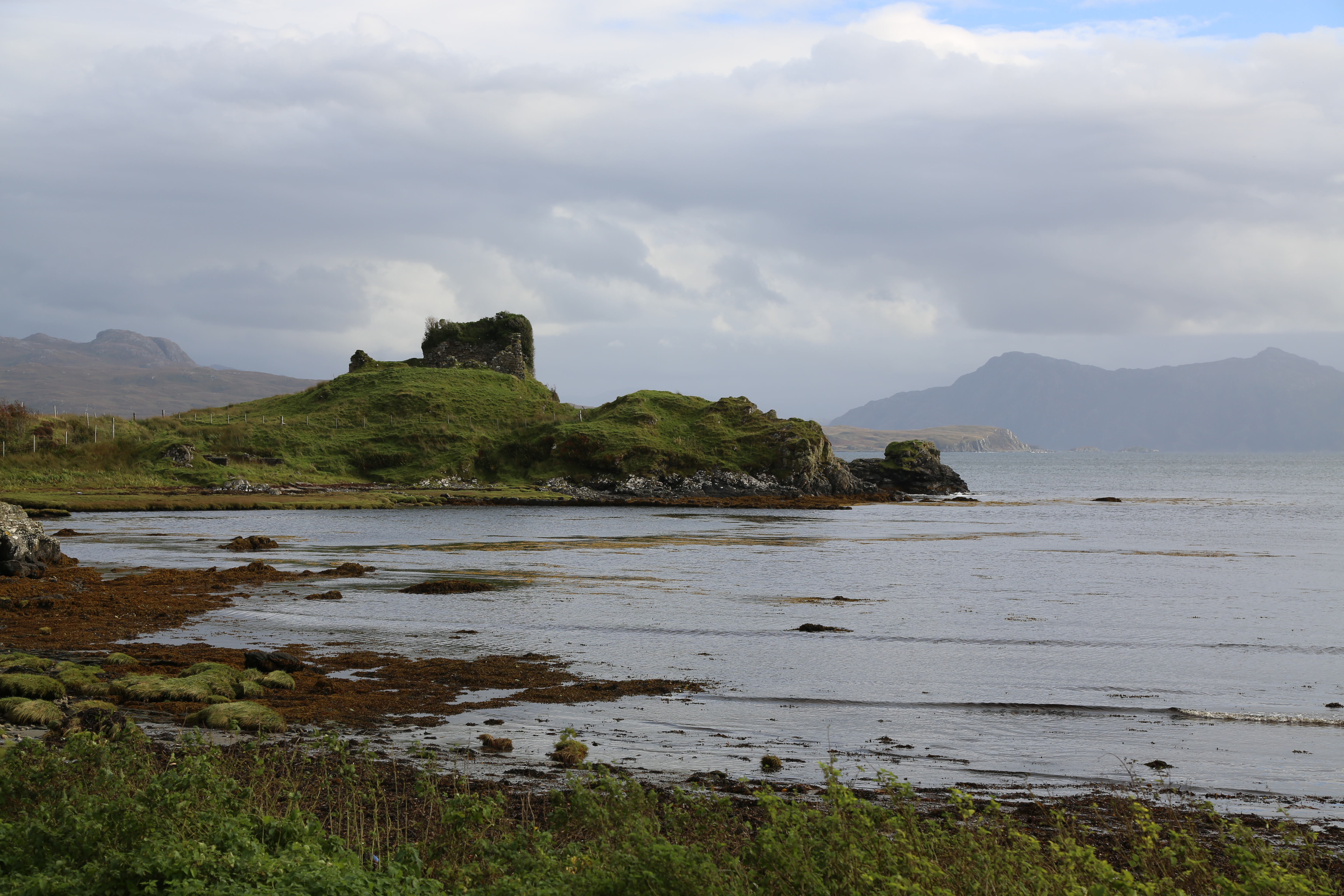
Knock Castle (Isle of Skye)

Knock Castle, also known as Caisteal Chamuis (Castle Camus) is a former stronghold of the MacDonalds. It lies on the east coast of Sleat, approximately...

Nearby Amenities

Located within 500m of 57.083212,-5.7680444
Source: PGS
Lat/Long: 57.0864794/-5.7680594
Source: PGS
Lat/Long: 57.0866607/-5.7678548
Source: PGS
Lat/Long: 57.087292/-5.7672953
Source: PGS
Lat/Long: 57.087162/-5.7670632
Source: PGS
Lat/Long: 57.0869847/-5.7673124
Source: PGS
Lat/Long: 57.0868426/-5.7674873
Source: PGS
Lat/Long: 57.0862412/-5.7677766
Source: PGS
Lat/Long: 57.0846416/-5.7713471
Source: PGS
Lat/Long: 57.085618/-5.7710423
Source: PGS
Lat/Long: 57.0858638/-5.7708559
Created By: almien_coastlines
Source: PGS
Lat/Long: 57.085952/-5.770775
Source: PGS
Lat/Long: 57.086021/-5.7703257
Source: PGS
Lat/Long: 57.0857817/-5.7701103
Source: PGS
Lat/Long: 57.0855833/-5.7698519
Source: PGS
Lat/Long: 57.0852337/-5.7698418
Source: PGS
Lat/Long: 57.0851509/-5.7699031
Source: PGS
Lat/Long: 57.0849648/-5.7702006
Source: PGS
Lat/Long: 57.0845004/-5.7707518
Source: PGS
Lat/Long: 57.0868206/-5.7631813
Source: PGS
Lat/Long: 57.0867731/-5.7640239
Source: PGS
Lat/Long: 57.086784/-5.7644695
Source: PGS
Lat/Long: 57.0861185/-5.7648195
Source: PGS
Lat/Long: 57.0858968/-5.7651158
Source: PGS
Lat/Long: 57.0855482/-5.7653307
Created By: almien_coastlines
Source: PGS
Lat/Long: 57.085412/-5.766267
Source: PGS
Lat/Long: 57.0833035/-5.7662836
Source: PGS
Lat/Long: 57.0823769/-5.766135
Source: PGS
Lat/Long: 57.0820255/-5.7666585
Source: PGS
Lat/Long: 57.0818502/-5.7679063
Source: PGS
Lat/Long: 57.0826748/-5.7694
Source: PGS
Lat/Long: 57.0829927/-5.7693945
Source: PGS
Lat/Long: 57.0832831/-5.7696561
Source: PGS
Lat/Long: 57.0832201/-5.7706118
Source: PGS
Lat/Long: 57.0831612/-5.7713309
Source: PGS
Lat/Long: 57.0827209/-5.771811
Source: PGS
Lat/Long: 57.0824382/-5.7725499
Source: PGS
Lat/Long: 57.0821637/-5.7728362
Source: PGS
Lat/Long: 57.0817/-5.7728166
Source: PGS
Lat/Long: 57.0812654/-5.7730652
Source: PGS
Lat/Long: 57.0808653/-5.7735913
Source: PGS
Lat/Long: 57.0806518/-5.773934
Airor
Name En: Airor
Name Gd: Eàrar
Place: hamlet
Lat/Long: 57.0841227/-5.7636626
Airor Bay
Natural: bay
Lat/Long: 57.083592/-5.7682192
The data included in this document is from www.openstreetmap.org. The data is made available under ODbL.

Have you been to Airor Bay?

Leave your review of Airor Bay below (or comments, questions and feedback).