Tixall

Settlement in Staffordshire Stafford

England

Tixall

Shugborough Hall, near Cannock Chase This is the home of Lord Lichfield. Part of the house is open to the public. The County Museum is in the grounds as is a working farm museum.
Shugborough Hall, near Cannock Chase Credit: Angella Streluk

Tixall is a small village located in the county of Staffordshire, England. Situated approximately 3 miles north of Stafford, the village is known for its historic significance and picturesque surroundings.

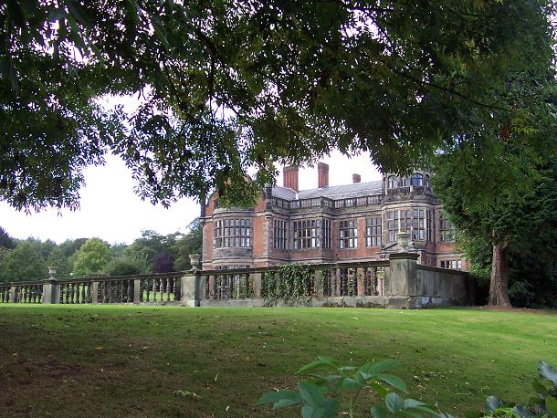
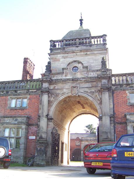
One of the key landmarks in Tixall is Tixall Gatehouse, a Grade I listed building that dates back to the 16th century. Originally part of a larger complex, the gatehouse is all that remains of Tixall Hall, a grand Elizabethan mansion that was demolished in the 1920s. The gatehouse is renowned for its intricate architectural details, including Jacobean carvings and stunning stone mullioned windows.

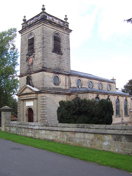
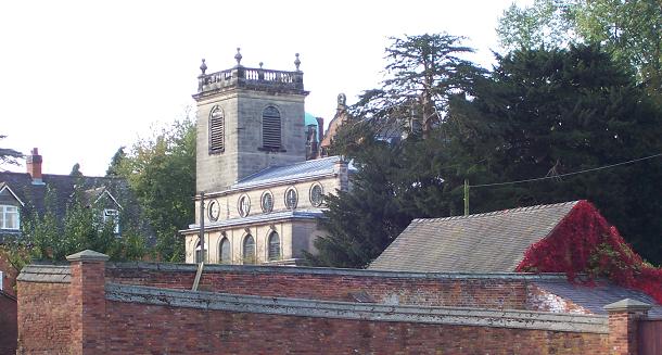
The village is also home to Tixall Church, a charming 12th-century church that boasts a beautiful Norman doorway. With its peaceful atmosphere and well-preserved interior, the church is a popular spot for visitors and locals alike.

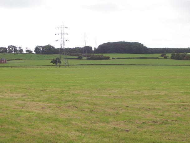
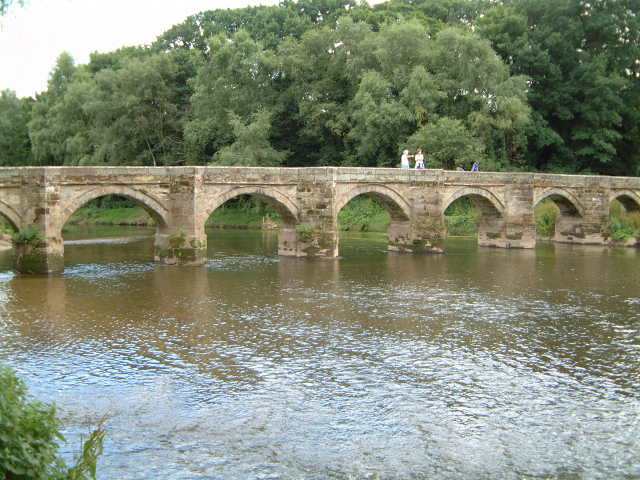
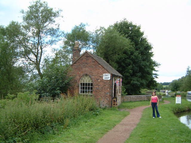
Tixall is surrounded by picturesque countryside and offers ample opportunities for outdoor activities. The Staffordshire and Worcestershire Canal runs through the village, providing scenic walking and cycling routes along its towpaths. The nearby Cannock Chase, an Area of Outstanding Natural Beauty, is also easily accessible from Tixall and offers extensive woodland, perfect for hiking or wildlife spotting.

While Tixall is a small village, it benefits from its proximity to Stafford, which provides a range of amenities including shops, restaurants, and leisure facilities. Overall, Tixall is a charming and historically significant village that offers a peaceful and idyllic setting for residents and visitors to enjoy.

If you have any feedback on the listing, please let us know in the comments section below.
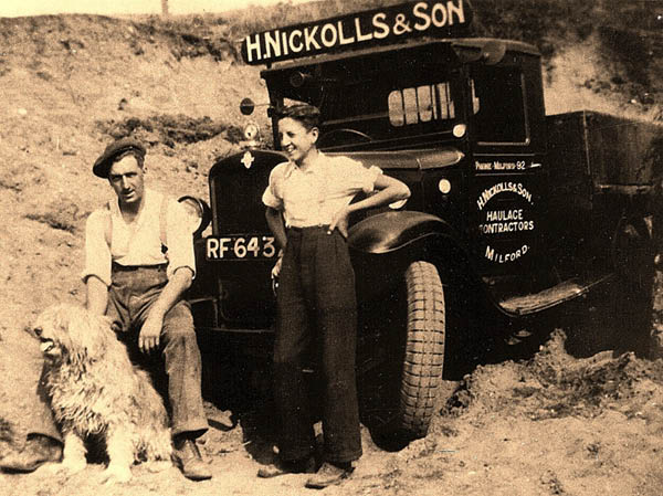
Tixall Images

Images are sourced within 2km of 52.80111/-2.036263 or Grid Reference SJ9722. Thanks to Geograph Open Source API. All images are credited.

Shugborough Hall, near Cannock Chase This is the home of Lord Lichfield. Part of the house is open to the public. The County Museum is in the grounds as is a working farm museum.
Shugborough Hall, near Cannock Chase
This is the home of Lord Lichfield. Part of the house is open to the public. The County Museum is in the grounds as is a working farm museum.
Tixall Wide on The Staffs. & Worcs. Canal When this stretch of the Staffs . & Worcs. Canal was built, the landowner at this point insisted that the canal be made very wide here so as to resemble a lake and not an ugly narrow canal!
Tixall Wide on The Staffs. & Worcs. Canal
When this stretch of the Staffs . & Worcs. Canal was built, the landowner at this point insisted that the canal be made very wide here so as to resemble a lake and not an ugly narrow canal!
Nickolls Transport DAF 85CF taken in our yard. The depot is in Milford near Stafford.
Nickolls Transport
DAF 85CF taken in our yard. The depot is in Milford near Stafford.
Milford Church Fete A true vision of little Britain, this picture was taken at the Church Garden Fete on a very warm day in June 2005
Milford Church Fete
A true vision of little Britain, this picture was taken at the Church Garden Fete on a very warm day in June 2005
Two Trucks in the yard Two vehicles belonging to Nickolls Transport, Milford, Stafford.  Behind the yard you can see the railway line.
Two Trucks in the yard
Two vehicles belonging to Nickolls Transport, Milford, Stafford. Behind the yard you can see the railway line.
Aerial View of Milford, near Stafford Showing Transport Depot
Aerial View of Milford, near Stafford
Showing Transport Depot
Quarrying on Cannock Chase 1926 Satnall Hills
Quarrying on Cannock Chase 1926
Satnall Hills
Ingestre Hall Chetwynd's Jacobean masterpiece is owned by Sandwell Borough Council, who use it as a residential arts centre. <span class="nowrap"><a title="http://pages.britishlibrary.net/tixandrews/ingestre/inghall.html" rel="nofollow ugc noopener" href="http://pages.britishlibrary.net/tixandrews/ingestre/inghall.html">Link</a><img style="margin-left:2px;" alt="External link" title="External link - shift click to open in new window" src="https://s1.geograph.org.uk/img/external.png" width="10" height="10"/></span>
Ingestre Hall
Chetwynd's Jacobean masterpiece is owned by Sandwell Borough Council, who use it as a residential arts centre. LinkExternal link
Fields at Tixall Farm The distant wood is Bricklawn Covert. The GR given is for the near pylon.
Fields at Tixall Farm
The distant wood is Bricklawn Covert. The GR given is for the near pylon.
Trent Lane, Great Haywood This splendid little street goes off to the west from the point where there's a sharp bend in the course of the old A51 through the village. Beyond the railway bridge you'll find the River Trent and Shugborough Hall. Well worth a detour.
Trent Lane, Great Haywood
This splendid little street goes off to the west from the point where there's a sharp bend in the course of the old A51 through the village. Beyond the railway bridge you'll find the River Trent and Shugborough Hall. Well worth a detour.
Essex Bridge, Shugborough When viewed from the river, this bridge looks just like any other old bridge, but it's much more fun than your average old bridge! This is a packhorse bridge, built to link the Shugborough estate to the village of Great Haywood. And if you search on the Web for information and photos of it, you'll be in for another surprise: it used to be over twice as long. By the way, it crosses the Trent just below the point where that river meets the River Sow.
Essex Bridge, Shugborough
When viewed from the river, this bridge looks just like any other old bridge, but it's much more fun than your average old bridge! This is a packhorse bridge, built to link the Shugborough estate to the village of Great Haywood. And if you search on the Web for information and photos of it, you'll be in for another surprise: it used to be over twice as long. By the way, it crosses the Trent just below the point where that river meets the River Sow.
The Chase from The Park A view from the Haywood entrance to the Shugborough estate, looking south to the Forestry Commission land at Coalpit Lane Covert (SJ 996207).
The Chase from The Park
A view from the Haywood entrance to the Shugborough estate, looking south to the Forestry Commission land at Coalpit Lane Covert (SJ 996207).
St Mary the Virgin, Ingestre Built 1676. <span class="nowrap"><a title="http://pages.britishlibrary.net/tixandrews/ingestre/ingchrch.html" rel="nofollow ugc noopener" href="http://pages.britishlibrary.net/tixandrews/ingestre/ingchrch.html">Link</a><img style="margin-left:2px;" alt="External link" title="External link - shift click to open in new window" src="https://s1.geograph.org.uk/img/external.png" width="10" height="10"/></span>
St Mary the Virgin, Ingestre
Built 1676. LinkExternal link
Ingestre This odd little place viewed from the stables.
Ingestre
This odd little place viewed from the stables.
Ingestre Stables <span class="nowrap"><a title="http://www.ingestre.com/" rel="nofollow ugc noopener" href="http://www.ingestre.com/">Link</a><img style="margin-left:2px;" alt="External link" title="External link - shift click to open in new window" src="https://s1.geograph.org.uk/img/external.png" width="10" height="10"/></span>
Ingestre is quite a surprise. The village is at the end of a no-through road, so you'll only arrive here by choice or by accident. Your reward is not only a magnificent hall and church, but these amazing stables, which look to me more like an Oxford college. Hmm...
Ingestre Stables
LinkExternal link Ingestre is quite a surprise. The village is at the end of a no-through road, so you'll only arrive here by choice or by accident. Your reward is not only a magnificent hall and church, but these amazing stables, which look to me more like an Oxford college. Hmm...
The bridge at the back of Shugborough Hall At summer level in times of drought the left bank exposes sand
The bridge at the back of Shugborough Hall
At summer level in times of drought the left bank exposes sand
Toll House The Toll House at the end of the Staffs & Worcester Canal where it joins the Trent & Mersey. The Aqueduct in the background is over the Trent. At the time this photo was taken the toll house was let as a shop.
Toll House
The Toll House at the end of the Staffs & Worcester Canal where it joins the Trent & Mersey. The Aqueduct in the background is over the Trent. At the time this photo was taken the toll house was let as a shop.
Essex Bridge Seen from the south, spanning the River Trent.  Originally there were 40 arches at least, although only 14 remain today - that still makes it the longest surviving packhorse bridge in Britain.  Named after the Earls of Essex who required a short cut onto the heights of Cannock Chase.  To day it takes the Staffordshire Way into the Shugborough Estate
Essex Bridge
Seen from the south, spanning the River Trent. Originally there were 40 arches at least, although only 14 remain today - that still makes it the longest surviving packhorse bridge in Britain. Named after the Earls of Essex who required a short cut onto the heights of Cannock Chase. To day it takes the Staffordshire Way into the Shugborough Estate
Show me another place!

Tixall is located at Grid Ref: SJ9722 (Lat: 52.80111, Lng: -2.036263)

Administrative County: Staffordshire

District: Stafford

Police Authority: Staffordshire

What 3 Words

///slopes.poems.shampoos. Near Great Haywood, Staffordshire

Related Wikis

Tixall

Tixall is a small village and civil parish in the Stafford district, in the English county of Staffordshire lying on the western side of the Trent valley...

Tixall Gatehouse

Tixall Gatehouse is a 16th-century gatehouse situated at Tixall, near Stafford, Staffordshire and is all that remains of Tixall Hall which was demolished...
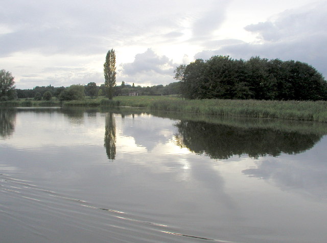
Tixall Wide

Tixall Wide, also known as Tixall Broad or The Broad Water, is a body of water that forms part of the Staffordshire and Worcestershire Canal near Tixall...

Way for the Millennium

The Way for the Millennium is a 41-mile-long (66 km) east–west route across Staffordshire, deliberately designed for easy walking, using towpaths, old...

Shugborough Tunnel

The Shugborough Tunnel is a 777-yard (710 m) railway tunnel on the Trent Valley line running under part of the Shugborough Estate in Colwich, Staffordshire...

Milford and Brocton railway station

Milford and Brocton railway station served the villages of Milford and Brocton in Staffordshire, England from 1877 to 1950 on the Trent Valley line....

Staffordshire County Museum

Staffordshire County Museum is housed in the Servants' Quarters of Shugborough Hall, Milford, near Stafford, Staffordshire, England. The museum features...

Milford, Staffordshire

Milford is a village in the county of Staffordshire, England. It lies at the edge of Cannock Chase, on the A513 road between Stafford and Rugeley. Just...

Nearby Amenities

Located within 500m of 52.80111,-2.036263
Tixall
Place: village
Wikidata: Q690473
Lat/Long: 52.8019456/-2.0340337
Bus Stop
Church
Bus: yes
Naptan AtcoCode: 3800C714200
Naptan Bearing: NE
Naptan BusStopType: CUS
Naptan CommonName: Church
Naptan Indicator: Opp
Naptan Landmark: Church
Naptan Street: Tixall Rd
Naptan Verified: no
Public Transport: platform
Source: naptan_import
Lat/Long: 52.8028787/-2.0340277
Bus Stop
Church
Bus: yes
Naptan AtcoCode: 3800C714201
Naptan Bearing: SW
Naptan CommonName: Church
Naptan Indicator: Adj
Naptan Landmark: Church
Naptan Street: Tixall Road
Naptan Verified: no
Public Transport: platform
Source: naptan_import
Lat/Long: 52.8029237/-2.0337755
Post Box
Post Box Type: lamp
Ref: ST18 196
Royal Cypher: EIIR
Lat/Long: 52.8029591/-2.0343114
Telephone
Booth: K6
Covered: booth
Listed Status: Grade II
Man Made: telephone_box
Note: moved from Tixall Mews
Lat/Long: 52.8029035/-2.0343055
Noexit: yes
Lat/Long: 52.8010084/-2.0384387
Noexit: yes
Lat/Long: 52.8028766/-2.0353513
Noexit: yes
Lat/Long: 52.8028339/-2.0356242
Give Way
Direction: forward
Lat/Long: 52.8014383/-2.0362379
Give Way
Direction: forward
Lat/Long: 52.8012815/-2.0366008
Noexit: yes
Lat/Long: 52.8024476/-2.0360796
Noexit: yes
Lat/Long: 52.8031252/-2.0323799
The data included in this document is from www.openstreetmap.org. The data is made available under ODbL.

Have you been to Tixall?

Leave your review of Tixall below (or comments, questions and feedback).