Old Quarry Covert

Wood, Forest in Staffordshire Stafford

England

Old Quarry Covert

Tixall Wide on The Staffs. & Worcs. Canal When this stretch of the Staffs . & Worcs. Canal was built, the landowner at this point insisted that the canal be made very wide here so as to resemble a lake and not an ugly narrow canal!
Tixall Wide on The Staffs. & Worcs. Canal Credit: Andy Beecroft

Old Quarry Covert is a picturesque woodland located in Staffordshire, England. Covering an area of approximately 50 acres, this ancient woodland is known for its tranquil atmosphere and diverse range of flora and fauna. The covert is situated in close proximity to the village of Wood, providing a serene escape from the bustle of urban life.

The woodland boasts a rich and varied ecosystem, with a mix of broadleaf and coniferous trees. Native species such as oak, beech, and birch dominate the landscape, providing a dense canopy that offers shelter to a wide array of wildlife. Woodland birds, including woodpeckers, owls, and various songbirds, can often be heard chirping and drumming amidst the trees.

Old Quarry Covert is also home to a number of mammal species, including rabbits, squirrels, and foxes. The woodland's diverse undergrowth supports a myriad of insects and small invertebrates, making it a haven for naturalists and wildlife enthusiasts.

The woodland is crisscrossed by a network of footpaths, allowing visitors to explore its natural beauty at their leisure. These paths meander through the woodland, providing glimpses of sun-dappled glades, babbling brooks, and moss-covered rocks. The dense vegetation and towering trees create a sense of enchantment, making it a popular destination for walkers, joggers, and nature lovers.

In addition to its natural beauty, Old Quarry Covert holds historical significance. The name "Old Quarry" refers to the past quarrying activities that took place in the area, which have left behind remnants of the industry. These historical features add an extra layer of interest for visitors, blending the past and present within the woodland's boundaries.

Overall, Old Quarry Covert is a captivating woodland that offers a peaceful retreat and a chance to connect with nature in the heart of Staffordshire.

If you have any feedback on the listing, please let us know in the comments section below.

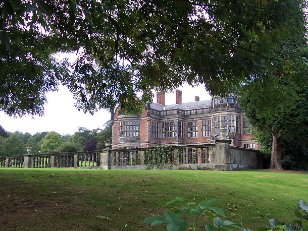
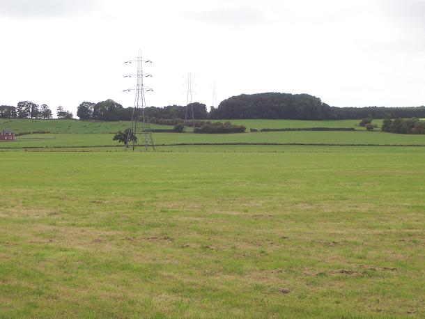
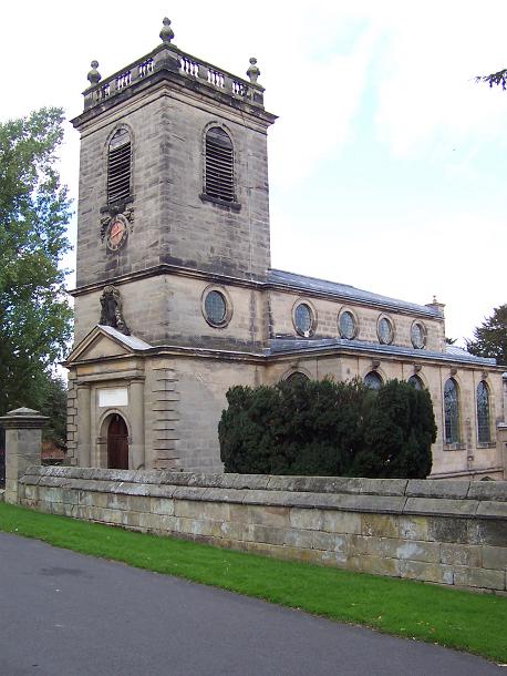
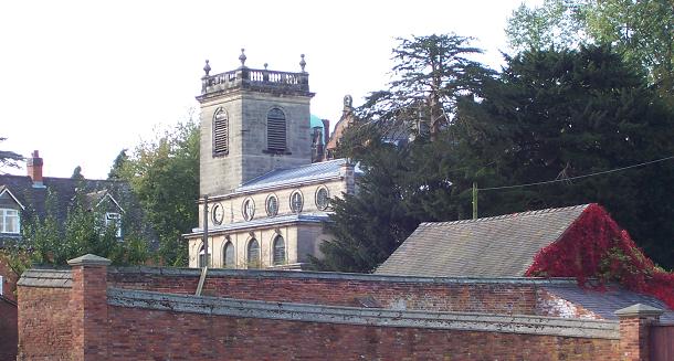
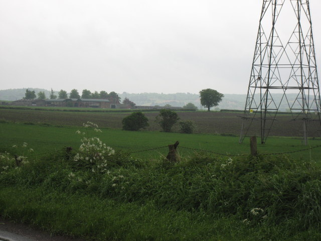
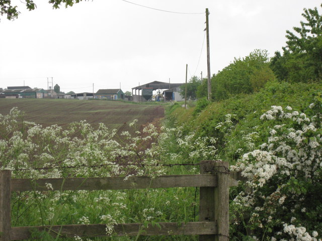
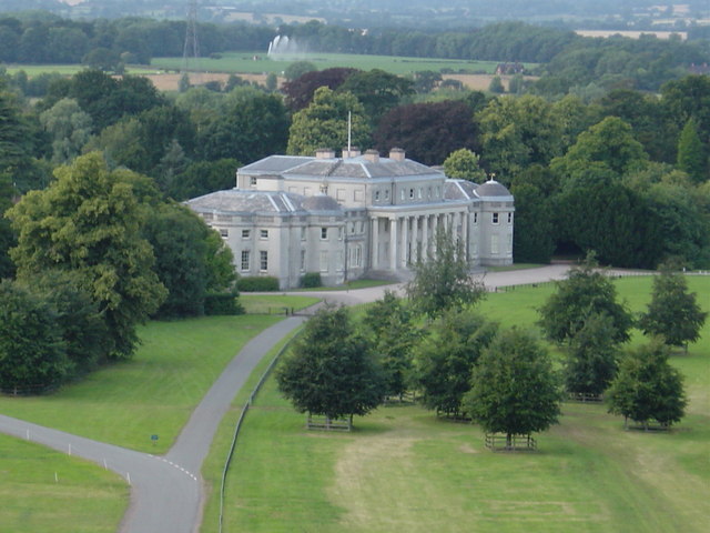
Old Quarry Covert Images

Images are sourced within 2km of 52.802344/-2.0410742 or Grid Reference SJ9722. Thanks to Geograph Open Source API. All images are credited.

Tixall Wide on The Staffs. & Worcs. Canal When this stretch of the Staffs . & Worcs. Canal was built, the landowner at this point insisted that the canal be made very wide here so as to resemble a lake and not an ugly narrow canal!
Tixall Wide on The Staffs. & Worcs. Canal
When this stretch of the Staffs . & Worcs. Canal was built, the landowner at this point insisted that the canal be made very wide here so as to resemble a lake and not an ugly narrow canal!
Nickolls Transport DAF 85CF taken in our yard. The depot is in Milford near Stafford.
Nickolls Transport
DAF 85CF taken in our yard. The depot is in Milford near Stafford.
Milford Church Fete A true vision of little Britain, this picture was taken at the Church Garden Fete on a very warm day in June 2005
Milford Church Fete
A true vision of little Britain, this picture was taken at the Church Garden Fete on a very warm day in June 2005
Two Trucks in the yard Two vehicles belonging to Nickolls Transport, Milford, Stafford.  Behind the yard you can see the railway line.
Two Trucks in the yard
Two vehicles belonging to Nickolls Transport, Milford, Stafford. Behind the yard you can see the railway line.
Aerial View of Milford, near Stafford Showing Transport Depot
Aerial View of Milford, near Stafford
Showing Transport Depot
Ingestre Hall Chetwynd's Jacobean masterpiece is owned by Sandwell Borough Council, who use it as a residential arts centre. <span class="nowrap"><a title="http://pages.britishlibrary.net/tixandrews/ingestre/inghall.html" rel="nofollow ugc noopener" href="http://pages.britishlibrary.net/tixandrews/ingestre/inghall.html">Link</a><img style="margin-left:2px;" alt="External link" title="External link - shift click to open in new window" src="https://s1.geograph.org.uk/img/external.png" width="10" height="10"/></span>
Ingestre Hall
Chetwynd's Jacobean masterpiece is owned by Sandwell Borough Council, who use it as a residential arts centre. LinkExternal link
Fields at Tixall Farm The distant wood is Bricklawn Covert. The GR given is for the near pylon.
Fields at Tixall Farm
The distant wood is Bricklawn Covert. The GR given is for the near pylon.
St Mary the Virgin, Ingestre Built 1676. <span class="nowrap"><a title="http://pages.britishlibrary.net/tixandrews/ingestre/ingchrch.html" rel="nofollow ugc noopener" href="http://pages.britishlibrary.net/tixandrews/ingestre/ingchrch.html">Link</a><img style="margin-left:2px;" alt="External link" title="External link - shift click to open in new window" src="https://s1.geograph.org.uk/img/external.png" width="10" height="10"/></span>
St Mary the Virgin, Ingestre
Built 1676. LinkExternal link
Ingestre This odd little place viewed from the stables.
Ingestre
This odd little place viewed from the stables.
Ingestre Stables <span class="nowrap"><a title="http://www.ingestre.com/" rel="nofollow ugc noopener" href="http://www.ingestre.com/">Link</a><img style="margin-left:2px;" alt="External link" title="External link - shift click to open in new window" src="https://s1.geograph.org.uk/img/external.png" width="10" height="10"/></span>
Ingestre is quite a surprise. The village is at the end of a no-through road, so you'll only arrive here by choice or by accident. Your reward is not only a magnificent hall and church, but these amazing stables, which look to me more like an Oxford college. Hmm...
Ingestre Stables
LinkExternal link Ingestre is quite a surprise. The village is at the end of a no-through road, so you'll only arrive here by choice or by accident. Your reward is not only a magnificent hall and church, but these amazing stables, which look to me more like an Oxford college. Hmm...
Toll House The Toll House at the end of the Staffs & Worcester Canal where it joins the Trent & Mersey. The Aqueduct in the background is over the Trent. At the time this photo was taken the toll house was let as a shop.
Toll House
The Toll House at the end of the Staffs & Worcester Canal where it joins the Trent & Mersey. The Aqueduct in the background is over the Trent. At the time this photo was taken the toll house was let as a shop.
Folly, Shugborough Estate Bizarre edifice near the railway line that runs through the Shrugborough Estate, taken from the Staffordshire Way
Folly, Shugborough Estate
Bizarre edifice near the railway line that runs through the Shrugborough Estate, taken from the Staffordshire Way
Barley Mow at Milford On the corner of Milford Common
Barley Mow at Milford
On the corner of Milford Common
Milford Common Looking towards the south with the Barley Mow Public House behind the right shoulder
Milford Common
Looking towards the south with the Barley Mow Public House behind the right shoulder
Tixall  The obelisk
Tixall The obelisk
Brancote Farm On a rather poor day !
Brancote Farm
On a rather poor day !
Tixall Heath Farm From the side of its drive way
Tixall Heath Farm
From the side of its drive way
Shugborough Hall from hot air balloon
Show me another place!

Old Quarry Covert is located at Grid Ref: SJ9722 (Lat: 52.802344, Lng: -2.0410742)

Administrative County: Staffordshire

District: Stafford

Police Authority: Staffordshire

What 3 Words

///supply.surnames.unravel. Near Great Haywood, Staffordshire

Related Wikis

Tixall

Tixall is a small village and civil parish in the Stafford district, in the English county of Staffordshire lying on the western side of the Trent valley...
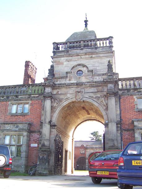
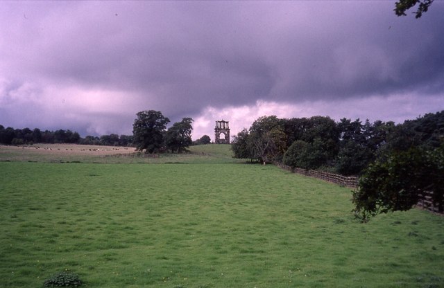
Tixall Gatehouse

Tixall Gatehouse is a 16th-century gatehouse situated at Tixall, near Stafford, Staffordshire and is all that remains of Tixall Hall which was demolished...
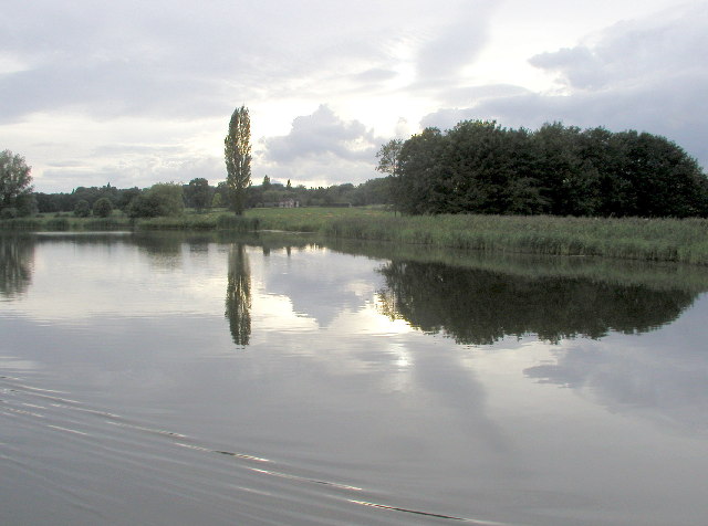
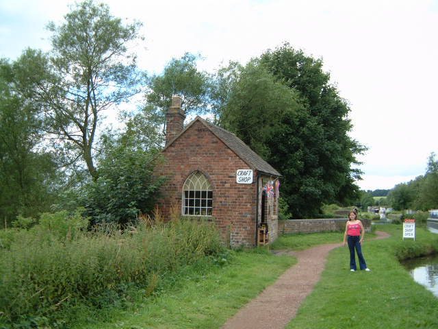
Tixall Wide

Tixall Wide, also known as Tixall Broad or The Broad Water, is a body of water that forms part of the Staffordshire and Worcestershire Canal near Tixall...

Way for the Millennium

The Way for the Millennium is a 41-mile-long (66 km) east–west route across Staffordshire, deliberately designed for easy walking, using towpaths, old...

Shugborough Tunnel

The Shugborough Tunnel is a 777-yard (710 m) railway tunnel on the Trent Valley line running under part of the Shugborough Estate in Colwich, Staffordshire...

Milford and Brocton railway station

Milford and Brocton railway station served the villages of Milford and Brocton in Staffordshire, England from 1877 to 1950 on the Trent Valley line....

Milford, Staffordshire

Milford is a village in the county of Staffordshire, England. It lies at the edge of Cannock Chase, on the A513 road between Stafford and Rugeley. Just...

Milford Hall

Milford Hall is a privately owned 18th-century English country house at Milford, near Stafford. It is the family seat of the Levett Haszard family and...

Nearby Amenities

Located within 500m of 52.802344,-2.0410742
Tixall
Place: village
Wikidata: Q690473
Lat/Long: 52.8019456/-2.0340337
Bus Stop
Church
Bus: yes
Naptan AtcoCode: 3800C714200
Naptan Bearing: NE
Naptan BusStopType: CUS
Naptan CommonName: Church
Naptan Indicator: Opp
Naptan Landmark: Church
Naptan Street: Tixall Rd
Naptan Verified: no
Public Transport: platform
Source: naptan_import
Lat/Long: 52.8028787/-2.0340277
Bus Stop
Church
Bus: yes
Naptan AtcoCode: 3800C714201
Naptan Bearing: SW
Naptan CommonName: Church
Naptan Indicator: Adj
Naptan Landmark: Church
Naptan Street: Tixall Road
Naptan Verified: no
Public Transport: platform
Source: naptan_import
Lat/Long: 52.8029237/-2.0337755
Post Box
Post Box Type: lamp
Ref: ST18 196
Royal Cypher: EIIR
Lat/Long: 52.8029591/-2.0343114
Telephone
Booth: K6
Covered: booth
Listed Status: Grade II
Man Made: telephone_box
Note: moved from Tixall Mews
Lat/Long: 52.8029035/-2.0343055
Noexit: yes
Lat/Long: 52.8010084/-2.0384387
Noexit: yes
Lat/Long: 52.8028766/-2.0353513
Noexit: yes
Lat/Long: 52.8028339/-2.0356242
Give Way
Direction: forward
Lat/Long: 52.8014383/-2.0362379
Give Way
Direction: forward
Lat/Long: 52.8012815/-2.0366008
Noexit: yes
Lat/Long: 52.8024476/-2.0360796
The data included in this document is from www.openstreetmap.org. The data is made available under ODbL.

Have you been to Old Quarry Covert?

Leave your review of Old Quarry Covert below (or comments, questions and feedback).