Tivy Dale

Settlement in Yorkshire

England

Tivy Dale

View to Kexbrough over South Yorkshire countryside From  the lane that leads from Barnby Green to Barnby Furnace
View to Kexbrough over South Yorkshire countryside Credit: Neil Theasby

The requested URL returned error: 429 Too Many Requests

If you have any feedback on the listing, please let us know in the comments section below.
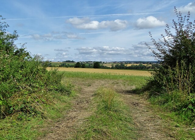
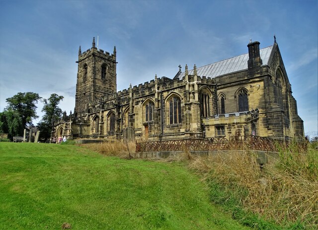
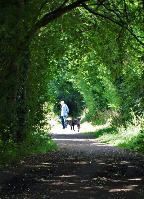
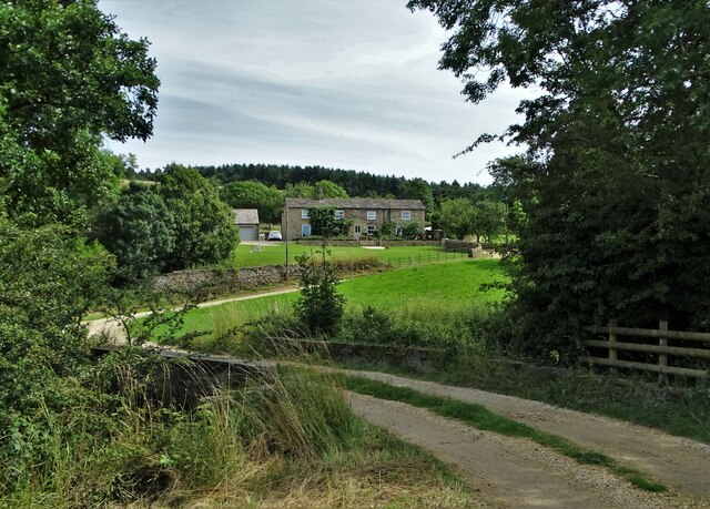
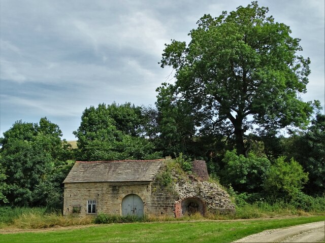
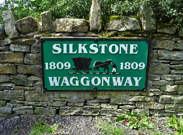
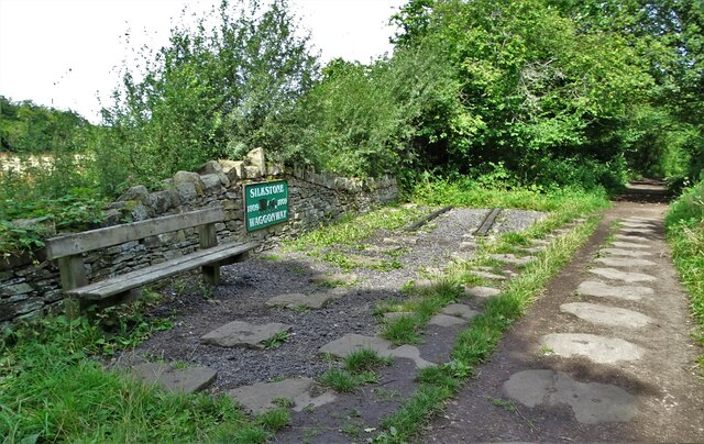
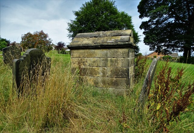
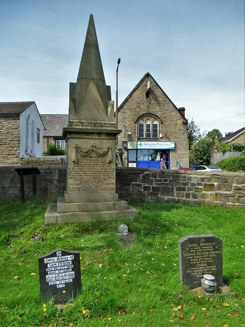
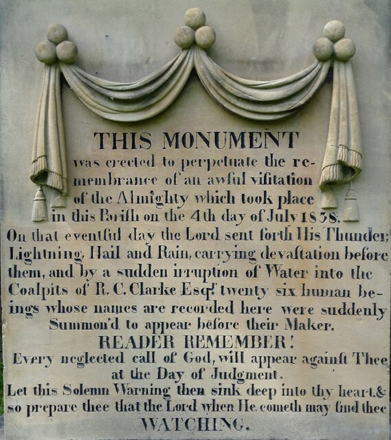
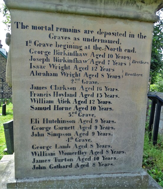
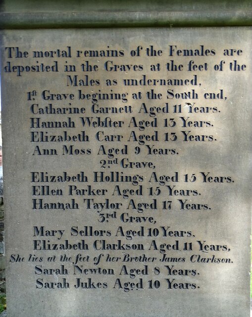
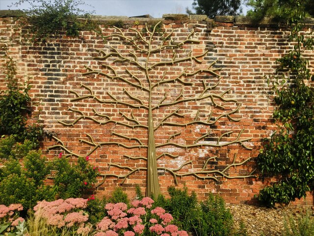
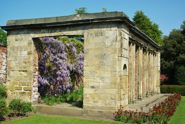
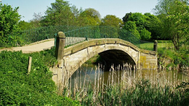
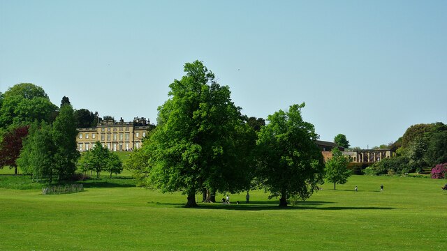
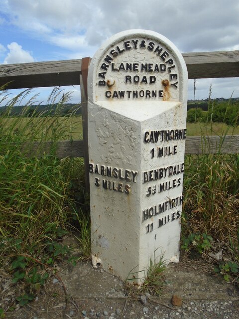
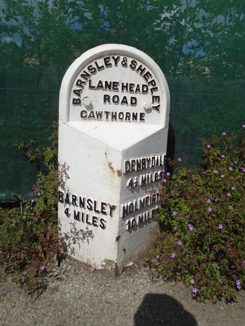
Tivy Dale Images

Images are sourced within 2km of 53.563361/-1.577223 or Grid Reference SE2807. Thanks to Geograph Open Source API. All images are credited.

View to Kexbrough over South Yorkshire countryside From  the lane that leads from Barnby Green to Barnby Furnace
View to Kexbrough over South Yorkshire countryside
From the lane that leads from Barnby Green to Barnby Furnace
All Saints Church, Silkstone A Christian church has stood here since before 1066 with the current building dating back to the twelfth century with various additions having been made since it was first built.
All Saints Church, Silkstone
A Christian church has stood here since before 1066 with the current building dating back to the twelfth century with various additions having been made since it was first built.
Dog walker on the Silkstone Waggonway trail Constructed in 1809, the waggonway was created to take tubs of coal from the workings at Silkstone to Barnby Basin - the terminus of the Aire and Calder Canal - a mile and a half to the north. The tubs were pulled on rails by horses.
Dog walker on the Silkstone Waggonway trail
Constructed in 1809, the waggonway was created to take tubs of coal from the workings at Silkstone to Barnby Basin - the terminus of the Aire and Calder Canal - a mile and a half to the north. The tubs were pulled on rails by horses.
Low Mill Farm
Low Mill Farm
Dilapidated building at Low Mill Farm There appears to be some sort of kiln chimney to the right of this structure.
Dilapidated building at Low Mill Farm
There appears to be some sort of kiln chimney to the right of this structure.
Silkstone Waggonway sign See the Wikipedia entry for this historic coal tramway: <span class="nowrap"><a title="https://en.wikipedia.org/wiki/Silkstone_Waggonway" rel="nofollow ugc noopener" href="https://en.wikipedia.org/wiki/Silkstone_Waggonway">Link</a><img style="margin-left:2px;" alt="External link" title="External link - shift click to open in new window" src="https://s1.geograph.org.uk/img/external.png" width="10" height="10"/></span>
Silkstone Waggonway sign
See the Wikipedia entry for this historic coal tramway: LinkExternal link
Evidence of Silkstone Waggonway For fifty to sixty years in the mid-nineteenth century the waggonway facilitated the transport of coal from the Silkstone area to the canal basin at Barnby -  two miles north of the village. The coal tubs were pulled along the rails by horses.
Evidence of Silkstone Waggonway
For fifty to sixty years in the mid-nineteenth century the waggonway facilitated the transport of coal from the Silkstone area to the canal basin at Barnby - two miles north of the village. The coal tubs were pulled along the rails by horses.
Unusual grave in Silkstone churchyard Attributed to Thomas Peigham, Vicar of Silkstone 1677-89.
Unusual grave in Silkstone churchyard
Attributed to Thomas Peigham, Vicar of Silkstone 1677-89.
Huskar Disaster Monument in Silkstone churchyard Erected in memory of the twenty six children who tragically died in the Huskar coalmine disaster of July 4th 1838. For Wikipedia page see <span class="nowrap"><a title="https://en.wikipedia.org/wiki/Huskar_Pit" rel="nofollow ugc noopener" href="https://en.wikipedia.org/wiki/Huskar_Pit">Link</a><img style="margin-left:2px;" alt="External link" title="External link - shift click to open in new window" src="https://s1.geograph.org.uk/img/external.png" width="10" height="10"/></span>
Closer detail of inscriptions:-
Front face of monument:<a title="https://www.geograph.org.uk/photo/6939983" href="https://www.geograph.org.uk/photo/6939983">Link</a>
North face of monument:<a title="https://www.geograph.org.uk/photo/6939991" href="https://www.geograph.org.uk/photo/6939991">Link</a>
South face of monument:<a title="https://www.geograph.org.uk/photo/6939996" href="https://www.geograph.org.uk/photo/6939996">Link</a>
Huskar Disaster Monument in Silkstone churchyard
Erected in memory of the twenty six children who tragically died in the Huskar coalmine disaster of July 4th 1838. For Wikipedia page see LinkExternal link Closer detail of inscriptions:- Front face of monument:Link North face of monument:Link South face of monument:Link
Front face of the Huskar disaster monument In Silkstone All Saints churchyard. In memory of the twenty six children who died in a nearby coalmine on July 4th 1838. For Wikipedia entry see <span class="nowrap"><a title="https://en.wikipedia.org/wiki/Huskar_Pit" rel="nofollow ugc noopener" href="https://en.wikipedia.org/wiki/Huskar_Pit">Link</a><img style="margin-left:2px;" alt="External link" title="External link - shift click to open in new window" src="https://s1.geograph.org.uk/img/external.png" width="10" height="10"/></span>
For a full view of the monument go here: <a title="https://www.geograph.org.uk/photo/6939977" href="https://www.geograph.org.uk/photo/6939977">Link</a>
Front face of the Huskar disaster monument
In Silkstone All Saints churchyard. In memory of the twenty six children who died in a nearby coalmine on July 4th 1838. For Wikipedia entry see LinkExternal link For a full view of the monument go here: Link
North face of the Huskar disaster monument In Silkstone churchyard and in memory of the twenty six children who died in a nearby mine on July 4th 1838. The north face of the monument lists the boys who died that terrible day. The girls who died are listed on the south face. For the Huskar Pit page in Wikipedia go here <span class="nowrap"><a title="https://en.wikipedia.org/wiki/Huskar_Pit" rel="nofollow ugc noopener" href="https://en.wikipedia.org/wiki/Huskar_Pit">Link</a><img style="margin-left:2px;" alt="External link" title="External link - shift click to open in new window" src="https://s1.geograph.org.uk/img/external.png" width="10" height="10"/></span>
For a full view of the monument go here: <a title="https://www.geograph.org.uk/photo/6939977" href="https://www.geograph.org.uk/photo/6939977">Link</a>
North face of the Huskar disaster monument
In Silkstone churchyard and in memory of the twenty six children who died in a nearby mine on July 4th 1838. The north face of the monument lists the boys who died that terrible day. The girls who died are listed on the south face. For the Huskar Pit page in Wikipedia go here LinkExternal link For a full view of the monument go here: Link
South face of the Huskar monument, Silkstone In All Saints churchyard and in memory of the twenty six children in a nearby coalmine on July 4th, 1838. The south face shows the names of the girls who died that terrible day while the north face lists the names of the boys who died. For the Huskar Pit Wikipedia page go here: <span class="nowrap"><a title="https://en.wikipedia.org/wiki/Huskar_Pit" rel="nofollow ugc noopener" href="https://en.wikipedia.org/wiki/Huskar_Pit">Link</a><img style="margin-left:2px;" alt="External link" title="External link - shift click to open in new window" src="https://s1.geograph.org.uk/img/external.png" width="10" height="10"/></span>
For a full view of the monument go here: <a title="https://www.geograph.org.uk/photo/6939977" href="https://www.geograph.org.uk/photo/6939977">Link</a>
South face of the Huskar monument, Silkstone
In All Saints churchyard and in memory of the twenty six children in a nearby coalmine on July 4th, 1838. The south face shows the names of the girls who died that terrible day while the north face lists the names of the boys who died. For the Huskar Pit Wikipedia page go here: LinkExternal link For a full view of the monument go here: Link
Cannon Hall walled garden Cannon Hall is a country estate in South Yorkshire, managed by Barnsley District Council.  The estate, including outlying farms and the Rowlands cricket ground, covers parts of Cawthorne and High Hoyland civil parishes and is a grade II listed park (list entry 1001159).

The park was laid out in the 1760s by Richard Woods for John Spencer of Cawthorne, a local iron mine owner, and was taken over as a public park including the grade II* listed Hall (list entry 1151805).
Cannon Hall walled garden
Cannon Hall is a country estate in South Yorkshire, managed by Barnsley District Council. The estate, including outlying farms and the Rowlands cricket ground, covers parts of Cawthorne and High Hoyland civil parishes and is a grade II listed park (list entry 1001159). The park was laid out in the 1760s by Richard Woods for John Spencer of Cawthorne, a local iron mine owner, and was taken over as a public park including the grade II* listed Hall (list entry 1151805).
Wisteria in Hot House On the Cannon Hall Estate
Wisteria in Hot House
On the Cannon Hall Estate
Footbridge over The Pond In Cannon Hall Park an historic bridge
Footbridge over The Pond
In Cannon Hall Park an historic bridge
Cannon Hall Country Park With Cannon Hall south frontage and gardens on a higher level
Cannon Hall Country Park
With Cannon Hall south frontage and gardens on a higher level
Old milestone The A635 goes down and under the M1.   It then climbs from Cawthorpe Basin towards the village.   The third West Riding County Council milestone from Barnsley is on the north side of the road.  It was painted in 2015.  At some time in its history the backing stone had been painted so it was given a new coat of white masonry paint.   This milestone within Cawthorne Parish is Grade II listed 1151794.
Old milestone
The A635 goes down and under the M1. It then climbs from Cawthorpe Basin towards the village. The third West Riding County Council milestone from Barnsley is on the north side of the road. It was painted in 2015. At some time in its history the backing stone had been painted so it was given a new coat of white masonry paint. This milestone within Cawthorne Parish is Grade II listed 1151794.
Old milestone The road towards Shepley Lane Head and Holmfirth used to wend its way through Cawthorne village.  In the 20C a by-pass was built.   Some years ago this stone was found buried, perhaps from the 1940 Government instructions, but set up and in 2015 was repainted.   Although set into the pavement all the legends can be read.  The herb robert makes an attractive addition. It is Grade II listed 1151767.
Old milestone
The road towards Shepley Lane Head and Holmfirth used to wend its way through Cawthorne village. In the 20C a by-pass was built. Some years ago this stone was found buried, perhaps from the 1940 Government instructions, but set up and in 2015 was repainted. Although set into the pavement all the legends can be read. The herb robert makes an attractive addition. It is Grade II listed 1151767.
Show me another place!

Tivy Dale is located at Grid Ref: SE2807 (Lat: 53.563361, Lng: -1.577223)

Division: West Riding

Unitary Authority: Barnsley

Police Authority: South Yorkshire

What 3 Words

///regular.encodes.spilled. Near Cawthorne, South Yorkshire

Nearby Locations

Windmill Hill Tivy Dale

Related Wikis

Cawthorne

Cawthorne is a village and civil parish in the Metropolitan Borough of Barnsley, South Yorkshire, England. The village was once a centre of the iron and...

Cannon Hall

Cannon Hall is a country house museum located between the villages of Cawthorne and High Hoyland some 5 miles (8 km) west of Barnsley, South Yorkshire...

Barnsley West and Penistone (UK Parliament constituency)

Barnsley West and Penistone was a parliamentary constituency in South Yorkshire which returned one Member of Parliament (MP) to the House of Commons of...

Cannon Hall Farm

Cannon Hall Farm is a working farm and tourist attraction close to the village of Cawthorne, near Barnsley in the English county of South Yorkshire. Open...

Nearby Amenities

Located within 500m of 53.563361,-1.577223
Bus Stop
Tivy Dale/Tivy Dale Drive
Alt Name: Tivy Dale/Tivy Dale Drive
Naptan AltCommonName: Tivy Dale/Tivy Dale Drive
Naptan AtcoCode: 370051039
Naptan Bearing: NE
Naptan CommonName: Tivy Dale/Tivy Dale Drive
Naptan Indicator: 51039
Naptan Landmark: DALE HOUSE
Naptan PlusbusZoneRef: ROTHCEN
Naptan Street: Tivy Dale
Naptan Verified: no
Source: naptan_import
Lat/Long: 53.5636665/-1.5788806
Bus Stop
Tivy Dale/Back Lane
Alt Name: Tivy Dale/Back Lane
Naptan AltCommonName: Tivy Dale/Back Lane
Naptan AtcoCode: 370051046
Naptan Bearing: SW
Naptan CommonName: Tivy Dale/Back Lane
Naptan Indicator: 51046
Naptan Landmark: CAWTHORNE HOUSE
Naptan PlusbusZoneRef: ROTHCEN
Naptan Street: Tivy Dale
Naptan Verified: no
Source: naptan_import
Lat/Long: 53.565091/-1.5775529
Bus Stop
Tivy Dale Road/The Park
Alt Name: Tivy Dale Road/The Park
Naptan AltCommonName: Tivy Dale Road/The Park
Naptan AtcoCode: 370055398
Naptan Bearing: N
Naptan CommonName: Tivy Dale Road/The Park
Naptan Indicator: 55398
Naptan Landmark: 55398
Naptan PlusbusZoneRef: ROTHCEN
Naptan Street: Tivy Dale Road
Naptan Verified: no
Source: naptan_import
Lat/Long: 53.5662467/-1.5764844
Lane Head Road/South Lane
Naptan AtcoCode: 370055778
Naptan Bearing: NE
Naptan BusStopType: CUS
Naptan CommonName: Lane Head Road/South Lane
Naptan Indicator: 55778
Naptan Landmark: 55778
Naptan PlusbusZoneRef: ROTHCEN
Naptan Street: Lane Head Road
Naptan Verified: no
Source: naptan_import
Lat/Long: 53.5626343/-1.5797712
Bus Stop
Tivy Dale/Alexander Gardens
Alt Name: Tivy Dale/Alexander Gardens
Naptan AltCommonName: Tivy Dale/Alexander Gardens
Naptan AtcoCode: 370051165
Naptan Bearing: N
Naptan CommonName: Tivy Dale/Alexander Gardens
Naptan Indicator: 51165
Naptan Landmark: 51165
Naptan PlusbusZoneRef: ROTHCEN
Naptan Street: Tivy Dale
Naptan Verified: no
Source: naptan_import
Lat/Long: 53.5668346/-1.5749686
Tivy Dale
Place: locality
Lat/Long: 53.5636359/-1.5808486
Bench
Backrest: yes
Source: survey
Lat/Long: 53.5645017/-1.5744576
Post Box
Collection Times: Mo-Fr 16:15; Sa 10:30
Operator: Royal Mail
Post Box Type: wall
Ref: S75 77
Royal Cypher: EIIR
Royal Cypher Wikidata: Q33102113
Source: survey
Lat/Long: 53.5630949/-1.579236
Bench
Backrest: yes
Lat/Long: 53.5670068/-1.5770019
Barrier: stile
Stile: stepover
Lat/Long: 53.5657075/-1.5711156
Barrier: stile
Stile: stepover
Lat/Long: 53.5618078/-1.5754455
Parking
Capacity Disabled: 3
Lat/Long: 53.5595608/-1.573361
Barrier: stile
Step Count: 1
Stile: stepover
Lat/Long: 53.5631196/-1.5769315
Barrier: stile
Stile: stepover
Lat/Long: 53.562431/-1.5726869
Barrier: stile
Stile: stepover
Lat/Long: 53.5625752/-1.5763735
Barrier: stile
Stile: stepover
Lat/Long: 53.5621373/-1.5738523
Barrier: stile
Step Count: 1
Stile: stepover
Lat/Long: 53.5641415/-1.5708097
Bench
Backrest: yes
Lat/Long: 53.5633816/-1.5771232
Barrier: stile
Stile: stepover
Lat/Long: 53.5620358/-1.5757134
Bench
Backrest: yes
Lat/Long: 53.5642414/-1.5708107
Waste Basket
Waste: litter
Lat/Long: 53.5673055/-1.573702
Bench
Backrest: yes
Material: wood
Lat/Long: 53.56732/-1.5736624
The data included in this document is from www.openstreetmap.org. The data is made available under ODbL.

Have you been to Tivy Dale?

Leave your review of Tivy Dale below (or comments, questions and feedback).