Thunder Bridge

Settlement in Yorkshire

England

Thunder Bridge

Cliffe House, Shepley Photographed during the 2021 artinthehouse event.
Cliffe House, Shepley Credit: Dave Pickersgill

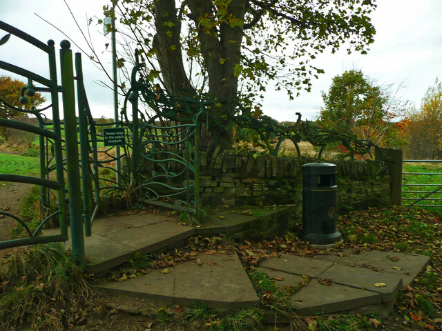
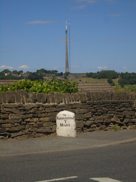
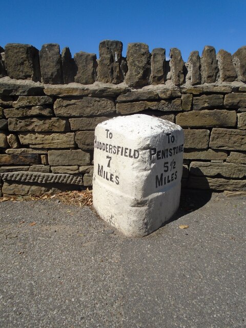
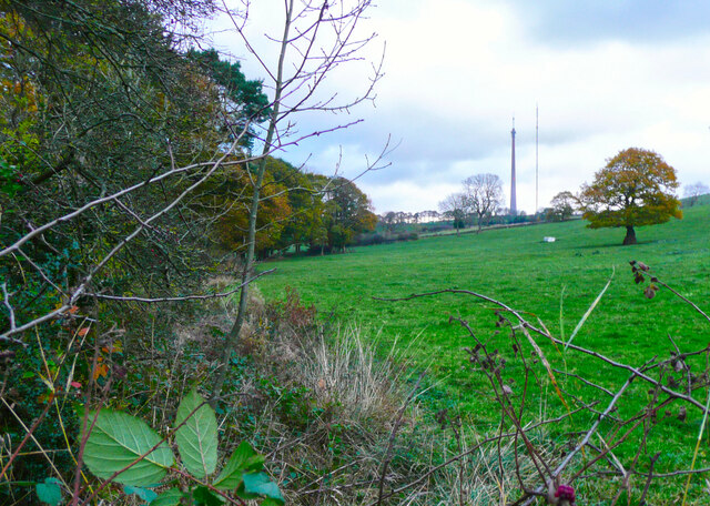
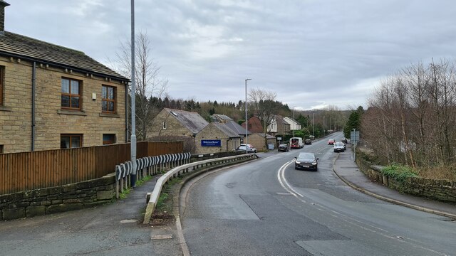
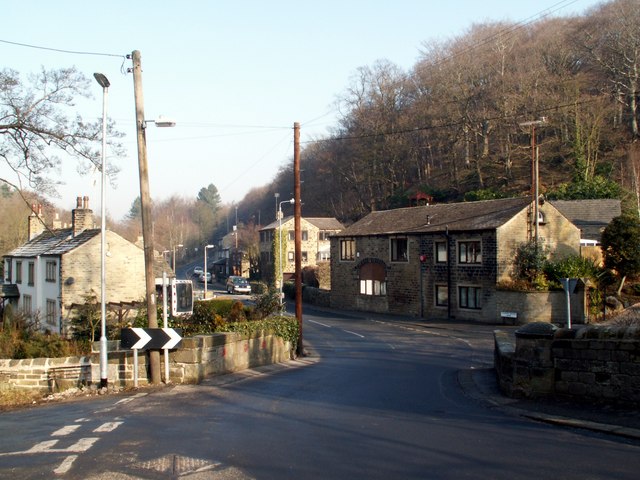
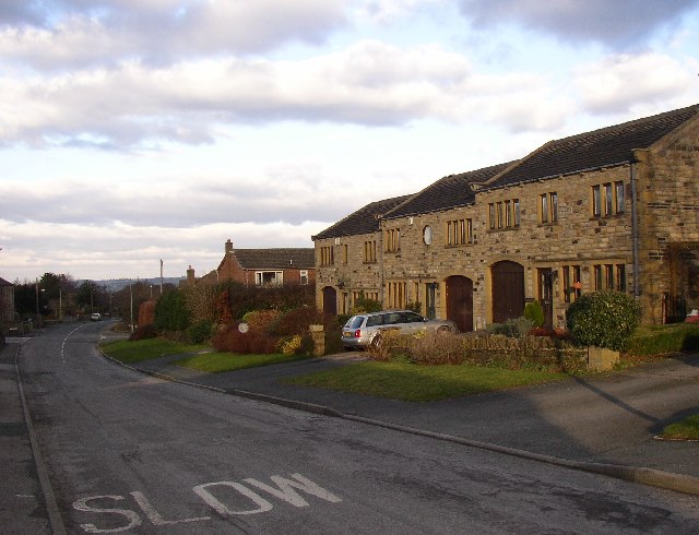
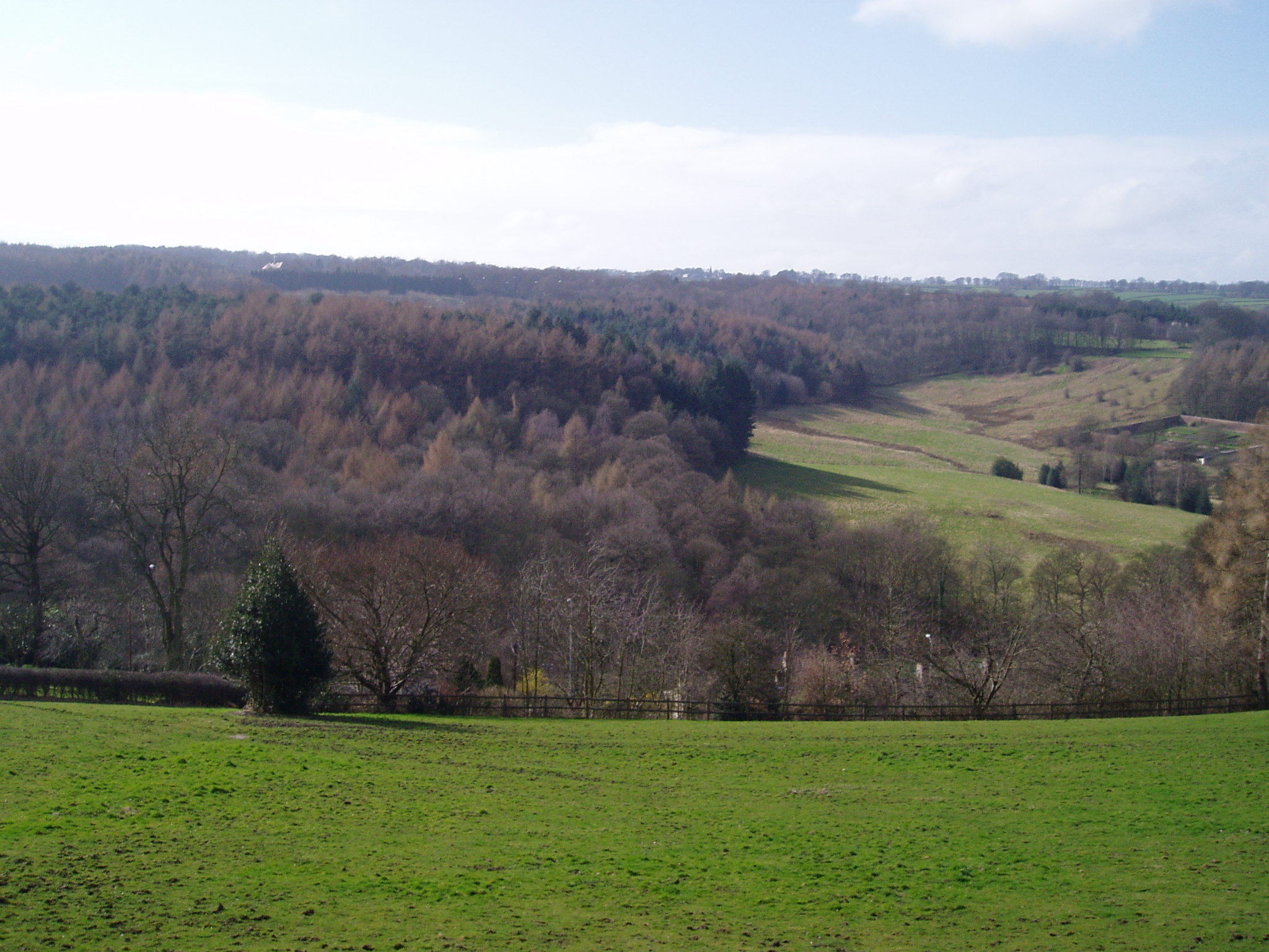
Thunder Bridge is a small village located in the county of Yorkshire, England. Situated in the picturesque Holme Valley, this rural settlement is nestled among rolling hills and lush greenery, providing a tranquil and idyllic setting. With a population of just over 500 residents, Thunder Bridge is known for its close-knit community and friendly atmosphere.

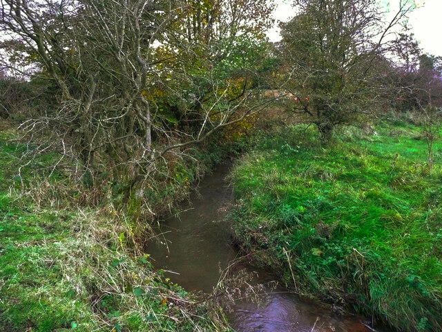
The village takes its name from the historic stone bridge that spans the River Holme, which is believed to have been constructed during the medieval period. The bridge is an iconic landmark in the area and offers stunning views of the surrounding countryside.

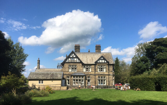
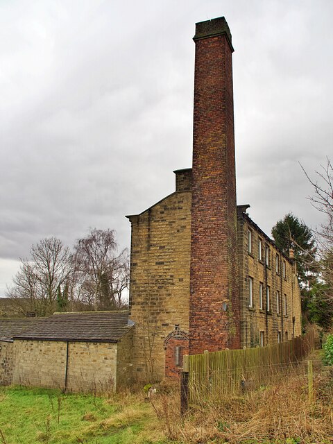
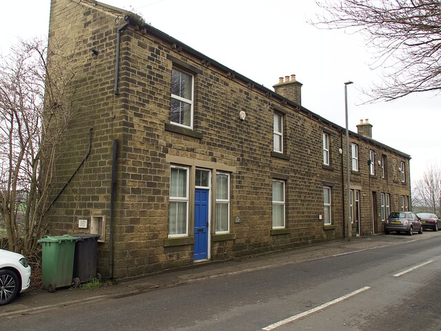
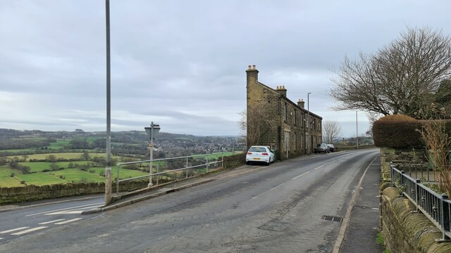
Although Thunder Bridge may be small in size, it boasts a rich history and heritage. The village is home to several beautifully preserved buildings dating back to the 17th and 18th centuries, including traditional stone cottages and a charming village church. These architectural gems provide a glimpse into the area's past and add to the village's rustic charm.

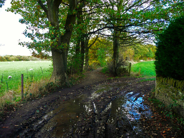
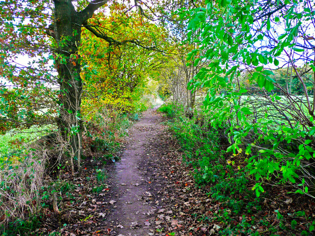
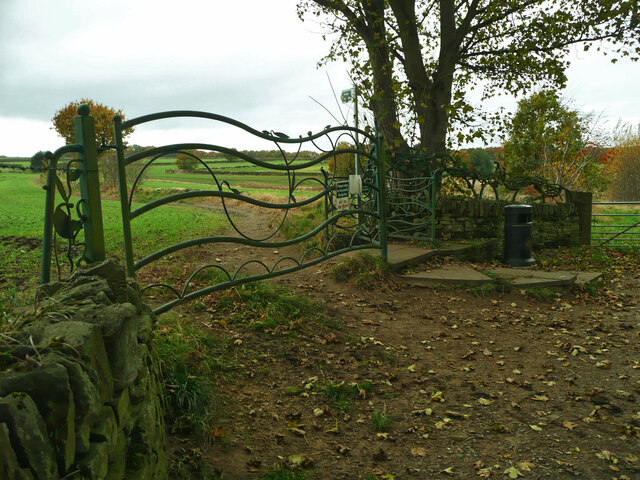
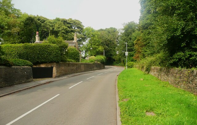
Nature enthusiasts will find plenty to explore in Thunder Bridge. The village is surrounded by picturesque walking trails, offering breathtaking views of vibrant wildflowers, babbling brooks, and wildlife. The nearby Peak District National Park is within easy reach, providing ample opportunities for hiking, cycling, and other outdoor activities.

Overall, Thunder Bridge is a hidden gem in the heart of Yorkshire. With its beautiful landscapes, rich history, and welcoming community, it offers a peaceful retreat for those seeking a slice of rural England.

If you have any feedback on the listing, please let us know in the comments section below.

Thunder Bridge Images

Images are sourced within 2km of 53.59882/-1.717353 or Grid Reference SE1811. Thanks to Geograph Open Source API. All images are credited.

Cliffe House, Shepley Photographed during the 2021 artinthehouse event.
Cliffe House, Shepley
Photographed during the 2021 artinthehouse event.
Muddy field entrance on High Moor Lane, Shepley The bridleway is mostly dry after this muddy start.
Muddy field entrance on High Moor Lane, Shepley
The bridleway is mostly dry after this muddy start.
High Moor Lane, Shepley A pleasant bridleway.
High Moor Lane, Shepley
A pleasant bridleway.
Millennium Gate, Jenkyn Lane, Shepley See <span class="nowrap"><a title="https://www.shepleyvillage.org/village-association-news-august-2014/" rel="nofollow ugc noopener" href="https://www.shepleyvillage.org/village-association-news-august-2014/">Link</a><img style="margin-left:2px;" alt="External link" title="External link - shift click to open in new window" src="https://s1.geograph.org.uk/img/external.png" width="10" height="10"/></span> for a better photograph.
Millennium Gate, Jenkyn Lane, Shepley
See LinkExternal link for a better photograph.
Part of the Millennium Gate, Jenkyn Lane, Shepley This is a revisit to the first geograph for the square: <a href="https://www.geograph.org.uk/photo/81818">SE1809 : Ornate Gateway on the Kirklees Way</a> taken in June 2005. I litter bin has been provided and the foot gate now has a sign asking people to keep to the public footpath.
Part of the Millennium Gate, Jenkyn Lane, Shepley
This is a revisit to the first geograph for the square: SE1809 : Ornate Gateway on the Kirklees Way taken in June 2005. I litter bin has been provided and the foot gate now has a sign asking people to keep to the public footpath.
Old milestone A view across the A629 in Shepley.   The milestone has been painted recently.   But in the distance the two masts of Emley Moor Transmitter.  The shorter one was a replacement for the original which collapsed from the weight of snow in 1963.   Now that needs repairs and alterations so the thinner structure has been set up beside it.
Old milestone
A view across the A629 in Shepley. The milestone has been painted recently. But in the distance the two masts of Emley Moor Transmitter. The shorter one was a replacement for the original which collapsed from the weight of snow in 1963. Now that needs repairs and alterations so the thinner structure has been set up beside it.
Old milestone A close-up of the milestone on Abbey Road in Shepley, the A629.   It may have been defaced at some time, 1940?, but the legend has been recut and the stone is well-maintained.   Grade II listed 1135384.
Old milestone
A close-up of the milestone on Abbey Road in Shepley, the A629. It may have been defaced at some time, 1940?, but the legend has been recut and the stone is well-maintained. Grade II listed 1135384.
View towards Emley Mast from Huddersfield Road, Shelley This is a revisit to the first geograph for the square: <a href="https://www.geograph.org.uk/photo/123985">SE2011 : Radcliffe Wood, near Shelley</a>  taken in February 2006. Radcliffe Wood is on the left. A young tree has grown and the hawthorn hedge makes the viewpoint a bit uncomfortable. The slender mast to the right of Emley Moor mast is a temporary one. "A temporary 310m mast was erected to May 2018 to enable transmissions to continue whilst the existing mast’s antennas are being modified to prepare for the 700MHz clearance and interruption of the broadcasts are not allowed. It was never made clear how long the temporary mast would be up for, but mid to late 2021 would seem a good guess,  being as they were advertising its sale (for collection...) from that date !" From <span class="nowrap"><a title="https://www.aerialsandtv.com/knowledge/transmitters/emley-moor-transmitter" rel="nofollow ugc noopener" href="https://www.aerialsandtv.com/knowledge/transmitters/emley-moor-transmitter">Link</a><img style="margin-left:2px;" alt="External link" title="External link - shift click to open in new window" src="https://s1.geograph.org.uk/img/external.png" width="10" height="10"/></span> .
View towards Emley Mast from Huddersfield Road, Shelley
This is a revisit to the first geograph for the square: SE2011 : Radcliffe Wood, near Shelley taken in February 2006. Radcliffe Wood is on the left. A young tree has grown and the hawthorn hedge makes the viewpoint a bit uncomfortable. The slender mast to the right of Emley Moor mast is a temporary one. "A temporary 310m mast was erected to May 2018 to enable transmissions to continue whilst the existing mast’s antennas are being modified to prepare for the 700MHz clearance and interruption of the broadcasts are not allowed. It was never made clear how long the temporary mast would be up for, but mid to late 2021 would seem a good guess, being as they were advertising its sale (for collection...) from that date !" From LinkExternal link .
Shepley Dike off Near Bank, Shelley, looking downstream A tree, probably hawthorn. has fallen over the stream.
Shepley Dike off Near Bank, Shelley, looking downstream
A tree, probably hawthorn. has fallen over the stream.
Shepley Dike off Near Bank looking upstream Brook House Bridge is a little way upstream.
Shepley Dike off Near Bank looking upstream
Brook House Bridge is a little way upstream.
Old industrial building and chimney Off Abbey Road in Shepley. The building now appears to be in residential use.
Old industrial building and chimney
Off Abbey Road in Shepley. The building now appears to be in residential use.
Bus stop and shelter on Far Bank Provided by West Yorkshire PTE
Bus stop and shelter on Far Bank
Provided by West Yorkshire PTE
Three cottages on Far Bank Named Bakers Cottage, Drapers Cottage and Grocers Cottage they were presumably small businesses before being converted to residential use.
Three cottages on Far Bank
Named Bakers Cottage, Drapers Cottage and Grocers Cottage they were presumably small businesses before being converted to residential use.
Abbey Road, Shelley
Abbey Road, Shelley
Huddersfield Road, Shelley Slim line housing between two roads on the hillside, previously including small shop units.
Huddersfield Road, Shelley
Slim line housing between two roads on the hillside, previously including small shop units.
Old milestone In Shelley at the junction of the B6116 Huddersfield Road and Far Bank.   This stone has been painted recently.   Note the very small hands.   It may date from the 19thC.  Grade II listed 1135366.
Old milestone
In Shelley at the junction of the B6116 Huddersfield Road and Far Bank. This stone has been painted recently. Note the very small hands. It may date from the 19thC. Grade II listed 1135366.
Turnshaw Road, Kirkburton
Cross Lane Running down to the Huddersfield Road.
Cross Lane
Running down to the Huddersfield Road.
Show me another place!

Thunder Bridge is located at Grid Ref: SE1811 (Lat: 53.59882, Lng: -1.717353)

Division: West Riding

Unitary Authority: Kirklees

Police Authority: West Yorkshire

What 3 Words

///mammal.prepares.freezers. Near Kirkburton, West Yorkshire

Related Wikis

Thunder Bridge

Thunder Bridge or Thunderbridge is a hamlet and bridge in the civil parish of Kirkburton, in the Kirklees district, in the county of West Yorkshire, England...

Stocksmoor railway station

Stocksmoor railway station serves the village of Stocksmoor near Huddersfield in West Yorkshire, England. The station is 6.25 miles (10 km) from Huddersfield...

Stocksmoor

Stocksmoor is a hamlet, near Huddersfield, West Yorkshire, England. It is situated between the villages of Shepley and Brockholes. The total population...

Huddersfield Town F.C. Women

Huddersfield Town Women Football Club is an English women's football club based in Huddersfield, West Yorkshire. The team play their homes matches at the...

Shelley C.F.C.

Shelley Community Football Club is a football club based in Shelley, West Yorkshire, England. They are currently members of the North West Counties League...

Myers Wood

Myers Wood is a wooded area in the village of Kirkburton, West Yorkshire, England. It forms part of a heavily forested area to the west of the village...

Shepley railway station

Shepley railway station serves the villages of Shepley and Shelley in West Yorkshire, England. It lies on the Penistone Line operated by Northern. Opened...

Storthes Hall

Storthes Hall is part of the civil parish of Kirkburton in West Yorkshire, England. A heavily wooded area, it comprises a single road, Storthes Hall Lane...

Nearby Amenities

Located within 500m of 53.59882,-1.717353
Bus Stop
Thunder Bridge Lane Woodman Inn PH
Bus: yes
Local Ref: 45051310
Naptan AtcoCode: 450051310
Naptan Bearing: SW
Naptan BusStopType: CUS
Naptan CommonName: Thunder Bridge Lane Woodman Inn PH
Naptan Indicator: Stop 45051310
Naptan PlusbusZoneRef: LEEDS
Naptan ShortCommonName: Thunder Bridge Lane
Naptan Street: Thunder Bridge Lane
Naptan Verified: no
Public Transport: platform
Source: naptan_import
Lat/Long: 53.5997836/-1.7166222
Thunderbridge
Place: hamlet
Source: Survey
Lat/Long: 53.5995467/-1.7163487
Bench
Backrest: yes
Lat/Long: 53.6008833/-1.7210698
Ford: yes
Lat/Long: 53.6022433/-1.7150667
Barrier: kissing_gate
Material: metal;wood
Note: approximate position
Lat/Long: 53.6030471/-1.7150614
Barrier: kissing_gate
Material: metal;wood
Lat/Long: 53.6012246/-1.7159191
Barrier: kissing_gate
Lat/Long: 53.5992422/-1.7176525
Barrier: kissing_gate
Material: wood
Vehicle: no
Lat/Long: 53.5963824/-1.7143593
Bench
Backrest: yes
Lat/Long: 53.6029862/-1.7147581
Board Title: Thunder Bridge Meadows
Board Type: nature
Information: board
Tourism: information
Lat/Long: 53.5992569/-1.7175892
Bench
Backrest: no
Lat/Long: 53.6014925/-1.7151047
Barrier: stile
Step Count: 2
Stile: stepover
Lat/Long: 53.6001542/-1.7110231
Barrier: stile
Step Count: 1
Stile: stepover
Lat/Long: 53.6003745/-1.710887
The data included in this document is from www.openstreetmap.org. The data is made available under ODbL.

Have you been to Thunder Bridge?

Leave your review of Thunder Bridge below (or comments, questions and feedback).