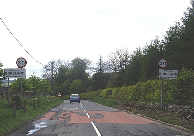
Boreland

Settlement in Dumfriesshire

Scotland

Boreland

B723 near Boreland
B723 near Boreland Credit: Steven Brown

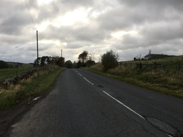
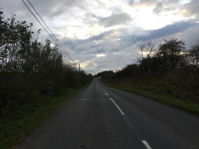
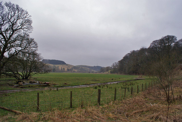
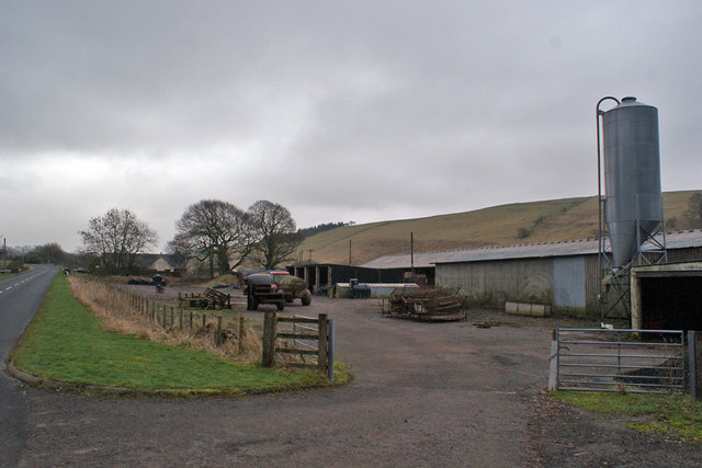
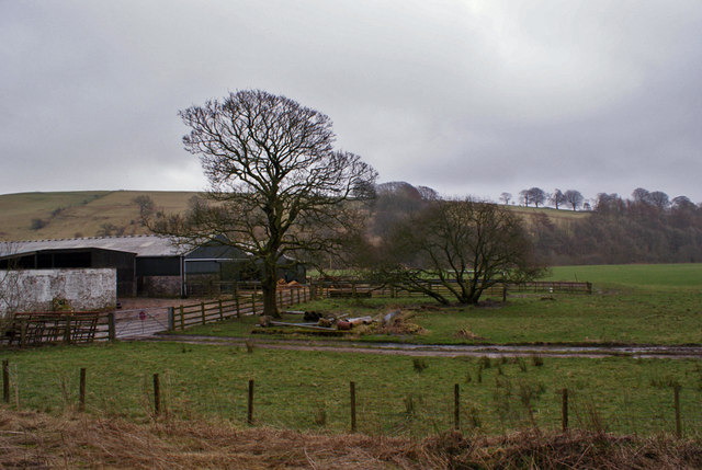
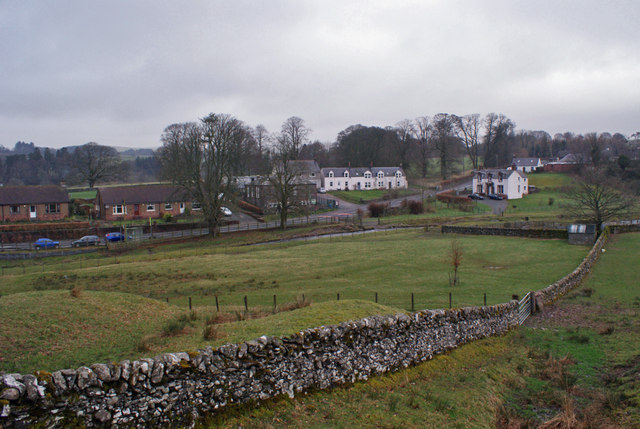
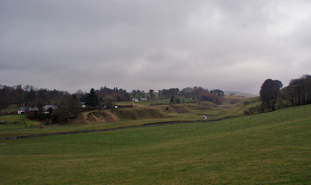
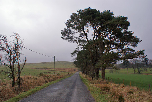
Boreland is a small village located in the Dumfriesshire region of southwest Scotland. Situated approximately 12 miles northwest of Dumfries town, Boreland is nestled within a picturesque rural landscape characterized by rolling hills, green fields, and scattered farmland.

The village itself is relatively small, with a population of around 200 residents. It boasts a tight-knit community atmosphere, where neighbors often gather at the local pub or community center to socialize and engage in various activities. The village is known for its friendly and welcoming nature, providing a peaceful and tranquil environment for its inhabitants.

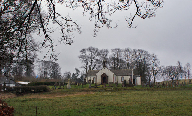
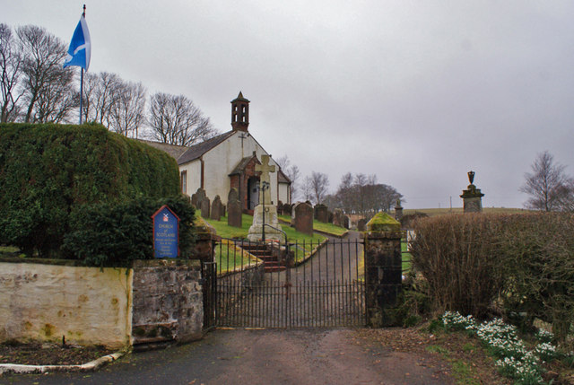
One of the notable landmarks in Boreland is the Boreland Tower, a historic tower house that dates back to the 16th century. This well-preserved structure serves as a reminder of the area's rich history and attracts visitors interested in exploring the region's architectural heritage.

The surrounding countryside offers ample opportunities for outdoor enthusiasts, with numerous walking trails and cycling routes available. The nearby Ae Forest is a popular destination for nature lovers, offering scenic woodland walks, mountain biking trails, and opportunities for birdwatching.

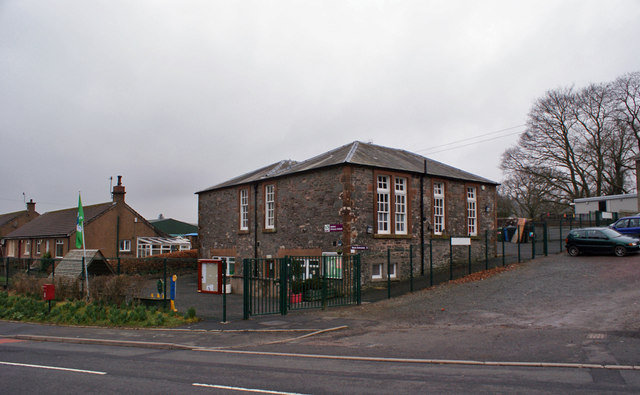
In terms of amenities, Boreland has limited facilities, with a local shop providing essential groceries and a primary school catering to the educational needs of the village's children. For more extensive amenities, residents typically travel to nearby Dumfries, where they can access a wider range of shops, schools, healthcare services, and recreational facilities.

Overall, Boreland offers a peaceful and idyllic lifestyle in the heart of the Scottish countryside, making it an attractive place to live for those seeking a close-knit community and a connection with nature.

If you have any feedback on the listing, please let us know in the comments section below.
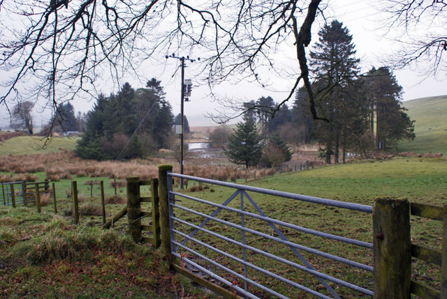
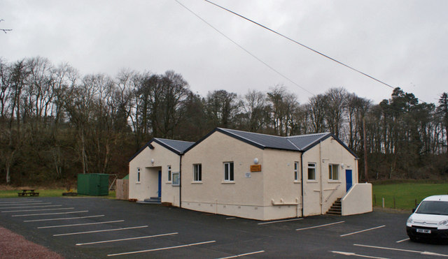
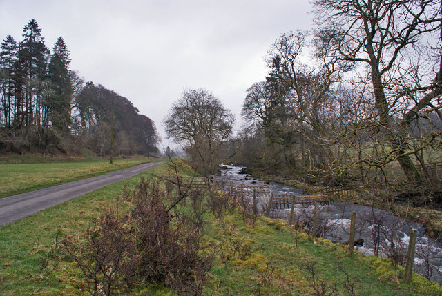
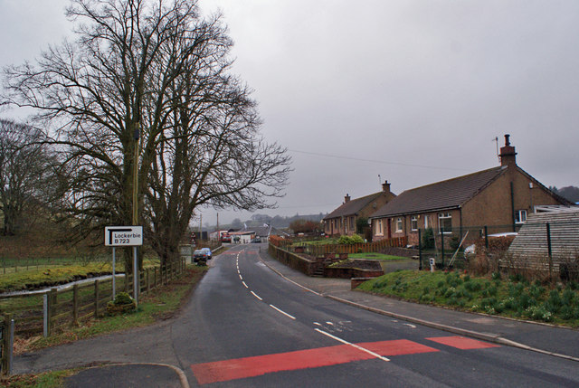
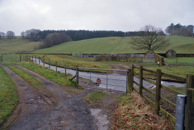
Boreland Images

Images are sourced within 2km of 55.206587/-3.306604 or Grid Reference NY1691. Thanks to Geograph Open Source API. All images are credited.

B723 near Boreland
B723 near Boreland
B723 towards Lockerbie
Broom Hill Fort A view of the Broom Hill fort from the south-west.
Broom Hill Fort
A view of the Broom Hill fort from the south-west.
Entering Boreland On the B723 from Eskdalemuir.
Entering Boreland
On the B723 from Eskdalemuir.
Farmland at Berryscaur Looking south from the side of the B723.
Farmland at Berryscaur
Looking south from the side of the B723.
Farm buildings at Berryscaur The road on the left is the B723
Farm buildings at Berryscaur
The road on the left is the B723
Berryscaur Farm buildings and farmland, viewed from the side of the B732.
Berryscaur
Farm buildings and farmland, viewed from the side of the B732.
Hutton and Corrie Church of Scotland The church stands in an isolated location, some distance from the village of Boreland.
Hutton and Corrie Church of Scotland
The church stands in an isolated location, some distance from the village of Boreland.
Walled fields at Boreland The village stands on the B723 between Lockerbie and Eskdalemuir.
Walled fields at Boreland
The village stands on the B723 between Lockerbie and Eskdalemuir.
Entrance to Hutton and Corrie Church The church dates from 1710.
Entrance to Hutton and Corrie Church
The church dates from 1710.
Pastureland at Boreland Beyond, the Boreland Burn meanders in a shallow valley.
Pastureland at Boreland
Beyond, the Boreland Burn meanders in a shallow valley.
Tree-lined road The unclassified road runs south east from Boreland village.
Tree-lined road
The unclassified road runs south east from Boreland village.
Field entrance and ponds The ponds are probably man made, created by damming a small stream.
Field entrance and ponds
The ponds are probably man made, created by damming a small stream.
Boreland Village Hall The community owned hall was built in the early 1950s. A three-phase refurbishment project was completed in October 2012. The first two phases upgraded the heating and existing kitchen, while the third phase was to build an extension (here, the part of the building closest to the camera) which houses new toilet facilities, storeroom and cloakroom.
Boreland Village Hall
The community owned hall was built in the early 1950s. A three-phase refurbishment project was completed in October 2012. The first two phases upgraded the heating and existing kitchen, while the third phase was to build an extension (here, the part of the building closest to the camera) which houses new toilet facilities, storeroom and cloakroom.
Dryfe Water Looking upstream from close to Boreland village hall. The road on the left is a farm access road.
Dryfe Water
Looking upstream from close to Boreland village hall. The road on the left is a farm access road.
Hutton Primary School, Boreland Built 1857 and extended 1906, the school currently has a roll of 21 children.
Hutton Primary School, Boreland
Built 1857 and extended 1906, the school currently has a roll of 21 children.
Boreland village The village lies on the B723, about seven miles north-east of Lockerbie.
Boreland village
The village lies on the B723, about seven miles north-east of Lockerbie.
Gated ford Through the gate, a ford in the track crosses the Boreland Burn.
Gated ford
Through the gate, a ford in the track crosses the Boreland Burn.
Show me another place!

Boreland is located at Grid Ref: NY1691 (Lat: 55.206587, Lng: -3.306604)

Unitary Authority: Dumfries and Galloway

Police Authority: Dumfries and Galloway

What 3 Words

///applies.bossy.inspects. Near Johnstonebridge, Dumfries & Galloway

Related Wikis

Boreland

Boreland is a village in Dumfries and Galloway, Scotland, which is located in Dryfesdale about 7 miles (11 kilometres) north of Lockerbie on the B723 road...

Sibbaldbie

Sibbaldbie is a small village in Annandale, Dumfries and Galloway, Scotland. == References ==

Dinwoodie railway station

Dinwoodie railway station was a station which served the rural area around the settlement of Dinwoodie, 6 miles north of Lockerbie in Applegarth parish...

Whitcastles stone circle

Whitcastles or Little Hartfell (grid reference NY 2240 8806) is a stone circle 6½ miles NE of Lockerbie, Dumfries and Galloway. Nine fallen stones lie...

Annandale Water services

Annandale Water services is a motorway service station in the village of Johnstonebridge, Scotland. The service station is located next to the A74(M) motorway...

Annandale Water

Annandale Water is a loch in Annandale, Dumfries and Galloway, in the south west of Scotland. It is part of Annandale Water service station at Junction...

Newton Wamphray

Newton Wamphray is a village in Dumfries and Galloway. Wamphray is the name of the surrounding parish and of the Wamphray Water, which flows south-west...

Wamphray railway station

Wamphray railway station served Newton Wamphray, near Beattock, in the Scottish county of Dumfries and Galloway. It was served by local trains on what...

Nearby Amenities

Located within 500m of 55.206587,-3.306604
Boreland
Place: village
Source: os7
Lat/Long: 55.2069581/-3.3072385
Bus Stop
Village
Naptan AtcoCode: 680000192111
Naptan Bearing: NE
Naptan CommonName: Village
Naptan Indicator: o/s school
Naptan Landmark: Primary School
Naptan NaptanCode: 34234287
Naptan Notes: none
Naptan Street: Main Street
Naptan Verified: no
Public Transport: platform
Source: naptan_import
Lat/Long: 55.207071/-3.3048574
Bus Stop
Village
Bus: yes
Naptan AtcoCode: 680000192222
Naptan Bearing: SW
Naptan CommonName: Village
Naptan Indicator: opp school
Naptan Landmark: Primary School
Naptan NaptanCode: 34234286
Naptan Notes: none
Naptan Street: Main Street
Naptan Verified: no
Public Transport: platform
Shelter: yes
Source: naptan_import;survey
Lat/Long: 55.2066731/-3.3058301
Ford: yes
Lat/Long: 55.2067458/-3.3050339
Parking
Lat/Long: 55.2071787/-3.3051161
Generator Method: photovoltaic
Generator Output Electricity: yes
Generator Source: solar
Generator Type: solar_photovoltaic_panel
Power: generator
Lat/Long: 55.2073012/-3.3051476
Power: pole
Lat/Long: 55.2104485/-3.3046171
Power: pole
Lat/Long: 55.2095799/-3.3060932
Power: pole
Lat/Long: 55.2087113/-3.3076014
Power: pole
Lat/Long: 55.2083114/-3.3082956
Power: pole
Lat/Long: 55.2078499/-3.3090903
Power: pole
Lat/Long: 55.2074281/-3.3099275
Power: pole
Lat/Long: 55.2068754/-3.3110763
Power: pole
Lat/Long: 55.20653/-3.3116482
Power: pole
Lat/Long: 55.2060581/-3.3124287
Power: pole
Lat/Long: 55.2055047/-3.3134037
Power: pole
Lat/Long: 55.2100355/-3.306987
Power: pole
Lat/Long: 55.2105044/-3.30785
Power: pole
Lat/Long: 55.2082394/-3.3060996
Power: pole
Lat/Long: 55.2077603/-3.3045283
Power: pole
Lat/Long: 55.2074237/-3.3102237
Power: pole
Lat/Long: 55.2073884/-3.311151
Power: pole
Lat/Long: 55.2073605/-3.3118672
Power: pole
Lat/Long: 55.2077617/-3.3109553
Power: pole
Lat/Long: 55.2081321/-3.3107492
Power: pole
Lat/Long: 55.2063889/-3.3104246
Power: pole
Lat/Long: 55.2057936/-3.3096415
Power: pole
Lat/Long: 55.2051483/-3.3087992
Power: pole
Lat/Long: 55.2045103/-3.3079517
Power: pole
Lat/Long: 55.2040958/-3.3074133
Power: pole
Lat/Long: 55.2035239/-3.3066766
Power: pole
Lat/Long: 55.2029844/-3.3059528
Power: pole
Lat/Long: 55.2024111/-3.3052083
Power: pole
Lat/Long: 55.2060104/-3.3129297
Historic: memorial
Memorial: war_memorial
Wikidata: Q114168101
Lat/Long: 55.2050109/-3.3048476
Post Box
Operator: Royal Mail
Post Box Mounting: pier
Post Box Type: lamp
Ref: DG11 14
Royal Cypher: scottish_crown
Lat/Long: 55.2069115/-3.3052667
Telephone
Booth: KX100
Covered: booth
Operator: BT
Lat/Long: 55.2074399/-3.3084941
The data included in this document is from www.openstreetmap.org. The data is made available under ODbL.

Have you been to Boreland?

Leave your review of Boreland below (or comments, questions and feedback).