Boreley

Settlement in Worcestershire Wychavon

England

Boreley

The Red Lion Presumably originally a coaching inn site.  Has been geographed a number of times before. <a title="https://www.geograph.org.uk/search.php?i=140480960&page=1" href="https://www.geograph.org.uk/search.php?i=140480960&page=1">Link</a>
The Red Lion Credit: David Lally

Boreley is a small village located in the county of Worcestershire, England. Situated approximately 6 miles north of the city of Worcester, Boreley is nestled amidst the picturesque countryside of the region. The village has a population of around 200 residents, making it a close-knit and tight community.

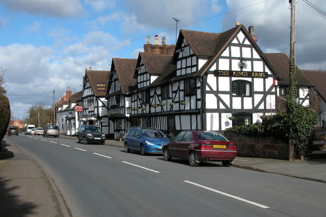
The history of Boreley dates back to medieval times, with records indicating its existence as early as the 12th century. The village is known for its charming and well-preserved architecture, including quaint cottages and traditional houses that line its streets. The centerpiece of Boreley is the St. John the Baptist Church, a beautiful medieval church that stands as a testament to the village's rich history.

Despite its small size, Boreley is a vibrant community with a range of amenities and services available to its residents. These include a village hall, a primary school, a local pub, and a post office. The village also benefits from its close proximity to Worcester, where residents can access a wider range of facilities and services.

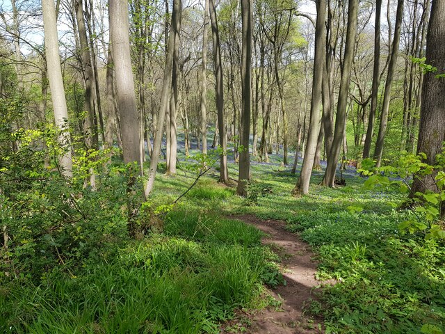
Surrounded by lush green fields and rolling hills, Boreley offers its residents a peaceful and idyllic lifestyle. It is an ideal location for those seeking a rural retreat while still having easy access to urban amenities. The village is also surrounded by several walking and cycling routes, allowing residents and visitors to explore the stunning Worcestershire countryside.

In conclusion, Boreley is a charming and historic village in Worcestershire, known for its beautiful architecture, tight-knit community, and idyllic countryside setting.

If you have any feedback on the listing, please let us know in the comments section below.

Boreley Images

Images are sourced within 2km of 52.282366/-2.263094 or Grid Reference SO8264. Thanks to Geograph Open Source API. All images are credited.

The Red Lion Presumably originally a coaching inn site.  Has been geographed a number of times before. <a title="https://www.geograph.org.uk/search.php?i=140480960&page=1" href="https://www.geograph.org.uk/search.php?i=140480960&page=1">Link</a>
The Red Lion
Presumably originally a coaching inn site. Has been geographed a number of times before. Link
The sign of The Red Lion See <a href="https://www.geograph.org.uk/photo/6966232">SO8163 : The Red Lion</a>
The sign of The Red Lion
Calligraphy on The Red Lion See <a href="https://www.geograph.org.uk/photo/6966232">SO8163 : The Red Lion</a>.
Calligraphy on The Red Lion
Fields next to a footpath, near to Uphampton
Field boundary near Uphampton, Worcestershire
Walkers heading for Boreley House With the Abberley Hills in the distance.
Walkers heading for Boreley House
With the Abberley Hills in the distance.
Farm buildings at Boreley House with Woodbury Hill behind
Black Barn, Boreley Lane from the field side
A very distant view of Abberley Clocktower
Brook Cottages, Boreley Lane, Ombersley
The River Severn and The Lenchford Inn
Boat on the River Severn with chalets on the far shore
Lock Keeper's Cottage, Holt Fleet, Worcestershire
Fish pond by The Wharf Inn, Holt Fleet
Houses at Holt Fleet from the riverside path (1)
Houses at Holt Fleet from the riverside path (2)
Minor path in Shrawley woods with Bluebells and Ramsons
Looking across fields towards Mutton Hall The River Severn flows before the trees.
Looking across fields towards Mutton Hall
The River Severn flows before the trees.
Show me another place!

Boreley is located at Grid Ref: SO8264 (Lat: 52.282366, Lng: -2.263094)

Administrative County: Worcestershire

District: Wychavon

Police Authority: West Mercia

What 3 Words

///illogical.bucked.unlucky. Near Hartlebury, Worcestershire

Nearby Locations

Boreley

Related Wikis

Shrawley

Shrawley is a village and civil parish in the Malvern Hills District in the county of Worcestershire, England. The village is situated on the western bank...

Holt Fleet Bridge

Holt Fleet Bridge, also known as Holt Bridge, is a cast-iron arch bridge over the River Severn, at Holt in Worcestershire, England. It has a span of 150...

Dick Brook

Dick Brook is small tributary stream of the River Severn that flows through Worcestershire, England.The brook is formed from two small unnamed streams...

Holt Heath, Worcestershire

Holt Heath, in the parish of Holt, is a village near the west bank of the River Severn in Worcestershire. The nearest towns are all about 6 miles away...

Frog Pool

Frog Pool is a hamlet within the civil parish of Shrawley in Worcestershire, England. == References ==

Ombersley and Doverdale

Ombersley and Doverdale is an area in Wychavon district, Worcestershire, England served by a single parish council but comprising the two separate civil...

Holt, Worcestershire

Holt is a village and civil parish in the Malvern Hills District of the county of Worcestershire, England. The church is dedicated to St. Martin, and dates...

Ombersley

Ombersley is a village and civil parish in Wychavon district, in the county of Worcestershire, England. The parish includes the hamlet of Holt Fleet,...

Nearby Amenities

Located within 500m of 52.282366,-2.263094
Post Box
Collection Times: Mo-Fr 15:30; Sa 08:00
Post Box Type: wall
Ref: WR9 349
Royal Cypher: EIIR
Royal Cypher Wikidata: Q33102113
Lat/Long: 52.2832842/-2.2618818
Boreley
Place: hamlet
Source: OS_OpenData_StreetView
Lat/Long: 52.282442/-2.2619283
Marker: aerial
Operator: CLH
Operator Old: GPSS
Ref GPSS: 19724
Source: survey
Utility: oil
Lat/Long: 52.2818263/-2.2666034
Boreley
Power: pole
Transformer: distribution
Voltage Primary: 11000
Lat/Long: 52.2866117/-2.2635926
Power: pole
Lat/Long: 52.2862856/-2.2624259
Power: pole
Lat/Long: 52.2858443/-2.2624809
Hollies Farm
Power: pole
Transformer: distribution
Voltage Primary: 11000
Lat/Long: 52.2853406/-2.2625466
Power: pole
Lat/Long: 52.2846736/-2.2622247
Power: pole
Lat/Long: 52.2841378/-2.2619699
Power: pole
Lat/Long: 52.2833117/-2.2615689
Power: pole
Lat/Long: 52.2827037/-2.2612792
Power: pole
Lat/Long: 52.2825339/-2.2607549
Boreley
Power: pole
Transformer: distribution
Voltage Primary: 11000
Lat/Long: 52.2822574/-2.2598737
Power: pole
Lat/Long: 52.2819571/-2.258935
Power: pole
Lat/Long: 52.2807716/-2.2598228
Power: pole
Lat/Long: 52.2780943/-2.2643799
Power: pole
Lat/Long: 52.2786153/-2.2644214
Power: pole
Lat/Long: 52.2789841/-2.2644576
Black Barn Cottage Boreley
Power: pole
Transformer: distribution
Voltage Primary: 11000
Lat/Long: 52.2793993/-2.2633667
Power: pole
Lat/Long: 52.2794666/-2.2631983
Power: pole
Lat/Long: 52.2798403/-2.2622488
Power: pole
Lat/Long: 52.2803244/-2.2609875
Power: pole
Lat/Long: 52.2811777/-2.2587982
Power: pole
Lat/Long: 52.2812954/-2.2585052
Power: pole
Lat/Long: 52.280772/-2.2581323
Power: pole
Lat/Long: 52.2800208/-2.2575939
The data included in this document is from www.openstreetmap.org. The data is made available under ODbL.

Have you been to Boreley?

Leave your review of Boreley below (or comments, questions and feedback).