Tellisford

Settlement in Somerset Mendip

England

Tellisford

The Red Lion at Woolverton
The Red Lion at Woolverton Credit: Anthony Parkes

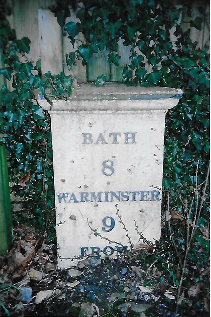
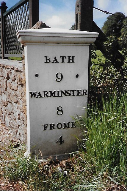
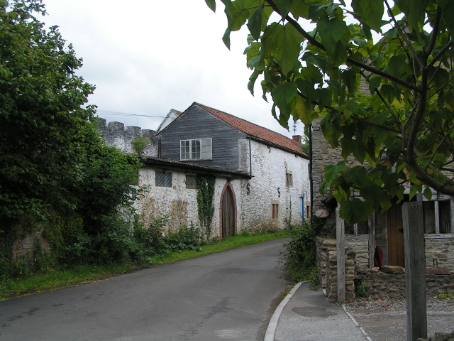
Tellisford is a small village located in the county of Somerset, England. Situated on the banks of the River Frome, it lies approximately 9 miles southeast of the city of Bath. The village is nestled amidst picturesque countryside, offering stunning views and a tranquil environment.

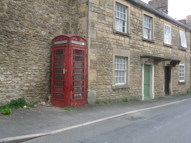
With a population of around 200 people, Tellisford boasts a tight-knit community that takes pride in preserving its historical charm. The village is known for its beautiful stone houses and traditional thatched cottages, showcasing the architectural heritage of the region.

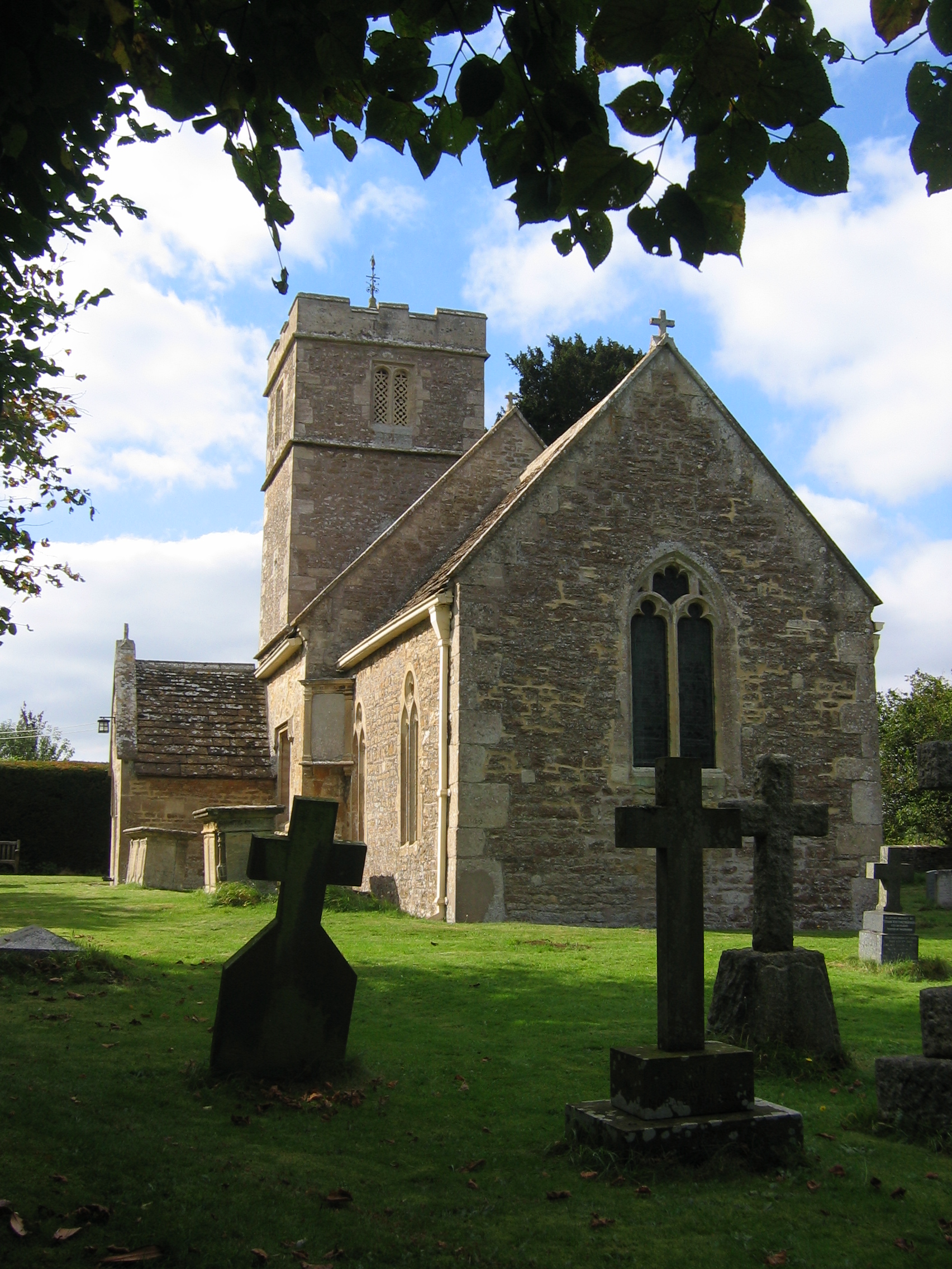
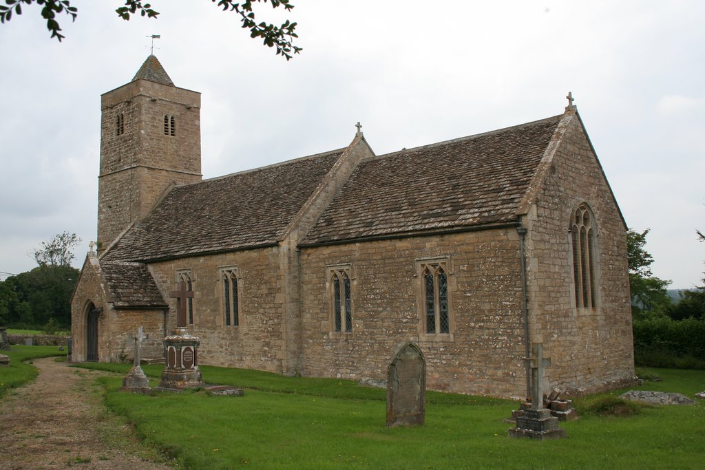
At the heart of the village lies the St. Peter and St. Paul Church, a Grade II listed building dating back to the 12th century. This medieval church features a Norman font and an impressive tower, adding to the village's historical significance.

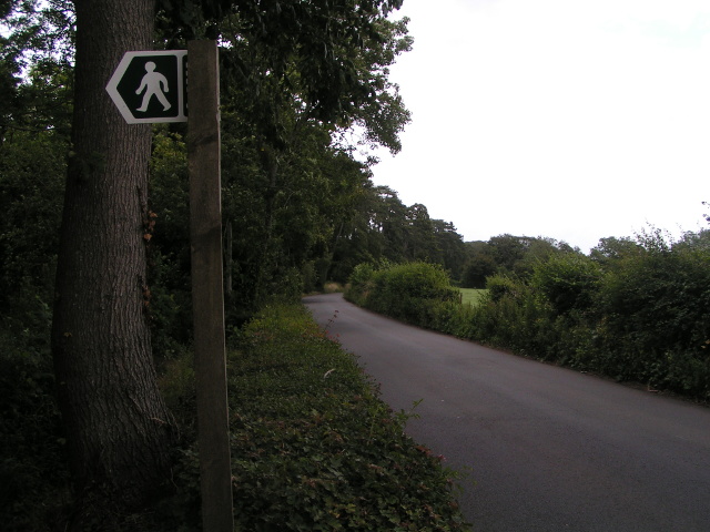
The River Frome, which meanders through Tellisford, provides a range of recreational opportunities. Anglers flock to its banks, hoping to catch trout and grayling, while walkers and cyclists can enjoy the scenic river paths and nearby countryside. The river is also popular for canoeing and kayaking enthusiasts.

Though small in size, Tellisford benefits from a vibrant community spirit. The village hosts various events and activities throughout the year, including a summer fete and a Christmas market, fostering a strong sense of camaraderie among its residents.

Overall, Tellisford offers a peaceful retreat for those seeking a rural escape, with its rich history, stunning landscapes, and a welcoming community.

If you have any feedback on the listing, please let us know in the comments section below.

Tellisford Images

Images are sourced within 2km of 51.299017/-2.2882 or Grid Reference ST8055. Thanks to Geograph Open Source API. All images are credited.

The Red Lion at Woolverton
Entrance to Wick Farm
New Entrance to Lower Chartley Farm & Training Centre
A336 from the A36
A336 from the A36
The Hungerford Arms
The Hungerford Arms
Farleigh Road farm shop Farleigh Road Farm Shop and Café <span class="nowrap"><a title="https://www.farleighroadfarmshop.co.uk/" rel="nofollow ugc noopener" href="https://www.farleighroadfarmshop.co.uk/">Link</a><img style="margin-left:2px;" alt="External link" title="External link - shift click to open in new window" src="https://s1.geograph.org.uk/img/external.png" width="10" height="10"/></span> lies just off the A366, the road running from the A36 to Norton St Philip.  To judge by the number of cars parked there (one is just arriving and more were out of shot) it was a popular place to visit on this autumn Tuesday afternoon.
Farleigh Road farm shop
Farleigh Road Farm Shop and Café LinkExternal link lies just off the A366, the road running from the A36 to Norton St Philip. To judge by the number of cars parked there (one is just arriving and more were out of shot) it was a popular place to visit on this autumn Tuesday afternoon.
Old Milestone, B3110, South East of Norton St Philip The milestone is located outside Chatley Cottage against the fence on the south side of the road. Parish of Tellisford (Mendip District). Cast iron post, C&M Classical iron casting design, erected by the Black Dog Turnpike Trust in the 19th century.

Inscription reads:-
BATH
8
WARMINSTER
9
(FROME)
(5)

Milestone Society National ID: SO_BAWM08
Old Milestone, B3110, South East of Norton St Philip
The milestone is located outside Chatley Cottage against the fence on the south side of the road. Parish of Tellisford (Mendip District). Cast iron post, C&M Classical iron casting design, erected by the Black Dog Turnpike Trust in the 19th century. Inscription reads:- BATH 8 WARMINSTER 9 (FROME) (5) Milestone Society National ID: SO_BAWM08
Farleigh Road Farm Shop and Cafe
Old Milestone, A36, Woolverton The milestone is located in Woolverton village, south of the Red Lion, at the end of the low stone wall at the farmhouse, on the grass verge, on the west side of the road. Parish of Tellisford (Mendip district). Cast iron post, C&M Classical iron casting design, erected by the Black Dog turnpike trust in the 19th century. See also <a title="https://www.geograph.org.uk/photo/5789494" href="https://www.geograph.org.uk/photo/5789494">Link</a>

Inscription reads:-
BATH / 9 / MILES / WARMINSTER / 8 / FROME / 4 

Grade II Listed,  List entry number: 1058876 <span class="nowrap"><a title="https://historicengland.org.uk/listing/the-list/list-entry/1058876" rel="nofollow ugc noopener" href="https://historicengland.org.uk/listing/the-list/list-entry/1058876">Link</a><img style="margin-left:2px;" alt="External link" title="External link - shift click to open in new window" src="https://s1.geograph.org.uk/img/external.png" width="10" height="10"/></span>

Milestone Society National ID: SO_BAWM09
Old Milestone, A36, Woolverton
The milestone is located in Woolverton village, south of the Red Lion, at the end of the low stone wall at the farmhouse, on the grass verge, on the west side of the road. Parish of Tellisford (Mendip district). Cast iron post, C&M Classical iron casting design, erected by the Black Dog turnpike trust in the 19th century. See also Link Inscription reads:- BATH / 9 / MILES / WARMINSTER / 8 / FROME / 4 Grade II Listed, List entry number: 1058876 LinkExternal link Milestone Society National ID: SO_BAWM09
Field corner
Field corner
The Hungerford Arms
The Hungerford Arms
Castellated wall in Woolverton
Lane and footpath sign
Sign for Rode Manor Nurseries
Woodys, Norton St Philip
Lane heading north near Farleigh Wood
West Terrace A row of Grade II listed houses <span class="nowrap"><a title="https://historicengland.org.uk/listing/the-list/list-entry/1058873" rel="nofollow ugc noopener" href="https://historicengland.org.uk/listing/the-list/list-entry/1058873">Link</a><img style="margin-left:2px;" alt="External link" title="External link - shift click to open in new window" src="https://s1.geograph.org.uk/img/external.png" width="10" height="10"/></span>  & <span class="nowrap"><a title="https://historicengland.org.uk/listing/the-list/list-entry/1307981" rel="nofollow ugc noopener" href="https://historicengland.org.uk/listing/the-list/list-entry/1307981">Link</a><img style="margin-left:2px;" alt="External link" title="External link - shift click to open in new window" src="https://s1.geograph.org.uk/img/external.png" width="10" height="10"/></span>  and K6 telephone kiosk <span class="nowrap"><a title="https://historicengland.org.uk/listing/the-list/list-entry/1393245" rel="nofollow ugc noopener" href="https://historicengland.org.uk/listing/the-list/list-entry/1393245">Link</a><img style="margin-left:2px;" alt="External link" title="External link - shift click to open in new window" src="https://s1.geograph.org.uk/img/external.png" width="10" height="10"/></span>
West Terrace
A row of Grade II listed houses LinkExternal link & LinkExternal link and K6 telephone kiosk LinkExternal link
Woolverton: red telephone box A traditional phone box whose paintwork is peeling markedly.
Woolverton: red telephone box
A traditional phone box whose paintwork is peeling markedly.
Show me another place!

Tellisford is located at Grid Ref: ST8055 (Lat: 51.299017, Lng: -2.2882)

Administrative County: Somerset

District: Mendip

Police Authority: Avon and Somerset

What 3 Words

///dining.kicked.sings. Near Rode, Somerset

Related Wikis

Tellisford

Tellisford is a village and civil parish 6 miles (10 km) north-east of Frome in the Mendip district of Somerset, England. The parish includes the village...
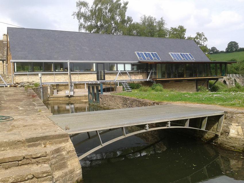
Tellisford Mill

Tellisford Mill is a 55 kilowatts (74 hp) installed capacity micro hydro run-of-the-river power station on the site of a former watermill in the village...

Ravenscroft School, Somerset

Ravenscroft School (founded 1931 at Yelverton, Devon, and until 1978 known as Ravenscroft Preparatory School) was an independent day and boarding school...
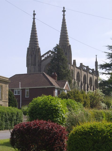
Christ Church, Rode

The Anglican Church of St Peter in Rode, within the English county of Somerset, dates from 1824. It is a redundant church and a Grade II* listed building...

Rode, Somerset

Rode (formerly Road) is a village and civil parish in the ceremonial county of Somerset in England, 5 miles (8.0 km) north-east of Frome and 5 miles (8...

Church of St Leonard, Farleigh Hungerford

The Anglican Church of St Leonard in Farleigh Hungerford, within the English county of Somerset, was consecrated in 1443. It is a Grade II* listed building...

Farleigh Hungerford

Farleigh Hungerford (grid reference ST800576) is a village and former civil parish, now in the parish of Norton St Philip, in the Somerset district, in...

Farleigh Hungerford Castle

Farleigh Hungerford Castle, sometimes called Farleigh Castle or Farley Castle, is a medieval castle in Farleigh Hungerford, Somerset, England. The castle...

Nearby Amenities

Located within 500m of 51.299017,-2.2882
Tellisford
Place: hamlet
Wikidata: Q7697630
Wikipedia: en:Tellisford
Lat/Long: 51.3006243/-2.2860562
Barrier: stile
Foot: yes
Lat/Long: 51.2958767/-2.2832209
Barrier: stile
Foot: yes
Lat/Long: 51.2977569/-2.2828575
Barrier: kissing_gate
Foot: yes
Lat/Long: 51.2998955/-2.2831107
The data included in this document is from www.openstreetmap.org. The data is made available under ODbL.

Have you been to Tellisford?

Leave your review of Tellisford below (or comments, questions and feedback).