Takeley

Settlement in Essex Uttlesford

England

Takeley

Road junction between Brickkiln Spring and Canfield Hart These are each the names of woods nearby. The B183 runs across ahead in the shot.
Road junction between Brickkiln Spring and Canfield Hart Credit: Trevor Harris

Takeley is a village and civil parish located in the Uttlesford district of Essex, England. Situated approximately three miles north of Bishop's Stortford, it is conveniently close to Stansted Airport and benefits from good transport links to London and Cambridge.

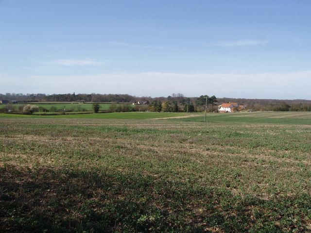
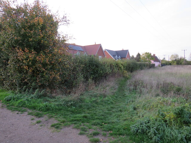
With a population of around 5,000, Takeley offers a rural and picturesque setting, surrounded by beautiful countryside. The village is known for its charming character and strong sense of community, making it an attractive place to live for families and individuals seeking a quieter lifestyle.

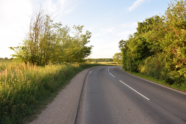
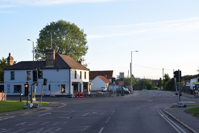
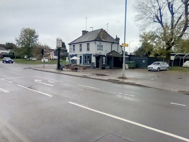
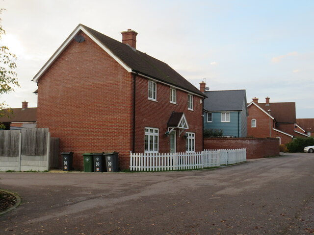
Takeley boasts a range of amenities, including a village hall, primary school, and several local shops and pubs. The nearby M11 motorway provides easy access to larger retail centers, such as Harlow and Chelmsford.

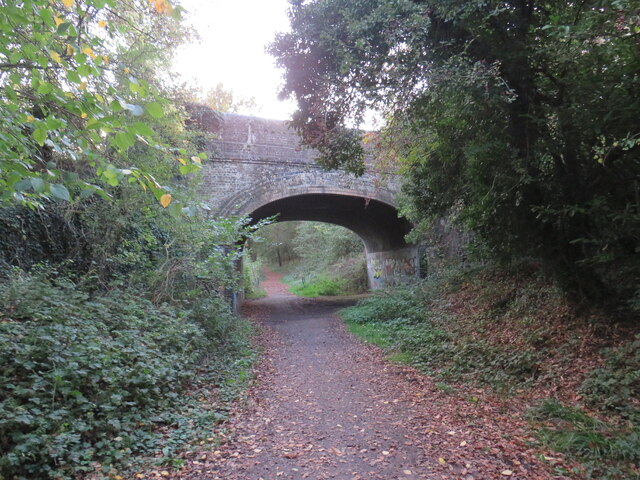
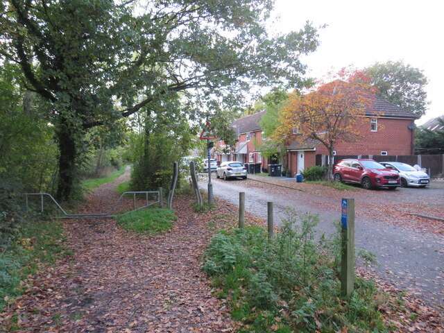
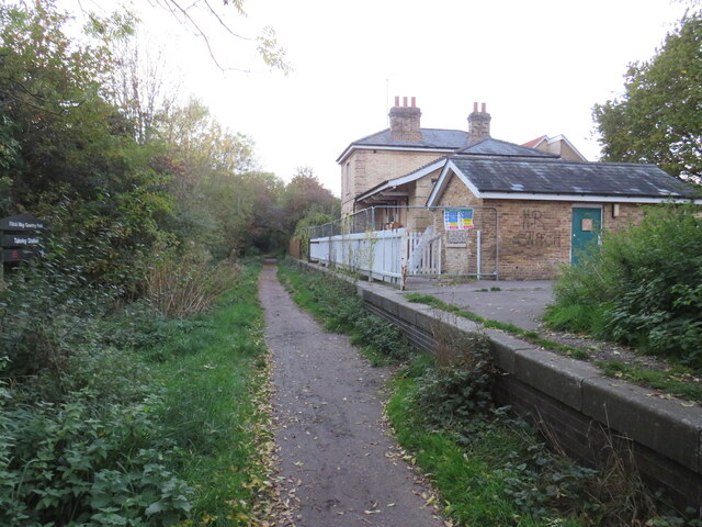
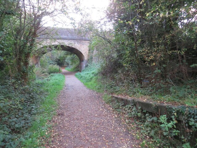
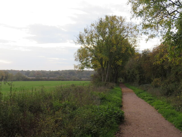
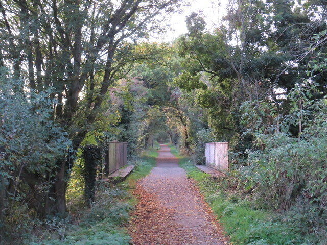
For those who enjoy outdoor activities, the area offers ample opportunities. The Flitch Way, a former railway line, has been converted into a scenic walking and cycling route, attracting locals and visitors alike. The surrounding countryside also features numerous footpaths and bridleways, ideal for exploring the natural beauty of the region.

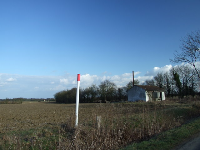
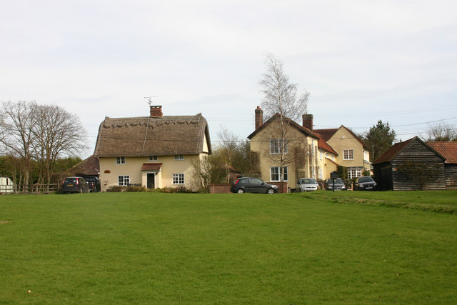
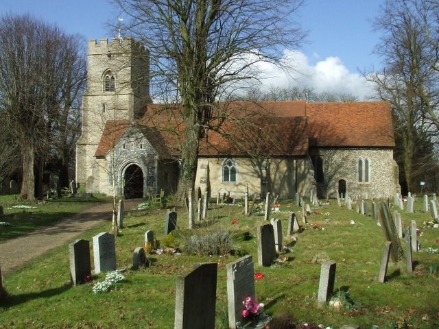
Takeley's proximity to Stansted Airport has contributed to its growth over the years, with some residents finding employment in the aviation industry. However, the village has managed to maintain its rural charm, with many historic buildings and traditional cottages dotted throughout the area.

Overall, Takeley is a peaceful and picturesque village in Essex, offering residents a desirable combination of rural living and convenient access to nearby towns and cities.

If you have any feedback on the listing, please let us know in the comments section below.
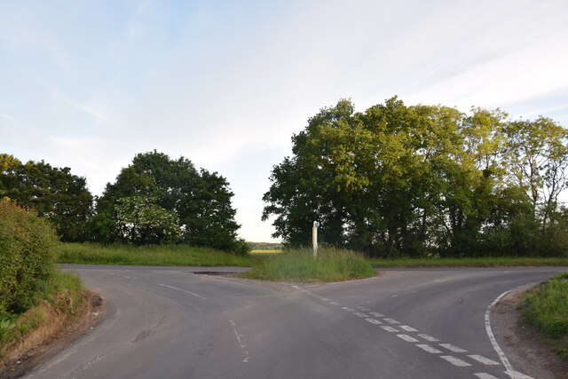
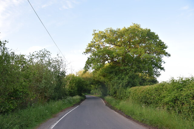
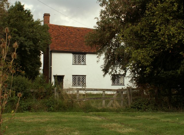
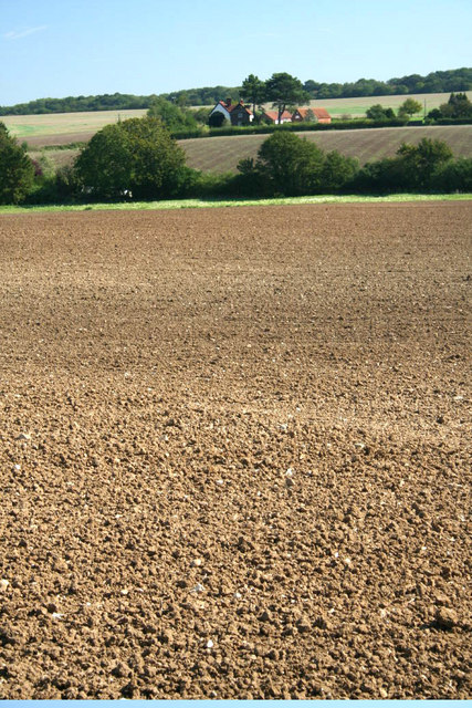
Takeley Images

Images are sourced within 2km of 51.867761/0.266412 or Grid Reference TL5621. Thanks to Geograph Open Source API. All images are credited.

Road junction between Brickkiln Spring and Canfield Hart These are each the names of woods nearby. The B183 runs across ahead in the shot.
Road junction between Brickkiln Spring and Canfield Hart
These are each the names of woods nearby. The B183 runs across ahead in the shot.
Lane to Great Canfield
House at Bush End, near Hatfield Forest, Essex
High House Farm, Bush End
Watch out- there's an airport about! Looking across this Essex farming landscape, it's difficult to believe that on the horizon is one of the busiest airports in Britain.  This is a view towards Little Barrington Hall and beyond that Hatfield Forest which is a National Trust countryside park.  If BAA get their way and Stansted Airport is tripled in size over the next 15 years, then areas like this will disappear under concrete and sprawling buildings disfigure the landscape.
Watch out- there's an airport about!
Looking across this Essex farming landscape, it's difficult to believe that on the horizon is one of the busiest airports in Britain. This is a view towards Little Barrington Hall and beyond that Hatfield Forest which is a National Trust countryside park. If BAA get their way and Stansted Airport is tripled in size over the next 15 years, then areas like this will disappear under concrete and sprawling buildings disfigure the landscape.
Derelict Building, South of Puttock's End The pole in the foreground, shows where a gas pipeline runs.
Derelict Building, South of Puttock's End
The pole in the foreground, shows where a gas pipeline runs.
Bush End The hamlet of Bush End viewed here from the Three Forests Way footpath.
Bush End
The hamlet of Bush End viewed here from the Three Forests Way footpath.
Near Le Knell's Cottage On the lane between Stansted Airport and Takeley.
Near Le Knell's Cottage
On the lane between Stansted Airport and Takeley.
Crossroads in Takeley The public house on the corner is The Four Ashes.
Crossroads in Takeley
The public house on the corner is The Four Ashes.
The Four Ashes Public house in Takeley.
The Four Ashes
Public house in Takeley.
Public footpath, Takeley, near Bishop's Stortford A public footpath on the edge of the village of Takeley in north Essex.
Public footpath, Takeley, near Bishop's Stortford
A public footpath on the edge of the village of Takeley in north Essex.
Flitch Way, Takeley, near Bishop's Stortford Flitch Way passing through the village of Takeley in north Essex.  The bridge carrying a road over the path is a clear sign that the path is a former railway line.
Flitch Way, Takeley, near Bishop's Stortford
Flitch Way passing through the village of Takeley in north Essex. The bridge carrying a road over the path is a clear sign that the path is a former railway line.
Flitch Way, Takeley, near Bishop's Stortford Flitch Way entering the site of Takeley railway station.  A modern housing development occupies the site of the former railway goods yard.

This image was taken on a late October day.  Leaves were turning autumnal shades of golden yellow and falling from the trees as the winter months were approaching.
Flitch Way, Takeley, near Bishop's Stortford
Flitch Way entering the site of Takeley railway station. A modern housing development occupies the site of the former railway goods yard. This image was taken on a late October day. Leaves were turning autumnal shades of golden yellow and falling from the trees as the winter months were approaching.
Takeley railway station The former railway station at Takeley, in north Essex.  The station closed to passengers in 1952.  The building is currently disused.  The former railway line is now a walking and cycling path, Flitch Way.
Takeley railway station
The former railway station at Takeley, in north Essex. The station closed to passengers in 1952. The building is currently disused. The former railway line is now a walking and cycling path, Flitch Way.
Flitch Way, Takeley, near Bishop's Stortford This image of Flitch Way was taken from the site of Takeley railway station.  The end of the station platform is visible to the right of the image.  The bridge ahead carries a road across the former railway line.
Flitch Way, Takeley, near Bishop's Stortford
This image of Flitch Way was taken from the site of Takeley railway station. The end of the station platform is visible to the right of the image. The bridge ahead carries a road across the former railway line.
Russel Francis Way, Takeley, near Bishop's Stortford Russel Francis Way is a recent housing development in the village of Takeley in north Essex.
Russel Francis Way, Takeley, near Bishop's Stortford
Russel Francis Way is a recent housing development in the village of Takeley in north Essex.
Flitch Way, Takeley, near Bishop's Stortford Flitch Way heading out of the village of Takeley in north Essex.  This image was taken in the late afternoon on an October day, as the daylight was fading.  Dusk would soon fall.
Flitch Way, Takeley, near Bishop's Stortford
Flitch Way heading out of the village of Takeley in north Essex. This image was taken in the late afternoon on an October day, as the daylight was fading. Dusk would soon fall.
Flitch Way, near Bishop's Stortford Flitch Way follows the course of a dismantled railway, using a former railway bridge here to cross a minor road.
Flitch Way, near Bishop's Stortford
Flitch Way follows the course of a dismantled railway, using a former railway bridge here to cross a minor road.
Show me another place!

Takeley is located at Grid Ref: TL5621 (Lat: 51.867761, Lng: 0.266412)

Administrative County: Essex

District: Uttlesford

Police Authority: Essex

What 3 Words

///skipped.samplers.servicing. Near Takeley, Essex

Related Wikis

Takeley

Takeley is a village and civil parish in the Uttlesford district of Essex, England. == History == A number of theories have arisen over the origin of the...

Takeley railway station

Takeley railway station was a station serving the Hockerill area of Takeley in Bishop's Stortford, England. The station was 5 miles 11 chains (8.27 km...

Takeley Priory

Takeley Priory, dedicated to Saint Valery, was a Benedictine monastery in Takeley, Essex, England, founded by William the Conqueror between 1066 and 1086...

Takeley F.C.

Takeley Football Club is an English football club based in Takeley, Essex. The club are currently members of the Essex Senior League and play at Station...

The Christian School, Takeley

The Christian School (Takeley) is an independent Christian school located in Takeley, Bishop's Stortford, Essex. The school caters for children of 7 through...

Stane Street Halt railway station

Stane Street Halt railway station was a station serving the community of Takeley Street to the west of the village of Takeley near Bishop's Stortford,...

Bamber's Green

Bamber's Green is a hamlet in Essex, England. It is located near to Molehill Green and close to London Stansted Airport. The hamlet has approximately 20...

Stansted Airport railway station

Stansted Airport railway station is on a branch line off the West Anglia Main Line in the East of England and was opened in 1991 to provide a rail link...

Nearby Amenities

Located within 500m of 51.867761,0.266412
Takeley
Historic Railway: station
Railway: site
Wikidata: Q7678006
Wikipedia: en:Takeley railway station
Lat/Long: 51.8662707/0.267256
Traffic Signals
Traffic Signals Direction: both
Lat/Long: 51.8678048/0.2663625
Takeley
Place: village
Lat/Long: 51.8680753/0.266063
The Four Ashes
Naptan AtcoCode: 150020015004
Naptan Bearing: E
Naptan BusStopType: CUS
Naptan CommonName: The Four Ashes
Naptan Crossing: Parsonage Road
Naptan Indicator: E-bound
Naptan Landmark: The Four Ashes
Naptan NaptanCode: esxdgjpg
Naptan Street: Dunmow Road
Naptan Verified: no
Public Transport: platform
Source: naptan_import
Lat/Long: 51.8678214/0.2669061
Bus Stop
The Four Ashes
Bus: yes
Naptan AtcoCode: 150020015005
Naptan Bearing: W
Naptan CommonName: The Four Ashes
Naptan Crossing: Parsonage Road
Naptan Indicator: Opp
Naptan Landmark: The Four Ashes
Naptan NaptanCode: esxdgjpd
Naptan Street: Dunmow Road
Naptan Verified: no
Public Transport: platform
Source: naptan_import
Lat/Long: 51.8678315/0.2656711
Bus Stop
Mill Court
Bus: yes
Naptan AtcoCode: 150020015006
Naptan Bearing: W
Naptan CommonName: Mill Court
Naptan Crossing: Church Lane
Naptan Indicator: Adj
Naptan Landmark: Mill Court
Naptan NaptanCode: esxdgjpa
Naptan Street: Dunmow Road
Naptan Verified: no
Public Transport: platform
Source: naptan_import
Lat/Long: 51.868206/0.2624247
Bus Stop
Garnetts
Bus: yes
Naptan AtcoCode: 150020016002
Naptan Bearing: N
Naptan CommonName: Garnetts
Naptan Indicator: Adj
Naptan Landmark: Garnetts
Naptan NaptanCode: esxdgjdj
Naptan Street: Parsonage Road
Naptan Verified: no
Public Transport: platform
Source: naptan_import
Lat/Long: 51.8709939/0.265688
Bus Stop
Garnetts
Bus: yes
Naptan AtcoCode: 150020016003
Naptan Bearing: S
Naptan CommonName: Garnetts
Naptan Indicator: Opp
Naptan Landmark: Garnetts
Naptan NaptanCode: esxdgjdm
Naptan Street: Parsonage Road
Naptan Verified: no
Public Transport: platform
Source: naptan_import
Lat/Long: 51.871921/0.2657172
Chestnut Way
Naptan AtcoCode: 150020016006
Naptan Bearing: N
Naptan BusStopType: CUS
Naptan CommonName: Parsonage Road
Naptan Crossing: Chestnut Way
Naptan Indicator: N-bound
Naptan Landmark: Parsonage Road
Naptan NaptanCode: esxdgmjd
Naptan Street: Parsonage Road
Naptan Verified: no
Public Transport: platform
Source: naptan_import
Lat/Long: 51.8696896/0.2661745
Chestnut Way
Naptan AtcoCode: 1500200160Y6
Naptan Bearing: S
Naptan BusStopType: CUS
Naptan CommonName: Parsonage Road
Naptan Crossing: Chestnut Way
Naptan Indicator: S-bound
Naptan Landmark: Parsonage Road
Naptan NaptanCode: esxgpawj
Naptan Street: Parsonage Road
Naptan Verified: no
Public Transport: platform
Source: naptan_import
Lat/Long: 51.8696966/0.2662765
The Four Ashes
Naptan AtcoCode: 1500IM175
Naptan Bearing: N
Naptan BusStopType: CUS
Naptan CommonName: The Four Ashes
Naptan Crossing: Dunmow Road
Naptan Indicator: Adj
Naptan Landmark: The Four Ashes
Naptan NaptanCode: esxdgjdg
Naptan Street: Parsonage Road
Naptan Verified: no
Public Transport: platform
Source: naptan_import
Lat/Long: 51.8685888/0.2663661
Bus Stop
Mobile Home Park
Bus: yes
Naptan AtcoCode: 1500IM2134
Naptan Bearing: S
Naptan BusStopType: CUS
Naptan CommonName: Mobile Home Park
Naptan Indicator: o/s
Naptan Landmark: Mobile Home Park
Naptan NaptanCode: esxdgjdp
Naptan Street: B183 Station Road
Naptan Verified: no
Public Transport: platform
Source: naptan_import
Lat/Long: 51.8643481/0.267582
Bus Stop
Mobile Home Park
Bus: yes
Naptan AtcoCode: 1500IM2134AA
Naptan Bearing: N
Naptan BusStopType: CUS
Naptan CommonName: Mobile Home Park
Naptan Indicator: Opp
Naptan Landmark: Mobile Home Park
Naptan NaptanCode: esxgtjmp
Naptan Street: B183 Station Road
Naptan Verified: no
Public Transport: platform
Source: naptan_import
Lat/Long: 51.8643283/0.2674854
Addr City: Takeley
Addr Housenumber: Westcotts
Addr Street: Smith's Green
Lat/Long: 51.8687173/0.2733099
Addr City: Takeley
Addr Housenumber: Beech Cottage
Addr Street: Smith's Green
Lat/Long: 51.8689359/0.2732991
Addr City: Takeley
Addr Housenumber: The White House
Addr Street: Smith's Green
Lat/Long: 51.8673327/0.2723228
Addr City: Takeley
Addr Housenumber: The Croft
Addr Street: Smith's Green
Lat/Long: 51.8678494/0.2726125
Addr City: Takeley
Addr Housenumber: Moat Cottage
Addr Street: Smith's Green
Lat/Long: 51.8683529/0.27287
Direction: both
Traffic Calming: table
Lat/Long: 51.8672736/0.2615268
Bench
Lat/Long: 51.867921/0.2665872
Bench
Lat/Long: 51.8679477/0.2665545
Post Office
Takeley Post Office
Addr Country: GB
Addr Postcode: CM22 6SH
Brand: Post Office
Brand Wikidata: Q1783168
Contact Website: https://www.postoffice.co.uk/branch-finder/0811246/takeley
Ref Pol Id: 802
Lat/Long: 51.8679359/0.2672694
Takeley Park
Place: neighbourhood
Lat/Long: 51.8647551/0.2697687
Cafe
Takeley Station
Addr Street: Flitch Way
Lat/Long: 51.8663477/0.2670915
Kindergarten
Happy Kids Childminding Service
Addr City: Takeley
Addr Housenumber: 30
Addr Postcode: CM22 6SD
Addr Street: Hawthorn Close
Phone: +44 742 904132
Website: www.happykids.moonfruit.com
Lat/Long: 51.8669431/0.2640897
Crossing
Crossing: traffic_signals
Crossing Island: no
Crossing Markings: yes
Tactile Paving: yes
Lat/Long: 51.8678241/0.2661807
Takeley News
Addr City: Takeley
Addr Street: Dunmow Road
Shop: newsagent
Lat/Long: 51.8678871/0.2670182
Post Box
Operator: Royal Mail
Operator Wikidata: Q638098
Post Box Design: type_a
Post Box Type: pillar
Ref: CM22 211
Lat/Long: 51.8678062/0.2672924
Barrier: motorcycle_barrier
Description: A vehicle barrier and a cycle barrier.
Lat/Long: 51.8662832/0.2685614
Barrier: motorcycle_barrier
Description: A vehicle barrier and a cycle barrier.
Lat/Long: 51.8662829/0.2684171
Crossing
Crossing: traffic_signals
Crossing Island: no
Crossing Markings: yes
Tactile Paving: yes
Lat/Long: 51.8679045/0.2664511
Crossing
Crossing: traffic_signals
Crossing Island: no
Crossing Markings: yes
Tactile Paving: yes
Lat/Long: 51.8677905/0.2665671
Crossing
Lat/Long: 51.8685793/0.2665542
Crossing
Lat/Long: 51.871277/0.2658578
Crossing
Lat/Long: 51.8703586/0.2660003
Crossing
Lat/Long: 51.8693263/0.2664768
Barrier: cycle_barrier
Lat/Long: 51.8675625/0.2694807
Bench
Lat/Long: 51.8670964/0.2733949
Waste Basket
Lat/Long: 51.8670914/0.2734512
Crossing
Crossing: traffic_signals
Crossing Island: no
Crossing Markings: yes
Tactile Paving: yes
Lat/Long: 51.8676626/0.2663365
Crossing
Lat/Long: 51.8675326/0.2662075
Direction: forward
Traffic Calming: hump
Lat/Long: 51.8675847/0.2624548
Direction: forward
Traffic Calming: choker
Lat/Long: 51.867063/0.2630471
Crossing
Lat/Long: 51.8707329/0.2658355
Takeley War Memorial
Historic: memorial
Memorial: war_memorial
Lat/Long: 51.8684155/0.2626115
Crossing
Crossing: unmarked
Crossing Island: yes
Tactile Paving: yes
Lat/Long: 51.864046/0.2669221
Parking Space
Capacity: 1
Lat/Long: 51.8664258/0.2670414
Parking Space
Capacity: 1
Parking Space: disabled
Lat/Long: 51.8664084/0.2671836
Power: pole
Lat/Long: 51.8649373/0.2612951
Power: pole
Lat/Long: 51.8648861/0.2627515
Power: pole
Lat/Long: 51.8648444/0.2640897
Power: pole
Lat/Long: 51.8648065/0.265371
Power: pole
Lat/Long: 51.8645298/0.2666202
Brewer's End
Place: locality
Lat/Long: 51.8682802/0.2640356
Ford: yes
Lat/Long: 51.8678097/0.2736684
Ford: yes
Lat/Long: 51.8679908/0.273671
Takeley Social & Sports Club
Entrance: yes
Lat/Long: 51.86868/0.2624813
Post Box
Operator: Royal Mail
Operator Wikidata: Q638098
Post Box Design: type_b
Post Box Type: pillar
Ref: CM22 210
Royal Cypher: EIIR
Royal Cypher Wikidata: Q33102113
Lat/Long: 51.869742/0.270086
Wayletts Hill
Place: locality
Lat/Long: 51.8707947/0.2659277
The data included in this document is from www.openstreetmap.org. The data is made available under ODbL.

Have you been to Takeley?

Leave your review of Takeley below (or comments, questions and feedback).