Prior's Wood

Wood, Forest in Essex Uttlesford

England

Prior's Wood

The end of the platform at Stansted Airport station
The end of the platform at Stansted Airport station Credit: John Lucas

Prior's Wood is a picturesque forest located in Essex, England. Spanning over a vast area, it is known for its abundant wildlife and serene atmosphere, attracting nature enthusiasts and visitors from all around. The wood is situated near the village of Prior's Roding, giving it its name.

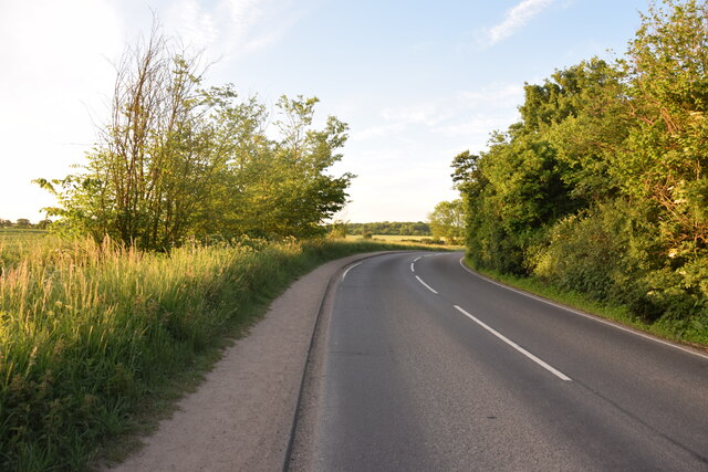
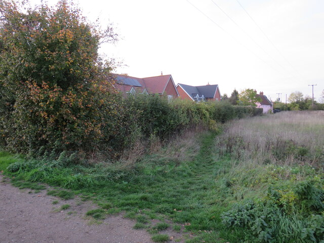
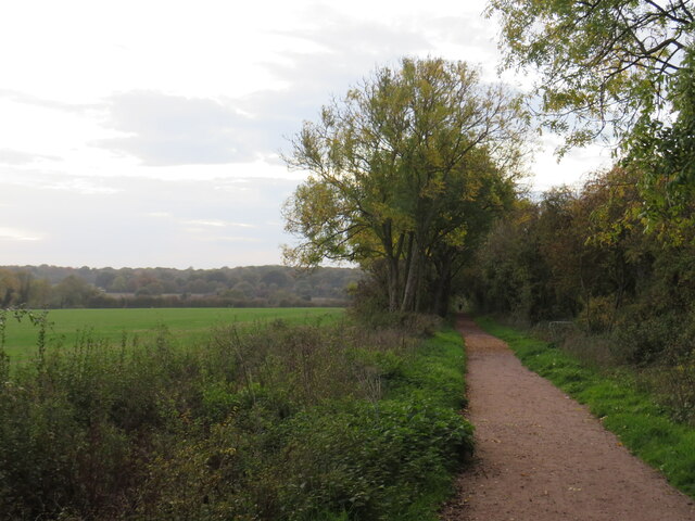
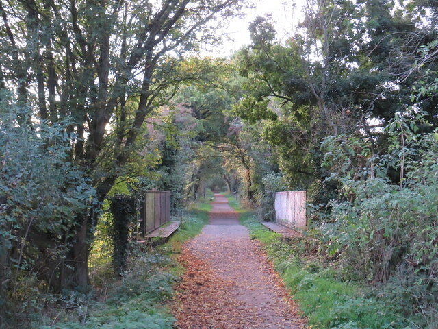
The woodland is primarily composed of broadleaf trees, including oak, beech, and ash. The dense canopy created by these mature trees allows only dappled sunlight to filter through, creating a magical ambiance. The forest floor is covered with a rich carpet of moss, ferns, and wildflowers, offering a diverse habitat for various flora and fauna.

Birdwatchers flock to Prior's Wood for its impressive avian population. The wood provides a haven for a variety of bird species, including woodpeckers, owls, and warblers. The melodic sounds of birdsong can be heard throughout the forest, adding to its natural charm.

The wood is also home to numerous mammals, such as deer, foxes, and badgers. These creatures find refuge in the dense undergrowth and use the forest as a vital source of food and shelter.

Prior's Wood is a popular destination for walkers and hikers due to its well-maintained trails. These pathways meander through the wood, allowing visitors to explore its beauty at their own pace. The forest also offers picnic areas and benches, providing opportunities for visitors to relax and appreciate the tranquility of the surroundings.

Overall, Prior's Wood stands as a testament to the beauty and biodiversity of the Essex countryside. Its lush foliage, diverse wildlife, and peaceful ambience make it a treasured natural gem for both locals and tourists alike.

If you have any feedback on the listing, please let us know in the comments section below.
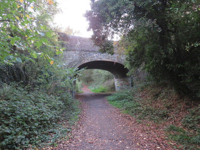
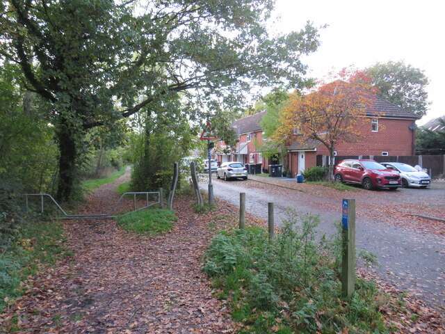
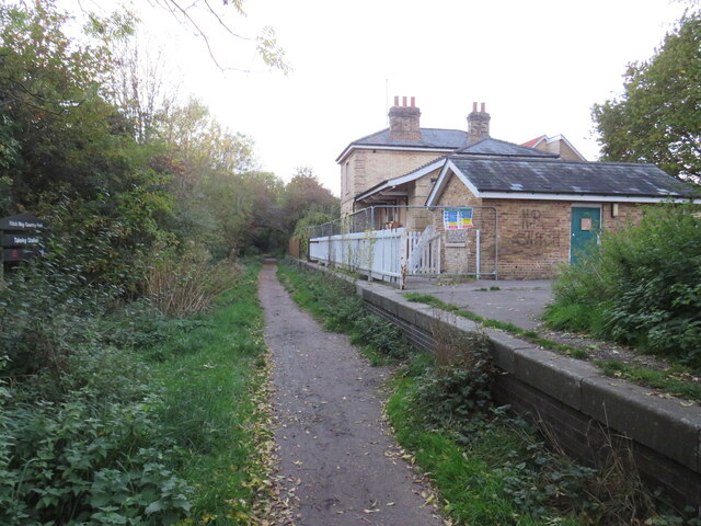
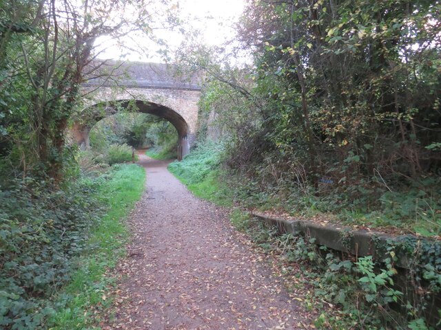
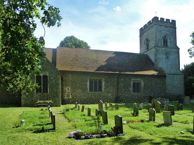
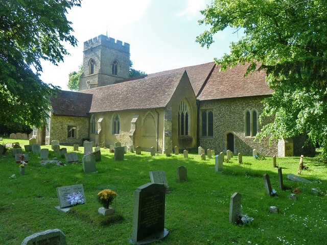
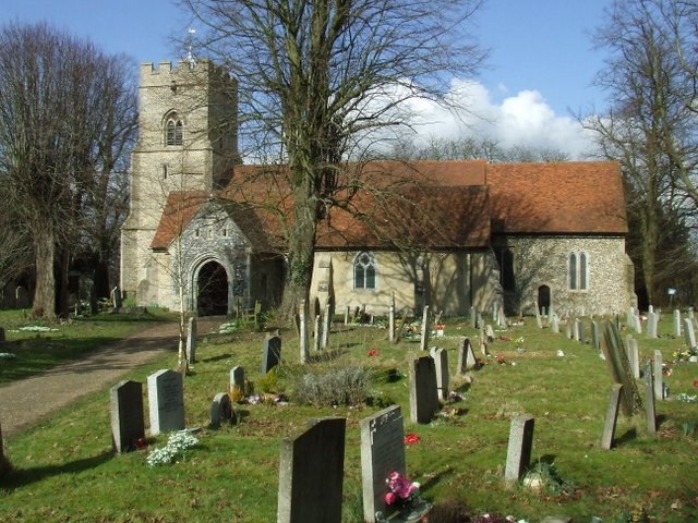
Prior's Wood Images

Images are sourced within 2km of 51.872661/0.2725973 or Grid Reference TL5621. Thanks to Geograph Open Source API. All images are credited.

The end of the platform at Stansted Airport station
Class 170 Multiple Unit at Stansted Airport
Near Le Knell's Cottage On the lane between Stansted Airport and Takeley.
Near Le Knell's Cottage
On the lane between Stansted Airport and Takeley.
Crossroads in Takeley The public house on the corner is The Four Ashes.
Crossroads in Takeley
The public house on the corner is The Four Ashes.
The Four Ashes Public house in Takeley.
The Four Ashes
Public house in Takeley.
Public footpath, Takeley, near Bishop's Stortford A public footpath on the edge of the village of Takeley in north Essex.
Public footpath, Takeley, near Bishop's Stortford
A public footpath on the edge of the village of Takeley in north Essex.
Flitch Way, Takeley, near Bishop's Stortford Flitch Way passing through the village of Takeley in north Essex.  The bridge carrying a road over the path is a clear sign that the path is a former railway line.
Flitch Way, Takeley, near Bishop's Stortford
Flitch Way passing through the village of Takeley in north Essex. The bridge carrying a road over the path is a clear sign that the path is a former railway line.
Flitch Way, Takeley, near Bishop's Stortford Flitch Way entering the site of Takeley railway station.  A modern housing development occupies the site of the former railway goods yard.

This image was taken on a late October day.  Leaves were turning autumnal shades of golden yellow and falling from the trees as the winter months were approaching.
Flitch Way, Takeley, near Bishop's Stortford
Flitch Way entering the site of Takeley railway station. A modern housing development occupies the site of the former railway goods yard. This image was taken on a late October day. Leaves were turning autumnal shades of golden yellow and falling from the trees as the winter months were approaching.
Takeley railway station The former railway station at Takeley, in north Essex.  The station closed to passengers in 1952.  The building is currently disused.  The former railway line is now a walking and cycling path, Flitch Way.
Takeley railway station
The former railway station at Takeley, in north Essex. The station closed to passengers in 1952. The building is currently disused. The former railway line is now a walking and cycling path, Flitch Way.
Flitch Way, Takeley, near Bishop's Stortford This image of Flitch Way was taken from the site of Takeley railway station.  The end of the station platform is visible to the right of the image.  The bridge ahead carries a road across the former railway line.
Flitch Way, Takeley, near Bishop's Stortford
This image of Flitch Way was taken from the site of Takeley railway station. The end of the station platform is visible to the right of the image. The bridge ahead carries a road across the former railway line.
Russel Francis Way, Takeley, near Bishop's Stortford Russel Francis Way is a recent housing development in the village of Takeley in north Essex.
Russel Francis Way, Takeley, near Bishop's Stortford
Russel Francis Way is a recent housing development in the village of Takeley in north Essex.
Flitch Way, Takeley, near Bishop's Stortford Flitch Way heading out of the village of Takeley in north Essex.  This image was taken in the late afternoon on an October day, as the daylight was fading.  Dusk would soon fall.
Flitch Way, Takeley, near Bishop's Stortford
Flitch Way heading out of the village of Takeley in north Essex. This image was taken in the late afternoon on an October day, as the daylight was fading. Dusk would soon fall.
Flitch Way, near Bishop's Stortford Flitch Way follows the course of a dismantled railway, using a former railway bridge here to cross a minor road.
Flitch Way, near Bishop's Stortford
Flitch Way follows the course of a dismantled railway, using a former railway bridge here to cross a minor road.
Stane Street Halt, Flitch Way, near Bishop's Stortford Stane Street Halt was an intermediate stop on the railway line linking Bishop's Stortford with Great Dunmow and Braintree.  The halt has been reconstructed as a feature on the Flitch Way.

More information about Stane Street Halt can be found on the Disused Stations website: <span class="nowrap"><a title="http://www.disused-stations.org.uk/s/stane_street_halt/index.shtml" rel="nofollow ugc noopener" href="http://www.disused-stations.org.uk/s/stane_street_halt/index.shtml">Link</a><img style="margin-left:2px;" alt="External link" title="External link - shift click to open in new window" src="https://s1.geograph.org.uk/img/external.png" width="10" height="10"/></span>
Stane Street Halt, Flitch Way, near Bishop's Stortford
Stane Street Halt was an intermediate stop on the railway line linking Bishop's Stortford with Great Dunmow and Braintree. The halt has been reconstructed as a feature on the Flitch Way. More information about Stane Street Halt can be found on the Disused Stations website: LinkExternal link
Takeley church - porch and tower Holy Trinity is a grade I listed building, oldest part 12th century. The tower and porch are 15th century.
Takeley church - porch and tower
Holy Trinity is a grade I listed building, oldest part 12th century. The tower and porch are 15th century.
Takeley church - north side Holy Trinity is a grade I listed building, oldest part, the nave, 12th century with later alterations.
Takeley church - north side
Holy Trinity is a grade I listed building, oldest part, the nave, 12th century with later alterations.
Takeley church - south side Holy Trinity is a grade I listed building, oldest part, the nave, 12th century with later alterations and additions.
Takeley church - south side
Holy Trinity is a grade I listed building, oldest part, the nave, 12th century with later alterations and additions.
Show me another place!

Prior's Wood is located at Grid Ref: TL5621 (Lat: 51.872661, Lng: 0.2725973)

Administrative County: Essex

District: Uttlesford

Police Authority: Essex

What 3 Words

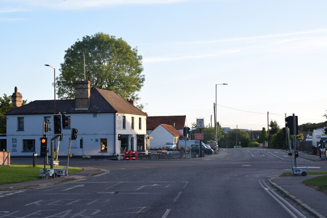
///ropes.templates.magazine. Near Takeley, Essex

Related Wikis

Takeley Priory

Takeley Priory, dedicated to Saint Valery, was a Benedictine monastery in Takeley, Essex, England, founded by William the Conqueror between 1066 and 1086...

Takeley

Takeley is a village and civil parish in the Uttlesford district of Essex, England. == History == A number of theories have arisen over the origin of the...

Takeley railway station

Takeley railway station was a station serving the Hockerill area of Takeley in Bishop's Stortford, England. The station was 5 miles 11 chains (8.27 km...

Bamber's Green

Bamber's Green is a hamlet in Essex, England. It is located near to Molehill Green and close to London Stansted Airport. The hamlet has approximately 20...

Takeley F.C.

Takeley Football Club is an English football club based in Takeley, Essex. The club are currently members of the Essex Senior League and play at Station...

The Christian School, Takeley

The Christian School (Takeley) is an independent Christian school located in Takeley, Bishop's Stortford, Essex. The school caters for children of 7 through...

Stane Street Halt railway station

Stane Street Halt railway station was a station serving the community of Takeley Street to the west of the village of Takeley near Bishop's Stortford,...

Stansted Airport railway station

Stansted Airport railway station is on a branch line off the West Anglia Main Line in the East of England and was opened in 1991 to provide a rail link...

Nearby Amenities

Located within 500m of 51.872661,0.2725973
Bus Stop
Garnetts
Bus: yes
Naptan AtcoCode: 150020016003
Naptan Bearing: S
Naptan CommonName: Garnetts
Naptan Indicator: Opp
Naptan Landmark: Garnetts
Naptan NaptanCode: esxdgjdm
Naptan Street: Parsonage Road
Naptan Verified: no
Public Transport: platform
Source: naptan_import
Lat/Long: 51.871921/0.2657172
Addr City: Takeley
Addr Housenumber: South View
Addr Street: Warren Close
Lat/Long: 51.8690154/0.2763461
Addr City: Takeley
Addr Housenumber: The Laurels
Addr Street: Warren Close
Lat/Long: 51.8689823/0.2760242
Addr City: Takeley
Addr Housenumber: Plason
Addr Street: Warren Close
Lat/Long: 51.8690618/0.2766036
Addr City: Takeley
Addr Housenumber: Kerria
Addr Street: Warren Close
Lat/Long: 51.8691148/0.2768611
Addr City: Takeley
Addr Housenumber: Westcotts
Addr Street: Smith's Green
Lat/Long: 51.8687173/0.2733099
Addr City: Takeley
Addr Housenumber: Goar Lodge
Addr Street: Smith's Green
Lat/Long: 51.8691744/0.2734064
Addr City: Takeley
Addr Housenumber: Smith's Cottage
Addr Street: Smith's Green
Lat/Long: 51.8689823/0.2738141
Addr City: Takeley
Addr Housenumber: South Cottage
Addr Street: Smith's Green
Lat/Long: 51.8689094/0.2737712
Addr City: Takeley
Addr Housenumber: Wood View
Addr Street: Warren Close
Lat/Long: 51.8690021/0.2757453
Addr City: Takeley
Addr Housenumber: Gages
Addr Street: Smith's Green
Lat/Long: 51.8683132/0.2743184
Addr City: Takeley
Addr Housenumber: Pippins
Addr Street: Smith's Green
Lat/Long: 51.8687703/0.274651
Addr City: Takeley
Addr Housenumber: Homelands
Addr Street: Smith's Green
Lat/Long: 51.8689425/0.2752303
Addr City: Takeley
Addr Housenumber: Crown Cottage
Addr Street: Smith's Green
Lat/Long: 51.8691611/0.2738999
Addr City: Takeley
Addr Housenumber: Beech Cottage
Addr Street: Smith's Green
Lat/Long: 51.8689359/0.2732991
Addr City: Takeley
Addr Housenumber: Moat Cottage
Addr Street: Smith's Green
Lat/Long: 51.8683529/0.27287
Power: pole
Lat/Long: 51.8752772/0.2671561
Power: pole
Lat/Long: 51.8758303/0.2685669
Power: pole
Lat/Long: 51.8760836/0.270077
Power: pole
Lat/Long: 51.8763552/0.2716434
Power: pole
Lat/Long: 51.8766102/0.2732447
Crossing
Lat/Long: 51.872256/0.2655003
Crossing
Lat/Long: 51.871277/0.2658578
Smith's Green
Place: locality
Lat/Long: 51.8683943/0.2737028
Post Box
Operator: Royal Mail
Operator Wikidata: Q638098
Post Box Design: type_b
Post Box Type: pillar
Ref: CM22 210
Royal Cypher: EIIR
Royal Cypher Wikidata: Q33102113
Lat/Long: 51.869742/0.270086
The data included in this document is from www.openstreetmap.org. The data is made available under ODbL.

Have you been to Prior's Wood?

Leave your review of Prior's Wood below (or comments, questions and feedback).