St Johns

Settlement in Warwickshire Warwick

England

St Johns

The Green Man public house, Kenilworth
The Green Man public house, Kenilworth Credit: Ian S

St Johns is a small village located in the county of Warwickshire, England. Situated approximately 5 miles southeast of the town of Warwick, it has a population of around 2,000 residents. The village is nestled in a picturesque rural setting, surrounded by rolling hills and fields, offering a peaceful and idyllic atmosphere.

St Johns has a rich history dating back to medieval times, with several historical landmarks scattered throughout the area. One of the most notable attractions is the St John the Baptist Church, a beautiful Grade I listed building that dates back to the 12th century. The church features stunning architecture and intricate stained glass windows, attracting visitors and history enthusiasts from far and wide.

In addition to its historical significance, St Johns offers a range of amenities and facilities for its residents. The village is home to a primary school, providing education for local children, and there are several shops, including a convenience store and a post office, catering to the everyday needs of the community. St Johns also boasts a vibrant community center, which hosts various events and activities throughout the year, fostering a strong sense of community spirit.

The surrounding countryside offers ample opportunities for outdoor pursuits, with numerous walking and cycling trails nearby. The nearby Warwick Castle, a magnificent medieval fortress, is a popular tourist destination and provides a chance to delve further into the region's history.

Overall, St Johns, Warwickshire is a charming village that combines its rich history with a strong sense of community, making it an attractive place to live and visit.

If you have any feedback on the listing, please let us know in the comments section below.
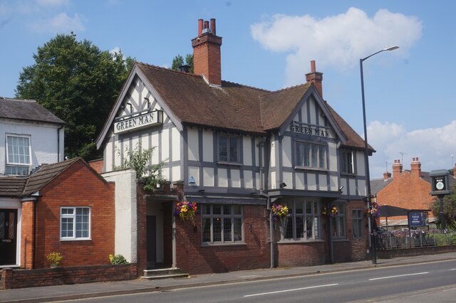
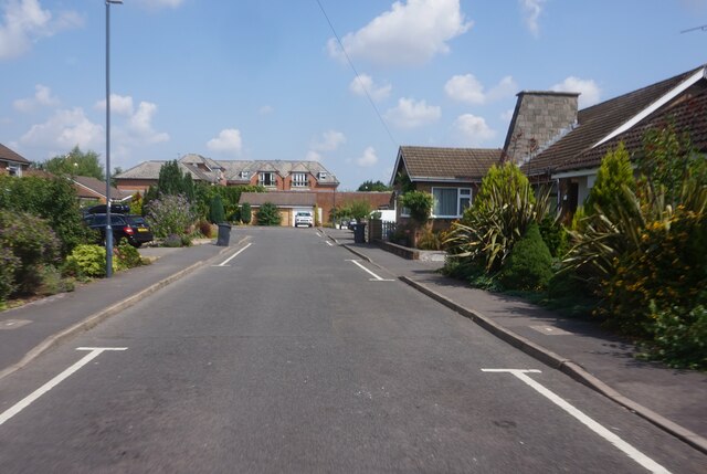
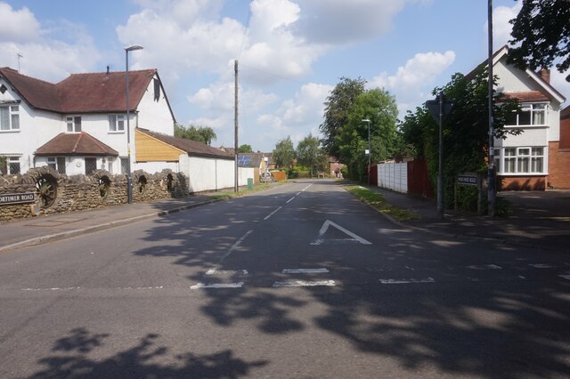
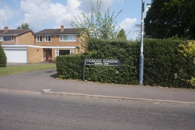
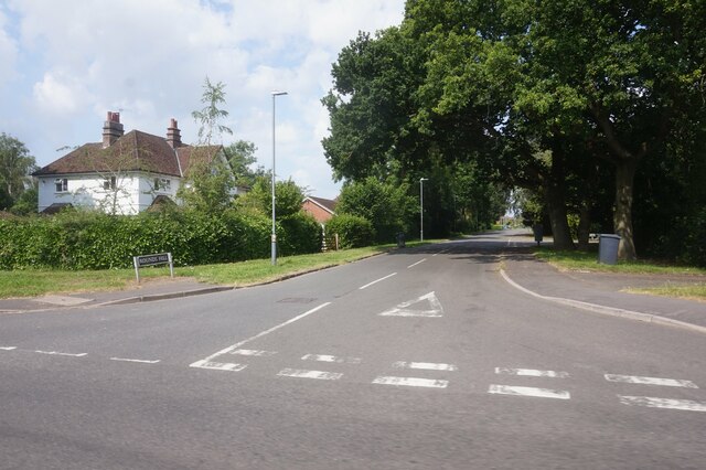
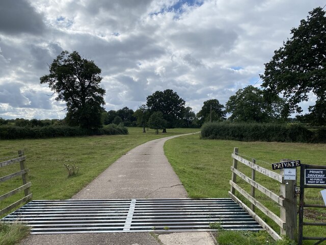
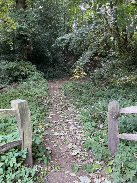
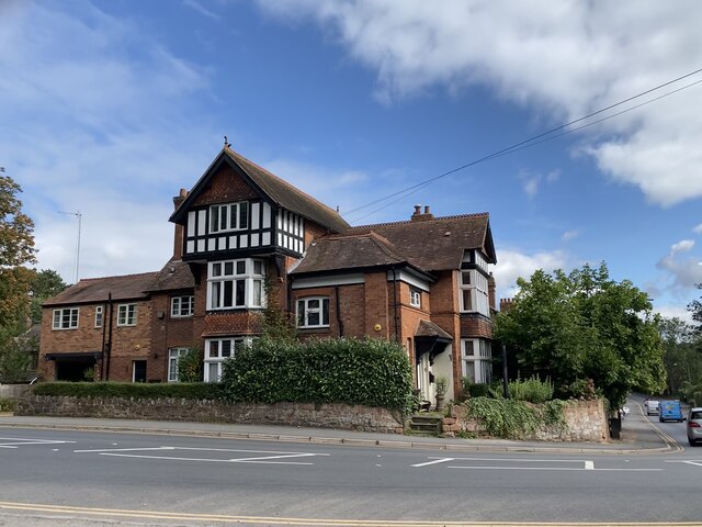
St Johns Images

Images are sourced within 2km of 52.336391/-1.5799171 or Grid Reference SP2871. Thanks to Geograph Open Source API. All images are credited.

The Green Man public house, Kenilworth
Clarke's Avenue, Kenilworth
Mortimer Road, Kenilworth
Vicarage Gardens off Rouncil Lane, Kenilworth
Rounds Hill off Mortimer Road
Making a deck, The Engine public house, Mill End, Kenilworth In the later phase of the pandemic, pubs that had had to close invested in creating outdoor space so that they could safely serve socially-distanced patrons.
Making a deck, The Engine public house, Mill End, Kenilworth
In the later phase of the pandemic, pubs that had had to close invested in creating outdoor space so that they could safely serve socially-distanced patrons.
Odibourne Allotments, Manor Road, Kenilworth The allotments were open to the public for the Heritage Open Days 2021 and Edible England events; members of the Kenilworth Allotment Tenants' Association (KATA) can be seen welcoming visitors. 

The Odibourne site was established in 1919, when Kenilworth Urban District Council bought land from the estate of the deceased William Thomas Pears. The council had recently decided to build on the 'Noah's Ark' allotments nearby, but was obliged under the 1908 Smallholding & Allotments Act to provide sufficient land for local people who wanted plots for growing food. The site is owned today by Kenilworth Town Council, but has been managed since 1983 by KATA (information taken from a notice board on the site).
Odibourne Allotments, Manor Road, Kenilworth
The allotments were open to the public for the Heritage Open Days 2021 and Edible England events; members of the Kenilworth Allotment Tenants' Association (KATA) can be seen welcoming visitors. The Odibourne site was established in 1919, when Kenilworth Urban District Council bought land from the estate of the deceased William Thomas Pears. The council had recently decided to build on the 'Noah's Ark' allotments nearby, but was obliged under the 1908 Smallholding & Allotments Act to provide sufficient land for local people who wanted plots for growing food. The site is owned today by Kenilworth Town Council, but has been managed since 1983 by KATA (information taken from a notice board on the site).
Plot 58a, Odibourne Allotments, Kenilworth These allotments, which to this city dweller appear impossibly idyllic, were open to the public for the Heritage Open Days 2021. Behind the idyll, of course, lies hard work and long term commitment, the challenge of group politics, the uncertainty of the weather and the threat, even here, of theft and vandalism. The Odibourne allotments were established in 1919.
Plot 58a, Odibourne Allotments, Kenilworth
These allotments, which to this city dweller appear impossibly idyllic, were open to the public for the Heritage Open Days 2021. Behind the idyll, of course, lies hard work and long term commitment, the challenge of group politics, the uncertainty of the weather and the threat, even here, of theft and vandalism. The Odibourne allotments were established in 1919.
I'm in the Green Zone A scarecrow, probably more decorative than functional, at the Odibourne allotments in Kenilworth, which were open to the public for the Heritage Open Days 2021.
I'm in the Green Zone
A scarecrow, probably more decorative than functional, at the Odibourne allotments in Kenilworth, which were open to the public for the Heritage Open Days 2021.
Apple Pressing at Odibourne Allotments, Kenilworth The allotment site was open to the public as part of the Heritage Open Days 2021 and Edible England events.
Apple Pressing at Odibourne Allotments, Kenilworth
The allotment site was open to the public as part of the Heritage Open Days 2021 and Edible England events.
'My Shed, My Rules' The sheds of the Odibourne Allotments, Kenilworth, are the subject of their own book, 'Odibourne Sheds: rural retreats in a Kenilworth allotment', by Peter James, published by the Bothy Press in 2020.
'My Shed, My Rules'
The sheds of the Odibourne Allotments, Kenilworth, are the subject of their own book, 'Odibourne Sheds: rural retreats in a Kenilworth allotment', by Peter James, published by the Bothy Press in 2020.
The Rules: Water butt on Odibourne Allotments, Kenilworth A water butt and rules governing its use, on the Odibourne Allotments, open to the public for the Heritage Open Days 2021 and Edible England events.
The Rules: Water butt on Odibourne Allotments, Kenilworth
A water butt and rules governing its use, on the Odibourne Allotments, open to the public for the Heritage Open Days 2021 and Edible England events.
Odibourne Allotments, Kenilworth, looking towards Lower Ladyes Hills Not normally open to the public, the allotments were welcoming visitors for the day as part of the Heritage Open Days 2021 and Edible England events. A scarecrow in the form of a Tokyo Olympics mascot can be seen to the right of the picture.
Odibourne Allotments, Kenilworth, looking towards Lower Ladyes Hills
Not normally open to the public, the allotments were welcoming visitors for the day as part of the Heritage Open Days 2021 and Edible England events. A scarecrow in the form of a Tokyo Olympics mascot can be seen to the right of the picture.
Bridge over the Finham Brook, Odibourne Allotments, Kenilworth No doubt flooding is another hazard of allotment life here, but the stream must have enriched the fertility of the valley over the years. Not normally accessible to the public, the allotments were open as part of the Heritage Open Days 2021 and Edible England events.
Bridge over the Finham Brook, Odibourne Allotments, Kenilworth
No doubt flooding is another hazard of allotment life here, but the stream must have enriched the fertility of the valley over the years. Not normally accessible to the public, the allotments were open as part of the Heritage Open Days 2021 and Edible England events.
Lower Ladyes Hills, Kenilworth, seen from the entrance to the Odibourne Allotments The allotments, which were established in the valley of the Finham Brook in 1919, were open to the public as part of the Heritage Open Days.
Lower Ladyes Hills, Kenilworth, seen from the entrance to the Odibourne Allotments
The allotments, which were established in the valley of the Finham Brook in 1919, were open to the public as part of the Heritage Open Days.
Farm Road to Oaks Farm
Path to castle earthworks Kenilworth Castle remains.
Path to castle earthworks
Kenilworth Castle remains.
House on Castle Road, Kenilworth B4103 near Kenilworth.
House on Castle Road, Kenilworth
B4103 near Kenilworth.
Show me another place!

St Johns is located at Grid Ref: SP2871 (Lat: 52.336391, Lng: -1.5799171)

Administrative County: Warwickshire

District: Warwick

Police Authority: Warwickshire

What 3 Words

///fallen.villa.degree. Near Kenilworth, Warwickshire

Related Wikis

Nearby Amenities

Located within 500m of 52.336391,-1.5799171
Bus Stop
Dudley Road
Bench: no
Bin: no
Bus: yes
Covered: no
Lit: no
Naptan AtcoCode: 4200F030800
Naptan Bearing: SW
Naptan CommonName: Mortimer Road
Naptan Crossing: Mortimer Road
Naptan Indicator: Nr
Naptan NaptanCode: wardamat
Naptan Street: Dudley Road
Naptan Verified: no
Passenger Information Display: no
Public Transport: platform
Shelter: no
Source: naptan_import
Tactile Paving: no
Lat/Long: 52.3346473/-1.5788449
Bus Stop
Dudley Road
Bench: no
Bin: no
Bus: yes
Covered: no
Lit: no
Naptan AtcoCode: 4200F030900
Naptan Bearing: NE
Naptan CommonName: Mortimer Road
Naptan Crossing: Mortimer Road
Naptan Indicator: Nr
Naptan NaptanCode: wardamaw
Naptan Street: Dudley Road
Naptan Verified: no
Passenger Information Display: no
Public Transport: platform
Shelter: no
Source: naptan_import
Tactile Paving: no
Lat/Long: 52.3346485/-1.5789908
Bus Stop
Siddeley Avenue
Bench: no
Bin: no
Bus: yes
Covered: no
Lit: no
Naptan AtcoCode: 4200F032000
Naptan Bearing: NE
Naptan CommonName: Siddeley Avenue
Naptan Crossing: Siddeley Avenue
Naptan Indicator: Opp
Naptan NaptanCode: warapdwd
Naptan Street: Randall Road
Naptan Verified: no
Passenger Information Display: no
Public Transport: platform
Shelter: no
Source: naptan_import
Tactile Paving: no
Lat/Long: 52.3396298/-1.5814162
Bus Stop
St Johns Church
Bench: yes
Bin: yes
Bus: yes
Covered: no
Lit: yes
Naptan AtcoCode: 4200F032200
Naptan Bearing: SE
Naptan CommonName: St Johns Church
Naptan Indicator: Adj
Naptan Landmark: St Johns Church
Naptan NaptanCode: warapdwj
Naptan Street: Warwick Road
Naptan Verified: no
Passenger Information Display: no
Public Transport: platform
Shelter: yes
Source: naptan_import
Tactile Paving: yes
Lat/Long: 52.3371265/-1.5733115
Bus Stop
Earl of Clarendon
Bench: yes
Bin: no
Bus: yes
Covered: no
Naptan AtcoCode: 4200F032201
Naptan Bearing: SE
Naptan CommonName: Earl of Clarendon
Naptan Indicator: Adj
Naptan Landmark: Earl of Clarendon
Naptan NaptanCode: warapdwm
Naptan Street: Warwick Road
Naptan Verified: no
Passenger Information Display: no
Public Transport: platform
Shelter: yes
Source: naptan_import
Lat/Long: 52.3388169/-1.5750876
Bus Stop
St Johns Street
Bench: no
Bin: no
Bus: yes
Check Date Bin: 2023-08-24
Covered: no
Departures Board: timetable
Lit: yes
Naptan AtcoCode: 4200F032202
Naptan Bearing: NW
Naptan CommonName: St Johns Street
Naptan Crossing: St Johns Street
Naptan Indicator: Adj
Naptan NaptanCode: warapdwp
Naptan Street: Warwick Road
Naptan Verified: no
Passenger Information Display: no
Public Transport: platform
Shelter: no
Source: naptan_import
Tactile Paving: no
Lat/Long: 52.3379614/-1.574393
Bus Stop
Suncliffe Drive
Bench: no
Bin: no
Bus: yes
Covered: no
Lit: yes
Naptan AtcoCode: 4200F109501
Naptan Bearing: E
Naptan CommonName: Suncliffe Drive
Naptan Indicator: Opp
Naptan NaptanCode: warajpjw
Naptan Street: Rouncil Lane
Naptan Verified: no
Passenger Information Display: no
Public Transport: platform
Shelter: no
Source: naptan_import
Tactile Paving: no
Lat/Long: 52.3334641/-1.5743566
Bus Stop
Rouncil Lane
Bench: no
Bin: no
Bus: yes
Covered: no
Lit: yes
Naptan AtcoCode: 4200F109601
Naptan Bearing: N
Naptan CommonName: Rouncil Lane
Naptan Crossing: Rouncil Lane
Naptan Indicator: Nr
Naptan NaptanCode: warajpmd
Naptan Street: Mortimer Road
Naptan Verified: no
Passenger Information Display: no
Public Transport: platform
Shelter: no
Source: naptan_import
Tactile Paving: no
Lat/Long: 52.3337359/-1.577436
Bus Stop
Rouncil Lane
Bench: no
Bin: no
Bus: yes
Covered: no
Lit: yes
Naptan AtcoCode: 4200F109602
Naptan Bearing: S
Naptan CommonName: Rouncil Lane
Naptan Crossing: Rouncil Lane
Naptan Indicator: Nr
Naptan NaptanCode: warajpmg
Naptan Street: Mortimer Road
Naptan Verified: no
Passenger Information Display: no
Public Transport: platform
Shelter: no
Source: naptan_import
Tactile Paving: no
Lat/Long: 52.3337351/-1.5772159
Bus Stop
Beauchamp Road
Bench: yes
Bin: no
Bus: yes
Covered: no
Lit: yes
Naptan AtcoCode: 4200F109702
Naptan Bearing: NW
Naptan CommonName: Beauchamp Road
Naptan Indicator: Adj
Naptan NaptanCode: warajpmp
Naptan Street: Beauchamp Road
Naptan Verified: no
Passenger Information Display: no
Public Transport: platform
Shelter: yes
Source: naptan_import
Tactile Paving: no
Lat/Long: 52.3350482/-1.5824135
Bus Stop
Chestnut Avenue
Bench: no
Bin: no
Bus: yes
Covered: no
Lit: yes
Naptan AtcoCode: 4200F109801
Naptan Bearing: SW
Naptan CommonName: Chestnut Avenue
Naptan Crossing: Chestnut Avenue
Naptan Indicator: Adj
Naptan NaptanCode: warajpmt
Naptan Street: Oaks Road
Naptan Verified: no
Passenger Information Display: no
Public Transport: platform
Shelter: no
Source: naptan_import
Tactile Paving: no
Lat/Long: 52.3371537/-1.5825958
Bus Stop
Cemetery
Bench: yes
Bin: yes
Bus: yes
Covered: no
Lit: yes
Naptan AtcoCode: 4200F109802
Naptan Bearing: NE
Naptan CommonName: Cemetery
Naptan Crossing: Chestnut Avenue
Naptan Indicator: Adj
Naptan Landmark: Cemetery
Naptan NaptanCode: warajpmw
Naptan Street: Oaks Road
Naptan Verified: no
Passenger Information Display: no
Public Transport: platform
Shelter: no
Source: naptan_import
Tactile Paving: no
Lat/Long: 52.3373821/-1.582487
Bus Stop
Siddeley Avenue
Bench: no
Bin: no
Bus: yes
Covered: no
Lit: yes
Naptan AtcoCode: 4200F109901
Naptan Bearing: NE
Naptan CommonName: Siddeley Avenue
Naptan Crossing: Siddeley Avenue
Naptan Indicator: Opp
Naptan NaptanCode: wardagpg
Naptan Street: Randall Road
Naptan Verified: no
Passenger Information Display: no
Public Transport: platform
Shelter: no
Source: naptan_import
Tactile Paving: no
Lat/Long: 52.3395575/-1.5812848
Bus Stop
Rounds Hill
Bus: yes
Covered: no
Naptan AtcoCode: 4200F123171
Naptan Bearing: NE
Naptan CommonName: Rounds Hill
Naptan Crossing: Rounds Lane
Naptan Indicator: Adj
Naptan NaptanCode: warapwmw
Naptan Street: Rouncil Lane
Naptan Verified: no
Passenger Information Display: no
Public Transport: platform
Source: naptan_import
Lat/Long: 52.3324591/-1.5824525
Rounds Hill
Naptan AtcoCode: 4200F123172
Naptan Bearing: SW
Naptan BusStopType: CUS
Naptan CommonName: Rounds Hill
Naptan Crossing: Rounds Hill
Naptan Indicator: Opp
Naptan NaptanCode: warapwpa
Naptan Street: Rouncil Lane
Naptan Verified: no
Source: naptan_import
Lat/Long: 52.3323596/-1.5822774
Bus Stop
Gauntlet
Bench: no
Bus: yes
Covered: no
Naptan AtcoCode: 4200F123191
Naptan Bearing: S
Naptan CommonName: Gauntlet
Naptan Indicator: Adj
Naptan Landmark: Gauntlet
Naptan NaptanCode: warapwpd
Naptan Street: Caesar Road
Naptan Verified: no
Passenger Information Display: no
Public Transport: platform
Shelter: no
Source: naptan_import
Tactile Paving: no
Lat/Long: 52.336913/-1.5860211
Bus Stop
Oaks Road
Bench: no
Bin: no
Bus: yes
Covered: no
Lit: yes
Naptan AtcoCode: 4200F129751
Naptan Bearing: NW
Naptan CommonName: Oaks Road
Naptan Crossing: Oaks Road
Naptan Indicator: Nr
Naptan NaptanCode: warapatg
Naptan Street: Beauchamp Road
Naptan Verified: no
Passenger Information Display: no
Public Transport: platform
Shelter: no
Source: naptan_import
Tactile Paving: no
Lat/Long: 52.3358104/-1.5843876
Bus Stop
Oaks Road
Bench: no
Bin: no
Bus: yes
Covered: no
Lit: yes
Naptan AtcoCode: 4200F129752
Naptan Bearing: SE
Naptan CommonName: Oaks Road
Naptan Crossing: Oaks Road
Naptan Indicator: Nr
Naptan NaptanCode: warapgpd
Naptan Street: Beauchamp Road
Naptan Verified: no
Passenger Information Display: no
Public Transport: platform
Shelter: no
Source: naptan_import
Tactile Paving: no
Lat/Long: 52.3359175/-1.5841812
Bus Stop
Willoughby Avenue
Bench: no
Bin: no
Bus: yes
Covered: no
Lit: yes
Naptan AtcoCode: 4200F129810
Naptan Bearing: NW
Naptan CommonName: Willoughby Avenue
Naptan Indicator: Nr
Naptan NaptanCode: warapgpt
Naptan Street: Siddeley Avenue
Naptan Verified: no
Passenger Information Display: no
Public Transport: platform
Shelter: no
Source: naptan_import
Tactile Paving: yes
Lat/Long: 52.3398877/-1.5831605
Crossing
Crossing: unmarked
Crossing Island: no
Kerb: lowered
Tactile Paving: no
Lat/Long: 52.3370884/-1.5765907
Turning Circle
Lat/Long: 52.3383701/-1.5785279
Crossing
Crossing: unmarked
Lat/Long: 52.3404837/-1.5800271
Crossing
Crossing: unmarked
Crossing Island: no
Kerb: lowered
Tactile Paving: no
Lat/Long: 52.3394081/-1.5788366
Pub
The Gauntlet
Addr City: Kenilworth
Addr Housenumber: 3
Addr Postcode: CV8 1DP
Addr Street: Caesar Road
Fhrs Id: 351761
Source: survey
Website: http://www.thegauntletkenilworth.co.uk
Lat/Long: 52.3369686/-1.5857331
Access: yes
Leisure: playground
Lat/Long: 52.3354301/-1.5761536
Crossing
Crossing: unmarked
Crossing Island: no
Kerb: lowered
Tactile Paving: no
Lat/Long: 52.337804/-1.5768994
One Stop
Addr City: Kenilworth
Addr Housenumber: 5
Addr Postcode: CV8 1DP
Addr Street: Oaks Precinct
Brand: One Stop
Brand Wikidata: Q65954217
Contact Website: https://www.onestop.co.uk/store?store=83843f22-2a58-41c8-87b8-096f916390b8
Fhrs Id: 241620
Shop: convenience
Lat/Long: 52.3368046/-1.5853592
Crossing
Crossing: uncontrolled
Crossing Island: no
Kerb: lowered
Tactile Paving: yes
Lat/Long: 52.3373139/-1.5735662
Crossing
Crossing: traffic_signals
Crossing Island: no
Lat/Long: 52.3391735/-1.575536
Direction: backward
Maxspeed: 20 mph
Traffic Sign: maxspeed
Lat/Long: 52.3374891/-1.5736038
Post Box
Brand: Royal Mail
Brand Wikidata: Q638098
Brand Wikipedia: en:Royal Mail
Collection Times: Mo-Fr 17:15, Sa 12:00
Operator: Royal Mail
Operator Wikidata: Q638098
Ref: CV8 443
Royal Cypher: EIIR
Royal Cypher Wikidata: Q33102113
Source: survey
Lat/Long: 52.3367453/-1.5858977
Give Way
Direction: forward
Lat/Long: 52.3364023/-1.5798469
Post Box
Brand: Royal Mail
Brand Wikidata: Q638098
Brand Wikipedia: en:Royal Mail
Collection Times: Mo-Fr 18:00; Sa 08:45
Operator: Royal Mail
Operator Wikidata: Q638098
Post Box Type: lamp
Ref: CV8 196
Royal Cypher: EIIR
Royal Cypher Wikidata: Q33102113
Source: survey
Lat/Long: 52.3333816/-1.5763102
Bronze Tanning
Leisure: tanning_salon
Source: survey
Lat/Long: 52.3369055/-1.5855289
Care & Mobility
Phone: +44 1926 855009
Shop: medical_supply
Source: survey
Website: https://www.enhancedmobility.co.uk/
Lat/Long: 52.3366129/-1.5854266
Fast Food
Hong Kong Garden
Addr City: Kenilworth
Addr Housenumber: 6
Addr Postcode: CV8 1DP
Addr Street: Oaks Precinct
Cuisine: chinese
Fhrs Id: 242597
Phone: +44 1926 512640
Source: survey
Takeaway: yes
Website: http://www.hkgkenilworth.co.uk/
Lat/Long: 52.3368594/-1.5854581
Margaret Hills
Source: survey
Website: http://www.margarethillsclinic.com/
Lat/Long: 52.3365694/-1.5855071
Rumours Hair and Beauty
Phone: +44 1926 858951
Shop: hairdresser
Source: survey
Website: https://www.rumourshairandbeauty.co.uk/
Lat/Long: 52.3367456/-1.5852982
T&C Furniture
Shop: furniture
Source: survey
Lat/Long: 52.3366651/-1.5853309
The Barbers
Phone: +44 1926 850631
Shop: hairdresser
Source: survey
Lat/Long: 52.336639/-1.58537
Post Box
Brand: Royal Mail
Brand Wikidata: Q638098
Brand Wikipedia: en:Royal Mail
Collection Times: Mo-Fr 07:00, Sa 09:00
Operator: Royal Mail
Operator Wikidata: Q638098
Post Box Type: pillar
Ref: CV8 397D
Royal Cypher: EIIR
Royal Cypher Wikidata: Q33102113
Source: survey
Lat/Long: 52.3351885/-1.5829263
Post Box
Brand: Royal Mail
Brand Wikidata: Q638098
Brand Wikipedia: en:Royal Mail
Collection Times: Mo-Fr 17:00, Sa 07:00
Operator: Royal Mail
Operator Wikidata: Q638098
Post Box Type: pillar
Ref: CV8 319
Royal Cypher: GVIR
Royal Cypher Wikidata: Q33102169
Source: survey
Lat/Long: 52.3362755/-1.5796698
Post Office
Roseland Post Office
Addr City: Kenilworth
Addr Housenumber: 57
Addr Postcode: CV8 1GA
Addr Street: Roselands Road
Brand: Post Office
Brand Wikidata: Q1783168
Opening Hours: Mo-Su 06:30-21:00
Operator: Budgens
Ref Pol Id: 130099
Source: survey
Website: https://www.postoffice.co.uk/branch-finder/5562465/roseland
Lat/Long: 52.3363088/-1.5795897
copson hotel
Tourism: hotel
Lat/Long: 52.3324541/-1.5809808
Bus Stop
Beauchamp Road
Bench: no
Bin: no
Bus: yes
Covered: no
Lit: no
Naptan AtcoCode: 4200F109701
Naptan Bearing: SE
Naptan CommonName: Beauchamp Road
Naptan Indicator: Adj
Naptan NaptanCode: warajpmj
Naptan Street: Beauchamp Road
Naptan Verified: no
Passenger Information Display: no
Public Transport: platform
Shelter: no
Source: naptan_import
Tactile Paving: no
Lat/Long: 52.3351179/-1.5822716
The Peacock
Addr City: Kenilworth
Addr Housenumber: 149
Addr Postcode: CV8 1HY
Addr Street: Warwick Road
Tourism: hotel
Website: https://www.peacockhotel.com/
Lat/Long: 52.3383682/-1.5745472
Crossing
Crossing: unmarked
Crossing Island: no
Lat/Long: 52.3368931/-1.5766177
Bench
Backrest: yes
Lat/Long: 52.3374101/-1.5824666
Bench
Backrest: yes
Lat/Long: 52.3355085/-1.5758825
Covered: no
Leisure: picnic_table
Lat/Long: 52.3356339/-1.5761762
Bench
Backrest: yes
Lat/Long: 52.3357536/-1.5760515
Bench
Backrest: yes
Lat/Long: 52.3350157/-1.5765834
Waste Basket
Lat/Long: 52.3348618/-1.5765074
Waste Basket
Lat/Long: 52.3360197/-1.5760253
Waste Basket
Lat/Long: 52.3355577/-1.5760744
Waste Basket
Lat/Long: 52.3373834/-1.5825209
Addr Housenumber: 32
Addr Street: Beauchamp Road
Lat/Long: 52.3352361/-1.5820671
Bench
Backrest: yes
Material: wood
Lat/Long: 52.3352785/-1.5822534
Bench
Backrest: yes
Material: wood
Lat/Long: 52.3351733/-1.5820172
Bench
Backrest: yes
Material: wood
Lat/Long: 52.3350829/-1.5818151
Bench
Backrest: yes
Material: wood
Lat/Long: 52.3350298/-1.5825793
Bench
Backrest: yes
Material: wood
Lat/Long: 52.3350707/-1.5827885
Generator Method: photovoltaic
Generator Output Electricity: yes
Generator Source: solar
Generator Type: solar_photovoltaic_panel
Location: roof
Power: generator
Lat/Long: 52.3375122/-1.5775064
Generator Method: photovoltaic
Generator Output Electricity: yes
Generator Source: solar
Generator Type: solar_photovoltaic_panel
Location: roof
Power: generator
Lat/Long: 52.334123/-1.5803763
Generator Method: photovoltaic
Generator Output Electricity: yes
Generator Source: solar
Generator Type: solar_photovoltaic_panel
Location: roof
Power: generator
Lat/Long: 52.3335837/-1.5799096
Generator Method: photovoltaic
Generator Output Electricity: yes
Generator Source: solar
Generator Type: solar_photovoltaic_panel
Location: roof
Power: generator
Lat/Long: 52.3344196/-1.5755537
Barrier: bollard
Bollard: removable
Lat/Long: 52.3372782/-1.5845563
Generator Method: photovoltaic
Generator Output Electricity: yes
Generator Source: solar
Generator Type: solar_photovoltaic_panel
Location: roof
Power: generator
Lat/Long: 52.3339794/-1.5775644
Entrance: yes
Lat/Long: 52.3379756/-1.5837858
Generator Method: photovoltaic
Generator Output Electricity: yes
Generator Source: solar
Generator Type: solar_photovoltaic_panel
Location: roof
Power: generator
Lat/Long: 52.336285/-1.5794319
Generator Method: photovoltaic
Generator Output Electricity: yes
Generator Source: solar
Generator Type: solar_photovoltaic_panel
Location: roof
Power: generator
Lat/Long: 52.3362089/-1.5817361
Direction: backward
Maxspeed: 20 mph
Traffic Sign: maxspeed
Lat/Long: 52.340242/-1.5768734
Bench
Backrest: yes
Lat/Long: 52.3372779/-1.5838334
Bench
Backrest: yes
Lat/Long: 52.3376345/-1.5837829
Bench
Backrest: yes
Lat/Long: 52.3379778/-1.5827901
Bench
Backrest: yes
Lat/Long: 52.3380175/-1.5835913
Generator Method: photovoltaic
Generator Output Electricity: yes
Generator Source: solar
Generator Type: solar_photovoltaic_panel
Location: roof
Power: generator
Lat/Long: 52.3381944/-1.5811281
Generator Method: photovoltaic
Generator Output Electricity: yes
Generator Source: solar
Generator Type: solar_photovoltaic_panel
Location: roof
Power: generator
Lat/Long: 52.3388634/-1.5805723
Generator Method: photovoltaic
Generator Output Electricity: yes
Generator Source: solar
Generator Type: solar_photovoltaic_panel
Location: roof
Power: generator
Lat/Long: 52.3407505/-1.5806255
Generator Method: photovoltaic
Generator Output Electricity: yes
Generator Source: solar
Generator Type: solar_photovoltaic_panel
Location: roof
Power: generator
Lat/Long: 52.3403822/-1.5814258
Generator Method: photovoltaic
Generator Output Electricity: yes
Generator Source: solar
Generator Type: solar_photovoltaic_panel
Location: roof
Power: generator
Lat/Long: 52.3386342/-1.5821228
Generator Method: photovoltaic
Generator Output Electricity: yes
Generator Source: solar
Generator Type: solar_photovoltaic_panel
Location: roof
Power: generator
Lat/Long: 52.336875/-1.5798404
Telephone
Booth: KX100
Operator: BT
Operator Wikidata: Q593786
Phone: +44 1926 851137
Source: survey
Lat/Long: 52.3372873/-1.5742278
Parcel Locker
Amazon Hub Locker
Brand: Amazon Hub
Brand Wikidata: Q16974764
Brand Wikipedia: en:Amazon Locker
Operator: Amazon
Source: survey
Lat/Long: 52.3361144/-1.5726963
Atm
Source: survey
Lat/Long: 52.336087/-1.5727029
Power: transformer
Source: bing
Lat/Long: 52.3369695/-1.5848561
Power: transformer
Source: bing
Lat/Long: 52.3370411/-1.5847269
Borrowell
Place: suburb
Lat/Long: 52.3372603/-1.5826803
Barrier: cycle_barrier
Cycle Barrier: double
Cycle Barrier Installation: fixed
Lat/Long: 52.3377414/-1.5768362
Bench
Backrest: yes
Lat/Long: 52.3356024/-1.5762628
Give Way
Direction: forward
Lat/Long: 52.3392391/-1.5817526
Give Way
Direction: forward
Lat/Long: 52.3382621/-1.5815629
Give Way
Direction: forward
Lat/Long: 52.3378812/-1.581321
Give Way
Direction: backward
Lat/Long: 52.3348581/-1.5785007
Give Way
Direction: forward
Lat/Long: 52.3342082/-1.5773696
Give Way
Direction: backward
Lat/Long: 52.3334273/-1.577319
Give Way
Direction: backward
Lat/Long: 52.3323176/-1.5826227
Give Way
Direction: backward
Lat/Long: 52.3325409/-1.5830742
Give Way
Direction: forward
Lat/Long: 52.3343919/-1.5802115
Give Way
Direction: backward
Lat/Long: 52.3344629/-1.5798566
St John's
Place: suburb
Lat/Long: 52.3363066/-1.577729
Direction: backward
Traffic Sign: maxspeed
Lat/Long: 52.3390385/-1.5752688
Direction: forward
Maxspeed: 20 mph
Traffic Sign: maxspeed
Lat/Long: 52.336434/-1.5729218
Direction: backward
Maxspeed: 20 mph
Traffic Sign: maxspeed
Lat/Long: 52.3384411/-1.5749895
Direction: forward
Maxspeed: 30 mph
Traffic Sign: maxspeed
Lat/Long: 52.3366781/-1.5728701
Direction: backward
Maxspeed: 20 mph
Traffic Sign: maxspeed
Lat/Long: 52.3399324/-1.5760422
The data included in this document is from www.openstreetmap.org. The data is made available under ODbL.

Have you been to St Johns?

Leave your review of St Johns below (or comments, questions and feedback).