Kenilworth

Settlement in Warwickshire Warwick

England

Kenilworth

The Green Man public house, Kenilworth
The Green Man public house, Kenilworth Credit: Ian S

Kenilworth is a historic town located in Warwickshire, England. Situated around 6 miles south-west of Coventry, the town is known for its rich history and beautiful surroundings.

The focal point of Kenilworth is its magnificent castle, which stands as a testament to the town's medieval heritage. Built in the 12th century, the castle was once a grand fortress and royal residence. Today, visitors can explore its ruins and enjoy panoramic views from the tower. The castle's gardens are also a popular attraction, featuring a restored Elizabethan garden and a tranquil lake.

Aside from its castle, Kenilworth boasts a charming town center with a mix of Tudor and Georgian architecture. Here, visitors can find a variety of independent shops, cafes, and restaurants, offering a range of local and international cuisine. The town also hosts a weekly market, where locals and tourists can browse for fresh produce, clothing, and crafts.

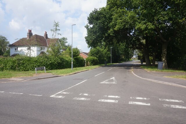
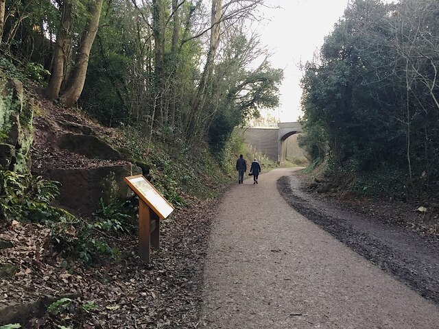
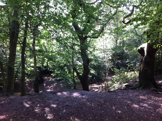
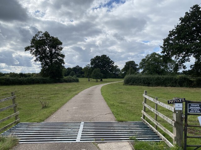
Surrounded by the beautiful Warwickshire countryside, Kenilworth offers ample opportunities for outdoor activities. The nearby Kenilworth Common is a popular spot for walking and picnicking, while the Kenilworth Greenway is perfect for cycling enthusiasts. The town is also close to the vast Warwickshire Wildlife Trust nature reserves, which provide a habitat for various plant and animal species.

Kenilworth has excellent transport links, with easy access to major road networks and rail connections to surrounding cities. This makes it an ideal base for exploring the wider region, including nearby Warwick and Stratford-upon-Avon.

In summary, Kenilworth is a charming town with a rich history, stunning castle, and picturesque surroundings. It offers a range of cultural, recreational, and natural attractions, making it a popular destination for visitors from near and far.

If you have any feedback on the listing, please let us know in the comments section below.
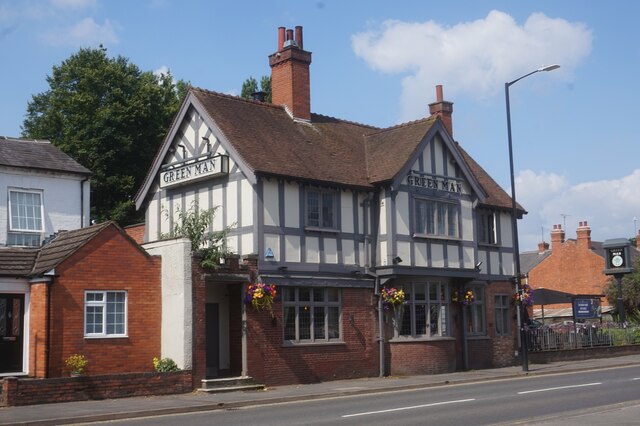
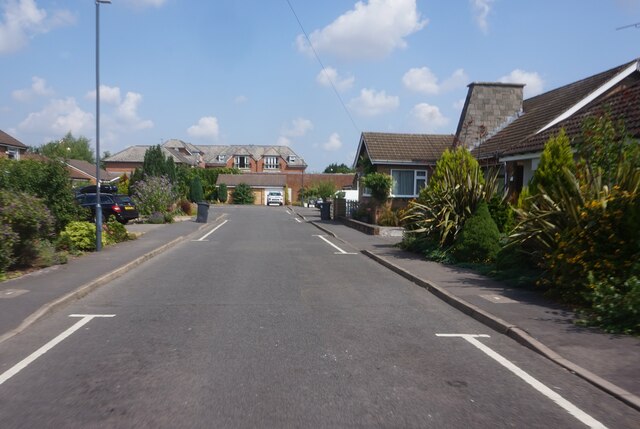
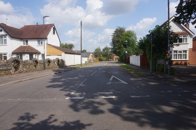
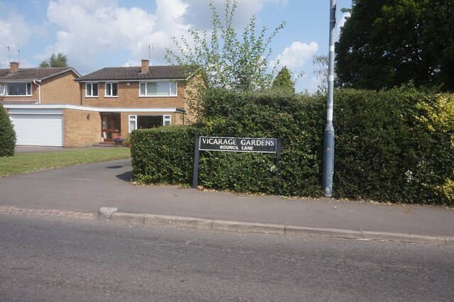
Kenilworth Images

Images are sourced within 2km of 52.342523/-1.579099 or Grid Reference SP2871. Thanks to Geograph Open Source API. All images are credited.

The Green Man public house, Kenilworth
Clarke's Avenue, Kenilworth
Mortimer Road, Kenilworth
Vicarage Gardens off Rouncil Lane, Kenilworth
Rounds Hill off Mortimer Road
Making a deck, The Engine public house, Mill End, Kenilworth In the later phase of the pandemic, pubs that had had to close invested in creating outdoor space so that they could safely serve socially-distanced patrons.
Making a deck, The Engine public house, Mill End, Kenilworth
In the later phase of the pandemic, pubs that had had to close invested in creating outdoor space so that they could safely serve socially-distanced patrons.
Kenilworth Greenway turns south, Crackley, Kenilworth The Greenway was created on a former railway line. The information board has accounts of the Kenilworth Sandstone, exposed here, and of the railway.
Kenilworth Greenway turns south, Crackley, Kenilworth
The Greenway was created on a former railway line. The information board has accounts of the Kenilworth Sandstone, exposed here, and of the railway.
Odibourne Allotments, Manor Road, Kenilworth The allotments were open to the public for the Heritage Open Days 2021 and Edible England events; members of the Kenilworth Allotment Tenants' Association (KATA) can be seen welcoming visitors. 

The Odibourne site was established in 1919, when Kenilworth Urban District Council bought land from the estate of the deceased William Thomas Pears. The council had recently decided to build on the 'Noah's Ark' allotments nearby, but was obliged under the 1908 Smallholding & Allotments Act to provide sufficient land for local people who wanted plots for growing food. The site is owned today by Kenilworth Town Council, but has been managed since 1983 by KATA (information taken from a notice board on the site).
Odibourne Allotments, Manor Road, Kenilworth
The allotments were open to the public for the Heritage Open Days 2021 and Edible England events; members of the Kenilworth Allotment Tenants' Association (KATA) can be seen welcoming visitors. The Odibourne site was established in 1919, when Kenilworth Urban District Council bought land from the estate of the deceased William Thomas Pears. The council had recently decided to build on the 'Noah's Ark' allotments nearby, but was obliged under the 1908 Smallholding & Allotments Act to provide sufficient land for local people who wanted plots for growing food. The site is owned today by Kenilworth Town Council, but has been managed since 1983 by KATA (information taken from a notice board on the site).
Plot 58a, Odibourne Allotments, Kenilworth These allotments, which to this city dweller appear impossibly idyllic, were open to the public for the Heritage Open Days 2021. Behind the idyll, of course, lies hard work and long term commitment, the challenge of group politics, the uncertainty of the weather and the threat, even here, of theft and vandalism. The Odibourne allotments were established in 1919.
Plot 58a, Odibourne Allotments, Kenilworth
These allotments, which to this city dweller appear impossibly idyllic, were open to the public for the Heritage Open Days 2021. Behind the idyll, of course, lies hard work and long term commitment, the challenge of group politics, the uncertainty of the weather and the threat, even here, of theft and vandalism. The Odibourne allotments were established in 1919.
I'm in the Green Zone A scarecrow, probably more decorative than functional, at the Odibourne allotments in Kenilworth, which were open to the public for the Heritage Open Days 2021.
I'm in the Green Zone
A scarecrow, probably more decorative than functional, at the Odibourne allotments in Kenilworth, which were open to the public for the Heritage Open Days 2021.
Apple Pressing at Odibourne Allotments, Kenilworth The allotment site was open to the public as part of the Heritage Open Days 2021 and Edible England events.
Apple Pressing at Odibourne Allotments, Kenilworth
The allotment site was open to the public as part of the Heritage Open Days 2021 and Edible England events.
'My Shed, My Rules' The sheds of the Odibourne Allotments, Kenilworth, are the subject of their own book, 'Odibourne Sheds: rural retreats in a Kenilworth allotment', by Peter James, published by the Bothy Press in 2020.
'My Shed, My Rules'
The sheds of the Odibourne Allotments, Kenilworth, are the subject of their own book, 'Odibourne Sheds: rural retreats in a Kenilworth allotment', by Peter James, published by the Bothy Press in 2020.
The Rules: Water butt on Odibourne Allotments, Kenilworth A water butt and rules governing its use, on the Odibourne Allotments, open to the public for the Heritage Open Days 2021 and Edible England events.
The Rules: Water butt on Odibourne Allotments, Kenilworth
A water butt and rules governing its use, on the Odibourne Allotments, open to the public for the Heritage Open Days 2021 and Edible England events.
Odibourne Allotments, Kenilworth, looking towards Lower Ladyes Hills Not normally open to the public, the allotments were welcoming visitors for the day as part of the Heritage Open Days 2021 and Edible England events. A scarecrow in the form of a Tokyo Olympics mascot can be seen to the right of the picture.
Odibourne Allotments, Kenilworth, looking towards Lower Ladyes Hills
Not normally open to the public, the allotments were welcoming visitors for the day as part of the Heritage Open Days 2021 and Edible England events. A scarecrow in the form of a Tokyo Olympics mascot can be seen to the right of the picture.
Bridge over the Finham Brook, Odibourne Allotments, Kenilworth No doubt flooding is another hazard of allotment life here, but the stream must have enriched the fertility of the valley over the years. Not normally accessible to the public, the allotments were open as part of the Heritage Open Days 2021 and Edible England events.
Bridge over the Finham Brook, Odibourne Allotments, Kenilworth
No doubt flooding is another hazard of allotment life here, but the stream must have enriched the fertility of the valley over the years. Not normally accessible to the public, the allotments were open as part of the Heritage Open Days 2021 and Edible England events.
Lower Ladyes Hills, Kenilworth, seen from the entrance to the Odibourne Allotments The allotments, which were established in the valley of the Finham Brook in 1919, were open to the public as part of the Heritage Open Days.
Lower Ladyes Hills, Kenilworth, seen from the entrance to the Odibourne Allotments
The allotments, which were established in the valley of the Finham Brook in 1919, were open to the public as part of the Heritage Open Days.
Kenilworth Common Once a heath used for grazing farm animals, the common was colonised by birch and oak trees once grazing stopped, and is now a wood with a few remnants of heathland. The land slopes down to the Finham Brook and is crossed by the Coventry to Leamington railway. The common is now a local nature reserve: see the website of the Warwickshire Wildlife Trust here <span class="nowrap"><a title="https://www.warwickshirewildlifetrust.org.uk/reserves/KenilworthCommon" rel="nofollow ugc noopener" href="https://www.warwickshirewildlifetrust.org.uk/reserves/KenilworthCommon">Link</a><img style="margin-left:2px;" alt="External link" title="External link - shift click to open in new window" src="https://s1.geograph.org.uk/img/external.png" width="10" height="10"/></span> .
Kenilworth Common
Once a heath used for grazing farm animals, the common was colonised by birch and oak trees once grazing stopped, and is now a wood with a few remnants of heathland. The land slopes down to the Finham Brook and is crossed by the Coventry to Leamington railway. The common is now a local nature reserve: see the website of the Warwickshire Wildlife Trust here LinkExternal link .
Farm Road to Oaks Farm
Show me another place!

Kenilworth is located at Grid Ref: SP2871 (Lat: 52.342523, Lng: -1.579099)

Administrative County: Warwickshire

District: Warwick

Police Authority: Warwickshire

What 3 Words

///suffer.sculpture.proper. Near Kenilworth, Warwickshire

Related Wikis

Nearby Amenities

Located within 500m of 52.342523,-1.579099
Kenilworth
Abandoned Railway: station
End Date: 1965-01-18
Railway: site
Wikidata: Q6389304
Wikipedia: en:Kenilworth railway station
Lat/Long: 52.3421656/-1.5724887
Kenilworth
Is In: Warwickshire
Is In County: Warwickshire
Is In District: Warwick
Place: town
Wikidata: Q2281103
Wikipedia: en:Kenilworth
Lat/Long: 52.3450526/-1.5816028
Give Way
Direction: backward
Lat/Long: 52.3408621/-1.5848684
Barrier: height_restrictor
Lat/Long: 52.3411304/-1.5855285
Kenilworth War Memorial
Historic: memorial
Memorial: war_memorial
Lat/Long: 52.3449952/-1.5815326
Bus Stop
Church
Bench: no
Bus: yes
Covered: no
Naptan AtcoCode: 4200F029801
Naptan Bearing: SW
Naptan CommonName: Church
Naptan Indicator: Adj
Naptan Landmark: Church
Naptan NaptanCode: warajwdg
Naptan Street: Abbey Hill
Passenger Information Display: no
Public Transport: platform
Shelter: no
Source: naptan_import
Tactile Paving: no
Lat/Long: 52.3463092/-1.5782465
Bus Stop
Church
Bench: yes
Bus: yes
Covered: no
Naptan AtcoCode: 4200F029802
Naptan Bearing: NE
Naptan CommonName: Church
Naptan Indicator: Opp
Naptan Landmark: Church
Naptan NaptanCode: warajwdj
Naptan Street: Abbey Hill
Passenger Information Display: no
Public Transport: platform
Shelter: yes
Source: naptan_import
Tactile Paving: no
Lat/Long: 52.3462713/-1.5785893
Bus Stop
Shops
Bus: yes
Covered: no
Departures Board: realtime
Local Ref: A
Naptan AtcoCode: 4200F030500
Naptan Bearing: S
Naptan CommonName: Shops
Naptan Indicator: Stand A
Naptan NaptanCode: waragtgw
Naptan Street: Abbey End
Naptan Verified: no
Passenger Information Display: no
Public Transport: platform
Shelter: yes
Source: naptan_import
Lat/Long: 52.3439298/-1.5799581
Bus Stop
Shops
Bus: yes
Covered: no
Local Ref: B
Naptan AtcoCode: 4200F030501
Naptan Bearing: S
Naptan CommonName: Shops
Naptan Indicator: Stand B
Naptan NaptanCode: waragtja
Naptan Street: Abbey End
Naptan Verified: no
Passenger Information Display: no
Public Transport: platform
Shelter: yes
Source: naptan_import
Lat/Long: 52.344019/-1.5800611
Bus Stop
Warwick Road
Bus: yes
Covered: no
Naptan AtcoCode: 4200F031901
Naptan Bearing: NE
Naptan CommonName: Warwick Road
Naptan Crossing: Warwick Road
Naptan Indicator: Nr
Naptan NaptanCode: warapdwa
Naptan Street: Randall Road
Naptan Verified: no
Passenger Information Display: no
Public Transport: platform
Shelter: no
Source: naptan_import
Tactile Paving: no
Lat/Long: 52.3411374/-1.5783019
Bus Stop
Siddeley Avenue
Bench: no
Bin: no
Bus: yes
Covered: no
Lit: no
Naptan AtcoCode: 4200F032000
Naptan Bearing: NE
Naptan CommonName: Siddeley Avenue
Naptan Crossing: Siddeley Avenue
Naptan Indicator: Opp
Naptan NaptanCode: warapdwd
Naptan Street: Randall Road
Naptan Verified: no
Passenger Information Display: no
Public Transport: platform
Shelter: no
Source: naptan_import
Tactile Paving: no
Lat/Long: 52.3396298/-1.5814162
Bus Stop
Earl of Clarendon
Bench: yes
Bin: no
Bus: yes
Covered: no
Naptan AtcoCode: 4200F032201
Naptan Bearing: SE
Naptan CommonName: Earl of Clarendon
Naptan Indicator: Adj
Naptan Landmark: Earl of Clarendon
Naptan NaptanCode: warapdwm
Naptan Street: Warwick Road
Naptan Verified: no
Passenger Information Display: no
Public Transport: platform
Shelter: yes
Source: naptan_import
Lat/Long: 52.3388169/-1.5750876
Bus Stop
Holiday Inn
Bus: yes
Covered: no
Departures Board: realtime
Local Ref: C
Naptan AtcoCode: 4200F108901
Naptan Bearing: N
Naptan CommonName: Holiday Inn
Naptan Indicator: Stand C
Naptan NaptanCode: warajpgp
Naptan Street: Abbey End
Naptan Verified: no
Passenger Information Display: no
Public Transport: platform
Shelter: yes
Source: naptan_import
Tactile Paving: yes
Lat/Long: 52.3441346/-1.5805896
Bus Stop
Lion
Bus: yes
Covered: no
Departures Board: timetable
Naptan AtcoCode: 4200F109001
Naptan Bearing: SE
Naptan CommonName: Lion
Naptan Indicator: Adj
Naptan Landmark: Lion
Naptan NaptanCode: warajpgt
Naptan Street: Warwick Road
Naptan Verified: no
Passenger Information Display: no
Public Transport: platform
Shelter: no
Source: naptan_import
Tactile Paving: no
Lat/Long: 52.3415564/-1.5779262
Bus Stop
Randall Road
Bench: yes
Bus: yes
Covered: no
Departures Board: realtime
Naptan AtcoCode: 4200F109002
Naptan Bearing: NW
Naptan CommonName: Randall Road
Naptan Crossing: Randall Road
Naptan Indicator: Adj
Naptan NaptanCode: warajpgw
Naptan Street: Warwick Road
Naptan Verified: no
Passenger Information Display: no
Public Transport: platform
Shelter: yes
Source: naptan_import
Tactile Paving: no
Lat/Long: 52.3411386/-1.5776594
Bus Stop
Siddeley Avenue
Bench: no
Bin: no
Bus: yes
Covered: no
Lit: yes
Naptan AtcoCode: 4200F109901
Naptan Bearing: NE
Naptan CommonName: Siddeley Avenue
Naptan Crossing: Siddeley Avenue
Naptan Indicator: Opp
Naptan NaptanCode: wardagpg
Naptan Street: Randall Road
Naptan Verified: no
Passenger Information Display: no
Public Transport: platform
Shelter: no
Source: naptan_import
Tactile Paving: no
Lat/Long: 52.3395575/-1.5812848
Bus Stop
Warwick Road
Bus: yes
Covered: no
Naptan AtcoCode: 4200F110001
Naptan Bearing: NE
Naptan CommonName: Warwick Road
Naptan Crossing: Warwick Road
Naptan Indicator: Adj
Naptan NaptanCode: wardagpj
Naptan Street: Waverley Road
Naptan Verified: no
Passenger Information Display: no
Public Transport: platform
Source: naptan_import
Lat/Long: 52.3401311/-1.5757458
Bus Stop
Willoughby Avenue
Bench: no
Bin: no
Bus: yes
Covered: no
Lit: yes
Naptan AtcoCode: 4200F129810
Naptan Bearing: NW
Naptan CommonName: Willoughby Avenue
Naptan Indicator: Nr
Naptan NaptanCode: warapgpt
Naptan Street: Siddeley Avenue
Naptan Verified: no
Passenger Information Display: no
Public Transport: platform
Shelter: no
Source: naptan_import
Tactile Paving: yes
Lat/Long: 52.3398877/-1.5831605
Traffic Signals
Lat/Long: 52.3405667/-1.5769845
Turning Circle
Lat/Long: 52.3426674/-1.5809552
Turning Circle
Lat/Long: 52.3383701/-1.5785279
Post Box
Brand: Royal Mail
Brand Wikidata: Q638098
Brand Wikipedia: en:Royal Mail
Collection Times: Mo-Fr 09:00, Sa 07:00
Operator: Royal Mail
Operator Wikidata: Q638098
Post Box Type: pillar
Ref: CV8 381D
Royal Cypher: GVIR
Royal Cypher Wikidata: Q33102169
Source: survey
Lat/Long: 52.342311/-1.573959
Post Box
Brand: Royal Mail
Brand Wikidata: Q638098
Brand Wikipedia: en:Royal Mail
Collection Times: Mo-Fr 09:00; Sa 07:00
Drive Through: no
Operator: Royal Mail
Operator Wikidata: Q638098
Post Box Type: wall
Ref: CV8 345D
Royal Cypher: GVIR
Royal Cypher Wikidata: Q33102169
Source: survey
Lat/Long: 52.3468336/-1.5776564
Crossing
Crossing: unmarked
Lat/Long: 52.3404837/-1.5800271
Crossing
Crossing: unmarked
Crossing Island: no
Kerb: lowered
Tactile Paving: no
Lat/Long: 52.3394081/-1.5788366
Crossing
Crossing: unmarked
Crossing Island: no
Tactile Paving: no
Lat/Long: 52.3413528/-1.5807425
Give Way
Direction: backward
Lat/Long: 52.3449888/-1.5850872
Crossing
Button Operated: yes
Crossing: traffic_signals
Crossing Island: no
Kerb: lowered
Tactile Paving: yes
Traffic Signals Sound: yes
Traffic Signals Vibration: no
Lat/Long: 52.3430682/-1.5795763
Crossing
Crossing: traffic_signals
Tactile Paving: yes
Lat/Long: 52.3418599/-1.5783168
Give Way
Direction: forward
Source: Warwicks CC Aerial Imagery 2013
Lat/Long: 52.3449133/-1.5814971
Kenilworth
Addr City: Kenilworth
Addr Postcode: CV8 1LQ
Addr Street: Priory Road
Network: National Rail
Public Transport: stop_position
Railway: stop
Source: local_knowledge
Train: yes
Lat/Long: 52.3427453/-1.5723888
Barrier: bollard
Lat/Long: 52.3412518/-1.5775854
Crossing
Crossing: traffic_signals
Crossing Island: no
Lat/Long: 52.3391735/-1.575536
Ferndale Guest House
Tourism: guest_house
Lat/Long: 52.3442297/-1.5744721
Hollyhurst
Addr City: Kenilworth
Addr Housenumber: 47
Addr Postcode: CV8 1LL
Addr Street: Priory Road
Building: residential
Lat/Long: 52.3441611/-1.5743865
Clock
Kenilworth Clock Tower
Check Date: 2021-08-25
Historic: monument
Lat/Long: 52.3434455/-1.5799708
Parking Entrance
Lat/Long: 52.3421275/-1.5761182
Parking Entrance
Lat/Long: 52.3424421/-1.5770328
Crossing
Crossing: unmarked
Crossing Island: no
Kerb: lowered
Tactile Paving: no
Lat/Long: 52.342663/-1.5801719
Crossing
Button Operated: no
Crossing: traffic_signals
Tactile Paving: yes
Traffic Signals Sound: no
Lat/Long: 52.3429473/-1.5780546
Crossing
Crossing: unmarked
Lat/Long: 52.3423843/-1.5772443
Crossing
Crossing: zebra
Lat/Long: 52.3429598/-1.578003
Crossing
Crossing: zebra
Crossing Island: no
Lat/Long: 52.3430713/-1.5773459
Barrier: yes
Lat/Long: 52.3418338/-1.57784
Crossing
Crossing: zebra
Lat/Long: 52.3427478/-1.5769305
Crossing
Crossing: zebra
Lat/Long: 52.3427396/-1.5767766
Crossing
Crossing: zebra
Lat/Long: 52.3426929/-1.5770006
Crossing
Crossing: zebra
Lat/Long: 52.3423266/-1.576554
Barrier: yes
Lat/Long: 52.3438364/-1.581621
Barrier: yes
Lat/Long: 52.3444099/-1.5808927
Crossing
Crossing: unmarked
Lat/Long: 52.3437155/-1.5790487
Crossing
Crossing: uncontrolled
Crossing Island: no
Lat/Long: 52.3459612/-1.5770184
Post Box
Brand: Royal Mail
Brand Wikidata: Q638098
Brand Wikipedia: en:Royal Mail
Collection Times: Mo-Fr 17:15; Sa 12:00
Operator: Royal Mail
Operator Wikidata: Q638098
Post Box Type: pillar
Ref: CV8 446
Royal Cypher: EIIR
Royal Cypher Wikidata: Q33102113
Source: survey
Lat/Long: 52.3436603/-1.579852
Telephone
Booth: KX100
Check Date: 2022-03-08
Covered: booth
Operator: BT
Operator Wikidata: Q593786
Phone: +44 1926 864007
Source: Survey
Lat/Long: 52.3436291/-1.57986
Atm
HSBC
Brand: HSBC
Brand Wikidata: Q190464
Brand Wikipedia: en:HSBC
Operator: HSBC
Operator Wikidata: Q190464
Wheelchair: yes
Lat/Long: 52.3423133/-1.5771456
Post Box
Brand: Royal Mail
Brand Wikidata: Q638098
Brand Wikipedia: en:Royal Mail
Collection Times: Mo-Fr 17:00; Sa 12:30
Note: Ref currently not visible. Covered by sticker which says collection times are going to become Mo-Fr 09:00; Sa 07:00 from 06/03/2023
Operator: Royal Mail
Operator Wikidata: Q638098
Post Box Type: pillar
Ref: CV8 468
Royal Cypher: EIIR
Royal Cypher Wikidata: Q33102113
Source: survey
Lat/Long: 52.3429021/-1.5784328
Post Box
Brand: Royal Mail
Brand Wikidata: Q638098
Brand Wikipedia: en:Royal Mail
Collection Times: Mo-Fr 18:00; Sa 12:30
Operator: Royal Mail
Operator Wikidata: Q638098
Post Box Type: parcel
Ref: CV8 399P
Source: survey
Lat/Long: 52.3419664/-1.5786098
Post Box
Brand: Royal Mail
Brand Wikidata: Q638098
Brand Wikipedia: en:Royal Mail
Collection Times: Mo-Fr 18:00; Sa 12:30
Note: both apertures have same ref
Operator: Royal Mail
Operator Wikidata: Q638098
Post Box Apertures: 2
Post Box Type: pillar
Ref: CV8 423
Royal Cypher: EIIR
Royal Cypher Wikidata: Q33102113
Source: survey
Lat/Long: 52.3419532/-1.5786661
Direction: forward
Maxspeed: 30 mph
Traffic Sign: maxspeed
Lat/Long: 52.3434154/-1.5801074
Give Way
Direction: backward
Source: Warwicks CC Aerial Imagery 2013
Lat/Long: 52.3458205/-1.5791497
Atm
Drive Through: no
Lat/Long: 52.3442634/-1.5799756
Elevator
Lat/Long: 52.3431528/-1.5722291
Elevator
Lat/Long: 52.3431749/-1.572441
Millennium Globe
Tourism: artwork
Lat/Long: 52.3439266/-1.5797981
Crossing
Crossing: zebra
Tactile Paving: yes
Lat/Long: 52.3429289/-1.5727875
Bicycle Parking
Covered: yes
Mapillary: 509572900080751
Survey Date: 2018-09-26
Lat/Long: 52.3426984/-1.5726253
Motorcycle Parking
Covered: no
Lat/Long: 52.3428488/-1.5728503
Bus Stop
Kenilworth Railway Station
Bench: yes
Bin: no
Bus: yes
Covered: no
Lit: yes
Passenger Information Display: no
Public Transport: platform
Tactile Paving: no
Lat/Long: 52.3430659/-1.5731167
Anytime Fitness
Brand: Anytime Fitness
Brand Wikidata: Q4778364
Brand Wikipedia: en:Anytime Fitness
Leisure: fitness_centre
Opening Hours: 24/7
Website: https://www.anytimefitness.co.uk/gyms/uk-0118/kenilworth-west-midlands-cv8-1jb/
Lat/Long: 52.3425386/-1.5773018
Kenilworth
Addr City: Kenilworth
Addr Postcode: CV8 1JJ
Addr Street: Waverley Road
Naptan AtcoCode: 9100KENLSTN
Network: National Rail
Network Website: https://www.nationalrail.co.uk/stations/knw/
Network Wikidata: Q26334
Public Transport: station
Railway: station
Ref Crs: KNW
Train: yes
Wheelchair: yes
Wikidata: Q6389304
Wikipedia: en:Kenilworth railway station
Lat/Long: 52.3428168/-1.5724185
Bicycle Parking
Bicycle Parking: wall_loops
Capacity: 4
Covered: no
Fee: no
Lit: yes
Lat/Long: 52.3431819/-1.5774839
Defibrillator
Defibrillator Location: On the wall
Emergency: defibrillator
Indoor: no
Ref GB The Circuit: B89844A9-9AA5-4E69-AD61-75EB673CE9A9
Wheelchair: no
Lat/Long: 52.3431766/-1.5774774
Curves
Brand: Curves
Brand Wikidata: Q5196080
Brand Wikipedia: en:Curves International
Leisure: fitness_centre
Level: 1
Lat/Long: 52.342889/-1.5779302
Entrance: main
Lat/Long: 52.3429929/-1.5782331
Entrance: main
Lat/Long: 52.3423713/-1.5769877
Xmas Feature: shop
Xmas Feature Shop: christmas_tree
Lat/Long: 52.342329/-1.5771211
Xmas Feature: shop
Xmas Feature Shop: christmas_tree
Lat/Long: 52.3429189/-1.5783714
Lily rose
Clothes: bridal
Shop: clothes
Lat/Long: 52.346396/-1.5776395
Crustum
Addr City: Kenilworth
Addr Housenumber: 3
Addr Postcode: CV8 1LL
Addr Street: Priory Road
Contact Facebook: https://www.facebook.com/crustumbakery
Contact Instagram: https://www.instagram.com/crustum.bakery/
Email: info@crustum.co.uk
Fhrs Id: 243880
Mobile: +44 7942 910669
Shop: bakery
Website: https://crustum.co.uk/
Wheelchair: yes
Lat/Long: 52.3462704/-1.5775048
Generator Method: photovoltaic
Generator Output Electricity: yes
Generator Source: solar
Generator Type: solar_photovoltaic_panel
Location: roof
Power: generator
Lat/Long: 52.3421278/-1.5827836
Generator Method: photovoltaic
Generator Output Electricity: yes
Generator Source: solar
Generator Type: solar_photovoltaic_panel
Location: roof
Power: generator
Lat/Long: 52.3416174/-1.5829512
Bench
Backrest: yes
Lat/Long: 52.3441743/-1.5801076
Bench
Backrest: yes
Lat/Long: 52.3439566/-1.5798213
Bench
Backrest: yes
Lat/Long: 52.3438991/-1.5797691
Entrance: yes
Lat/Long: 52.3433715/-1.5806881
Timpson
Brand: Timpson
Brand Wikidata: Q7807658
Brand Wikipedia: en:Timpson (retailer)
Shop: locksmith
Lat/Long: 52.3461471/-1.5773444
Entrance: yes
Lat/Long: 52.343399/-1.5816235
Bench
Backrest: yes
Lat/Long: 52.3436121/-1.5816505
Bench
Backrest: yes
Lat/Long: 52.3427787/-1.586349
Cafe
Coffee on the Corner
Addr City: Kenilworth
Addr Housenumber: 16
Addr Postcode: CV8 1HE
Addr Street: Warwick Road
Fhrs Id: 1220418
Opening Hours: Tu-Sa 09:00-17:00; Su 10:00-15:00
Lat/Long: 52.3420853/-1.5787469
Bench
Backrest: yes
Lat/Long: 52.3429958/-1.5770629
CDRB Architects
Office: architect
Lat/Long: 52.3429771/-1.5770221
Bicycle Parking
Bicycle Parking: stands
Capacity: 4
Covered: no
Fee: no
Lat/Long: 52.3447012/-1.5799388
Bicycle Parking
Bicycle Parking: stands
Capacity: 4
Covered: no
Fee: no
Lat/Long: 52.3436049/-1.5798704
Bicycle Parking
Bicycle Parking: stands
Capacity: 12
Covered: no
Fee: no
Lat/Long: 52.3423843/-1.5782403
Bicycle Parking
Bicycle Parking: stands
Capacity: 4
Covered: no
Fee: no
Lat/Long: 52.3419068/-1.5788541
Bicycle Parking
Bicycle Parking: stands
Capacity: 4
Covered: no
Fee: no
Lat/Long: 52.3411663/-1.5780165
Bicycle Parking
Bicycle Parking: stands
Capacity: 4
Covered: no
Fee: no
Lat/Long: 52.3404941/-1.5767753
Crossing
Crossing: unmarked
Lat/Long: 52.3434866/-1.580604
Entrance: yes
Lat/Long: 52.3421355/-1.5758041
Entrance: yes
Lat/Long: 52.3420644/-1.575762
Pharmacy
Boots
Brand: Boots
Brand Wikidata: Q6123139
Brand Wikipedia: en:Boots (company)
Dispensing: yes
Healthcare: pharmacy
Website: https://www.boots.com/stores/5372-kenilworth-health-centre-cv8-1jp
Lat/Long: 52.3420703/-1.5757104
Direction: forward
Maxspeed: 20 mph
Traffic Sign: maxspeed
Lat/Long: 52.341994/-1.5786911
Direction: forward
Maxspeed: 20 mph
Traffic Sign: maxspeed
Lat/Long: 52.3412601/-1.5779063
Barrier: block
Lat/Long: 52.342598/-1.5790402
Give Way
Direction: backward
Lat/Long: 52.3436982/-1.5820626
Direction: backward
Maxspeed: 20 mph
Traffic Sign: maxspeed
Lat/Long: 52.340242/-1.5768734
Generator Method: photovoltaic
Generator Output Electricity: yes
Generator Source: solar
Generator Type: solar_photovoltaic_panel
Location: roof
Power: generator
Lat/Long: 52.3388634/-1.5805723
Generator Method: photovoltaic
Generator Output Electricity: yes
Generator Source: solar
Generator Type: solar_photovoltaic_panel
Location: roof
Power: generator
Lat/Long: 52.3407505/-1.5806255
Generator Method: photovoltaic
Generator Output Electricity: yes
Generator Source: solar
Generator Type: solar_photovoltaic_panel
Location: roof
Power: generator
Lat/Long: 52.3403822/-1.5814258
Generator Method: photovoltaic
Generator Output Electricity: yes
Generator Source: solar
Generator Type: solar_photovoltaic_panel
Location: roof
Power: generator
Lat/Long: 52.3386342/-1.5821228
Charging Station
Source: survey
Lat/Long: 52.3439888/-1.5807268
Man Made: street_cabinet
Source: survey
Street Cabinet: telecom
Lat/Long: 52.3430897/-1.5776968
Abbey End
Place: suburb
Lat/Long: 52.344539/-1.5813198
Abbey Fields
Place: suburb
Source: OS Open Names
Wikidata: Q17985380
Wikipedia: en:Abbey Fields
Lat/Long: 52.3449117/-1.5849628
Traffic Calming: choker
Lat/Long: 52.3420014/-1.5758748
Give Way
Direction: forward
Lat/Long: 52.3448698/-1.5849869
Give Way
Direction: backward
Lat/Long: 52.3431766/-1.5822576
Give Way
Direction: backward
Lat/Long: 52.3424999/-1.5817578
Give Way
Direction: backward
Lat/Long: 52.3426061/-1.5820016
Give Way
Direction: forward
Lat/Long: 52.3443643/-1.5806001
Give Way
Direction: forward
Lat/Long: 52.3429699/-1.5777126
Give Way
Direction: backward
Lat/Long: 52.3430471/-1.5777909
Give Way
Direction: backward
Lat/Long: 52.3414168/-1.5828046
Give Way
Direction: backward
Lat/Long: 52.3412268/-1.5835532
Give Way
Direction: forward
Lat/Long: 52.340967/-1.5836654
Give Way
Direction: forward
Lat/Long: 52.3403891/-1.5836819
Give Way
Direction: forward
Lat/Long: 52.3392391/-1.5817526
Bench
Backrest: yes
Lat/Long: 52.3437646/-1.5799827
Generator Method: photovoltaic
Generator Output Electricity: yes
Generator Source: solar
Generator Type: solar_photovoltaic_panel
Location: roof
Power: generator
Lat/Long: 52.3429857/-1.5815565
Social Facility
The Kenilworth Centre, Warwick District Foodbank
Addr City: Kenilworth
Addr Housenumber: The Kenilworth Centre
Addr Postcode: CV8 1QJ
Address: The Kenilworth Centre Abbey End Car Park Abbey End Kenilworth CV8 1QJ
Email: info@warwickdistrict.foodbank.org.uk
Foodbank: Warwick District
Foodbank Url: https://www.givefood.org.uk/needs/at/warwick-district/
Network: Trussell Trust
Parliamentary Constituency: Kenilworth and Southam
Phone: 07850293383
Social Facility: food_bank
Social Facility For: underprivileged
Source: give_food
Url: https://www.givefood.org.uk/needs/at/warwick-district/the-kenilworth-centre/
Lat/Long: 52.3441835/-1.5786678
Direction: backward
Traffic Sign: maxspeed
Lat/Long: 52.3390385/-1.5752688
Direction: backward
Maxspeed: 20 mph
Traffic Sign: maxspeed
Lat/Long: 52.3406109/-1.5768669
Direction: backward
Maxspeed: 20 mph
Traffic Sign: maxspeed
Lat/Long: 52.3444255/-1.5804722
Direction: backward
Maxspeed: 20 mph
Traffic Sign: maxspeed
Lat/Long: 52.3399324/-1.5760422
Direction: forward
Maxspeed: 20 mph
Traffic Sign: maxspeed
Lat/Long: 52.3435339/-1.5798925
Direction: forward
Maxspeed: 20 mph
Traffic Sign: maxspeed
Lat/Long: 52.3430939/-1.577831
Crossing
Crossing: traffic_signals
Lat/Long: 52.3427717/-1.5736164
The data included in this document is from www.openstreetmap.org. The data is made available under ODbL.

Have you been to Kenilworth?

Leave your review of Kenilworth below (or comments, questions and feedback).