Abbey Fields

Settlement in Warwickshire Warwick

England

Abbey Fields

A452 Birmingham Road at Red Lane
A452 Birmingham Road at Red Lane Credit: Ian S

Abbey Fields is a picturesque open space located in the heart of Kenilworth, Warwickshire, England. Covering an area of approximately 68 acres, this public park offers a tranquil retreat for locals and visitors alike. Its name originates from the nearby ruins of Kenilworth Abbey, which add a historical charm to the surroundings.

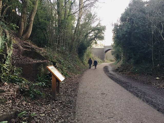
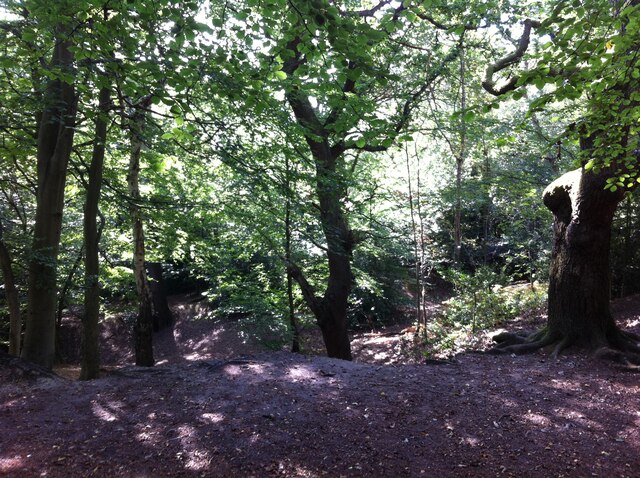
The park boasts a diverse range of features, including well-maintained lawns, beautiful flower beds, and mature trees, creating a serene and inviting environment for recreational activities. Visitors can enjoy leisurely walks along the meandering footpaths that wind through the park, taking in the stunning views and fresh air. For fitness enthusiasts, there are also fitness stations and outdoor gym equipment available.

Abbey Fields has something to offer for all ages. Children can have fun exploring the well-equipped playgrounds, while older visitors can enjoy activities such as tennis, bowling, and putting on the well-maintained sports facilities. The park also features a large outdoor swimming pool, which is a popular attraction during the summer months.

Nature lovers will appreciate the wildlife-rich areas within Abbey Fields, home to a variety of bird species and small mammals. The River Avon runs alongside the park, providing a scenic backdrop and offering opportunities for fishing and ornithology.

With its well-preserved natural beauty, historical significance, and extensive recreational facilities, Abbey Fields is a cherished gem in Warwickshire, attracting both locals and tourists seeking relaxation, exercise, and a connection with nature.

If you have any feedback on the listing, please let us know in the comments section below.
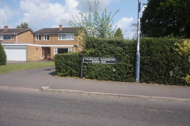
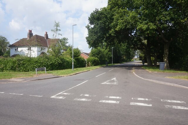
Abbey Fields Images

Images are sourced within 2km of 52.344896/-1.5849743 or Grid Reference SP2871. Thanks to Geograph Open Source API. All images are credited.

A452 Birmingham Road at Red Lane
The Green Man public house, Kenilworth
Clarke's Avenue, Kenilworth
Mortimer Road, Kenilworth
Vicarage Gardens off Rouncil Lane, Kenilworth
Rounds Hill off Mortimer Road
Making a deck, The Engine public house, Mill End, Kenilworth In the later phase of the pandemic, pubs that had had to close invested in creating outdoor space so that they could safely serve socially-distanced patrons.
Making a deck, The Engine public house, Mill End, Kenilworth
In the later phase of the pandemic, pubs that had had to close invested in creating outdoor space so that they could safely serve socially-distanced patrons.
Kenilworth Greenway turns south, Crackley, Kenilworth The Greenway was created on a former railway line. The information board has accounts of the Kenilworth Sandstone, exposed here, and of the railway.
Kenilworth Greenway turns south, Crackley, Kenilworth
The Greenway was created on a former railway line. The information board has accounts of the Kenilworth Sandstone, exposed here, and of the railway.
Odibourne Allotments, Manor Road, Kenilworth The allotments were open to the public for the Heritage Open Days 2021 and Edible England events; members of the Kenilworth Allotment Tenants' Association (KATA) can be seen welcoming visitors. 

The Odibourne site was established in 1919, when Kenilworth Urban District Council bought land from the estate of the deceased William Thomas Pears. The council had recently decided to build on the 'Noah's Ark' allotments nearby, but was obliged under the 1908 Smallholding & Allotments Act to provide sufficient land for local people who wanted plots for growing food. The site is owned today by Kenilworth Town Council, but has been managed since 1983 by KATA (information taken from a notice board on the site).
Odibourne Allotments, Manor Road, Kenilworth
The allotments were open to the public for the Heritage Open Days 2021 and Edible England events; members of the Kenilworth Allotment Tenants' Association (KATA) can be seen welcoming visitors. The Odibourne site was established in 1919, when Kenilworth Urban District Council bought land from the estate of the deceased William Thomas Pears. The council had recently decided to build on the 'Noah's Ark' allotments nearby, but was obliged under the 1908 Smallholding & Allotments Act to provide sufficient land for local people who wanted plots for growing food. The site is owned today by Kenilworth Town Council, but has been managed since 1983 by KATA (information taken from a notice board on the site).
Plot 58a, Odibourne Allotments, Kenilworth These allotments, which to this city dweller appear impossibly idyllic, were open to the public for the Heritage Open Days 2021. Behind the idyll, of course, lies hard work and long term commitment, the challenge of group politics, the uncertainty of the weather and the threat, even here, of theft and vandalism. The Odibourne allotments were established in 1919.
Plot 58a, Odibourne Allotments, Kenilworth
These allotments, which to this city dweller appear impossibly idyllic, were open to the public for the Heritage Open Days 2021. Behind the idyll, of course, lies hard work and long term commitment, the challenge of group politics, the uncertainty of the weather and the threat, even here, of theft and vandalism. The Odibourne allotments were established in 1919.
I'm in the Green Zone A scarecrow, probably more decorative than functional, at the Odibourne allotments in Kenilworth, which were open to the public for the Heritage Open Days 2021.
I'm in the Green Zone
A scarecrow, probably more decorative than functional, at the Odibourne allotments in Kenilworth, which were open to the public for the Heritage Open Days 2021.
Apple Pressing at Odibourne Allotments, Kenilworth The allotment site was open to the public as part of the Heritage Open Days 2021 and Edible England events.
Apple Pressing at Odibourne Allotments, Kenilworth
The allotment site was open to the public as part of the Heritage Open Days 2021 and Edible England events.
'My Shed, My Rules' The sheds of the Odibourne Allotments, Kenilworth, are the subject of their own book, 'Odibourne Sheds: rural retreats in a Kenilworth allotment', by Peter James, published by the Bothy Press in 2020.
'My Shed, My Rules'
The sheds of the Odibourne Allotments, Kenilworth, are the subject of their own book, 'Odibourne Sheds: rural retreats in a Kenilworth allotment', by Peter James, published by the Bothy Press in 2020.
The Rules: Water butt on Odibourne Allotments, Kenilworth A water butt and rules governing its use, on the Odibourne Allotments, open to the public for the Heritage Open Days 2021 and Edible England events.
The Rules: Water butt on Odibourne Allotments, Kenilworth
A water butt and rules governing its use, on the Odibourne Allotments, open to the public for the Heritage Open Days 2021 and Edible England events.
Odibourne Allotments, Kenilworth, looking towards Lower Ladyes Hills Not normally open to the public, the allotments were welcoming visitors for the day as part of the Heritage Open Days 2021 and Edible England events. A scarecrow in the form of a Tokyo Olympics mascot can be seen to the right of the picture.
Odibourne Allotments, Kenilworth, looking towards Lower Ladyes Hills
Not normally open to the public, the allotments were welcoming visitors for the day as part of the Heritage Open Days 2021 and Edible England events. A scarecrow in the form of a Tokyo Olympics mascot can be seen to the right of the picture.
Bridge over the Finham Brook, Odibourne Allotments, Kenilworth No doubt flooding is another hazard of allotment life here, but the stream must have enriched the fertility of the valley over the years. Not normally accessible to the public, the allotments were open as part of the Heritage Open Days 2021 and Edible England events.
Bridge over the Finham Brook, Odibourne Allotments, Kenilworth
No doubt flooding is another hazard of allotment life here, but the stream must have enriched the fertility of the valley over the years. Not normally accessible to the public, the allotments were open as part of the Heritage Open Days 2021 and Edible England events.
Lower Ladyes Hills, Kenilworth, seen from the entrance to the Odibourne Allotments The allotments, which were established in the valley of the Finham Brook in 1919, were open to the public as part of the Heritage Open Days.
Lower Ladyes Hills, Kenilworth, seen from the entrance to the Odibourne Allotments
The allotments, which were established in the valley of the Finham Brook in 1919, were open to the public as part of the Heritage Open Days.
Kenilworth Common Once a heath used for grazing farm animals, the common was colonised by birch and oak trees once grazing stopped, and is now a wood with a few remnants of heathland. The land slopes down to the Finham Brook and is crossed by the Coventry to Leamington railway. The common is now a local nature reserve: see the website of the Warwickshire Wildlife Trust here <span class="nowrap"><a title="https://www.warwickshirewildlifetrust.org.uk/reserves/KenilworthCommon" rel="nofollow ugc noopener" href="https://www.warwickshirewildlifetrust.org.uk/reserves/KenilworthCommon">Link</a><img style="margin-left:2px;" alt="External link" title="External link - shift click to open in new window" src="https://s1.geograph.org.uk/img/external.png" width="10" height="10"/></span> .
Kenilworth Common
Once a heath used for grazing farm animals, the common was colonised by birch and oak trees once grazing stopped, and is now a wood with a few remnants of heathland. The land slopes down to the Finham Brook and is crossed by the Coventry to Leamington railway. The common is now a local nature reserve: see the website of the Warwickshire Wildlife Trust here LinkExternal link .
Show me another place!

Abbey Fields is located at Grid Ref: SP2871 (Lat: 52.344896, Lng: -1.5849743)

Administrative County: Warwickshire

District: Warwick

Police Authority: Warwickshire

What 3 Words

///icons.fingernails.funded. Near Kenilworth, Warwickshire

Related Wikis

Nearby Amenities

Located within 500m of 52.344896,-1.5849743
Crossing
Crossing: marked
Crossing Island: no
Tactile Paving: no
Lat/Long: 52.3449886/-1.5860122
Kenilworth
Is In: Warwickshire
Is In County: Warwickshire
Is In District: Warwick
Place: town
Wikidata: Q2281103
Wikipedia: en:Kenilworth
Lat/Long: 52.3450526/-1.5816028
Barrier: cycle_barrier
Cycle Barrier: double
Cycle Barrier Installation: fixed
Lat/Long: 52.3473776/-1.5888539
Give Way
Direction: backward
Lat/Long: 52.3408621/-1.5848684
Barrier: height_restrictor
Lat/Long: 52.3411304/-1.5855285
Kenilworth War Memorial
Historic: memorial
Memorial: war_memorial
Lat/Long: 52.3449952/-1.5815326
Old Kenilworth
Tourism: attraction
Lat/Long: 52.3484858/-1.5889961
Bus Stop
Church
Bench: no
Bus: yes
Covered: no
Naptan AtcoCode: 4200F029801
Naptan Bearing: SW
Naptan CommonName: Church
Naptan Indicator: Adj
Naptan Landmark: Church
Naptan NaptanCode: warajwdg
Naptan Street: Abbey Hill
Passenger Information Display: no
Public Transport: platform
Shelter: no
Source: naptan_import
Tactile Paving: no
Lat/Long: 52.3463092/-1.5782465
Bus Stop
Church
Bench: yes
Bus: yes
Covered: no
Naptan AtcoCode: 4200F029802
Naptan Bearing: NE
Naptan CommonName: Church
Naptan Indicator: Opp
Naptan Landmark: Church
Naptan NaptanCode: warajwdj
Naptan Street: Abbey Hill
Passenger Information Display: no
Public Transport: platform
Shelter: yes
Source: naptan_import
Tactile Paving: no
Lat/Long: 52.3462713/-1.5785893
Bus Stop
Shops
Bus: yes
Covered: no
Departures Board: realtime
Local Ref: A
Naptan AtcoCode: 4200F030500
Naptan Bearing: S
Naptan CommonName: Shops
Naptan Indicator: Stand A
Naptan NaptanCode: waragtgw
Naptan Street: Abbey End
Naptan Verified: no
Passenger Information Display: no
Public Transport: platform
Shelter: yes
Source: naptan_import
Lat/Long: 52.3439298/-1.5799581
Bus Stop
Shops
Bus: yes
Covered: no
Local Ref: B
Naptan AtcoCode: 4200F030501
Naptan Bearing: S
Naptan CommonName: Shops
Naptan Indicator: Stand B
Naptan NaptanCode: waragtja
Naptan Street: Abbey End
Naptan Verified: no
Passenger Information Display: no
Public Transport: platform
Shelter: yes
Source: naptan_import
Lat/Long: 52.344019/-1.5800611
Bus Stop
Holiday Inn
Bus: yes
Covered: no
Departures Board: realtime
Local Ref: C
Naptan AtcoCode: 4200F108901
Naptan Bearing: N
Naptan CommonName: Holiday Inn
Naptan Indicator: Stand C
Naptan NaptanCode: warajpgp
Naptan Street: Abbey End
Naptan Verified: no
Passenger Information Display: no
Public Transport: platform
Shelter: yes
Source: naptan_import
Tactile Paving: yes
Lat/Long: 52.3441346/-1.5805896
Turning Circle
Lat/Long: 52.3426674/-1.5809552
Barrier: cattle_grid
Source: survey
Lat/Long: 52.3446592/-1.5913735
Bench
Source: survey
Lat/Long: 52.3492714/-1.5864576
Bench
Backrest: yes
Source: survey
Lat/Long: 52.3462181/-1.5902109
Bench
Backrest: yes
Source: survey
Lat/Long: 52.3462855/-1.5902733
Barrier: kissing_gate
Source: survey
Lat/Long: 52.3457733/-1.5908002
Crossing
Crossing: unmarked
Crossing Island: no
Tactile Paving: no
Lat/Long: 52.3413528/-1.5807425
Give Way
Direction: backward
Lat/Long: 52.3449888/-1.5850872
Crossing
Button Operated: yes
Crossing: traffic_signals
Crossing Island: no
Kerb: lowered
Tactile Paving: yes
Traffic Signals Sound: yes
Traffic Signals Vibration: no
Lat/Long: 52.3430682/-1.5795763
Give Way
Direction: forward
Source: Warwicks CC Aerial Imagery 2013
Lat/Long: 52.3449133/-1.5814971
Bench
Backrest: yes
Lat/Long: 52.3487221/-1.5814679
Clock
Kenilworth Clock Tower
Check Date: 2021-08-25
Historic: monument
Lat/Long: 52.3434455/-1.5799708
Crossing
Crossing: unmarked
Crossing Island: no
Kerb: lowered
Tactile Paving: no
Lat/Long: 52.342663/-1.5801719
Barrier: yes
Lat/Long: 52.3438364/-1.581621
Barrier: yes
Lat/Long: 52.3444099/-1.5808927
Crossing
Crossing: unmarked
Lat/Long: 52.3437155/-1.5790487
Post Box
Brand: Royal Mail
Brand Wikidata: Q638098
Brand Wikipedia: en:Royal Mail
Collection Times: Mo-Fr 17:15; Sa 12:00
Operator: Royal Mail
Operator Wikidata: Q638098
Post Box Type: pillar
Ref: CV8 446
Royal Cypher: EIIR
Royal Cypher Wikidata: Q33102113
Source: survey
Lat/Long: 52.3436603/-1.579852
Telephone
Booth: KX100
Check Date: 2022-03-08
Covered: booth
Operator: BT
Operator Wikidata: Q593786
Phone: +44 1926 864007
Source: Survey
Lat/Long: 52.3436291/-1.57986
Post Box
Brand: Royal Mail
Brand Wikidata: Q638098
Brand Wikipedia: en:Royal Mail
Collection Times: Mo-Fr 17:00; Sa 12:30
Note: Ref currently not visible. Covered by sticker which says collection times are going to become Mo-Fr 09:00; Sa 07:00 from 06/03/2023
Operator: Royal Mail
Operator Wikidata: Q638098
Post Box Type: pillar
Ref: CV8 468
Royal Cypher: EIIR
Royal Cypher Wikidata: Q33102113
Source: survey
Lat/Long: 52.3429021/-1.5784328
Direction: forward
Maxspeed: 30 mph
Traffic Sign: maxspeed
Lat/Long: 52.3434154/-1.5801074
Post Box
Brand: Royal Mail
Brand Wikidata: Q638098
Brand Wikipedia: en:Royal Mail
Collection Times: Mo-Fr 09:00; Sa 07:00
Operator: Royal Mail
Operator Wikidata: Q638098
Post Box Type: pillar
Ref: CV8 378D
Royal Cypher: EIIR
Royal Cypher Wikidata: Q33102113
Source: survey
Lat/Long: 52.3449982/-1.5864885
Vending Machine
Check Date: 2022-06-25
Vending: parking_tickets
Lat/Long: 52.3459756/-1.5895127
Vending Machine
Vending: parking_tickets
Lat/Long: 52.3457246/-1.590321
Give Way
Direction: backward
Source: Warwicks CC Aerial Imagery 2013
Lat/Long: 52.3458205/-1.5791497
Atm
Drive Through: no
Lat/Long: 52.3442634/-1.5799756
Millennium Globe
Tourism: artwork
Lat/Long: 52.3439266/-1.5797981
Xmas Feature: shop
Xmas Feature Shop: christmas_tree
Lat/Long: 52.3429189/-1.5783714
Generator Method: photovoltaic
Generator Output Electricity: yes
Generator Source: solar
Generator Type: solar_photovoltaic_panel
Location: roof
Power: generator
Lat/Long: 52.3421278/-1.5827836
Generator Method: photovoltaic
Generator Output Electricity: yes
Generator Source: solar
Generator Type: solar_photovoltaic_panel
Location: roof
Power: generator
Lat/Long: 52.3416174/-1.5829512
Bench
Backrest: yes
Lat/Long: 52.3441743/-1.5801076
Bench
Backrest: yes
Lat/Long: 52.3439566/-1.5798213
Bench
Backrest: yes
Lat/Long: 52.3438991/-1.5797691
Covered: no
Leisure: picnic_table
Lat/Long: 52.3479549/-1.5833105
Entrance: yes
Lat/Long: 52.3433715/-1.5806881
Entrance: yes
Lat/Long: 52.343399/-1.5816235
Bench
Backrest: yes
Lat/Long: 52.3436121/-1.5816505
Barrier: cattle_grid
Lat/Long: 52.3448026/-1.5870941
Bench
Backrest: yes
Lat/Long: 52.3427787/-1.586349
Bicycle Parking
Bicycle Parking: stands
Capacity: 4
Covered: no
Fee: no
Lat/Long: 52.3447012/-1.5799388
Bicycle Parking
Bicycle Parking: stands
Capacity: 4
Covered: no
Fee: no
Lat/Long: 52.3436049/-1.5798704
Crossing
Crossing: unmarked
Lat/Long: 52.3434866/-1.580604
Barrier: block
Lat/Long: 52.342598/-1.5790402
Give Way
Direction: backward
Lat/Long: 52.3436982/-1.5820626
Charging Station
Source: survey
Lat/Long: 52.3439888/-1.5807268
Abbey End
Place: suburb
Lat/Long: 52.344539/-1.5813198
Bench
Backrest: yes
Lat/Long: 52.3409219/-1.5862994
Bench
Backrest: yes
Lat/Long: 52.341003/-1.5863668
Waste Basket
Lat/Long: 52.3410344/-1.5864171
Bench
Backrest: yes
Lat/Long: 52.3410415/-1.586631
Covered: no
Leisure: picnic_table
Lat/Long: 52.3408664/-1.5865701
Bench
Backrest: yes
Lat/Long: 52.3408187/-1.5863475
Abbey Fields
Place: suburb
Source: OS Open Names
Wikidata: Q17985380
Wikipedia: en:Abbey Fields
Lat/Long: 52.3449117/-1.5849628
Give Way
Direction: forward
Lat/Long: 52.3448698/-1.5849869
Give Way
Direction: backward
Lat/Long: 52.3431766/-1.5822576
Give Way
Direction: backward
Lat/Long: 52.3424999/-1.5817578
Give Way
Direction: backward
Lat/Long: 52.3426061/-1.5820016
Give Way
Direction: forward
Lat/Long: 52.3443643/-1.5806001
Give Way
Direction: backward
Lat/Long: 52.3414168/-1.5828046
Give Way
Direction: backward
Lat/Long: 52.3412268/-1.5835532
Give Way
Direction: forward
Lat/Long: 52.340967/-1.5836654
Bench
Backrest: yes
Lat/Long: 52.3437646/-1.5799827
Generator Method: photovoltaic
Generator Output Electricity: yes
Generator Source: solar
Generator Type: solar_photovoltaic_panel
Location: roof
Power: generator
Lat/Long: 52.3429857/-1.5815565
Social Facility
The Kenilworth Centre, Warwick District Foodbank
Addr City: Kenilworth
Addr Housenumber: The Kenilworth Centre
Addr Postcode: CV8 1QJ
Address: The Kenilworth Centre Abbey End Car Park Abbey End Kenilworth CV8 1QJ
Email: info@warwickdistrict.foodbank.org.uk
Foodbank: Warwick District
Foodbank Url: https://www.givefood.org.uk/needs/at/warwick-district/
Network: Trussell Trust
Parliamentary Constituency: Kenilworth and Southam
Phone: 07850293383
Social Facility: food_bank
Social Facility For: under_privileged
Source: give_food
Url: https://www.givefood.org.uk/needs/at/warwick-district/the-kenilworth-centre/
Lat/Long: 52.3441835/-1.5786678
Generator Method: photovoltaic
Generator Output Electricity: yes
Generator Source: solar
Generator Type: solar_photovoltaic_panel
Location: roof
Power: generator
Lat/Long: 52.3454059/-1.5873112
Bench
Backrest: yes
Colour: brown
Material: wood
Seats: 3
Lat/Long: 52.3483991/-1.5847176
Bench
Backrest: yes
Colour: brown
Material: wood
Seats: 3
Lat/Long: 52.3483184/-1.5838908
Direction: backward
Maxspeed: 20 mph
Traffic Sign: maxspeed
Lat/Long: 52.3444255/-1.5804722
Direction: forward
Maxspeed: 20 mph
Traffic Sign: maxspeed
Lat/Long: 52.3435339/-1.5798925
Turning Loop
Lat/Long: 52.341857/-1.5871236
Addr Housename: Castle Farm Leisure Centre
Entrance: yes
Lat/Long: 52.3414258/-1.587052
Addr Housename: Scout and Guide Centre
Entrance: yes
Lat/Long: 52.3418609/-1.5872972
The data included in this document is from www.openstreetmap.org. The data is made available under ODbL.

Have you been to Abbey Fields?

Leave your review of Abbey Fields below (or comments, questions and feedback).