St Day

Settlement in Cornwall

England

St Day

Paddock at Scorrier A few horses were enjoying the hint of sunshine as we passed on the train.  This photo was taken from the 1158 Penzance to London Paddington train, having left Redruth at 1231.
Paddock at Scorrier Credit: Graham Horn

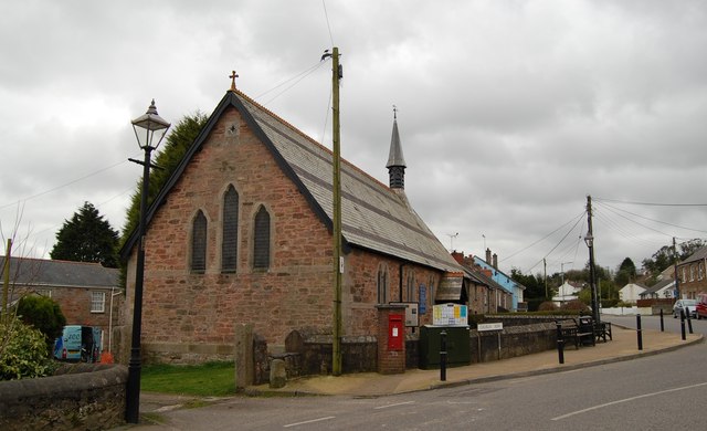
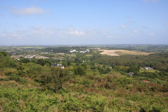
St Day is a small village located in the county of Cornwall, England. Situated about four miles northwest of Redruth, it is part of the civil parish of St Day with Carharrack. With a population of around 3,500 people, it retains a charming rural character.

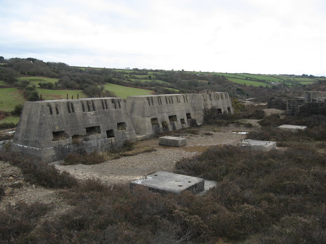
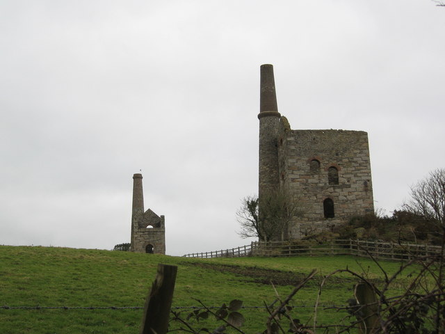
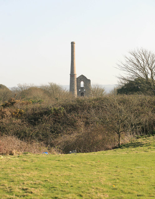
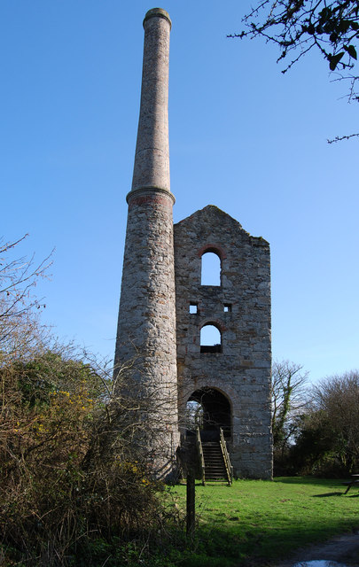
The village is steeped in mining history, having once been a significant mining hub during the 19th century. The remnants of this industrial past can still be seen in the form of old engine houses and mining chimneys that dot the landscape. The area was primarily involved in tin and copper mining, and visitors can explore the Wheal Busy mine, which has been transformed into a museum showcasing the village's mining heritage.

St Day is also known for its annual celebration called "Gorsedh Kernow," which is a festival of Cornish culture and language. This event attracts thousands of visitors who come to witness traditional Cornish music, dance, and poetry performances.

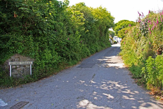
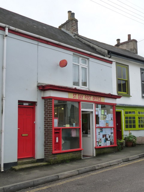
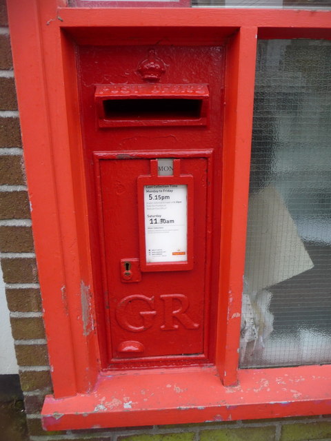
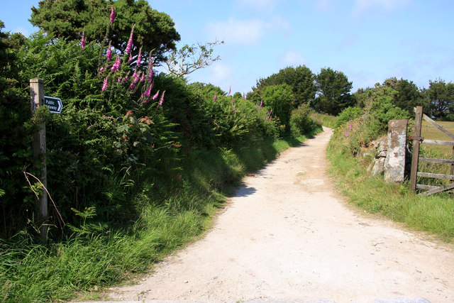
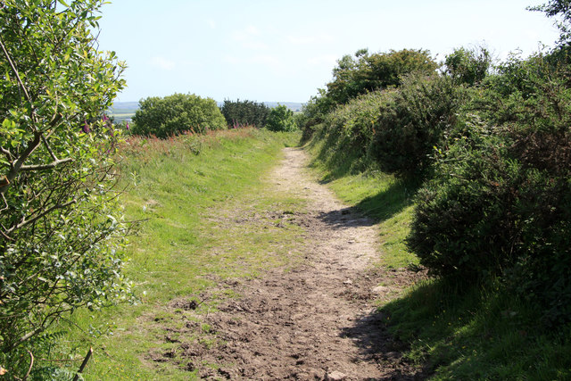
The village offers a range of amenities, including a primary school, a post office, a grocery store, and a few local pubs. Additionally, there are several picturesque footpaths and trails that wind through the surrounding countryside, providing opportunities for outdoor activities such as hiking and cycling.

Overall, St Day is a quaint village that proudly showcases its mining history and Cornish heritage. With its scenic countryside and rich cultural events, it offers a peaceful and enjoyable experience for residents and visitors alike.

If you have any feedback on the listing, please let us know in the comments section below.
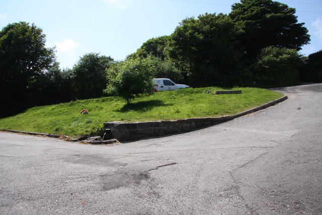
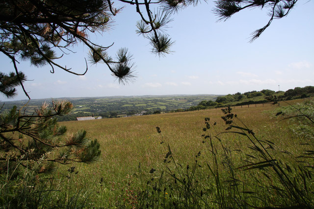
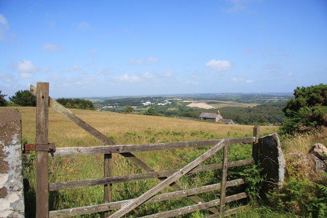
St Day Images

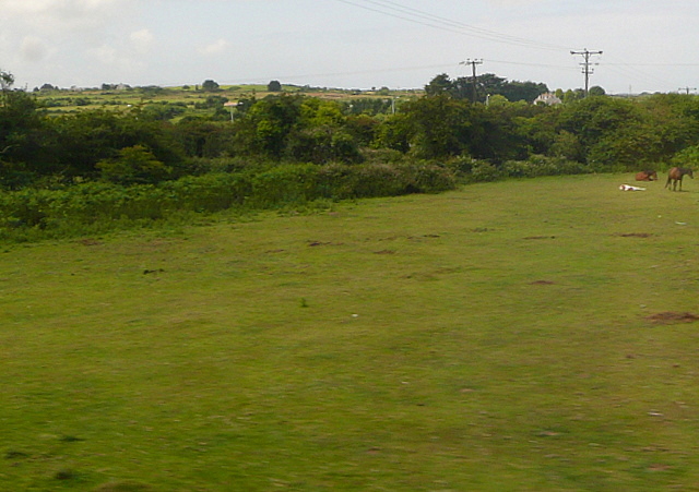
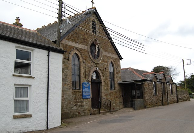
Images are sourced within 2km of 50.238785/-5.1858224 or Grid Reference SW7242. Thanks to Geograph Open Source API. All images are credited.

Paddock at Scorrier A few horses were enjoying the hint of sunshine as we passed on the train.  This photo was taken from the 1158 Penzance to London Paddington train, having left Redruth at 1231.
Paddock at Scorrier
A few horses were enjoying the hint of sunshine as we passed on the train. This photo was taken from the 1158 Penzance to London Paddington train, having left Redruth at 1231.
Mine remains in Poldice Valley
Wheal Bush
Wheal Bush
St Day's new church was the old Sunday School
St Piran's Church, Carharrack
Hawkes Shaft Pumping Engine House Seen across the fields , quite a large engine house and stack.
Hawkes Shaft Pumping Engine House
Seen across the fields , quite a large engine house and stack.
The Engine House at "Hawkes Shaft" This was the pumping engine house at "Killifreth Tin Mine" with the tallest stack in Cornwall.
The Engine House at "Hawkes Shaft"
This was the pumping engine house at "Killifreth Tin Mine" with the tallest stack in Cornwall.
Hillside Terrace, from the junction with Pennance Road
St. Day: the post office The post office, in Fore Street, retains a traditional looking frontage and unlike many these days is not part of a general village store. There has been a post office in St. Day since 1830.
St. Day: the post office
The post office, in Fore Street, retains a traditional looking frontage and unlike many these days is not part of a general village store. There has been a post office in St. Day since 1830.
St. Day: postbox № TR16 62, Fore Street The off-centre positioning of the collection plate is a giveaway that this postbox was designed for a post office frontage - and that is indeed the case, within the window of <a href="https://www.geograph.org.uk/photo/3705996">SW7242 : St. Day: the post office</a>.
St. Day: postbox № TR16 62, Fore Street
The off-centre positioning of the collection plate is a giveaway that this postbox was designed for a post office frontage - and that is indeed the case, within the window of SW7242 : St. Day: the post office.
Gwennap Pit John Wesley preached here.
Gwennap Pit
John Wesley preached here.
Old Railway Track Sections of the track of the Redruth and Chacewater Railway.  The track was not laid on wooden sleepers, but rather on granite "chairs" set in the ground.  In this shot there are actually two generations of track.  Nearer the camera the track is the original style, from when the wagons were horse-drawn.  Further from the camera the track is of a heavier cross section, installed when steam locomotives replaced horses.
Old Railway Track
Sections of the track of the Redruth and Chacewater Railway. The track was not laid on wooden sleepers, but rather on granite "chairs" set in the ground. In this shot there are actually two generations of track. Nearer the camera the track is the original style, from when the wagons were horse-drawn. Further from the camera the track is of a heavier cross section, installed when steam locomotives replaced horses.
The Shute The Shute, on the eponymous Shute Hill, flows non-stop regardless of the level of rainfall.  Reputedly it has never been known to dry up.  The water is believed to originate from ground water under the mass of Carn Marth, to the west, and is potable.  People still come to fill containers from it.  In days gone by villagers from Carharrack would come here not just to collect water but also to do the weekly wash.  Old photographs show the shute looking just the same as it does now.
The Shute
The Shute, on the eponymous Shute Hill, flows non-stop regardless of the level of rainfall. Reputedly it has never been known to dry up. The water is believed to originate from ground water under the mass of Carn Marth, to the west, and is potable. People still come to fill containers from it. In days gone by villagers from Carharrack would come here not just to collect water but also to do the weekly wash. Old photographs show the shute looking just the same as it does now.
Farmland on the lower slopes of Carn Marth Looking broadly towards Lanner, though Lanner itself is hidden in the valley.
Farmland on the lower slopes of Carn Marth
Looking broadly towards Lanner, though Lanner itself is hidden in the valley.
Farmland on the lower slopes of Carn Marth Looking broadly north east, towards United Downs and the site of the former refuse tip.  The white sheds in the distance, near the skyline, are on the United Downs industrial estate.  The light coloured field is the site of the former tip, now being grassed over.  The house slightly right of middle was once a barn.
Farmland on the lower slopes of Carn Marth
Looking broadly north east, towards United Downs and the site of the former refuse tip. The white sheds in the distance, near the skyline, are on the United Downs industrial estate. The light coloured field is the site of the former tip, now being grassed over. The house slightly right of middle was once a barn.
Bridleway near Carharrack
Bridleway on Carn Marth
Scrub on the slopes of Carn Marth Looking towards United Downs Industrial Estate (white sheds)  and the former refuse tip (light coloured field).  Carharrack village nestles in the middle left.
Scrub on the slopes of Carn Marth
Looking towards United Downs Industrial Estate (white sheds) and the former refuse tip (light coloured field). Carharrack village nestles in the middle left.
Show me another place!

St Day is located at Grid Ref: SW7242 (Lat: 50.238785, Lng: -5.1858224)

Unitary Authority: Cornwall

Police Authority: Devon and Cornwall

What 3 Words

///ounce.cared.diamond. Near St Day, Cornwall

Related Wikis

St Day

St Day (Cornish: Sen Day) is a civil parish and village in Cornwall, England, United Kingdom. It is positioned between the village of Chacewater and the...

Wheal Gorland

Wheal Gorland was a metalliferous mine located just to the north-east of the village of St Day, Cornwall, in England, United Kingdom. It was one of the...

Vogue, Cornwall

Vogue (Cornish: Fog, meaning blowing house or furnace) is a hamlet in the parish of St Day, Cornwall, England. == Mining industry == At Vogue there was...

Little Beside

Little Beside House is a Grade II listed country house in the civil parish of Gwennap, Cornwall, England, UK. It was built in the early 19th century and...

Nearby Amenities

Located within 500m of 50.238785,-5.1858224
Tolgullow
Fixme: Village?
Lat/Long: 50.2431073/-5.1845667
Bus Stop
Tresaddern Farm Caravan Park
Bus: yes
Naptan AtcoCode: 0800FWX38456
Naptan Bearing: W
Naptan CommonName: Tresaddern Farm Caravan Park
Naptan NaptanCode: corapgaj
Naptan PlusbusZoneRef: CBORNE
Naptan Street: Church Hill
Naptan Verified: no
Public Transport: platform
Source: naptan_import
Lat/Long: 50.2364616/-5.1803402
Bus Stop
Vogue, Star Inn
Bin: yes
Bus: yes
Departures Board: timetable
Naptan AtcoCode: 0800FWX38696;0800FWX38697
Naptan Bearing: E;W
Naptan CommonName: Vogue
Naptan NaptanCode: corapdaw;corapdat
Naptan PlusbusZoneRef: CBORNE
Naptan Street: Vogue Hill
Naptan Verified: no
Network: Transport for Cornwall
Note: The bus stop is located on the pavement side of the road and serves both directions.
Operator: Go Cornwall Bus
Public Transport: platform
Shelter: no
Source: naptan_import
Lat/Long: 50.2377979/-5.1919622
Bus Stop
Laburnum Cottage
Bus: yes
Naptan AtcoCode: 0800FWZ38516
Naptan Bearing: E
Naptan CommonName: Vogue Hill
Naptan Crossing: Pink Moors
Naptan Indicator: E-bound
Naptan NaptanCode: corapdgw
Naptan PlusbusZoneRef: CBORNE
Naptan Street: Vogue Hill
Naptan Verified: no
Public Transport: platform
Source: naptan_import
Lat/Long: 50.2380064/-5.1905984
Entrance: main
Lat/Long: 50.2358642/-5.1837809
Post Office
St Day Post Office
Addr Postcode: TR16 5JU
Addr Street: Fore Street
Branch: St Day
Brand: Post Office
Brand Wikidata: Q1783168
Check Date: 2020-02-20
Contact Website: https://www.postoffice.co.uk/branch-finder/3385558/st-day
Ref Pol Id: 13257
Source Addr: receipt
Lat/Long: 50.2387023/-5.185743
Barrier: stile
Foot: yes
Material: stone
Stile: stepover
Lat/Long: 50.2413393/-5.1913529
St Day
Name Br: Sen Day
Name Kw: Sen Day
Place: village
Source Name Br: proper translation
Wikidata: Q2625154
Wikipedia: en:St Day
Lat/Long: 50.2392986/-5.1848837
Vogue
Is In County: Cornwall
Place: hamlet
Source: OS_OpenData_StreetView
Wikidata: Q7939417
Lat/Long: 50.238601/-5.1909558
Post Box
Collection Times: Mo-Fr 09:00; Sa 07:00
Operator: Royal Mail
Operator Wikidata: Q638098
Post Box Type: wall
Ref: TR16 72D
Royal Cypher: GR
Royal Cypher Wikidata: Q33102273
Source: survey;gps
Lat/Long: 50.237872/-5.1916534
Plugged "Unnamed Shaft", Wheal Quick
Disused: yes
Fixme: unsure how to tag
Man Made: mineshaft
Source: survey; bing
Lat/Long: 50.2377684/-5.1855312
Emlyn Stone Fabrications
Addr Street: Brickworks Hill
Fixme: unsure how to tag - welders?
Lat/Long: 50.2365115/-5.1878519
John Penglase Butcher
Addr Housenumber: 10
Addr Postcode: TR16 5JY
Addr Street: Church Street
Alt Name: E J Penglase Butchers
Fhrs Id: 402683
Shop: butcher
Source: survey; knowledge; bing
Source Alt Name: fhrs
Lat/Long: 50.2387369/-5.1840752
Ruth's Sewing Service
Fixme: unsure of tagging
Note: Name appears to have changed?
Old Name: Make Do & Mend
Shop: tailor
Source: survey; knowledge; bing
Lat/Long: 50.2386842/-5.1842686
Londis
Addr City: St Day
Addr Country: GB
Addr Postcode: TR16 5JU
Addr Street: Fore Street
Alt Name: St Day Convenience Store
Brand: Londis
Brand Wikidata: Q21008564
Fhrs Id: 439144
Shop: convenience
Source: survey
Source Addr: fhrs
Source Alt Name: fhrs
Lat/Long: 50.2387342/-5.1855396
St Day General Store
Addr Housenumber: 12
Addr Postcode: TR16 5JY
Addr Street: Church Street
Alt Name: St Day General Stores
Brand: Premier express
Fhrs Id: 516175
Opening Hours: Su-Th 06:00-20:00; Fr-Sa 06:00-21:00
Shop: convenience
Source: survey; knowledge; bing
Source Addr: fhrs
Lat/Long: 50.2386783/-5.1840521
Pub
St Day Inn
Addr Postcode: TR16 5JU
Addr Street: Fore Street
Fhrs Id: 486906
Source Addr: fhrs
Lat/Long: 50.238888/-5.1855449
Post Box
Collection Times: Mo-Fr 17:15; Sa 11:30
Operator: Royal Mail
Operator Wikidata: Q638098
Post Box Type: wall
Ref: TR16 62
Royal Cypher: GR
Royal Cypher Wikidata: Q33102273
Source: survey
Lat/Long: 50.2387391/-5.1856999
Shop: laundry
Source: survey; knowledge; bing
Lat/Long: 50.2387772/-5.1841081
Barrier: bollard
Lat/Long: 50.2391207/-5.1850437
Barrier: cycle_barrier
Bicycle: yes
Foot: yes
Lat/Long: 50.2392324/-5.1855511
Barrier: cycle_barrier
Bicycle: yes
Foot: yes
Source: survey
Lat/Long: 50.2383339/-5.1861292
Barrier: stile
Foot: yes
Lat/Long: 50.2411771/-5.1891935
Barrier: stile
Foot: yes
Material: stone
Stile: stepover
Lat/Long: 50.241383/-5.1911094
Toilets
Lat/Long: 50.2384449/-5.1863988
Board Type: history
Information: board
Note: position relative to new graveyard
Source: survey; knowledge; bing
Tourism: information
Lat/Long: 50.2373214/-5.1835997
The Cedars B&B
Addr Housenumber: 22
Addr Postcode: TR16 5JY
Addr Street: Church Street
Contact Website: http://www.thecedarsbandb.co.uk/
Source: survey
Source Addr: survey
Tourism: guest_house
Lat/Long: 50.238051/-5.1836977
Leisure: picnic_table
Source: survey
Source Position: bing
Lat/Long: 50.2369978/-5.1846847
Leisure: picnic_table
Source: survey
Source Position: bing
Lat/Long: 50.2370406/-5.18469
Carew Road S/S No 4128
Note: Grid Ref? [on sign] SW 72894239
Operator: South Western Electricity PLC
Power: substation
Source: survey
Lat/Long: 50.2382407/-5.1861109
Waste Basket
Source: survey
Lat/Long: 50.2369995/-5.1847342
Bench
Backrest: yes
Source: survey; bing
Lat/Long: 50.2408712/-5.1835041
Waste Basket
Source: survey
Lat/Long: 50.2369912/-5.1849949
Bench
Backrest: yes
Source: survey
Lat/Long: 50.23701/-5.1849976
Unnamed Shaft, 15m, Wheal Jewel, Plugged November 1998 by Kerrier District Council, Shaft Reference No. 031/045
Disused: yes
Fixme: unsure how to tag
Man Made: mineshaft
Source: survey; bing
Lat/Long: 50.2372657/-5.1845068
Unnamed Shaft, 5m, Wheal Jewel, Plugged October 1998 by Kerrier District Council, Shaft Reference No. 031/046
Disused: yes
Fixme: unsure how to tag
Man Made: mineshaft
Source: survey; bing
Lat/Long: 50.236876/-5.1847476
Material: wood
Power: pole
Source: survey
Lat/Long: 50.2368405/-5.1849405
Material: wood
Power: pole
Source: survey
Lat/Long: 50.2374052/-5.185487
Waste Basket
Source: survey
Waste: dog_excrement
Lat/Long: 50.2400642/-5.183845
B C Braddon
Addr Housenumber: 17
Addr Postcode: TR16 5LH
Addr Street: Scorrier Street
Fhrs Id: 492678
Shop: butcher
Source: survey; bing; gps
Source Addr: fhrs
Lat/Long: 50.2396262/-5.1844943
Doctors
Branch Surgery St Day
Addr Housenumber: 17
Addr Street: Scorrier Street
Healthcare: doctor
Source: knowledge
Lat/Long: 50.2396238/-5.1845602
Waste Basket
Source: survey
Waste: dog_excrement
Lat/Long: 50.240492/-5.1843561
Waste Basket
Source: survey
Lat/Long: 50.2401676/-5.1850484
Waste Basket
Source: survey
Waste: dog_excrement
Lat/Long: 50.2405131/-5.1879878
Waste Basket
Source: survey
Lat/Long: 50.2402536/-5.1877088
Waste Basket
Source: survey
Lat/Long: 50.2391983/-5.1877082
Chapel Street St Day 41/0589
Operator: South Western Electricity PLC
Power: substation
Source: survey
Lat/Long: 50.2403217/-5.1876499
Bench
Backrest: yes
Source: survey
Lat/Long: 50.2377955/-5.1840483
Waste Basket
Source: survey
Waste: dog_excrement
Lat/Long: 50.2378174/-5.1840065
Bench
Source: survey
Lat/Long: 50.237177/-5.1832104
Waste Basket
Source: survey; gps
Waste: dog_excrement
Lat/Long: 50.237416/-5.1860747
Commnity Notices
Board Type: notice
Information: board
Tourism: information
Lat/Long: 50.2389923/-5.1848148
2 The Old Reservoir
Information: route_marker
Source: survey
Tourism: information
Lat/Long: 50.2377777/-5.1848017
1 St Day Old Church
Information: route_marker
Source: survey
Tourism: information
Lat/Long: 50.2373057/-5.1835708
10 Site of Trinity Chapel
Information: route_marker
Source: survey
Source Name: plaque; knowledge
Tourism: information
Lat/Long: 50.2387637/-5.1865655
11 Former Wesleyan Chapel
Information: route_marker
Source: survey
Tourism: information
Lat/Long: 50.2392435/-5.1875849
12 Former Downing's School
Information: route_marker
Source: survey
Tourism: information
Lat/Long: 50.2398393/-5.188251
13 Former Girls' School
Information: route_marker
Source: survey
Tourism: information
Lat/Long: 50.2383098/-5.1862202
3 Cedars Lodge
Information: route_marker
Source: survey
Tourism: information
Lat/Long: 50.2382843/-5.1839186
4 Site of "Market Inn"
Information: route_marker
Source: survey
Tourism: information
Lat/Long: 50.2389842/-5.1841815
5 The Manor Workshop
Information: route_marker
Source: survey
Tourism: information
Lat/Long: 50.2394202/-5.1854014
6 Former Chemist Shop
Fixme: position unclear/approximate
Information: route_marker
Source: survey
Tourism: information
Lat/Long: 50.2390454/-5.1846883
7 The Old Post Office
Information: route_marker
Source: survey
Tourism: information
Lat/Long: 50.2389652/-5.1847025
8 Carew House
Information: route_marker
Source: survey
Tourism: information
Lat/Long: 50.2387742/-5.1853703
9 Site of the Mediæval Cross
Information: route_marker
Source: survey
Tourism: information
Lat/Long: 50.2388065/-5.185801
14 Former National School
Information: route_marker
Source: survey
Tourism: information
Lat/Long: 50.2373392/-5.1842923
RGLC1
Material: wood
Power: pole
Source: survey; bing
Lat/Long: 50.2364681/-5.1816473
Material: wood
Power: pole
Ref: RGLC 2
Source: survey; bing
Lat/Long: 50.2366739/-5.1828362
Material: wood
Power: pole
Ref: RGLC 3
Source: survey; bing
Lat/Long: 50.2367763/-5.1837473
Waste Basket
Source: survey
Waste: dog_excrement
Lat/Long: 50.237049/-5.1840445
Material: wood
Power: pole
Source: survey; bing
Lat/Long: 50.2363328/-5.1816596
Material: wood
Power: pole
Source: survey; bing; gps
Lat/Long: 50.2365704/-5.1807074
Material: wood
Power: pole
Source: survey; bing; gps
Lat/Long: 50.2373339/-5.1803665
Advance Driving School
Source: survey; bing
Lat/Long: 50.2393625/-5.1791543
Addr Housename: Glebe House
Addr Street: Vicarage Hill
Source Addr: survey
Lat/Long: 50.238404/-5.1821288
Lower Poldice Cottage
Building: house
Source Name: survey
Lat/Long: 50.2375738/-5.1794111
The Homestead
Building: house
Lat/Long: 50.2391541/-5.1791384
The Old Coach House
Building: house
Source: bing; gps
Source Name: survey
Lat/Long: 50.2385131/-5.1831094
Material: wood
Power: pole
Source: survey; bing; gps
Lat/Long: 50.2387708/-5.18317
Tinners Loft
Building: house
Source: bing; gps
Source Name: survey
Lat/Long: 50.23856/-5.183789
St Day S/S No 2804
Note: Grid Ref W 7307 4245
Operator: South Western Electricity PLC
Power: substation
Source: survey
Lat/Long: 50.2384089/-5.1837094
Bus Stop
Church Street
Bench: no
Bus: yes
Naptan AtcoCode: 0800COC30519
Naptan Bearing: N
Naptan BusStopType: CUS
Naptan CommonName: Church Street
Naptan Indicator: N-bound
Naptan NaptanCode: corapdpw
Naptan Street: Church Street
Naptan Verified: no
Note: number 47 bus
Public Transport: platform
Shelter: no
Source: bing;naptan
Lat/Long: 50.2369699/-5.1836884
Bus Stop
Church Street
Bench: yes
Bus: yes
Naptan AtcoCode: 0800COC30518
Naptan Bearing: S
Naptan BusStopType: CUS
Naptan CommonName: Church Street
Naptan Indicator: S-bound
Naptan NaptanCode: corapdta
Naptan Street: Church Street
Naptan Verified: no
Note: number 47 bus
Public Transport: platform
Shelter: yes
Source: bing;naptan
Lat/Long: 50.237146/-5.183587
Waste Basket
Source: survey; gps
Lat/Long: 50.2358681/-5.1836458
Material: wood
Power: pole
Source: survey; bing
Lat/Long: 50.2363855/-5.1816338
Waste Basket
Source: survey; bing
Lat/Long: 50.2388733/-5.1845095
Material: wood
Power: pole
Source: survey; bing
Lat/Long: 50.2420224/-5.1845678
Waste Basket
Source: survey
Lat/Long: 50.2414103/-5.1911043
Waste Basket
Source: survey; gps
Lat/Long: 50.2401778/-5.1923435
Source: survey; gps
Traffic Calming: hump
Lat/Long: 50.239151/-5.1918465
Source: survey; gps
Traffic Calming: hump
Lat/Long: 50.2380531/-5.1915382
Bus Stop
Vogue Hill
Bench: yes
Bus: yes
Naptan AtcoCode: 0800COA15835
Naptan Bearing: W
Naptan CommonName: Vogue Hill
Naptan Indicator: W-bound
Naptan NaptanCode: corgjwta
Naptan Street: Vogue Hill
Naptan Verified: no
Note: bus number 47, direction Redruth
Public Transport: platform
Shelter: yes
Lat/Long: 50.2378726/-5.1909671
Waste Basket
Source: survey; bing
Lat/Long: 50.2378073/-5.1895222
Waste Basket
Source: survey; bing
Lat/Long: 50.2386819/-5.1881637
Bench
Backrest: yes
Source: survey; bing
Lat/Long: 50.2387083/-5.1880961
Cedric House
Building: house
Source Name: survey
Lat/Long: 50.238728/-5.1883302
Restormel
Building: house
Source Name: survey
Lat/Long: 50.2387013/-5.1884417
Bus Stop
Post Office
Bench: no
Bus: yes
Naptan AtcoCode: 0800COA15608
Naptan Bearing: W
Naptan BusStopType: CUS
Naptan CommonName: Post Office
Naptan Indicator: W-bound
Naptan NaptanCode: corgjgdp
Naptan Verified: no
Public Transport: platform
Shelter: no
Source: survey;naptan
Lat/Long: 50.2387486/-5.1856528
Williams Shaft
Description: 15m, Wheal Gorland, Plugged March 1997 by Kerrier District Council, Shaft Reference No. 031/021, 5 mtrs to the south
Historic: mine_shaft
Source: survey;gps
Lat/Long: 50.2402131/-5.1881051
Bench
Backrest: yes
Inscription: IN MEMORY OF BILLY CAMPBELL SADLY MISSED
Source: gps; survey
Lat/Long: 50.239077/-5.1882123
Addr Housename: Vogue House
Source Addr: survey
Lat/Long: 50.2384807/-5.1896907
Addr Housename: Community Cottage
Building: house
Source: gps
Source Addr: survey
Lat/Long: 50.2385965/-5.1864186
St Day Public Institute
Lat/Long: 50.2385687/-5.1839936
Addr Housenumber: 10
Lat/Long: 50.2387681/-5.1882525
Addr Housenumber: 3
Lat/Long: 50.2388903/-5.1877272
Addr Housenumber: 1
Addr Street: Vogue Hill
Building: house
Source: survey
Lat/Long: 50.2383014/-5.1893228
Addr Housenumber: 10
Addr Street: Vogue Hill
Building: house
Source: survey
Lat/Long: 50.2386136/-5.1885384
Material: wood
Power: pole
Source: survey
Lat/Long: 50.2380977/-5.1893636
Material: wood
Power: pole
Source: survey; bing
Lat/Long: 50.2347825/-5.1842842
Addr Housename: Little Burnwithian Cottage
Building: house
Source Addr: survey
Lat/Long: 50.2357254/-5.1841892
Addr Housename: Ponderosa
Building: residential
Source: survey; bing
Lat/Long: 50.2367488/-5.1876101
Addr Housename: Tresidders
Source Addr: survey
Lat/Long: 50.2381122/-5.1862026
Addr Housename: The White House
Source Addr: survey
Lat/Long: 50.2385549/-5.1839109
Addr Housenumber: 16
Addr Street: Church Street
Source Addr: survey
Lat/Long: 50.238546/-5.1839808
Material: wood
Power: pole
Source: survey
Lat/Long: 50.2372216/-5.1876749
Addr Housename: Amber House
Addr Street: Fore Street
Source Addr: survey
Lat/Long: 50.2388485/-5.1843793
Addr Housenumber: 23
Addr Street: Church Street
Source Addr: survey
Lat/Long: 50.2380634/-5.1840742
Addr Housenumber: 25
Addr Street: Church Street
Source Addr: survey
Lat/Long: 50.2380155/-5.1840619
Addr Housenumber: 1
Addr Street: Church Street
Source Addr: survey
Lat/Long: 50.2388005/-5.1843115
Addr Housenumber: 3
Addr Street: Church Street
Source Addr: survey
Lat/Long: 50.238654/-5.1842581
Waste Basket
Source: survey
Lat/Long: 50.2387683/-5.1854593
Addr Housename: St Day Inn Flat
Addr Street: Fore Street
Lat/Long: 50.2388088/-5.1856729
Addr Housename: Gwel Ledan
Addr Street: Brickworks Hill
Fixme: Is this address one of the buildings?
Source Addr: survey
Lat/Long: 50.2373612/-5.1864639
Material: wood
Power: pole
Source: survey; bing
Lat/Long: 50.2417103/-5.1810484
Material: wood
Power: pole
Source: survey; bing
Lat/Long: 50.2418923/-5.181702
Material: wood
Power: pole
Source: survey; bing
Lat/Long: 50.2419208/-5.1826816
Generator Method: photovoltaic
Generator Output Electricity: small_installation
Generator Source: solar
Generator Type: solar_photovoltaic_panel
Location: roof
Power: generator
Source: bing
Lat/Long: 50.2388871/-5.1914652
Generator Method: photovoltaic
Generator Output Electricity: small_installation
Generator Source: solar
Generator Type: solar_photovoltaic_panel
Location: roof
Power: generator
Source: bing
Lat/Long: 50.2388074/-5.1892939
Generator Method: photovoltaic
Generator Output Electricity: small_installation
Generator Source: solar
Generator Type: solar_photovoltaic_panel
Location: roof
Power: generator
Source: bing
Lat/Long: 50.2391616/-5.187415
Generator Method: photovoltaic
Generator Output Electricity: small_installation
Generator Source: solar
Generator Type: solar_photovoltaic_panel
Location: roof
Power: generator
Source: bing
Lat/Long: 50.2392165/-5.1885858
Generator Method: photovoltaic
Generator Output Electricity: small_installation
Generator Source: solar
Generator Type: solar_photovoltaic_panel
Location: roof
Power: generator
Source: bing
Lat/Long: 50.2403444/-5.1858003
Generator Method: photovoltaic
Generator Output Electricity: small_installation
Generator Source: solar
Generator Type: solar_photovoltaic_panel
Location: roof
Power: generator
Source: bing
Lat/Long: 50.2404739/-5.1866815
Generator Method: photovoltaic
Generator Output Electricity: small_installation
Generator Source: solar
Generator Type: solar_photovoltaic_panel
Location: roof
Power: generator
Source: bing
Lat/Long: 50.2411687/-5.1866198
Generator Method: photovoltaic
Generator Output Electricity: small_installation
Generator Source: solar
Generator Type: solar_photovoltaic_panel
Location: roof
Power: generator
Source: bing
Lat/Long: 50.2410366/-5.1858044
Generator Method: photovoltaic
Generator Output Electricity: small_installation
Generator Source: solar
Generator Type: solar_photovoltaic_panel
Location: roof
Power: generator
Source: bing
Lat/Long: 50.2408891/-5.1854986
Generator Method: photovoltaic
Generator Output Electricity: small_installation
Generator Source: solar
Generator Type: solar_photovoltaic_panel
Location: roof
Power: generator
Source: bing
Lat/Long: 50.2407501/-5.1857561
Generator Method: photovoltaic
Generator Output Electricity: small_installation
Generator Source: solar
Generator Type: solar_photovoltaic_panel
Location: roof
Power: generator
Source: bing
Lat/Long: 50.2408136/-5.1847878
Generator Method: photovoltaic
Generator Output Electricity: small_installation
Generator Source: solar
Generator Type: solar_photovoltaic_panel
Location: roof
Power: generator
Source: bing
Lat/Long: 50.2408411/-5.1824811
Generator Method: photovoltaic
Generator Output Electricity: small_installation
Generator Source: solar
Generator Type: solar_photovoltaic_panel
Location: roof
Power: generator
Source: bing
Lat/Long: 50.2399147/-5.1854396
Generator Method: photovoltaic
Generator Output Electricity: small_installation
Generator Source: solar
Generator Type: solar_photovoltaic_panel
Location: roof
Power: generator
Source: bing
Lat/Long: 50.2399404/-5.1859546
Generator Method: photovoltaic
Generator Output Electricity: small_installation
Generator Source: solar
Generator Type: solar_photovoltaic_panel
Location: roof
Power: generator
Source: bing
Lat/Long: 50.2386572/-5.1869282
Generator Method: photovoltaic
Generator Output Electricity: small_installation
Generator Source: solar
Generator Type: solar_photovoltaic_panel
Location: roof
Power: generator
Source: bing
Lat/Long: 50.2379213/-5.186432
Generator Method: photovoltaic
Generator Output Electricity: small_installation
Generator Source: solar
Generator Type: solar_photovoltaic_panel
Location: roof
Power: generator
Source: bing
Lat/Long: 50.2384394/-5.1844955
Generator Method: photovoltaic
Generator Output Electricity: small_installation
Generator Source: solar
Generator Type: solar_photovoltaic_panel
Location: roof
Power: generator
Source: bing
Lat/Long: 50.2380825/-5.1837122
Barrier: cycle_barrier
Lat/Long: 50.2395159/-5.1854871
The data included in this document is from www.openstreetmap.org. The data is made available under ODbL.

Have you been to St Day?

Leave your review of St Day below (or comments, questions and feedback).