Blindmoor

Settlement in Somerset South Somerset

England

Blindmoor

Old Milestone by road, Dommett Moor, Northeast of Buckland St Mary The Milestone is located beside road under trees on the East of the road.  Parish of Buckland St Mary (South Somerset District). Carved stone post, Chard limestone post design, erected by the Chard turnpike trust in the 19th Century, becoming unreadable. 

Lost since 2002 when surveyed.

Inscription reads:-   
CHARD / 5 / TAUNTON / 8  

Grade II listed. List Entry Number: 1039992 <span class="nowrap"><a title="https://historicengland.org.uk/listing/the-list/list-entry/1039992" rel="nofollow ugc noopener" href="https://historicengland.org.uk/listing/the-list/list-entry/1039992">Link</a><img style="margin-left:2px;" alt="External link" title="External link - shift click to open in new window" src="https://s1.geograph.org.uk/img/external.png" width="10" height="10"/></span> 

Milestone Society National ID: SO_TACH08
Old Milestone by road, Dommett Moor, Northeast of Buckland St Mary Credit: JR Dowding

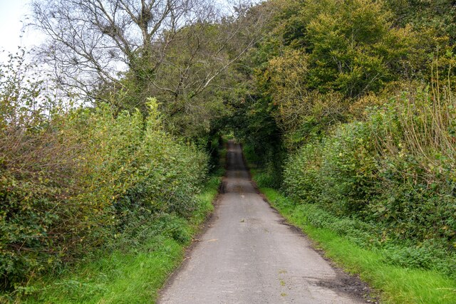
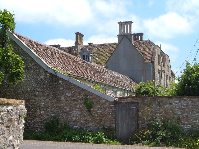
Blindmoor is a small village located in the county of Somerset, in the southwestern part of England. Situated on the Somerset Levels, it is surrounded by picturesque countryside and offers a tranquil and scenic setting for residents and visitors alike.

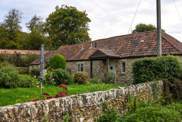
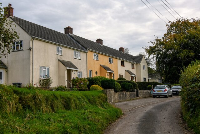
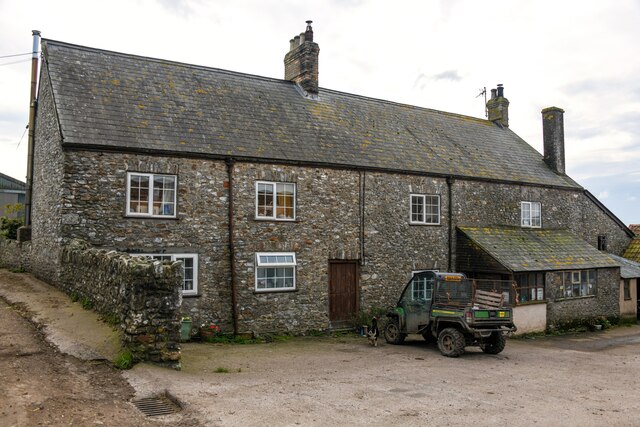
The village itself is relatively small, with a population of around 500 people. It is characterized by its charming cottages made from local stone, adding to its traditional and rustic atmosphere. The community in Blindmoor is tight-knit and friendly, welcoming newcomers with open arms.

One of the main attractions in Blindmoor is its proximity to the nearby nature reserves, including the renowned RSPB Greylake and Westhay Moor. These reserves provide excellent opportunities for birdwatching and wildlife spotting, with a variety of rare and endangered species making their home in the area.

Blindmoor benefits from a range of amenities, including a local pub, village hall, and a primary school. The pub serves as a gathering place for residents and visitors to enjoy a drink and a meal, while the village hall hosts various community events and activities throughout the year.

The village is well-connected to larger towns and cities in the region, with good road links to nearby Bridgwater and Taunton. Public transportation is also available, allowing for easy access to the wider Somerset area.

In conclusion, Blindmoor offers a peaceful and idyllic retreat for those seeking a rural lifestyle. With its natural beauty, friendly community, and convenient location, it provides an attractive destination for both residents and tourists alike.

If you have any feedback on the listing, please let us know in the comments section below.
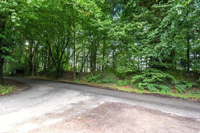
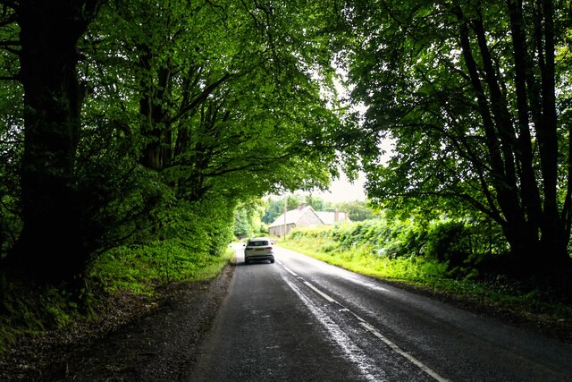
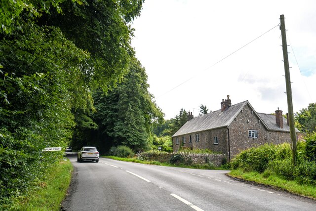
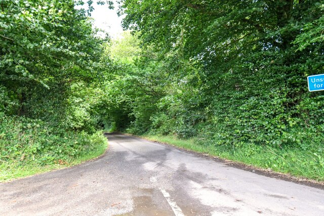
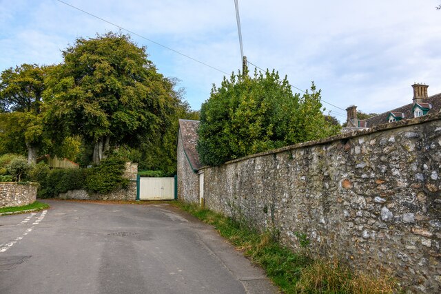
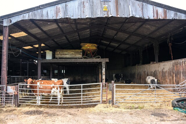
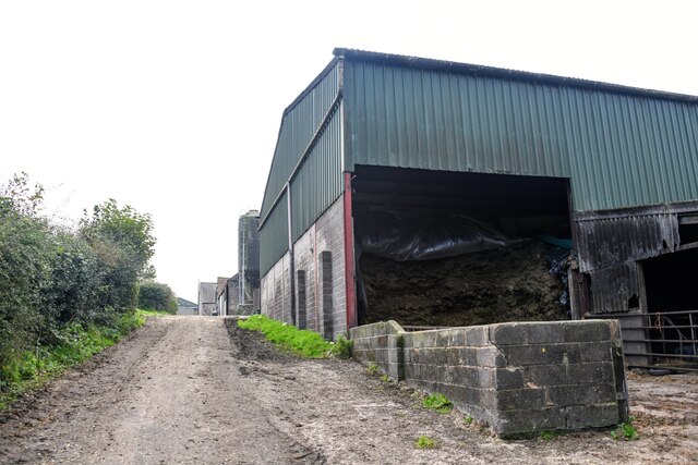
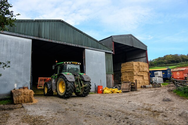
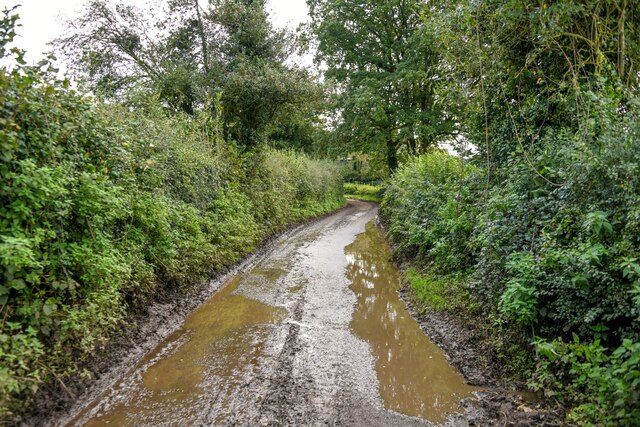
Blindmoor Images

Images are sourced within 2km of 50.920694/-3.0541468 or Grid Reference ST2614. Thanks to Geograph Open Source API. All images are credited.

Old Milestone by road, Dommett Moor, Northeast of Buckland St Mary The Milestone is located beside road under trees on the East of the road.  Parish of Buckland St Mary (South Somerset District). Carved stone post, Chard limestone post design, erected by the Chard turnpike trust in the 19th Century, becoming unreadable. 

Lost since 2002 when surveyed.

Inscription reads:-   
CHARD / 5 / TAUNTON / 8  

Grade II listed. List Entry Number: 1039992 <span class="nowrap"><a title="https://historicengland.org.uk/listing/the-list/list-entry/1039992" rel="nofollow ugc noopener" href="https://historicengland.org.uk/listing/the-list/list-entry/1039992">Link</a><img style="margin-left:2px;" alt="External link" title="External link - shift click to open in new window" src="https://s1.geograph.org.uk/img/external.png" width="10" height="10"/></span> 

Milestone Society National ID: SO_TACH08
Old Milestone by road, Dommett Moor, Northeast of Buckland St Mary
The Milestone is located beside road under trees on the East of the road.  Parish of Buckland St Mary (South Somerset District). Carved stone post, Chard limestone post design, erected by the Chard turnpike trust in the 19th Century, becoming unreadable.  Lost since 2002 when surveyed. Inscription reads:- CHARD / 5 / TAUNTON / 8 Grade II listed. List Entry Number: 1039992 LinkExternal link Milestone Society National ID: SO_TACH08
Staple Fitpaine : Castlemain Looking along the road.
Staple Fitpaine : Castlemain
Looking along the road.
Staple Fitpaine : Castlemain Looking along Castlemain.
Staple Fitpaine : Castlemain
Looking along Castlemain.
Curland : Road A road off Castlemain.
Curland : Road
A road off Castlemain.
Buckland St Mary : Road A road off Castlemain.
Buckland St Mary : Road
A road off Castlemain.
Buckland St Mary : Castlemain Looking along Castlemain.
Buckland St Mary : Castlemain
Looking along Castlemain.
Buckland St Mary : Castlemain Looking along Castlemain passing The Coach House.
Buckland St Mary : Castlemain
Looking along Castlemain passing The Coach House.
Buckland St Mary : Folly Lane Folly Lane off Castlemain.
Buckland St Mary : Folly Lane
Folly Lane off Castlemain.
Buckland St Mary : Fairend Lane Looking along a road through the village.
Buckland St Mary : Fairend Lane
Looking along a road through the village.
Buckland St Mary : Hillcrest Barn Hillcrest Barn in Buckland St Mary.
Buckland St Mary : Hillcrest Barn
Hillcrest Barn in Buckland St Mary.
Buckland St Mary : Pound Lane Looking along Pound Lane with dwellings alongside it.
Buckland St Mary : Pound Lane
Looking along Pound Lane with dwellings alongside it.
Buckland St Mary : Pound Lane Passing Pound Farm.
Buckland St Mary : Pound Lane
Passing Pound Farm.
Buckland St Mary : Pound Farm Looking towards the farmhouse from Pound Lane.
Buckland St Mary : Pound Farm
Looking towards the farmhouse from Pound Lane.
Buckland St Mary : Pound Farm Looking into one of the cattle barns.
Buckland St Mary : Pound Farm
Looking into one of the cattle barns.
Buckland St Mary : Pound Lane Passing Pound Farm.
Buckland St Mary : Pound Lane
Passing Pound Farm.
Buckland St Mary : Pound Farm Farm buildings off Pound Lane.
Buckland St Mary : Pound Farm
Farm buildings off Pound Lane.
Buckland St Mary : Pound Lane Looking along a wet looking Pound Lane.
Buckland St Mary : Pound Lane
Looking along a wet looking Pound Lane.
Buckland St Mary : Pound Lane Looking along Pound Lane.
Buckland St Mary : Pound Lane
Looking along Pound Lane.
Show me another place!

Blindmoor is located at Grid Ref: ST2614 (Lat: 50.920694, Lng: -3.0541468)

Administrative County: Somerset

District: South Somerset

Police Authority: Avon and Somerset

What 3 Words

///shuttled.emails.commands. Near Chard, Somerset

Related Wikis

Buckland St Mary

Buckland St Mary is a village and parish in Somerset, England, situated 6 miles (9.7 km) to the west of Ilminster and 8 miles (12.9 km) south of Taunton...

Bishopswood Meadows

Bishopswood Meadows is a nature reserve situated within the Blackdown Hills Area of Outstanding Natural Beauty in the county of Somerset, England. The...

Church of St Mary, Buckland St Mary

The Anglican Church of St Mary in Buckland St Mary, Somerset, England was built in 1853-1863. It is a Grade II* listed building. == History == The church...

Long Lye

Long Lye (grid reference ST265122) is an 11.7 hectare (29.0 acre) biological Site of Special Scientific Interest at Buckland St Mary in the Blackdown Hills...

Castle Neroche

Castle Neroche is a Norman motte-and-bailey castle on the site of an earlier hill fort in the parish of Curland, near Staple Fitzpaine, Somerset, England...

Long Lye Meadow

Long Lye Meadow (grid reference ST267119) is a 3.3 hectare biological Site of Special Scientific Interest at Buckland St Mary in the Blackdown Hills, Somerset...

Freshmoor

Freshmoor (grid reference ST280125) is an 11.2 hectare (27.7 acre) biological Site of Special Scientific Interest in Somerset, notified in 1989. Freshmoor...

Robin Hood's Butts

Robin Hood's Butts are a group of nine Bronze Age barrows near Otterford on the Blackdown Hills in Somerset, England. They have been scheduled as ancient...

Nearby Amenities

Located within 500m of 50.920694,-3.0541468
Power: pole
Source: bing
Transformer: distribution
Lat/Long: 50.9216182/-3.0590943
Power: pole
Source: bing
Lat/Long: 50.9214217/-3.0589467
Power: pole
Source: bing
Lat/Long: 50.9206574/-3.0588408
Power: pole
Source: bing
Lat/Long: 50.9200681/-3.0587509
Power: pole
Source: bing
Lat/Long: 50.9194053/-3.0590943
Power: pole
Source: bing
Lat/Long: 50.9191973/-3.0602852
The data included in this document is from www.openstreetmap.org. The data is made available under ODbL.

Have you been to Blindmoor?

Leave your review of Blindmoor below (or comments, questions and feedback).