Salum

Settlement in Argyllshire

Scotland

Salum

Sgeir a' Phartain The only bit of the mapped skerries that were above water at the time (Neap flood tide a couple of hours after low water).  Frustrating as the square to the south was undocumented here and on paper a bit of an easy bag in these conditions.
Sgeir a' Phartain Credit: Richard Webb

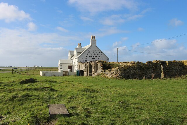
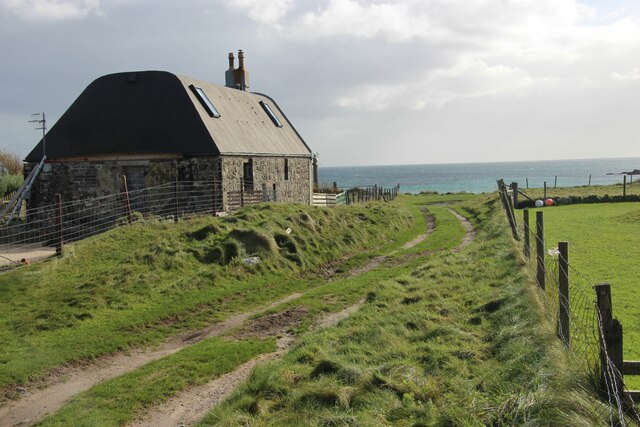
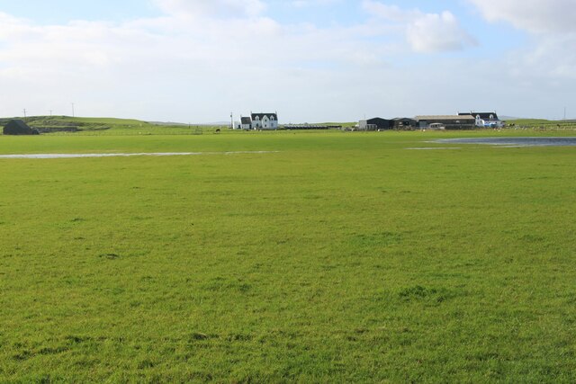
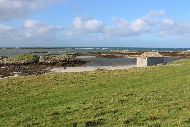
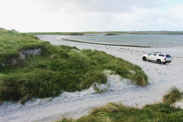
Salum is a small coastal village located in the region of Argyllshire, Scotland. Situated on the eastern shore of the Isle of Mull, it enjoys breathtaking views of the Sound of Mull and the surrounding mountains. With a population of around 200 residents, Salum is known for its serene and picturesque environment, making it a popular destination for nature lovers and those seeking tranquility.

The village is characterized by its traditional Scottish charm, with a few scattered cottages and houses along its winding streets. It offers a peaceful retreat from the hustle and bustle of urban life, surrounded by lush greenery and the calming sound of the waves crashing against the shore.

Salum's economy is primarily driven by tourism, as visitors flock to the area to explore its natural wonders. The village serves as an excellent base for outdoor activities such as hiking, birdwatching, and wildlife spotting. The nearby forests and hills offer numerous trails, providing opportunities for adventurous walkers to immerse themselves in the stunning Scottish landscape.

While Salum is a quiet village, it offers a few amenities to cater to the needs of both locals and tourists. There is a small grocery store, a quaint café, and a local pub where visitors can enjoy a traditional meal or a refreshing drink.

Overall, Salum in Argyllshire is a hidden gem that showcases the beauty of Scotland's countryside. Its untouched landscapes, friendly atmosphere, and peaceful surroundings make it an ideal destination for those seeking an authentic Scottish experience.

If you have any feedback on the listing, please let us know in the comments section below.
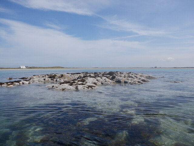
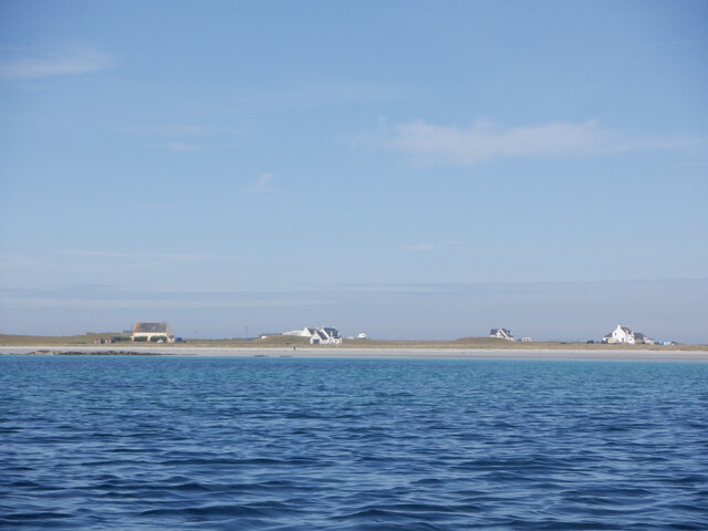
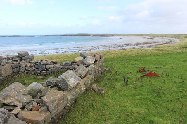
Salum Images

Images are sourced within 2km of 56.533585/-6.7704923 or Grid Reference NM0648. Thanks to Geograph Open Source API. All images are credited.

Sgeir a' Phartain The only bit of the mapped skerries that were above water at the time (Neap flood tide a couple of hours after low water).  Frustrating as the square to the south was undocumented here and on paper a bit of an easy bag in these conditions.
Sgeir a' Phartain
The only bit of the mapped skerries that were above water at the time (Neap flood tide a couple of hours after low water). Frustrating as the square to the south was undocumented here and on paper a bit of an easy bag in these conditions.
Houses, Gott Bay View from  Gott Bay, just above the mapped rocks.
Houses, Gott Bay
View from Gott Bay, just above the mapped rocks.
Vaul Bay, Tiree
Vaul Bay, Tiree
Silversands, a 'white house' by Tràigh Mhòr The old 'black house' sits alongside.
Silversands, a 'white house' by Tràigh Mhòr
The old 'black house' sits alongside.
A refurbished house at Ruaig
Coastal sward at The Reef
Store by the shore at Salum Bay
Salum Bay
Salum Bay
Wind turbine at Caolas
Croft buildings, northeast Tiree
Restored Tiree 'spotted' house
Milton Small fishing port at Milton
Milton
Small fishing port at Milton
Vaul Bay
Vaul Bay
Foreshore and beach at Ruaig, Tiree (Rubh'a' Phuirt Bhig) Looking over the beach, across Gott Bay, to Scarinish in the distance.
Foreshore and beach at Ruaig, Tiree (Rubh'a' Phuirt Bhig)
Looking over the beach, across Gott Bay, to Scarinish in the distance.
Old Plough at Vaul Bay
Sand ripples on Gott Beach
Reflections on Gott Beach
Icelandic horses, Tiree These horses are kept at Caolas and are used for 4 day treks around Tiree through the dunes and over the beaches
Icelandic horses, Tiree
These horses are kept at Caolas and are used for 4 day treks around Tiree through the dunes and over the beaches
Show me another place!

Salum is located at Grid Ref: NM0648 (Lat: 56.533585, Lng: -6.7704923)

Unitary Authority: Argyll and Bute

Police Authority: Argyll and West Dunbartonshire

What 3 Words

///hushed.index.plausible. Near Scarinish, Argyll & Bute

Related Wikis

Dun Mor Vaul

Dun Mor Vaul (or simply Dun Mor; Scottish Gaelic: Dùn Mòr) is an iron-age broch located on the north coast of the island of Tiree, in Scotland. ��2�...

Tiree

Tiree (; Scottish Gaelic: Tiriodh, pronounced [ˈtʲʰiɾʲəɣ]) is the most westerly island in the Inner Hebrides of Scotland. The low-lying island, southwest...

Scarinish

Scarinish (Scottish Gaelic: Sgairinis [ˈs̪kaɾʲɪnɪʃ]) is the main village on the island of Tiree, in the Inner Hebrides of Scotland. It is located on the...

Gunna, Scotland

Gunna (Gaelic: Gunnaigh) is an island in the Inner Hebrides of Scotland. == Geography and geology == Gunna lies between Coll and Tiree, closer to Coll...

Nearby Amenities

Located within 500m of 56.533585,-6.7704923
Passing Place
Lat/Long: 56.5355551/-6.7640313
Barrier: cattle_grid
Bicycle: yes
Foot: yes
Lat/Long: 56.5346144/-6.7714918
Post Box
Ref: PA77 144
Lat/Long: 56.5315186/-6.7761563
Salum
Name Gd: Sàlum
Place: hamlet
Lat/Long: 56.5373124/-6.7727026
Man Made: water_well
Lat/Long: 56.5358598/-6.7664305
Frequency: 50
Power: pole
Voltage: 11000
Lat/Long: 56.5334493/-6.7781883
Frequency: 50
Power: pole
Voltage: 11000
Lat/Long: 56.5337495/-6.7771181
Frequency: 50
Power: pole
Voltage: 11000
Lat/Long: 56.5343264/-6.7760962
Frequency: 50
Power: pole
Voltage: 11000
Lat/Long: 56.5354386/-6.7740658
Frequency: 50
Power: pole
Voltage: 11000
Lat/Long: 56.5359267/-6.7732236
Power: pole
Lat/Long: 56.5374101/-6.7719737
Power: pole
Lat/Long: 56.5368333/-6.7715391
Power: pole
Lat/Long: 56.536014/-6.7709008
Power: pole
Lat/Long: 56.5354172/-6.7704649
Power: pole
Lat/Long: 56.5351199/-6.771578
Power: pole
Lat/Long: 56.5348137/-6.7727502
Power: pole
Lat/Long: 56.5345105/-6.7738445
Power: pole
Lat/Long: 56.5342103/-6.774845
Power: pole
Lat/Long: 56.5338435/-6.7762397
Power: pole
Lat/Long: 56.5334826/-6.7775755
Frequency: 50
Power: pole
Voltage: 11000
Lat/Long: 56.5378075/-6.7679644
Frequency: 50
Power: pole
Voltage: 11000
Lat/Long: 56.5371021/-6.7701665
Frequency: 50
Power: pole
Voltage: 11000
Lat/Long: 56.5367382/-6.7712769
Frequency: 50
Power: pole
Voltage: 11000
Lat/Long: 56.5363714/-6.7724302
Ruaig
Name Gd: Rubhaig
Place: hamlet
Lat/Long: 56.5298337/-6.7665076
Power: pole
Lat/Long: 56.5367663/-6.7657328
Power: pole
Lat/Long: 56.5358405/-6.7690346
Power: pole
Lat/Long: 56.5295771/-6.7728798
Power: pole
Lat/Long: 56.5302456/-6.7736274
Power: pole
Lat/Long: 56.5305938/-6.7746304
Power: pole
Lat/Long: 56.5309886/-6.7752238
Power: pole
Lat/Long: 56.5313426/-6.7756757
Power: pole
Lat/Long: 56.5317257/-6.7761656
Power: pole
Lat/Long: 56.5297972/-6.7676239
Power: pole
Lat/Long: 56.5303061/-6.7675901
Power: pole
Lat/Long: 56.5312483/-6.7680441
Power: pole
Lat/Long: 56.5318177/-6.768798
Power: pole
Lat/Long: 56.5323196/-6.7694843
Power: pole
Lat/Long: 56.5328238/-6.7701389
Power: pole
Lat/Long: 56.5332896/-6.7707661
Power: pole
Lat/Long: 56.5336483/-6.7712264
Power: pole
Lat/Long: 56.5344436/-6.7722611
The data included in this document is from www.openstreetmap.org. The data is made available under ODbL.

Have you been to Salum?

Leave your review of Salum below (or comments, questions and feedback).