Tràigh Shathalum

Beach in Argyllshire

Scotland

Tràigh Shathalum

Coastal grassland at Urvaig
Coastal grassland at Urvaig Credit: Alan Reid

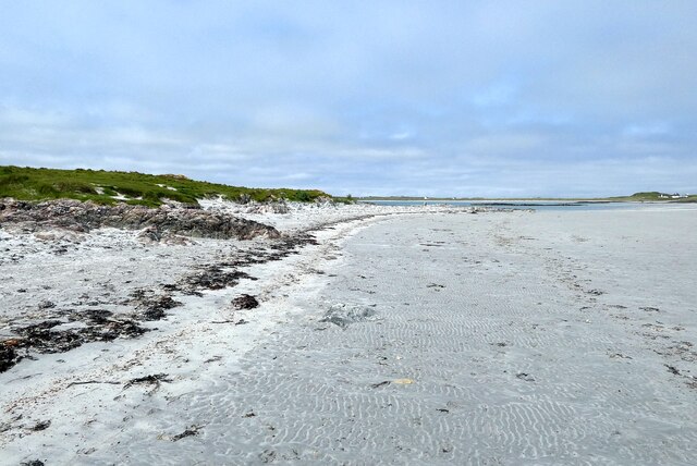
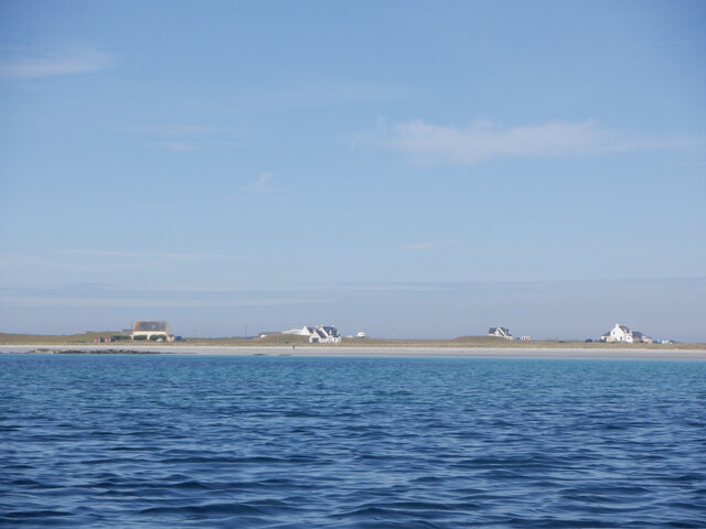
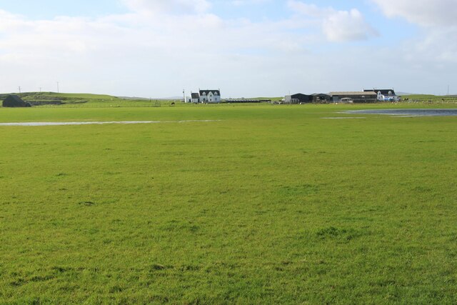
Tràigh Shathalum, located in Argyllshire, Scotland, is a picturesque beach renowned for its stunning natural beauty and tranquil atmosphere. Situated on the west coast of Scotland, this beach is a hidden gem that offers visitors an opportunity to escape the hustle and bustle of everyday life and immerse themselves in a peaceful and unspoiled environment.

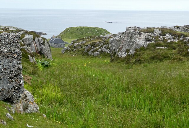
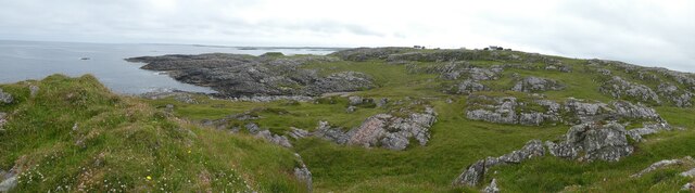
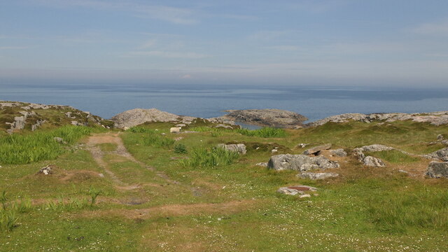
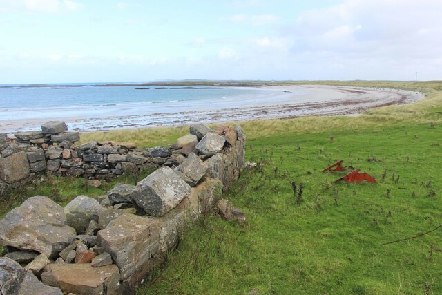
The beach stretches for approximately half a mile and is characterized by its soft golden sand and crystal-clear turquoise waters. Framed by rugged cliffs and surrounded by lush green hills, Tràigh Shathalum offers breathtaking panoramic views of the surrounding landscape, making it a haven for nature lovers and photographers alike.

The beach is known for its peacefulness, with visitors often remarking on the sense of solitude and serenity that can be enjoyed here. The absence of crowds and commercial development allows for a truly authentic and undisturbed beach experience.

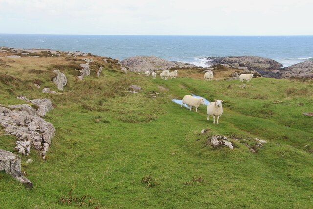
Tràigh Shathalum is also a popular spot for wildlife enthusiasts, as the area is home to a variety of bird species, including oystercatchers, gulls, and terns. Seals can also be spotted basking on the rocks, adding to the charm of this idyllic beach.

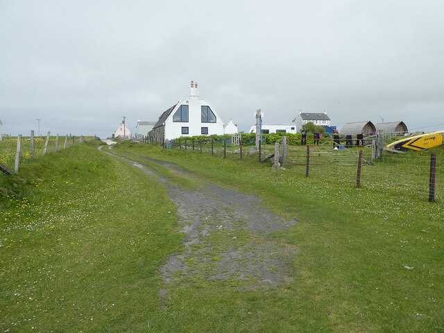
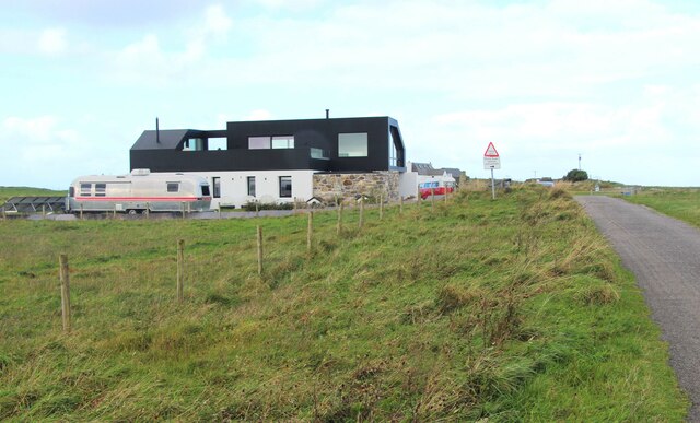
Access to Tràigh Shathalum is relatively easy, with a car park located nearby and a short walk leading down to the beach. Facilities such as toilets and picnic areas are available, ensuring visitors have everything they need for a comfortable day at the beach.

In summary, Tràigh Shathalum is a hidden gem on the west coast of Scotland, offering visitors a chance to escape to a peaceful and unspoiled beach surrounded by stunning natural beauty.

If you have any feedback on the listing, please let us know in the comments section below.

Tràigh Shathalum Images

Images are sourced within 2km of 56.539088/-6.7775848 or Grid Reference NM0648. Thanks to Geograph Open Source API. All images are credited.

Coastal grassland at Urvaig
On Eilean Ghreusgain The view across the beach from this tiny low tide island towards the croft house at Miodar.
On Eilean Ghreusgain
The view across the beach from this tiny low tide island towards the croft house at Miodar.
Looking across Vaul bay A view southwest from Urvaig.
Looking across Vaul bay
A view southwest from Urvaig.
Tiree - An Cnap north of Vaul Looking seaward from the rocky outcrops north of Vaul. A small renovated building can be seen lower down the slope. I think that the grassy knoll (11m, 36') beyond it is probably the site of Dun Beag Fort.
Tiree - An Cnap north of Vaul
Looking seaward from the rocky outcrops north of Vaul. A small renovated building can be seen lower down the slope. I think that the grassy knoll (11m, 36') beyond it is probably the site of Dun Beag Fort.
Tiree - An Cnap Triangulation Pillar The triangulation pillar (trig point) seen here is at An Cnap north of Vaul. It is at the modest height of 23m (75') ... but that's quite high for Tiree!
Tiree - An Cnap Triangulation Pillar
The triangulation pillar (trig point) seen here is at An Cnap north of Vaul. It is at the modest height of 23m (75') ... but that's quite high for Tiree!
Tiree - Northern coast north of Vaul from Dùn Mòr broch A panoramic view of the northern coast of Tiree north of Vaul as seen from the elevated position of Dùn Mòr broch. Dun Beag Fort is situated along this coastline but is not obvious in this image. 
The houses seen in the distance are near <a href="https://www.geograph.org.uk/photo/6904545">NM0449 : Tiree - An Cnap Triangulation Pillar</a> towards the north of the settlement of Vaul.
Tiree - Northern coast north of Vaul from Dùn Mòr broch
A panoramic view of the northern coast of Tiree north of Vaul as seen from the elevated position of Dùn Mòr broch. Dun Beag Fort is situated along this coastline but is not obvious in this image. The houses seen in the distance are near NM0449 : Tiree - An Cnap Triangulation Pillar towards the north of the settlement of Vaul.
Tiree - Ruaig - looking along the track from Tràigh Crionaig According to the map the "yellow" (i.e. tarmacked) road through Ruaig continues all the way to the coast, but as can be seen from this image the tarmac actually runs out with quite a few yards to go.
Tiree - Ruaig - looking along the track from Tràigh Crionaig
According to the map the "yellow" (i.e. tarmacked) road through Ruaig continues all the way to the coast, but as can be seen from this image the tarmac actually runs out with quite a few yards to go.
Tiree - Oystercatchers (Haematopus ostralegus) on a rock A small gathering of oystercatchers (Haematopus ostralegus) on a rock on Tràigh Crìonaig south of Ruaig.
Tiree - Oystercatchers (Haematopus ostralegus) on a rock
A small gathering of oystercatchers (Haematopus ostralegus) on a rock on Tràigh Crìonaig south of Ruaig.
Tiree - Rubh' a' Phuirt Bhig and the edge of Carsamull Looking along the edge of the rocky outcrop of Carsamull towards Rubh' a' Phuirt Bhig (the point of land). This rock platform (off to the left) joins the island of Soa to the mainland of Tiree at low tide.
Tiree - Rubh' a' Phuirt Bhig and the edge of Carsamull
Looking along the edge of the rocky outcrop of Carsamull towards Rubh' a' Phuirt Bhig (the point of land). This rock platform (off to the left) joins the island of Soa to the mainland of Tiree at low tide.
Houses, Gott Bay View from  Gott Bay, just above the mapped rocks.
Houses, Gott Bay
View from Gott Bay, just above the mapped rocks.
Tigh Dubh House on the machair, east side of Tiree.
Tigh Dubh
House on the machair, east side of Tiree.
Track, Vaul
Track, Vaul
A grassy track by An Cnap
A modern house at Vaul
Vaul Bay, Tiree
Vaul Bay, Tiree
Silversands, a 'white house' by Tràigh Mhòr The old 'black house' sits alongside.
Silversands, a 'white house' by Tràigh Mhòr
The old 'black house' sits alongside.
A refurbished house at Ruaig
Coastal sward at The Reef
Show me another place!

Tràigh Shathalum is located at Grid Ref: NM0648 (Lat: 56.539088, Lng: -6.7775848)

Unitary Authority: Argyll and Bute

Police Authority: Argyll and West Dunbartonshire

What 3 Words

///event.dugouts.cabbages. Near Scarinish, Argyll & Bute

Related Wikis

Dun Mor Vaul

Dun Mor Vaul (or simply Dun Mor; Scottish Gaelic: Dùn Mòr) is an iron-age broch located on the north coast of the island of Tiree, in Scotland. ��2�...

Tiree

Tiree (; Scottish Gaelic: Tiriodh, pronounced [ˈtʲʰiɾʲəɣ]) is the most westerly island in the Inner Hebrides of Scotland. The low-lying island, southwest...

Scarinish

Scarinish (Scottish Gaelic: Sgairinis [ˈs̪kaɾʲɪnɪʃ]) is the main village on the island of Tiree, in the Inner Hebrides of Scotland. It is located on the...

Gunna, Scotland

Gunna (Gaelic: Gunnaigh) is an island in the Inner Hebrides of Scotland. == Geography and geology == Gunna lies between Coll and Tiree, closer to Coll...

Tiree Airport

Tiree Airport (Scottish Gaelic: Port-adhair Thiriodh) (IATA: TRE, ICAO: EGPU) is located 2.5 nautical miles (4.6 km; 2.9 mi) north northeast of Balemartine...

Tiree Music Festival

Tiree Music Festival is a Scottish folk music festival held annually on the Island of Tiree in the Inner Hebrides. The festival was founded in 2010 by...

Nearby Amenities

Located within 500m of 56.539088,-6.7775848
Created By: dmgroom_coastlines
Source: PGS
Lat/Long: 56.53714/-6.78483
Created By: dmgroom_coastlines
Source: PGS
Lat/Long: 56.53712/-6.78437
Created By: dmgroom_coastlines
Source: PGS
Lat/Long: 56.53686/-6.78345
Created By: dmgroom_coastlines
Source: PGS
Lat/Long: 56.53685/-6.78253
Created By: dmgroom_coastlines
Source: PGS
Lat/Long: 56.53709/-6.78159
Created By: dmgroom_coastlines
Source: PGS
Lat/Long: 56.53708/-6.78112
Created By: dmgroom_coastlines
Source: PGS
Lat/Long: 56.53681/-6.78068
Created By: dmgroom_coastlines
Source: PGS
Lat/Long: 56.5368/-6.78021
Created By: dmgroom_coastlines
Source: PGS
Lat/Long: 56.53705/-6.77974
Created By: dmgroom_coastlines
Source: PGS
Lat/Long: 56.53729/-6.77879
Created By: dmgroom_coastlines
Source: PGS
Lat/Long: 56.5374/-6.77785
Created By: dmgroom_coastlines
Source: PGS
Lat/Long: 56.53766/-6.77761
Created By: dmgroom_coastlines
Source: PGS
Lat/Long: 56.5379/-6.77714
Created By: dmgroom_coastlines
Source: PGS
Lat/Long: 56.53841/-6.77687
Created By: dmgroom_coastlines
Source: PGS
Lat/Long: 56.53839/-6.77595
Created By: dmgroom_coastlines
Source: PGS
Lat/Long: 56.53942/-6.77589
Created By: dmgroom_coastlines
Source: PGS
Lat/Long: 56.5394/-6.77496
Created By: dmgroom_coastlines
Source: PGS
Lat/Long: 56.54016/-6.77469
Source: PGS
Lat/Long: 56.5404771/-6.7739868
Source: PGS
Lat/Long: 56.5407575/-6.7740887
Source: PGS
Lat/Long: 56.5410556/-6.7744964
Source: PGS
Lat/Long: 56.5415182/-6.7746037
Source: PGS
Lat/Long: 56.5417465/-6.7747442
Source: PGS
Lat/Long: 56.5423108/-6.774609
Source: PGS
Lat/Long: 56.54248/-6.7739814
Source: PGS
Lat/Long: 56.5429082/-6.7733806
Barrier: cattle_grid
Bicycle: yes
Foot: yes
Lat/Long: 56.5383362/-6.773634
Salum
Name Gd: Sàlum
Place: hamlet
Lat/Long: 56.5373124/-6.7727026
Frequency: 50
Power: pole
Voltage: 11000
Lat/Long: 56.5354386/-6.7740658
Frequency: 50
Power: pole
Voltage: 11000
Lat/Long: 56.5359267/-6.7732236
Power: pole
Lat/Long: 56.5374101/-6.7719737
Power: pole
Lat/Long: 56.5368333/-6.7715391
Frequency: 50
Power: pole
Voltage: 11000
Lat/Long: 56.5367382/-6.7712769
Frequency: 50
Power: pole
Voltage: 11000
Lat/Long: 56.5363714/-6.7724302
Power: pole
Lat/Long: 56.5410559/-6.7728735
Power: pole
Lat/Long: 56.5403772/-6.7724892
Power: pole
Lat/Long: 56.5396809/-6.7728482
Power: pole
Lat/Long: 56.5389602/-6.7731184
Power: pole
Lat/Long: 56.5384188/-6.7732071
Power: pole
Lat/Long: 56.5381353/-6.7725599
The data included in this document is from www.openstreetmap.org. The data is made available under ODbL.

Have you been to Tràigh Shathalum?

Leave your review of Tràigh Shathalum below (or comments, questions and feedback).