Tromslum Beag

Island in Argyllshire

Scotland

Tromslum Beag

Tiree - An Cnap north of Vaul Looking seaward from the rocky outcrops north of Vaul. A small renovated building can be seen lower down the slope. I think that the grassy knoll (11m, 36') beyond it is probably the site of Dun Beag Fort.
Tiree - An Cnap north of Vaul Credit: Rob Farrow

Tromslum Beag is a small island located off the western coast of Scotland in the region of Argyllshire. Covering an area of approximately 2 square kilometers, it is situated in the Inner Hebrides, a picturesque archipelago known for its stunning landscapes and rich cultural heritage.

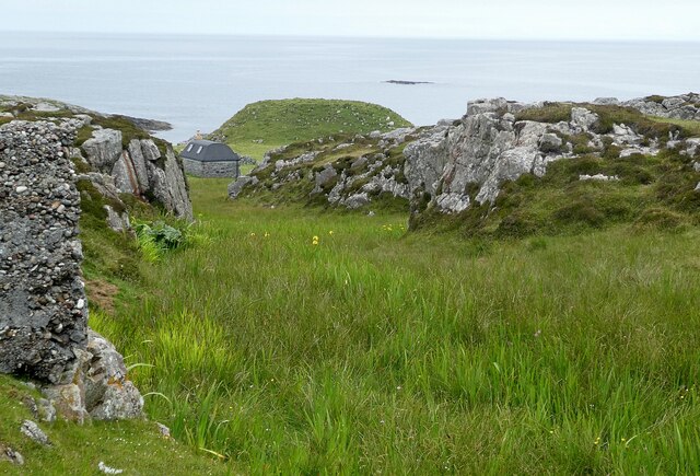
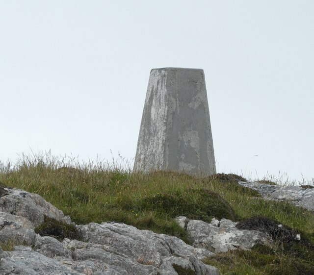
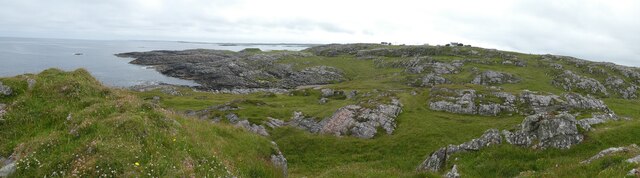
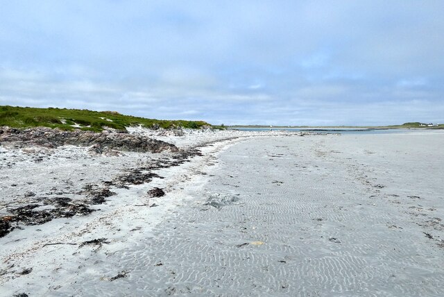
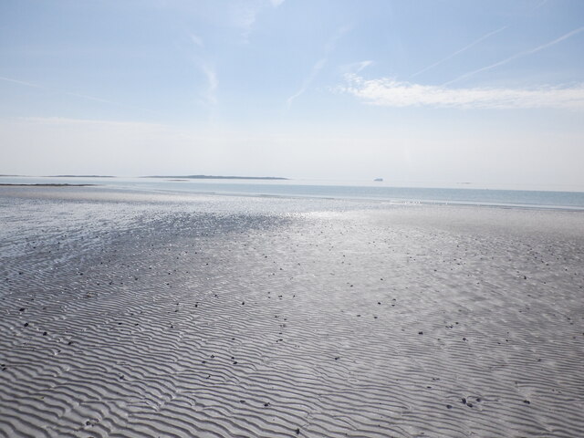
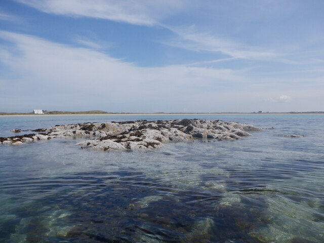
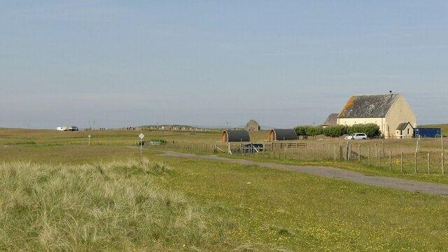
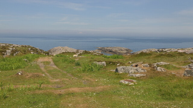
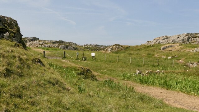
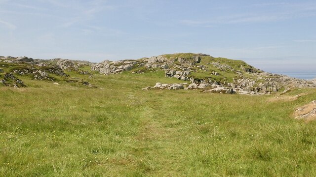
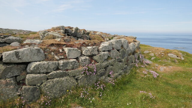
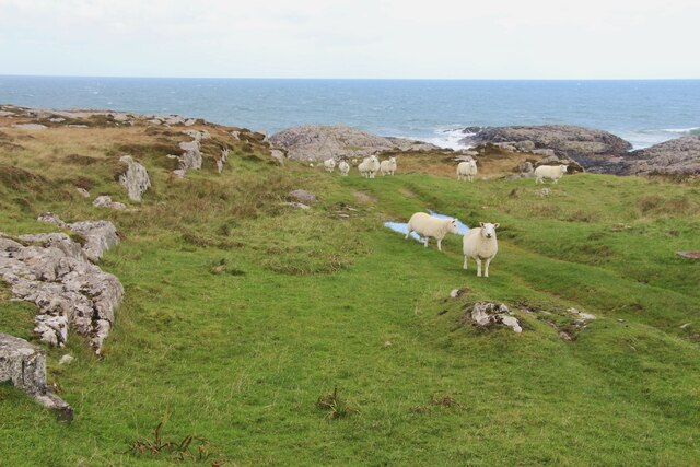
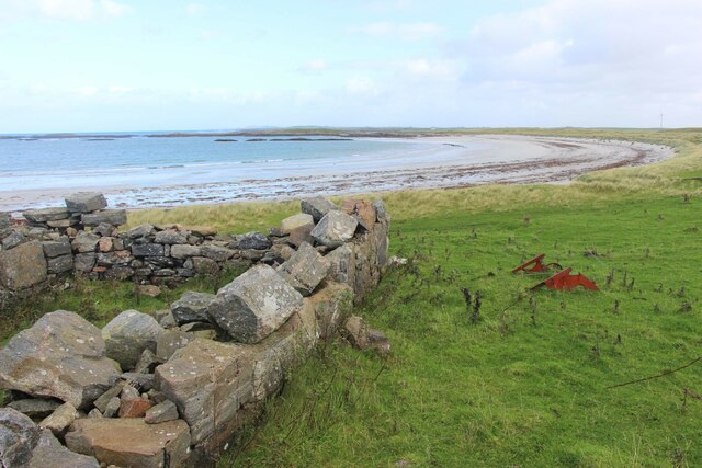
The island boasts a diverse topography, characterized by rolling hills, rocky cliffs, and lush green meadows. It is home to a variety of flora and fauna, including seabirds, otters, and seals, making it a haven for nature enthusiasts and wildlife lovers. The coastal areas are adorned with beautiful sandy beaches, providing opportunities for leisurely walks and relaxation.

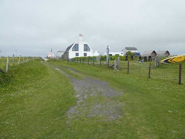
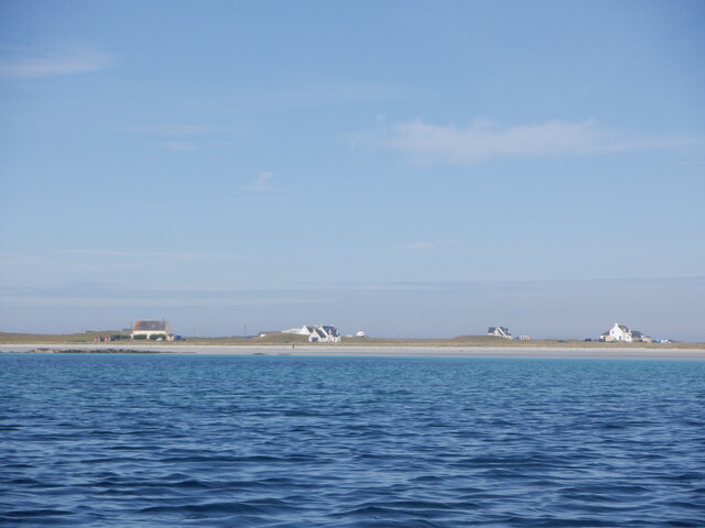
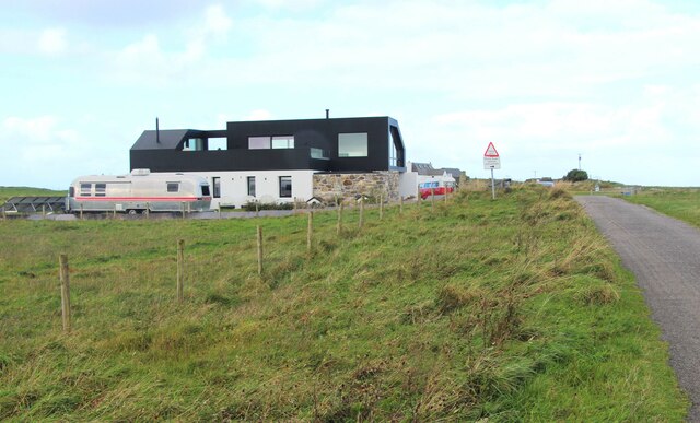
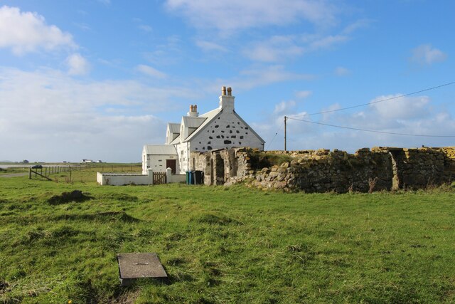
Tromslum Beag offers a tranquil and peaceful atmosphere, attracting visitors seeking a retreat from the hustle and bustle of city life. The island's small population resides in a charming village, where visitors can experience the warmth and hospitality of the local community. Traditional Scottish culture is deeply rooted in the island's heritage, and visitors can immerse themselves in the rich history and folklore through storytelling, music, and local festivals.

Recreational activities on the island include hiking, fishing, and birdwatching. The surrounding waters are also ideal for sailing and boating, offering visitors the chance to explore the stunning coastline and nearby islands.

Access to Tromslum Beag is primarily by boat, with regular ferry services available from the mainland. The island's remote location and untouched beauty make it a hidden gem for those seeking an authentic Scottish island experience.

If you have any feedback on the listing, please let us know in the comments section below.

Tromslum Beag Images

Images are sourced within 2km of 56.5375/-6.7818946 or Grid Reference NM0648. Thanks to Geograph Open Source API. All images are credited.

Tiree - An Cnap north of Vaul Looking seaward from the rocky outcrops north of Vaul. A small renovated building can be seen lower down the slope. I think that the grassy knoll (11m, 36') beyond it is probably the site of Dun Beag Fort.
Tiree - An Cnap north of Vaul
Looking seaward from the rocky outcrops north of Vaul. A small renovated building can be seen lower down the slope. I think that the grassy knoll (11m, 36') beyond it is probably the site of Dun Beag Fort.
Tiree - An Cnap Triangulation Pillar The triangulation pillar (trig point) seen here is at An Cnap north of Vaul. It is at the modest height of 23m (75') ... but that's quite high for Tiree!
Tiree - An Cnap Triangulation Pillar
The triangulation pillar (trig point) seen here is at An Cnap north of Vaul. It is at the modest height of 23m (75') ... but that's quite high for Tiree!
Tiree - Northern coast north of Vaul from Dùn Mòr broch A panoramic view of the northern coast of Tiree north of Vaul as seen from the elevated position of Dùn Mòr broch. Dun Beag Fort is situated along this coastline but is not obvious in this image. 
The houses seen in the distance are near <a href="https://www.geograph.org.uk/photo/6904545">NM0449 : Tiree - An Cnap Triangulation Pillar</a> towards the north of the settlement of Vaul.
Tiree - Northern coast north of Vaul from Dùn Mòr broch
A panoramic view of the northern coast of Tiree north of Vaul as seen from the elevated position of Dùn Mòr broch. Dun Beag Fort is situated along this coastline but is not obvious in this image. The houses seen in the distance are near NM0449 : Tiree - An Cnap Triangulation Pillar towards the north of the settlement of Vaul.
Tiree - Ruaig - looking along the track from Tràigh Crionaig According to the map the "yellow" (i.e. tarmacked) road through Ruaig continues all the way to the coast, but as can be seen from this image the tarmac actually runs out with quite a few yards to go.
Tiree - Ruaig - looking along the track from Tràigh Crionaig
According to the map the "yellow" (i.e. tarmacked) road through Ruaig continues all the way to the coast, but as can be seen from this image the tarmac actually runs out with quite a few yards to go.
Tiree - Oystercatchers (Haematopus ostralegus) on a rock A small gathering of oystercatchers (Haematopus ostralegus) on a rock on Tràigh Crìonaig south of Ruaig.
Tiree - Oystercatchers (Haematopus ostralegus) on a rock
A small gathering of oystercatchers (Haematopus ostralegus) on a rock on Tràigh Crìonaig south of Ruaig.
Tiree - Rubh' a' Phuirt Bhig and the edge of Carsamull Looking along the edge of the rocky outcrop of Carsamull towards Rubh' a' Phuirt Bhig (the point of land). This rock platform (off to the left) joins the island of Soa to the mainland of Tiree at low tide.
Tiree - Rubh' a' Phuirt Bhig and the edge of Carsamull
Looking along the edge of the rocky outcrop of Carsamull towards Rubh' a' Phuirt Bhig (the point of land). This rock platform (off to the left) joins the island of Soa to the mainland of Tiree at low tide.
Tràigh Mhòr, Tiree Arriving ferry in the distance.
Tràigh Mhòr, Tiree
Arriving ferry in the distance.
Sgeir a' Phartain The only bit of the mapped skerries that were above water at the time (Neap flood tide a couple of hours after low water).  Frustrating as the square to the south was undocumented here and on paper a bit of an easy bag in these conditions.
Sgeir a' Phartain
The only bit of the mapped skerries that were above water at the time (Neap flood tide a couple of hours after low water). Frustrating as the square to the south was undocumented here and on paper a bit of an easy bag in these conditions.
Houses, Gott Bay View from  Gott Bay, just above the mapped rocks.
Houses, Gott Bay
View from Gott Bay, just above the mapped rocks.
Kirkapol, Tiree
Kirkapol, Tiree
Track, Vaul
Track, Vaul
Track beneath Dùn Mòr A pleasant short walk to a fine broch.
Track beneath Dùn Mòr
A pleasant short walk to a fine broch.
Dùn Mòr A broch on the north coast of Tiree.
Dùn Mòr
A broch on the north coast of Tiree.
Dùn Mòr Surviving wall of a broch.  Dùn Mòr has been excavated in the recent past and very recognisable broch features can be seen.
Dùn Mòr
Surviving wall of a broch. Dùn Mòr has been excavated in the recent past and very recognisable broch features can be seen.
A grassy track by An Cnap
A modern house at Vaul
Vaul Bay, Tiree
Vaul Bay, Tiree
Silversands, a 'white house' by Tràigh Mhòr The old 'black house' sits alongside.
Silversands, a 'white house' by Tràigh Mhòr
The old 'black house' sits alongside.
Show me another place!

Tromslum Beag is located at Grid Ref: NM0648 (Lat: 56.5375, Lng: -6.7818946)

Unitary Authority: Argyll and Bute

Police Authority: Argyll and West Dunbartonshire

What 3 Words

///slack.sigh.slippery. Near Scarinish, Argyll & Bute

Related Wikis

Dun Mor Vaul

Dun Mor Vaul (or simply Dun Mor; Scottish Gaelic: Dùn Mòr) is an iron-age broch located on the north coast of the island of Tiree, in Scotland. ��2�...

Tiree

Tiree (; Scottish Gaelic: Tiriodh, pronounced [ˈtʲʰiɾʲəɣ]) is the most westerly island in the Inner Hebrides of Scotland. The low-lying island, southwest...

Scarinish

Scarinish (Scottish Gaelic: Sgairinis [ˈs̪kaɾʲɪnɪʃ]) is the main village on the island of Tiree, in the Inner Hebrides of Scotland. It is located on the...

Gunna, Scotland

Gunna (Gaelic: Gunnaigh) is an island in the Inner Hebrides of Scotland. == Geography and geology == Gunna lies between Coll and Tiree, closer to Coll...

Tiree Airport

Tiree Airport (Scottish Gaelic: Port-adhair Thiriodh) (IATA: TRE, ICAO: EGPU) is located 2.5 nautical miles (4.6 km; 2.9 mi) north northeast of Balemartine...

Tiree Music Festival

Tiree Music Festival is a Scottish folk music festival held annually on the Island of Tiree in the Inner Hebrides. The festival was founded in 2010 by...

Nearby Amenities

Located within 500m of 56.5375,-6.7818946
Created By: dmgroom_coastlines
Source: PGS
Lat/Long: 56.53736/-6.78968
Created By: dmgroom_coastlines
Source: PGS
Lat/Long: 56.53761/-6.78967
Created By: dmgroom_coastlines
Source: PGS
Lat/Long: 56.53813/-6.78987
Created By: dmgroom_coastlines
Source: PGS
Lat/Long: 56.53799/-6.78942
Created By: dmgroom_coastlines
Source: PGS
Lat/Long: 56.53773/-6.78897
Created By: dmgroom_coastlines
Source: PGS
Lat/Long: 56.53759/-6.78851
Created By: dmgroom_coastlines
Source: PGS
Lat/Long: 56.53836/-6.78824
Created By: dmgroom_coastlines
Source: PGS
Lat/Long: 56.53861/-6.78822
Created By: dmgroom_coastlines
Source: PGS
Lat/Long: 56.53874/-6.78844
Created By: dmgroom_coastlines
Source: PGS
Lat/Long: 56.53888/-6.78867
Created By: dmgroom_coastlines
Source: PGS
Lat/Long: 56.53901/-6.78889
Created By: dmgroom_coastlines
Source: PGS
Lat/Long: 56.53914/-6.78912
Created By: dmgroom_coastlines
Source: PGS
Lat/Long: 56.54015/-6.78813
Created By: dmgroom_coastlines
Source: PGS
Lat/Long: 56.53963/-6.78793
Created By: dmgroom_coastlines
Source: PGS
Lat/Long: 56.53962/-6.787
Created By: dmgroom_coastlines
Source: PGS
Lat/Long: 56.53884/-6.78682
Created By: dmgroom_coastlines
Source: PGS
Lat/Long: 56.53782/-6.78688
Created By: dmgroom_coastlines
Source: PGS
Lat/Long: 56.53731/-6.78714
Created By: dmgroom_coastlines
Source: PGS
Lat/Long: 56.53715/-6.78529
Created By: dmgroom_coastlines
Source: PGS
Lat/Long: 56.53714/-6.78483
Created By: dmgroom_coastlines
Source: PGS
Lat/Long: 56.53712/-6.78437
Created By: dmgroom_coastlines
Source: PGS
Lat/Long: 56.53686/-6.78345
Created By: dmgroom_coastlines
Source: PGS
Lat/Long: 56.53685/-6.78253
Created By: dmgroom_coastlines
Source: PGS
Lat/Long: 56.53709/-6.78159
Created By: dmgroom_coastlines
Source: PGS
Lat/Long: 56.53708/-6.78112
Created By: dmgroom_coastlines
Source: PGS
Lat/Long: 56.53681/-6.78068
Created By: dmgroom_coastlines
Source: PGS
Lat/Long: 56.5368/-6.78021
Created By: dmgroom_coastlines
Source: PGS
Lat/Long: 56.53705/-6.77974
Created By: dmgroom_coastlines
Source: PGS
Lat/Long: 56.53729/-6.77879
Created By: dmgroom_coastlines
Source: PGS
Lat/Long: 56.5374/-6.77785
Created By: dmgroom_coastlines
Source: PGS
Lat/Long: 56.53766/-6.77761
Created By: dmgroom_coastlines
Source: PGS
Lat/Long: 56.5379/-6.77714
Created By: dmgroom_coastlines
Source: PGS
Lat/Long: 56.53841/-6.77687
Created By: dmgroom_coastlines
Source: PGS
Lat/Long: 56.53839/-6.77595
Created By: dmgroom_coastlines
Source: PGS
Lat/Long: 56.53942/-6.77589
Created By: dmgroom_coastlines
Source: PGS
Lat/Long: 56.5394/-6.77496
The data included in this document is from www.openstreetmap.org. The data is made available under ODbL.

Have you been to Tromslum Beag?

Leave your review of Tromslum Beag below (or comments, questions and feedback).