Salendine Nook

Settlement in Yorkshire

England

Salendine Nook

The 643, Lindley Moor Road
The 643, Lindley Moor Road Credit: Ian S

Salendine Nook is a suburban area located in Huddersfield, West Yorkshire, England. It is nestled on the southern slopes of the Pennines, offering picturesque views of the surrounding countryside. The area is part of the larger Kirklees district and falls within the HD3 postcode.

Salendine Nook is primarily a residential neighborhood, known for its tranquil and family-friendly atmosphere. The housing stock consists of a mixture of detached and semi-detached houses, as well as some modern apartment buildings. The area has experienced significant growth in recent years, with new developments catering to the increasing demand for housing.

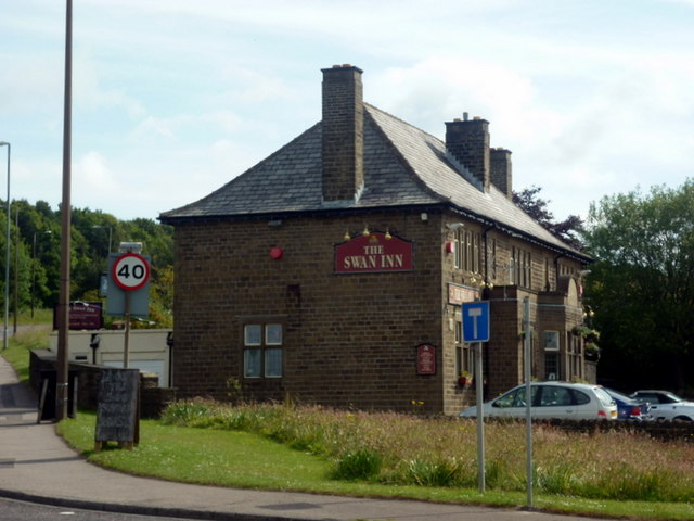
The neighborhood is well-served by a range of amenities, including a number of local shops, supermarkets, and restaurants, providing convenient options for everyday needs. There are also several primary and secondary schools in the area, making it an appealing choice for families with children.

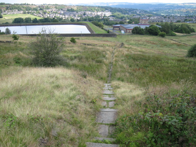
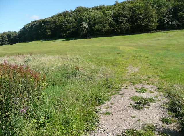
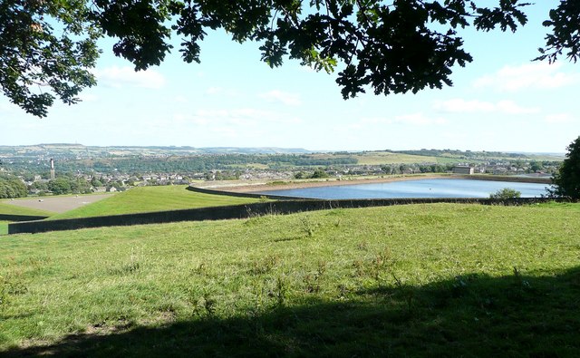
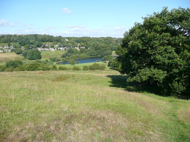
Salendine Nook benefits from its proximity to the beautiful countryside, offering residents ample opportunities for outdoor activities such as hiking, cycling, and picnicking. The nearby Castle Hill, a prominent landmark and historic site, provides stunning panoramic views of the surrounding area.

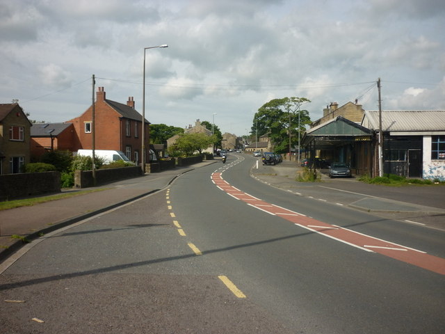
Transport links in Salendine Nook are excellent, with regular bus services connecting the area to Huddersfield town center and other neighboring towns. The M62 motorway is easily accessible, providing convenient connections to major cities like Leeds and Manchester.

In summary, Salendine Nook is a charming residential area in Yorkshire with a peaceful ambiance, stunning natural surroundings, and excellent amenities. It is an ideal place for families and individuals seeking a serene suburban lifestyle within easy reach of urban conveniences.

If you have any feedback on the listing, please let us know in the comments section below.

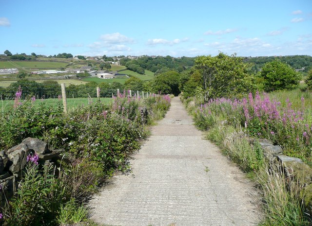
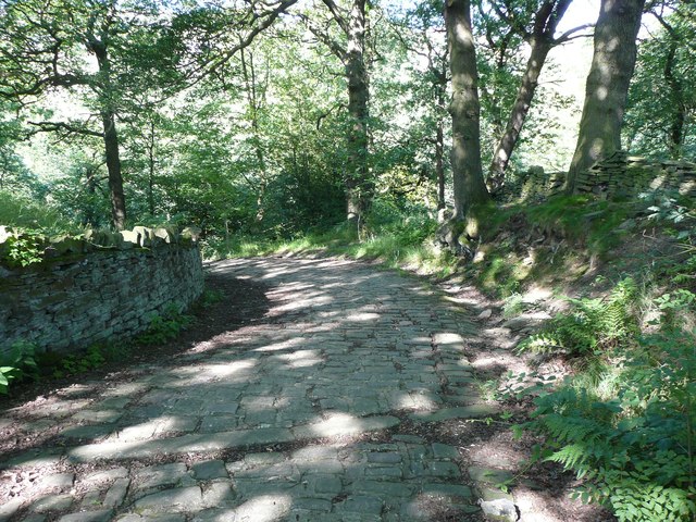
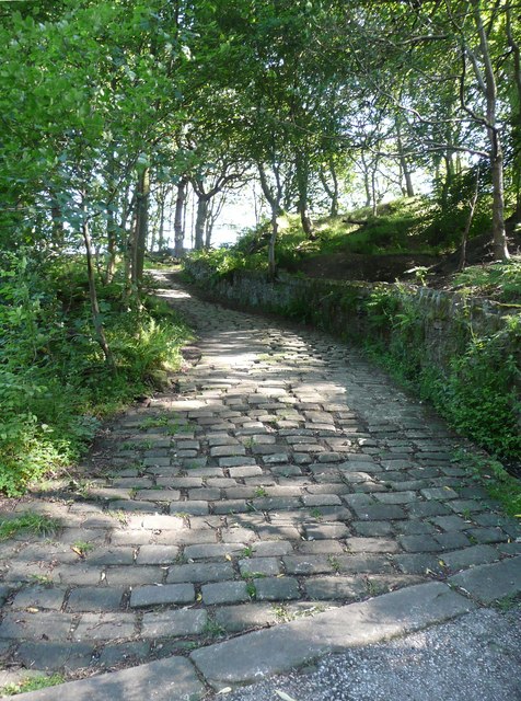
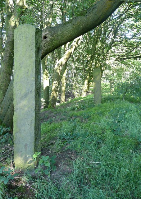
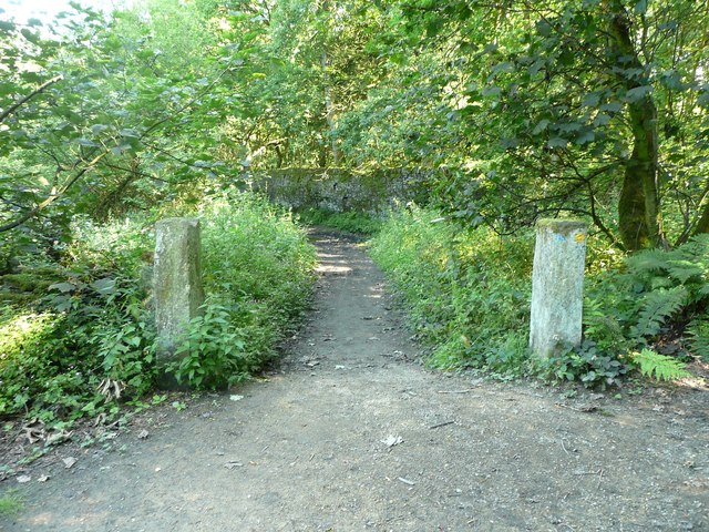
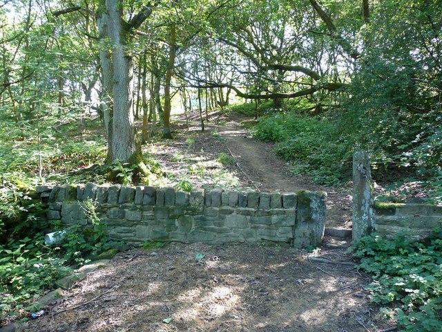
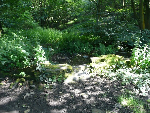
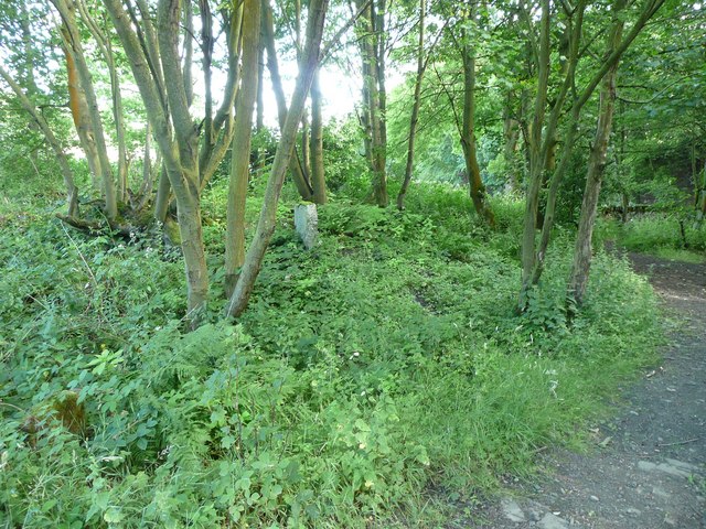
Salendine Nook Images

Images are sourced within 2km of 53.654785/-1.841096 or Grid Reference SE1017. Thanks to Geograph Open Source API. All images are credited.

The 643, Lindley Moor Road
The A640, New Hey Road, goes over the M62
The Swan Inn on New Hey Road, Outlane
New Hey Road, Outlane
Footpath to Longwood Reservoir
Path across the golf course, Longwood This path leads to Nettleton Hill via the site of Petty Royd, with a branch up through Pighill Wood.
Path across the golf course, Longwood
This path leads to Nettleton Hill via the site of Petty Royd, with a branch up through Pighill Wood.
Shaw Lane, Longwood An old lane, shown on the 1850 six-inch map, now with a modern concrete surface.
Shaw Lane, Longwood
An old lane, shown on the 1850 six-inch map, now with a modern concrete surface.
Shaw Lane, Longwood The bend at the top of the climb up through Hirst Wood.
Shaw Lane, Longwood
The bend at the top of the climb up through Hirst Wood.
Shaw Lane, Longwood The climb up through Hirst Wood. Paving this lane with setts must have been expensive; was it paid for by the owner of Shaw, or by the township?
Shaw Lane, Longwood
The climb up through Hirst Wood. Paving this lane with setts must have been expensive; was it paid for by the owner of Shaw, or by the township?
Site of Petty Royd, Longwood From the name I assume that this was a farmstead made by clearing woodland in the medieval or early modern period. There is very little of the buildings left now.
Site of Petty Royd, Longwood
From the name I assume that this was a farmstead made by clearing woodland in the medieval or early modern period. There is very little of the buildings left now.
Stone posts at Petty Royd, Longwood It seems likely that these are tenter posts, but not the usual type. The cloth pieces were stretched between the post and a hook on the wall of a weaver's cottage. (information from Ian Beesley via Chris Allen)
Stone posts at Petty Royd, Longwood
It seems likely that these are tenter posts, but not the usual type. The cloth pieces were stretched between the post and a hook on the wall of a weaver's cottage. (information from Ian Beesley via Chris Allen)
Footpath east of Petty Royd, Longwood Eventually this path splits, with one way down to Leys and one along the top side of Longwood Reservoir.
Footpath east of Petty Royd, Longwood
Eventually this path splits, with one way down to Leys and one along the top side of Longwood Reservoir.
Entrance to Hirst Mill, Longwood Not very grand, but presumably there was a gate here at one time.
Entrance to Hirst Mill, Longwood
Not very grand, but presumably there was a gate here at one time.
Footpath in Hirst Wood, Longwood This looks very tidy, with the wall and stile repaired and an edging to the path, which leads onto and across the golf course.
Footpath in Hirst Wood, Longwood
This looks very tidy, with the wall and stile repaired and an edging to the path, which leads onto and across the golf course.
Ruin in the site of Hirst Mill, Longwood  Not enough left to guess what part of the mill this was. Hirst Mill was founded at the end of the 19C, and functioned until the early 20C.
Ruin in the site of Hirst Mill, Longwood
Not enough left to guess what part of the mill this was. Hirst Mill was founded at the end of the 19C, and functioned until the early 20C.
Site of Hirst Mill Cottages, Longwood There were two cottages here until the 1950s. Now all that is left is what looks like a gravestone.
Site of Hirst Mill Cottages, Longwood
There were two cottages here until the 1950s. Now all that is left is what looks like a gravestone.
Longwood Reservoir An open reservoir that collects water from springs, a treatment works beyond, and a covered reservoir, presumably for treated water, below (to the left).
Longwood Reservoir
An open reservoir that collects water from springs, a treatment works beyond, and a covered reservoir, presumably for treated water, below (to the left).
Footpath to Leys Farm, Longwood The farm is hidden by the trees. Beyond is Longwood Compensation Reservoir, and the houses are along Lamb Hall Road.
Footpath to Leys Farm, Longwood
The farm is hidden by the trees. Beyond is Longwood Compensation Reservoir, and the houses are along Lamb Hall Road.
Show me another place!

Salendine Nook is located at Grid Ref: SE1017 (Lat: 53.654785, Lng: -1.841096)

Division: West Riding

Unitary Authority: Kirklees

Police Authority: West Yorkshire

What 3 Words

///smashes.film.across. Near Holywell Green, West Yorkshire

Related Wikis

Huddersfield New College

Huddersfield New College is a former grammar school and current sixth form college located in Salendine Nook on the outskirts of Huddersfield, in the county...

Salendine Nook High School

Salendine Nook High School Academy is a large secondary school in Huddersfield, West Yorkshire, England. It is adjacent to Huddersfield New College....

Salendine Nook

Salendine Nook is an area of Huddersfield in West Yorkshire, England. It is 2 miles (3 km) to the north-west of central Huddersfield, and is bordered to...

Longwood trolleybus turntable

The Longwood trolleybus turntable formed part of the Huddersfield trolleybus system, which served the market town of Huddersfield, in West Yorkshire, England...

Related Videos

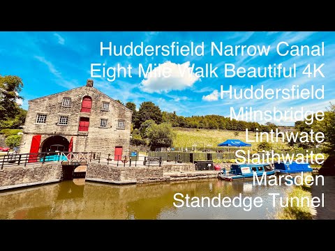
Atmospheric 8 Mile Huddersfield Narrow Canal Walk To Standedge Tunnel Marsden | 4K & 3D Audio 🎧

In todays video we're starting the walk at Kirklees college Huddersfield, we join the canal and travel through Milnsbridge, ...

Old Huddersfield Milnsbridge / Longwood Edge

You join me hear in the Colne Valley about 2 miles west of huddersfield at Milnsbridge Now Milnsbridge gets its name from from ...

OVERCAST BLACKLEY WALKING

Hello Jamie here and with another video. So on one of my walks, I was in Blackley, and during overcast weather, with the brave ...

Nearby Amenities

Located within 500m of 53.654785,-1.841096
Salendine Nook
Is In: Huddersfield
Is In Country: UK
Is In County: West Yorkshire
Is In District: Kirklees
Is In Town: Huddersfield
Place: village
Lat/Long: 53.6572256/-1.8401655
Bus Stop
Longwood Dodlee Bank
Local Ref: 45022479
Naptan AtcoCode: 450022479
Naptan Bearing: NW
Naptan CommonName: Longwood Dodlee Bank
Naptan Crossing: Dodlee Lane
Naptan Indicator: Stop 45022479
Naptan Notes: OSR taken place 081205
Naptan PlusbusZoneRef: LEEDS
Naptan ShortCommonName: Dodlee Lane
Naptan Street: Longwood Gate
Naptan Verified: no
Source: naptan_import
Lat/Long: 53.6508378/-1.8435781
Bus Stop
New Hey Road Pennie Crescent
Local Ref: 45022483
Naptan AtcoCode: 450022483
Naptan Bearing: E
Naptan CommonName: New Hey Road Pennie Crescent
Naptan Crossing: Pennine Crescent
Naptan Indicator: Stop 45022483
Naptan PlusbusZoneRef: LEEDS
Naptan ShortCommonName: Pennine Crescent
Naptan Street: New Hey Road
Naptan Verified: no
Source: naptan_import
Lat/Long: 53.6569794/-1.8455225
Bus Stop
New Hey Road Moor Hill Road
Local Ref: 45022484
Naptan AtcoCode: 450022484
Naptan Bearing: E
Naptan CommonName: New Hey Road Moor Hill Road
Naptan Crossing: Moor Hill Road
Naptan Indicator: Stop 45022484
Naptan Landmark: Filling Station
Naptan Notes: New TF shelter and 3P case fitted - Awaiting survey
Naptan PlusbusZoneRef: LEEDS
Naptan ShortCommonName: Salendine Nook
Naptan Street: New Hey Road
Naptan Verified: no
Source: naptan_import
Lat/Long: 53.6565441/-1.842513
Bus Stop
New Hey Road Dunsmore Drive
Local Ref: 45022485
Naptan AtcoCode: 450022485
Naptan Bearing: E
Naptan CommonName: New Hey Road Dunsmore Drive
Naptan Crossing: Dunsmore Drive
Naptan Indicator: Stop 45022485
Naptan Landmark: Spotted Cow PH
Naptan PlusbusZoneRef: LEEDS
Naptan ShortCommonName: Dunsmore Drive
Naptan Street: New Hey Road
Naptan Verified: no
Source: naptan_import
Lat/Long: 53.6560369/-1.8396551
Bus Stop
New Hey Road New College
Local Ref: 45022486
Naptan AtcoCode: 450022486
Naptan Bearing: E
Naptan CommonName: New Hey Road New College
Naptan Crossing: Winfield Drive
Naptan Indicator: Stop 45022486
Naptan Landmark: New College
Naptan PlusbusZoneRef: LEEDS
Naptan ShortCommonName: New College
Naptan Street: New Hey Road
Naptan Verified: no
Source: naptan_import
Lat/Long: 53.6553841/-1.8354663
Bus Stop
New College New Hey Road
Local Ref: 45022497
Naptan AtcoCode: 450022497
Naptan Bearing: W
Naptan CommonName: New College New Hey Road
Naptan Crossing: Deer Croft Avenue
Naptan Indicator: Stop 45022497
Naptan Landmark: High School
Naptan PlusbusZoneRef: LEEDS
Naptan ShortCommonName: Deer Croft Avenue
Naptan Street: New Hey Road
Naptan Verified: no
Source: naptan_import
Lat/Long: 53.6551591/-1.8352704
Bus Stop
New Hey Road Dunsmore Drive
Local Ref: 45022498
Naptan AtcoCode: 450022498
Naptan Bearing: W
Naptan CommonName: New Hey Road Dunsmore Drive
Naptan Crossing: Dunsmore Drive
Naptan Indicator: Stop 45022498
Naptan Landmark: Spotted Cow PH
Naptan PlusbusZoneRef: LEEDS
Naptan ShortCommonName: Dunsmore Drive
Naptan Street: New Hey Road
Naptan Verified: no
Source: naptan_import
Lat/Long: 53.6557572/-1.8388542
Bus Stop
Salendine Nook Celandine Avenue
Local Ref: 45022499
Naptan AtcoCode: 450022499
Naptan Bearing: W
Naptan CommonName: Salendine Nook Celandine Avenue
Naptan Crossing: Celandine Avenue
Naptan Indicator: Stop 45022499
Naptan Landmark: Garage
Naptan PlusbusZoneRef: LEEDS
Naptan ShortCommonName: Celandine Avenue
Naptan Street: New Hey Road
Naptan Verified: no
Source: naptan_import
Lat/Long: 53.6562378/-1.842045
Bus Stop
New Hey Road Eaw Nook Road
Local Ref: 45022500
Naptan AtcoCode: 450022500
Naptan Bearing: W
Naptan CommonName: New Hey Road Eaw Nook Road
Naptan Crossing: Helene Court
Naptan Indicator: Stop 45022500
Naptan PlusbusZoneRef: LEEDS
Naptan ShortCommonName: Helene Court
Naptan Street: New Hey Road
Naptan Verified: no
Source: naptan_import
Lat/Long: 53.6568176/-1.8454777
Bus Stop
Laund Road Morton Way
Local Ref: 45022745
Naptan AtcoCode: 450022745
Naptan Bearing: NW
Naptan CommonName: Laund Road Morton Way
Naptan Crossing: Morton Way
Naptan Indicator: Stop 45022745
Naptan PlusbusZoneRef: LEEDS
Naptan ShortCommonName: Morton Way
Naptan Street: Laund Road
Naptan Verified: no
Source: naptan_import
Lat/Long: 53.6589992/-1.8434874
Bus Stop
Laund Road Morton Way
Local Ref: 45022746
Naptan AtcoCode: 450022746
Naptan Bearing: SE
Naptan CommonName: Laund Road Morton Way
Naptan Crossing: Morton Way
Naptan Indicator: Stop 45022746
Naptan PlusbusZoneRef: LEEDS
Naptan ShortCommonName: Morton Way
Naptan Street: Laund Road
Naptan Verified: no
Source: naptan_import
Lat/Long: 53.658837/-1.8431854
Bus Stop
Moor Hill Road Maplin Avenue
Local Ref: 45022747
Naptan AtcoCode: 450022747
Naptan Bearing: SW
Naptan CommonName: Moor Hill Road Maplin Avenue
Naptan Crossing: Maplin Avenue
Naptan Indicator: Stop 45022747
Naptan Landmark: Church
Naptan PlusbusZoneRef: LEEDS
Naptan ShortCommonName: Maplin Avenue
Naptan Street: Moor Hill Road
Naptan Verified: no
Source: naptan_import
Lat/Long: 53.6577562/-1.8415097
Bus Stop
Moor Hill Road New Hey Road
Local Ref: 45022748
Naptan AtcoCode: 450022748
Naptan Bearing: N
Naptan CommonName: Moor Hill Road New Hey Road
Naptan Crossing: New Hey Road
Naptan Indicator: Stop 45022748
Naptan Landmark: Salendine Shopping Centre
Naptan PlusbusZoneRef: LEEDS
Naptan ShortCommonName: New Hey Road
Naptan Street: Moor Hill Road
Naptan Verified: no
Source: naptan_import
Lat/Long: 53.6568863/-1.8429959
Bus Stop
Moor Hill Road Deer Croft Road
Local Ref: 45022749
Naptan AtcoCode: 450022749
Naptan Bearing: SW
Naptan CommonName: Moor Hill Road Deer Croft Road
Naptan Crossing: Deer Croft Road
Naptan Indicator: Stop 45022749
Naptan PlusbusZoneRef: LEEDS
Naptan ShortCommonName: Deer Croft Road
Naptan Street: Moor Hill Road
Naptan Verified: no
Source: naptan_import
Lat/Long: 53.6591192/-1.8390835
Bus Stop
Greenhill Road Dodlee Lane
Local Ref: 45025149
Naptan AtcoCode: 450025149
Naptan Bearing: SE
Naptan CommonName: Greenhill Road Dodlee Lane
Naptan Crossing: Dodlee Lane
Naptan Indicator: Stop 45025149
Naptan Landmark: Turning Circle
Naptan PlusbusZoneRef: LEEDS
Naptan ShortCommonName: Dodlee Lane
Naptan Street: Greenhill Road
Naptan Verified: no
Source: naptan_import
Lat/Long: 53.6509632/-1.84326
Post Box
Operator: Royal Mail
Lat/Long: 53.6509008/-1.8434291
Pub
The Dusty Miller
Lat/Long: 53.6514897/-1.8437954
Post Office
Salendine Nook Post Office
Brand: Post Office
Brand Wikidata: Q1783168
Check Date: 2023-09-27
Ref Pol Id: 8080
Source: OS OpenData StreetView
Website: https://www.postoffice.co.uk/branch-finder/218320x/salendine-nook
Lat/Long: 53.6569017/-1.8445143
Atm
Lat/Long: 53.6569539/-1.843641
Traffic Signals
Source: survey
Traffic Signals: pedestrian_crossing
Lat/Long: 53.6567105/-1.8443888
Sainsbury's
Addr City: Huddersfield
Addr Country: GB
Addr Hamlet: Salendine Nook
Addr Housenumber: 144
Addr Postcode: HD3 3XA
Addr Street: Moor Hill Road
Brand: Sainsbury's
Brand Wikidata: Q152096
Fhrs Id: 227564
Shop: supermarket
Source: survey
Source Addr: FHRS Open Data
Website: https://stores.sainsburys.co.uk/2208/salendine-nook
Wheelchair: yes
Lat/Long: 53.6569712/-1.8440026
Fuel
Brand: BP
Source: survey
Lat/Long: 53.6562352/-1.8427017
Generator Method: photovoltaic
Generator Output Electricity: yes
Generator Source: solar
Generator Type: solar_photovoltaic_panel
Location: roof
Power: generator
Lat/Long: 53.6588516/-1.8399603
Generator Method: photovoltaic
Generator Output Electricity: yes
Generator Source: solar
Generator Type: solar_photovoltaic_panel
Location: roof
Power: generator
Lat/Long: 53.6584463/-1.8398261
Generator Method: photovoltaic
Generator Output Electricity: yes
Generator Source: solar
Generator Type: solar_photovoltaic_panel
Location: roof
Power: generator
Lat/Long: 53.658494/-1.8394882
Generator Method: photovoltaic
Generator Output Electricity: yes
Generator Source: solar
Generator Type: solar_photovoltaic_panel
Location: roof
Power: generator
Lat/Long: 53.6589454/-1.8405852
Generator Method: photovoltaic
Generator Output Electricity: yes
Generator Source: solar
Generator Type: solar_photovoltaic_panel
Location: roof
Power: generator
Lat/Long: 53.6555351/-1.8358739
Generator Method: photovoltaic
Generator Output Electricity: yes
Generator Source: solar
Generator Type: solar_photovoltaic_panel
Location: roof
Power: generator
Lat/Long: 53.6558483/-1.8380894
Generator Method: photovoltaic
Generator Output Electricity: yes
Generator Source: solar
Generator Type: solar_photovoltaic_panel
Location: roof
Power: generator
Lat/Long: 53.655923/-1.8380385
Generator Method: photovoltaic
Generator Output Electricity: yes
Generator Source: solar
Generator Type: solar_photovoltaic_panel
Location: roof
Power: generator
Lat/Long: 53.6563045/-1.8459349
Generator Method: photovoltaic
Generator Output Electricity: yes
Generator Source: solar
Generator Type: solar_photovoltaic_panel
Location: roof
Power: generator
Lat/Long: 53.6563172/-1.8460019
Generator Method: photovoltaic
Generator Output Electricity: yes
Generator Source: solar
Generator Type: solar_photovoltaic_panel
Location: roof
Power: generator
Lat/Long: 53.6548866/-1.8451061
Generator Method: photovoltaic
Generator Output Electricity: yes
Generator Source: solar
Generator Type: solar_photovoltaic_panel
Location: roof
Power: generator
Lat/Long: 53.6549215/-1.8452482
Generator Method: photovoltaic
Generator Output Electricity: yes
Generator Source: solar
Generator Type: solar_photovoltaic_panel
Location: roof
Power: generator
Lat/Long: 53.654753/-1.8438803
Generator Method: photovoltaic
Generator Output Electricity: yes
Generator Source: solar
Generator Type: solar_photovoltaic_panel
Location: roof
Power: generator
Lat/Long: 53.6548436/-1.8436791
Generator Method: photovoltaic
Generator Output Electricity: yes
Generator Source: solar
Generator Type: solar_photovoltaic_panel
Location: roof
Power: generator
Lat/Long: 53.6550598/-1.8432527
Generator Method: photovoltaic
Generator Output Electricity: yes
Generator Source: solar
Generator Type: solar_photovoltaic_panel
Location: roof
Power: generator
Lat/Long: 53.6530638/-1.8479073
Crossing
Crossing: unmarked
Crossing Island: yes
Tactile Paving: yes
Lat/Long: 53.6565977/-1.8436958
Crossing
Crossing: unmarked
Crossing Island: yes
Tactile Paving: yes
Lat/Long: 53.6565486/-1.8433946
Crossing
Crossing: unmarked
Crossing Island: yes
Tactile Paving: yes
Lat/Long: 53.6563012/-1.8417874
Crossing
Crossing: unmarked
Crossing Island: yes
Tactile Paving: yes
Lat/Long: 53.6560465/-1.8403396
Crossing
Crossing: unmarked
Crossing Island: yes
Tactile Paving: yes
Lat/Long: 53.655842/-1.8391672
Crossing
Crossing: zebra
Crossing Island: yes
Tactile Paving: yes
Lat/Long: 53.6557261/-1.8383922
Crossing
Crossing: zebra
Crossing Island: yes
Tactile Paving: yes
Lat/Long: 53.6553834/-1.8360987
Bicycle Parking
Bicycle Parking: stands
Capacity: 2
Lat/Long: 53.6568346/-1.8434653
The data included in this document is from www.openstreetmap.org. The data is made available under ODbL.

Have you been to Salendine Nook?

Leave your review of Salendine Nook below (or comments, questions and feedback).