Blackmoorfoot

Settlement in Yorkshire

England

Blackmoorfoot

Mills in New Street Slaithwaite From railway
Mills in New Street Slaithwaite Credit: John Firth

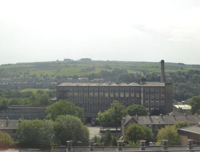
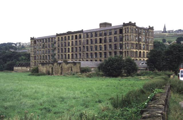
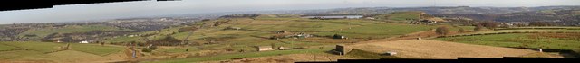
Blackmoorfoot is a small village located in the county of Yorkshire, England. Situated in the picturesque countryside, the village offers a tranquil and idyllic setting for its residents. It falls within the metropolitan borough of Kirklees and is positioned near the larger towns of Huddersfield and Holmfirth.

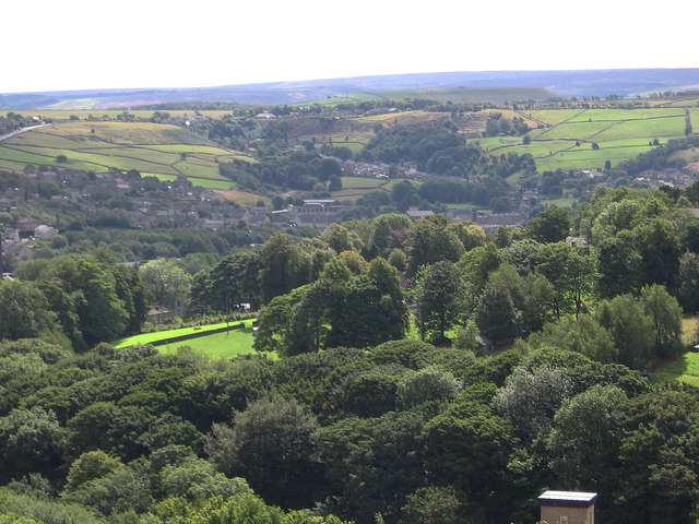
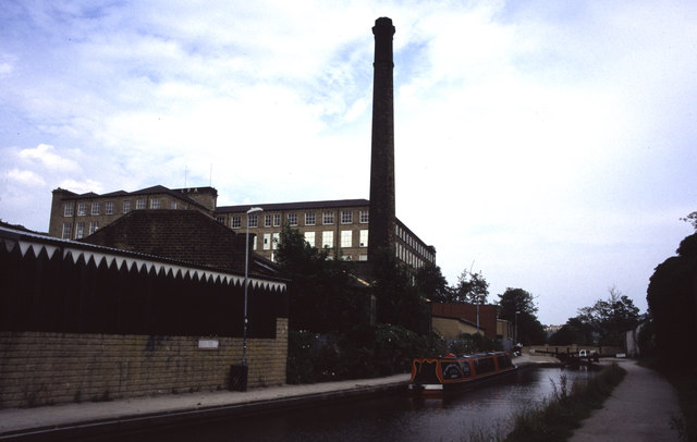
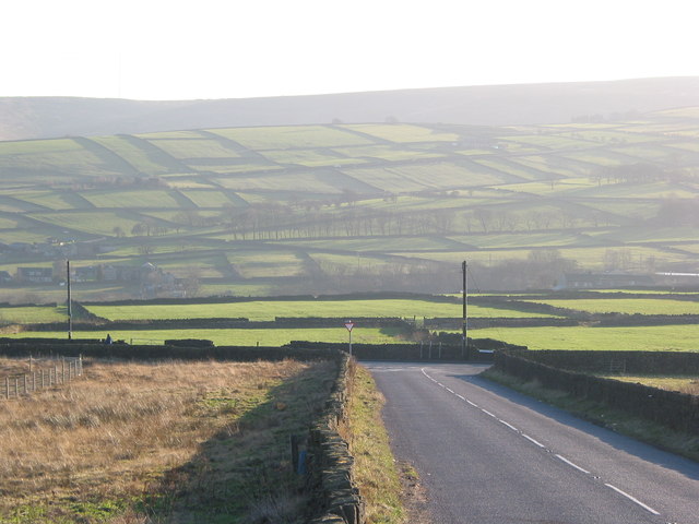
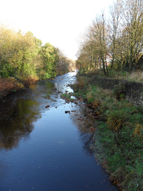
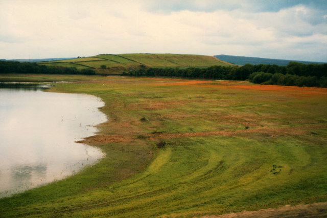
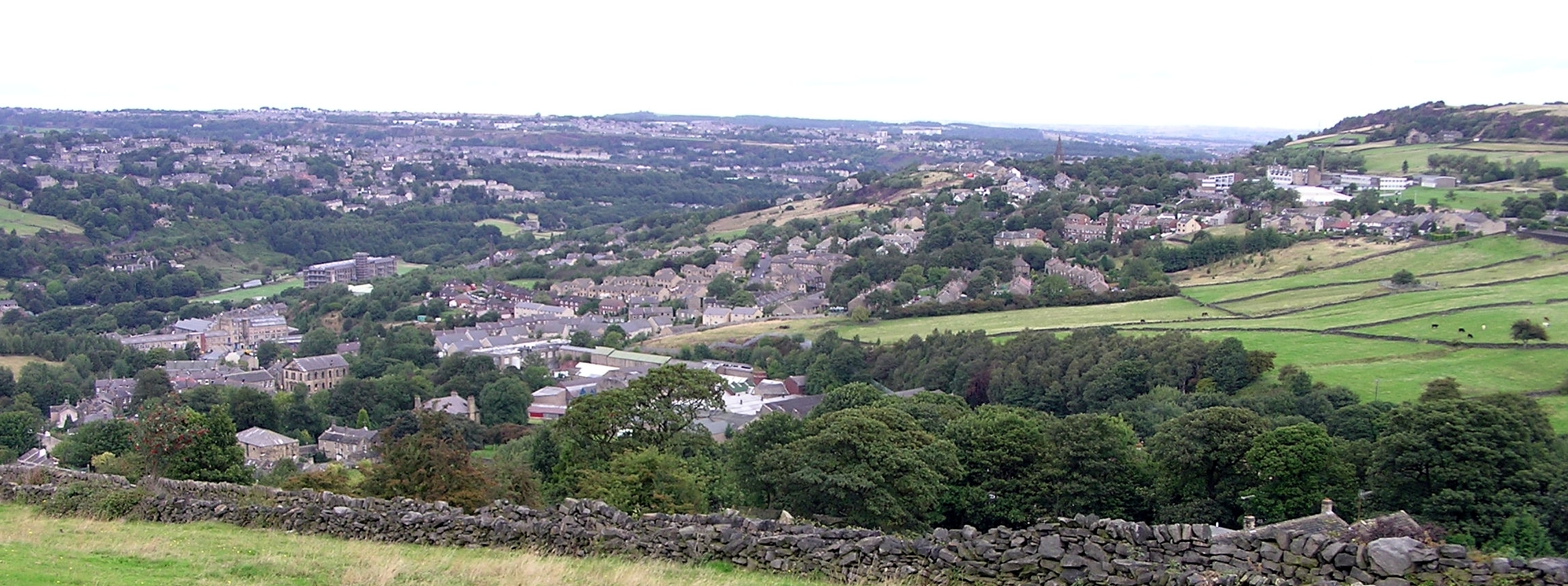
The village is renowned for its natural beauty, with rolling hills, verdant meadows, and dense woodlands surrounding the area. The Blackmoorfoot Reservoir, which sits on the edge of the village, is a prominent feature and provides a scenic spot for walking, picnicking, and birdwatching. The reservoir also offers recreational activities such as fishing and sailing.

Despite its small size, Blackmoorfoot has a close-knit community that takes pride in its local amenities. The village boasts a primary school, a village hall, and a church, which serve as important social hubs for residents. Additionally, there are a few small businesses in the area, including a pub and a convenience store, catering to the everyday needs of the villagers.

Blackmoorfoot is a popular destination for outdoor enthusiasts due to its extensive network of footpaths, bridleways, and cycling routes. The surrounding countryside provides ample opportunities for hiking, horse riding, and mountain biking. The village also hosts various events and festivals throughout the year, attracting visitors from near and far.

In conclusion, Blackmoorfoot, Yorkshire, is a charming village nestled in the heart of the countryside. Its natural beauty, community spirit, and recreational offerings make it an appealing place to live or visit for those seeking a peaceful retreat in the Yorkshire landscape.

If you have any feedback on the listing, please let us know in the comments section below.

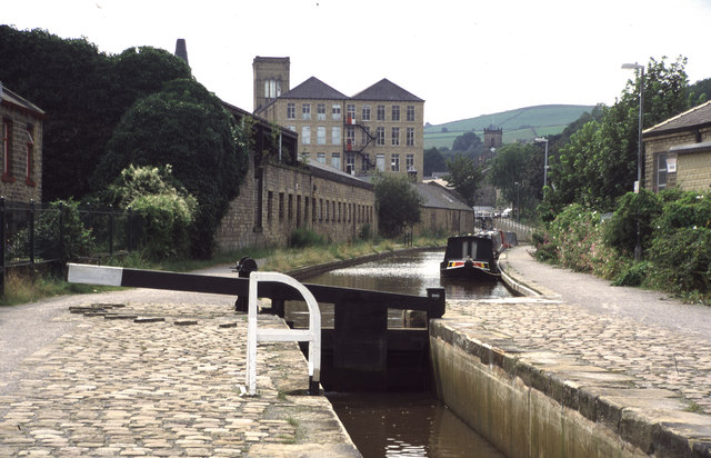
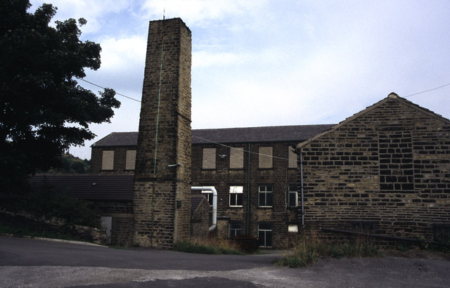
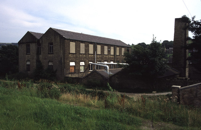
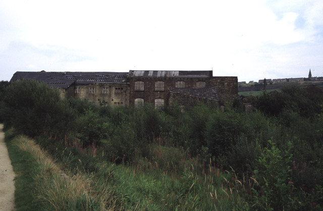
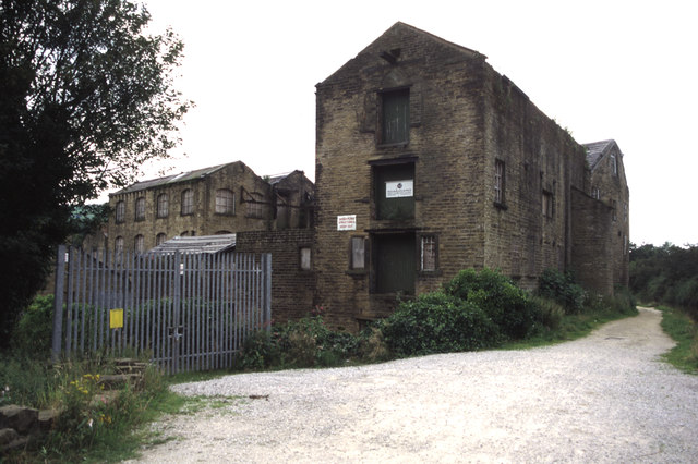
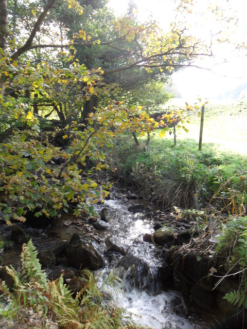
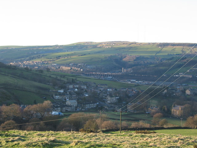
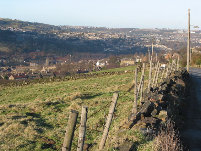
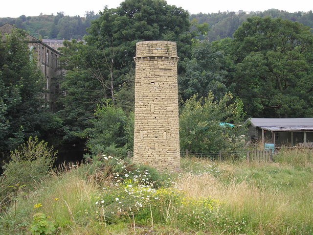
Blackmoorfoot Images

Images are sourced within 2km of 53.613454/-1.853343 or Grid Reference SE0913. Thanks to Geograph Open Source API. All images are credited.

Mills in New Street Slaithwaite From railway
Mills in New Street Slaithwaite
From railway
Golcar - view to Linthwaite Across the Colne Valley.
Golcar - view to Linthwaite
Across the Colne Valley.
Titanic Mill This textile mill was built in 1912 and was hence known as Titanic Mill. It was lying derelict and unloved when I photographed it in 2002 but it has since been converted in to apartments and the photograph here <a href="https://www.geograph.org.uk/photo/2194713">SE0914 : Titanic Mill</a> was taken from practically the same location. In some ways I prefer the earlier photograph.
Titanic Mill
This textile mill was built in 1912 and was hence known as Titanic Mill. It was lying derelict and unloved when I photographed it in 2002 but it has since been converted in to apartments and the photograph here SE0914 : Titanic Mill was taken from practically the same location. In some ways I prefer the earlier photograph.
Huddersfield Narrow Canal, Slaithwaite Platt Lane bridge in the distance alongside Spa Mill. The latter is an example of a Yorkshire cotton mill but in stone, rather than the red brick of lancashire. The chimney is that of Platt Mill
Huddersfield Narrow Canal, Slaithwaite
Platt Lane bridge in the distance alongside Spa Mill. The latter is an example of a Yorkshire cotton mill but in stone, rather than the red brick of lancashire. The chimney is that of Platt Mill
Huddersfield Narrow Canal, Slaithwaite The lock gate carries the date 2000. Globe Mills are seen in the distance. A magnificent feat of canal restoration to surpass the recent Droitwich Canals project.
Huddersfield Narrow Canal, Slaithwaite
The lock gate carries the date 2000. Globe Mills are seen in the distance. A magnificent feat of canal restoration to surpass the recent Droitwich Canals project.
Lees Mill, Golcar A small mill complex. Humphrey Bolton locates this in Golcar.
Lees Mill, Golcar
A small mill complex. Humphrey Bolton locates this in Golcar.
Lees Mill, Golcar Photographed across the Huddersfield Narrow Canal.
Lees Mill, Golcar
Photographed across the Huddersfield Narrow Canal.
Low Westwood Mill, Golcar Derelict mill with a silted up and overgrown pond. This view <a href="https://www.geograph.org.uk/photo/508312">SE0914 : Low Westwood Mills</a> shows it in better times. The towpath of the Huddersfield Narrow Canal is on the left.
Low Westwood Mill, Golcar
Derelict mill with a silted up and overgrown pond. This view SE0914 : Low Westwood Mills shows it in better times. The towpath of the Huddersfield Narrow Canal is on the left.
Low Westwood Mill, Golcar Now even more derelict. Plans for conversion to accommodation have so far fallenthrough (2011).
Low Westwood Mill, Golcar
Now even more derelict. Plans for conversion to accommodation have so far fallenthrough (2011).
Bradley Brook near Slaithwaite Looking upstream. Fast-flowing due to the recent rain.
Bradley Brook near Slaithwaite
Looking upstream. Fast-flowing due to the recent rain.
Upper Clough Beyond the hamlet of Upper Clough in the middle of the picture is Crimble Viaduct and on the skyline above a faint indication of the radio masts on Moorside Edge.
Upper Clough
Beyond the hamlet of Upper Clough in the middle of the picture is Crimble Viaduct and on the skyline above a faint indication of the radio masts on Moorside Edge.
Gilroyd Lane Looking back down the hill towards Linthwaite with Golcar across the valley and Longwood beyond with Longwood Edge the skyline.
Gilroyd Lane
Looking back down the hill towards Linthwaite with Golcar across the valley and Longwood beyond with Longwood Edge the skyline.
Blackmoorfoot Road junction with Slaithwaite Road Hassocks Road crosses the picture at the end of the first field beyond Slaithwaite Road. Beyond is the pattern of low-lit walls of the fields on Meltham Moor.
Blackmoorfoot Road junction with Slaithwaite Road
Hassocks Road crosses the picture at the end of the first field beyond Slaithwaite Road. Beyond is the pattern of low-lit walls of the fields on Meltham Moor.
River Colne, near Slaithwaite Looking north-east along the river from a footbridge leading to Slaithwaite Spa Park.  The river is a lovely blue on this fine autumn day.
River Colne, near Slaithwaite
Looking north-east along the river from a footbridge leading to Slaithwaite Spa Park. The river is a lovely blue on this fine autumn day.
West side of Blackmoorfoot Reservoir This view in a drought year shows how shallow this reservoir is, situated on the saddle of the hill.  See also <a href="https://www.geograph.org.uk/photo/1120117">SE0912 : Reservoir empty...</a>.
West side of Blackmoorfoot Reservoir
This view in a drought year shows how shallow this reservoir is, situated on the saddle of the hill. See also SE0912 : Reservoir empty....
View across Blackmoorfoot
Blackmoorfoot Reservoir 1960 Almost perfect reflection. Sometimes wonder if the picture is mirrored correctly
Blackmoorfoot Reservoir 1960
Almost perfect reflection. Sometimes wonder if the picture is mirrored correctly
Bat Tower near Linthwaite Looking like an infant mill chimney which hopes to grow larger, this six-metre structure was erected in 2009. It can house up to 200 bats. 

It is believed to be the first of its kind in the UK and includes a tunnel which allows flight access into the tower base. Several small gaps have been left in the stonework. 

It was created at a cost of £15,000 after a three-year survey involving volunteers from the River Colne Project and experts at the West Yorkshire Bat Group.
Bat Tower near Linthwaite
Looking like an infant mill chimney which hopes to grow larger, this six-metre structure was erected in 2009. It can house up to 200 bats. It is believed to be the first of its kind in the UK and includes a tunnel which allows flight access into the tower base. Several small gaps have been left in the stonework. It was created at a cost of £15,000 after a three-year survey involving volunteers from the River Colne Project and experts at the West Yorkshire Bat Group.
Show me another place!

Blackmoorfoot is located at Grid Ref: SE0913 (Lat: 53.613454, Lng: -1.853343)

Division: West Riding

Unitary Authority: Kirklees

Police Authority: West Yorkshire

What 3 Words

///tomato.worthy.split. Near Blackmoorfoot, West Yorkshire

Related Wikis

Colne Valley (UK Parliament constituency)

Colne Valley is a constituency represented in the House of Commons of the UK Parliament since 2019 by Jason McCartney of the Conservative Party. ��2�...

Helme, West Yorkshire

Helme is a small village in the Kirklees district, in the county of West Yorkshire, England. It is near the town of Meltham and Blackmoorfoot Reservoir...

Colne Valley High School

Colne Valley High School is a mixed secondary school in the village of Linthwaite, Huddersfield, West Yorkshire, England. It is named thus because it exists...

Linthwaite

Linthwaite (known as Linfit in the local community) is a village in Kirklees, West Yorkshire, England. Historically part of the West Riding of Yorkshire...

Colne Valley

The Colne Valley is a steep sided valley on the east flank of the Pennine Hills in the English county of West Yorkshire. It takes its name from the River...

Healey House railway station

Healey House railway station was in use from 1869 to 1949 on the Meltham branch line. == History == The station was opened on 6 July 1869 by the Lancashire...

Slaithwaite

Slaithwaite (, locally 'Slaithwaite' ; Old Norse for "timber-fell thwaite/clearing") is a town and former civil parish in the Colne Valley area of the...

Slaithwaite Town Hall

Slaithwaite Town Hall, also known as Empire House is a former municipal building in Lewisham Road in the town of Slaithwaite, West Yorkshire, England....

Nearby Amenities

Located within 500m of 53.613454,-1.853343
Bus Stop
Blackmoorfoot Road
Local Ref: 45019285
Naptan AtcoCode: 450019285
Naptan Bearing: NE
Naptan CommonName: Blackmoorfoot Road
Naptan Crossing: Black Lane
Naptan Indicator: Stop 45019285
Naptan PlusbusZoneRef: LEEDS
Naptan ShortCommonName: Blackmoorfoot
Naptan Street: Blackmoorfoot Road
Naptan Verified: no
Source: naptan_import
Lat/Long: 53.6153603/-1.8506176
Bus Stop
Upper Clough Road Fieldshead Bungalows
Local Ref: 45019350
Naptan AtcoCode: 450019350
Naptan Bearing: SE
Naptan CommonName: Upper Clough Road Fieldshead Bungalows
Naptan Crossing: Fieldshead Bungalows
Naptan Indicator: Stop 45019350
Naptan PlusbusZoneRef: LEEDS
Naptan ShortCommonName: Fieldshaw Bungalows
Naptan Street: Upper Clough Road
Naptan Verified: no
Source: naptan_import
Lat/Long: 53.6157705/-1.855257
Bus Stop
Gillroyd Lane Heights Lane
Local Ref: 45019351
Naptan AtcoCode: 450019351
Naptan Bearing: N
Naptan CommonName: Gillroyd Lane Heights Lane
Naptan Crossing: Heights Drive
Naptan Indicator: Stop 45019351
Naptan PlusbusZoneRef: LEEDS
Naptan ShortCommonName: Heights Drive
Naptan Street: Gillroyd Lane
Naptan Verified: no
Source: naptan_import
Lat/Long: 53.6173482/-1.8517897
Upper Clough Road Fieldshaw Bungalows
Local Ref: 45050810
Naptan AtcoCode: 450050810
Naptan Bearing: SW
Naptan BusStopType: CUS
Naptan CommonName: Upper Clough Road Fieldshaw Bungalows
Naptan Indicator: Stop 45050810
Naptan PlusbusZoneRef: LEEDS
Naptan ShortCommonName: Wild Brow Farm
Naptan Street: Upper Clough Road
Naptan Verified: no
Source: naptan_import
Lat/Long: 53.6157257/-1.855363
Gillroyd Lane Heights Drive
Local Ref: 45050811
Naptan AtcoCode: 450050811
Naptan Bearing: S
Naptan BusStopType: CUS
Naptan CommonName: Gillroyd Lane Heights Drive
Naptan Indicator: Stop 45050811
Naptan PlusbusZoneRef: LEEDS
Naptan ShortCommonName: Heights Drive
Naptan Street: Gillroyd Lane
Naptan Verified: no
Source: naptan_import
Lat/Long: 53.61733/-1.8516084
Fixme: How is access to the driveway made (if at all)? See note on the way to the south of this node.
Lat/Long: 53.6155598/-1.8481072
Blackmoorfoot
Place: hamlet
Lat/Long: 53.6153177/-1.8518342
Power: pole
Lat/Long: 53.6135644/-1.846977
Power: pole
Lat/Long: 53.6148856/-1.8475124
Power: pole
Lat/Long: 53.6162308/-1.84805
Power: pole
Lat/Long: 53.6179391/-1.852882
Power: pole
Lat/Long: 53.6176549/-1.8518807
Bench
Backrest: yes
Direction: W
Length: 1.9
Material: wood
Lat/Long: 53.6117742/-1.8475163
Waste Basket
Colour: blue
Lat/Long: 53.6135566/-1.8474875
Barrier: entrance
Width: 1.1
Lat/Long: 53.6135317/-1.8474828
Bench
Backrest: yes
Direction: W
Length: 1.9
Material: wood
Lat/Long: 53.6126299/-1.8477537
Bench
Backrest: yes
Direction: W
Length: 2.4
Material: metal;wood
Lat/Long: 53.6121143/-1.8476806
The data included in this document is from www.openstreetmap.org. The data is made available under ODbL.

Have you been to Blackmoorfoot?

Leave your review of Blackmoorfoot below (or comments, questions and feedback).