Ridge

Settlement in Lancashire Lancaster

England

Ridge

OS Bench Mark Ordnance Survey cut bench mark from the 19th century levelling, on stone gatepost in old road boundary. 308.4 feet above old datum.
OS Bench Mark Credit: Phil Johnstone

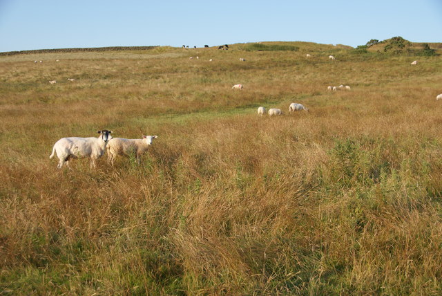
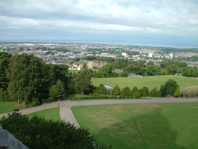
Ridge is a small village located in the county of Lancashire, in the northwest of England. Situated in the beautiful Ribble Valley, Ridge is surrounded by picturesque countryside and rolling hills, making it an ideal destination for nature lovers and outdoor enthusiasts.

With a population of around 500 residents, Ridge maintains a close-knit community atmosphere. The village is characterized by its charming stone houses and historic buildings, many of which date back to the 18th and 19th centuries. The local church, St. John the Evangelist, is a prominent landmark in the area, adding to the village's architectural appeal.

Despite its small size, Ridge offers a range of amenities for its residents and visitors. The village has a primary school, providing education for local children, and a village hall that serves as a hub for community events and gatherings. Additionally, there are a few local shops and businesses catering to everyday needs.

Ridge's location within the Ribble Valley provides easy access to a variety of outdoor activities. The surrounding countryside offers numerous walking and cycling trails, allowing visitors to explore the area's natural beauty. The nearby River Ribble is popular for fishing and boating, while the Bowland Forest and Pendle Hill provide opportunities for hiking and birdwatching.

In conclusion, Ridge, Lancashire is a small village with a strong sense of community and a picturesque setting. Its historic buildings, beautiful countryside, and proximity to outdoor recreation make it an appealing destination for those seeking a peaceful and idyllic rural experience.

If you have any feedback on the listing, please let us know in the comments section below.
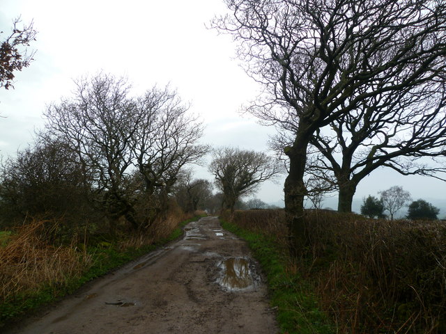
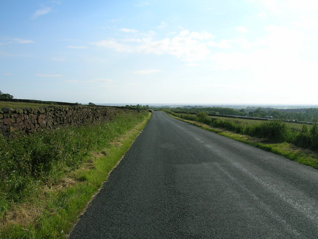
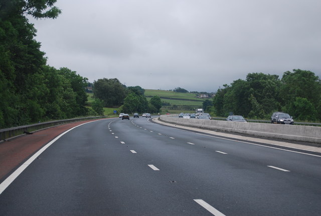
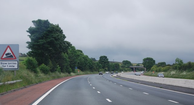
Ridge Images

Images are sourced within 2km of 54.053646/-2.784964 or Grid Reference SD4862. Thanks to Geograph Open Source API. All images are credited.

OS Bench Mark Ordnance Survey cut bench mark from the 19th century levelling, on stone gatepost in old road boundary. 308.4 feet above old datum.
OS Bench Mark
Ordnance Survey cut bench mark from the 19th century levelling, on stone gatepost in old road boundary. 308.4 feet above old datum.
OS Bench Mark Ordnance Survey cut bench mark from the 19th century levelling, on stone wall. 358.5 feet above old datum.
OS Bench Mark
Ordnance Survey cut bench mark from the 19th century levelling, on stone wall. 358.5 feet above old datum.
OS Bench Mark Ordnance Survey cut bench mark from the 19th century levelling, on stone gatepost. 396.9 feet above old datum.
OS Bench Mark
Ordnance Survey cut bench mark from the 19th century levelling, on stone gatepost. 396.9 feet above old datum.
Quernmore : M6 Motorway The M6 Motorway between Junction 34 and Junction 33.
Quernmore : M6 Motorway
The M6 Motorway between Junction 34 and Junction 33.
Grimeshaw Lane A track which runs from Denny Beck to The Ridge. Locally 'Grimsher'.
Grimeshaw Lane
A track which runs from Denny Beck to The Ridge. Locally 'Grimsher'.
Farmland east of the M6 motorway
Quernmore Road
Quernmore Road
Newlands Road towards Lancaster
M6, southbound The M6 motorway runs from junction 19 of the M1 at the Catthorpe Interchange, near Rugby to the Gretna junction (J45). Here it becomes the A74(M) and M74 which continues to Glasgow.

The M6 is the longest motorway in the United Kingdom (232 miles) and one of the busiest. It incorporates the first length of motorway opened in the UK (the Preston bypass in 1958) and forms part of a motorway "Backbone of Britain", running north-south between London and Glasgow via the industrial north of England. It is also part of the east-west route between the Midlands and the east coast ports.
M6, southbound
The M6 motorway runs from junction 19 of the M1 at the Catthorpe Interchange, near Rugby to the Gretna junction (J45). Here it becomes the A74(M) and M74 which continues to Glasgow. The M6 is the longest motorway in the United Kingdom (232 miles) and one of the busiest. It incorporates the first length of motorway opened in the UK (the Preston bypass in 1958) and forms part of a motorway "Backbone of Britain", running north-south between London and Glasgow via the industrial north of England. It is also part of the east-west route between the Midlands and the east coast ports.
Sheep near Lancaster Two Lancaster landmarks are visible here in the evening light, the Ashton Memorial and Moor Hospital. The M6 runs between: it can be heard but not seen.
Sheep near Lancaster
Two Lancaster landmarks are visible here in the evening light, the Ashton Memorial and Moor Hospital. The M6 runs between: it can be heard but not seen.
Sheep near Lancaster These are on slightly higher ground to the east of Lancaster.
Sheep near Lancaster
These are on slightly higher ground to the east of Lancaster.
OS Bench Mark OS cut bench mark, from the 20th century levelling, on north parapet of Ridge Lane Bridge over Lancaster Canal. 26.060 m above datum. This replaces an earlier bench mark on the south parapet of the first bridge.
OS Bench Mark
OS cut bench mark, from the 20th century levelling, on north parapet of Ridge Lane Bridge over Lancaster Canal. 26.060 m above datum. This replaces an earlier bench mark on the south parapet of the first bridge.
Junction 34 signage - M6 northbound
Bridge - M6 northbound
Junction 34 signage - M6 northbound
OS Bench Mark OS plug bolt bench mark from the 19th century levelling, on St Thomas's Church. 79.5 feet above old datum.
OS Bench Mark
OS plug bolt bench mark from the 19th century levelling, on St Thomas's Church. 79.5 feet above old datum.
OS Bench Mark OS cut bench mark from the 20th century levelling, on corner of Penny Street and Victoria Place. 21.562 m above datum.
OS Bench Mark
OS cut bench mark from the 20th century levelling, on corner of Penny Street and Victoria Place. 21.562 m above datum.
Show me another place!

Ridge is located at Grid Ref: SD4862 (Lat: 54.053646, Lng: -2.784964)

Administrative County: Lancashire

District: Lancaster

Police Authority: Lancashire

What 3 Words

///sulked.firming.buns. Near Lancaster, Lancashire

Related Wikis

Central Lancaster High School

Central Lancaster High School (CLHS) is a coeducational secondary school located in Lancaster, England. Located on Crag Road on the Ridge area in east...

Williamson Park, Lancaster

Williamson Park in Lancaster, England, was constructed by millionaire James Williamson, 1st Baron Ashton, and his father, also called James Williamson...

War Memorial, Lancaster Cemetery

The War Memorial, Lancaster Cemetery, was built to commemorate those lost in the Crimean War. It was erected in 1860, and designed by the local architect...

Lancaster Cemetery Chapels

The Lancaster Cemetery Chapels are the three chapels, each built to serve a different denomination, in the main cemetery of Lancaster, England. The chapels...

Nearby Amenities

Located within 500m of 54.053646,-2.784964
Mini Roundabout
Direction: clockwise
Lat/Long: 54.052836/-2.7897099
Direction: both
Surface: asphalt
Traffic Calming: chicane
Lat/Long: 54.0550652/-2.7879231
Cartmel Road
Bus: yes
Public Transport: stop_position
Lat/Long: 54.0575658/-2.7858233
Turning Circle
Lat/Long: 54.0535458/-2.7906877
Mini Roundabout
Lat/Long: 54.0542916/-2.7860138
Ridge General Store
Addr City: Lancaster
Addr Housenumber: 12-14
Addr Postcode: LA1 3HR
Addr Street: Ridge Square
Fhrs Id: 107781
Shop: convenience
Source Addr: FHRS Open Data
Lat/Long: 54.0554044/-2.7871688
Post Box
Collection Times: Mo-Fr 09:00
Post Box Type: pillar
Ref: LA1 193
Royal Cypher: EIIR
Royal Cypher Wikidata: Q33102113
Lat/Long: 54.0558122/-2.7870588
Crossing
Crossing: unmarked
Crossing Island: no
Crossing Markings: no
Tactile Paving: no
Lat/Long: 54.0531243/-2.7908992
Turning Circle
Lat/Long: 54.0538896/-2.7853778
Turning Circle
Lat/Long: 54.0527931/-2.7921323
Barrier: entrance
Bicycle: yes
Foot: yes
Lat/Long: 54.0527297/-2.7918236
The Corner Shop
Addr City: Lancaster
Addr Housenumber: 2
Addr Street: Ullswater Road
Opening Hours: Mo-Sa 08:00-21:00; Su 09:00-21:00
Shop: convenience
Wheelchair: yes
Lat/Long: 54.051108/-2.7903533
Leisure: playground
Lat/Long: 54.0528203/-2.791963
Direction: both
Surface: asphalt
Traffic Calming: bump
Lat/Long: 54.0525999/-2.7874488
Give Way
Direction: backward
Lat/Long: 54.0523712/-2.7868496
Crossing: informal
Lat/Long: 54.0562623/-2.7852999
Waste Basket
Check Date: 2023-07-19
Lat/Long: 54.0556059/-2.7872144
Bus Stop
Ridge Shops
Bench: yes
Bin: yes
Bus: yes
Lit: yes
Naptan AtcoCode: 2500898
Naptan Bearing: SW
Naptan CommonName: Ridge Shops
Naptan Indicator: by
Naptan LocalityCode: E0016010
Naptan NaptanCode: landagpa
Naptan Street: Patterdale Road
Naptan Verified: no
Public Transport: platform
Ref: landagpa
Shelter: yes
Tactile Paving: no
Lat/Long: 54.0555889/-2.787232
Waste Basket
Lat/Long: 54.0515352/-2.7908067
Waste Basket
Check Date: 2020-12-27
Lat/Long: 54.0511187/-2.7902643
Post Box
Collection Times: Mo-Fr 09:00, Sa 07:00
Ref: LA1 89
Royal Cypher: EIIR
Royal Cypher Wikidata: Q33102113
Lat/Long: 54.0502243/-2.7876124
Noexit: yes
Lat/Long: 54.0512907/-2.7799282
Crossing: informal
Lat/Long: 54.0564106/-2.7856166
Fast Food
Brendan's Chippy
Addr City: Lancaster
Addr Housenumber: 10
Addr Postcode: LA1 3HR
Addr Street: Ridge Square
Cuisine: fish_and_chips
Fhrs Id: 136433
Fixme: location approximate
Lat/Long: 54.0553094/-2.7868435
Bus Stop
Ridge Lane
Bus: yes
Naptan AtcoCode: 2500IMG1248
Naptan Bearing: SW
Naptan CommonName: Ridge Lane
Naptan Indicator: by
Naptan LocalityCode: E0016010
Naptan NaptanCode: landpmtj
Naptan Street: Patterdale Road
Naptan Verified: no
Public Transport: platform
Ref: landpmtj
Shelter: yes
Tactile Paving: no
Lat/Long: 54.0530989/-2.7897469
Bus Stop
Cartmel Road
Bus: yes
Naptan AtcoCode: 2500DCL3058
Naptan Bearing: SW
Naptan CommonName: Cartmel Road
Naptan Indicator: opp
Naptan LocalityCode: E0016010
Naptan NaptanCode: landgmat
Naptan Street: Patterdale Road
Naptan Verified: no
Public Transport: platform
Ref: landgmat
Shelter: yes
Lat/Long: 54.057529/-2.7857673
Bus Stop
Lyth Road
Bench: yes
Bin: yes
Bus: yes
Lit: yes
Naptan AtcoCode: 250011048
Naptan Bearing: NE
Naptan CommonName: Lyth Road
Naptan Indicator: by
Naptan LocalityCode: E0016010
Naptan NaptanCode: lanadtwm
Naptan Street: Keswick Road
Naptan Verified: no
Public Transport: platform
Ref: lanadtwm
Shelter: yes
Tactile Paving: no
Lat/Long: 54.0559371/-2.7845457
Bus Stop
Ridge Primary School
Bench: no
Bin: no
Bus: yes
Lit: yes
Naptan AtcoCode: 2500897
Naptan Bearing: NE
Naptan CommonName: Primary School
Naptan Indicator: o/s
Naptan LocalityCode: E0016010
Naptan NaptanCode: landagmw
Naptan Street: Keswick Road
Naptan Verified: yes
Public Transport: platform
Ref: landagmw
Shelter: no
Tactile Paving: no
Lat/Long: 54.0530014/-2.7867969
Bus Stop
Esthwaite Gardens
Bench: no
Bus: yes
Naptan AtcoCode: 2500IMG1246
Naptan Bearing: NW
Naptan CommonName: Esthwaite Gardens
Naptan Indicator: opp
Naptan LocalityCode: E0016010
Naptan NaptanCode: landpmtd
Naptan Street: Derwent Road
Naptan Verified: yes
Public Transport: platform
Ref: landpmtd
Shelter: no
Tactile Paving: no
Lat/Long: 54.0519522/-2.7864258
Bus Stop
Dalton Road East
Bench: no
Bin: no
Bus: yes
Lit: yes
Naptan AtcoCode: 25001891
Naptan Bearing: E
Naptan CommonName: Dalton Road East
Naptan Indicator: by
Naptan LocalityCode: N0078714
Naptan NaptanCode: lanatgwt
Naptan Street: Dalton Road
Naptan Verified: yes
Public Transport: platform
Ref: lanatgwt
Shelter: no
Tactile Paving: no
Lat/Long: 54.0498659/-2.7879749
Waste Basket
Lat/Long: 54.0519698/-2.7864417
Turning Circle
Lat/Long: 54.0546752/-2.7908488
Ridge Lane
Bus: yes
Public Transport: stop_position
Lat/Long: 54.0531198/-2.7898104
Ridge Shops
Bus: yes
Public Transport: stop_position
Lat/Long: 54.0556514/-2.7873603
Lyth Road
Bus: yes
Public Transport: stop_position
Lat/Long: 54.0559284/-2.7845086
Ridge Primary School
Bus: yes
Public Transport: stop_position
Lat/Long: 54.0529817/-2.7867283
Esthwaite Gardens
Bus: yes
Public Transport: stop_position
Lat/Long: 54.0519651/-2.7863853
Dalton Road East
Bus: yes
Public Transport: stop_position
Lat/Long: 54.0498389/-2.7879801
Noexit: yes
Lat/Long: 54.0498514/-2.7809083
Noexit: yes
Lat/Long: 54.0509249/-2.7794605
Noexit: yes
Lat/Long: 54.0503748/-2.7808163
Mardale Road
Bus: yes
Naptan AtcoCode: 2500LAA07524
Naptan Bearing: SW
Naptan BusStopType: MKD
Naptan CommonName: Mardale Road
Naptan Indicator: by
Naptan Landmark: Coniston Road
Naptan LocalityCode: E0016001
Naptan NaptanCode: lanjpjgj
Naptan Street: Langdale Road
Naptan Verified: no
Public Transport: stop_position
Ref: lanjpjgj
Lat/Long: 54.0554264/-2.7916313
Turning Circle
Lat/Long: 54.0542066/-2.791789
Turning Circle
Lat/Long: 54.0530949/-2.7917758
Bus Stop
Central Lancaster High School
Bench: no
Bus: yes
Naptan AtcoCode: 2500LA00436
Naptan Bearing: W
Naptan BusStopType: CUS
Naptan CommonName: Central Lancaster High School
Naptan Indicator: o/s
Naptan Landmark: Central Lancaster High School
Naptan LocalityCode: E0016010
Naptan NaptanCode: langpwma
Naptan Street: Crag Road
Naptan Verified: no
Public Transport: platform
Ref: langpwma
Shelter: no
Tactile Paving: no
Lat/Long: 54.054902/-2.7831514
Central Lancaster High School
Bus: yes
Public Transport: stop_position
Lat/Long: 54.0548928/-2.7831481
Give Way
Direction: forward
Lat/Long: 54.0500037/-2.7891158
Give Way
Direction: backward
Lat/Long: 54.049928/-2.789145
Give Way
Direction: forward
Lat/Long: 54.0498392/-2.7876951
Give Way
Direction: backward
Lat/Long: 54.049763/-2.7877208
Give Way
Direction: forward
Lat/Long: 54.0496469/-2.786327
Give Way
Direction: forward
Lat/Long: 54.0511654/-2.7901728
Give Way
Direction: backward
Lat/Long: 54.0509767/-2.7887846
Give Way
Direction: backward
Lat/Long: 54.0508139/-2.7873633
Give Way
Direction: backward
Lat/Long: 54.0506843/-2.7859751
Direction: both
Surface: asphalt
Traffic Calming: bump
Lat/Long: 54.0506939/-2.7903476
Direction: backward
Traffic Calming: chicane
Lat/Long: 54.049372/-2.7863532
Direction: forward
Traffic Calming: chicane
Lat/Long: 54.0497966/-2.7862443
Direction: forward
Traffic Calming: chicane
Lat/Long: 54.0509094/-2.7858846
Give Way
Direction: backward
Lat/Long: 54.0526492/-2.7871722
Give Way
Direction: forward
Lat/Long: 54.0521844/-2.7865874
Parking
Access: yes
Capacity: 6
Fee: no
Park Ride: no
Parking: lane
Supervised: no
Surface: asphalt
Lat/Long: 54.0514335/-2.7858198
Give Way
Direction: backward
Lat/Long: 54.051648/-2.7859699
Direction: forward
Traffic Calming: chicane
Lat/Long: 54.0516902/-2.7861029
Direction: forward
Traffic Calming: chicane
Lat/Long: 54.0518381/-2.7862594
Parking
Access: yes
Capacity: 4
Fee: no
Park Ride: no
Parking: lane
Supervised: no
Surface: asphalt
Lat/Long: 54.0519907/-2.7863418
Direction: forward
Traffic Calming: chicane
Lat/Long: 54.0522407/-2.7867269
Direction: backward
Traffic Calming: chicane
Lat/Long: 54.0524173/-2.7868891
Direction: both
Surface: asphalt
Traffic Calming: bump
Lat/Long: 54.0527073/-2.7890993
Direction: both
Surface: asphalt
Traffic Calming: bump
Lat/Long: 54.0525545/-2.788334
Grit Bin
Lat/Long: 54.0528681/-2.7895842
Crossing
Crossing: uncontrolled
Crossing Island: no
Kerb: lowered
Tactile Paving: no
Lat/Long: 54.0527356/-2.789785
Direction: both
Surface: asphalt
Traffic Calming: bump
Lat/Long: 54.0523627/-2.7900639
Barrier: kerb
Kerb: lowered
Tactile Paving: no
Lat/Long: 54.0520415/-2.7902237
Direction: both
Surface: asphalt
Traffic Calming: bump
Lat/Long: 54.0517679/-2.7905089
Give Way
Direction: forward
Lat/Long: 54.0514678/-2.7907448
Direction: both
Surface: asphalt
Traffic Calming: bump
Lat/Long: 54.051305/-2.7904597
Childcare
Christ Church Playgroup
Addr City: Lancaster
Addr Postcode: LA1 3ES
Addr Street: Derwent Road
Fhrs Id: 88939
Website: https://christchurchplaygroup.weebly.com/
Lat/Long: 54.0496603/-2.7837338
Post Office
Ullswater Road Post Office
Addr City: Lancaster
Addr Housenumber: 2
Addr Street: Ullswater Road
Brand: Post Office
Brand Wikidata: Q1783168
Check Date: 2023-09-27
Collection Times: Mo-Fr 15:50; Sa 11:30
Opening Hours: Mo-Sa 08:00-21:00; Su 09:00-21:00
Operator: Post Office
Ref Pol Id: 148489
Wheelchair: yes
Lat/Long: 54.0511365/-2.7903448
Give Way
Direction: forward
Lat/Long: 54.0542169/-2.7923871
Turning Circle
Lat/Long: 54.0529477/-2.7910975
Barrier: bollard
Bollard: fixed
Motor Vehicle: no
Lat/Long: 54.053065/-2.7910712
Turning Circle
Lat/Long: 54.0532524/-2.7858505
Direction: both
Surface: asphalt
Traffic Calming: bump
Lat/Long: 54.0534743/-2.7924239
Give Way
Direction: backward
Lat/Long: 54.0534408/-2.7920956
Direction: both
Surface: asphalt
Traffic Calming: bump
Lat/Long: 54.0529598/-2.7901415
Board Type: notice
Information: board
Tourism: information
Lat/Long: 54.0517086/-2.7897111
Waste Basket
Waste: dog_excrement
Lat/Long: 54.0516376/-2.7899215
Give Way
Direction: backward
Lat/Long: 54.0521842/-2.7913255
Give Way
Direction: backward
Lat/Long: 54.0529513/-2.789969
Direction: both
Surface: asphalt
Traffic Calming: chicane
Lat/Long: 54.057136/-2.7862887
Direction: both
Surface: asphalt
Traffic Calming: chicane
Lat/Long: 54.0578695/-2.7847113
Direction: both
Surface: asphalt
Traffic Calming: hump
Lat/Long: 54.053083/-2.789845
Direction: both
Surface: asphalt
Traffic Calming: hump
Lat/Long: 54.0537266/-2.7892329
Direction: both
Surface: asphalt
Traffic Calming: chicane
Lat/Long: 54.0542635/-2.7887006
Direction: both
Surface: asphalt
Traffic Calming: hump
Lat/Long: 54.0546037/-2.7883744
Direction: both
Surface: asphalt
Traffic Calming: hump
Lat/Long: 54.0557324/-2.7872767
Direction: both
Surface: asphalt
Traffic Calming: hump
Lat/Long: 54.0564135/-2.7867083
Direction: both
Surface: asphalt
Traffic Calming: hump
Lat/Long: 54.0576071/-2.7857478
Childcare
Rising Stars
Addr City: Lancaster
Addr Housename: Firbank Childrens Centre
Addr Postcode: LA1 3HL
Addr Street: Firbank Road
Fhrs Id: 112309
Website: https://www.risingstarslancaster.co.uk/
Lat/Long: 54.0531832/-2.7873812
Bulk
Place: suburb
Lat/Long: 54.0530062/-2.7889494
Bicycle Parking
Access: yes
Bicycle Parking: stands
Capacity: 2
Covered: yes
Fee: no
Lat/Long: 54.0553948/-2.7872498
Waste Basket
Lat/Long: 54.0554295/-2.7870245
Access: private
Entrance: yes
Lat/Long: 54.0513328/-2.7855386
Access: private
Entrance: yes
Lat/Long: 54.0515478/-2.7856421
Access: private
Entrance: yes
Lat/Long: 54.0520598/-2.7862093
Generator Method: photovoltaic
Generator Orientation: east
Generator Output Electricity: yes
Generator Solar Modules: 7
Generator Source: solar
Generator Type: solar_photovoltaic_panel
Location: roof
Power: generator
Lat/Long: 54.0575969/-2.7883695
Generator Method: photovoltaic
Generator Orientation: east
Generator Output Electricity: yes
Generator Solar Modules: 6
Generator Source: solar
Generator Type: solar_photovoltaic_panel
Location: roof
Power: generator
Lat/Long: 54.0519022/-2.790601
Generator Method: photovoltaic
Generator Orientation: south
Generator Output Electricity: yes
Generator Solar Modules: 4
Generator Source: solar
Generator Type: solar_photovoltaic_panel
Location: roof
Power: generator
Lat/Long: 54.0518784/-2.7906458
Generator Method: photovoltaic
Generator Orientation: east
Generator Output Electricity: yes
Generator Solar Modules: 10
Generator Source: solar
Generator Type: solar_photovoltaic_panel
Location: roof
Power: generator
Lat/Long: 54.0519579/-2.7905661
Generator Method: photovoltaic
Generator Orientation: west
Generator Output Electricity: yes
Generator Solar Modules: 10
Generator Source: solar
Generator Type: solar_photovoltaic_panel
Location: roof
Power: generator
Lat/Long: 54.0524207/-2.7915321
Generator Method: photovoltaic
Generator Orientation: east
Generator Output Electricity: yes
Generator Solar Modules: 10
Generator Source: solar
Generator Type: solar_photovoltaic_panel
Location: roof
Power: generator
Lat/Long: 54.0524137/-2.7914664
Generator Method: photovoltaic
Generator Orientation: west
Generator Output Electricity: yes
Generator Solar Modules: 7
Generator Source: solar
Generator Type: solar_photovoltaic_panel
Location: roof
Power: generator
Lat/Long: 54.0576105/-2.7884369
Generator Method: photovoltaic
Generator Orientation: west
Generator Output Electricity: yes
Generator Solar Modules: 14
Generator Source: solar
Generator Type: solar_photovoltaic_panel
Location: roof
Power: generator
Lat/Long: 54.0564453/-2.7870132
Generator Method: photovoltaic
Generator Orientation: south_west
Generator Output Electricity: yes
Generator Solar Modules: 12
Generator Source: solar
Generator Type: solar_photovoltaic_panel
Location: roof
Power: generator
Lat/Long: 54.0574586/-2.7829314
Generator Method: photovoltaic
Generator Orientation: east
Generator Output Electricity: yes
Generator Solar Modules: 6
Generator Source: solar
Generator Type: solar_photovoltaic_panel
Location: roof
Power: generator
Lat/Long: 54.0555137/-2.788419
Generator Method: photovoltaic
Generator Orientation: west
Generator Output Electricity: yes
Generator Solar Modules: 8
Generator Source: solar
Generator Type: solar_photovoltaic_panel
Location: roof
Power: generator
Lat/Long: 54.0555313/-2.7884847
Generator Method: photovoltaic
Generator Orientation: south
Generator Output Electricity: yes
Generator Solar Modules: 14
Generator Source: solar
Generator Type: solar_photovoltaic_panel
Location: roof
Power: generator
Lat/Long: 54.0527062/-2.7878555
Generator Method: photovoltaic
Generator Orientation: south
Generator Output Electricity: yes
Generator Solar Modules: 8
Generator Source: solar
Generator Type: solar_photovoltaic_panel
Location: roof
Power: generator
Lat/Long: 54.0526992/-2.787742
Generator Method: photovoltaic
Generator Orientation: south
Generator Output Electricity: yes
Generator Solar Modules: 15
Generator Source: solar
Generator Type: solar_photovoltaic_panel
Location: roof
Power: generator
Lat/Long: 54.0551386/-2.7845601
Generator Method: photovoltaic
Generator Orientation: south_east
Generator Output Electricity: yes
Generator Solar Modules: 12
Generator Source: solar
Generator Type: solar_photovoltaic_panel
Location: roof
Power: generator
Lat/Long: 54.0561507/-2.7839747
Generator Method: photovoltaic
Generator Orientation: south
Generator Output Electricity: yes
Generator Solar Modules: 4
Generator Source: solar
Generator Type: solar_photovoltaic_panel
Location: roof
Power: generator
Lat/Long: 54.0540422/-2.7853466
Generator Method: photovoltaic
Generator Orientation: east
Generator Output Electricity: yes
Generator Solar Modules: 7
Generator Source: solar
Generator Type: solar_photovoltaic_panel
Location: roof
Power: generator
Lat/Long: 54.054027/-2.7853984
Generator Method: photovoltaic
Generator Orientation: east
Generator Output Electricity: yes
Generator Solar Modules: 9
Generator Source: solar
Generator Type: solar_photovoltaic_panel
Location: roof
Power: generator
Lat/Long: 54.0540551/-2.7850719
Generator Method: photovoltaic
Generator Orientation: east
Generator Output Electricity: yes
Generator Solar Modules: 12
Generator Source: solar
Generator Type: solar_photovoltaic_panel
Location: roof
Power: generator
Lat/Long: 54.0531457/-2.7854999
Generator Method: photovoltaic
Generator Orientation: south
Generator Output Electricity: yes
Generator Solar Modules: 13
Generator Source: solar
Generator Type: solar_photovoltaic_panel
Location: roof
Power: generator
Lat/Long: 54.0531819/-2.7860216
Generator Method: photovoltaic
Generator Orientation: south_west
Generator Output Electricity: yes
Generator Solar Modules: 6
Generator Source: solar
Generator Type: solar_photovoltaic_panel
Location: roof
Power: generator
Lat/Long: 54.0525893/-2.7860535
Generator Method: photovoltaic
Generator Orientation: south
Generator Output Electricity: yes
Generator Solar Modules: 15
Generator Source: solar
Generator Type: solar_photovoltaic_panel
Location: roof
Power: generator
Lat/Long: 54.0523988/-2.7884309
Generator Method: photovoltaic
Generator Orientation: south
Generator Output Electricity: yes
Generator Solar Modules: 15
Generator Source: solar
Generator Type: solar_photovoltaic_panel
Location: roof
Power: generator
Lat/Long: 54.0527974/-2.790209
Generator Method: photovoltaic
Generator Orientation: west
Generator Output Electricity: yes
Generator Solar Modules: 6
Generator Source: solar
Generator Type: solar_photovoltaic_panel
Location: roof
Power: generator
Lat/Long: 54.0519862/-2.7906192
Generator Method: photovoltaic
Generator Orientation: west
Generator Output Electricity: yes
Generator Solar Modules: 6
Generator Source: solar
Generator Type: solar_photovoltaic_panel
Location: roof
Power: generator
Lat/Long: 54.0519254/-2.790657
Generator Method: photovoltaic
Generator Orientation: south
Generator Output Electricity: yes
Generator Solar Modules: 10
Generator Source: solar
Generator Type: solar_photovoltaic_panel
Location: roof
Power: generator
Lat/Long: 54.0508627/-2.7866859
Generator Method: photovoltaic
Generator Orientation: south
Generator Output Electricity: yes
Generator Solar Modules: 14
Generator Source: solar
Generator Type: solar_photovoltaic_panel
Location: roof
Power: generator
Lat/Long: 54.0511409/-2.7885157
Grit Bin
Lat/Long: 54.0509516/-2.7812961
Grit Bin
Lat/Long: 54.0513593/-2.7802372
Noexit: yes
Lat/Long: 54.0509081/-2.7813441
Grit Bin
Lat/Long: 54.0505827/-2.7812605
Grit Bin
Lat/Long: 54.0501646/-2.7812822
Grit Bin
Lat/Long: 54.050081/-2.7803533
Grit Bin
Lat/Long: 54.0507445/-2.779415
Grit Bin
Lat/Long: 54.0497774/-2.7814804
Grit Bin
Lat/Long: 54.049944/-2.7823811
Bench
Lat/Long: 54.0529639/-2.7845976
Bench
Backrest: no
Lat/Long: 54.0529802/-2.78454
Bench
Backrest: no
Lat/Long: 54.0529231/-2.7845281
Recycling
Operator: Rag Bag
Recycling Clothes: yes
Recycling Shoes: yes
Recycling Type: container
Lat/Long: 54.0494223/-2.7847118
Give Way
Direction: backward
Lat/Long: 54.0545902/-2.7920656
Man Made: street_cabinet
Lat/Long: 54.0538629/-2.7926126
Man Made: street_cabinet
Lat/Long: 54.0538756/-2.7925967
Give Way
Direction: backward
Lat/Long: 54.0535132/-2.7893732
Barrier: bollard
Bollard: fixed
Motor Vehicle: no
Lat/Long: 54.0532876/-2.7886196
Crossing: informal
Lat/Long: 54.0578406/-2.7854372
Crossing
Crossing: unmarked
Crossing Island: no
Crossing Markings: no
Tactile Paving: no
Lat/Long: 54.0556738/-2.7874896
Crossing
Crossing: unmarked
Crossing Island: no
Crossing Markings: no
Tactile Paving: no
Lat/Long: 54.0530175/-2.7899067
Give Way
Direction: forward
Lat/Long: 54.0515653/-2.7914041
Man Made: street_cabinet
Lat/Long: 54.0515363/-2.7907904
Give Way
Direction: forward
Lat/Long: 54.0515039/-2.7911029
Generator Method: photovoltaic
Generator Orientation: west
Generator Output Electricity: yes
Generator Solar Modules: 9
Generator Source: solar
Generator Type: solar_photovoltaic_panel
Location: roof
Power: generator
Lat/Long: 54.0520465/-2.7910995
Bench
Backrest: yes
Colour: black
Direction: north_west
Material: plastic
Seats: 2
Lat/Long: 54.0518465/-2.7884867
Bench
Backrest: yes
Colour: black
Direction: west
Material: plastic
Seats: 2
Lat/Long: 54.0519992/-2.7877804
Bench
Backrest: yes
Colour: black
Direction: south_west
Material: plastic
Seats: 2
Lat/Long: 54.0522005/-2.7867955
Man Made: street_cabinet
Lat/Long: 54.0509561/-2.7886758
Man Made: street_cabinet
Lat/Long: 54.0508453/-2.7877127
Man Made: street_cabinet
Lat/Long: 54.0506625/-2.7861213
Man Made: street_cabinet
Lat/Long: 54.0515142/-2.7905559
Man Made: street_cabinet
Lat/Long: 54.0497255/-2.7865851
Man Made: street_cabinet
Lat/Long: 54.0497255/-2.7866082
Man Made: street_cabinet
Lat/Long: 54.0498085/-2.7873058
Give Way
Direction: backward
Lat/Long: 54.0492837/-2.7864006
Waste Basket
Lat/Long: 54.0524204/-2.7869979
Give Way
Direction: backward
Lat/Long: 54.0521514/-2.7866
Give Way
Direction: backward
Lat/Long: 54.0515767/-2.7859817
Bench
Survey Date: 2023-07-20
Lat/Long: 54.0576161/-2.7820264
Covered: no
Leisure: picnic_table
Survey Date: 2023-07-20
Lat/Long: 54.0576435/-2.7821364
Bench
Backrest: no
Material: metal
Lat/Long: 54.0536827/-2.7911562
Man Made: street_cabinet
Ref: LAN32202
Lat/Long: 54.0525774/-2.7871578
Man Made: street_cabinet
Ref: LAN32201
Lat/Long: 54.0535642/-2.7865271
Man Made: street_cabinet
Lat/Long: 54.0541556/-2.7854994
Man Made: street_cabinet
Lat/Long: 54.0541583/-2.7855467
Bench
Backrest: no
Material: wood
Lat/Long: 54.0541353/-2.7847837
Bench: yes
Leisure: picnic_table
Material: wood
Lat/Long: 54.0532503/-2.7845075
Bench
Backrest: no
Material: wood
Lat/Long: 54.0529714/-2.7845764
Bench
Backrest: no
Material: wood
Lat/Long: 54.0529354/-2.7845876
Man Made: street_cabinet
Ref: LAN32208
Lat/Long: 54.0553227/-2.7818421
Man Made: street_cabinet
Ref: LAN32203
Lat/Long: 54.0541276/-2.786369
The data included in this document is from www.openstreetmap.org. The data is made available under ODbL.

Have you been to Ridge?

Leave your review of Ridge below (or comments, questions and feedback).