Ridge

Settlement in Pembrokeshire

Wales

Ridge

Abandoned building site? According to <a href="https://www.geograph.org.uk/photo/5565877">SM9528 : Hotel or residential development?</a> taken 5 years ago this was to be a development of 18 houses
Abandoned building site? Credit: Eirian Evans

Ridge is a small village located in the county of Pembrokeshire, Wales. Situated on the western coast of the country, Ridge offers breathtaking views of the rugged coastline and the vast expanse of the Celtic Sea. With a population of around 500 residents, the village retains a peaceful and close-knit community atmosphere.

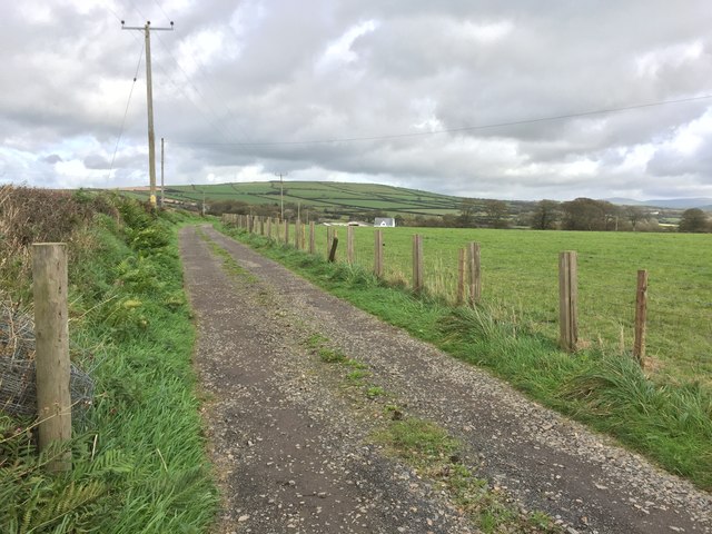
One of Ridge's notable features is its proximity to the famous Pembrokeshire Coast National Park, which spans over 600 square kilometers and is renowned for its stunning landscapes and diverse wildlife. Visitors to Ridge can enjoy exploring the park's numerous walking trails, which showcase the area's natural beauty and offer opportunities for birdwatching and wildlife spotting.

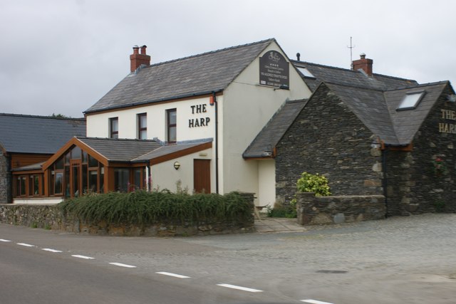
The village itself has a charming and traditional character, with picturesque stone cottages and a historic church that dates back several centuries. It also boasts a local pub and a small convenience store, providing basic amenities for both residents and tourists.

Ridge's coastal location makes it a popular destination for water sports enthusiasts. The nearby beaches offer excellent conditions for surfing, windsurfing, and kayaking. Additionally, the village's proximity to the Pembrokeshire Islands, such as Ramsey and Skomer, allows for exciting boat trips and wildlife excursions.

Overall, Ridge, Pembrokeshire offers a tranquil retreat for those seeking natural beauty and a slower pace of life. With its stunning coastal landscapes, charming village atmosphere, and easy access to outdoor activities, Ridge has something to offer for both locals and visitors alike.

If you have any feedback on the listing, please let us know in the comments section below.

Ridge Images

Images are sourced within 2km of 51.935548/-4.991288 or Grid Reference SM9430. Thanks to Geograph Open Source API. All images are credited.

Abandoned building site? According to <a href="https://www.geograph.org.uk/photo/5565877">SM9528 : Hotel or residential development?</a> taken 5 years ago this was to be a development of 18 houses
Abandoned building site?
According to SM9528 : Hotel or residential development? taken 5 years ago this was to be a development of 18 houses
Convenience store at Letterston
St. David's Road, Letterston This is the view near the newsagents shop looking down the B4331 leading to the busy crossroads near the local butcher, bakery, post office and charity shop.
St. David's Road, Letterston
This is the view near the newsagents shop looking down the B4331 leading to the busy crossroads near the local butcher, bakery, post office and charity shop.
Haverfordwest Road looking south
Barn at Swmbarch Farm Looking north-east towards Letterston.
Barn at Swmbarch Farm
Looking north-east towards Letterston.
Saron Baptist Chapel, Letterston
Village shop, Letterston
The Harp Inn, Letterston
Churchyard, St Giles Church Letterston
Centre of the village, Letterston Looking west along St David's Road, past the showroom of an electrical appliance shop, towards The Jubilee pub.
Centre of the village, Letterston
Looking west along St David's Road, past the showroom of an electrical appliance shop, towards The Jubilee pub.
Crossroads At Letterston The village derived its name form the ancient Norman family of Lettards to whom the parish belonged
Crossroads At Letterston
The village derived its name form the ancient Norman family of Lettards to whom the parish belonged
Classic Cars In Letterston Hopefully awaiting resurrection!
Classic Cars In Letterston
Hopefully awaiting resurrection!
Road Out Of Letterston Town or village?
Road Out Of Letterston
Town or village?
Harp Inn, Letterston The Harp Inn, Letterston.
Harp Inn, Letterston
The Harp Inn, Letterston.
Letterston railway station  (site), Pembrokeshire Opened in 1895 by the North Pembrokeshire and Fishguard Railway, later part of the Great Western Railway, on its line from Clunderwen to Fishguard & Goodwick, this station closed to passengers in 1937 and completely in 1965. View south east towards Beulah Halt and Clunderwen. No trace apparently remains. The site has become more overgrown in the seven years since <a href="https://www.geograph.org.uk/photo/1892338">SM9529 : Site of Letterston railway station</a> was taken. For more details, see <span class="nowrap"><a title="http://www.disused-stations.org.uk/l/letterston/index.shtml" rel="nofollow ugc noopener" href="http://www.disused-stations.org.uk/l/letterston/index.shtml">Link</a><img style="margin-left:2px;" alt="External link" title="External link - shift click to open in new window" src="https://s1.geograph.org.uk/img/external.png" width="10" height="10"/></span> .
Letterston railway station (site), Pembrokeshire
Opened in 1895 by the North Pembrokeshire and Fishguard Railway, later part of the Great Western Railway, on its line from Clunderwen to Fishguard & Goodwick, this station closed to passengers in 1937 and completely in 1965. View south east towards Beulah Halt and Clunderwen. No trace apparently remains. The site has become more overgrown in the seven years since SM9529 : Site of Letterston railway station was taken. For more details, see LinkExternal link .
Site of Letterston station, 2004 View SE, towards Clynderwen: ex-GWR Clynderwen - Rosebush - Fishguard branch. Until the shorter line from Clarbeston Road to Fishguard was opened in 8/1906  as the main line, this little-known branch was the access to Fishguard. The branch through Rosebush was closed 25/10/37 (goods 16/5/49), but the short stretch west from Letterston survived (for goods) until 1/3/65.
Site of Letterston station, 2004
View SE, towards Clynderwen: ex-GWR Clynderwen - Rosebush - Fishguard branch. Until the shorter line from Clarbeston Road to Fishguard was opened in 8/1906 as the main line, this little-known branch was the access to Fishguard. The branch through Rosebush was closed 25/10/37 (goods 16/5/49), but the short stretch west from Letterston survived (for goods) until 1/3/65.
Hotel or residential development? Marked on the OS map as a hotel, the site is currently being developed for residential properties.
Hotel or residential development?
Marked on the OS map as a hotel, the site is currently being developed for residential properties.
Track leading to Good Hope The track leads to Good Hope.  Out of sight to the right ( - where the grass is always greener?) is Better Hope!
Track leading to Good Hope
The track leads to Good Hope. Out of sight to the right ( - where the grass is always greener?) is Better Hope!
Show me another place!

Ridge is located at Grid Ref: SM9430 (Lat: 51.935548, Lng: -4.991288)

Unitary Authority: Pembrokeshire

Police Authority: Dyfed Powys

What 3 Words

///shiny.putts.thank. Near Letterston, Pembrokeshire

Nearby Locations

Letterston Ridge Treletert

Related Wikis

Letterston

Letterston (Welsh: Treletert) is a parish and local government community in north Pembrokeshire, Wales. Situated on the A40, Haverfordwest is 10 miles...

Letterston railway station

Letterston railway station served the parish of Letterston, Pembrokeshire, Wales, from 1895 to 1965 on the North Pembrokeshire and Fishguard Railway....

Mathry Road Halt railway station

Mathry Road Halt railway station was on the Clarbeston Road and Letterston line of the Great Western Railway. It served the village of Letterston 1 mile...

Preseli Pembrokeshire (Senedd constituency)

Preseli Pembrokeshire (Welsh: Preseli Sir Benfro) is a constituency of the Senedd. It elects one Member of the Senedd by the first past the post method...

Nearby Amenities

Located within 500m of 51.935548,-4.991288
Barrier: cattle_grid
Lat/Long: 51.9350533/-4.9909209
The data included in this document is from www.openstreetmap.org. The data is made available under ODbL.

Have you been to Ridge?

Leave your review of Ridge below (or comments, questions and feedback).