Bishopwearmouth

Settlement in Durham

England

Bishopwearmouth

St Peter's Church, Monkwearmouth, Sunderland Grade I listed Church 

<span class="nowrap"><a title="https://en.wikipedia.org/wiki/St_Peter%27s_Church,_Monkwearmouth" rel="nofollow ugc noopener" href="https://en.wikipedia.org/wiki/St_Peter%27s_Church,_Monkwearmouth">Link</a><img style="margin-left:2px;" alt="External link" title="External link - shift click to open in new window" src="https://s1.geograph.org.uk/img/external.png" width="10" height="10"/></span>
St Peter's Church, Monkwearmouth, Sunderland Credit: Brian Deegan

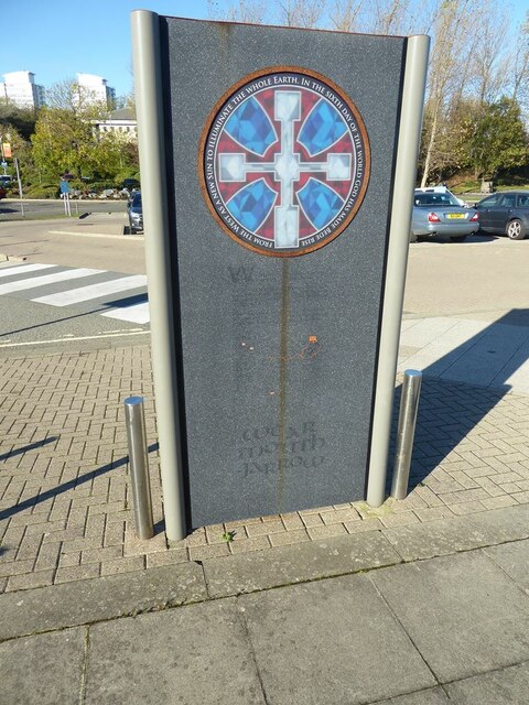
Bishopwearmouth is a historic area located in the city of Sunderland, in County Durham, England. It is situated on the southern bank of the River Wear, adjacent to the city center. The area has a rich history, dating back to Roman times when it was a significant settlement known as "Wearmouth."

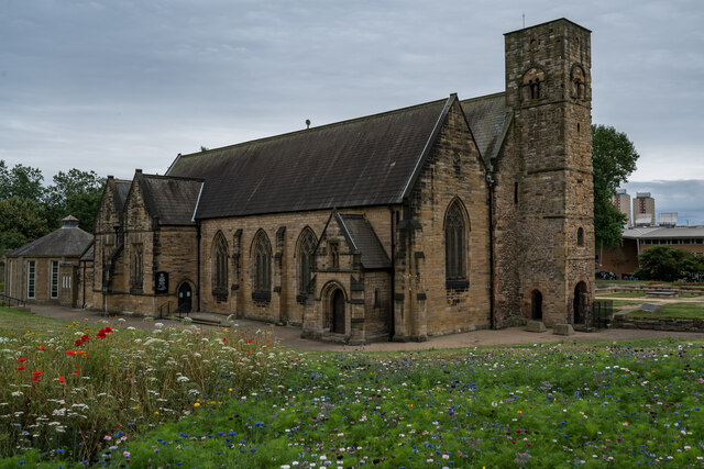
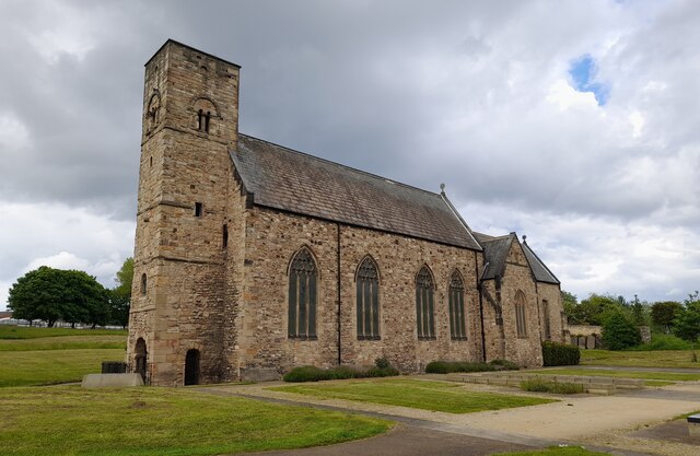
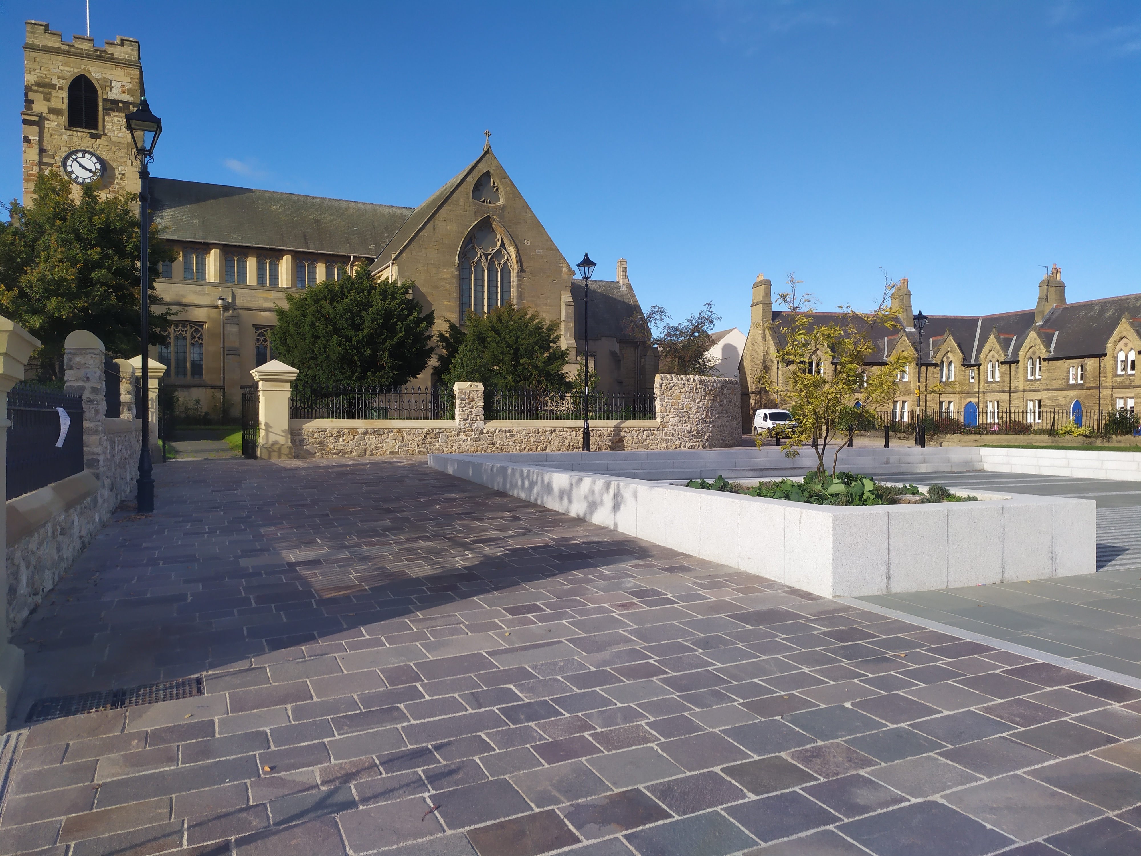
One of the notable features of Bishopwearmouth is St. Peter's Church, which dates back to the 7th century and is one of the oldest churches in the country. It was originally founded by Benedict Biscop and later became the site of a monastery. The church has undergone various renovations over the centuries but still retains its historical charm.

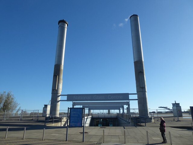
Bishopwearmouth is also known for its industrial heritage. In the 19th century, the area became heavily industrialized, with shipbuilding, coal mining, and glassmaking being prominent industries. Many of the old industrial buildings have been repurposed or demolished, but traces of the area's industrial past can still be seen.

Today, Bishopwearmouth is a mix of residential, commercial, and cultural spaces. It features a range of architectural styles, from Georgian and Victorian houses to modern developments. The area is well-connected to the rest of Sunderland and has good transportation links.

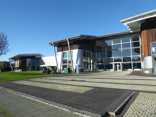
Bishopwearmouth offers a range of amenities, including shops, restaurants, and parks. It is also home to the University of Sunderland, which adds a vibrant and youthful atmosphere to the area. Overall, Bishopwearmouth is a blend of historical significance, industrial heritage, and modern amenities, making it an interesting and diverse place to explore.

If you have any feedback on the listing, please let us know in the comments section below.

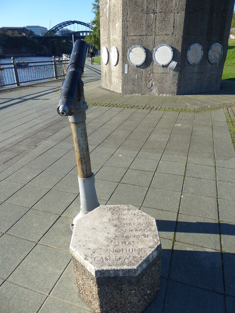
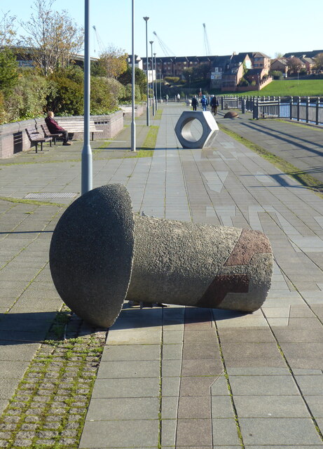
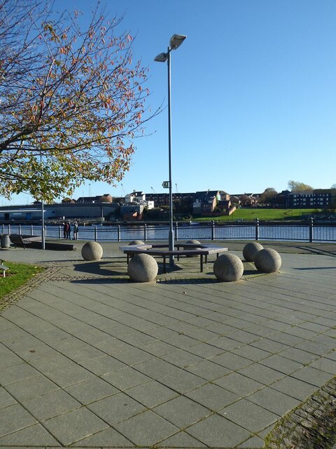
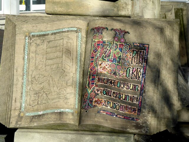
Bishopwearmouth Images

Images are sourced within 2km of 54.907831/-1.393339 or Grid Reference NZ3857. Thanks to Geograph Open Source API. All images are credited.

St Peter's Church, Monkwearmouth, Sunderland Grade I listed Church 

<span class="nowrap"><a title="https://en.wikipedia.org/wiki/St_Peter%27s_Church,_Monkwearmouth" rel="nofollow ugc noopener" href="https://en.wikipedia.org/wiki/St_Peter%27s_Church,_Monkwearmouth">Link</a><img style="margin-left:2px;" alt="External link" title="External link - shift click to open in new window" src="https://s1.geograph.org.uk/img/external.png" width="10" height="10"/></span>
St Peter's Church, Monkwearmouth, Sunderland
Grade I listed Church LinkExternal link
St Peter's Church in the parish of Monkwearmouth St Peter's Church, Monkwearmouth is the parish church of Monkwearmouth in Sunderland, Tyne and Wear, England. It is one of three churches in the Parish of Monkwearmouth. The others are the Victorian All Saints' Church, Monkwearmouth and the Edwardian St Andrew's Church, Roker.

St Peter's was founded in AD 674–5 as one of the two churches of the Benedictine double monastery of Monkwearmouth–Jarrow Abbey. The other church is St Paul's Church, Jarrow. St Peter's is a Grade I listed building and part of a scheduled monument.
St Peter's Church in the parish of Monkwearmouth
St Peter's Church, Monkwearmouth is the parish church of Monkwearmouth in Sunderland, Tyne and Wear, England. It is one of three churches in the Parish of Monkwearmouth. The others are the Victorian All Saints' Church, Monkwearmouth and the Edwardian St Andrew's Church, Roker. St Peter's was founded in AD 674–5 as one of the two churches of the Benedictine double monastery of Monkwearmouth–Jarrow Abbey. The other church is St Paul's Church, Jarrow. St Peter's is a Grade I listed building and part of a scheduled monument.
"Shadows in another light" Dating from 1998, one of the sculptures forming part of the St Peter's Riverside Sculpture Project. The base is actually the original base of a riverside crane. Sometimes alternatively known as "The Iron Tree". To the east, the supposed shadow of the original crane is picked out in the paving slabs along the riverside path. The University of Sunderland Library can be seen in the distance.
"Shadows in another light"
Dating from 1998, one of the sculptures forming part of the St Peter's Riverside Sculpture Project. The base is actually the original base of a riverside crane. Sometimes alternatively known as "The Iron Tree". To the east, the supposed shadow of the original crane is picked out in the paving slabs along the riverside path. The University of Sunderland Library can be seen in the distance.
"Shadows in another light" Dating from 1998, one of the sculptures forming part of the St Peter's Riverside Sculpture Project. The base is actually the original base of a riverside crane. Sometimes alternatively known as "The Iron Tree". To the east, the supposed shadow of the original crane is picked out in the paving slabs along the riverside path.
"Shadows in another light"
Dating from 1998, one of the sculptures forming part of the St Peter's Riverside Sculpture Project. The base is actually the original base of a riverside crane. Sometimes alternatively known as "The Iron Tree". To the east, the supposed shadow of the original crane is picked out in the paving slabs along the riverside path.
Shadow on St Peter's Riverside path The supposed shadow of a crane is picked out in the paving slabs along the riverside path. The University of Sunderland Library can be seen in the distance. See also <a href="https://www.geograph.org.uk/photo/7333203">NZ4057 : "Shadows in another light"</a>.
Shadow on St Peter's Riverside path
The supposed shadow of a crane is picked out in the paving slabs along the riverside path. The University of Sunderland Library can be seen in the distance. See also NZ4057 : "Shadows in another light".
Sculpture and "shadow" on St Peter's Riverside The supposed shadow of a crane (originally standing on the concrete base of the sculpture) is picked out in the paving slabs along the riverside path. A concrete "rivet" can also be seen, commemorating the days of shipbuilding.  See also <a href="https://www.geograph.org.uk/photo/7333203">NZ4057 : "Shadows in another light"</a>.
Sculpture and "shadow" on St Peter's Riverside
The supposed shadow of a crane (originally standing on the concrete base of the sculpture) is picked out in the paving slabs along the riverside path. A concrete "rivet" can also be seen, commemorating the days of shipbuilding. See also NZ4057 : "Shadows in another light".
Shadow beside St Peter's Riverside The actual shadow of the "Shadows in another light" sculpture. See also <a href="https://www.geograph.org.uk/photo/7333246">NZ4057 : Sculpture and "shadow" on St Peter's Riverside</a>.
Shadow beside St Peter's Riverside
The actual shadow of the "Shadows in another light" sculpture. See also NZ4057 : Sculpture and "shadow" on St Peter's Riverside.
Telescope on St Peter's Riverside The plinth bears the inscription:
"Look up and see behind you. A shadow can raise a memory that nothing can erase."
This refers to the sculpture seen in <a href="https://www.geograph.org.uk/photo/7333208">NZ4057 : "Shadows in another light"</a> and the supposed shadow of a crane seen in <a href="https://www.geograph.org.uk/photo/7333239">NZ4057 : Shadow on St Peter's Riverside path</a>.
Telescope on St Peter's Riverside
The plinth bears the inscription: "Look up and see behind you. A shadow can raise a memory that nothing can erase." This refers to the sculpture seen in NZ4057 : "Shadows in another light" and the supposed shadow of a crane seen in NZ4057 : Shadow on St Peter's Riverside path.
Rivet and nut Two artefacts commemorating the shipbuilding tradition of the locality; part of the St Peter's Riverside Sculpture Project.
Rivet and nut
Two artefacts commemorating the shipbuilding tradition of the locality; part of the St Peter's Riverside Sculpture Project.
Giant nut on St Peter's Riverside Artefact commemorating the shipbuilding tradition of the locality; part of the St Peter's Riverside Sculpture Project. A giant rivet and the "Shadows in another light" sculpture can be seen in the middle distance.
Giant nut on St Peter's Riverside
Artefact commemorating the shipbuilding tradition of the locality; part of the St Peter's Riverside Sculpture Project. A giant rivet and the "Shadows in another light" sculpture can be seen in the middle distance.
St Peter's Riverside Artefacts commemorating the shipbuilding tradition of the locality; part of the St Peter's Riverside Sculpture Project.
St Peter's Riverside
Artefacts commemorating the shipbuilding tradition of the locality; part of the St Peter's Riverside Sculpture Project.
Lamp standard on St Peter's Riverside.
"Pathways to Knowledge" The text was taken from an ancient manuscript kept  in St Peter's Church nearby, possibly with a connection to the Venerable Bede. This page is just one component of a sculpture of a pile of books installed in front of the University Library.
"Pathways to Knowledge"
The text was taken from an ancient manuscript kept in St Peter's Church nearby, possibly with a connection to the Venerable Bede. This page is just one component of a sculpture of a pile of books installed in front of the University Library.
University Library On St Peter's Riverside.
University Library
On St Peter's Riverside.
Bede's Way monument This monument which stands outside the National Glass Centre is apparently related to Bede's Way, a 20 km walking and cycling route linking the twin Anglo-Saxon monasteries of St Peter's in Wearmouth and St Paul's in Jarrow. However the thin yellow line (scarcely visible in this image) does not seem to conform to the shape of the route of Bede's Way. Small copies of the emblem can be found inserted into the paving of St Peter's Riverside (see <a href="https://www.geograph.org.uk/photo/7333194">NZ3957 : Emblem of Bede's Way</a>).
Bede's Way monument
This monument which stands outside the National Glass Centre is apparently related to Bede's Way, a 20 km walking and cycling route linking the twin Anglo-Saxon monasteries of St Peter's in Wearmouth and St Paul's in Jarrow. However the thin yellow line (scarcely visible in this image) does not seem to conform to the shape of the route of Bede's Way. Small copies of the emblem can be found inserted into the paving of St Peter's Riverside (see NZ3957 : Emblem of Bede's Way).
Entrance to the National Glass Centre
"Out  of the blue" Glass sculpture by Rachael Woodman, on display in the National Glass Centre.
"Out of the blue"
Glass sculpture by Rachael Woodman, on display in the National Glass Centre.
Show me another place!

Bishopwearmouth is located at Grid Ref: NZ3857 (Lat: 54.907831, Lng: -1.393339)

Unitary Authority: Sunderland

Police Authority: Northumbria

What 3 Words

///alarm.agenda.broke. Near Sunderland, Tyne & Wear

Related Wikis

University of Sunderland

The University of Sunderland is a public research university located in Sunderland in the North East of England. Its predecessor, Sunderland Technical...

Bishopwearmouth

Bishopwearmouth is a former village and parish which now constitutes the west side of Sunderland City Centre, merging with the settlement as it expanded...

Sunderland Minster

The Minster Church of St Michael and All Angels and St Benedict Biscop (commonly known as Sunderland Minster) is the minster church of Sunderland, Tyne...

City Hall, Sunderland

City Hall is a municipal building in Sunderland, Tyne and Wear, England. It is located on the Vaux Site, adjacent to Keel Square, and was opened in November...

Vaux Site

The Vaux Site is an area of brownfield land in the centre of Sunderland, Tyne and Wear currently undergoing development. The area of the former Vaux Breweries...

Sunderland Power Station

Sunderland Power Station was a coal-fired power station situated on the bank of the River Wear, in the city centre of Sunderland, in Tyne and Wear, North...

Millfield Metro station

Millfield is a Tyne and Wear Metro station, serving Sunderland Royal Hospital and the suburb of Millfield, City of Sunderland in Tyne and Wear, England...

University Metro station

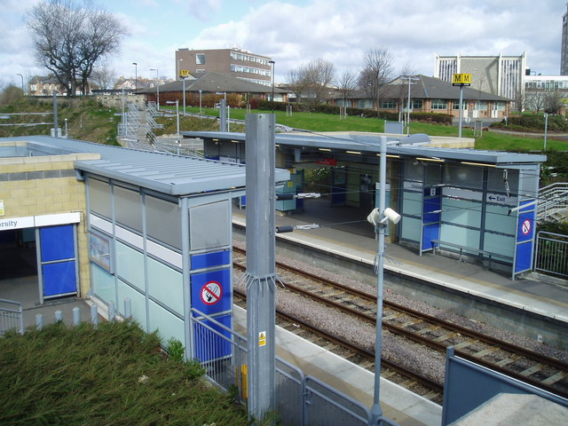
University is a Tyne and Wear Metro station, serving the University of Sunderland and suburb of Ashbrooke, City of Sunderland in Tyne and Wear. It joined...

Nearby Amenities

Located within 500m of 54.907831,-1.393339
Created By: almien_coastlines
Source: PGS
Lat/Long: 54.9119536/-1.3907457
Created By: almien_coastlines
Source: PGS
Lat/Long: 54.9117098/-1.3900037
Created By: almien_coastlines
Source: PGS
Lat/Long: 54.9115225/-1.3898404
Source: PGS
Lat/Long: 54.911296/-1.3886188
Source: PGS
Lat/Long: 54.9110632/-1.3882825
Source: PGS
Lat/Long: 54.9107818/-1.3876887
Source: PGS
Lat/Long: 54.9096896/-1.3871014
Source: PGS
Lat/Long: 54.9100825/-1.3881825
Source: PGS
Lat/Long: 54.9106138/-1.389387
Source: PGS
Lat/Long: 54.9107153/-1.3894196
Source: PGS
Lat/Long: 54.9112385/-1.3910231
Source: PGS
Lat/Long: 54.911424/-1.391572
Source: PGS
Lat/Long: 54.9115895/-1.3918774
Source: PGS
Lat/Long: 54.9118073/-1.3921513
Source: PGS
Lat/Long: 54.912216/-1.3925585
Traffic Signals
Traffic Signals Direction: backward
Lat/Long: 54.9047124/-1.389475
Traffic Signals
Traffic Signals: signal
Lat/Long: 54.9062953/-1.390352
Crossing
Crossing: traffic_signals
Lat/Long: 54.9043841/-1.3900089
Give Way
Lat/Long: 54.9042225/-1.3899699
Traffic Signals
Traffic Signals: signal
Lat/Long: 54.9077969/-1.3888523
Traffic Signals
Traffic Signals: signal
Lat/Long: 54.9077155/-1.3884611
Crossing
Crossing: unmarked
Crossing Island: yes
Tactile Paving: yes
Lat/Long: 54.9071119/-1.390438
Millfield
Created By: Potlatch 0.10f
Is In: Sunderland
Place: suburb
Lat/Long: 54.9079943/-1.3995599
Crossing
Crossing: traffic_signals
Lat/Long: 54.9045228/-1.3894707
Barrier: bollard
Lat/Long: 54.9049093/-1.38912
Pub
Victor's
Addr City: Sunderland
Addr Postcode: SR1 3PY
Addr Street: Low Row
Brand: Wetherspoon
Brand Wikidata: Q6109362
Brand Wikipedia: en:Wetherspoons
Fhrs Id: 998159
Source Addr: FHRS Open Data
Lat/Long: 54.9052888/-1.3894015
Crossing
Crossing: uncontrolled
Lat/Long: 54.9064343/-1.3868901
Entrance: yes
Lat/Long: 54.9065019/-1.3868721
Bus Stop
TRIMDON STREET-ENDERBY ROAD-E/B
Bus: yes
Local Ref: E
Naptan AtcoCode: 410000024397
Naptan Bearing: E
Naptan CommonName: TRIMDON STREET-ENDERBY ROAD-E/B
Naptan Indicator: E
Naptan Landmark: OUTSIDE THE CEMENT WORKS
Naptan NaptanCode: twrdwpaw
Naptan PlusbusZoneRef: SNDRLND
Naptan Street: TRIMDON STREET
Naptan Verified: no
Public Transport: platform
Source: naptan_import
Lat/Long: 54.9108549/-1.3986582
Bus Stop
Trimdon Street-B&Q
Bus: yes
Local Ref: S
Naptan AtcoCode: 410000024398
Naptan Bearing: S
Naptan Indicator: S-Bound
Naptan Landmark: Outside B&q
Naptan NaptanCode: twrdwpda
Naptan PlusbusZoneRef: SNDRLND
Naptan Street: Trimdon Street
Naptan Verified: no
Public Transport: platform
Source: naptan_import
Wheelchair: no
Lat/Long: 54.9100926/-1.3960024
Bus Stop
TRIMDON STREET-RETAIL PARK-S/B
Bus: yes
Local Ref: S
Naptan AtcoCode: 410000024399
Naptan Bearing: S
Naptan CommonName: TRIMDON STREET-RETAIL PARK-S/B
Naptan Indicator: S
Naptan Landmark: OUTSIDE RETAIL PARK
Naptan NaptanCode: twrdwpdg
Naptan PlusbusZoneRef: SNDRLND
Naptan Street: TRIMDON STREET
Naptan Verified: no
Public Transport: platform
Source: naptan_import
Lat/Long: 54.9086249/-1.3943745
Bus Stop
Chester Road
Bench: yes
Bin: no
Bus: yes
Departures Board: timetable
Local Ref: E
Naptan AtcoCode: 410000024934
Naptan Bearing: E
Naptan CommonName: CHESTER ROAD-UNIVERSITY-E/B
Naptan Indicator: E
Naptan Landmark: OUTSIDE THE UNIVERSITY OF SUNDERLAND BUILDING
Naptan NaptanCode: twrgagpa
Naptan PlusbusZoneRef: SNDRLND
Naptan Street: CHESTER ROAD
Naptan Verified: no
Public Transport: platform
Shelter: yes
Source: naptan_import
Lat/Long: 54.9034819/-1.3938725
Bus Stop
University Of Sunderland
Bench: yes
Bus: yes
Departures Board: timetable
Local Ref: A
Naptan AtcoCode: 410000024938
Naptan Bearing: E
Naptan CommonName: UNIVERSITY OF SUNDERLAND
Naptan Indicator: E
Naptan Landmark: OUTSIDE UNIERSITY OF SUNDERLAND
Naptan NaptanCode: twrgagpj
Naptan PlusbusZoneRef: SNDRLND
Naptan Street: CHESTER ROAD
Naptan Verified: no
Public Transport: platform
Shelter: yes
Source: naptan_import
Lat/Long: 54.9040496/-1.3909773
Bus Stop
Unversity of Sunderland
Bus: yes
Local Ref: W
Naptan AtcoCode: 410000024939
Naptan Bearing: W
Naptan CommonName: UNIVERSITY OF SUNDERLAND
Naptan Indicator: W
Naptan Landmark: OUTSIDE SUNDERLAND TECHNOLOGY PARK
Naptan NaptanCode: twrgagpm
Naptan PlusbusZoneRef: SNDRLND
Naptan Street: CHESTER ROAD
Naptan Verified: no
Public Transport: platform
Source: naptan_import
Lat/Long: 54.9037753/-1.3918236
Bus Stop
SUNDERLAND EMPIRE THEATRE
Bus: yes
Local Ref: E
Naptan AtcoCode: 410000024S02
Naptan Bearing: E
Naptan CommonName: SUNDERLAND EMPIRE THEATRE
Naptan Indicator: E
Naptan Landmark: OUTSIDE THE EMPIRE THEATRE
Naptan NaptanCode: twrgtata
Naptan PlusbusZoneRef: SNDRLND
Naptan Street: HIGH STREET WEST
Naptan Verified: no
Public Transport: platform
Source: naptan_import
Lat/Long: 54.9064771/-1.387603
Bus Stop
SILKSWORTH ROW-SHACKLETON HOUSE-N/B
Bus: yes
Local Ref: N
Naptan AtcoCode: 410000024S33
Naptan Bearing: N
Naptan CommonName: SILKSWORTH ROW-SHACKLETON HOUSE-N/B
Naptan Indicator: N
Naptan Landmark: OUTSIDE THE ISIS PUBLIC HOUSE
Naptan NaptanCode: twrgampj
Naptan PlusbusZoneRef: SNDRLND
Naptan Street: SILKSWORTH ROW
Naptan Verified: no
Public Transport: platform
Source: naptan_import
Lat/Long: 54.9068419/-1.3922609
Bus Stop
St Michaels Way (S/B)
Bus: yes
Local Ref: S
Naptan AtcoCode: 410000024S35
Naptan Bearing: S
Naptan CommonName: ST MICHAELS WAY-S/B
Naptan Indicator: S
Naptan Landmark: 80M NORTH OF THE GREENS PUBLIC HOUSE
Naptan NaptanCode: twrgampt
Naptan PlusbusZoneRef: SNDRLND
Naptan Street: ST MICHAEL'S WAY
Naptan Verified: no
Public Transport: platform
Source: naptan_import
Lat/Long: 54.9064636/-1.3902858
Bus Stop
Hind Street (N/B)
Bus: yes
Local Ref: N
Naptan AtcoCode: 410000024S36
Naptan Bearing: N
Naptan CommonName: HIND STREET-N/B
Naptan Indicator: N
Naptan Landmark: OPPOSITE TRAVELODGE
Naptan NaptanCode: twrgampw
Naptan PlusbusZoneRef: SNDRLND
Naptan Street: HIND STREET
Naptan Verified: no
Public Transport: platform
Source: naptan_import
Lat/Long: 54.9056381/-1.3905478
Bus Stop
Green Terrace
Bench: yes
Bin: no
Bus: yes
Departures Board: timetable
Local Ref: N
Naptan AtcoCode: 410000024S39
Naptan Bearing: N
Naptan CommonName: SUNDERLAND GREEN TERRACE
Naptan Indicator: N
Naptan Landmark: OUTSIDE PRIESTMAN BUILDING SUNDERLAND UNIVERSITY
Naptan NaptanCode: twrgtadg
Naptan PlusbusZoneRef: SNDRLND
Naptan Street: GREEN TERRACE
Naptan Verified: no
Public Transport: platform
Shelter: yes
Source: naptan_import
Lat/Long: 54.9042447/-1.3887924
Bus Stop
HYLTON ROAD-DEPTFORD ROAD-W/B
Bus: yes
Local Ref: W
Naptan AtcoCode: 410000024323
Naptan Bearing: W
Naptan CommonName: HYLTON ROAD-DEPTFORD ROAD-W/B
Naptan Indicator: W
Naptan Landmark: 35M EAST OPPOSITE DEPTFORD ROAD
Naptan NaptanCode: twrdwjpt
Naptan PlusbusZoneRef: SNDRLND
Naptan Street: HYLTON ROAD
Naptan Verified: no
Public Transport: platform
Source: naptan_import
Lat/Long: 54.9070557/-1.3954707
Bus Stop
Hylton Road
Bus: yes
Departures Board: timetable
Local Ref: W
Naptan AtcoCode: 410000024324
Naptan Bearing: W
Naptan CommonName: HYLTON ROAD-ST MARKS CHURCH-W/B
Naptan Indicator: W
Naptan Landmark: OUTSIDE ST MARK'S CHURCH
Naptan NaptanCode: twrdwjpw
Naptan PlusbusZoneRef: SNDRLND
Naptan Street: HYLTON ROAD
Naptan Verified: no
Public Transport: platform
Shelter: yes
Source: naptan_import
Lat/Long: 54.9065817/-1.3977549
Bus Stop
Millfield Metro
Bus: yes
Departures Board: timetable
Local Ref: A
Naptan AtcoCode: 410000024325
Naptan Bearing: W
Naptan CommonName: MILLFIELD METRO (M)
Naptan Indicator: W
Naptan Landmark: OUTSIDE SURGERY
Naptan NaptanCode: twrdwjta
Naptan PlusbusZoneRef: SNDRLND
Naptan Street: HYLTON ROAD
Naptan Verified: no
Public Transport: platform
Shelter: yes
Source: naptan_import
Lat/Long: 54.906844/-1.3999033
Bus Stop
MILLFIELD METRO (M)
Bus: yes
Local Ref: E
Naptan AtcoCode: 410000024357
Naptan Bearing: E
Naptan CommonName: MILLFIELD METRO (M)
Naptan Indicator: E
Naptan Landmark: OPPOSITE STONE BRIDGE PUBLIC HOUSE AND SURGERY
Naptan NaptanCode: twrdwmgj
Naptan PlusbusZoneRef: SNDRLND
Naptan Street: HYLTON ROAD
Naptan Verified: no
Public Transport: platform
Source: naptan_import
Lat/Long: 54.906957/-1.4009466
Bus Stop
HYLTON ROAD-TRIMDON STREET-W/B
Bus: yes
Local Ref: E
Naptan AtcoCode: 410000024358
Naptan Bearing: E
Naptan CommonName: HYLTON ROAD-TRIMDON STREET-W/B
Naptan Indicator: E
Naptan Landmark: 40M WEST OF TRIMDON STREET ROUNDABOUT
Naptan NaptanCode: twrdwmgm
Naptan PlusbusZoneRef: SNDRLND
Naptan Street: HYLTON ROAD
Naptan Verified: no
Public Transport: platform
Source: naptan_import
Lat/Long: 54.907286/-1.3948121
Bus Stop
TRIMDON STREET-RETAIL PARK-N/B
Bus: yes
Local Ref: N
Naptan AtcoCode: 410000024359
Naptan Bearing: N
Naptan CommonName: TRIMDON STREET-RETAIL PARK-N/B
Naptan Indicator: N
Naptan Landmark: OPPOSITE RETAIL PARK
Naptan NaptanCode: twrdwmgp
Naptan PlusbusZoneRef: SNDRLND
Naptan Street: TRIMDON STREET
Naptan Verified: no
Public Transport: platform
Shelter: no
Source: naptan_import
Lat/Long: 54.9084551/-1.3946316
Bus Stop
Trimdon Street
Bus: yes
Departures Board: timetable
Local Ref: N
Naptan AtcoCode: 410000024360
Naptan Bearing: N
Naptan CommonName: TRIMDON STREET-B&Q-N/B
Naptan Indicator: N
Naptan Landmark: OPPOSITE B&Q
Naptan NaptanCode: twrdwmgt
Naptan PlusbusZoneRef: SNDRLND
Naptan Street: TRIMDON STREET
Naptan Verified: no
Public Transport: platform
Shelter: no
Source: naptan_import
Lat/Long: 54.9098065/-1.3958188
Bus Stop
TRIMDON STREET-ENDERBY ROAD-W/B
Bus: yes
Local Ref: W
Naptan AtcoCode: 410000024361
Naptan Bearing: W
Naptan CommonName: TRIMDON STREET-ENDERBY ROAD-W/B
Naptan Indicator: W
Naptan Landmark: OPPOSITE THE CEMENT WORKS
Naptan NaptanCode: twrdwmgw
Naptan PlusbusZoneRef: SNDRLND
Naptan Street: TRIMDON STREET
Naptan Verified: no
Public Transport: platform
Source: naptan_import
Lat/Long: 54.9107489/-1.3990341
Bus Stop
MILLFIELD
Bus: yes
Local Ref: S
Naptan AtcoCode: 4100024MS03A
Naptan Bearing: S
Naptan CommonName: MILLFIELD
Naptan Indicator: S
Naptan Landmark: OUTSIDE THE STONE BRIDGE PUBLIC HOUSE
Naptan NaptanCode: twrgtjtw
Naptan PlusbusZoneRef: SNDRLND
Naptan Street: ALBERT ROAD
Naptan Verified: no
Public Transport: platform
Source: naptan_import
Lat/Long: 54.9068781/-1.4002831
Traffic Signals
Traffic Signals: signal
Lat/Long: 54.9105067/-1.3975956
Traffic Calming: hump
Lat/Long: 54.9103074/-1.3982091
Barrier: bollard
Lat/Long: 54.9084709/-1.3995275
Barrier: bollard
Lat/Long: 54.9086803/-1.3994512
Crossing
Button Operated: yes
Crossing: traffic_signals
Tactile Paving: yes
Lat/Long: 54.9060454/-1.3904638
Bicycle Parking
Capacity: 18
Lat/Long: 54.9055497/-1.392697
Crossing
Crossing: traffic_signals
Lat/Long: 54.9046743/-1.3894865
Traffic Signals
Traffic Signals Direction: forward
Lat/Long: 54.9045046/-1.3894436
Traffic Signals
Button Operated: yes
Traffic Signals Direction: forward
Lat/Long: 54.9044089/-1.3893875
Traffic Signals
Lat/Long: 54.9046789/-1.3895398
Traffic Signals
Traffic Signals Direction: forward
Lat/Long: 54.9043061/-1.3899764
Traffic Signals
Crossing: traffic_signals
Lat/Long: 54.9046244/-1.3896594
Traffic Signals
Crossing: traffic_signals
Lat/Long: 54.9045595/-1.3897595
Traffic Signals
Traffic Signals Direction: forward
Lat/Long: 54.9042231/-1.3897869
Traffic Signals
Traffic Signals Direction: forward
Lat/Long: 54.9046255/-1.3895001
Traffic Signals
Traffic Signals Direction: forward
Lat/Long: 54.9042365/-1.3896843
Traffic Signals
Traffic Signals: crossing
Lat/Long: 54.9071925/-1.3930133
Traffic Signals
Traffic Signals: crossing
Lat/Long: 54.9095249/-1.3949942
Railway: signal
Ref: T6295
Lat/Long: 54.9062108/-1.4006236
Barrier: bollard
Lat/Long: 54.9049421/-1.3991176
Barrier: bollard
Lat/Long: 54.9050126/-1.3989364
Barrier: bollard
Lat/Long: 54.9055205/-1.3884851
Crossing
Crossing: traffic_signals
Lat/Long: 54.9044722/-1.3898526
Bar
Kings Arms
Addr City: Sunderland
Addr Street: Beach Street
Lat/Long: 54.9118614/-1.3938312
Bicycle Parking
Capacity: 6
Lat/Long: 54.9071085/-1.3869938
Crossing
Crossing: uncontrolled
Lat/Long: 54.9074741/-1.3891339
Entrance: main
Lat/Long: 54.9074782/-1.3880693
Barrier: bollard
Note: removable bollard
Lat/Long: 54.9048233/-1.3883304
Barrier: bollard
Note: removable bollard
Lat/Long: 54.9048211/-1.3883596
Barrier: bollard
Lat/Long: 54.9061916/-1.3885346
Barrier: bollard
Lat/Long: 54.9061902/-1.3885494
Barrier: bollard
Lat/Long: 54.9061906/-1.3885645
Entrance: yes
Lat/Long: 54.905678/-1.3864893
Barrier: bollard
Lat/Long: 54.906464/-1.3867558
Waste Basket
Lat/Long: 54.9064847/-1.3867871
Waste Basket
Lat/Long: 54.9064869/-1.3867228
Bench
Lat/Long: 54.9065039/-1.3867909
Bench
Lat/Long: 54.9065354/-1.3868009
Artwork Type: sculpture
Inscription: First the keel line is laid, then the ship can be built
Tourism: artwork
Lat/Long: 54.9067792/-1.3868067
Crossing
Crossing: unmarked
Tactile Paving: yes
Lat/Long: 54.9072093/-1.3906562
Bench
Lat/Long: 54.9074185/-1.3871113
Bench
Lat/Long: 54.9074591/-1.3870572
Bus Stop
Bench: yes
Bus: yes
Departures Board: timetable
Naptan AtcoCode: 410000024S34
Naptan NaptanCode: twrgampm
Public Transport: platform
Shelter: yes
Lat/Long: 54.9076849/-1.3879093
Crossing
Crossing: uncontrolled
Lat/Long: 54.9077704/-1.385515
Crossing
Crossing: traffic_signals
Lat/Long: 54.9078028/-1.3869593
Traffic Signals
Crossing: traffic_signals
Traffic Signals: signal
Lat/Long: 54.9078741/-1.3887223
Crossing
Crossing: traffic_signals
Lat/Long: 54.9079168/-1.3869802
Entrance: yes
Lat/Long: 54.904667/-1.3879425
Parking Entrance
Exit: yes
Lat/Long: 54.904657/-1.3880276
Cafe
Starbucks
Addr City: Sunderland
Addr Housenumber: 86
Addr Postcode: SR1 3LB
Addr Street: The Bridges Shopping Centre
Brand: Starbucks
Brand Wikidata: Q37158
Brand Wikipedia: en:Starbucks
Cuisine: coffee_shop
Fhrs Id: 652820
Official Name: Starbucks Coffee
Source Addr: FHRS Open Data
Takeaway: yes
Website: https://www.starbucks.com/store-locator/store/1043250/sunderland-the-bridges-unit-14-15-the-bridges-shopping-centre-sunderland-
Lat/Long: 54.9056171/-1.3865919
Pandora
Addr City: Sunderland
Addr Street: The Bridges Shopping Centre
Brand: Pandora
Brand Wikidata: Q2241604
Brand Wikipedia: en:Pandora (jewelry)
Contact Website: https://stores.pandora.net/gb-net/sunderland/pandora-jewellery-gbfc9082cf.html
Shop: jewelry
Lat/Long: 54.9055271/-1.3866427
Halfords Autocentre
Addr City: Sunderland
Brand: Halfords Autocentre
Brand Wikidata: Q5641894
Brand Wikipedia: en:Halfords Autocentre
Shop: car_repair
Lat/Long: 54.9088978/-1.3933418
Currys
Addr City: Sunderland
Brand: currys
Brand Wikidata: Q3246464
Brand Wikipedia: en:Currys
Contact Website: https://www.currys.co.uk/store-finder/sunderland--2399.html
Shop: electronics
Lat/Long: 54.9083078/-1.3937205
B&Q
Addr City: Sunderland
Brand: B&Q
Brand Wikidata: Q707602
Brand Wikipedia: en:B&Q
Contact Website: https://www.diy.com/store/1050
Shop: doityourself
Lat/Long: 54.9106111/-1.3952464
Empire Theatre Box Office
Addr City: Sunderland
Addr Street: High Street West
Shop: ticket
Lat/Long: 54.9062471/-1.3893322
Alan Duckworth Funeral Directors
Addr City: Sunderland
Addr Street: High Street West
Phone: +44 191 567 2705
Shop: funeral_directors
Lat/Long: 54.906281/-1.389131
Restaurant
Happiness 3
Addr City: Sunderland
Addr Street: High Street West
Lat/Long: 54.9063103/-1.3889674
Entrance: yes
Lat/Long: 54.9063273/-1.3887555
The Little Waxing Co.
Addr City: Sunderland
Addr Street: Green Terrace
Shop: beauty
Lat/Long: 54.9042006/-1.3888541
Street Lamp
Camera Mount: street_lamp
Camera Type: dome
Man Made: surveillance
Surveillance Type: camera
Lat/Long: 54.9071404/-1.390946
Barrier: bollard
Lat/Long: 54.9084907/-1.399695
Home Bargains
Addr City: Sunderland
Addr Postcode: SR4 6DW
Addr Street: Trimdon Street
Brand: Home Bargains
Brand Wikidata: Q5888229
Brand Wikipedia: en:Home Bargains
Contact Website: https://storelocator.homebargains.co.uk/store/A661/Trimdon+Street,+Sunderland
Fhrs Id: 1095688
Shop: variety_store
Source Addr: FHRS Open Data
Lat/Long: 54.9099609/-1.3939393
Ocado Contact Centre
Office: company
Start Date: 2019-12-02
Lat/Long: 54.9087167/-1.387626
Traffic Signals
Button Operated: yes
Crossing: traffic_signals
Traffic Signals: signal
Lat/Long: 54.9078701/-1.3888999
Traffic Signals
Button Operated: yes
Crossing: traffic_signals
Traffic Signals: signal
Lat/Long: 54.9079152/-1.3885637
Diva Nails
Beauty: nails
Shop: beauty
Lat/Long: 54.9072867/-1.3857583
Shop: vacant
Lat/Long: 54.9073015/-1.385626
Bodyzone
Shop: sports
Lat/Long: 54.9072989/-1.3856965
Crossing
Crossing: traffic_signals
Crossing Island: yes
Crossing Ref: toucan
Tactile Paving: yes
Lat/Long: 54.9079307/-1.3943431
Traffic Signals
Traffic Signals: signal
Lat/Long: 54.9102116/-1.3971012
Traffic Signals
Traffic Signals: signal
Traffic Signals Direction: forward
Lat/Long: 54.9109885/-1.3988083
Traffic Signals
Traffic Signals: signal
Lat/Long: 54.9106131/-1.3975747
Traffic Signals
Traffic Signals: signal
Lat/Long: 54.9105292/-1.3970123
Crossing
Crossing: traffic_signals
Crossing Island: yes
Crossing Ref: toucan
Tactile Paving: yes
Lat/Long: 54.9080212/-1.3942188
Post Box
Brand: Royal Mail
Brand Wikidata: Q638098
Operator: Royal Mail
Operator Wikidata: Q638098
Post Box Type: pillar
Royal Cypher: GVIR
Royal Cypher Wikidata: Q33102169
Lat/Long: 54.9036864/-1.3932214
Traffic Signals
Traffic Signals: signal
Traffic Signals Direction: forward
Lat/Long: 54.910923/-1.3989547
Traffic Signals
Traffic Signals: signal
Lat/Long: 54.9105436/-1.3972191
Traffic Signals
Traffic Signals: crossing
Lat/Long: 54.9093389/-1.3949822
Crossing
Crossing: traffic_signals
Crossing Island: yes
Crossing Ref: toucan
Tactile Paving: yes
Lat/Long: 54.9093768/-1.395018
Crossing
Crossing: traffic_signals
Crossing Island: yes
Crossing Ref: toucan
Tactile Paving: yes
Lat/Long: 54.9094854/-1.3949508
Traffic Signals
Traffic Signals: signal
Lat/Long: 54.9102719/-1.3970568
Crossing
Crossing: unmarked
Crossing Island: yes
Tactile Paving: yes
Lat/Long: 54.9073309/-1.3939008
Traffic Signals
Traffic Signals: crossing
Lat/Long: 54.908068/-1.3942416
Traffic Signals
Traffic Signals: crossing
Lat/Long: 54.9078854/-1.3943224
Traffic Signals
Traffic Signals: crossing
Lat/Long: 54.9073912/-1.3930743
Crossing
Crossing: traffic_signals
Crossing Island: yes
Crossing Ref: toucan
Tactile Paving: yes
Lat/Long: 54.9073583/-1.3930148
Crossing
Crossing: traffic_signals
Crossing Island: yes
Crossing Ref: toucan
Tactile Paving: yes
Lat/Long: 54.9072208/-1.3930708
Crossing
Crossing: unmarked
Crossing Island: yes
Tactile Paving: yes
Lat/Long: 54.9077501/-1.3933079
Crossing
Crossing: unmarked
Crossing Island: yes
Tactile Paving: yes
Lat/Long: 54.9078017/-1.3934499
Crossing
Crossing: zebra
Crossing Island: no
Tactile Paving: yes
Lat/Long: 54.9073575/-1.3943487
Give Way
Direction: backward
Lat/Long: 54.9120581/-1.3939958
Crossing
Crossing: traffic_signals
Crossing Island: yes
Crossing Ref: toucan
Tactile Paving: yes
Lat/Long: 54.9102908/-1.397128
Crossing
Crossing: traffic_signals
Crossing Island: yes
Crossing Ref: toucan
Tactile Paving: yes
Lat/Long: 54.9102326/-1.3971716
Crossing
Crossing: traffic_signals
Crossing Island: yes
Crossing Ref: toucan
Tactile Paving: yes
Lat/Long: 54.9103901/-1.3971623
Crossing
Crossing: traffic_signals
Crossing Island: yes
Crossing Ref: toucan
Tactile Paving: yes
Lat/Long: 54.9105066/-1.3972527
Crossing
Crossing: traffic_signals
Crossing Island: yes
Crossing Ref: toucan
Tactile Paving: yes
Lat/Long: 54.9105435/-1.3973756
Crossing
Crossing: traffic_signals
Crossing Island: yes
Crossing Ref: toucan
Tactile Paving: yes
Lat/Long: 54.9106248/-1.3975071
Crossing
Crossing: traffic_signals
Crossing Island: yes
Crossing Ref: toucan
Tactile Paving: yes
Lat/Long: 54.9104864/-1.3970008
Crossing
Crossing: unmarked
Crossing Island: no
Tactile Paving: yes
Lat/Long: 54.9097864/-1.3961135
Crossing
Crossing: unmarked
Crossing Island: no
Tactile Paving: yes
Lat/Long: 54.9112275/-1.3960639
Crossing
Crossing: unmarked
Crossing Island: yes
Tactile Paving: yes
Lat/Long: 54.9109187/-1.3963252
Give Way
Lat/Long: 54.9057532/-1.3904701
Bus Stop
CITY HALL--E/B
Bus: yes
Naptan: twrgtata
Naptan AtcoCode: 410000024S02
Naptan NaptanCode: twrgtata
Public Transport: platform
Lat/Long: 54.9080574/-1.3862108
Traffic Signals
Traffic Signals: crossing
Lat/Long: 54.9079103/-1.387129
Traffic Signals
Traffic Signals: signal
Lat/Long: 54.9078111/-1.3867953
Bus Stop
Bus: yes
Public Transport: platform
Lat/Long: 54.9072685/-1.3892437
Crossing
Crossing: unmarked
Crossing Island: yes
Tactile Paving: yes
Lat/Long: 54.9073236/-1.3937528
Crossing
Crossing: unmarked
Crossing Island: no
Tactile Paving: yes
Lat/Long: 54.9070172/-1.392736
Barrier: bollard
Lat/Long: 54.9065337/-1.3914995
Crossing
Crossing: pavement
Lat/Long: 54.907663/-1.3944746
Crossing
Crossing: unmarked
Crossing Island: no
Tactile Paving: yes
Lat/Long: 54.9078734/-1.3945596
Crossing
Crossing: pavement
Lat/Long: 54.9080665/-1.3946384
Crossing
Crossing: unmarked
Crossing Island: no
Tactile Paving: yes
Lat/Long: 54.9082797/-1.3947249
Crossing
Crossing: pavement
Lat/Long: 54.9084873/-1.3948102
Crossing
Crossing: unmarked
Crossing Island: no
Tactile Paving: yes
Lat/Long: 54.908706/-1.3949004
Crossing
Crossing: unmarked
Crossing Island: no
Tactile Paving: yes
Lat/Long: 54.9091159/-1.3950888
Crossing
Crossing: unmarked
Crossing Island: no
Tactile Paving: yes
Lat/Long: 54.909564/-1.3957509
Crossing
Crossing: pavement
Lat/Long: 54.9089103/-1.3949907
Crossing
Button Operated: yes
Crossing: traffic_signals
Tactile Paving: yes
Lat/Long: 54.9059929/-1.390286
Give Way
Lat/Long: 54.9045492/-1.3899347
Barrier: bollard
Lat/Long: 54.9063145/-1.3886811
Traffic Signals
Traffic Signals Direction: backward
Lat/Long: 54.9044822/-1.3889172
Traffic Signals
Traffic Signals Direction: forward
Lat/Long: 54.9045063/-1.3888251
Traffic Signals
Traffic Signals Direction: forward
Lat/Long: 54.9045897/-1.3888354
Traffic Signals
Traffic Signals Direction: backward
Lat/Long: 54.9045546/-1.3888051
Traffic Signals
Lat/Long: 54.9046601/-1.3888826
Traffic Signals
Traffic Signals Direction: forward
Lat/Long: 54.904674/-1.3888344
Traffic Signals
Traffic Signals Direction: backward
Lat/Long: 54.9045561/-1.3894934
Traffic Signals
Traffic Signals Direction: backward
Lat/Long: 54.9046283/-1.3888624
Traffic Signals
Button Operated: yes
Crossing: traffic_signals
Lat/Long: 54.9044511/-1.3894196
Traffic Signals
Lat/Long: 54.9045844/-1.3887689
Traffic Signals
Traffic Signals Direction: backward
Lat/Long: 54.9044644/-1.3894784
Traffic Signals
Lat/Long: 54.9044689/-1.3888457
Door: yes
Entrance: yes
Lat/Long: 54.9035531/-1.3938545
Gan Canny
Artwork Type: sculpture
Tourism: artwork
Lat/Long: 54.9074746/-1.3875604
Beauty: tanning
Shop: beauty
Lat/Long: 54.9091748/-1.3952353
Crossing
Crossing: traffic_signals
Lat/Long: 54.9044405/-1.3894392
The data included in this document is from www.openstreetmap.org. The data is made available under ODbL.

Have you been to Bishopwearmouth?

Leave your review of Bishopwearmouth below (or comments, questions and feedback).