Portfield

Settlement in Somerset South Somerset

England

Portfield

Flats fields, and a railway line out there somewhere
Flats fields, and a railway line out there somewhere Credit: Rob Purvis

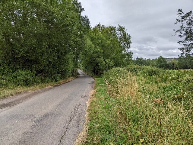
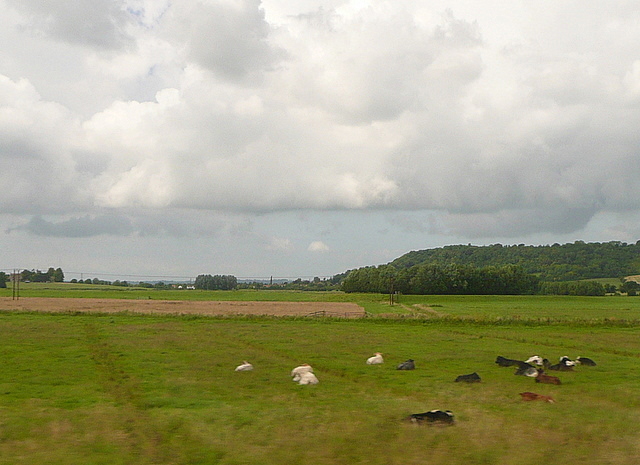
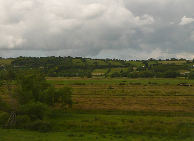
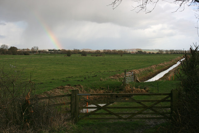
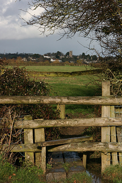
Portfield is a small village located in the county of Somerset, England. Situated in the South West of the country, it lies approximately 5 miles south of the town of Yeovil and 20 miles north of the coastal city of Weymouth. The village is nestled in a rural area, surrounded by picturesque countryside and rolling hills.

The population of Portfield is relatively small, with roughly 300 residents. The village has a close-knit community, and many of its inhabitants are engaged in agricultural activities or commute to nearby towns for work.

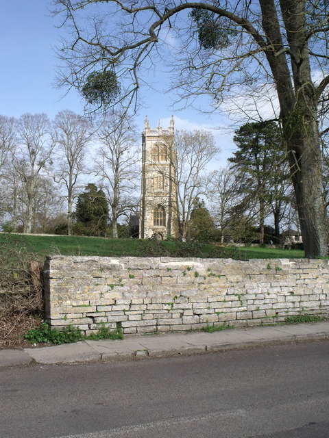
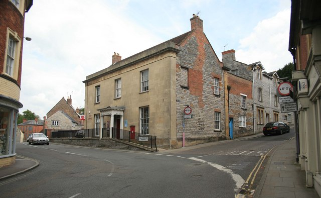
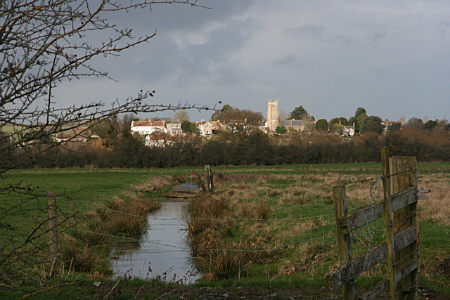
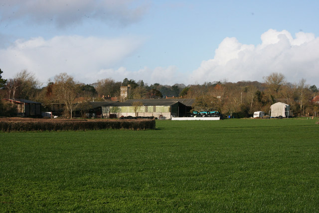
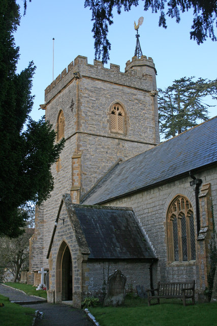
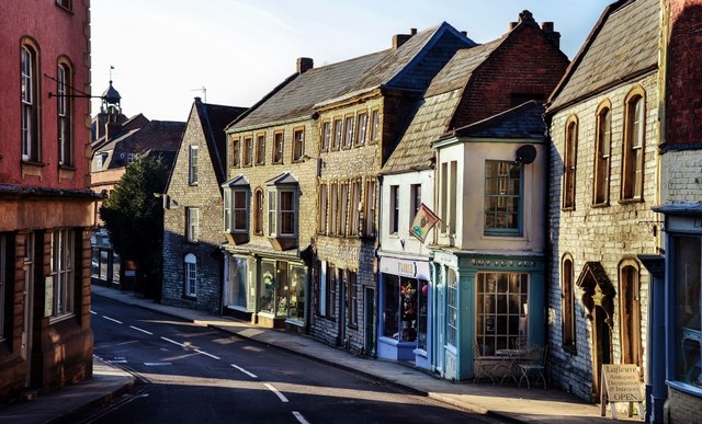
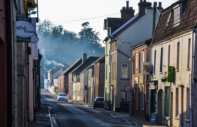
Portfield boasts a charming, traditional English village aesthetic. Its architecture primarily consists of stone cottages and farmhouses, giving it a rustic and timeless appeal. The village is also home to a historic church, which dates back to the 12th century and is a popular landmark among locals and visitors alike.

Although Portfield is a small village, it offers a few amenities to its residents. This includes a local pub, which serves as a social hub for the community. Additionally, there is a small primary school that caters to the educational needs of the village's children.

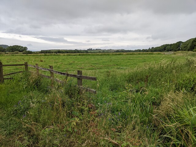
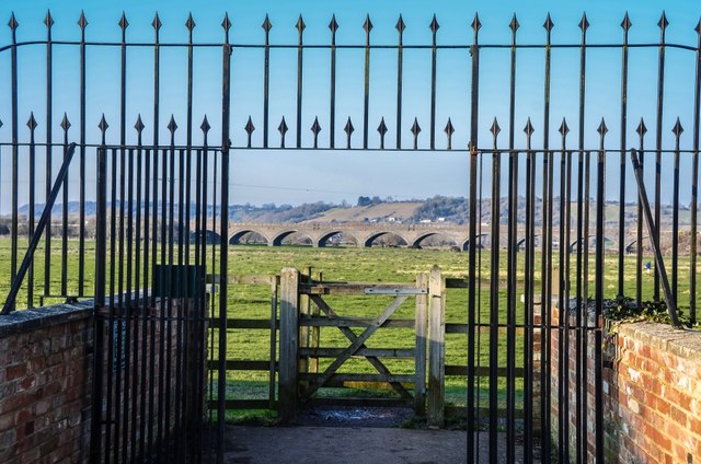
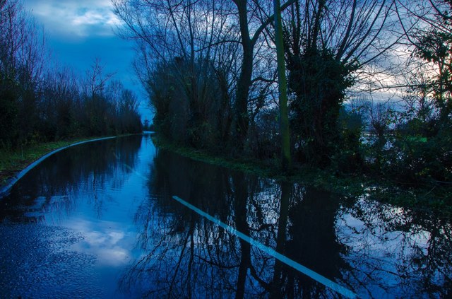
Portfield is located in an area known for its natural beauty, making it an ideal destination for outdoor enthusiasts. The surrounding countryside provides ample opportunities for hiking, cycling, and exploring the scenic landscape.

Overall, Portfield is a tranquil and idyllic village that offers a peaceful retreat for those seeking a rural lifestyle in the heart of Somerset.

If you have any feedback on the listing, please let us know in the comments section below.
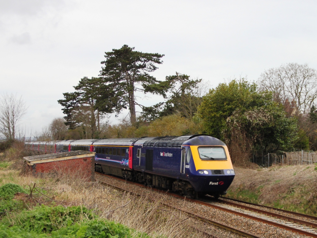
Portfield Images

Images are sourced within 2km of 51.036003/-2.845005 or Grid Reference ST4026. Thanks to Geograph Open Source API. All images are credited.

Flats fields, and a railway line out there somewhere
Lane heading towards Wick
Signposts, Huish Episcopi, Somerset
St. Mary's, Huish Episcopi, Somerset
The Post Office at Langport
Port Moor Part of the Somerset Levels, where all the lines you see are one sort of ditch or another.  Looking north towards Aller Hill <a href="https://www.geograph.org.uk/gridref/ST4029">ST4029</a>
This photo was taken from the 1158 Penzance to London Paddington train, having left Taunton at 1529.
Port Moor
Part of the Somerset Levels, where all the lines you see are one sort of ditch or another. Looking north towards Aller Hill ST4029 This photo was taken from the 1158 Penzance to London Paddington train, having left Taunton at 1529.
Poolmead An area of what looks like particularly wet and poor quality pasture to the north-west of Langport, despite the many drainage ditches.  On the map this has almost a paddy field quality.
This photo was taken from the 1158 Penzance to London Paddington train, having left Taunton at 1529.
Poolmead
An area of what looks like particularly wet and poor quality pasture to the north-west of Langport, despite the many drainage ditches. On the map this has almost a paddy field quality. This photo was taken from the 1158 Penzance to London Paddington train, having left Taunton at 1529.
Langport across Huish Level
Huish Level, Langport
Langport from the footpath to Drayton
Drayton from Latch Meads
Drayton church
Drayton church
Langport: Bow Street
Langport: View across Little Moor towards the Viaduct
Langport: Bow Street
Langport Telephone Exchange Situated in Old Market Square off the A378 North Street, this modern TE would have replaced a smaller building from the GPO era during the early 1970s. Besides Langport, this TE also serves Aller, Bramwell, Curry Rivel, Drayton, Henley, High Ham, Huish Episcopi, Low Ham, Muchelney, Pibsbury, Pitney and Wearne nearby. This TE has (01458) 25xxxx numbers, the (01458) referring to the Glastonbury group of TEs, and its postcode is TA10 9RP.
Langport Telephone Exchange
Situated in Old Market Square off the A378 North Street, this modern TE would have replaced a smaller building from the GPO era during the early 1970s. Besides Langport, this TE also serves Aller, Bramwell, Curry Rivel, Drayton, Henley, High Ham, Huish Episcopi, Low Ham, Muchelney, Pibsbury, Pitney and Wearne nearby. This TE has (01458) 25xxxx numbers, the (01458) referring to the Glastonbury group of TEs, and its postcode is TA10 9RP.
Langport: Road from Langport during the Floods
The Town Hall, Langport
Show me another place!

Portfield is located at Grid Ref: ST4026 (Lat: 51.036003, Lng: -2.845005)

Administrative County: Somerset

District: South Somerset

Police Authority: Avon and Somerset

What 3 Words

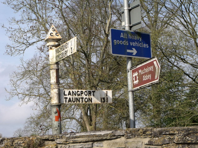
///truffles.needed.chestnuts. Near Langport, Somerset

Related Wikis

Warehouse, Langport

The Warehouse in Great Bow Yard Langport, Somerset, England is an example of Victorian industrial architecture. The Warehouse was built in the late 18th...
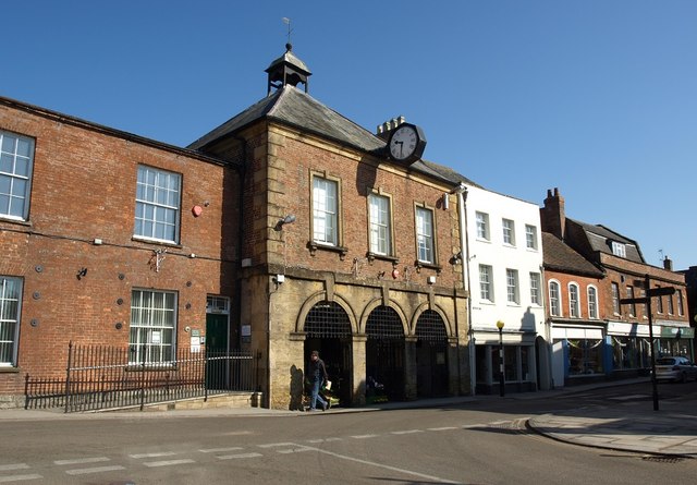
Langport Town Hall

Langport Town Hall is a municipal building in Bow Street in Langport, Somerset, England. The building, which is the meeting place of Langport Town Council...

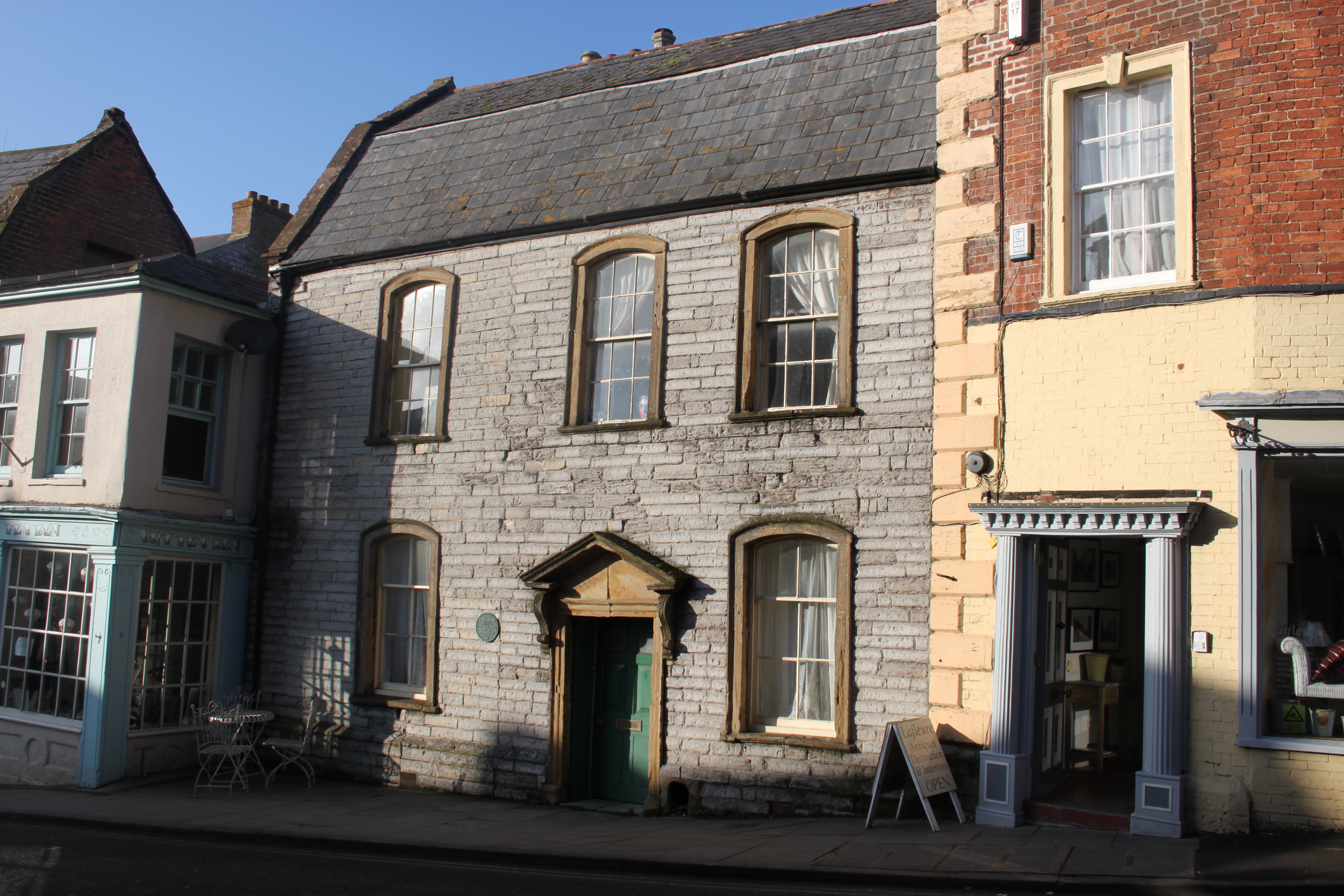
Tudor House, Langport

The Tudor House is an 18th-century house in Langport, Somerset, England. It was built in 1776 but had fallen into disrepair until it was bought and restored...

Langport

Langport is a town and civil parish in Somerset, England, 5 miles (8 km) west of Somerton. The parish, which covers only part of the town, has a population...

Langport Rural District

Langport was a rural district in Somerset, England, from 1894 to 1974. It was created in 1894 under the Local Government Act 1894. In 1974 it was abolished...

Church of All Saints, Langport

The Church of All Saints in Langport, Somerset, England, has 12th-century origins but was rebuilt in the late 15th century. It is recorded in the National...
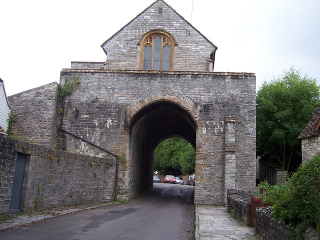
The Hanging Chapel

The Hanging Chapel (more formally known as the Chantry Chapel of the Blessed Virgin Mary) in Langport, Somerset, England is a 13th-century archway, bearing...

Langport East railway station

Langport East was a railway station situated in Langport in Somerset. The station also served Huish Episcopi. The station was on the Langport and Castle...

Nearby Amenities

Located within 500m of 51.036003,-2.845005
Power: pole
Lat/Long: 51.0323207/-2.8447149
Power: pole
Ref: ZDX27
Lat/Long: 51.0332457/-2.8450514
Power: pole
Source: bing
Lat/Long: 51.0376295/-2.8454744
Power: pole
Source: bing
Lat/Long: 51.0377452/-2.8441233
Power: pole
Source: bing
Lat/Long: 51.0378587/-2.8428031
Power: pole
Source: bing
Lat/Long: 51.0379793/-2.8414347
Power: pole
Source: bing
Lat/Long: 51.0380791/-2.8402293
Power: pole
Source: bing
Lat/Long: 51.0381311/-2.8396381
Power: pole
Source: bing
Lat/Long: 51.0350217/-2.8508392
Power: pole
Source: bing
Lat/Long: 51.0355665/-2.8499433
Power: pole
Source: bing
Lat/Long: 51.0361184/-2.8490854
Power: pole
Source: bing
Lat/Long: 51.036674/-2.8481405
Power: pole
Source: bing
Lat/Long: 51.0368708/-2.8478088
Power: pole
Source: bing
Lat/Long: 51.037517/-2.8467976
Power: pole
Source: bing
Lat/Long: 51.0345781/-2.8515513
Power: pole
Lat/Long: 51.0341809/-2.8458431
Power: pole
Lat/Long: 51.0346711/-2.8462005
Power: pole
Lat/Long: 51.0356617/-2.8470043
Power: pole
Lat/Long: 51.036646/-2.8477924
Power: pole
Lat/Long: 51.0374454/-2.8483246
Poles: bipole
Power: pole
Lat/Long: 51.0378986/-2.848613
Poles: bipole
Power: pole
Lat/Long: 51.0385235/-2.8490162
Power: pole
Lat/Long: 51.0390831/-2.8493347
Portway House
Building: yes
Lat/Long: 51.0328125/-2.845986
Rag Acre
Building: yes
Lat/Long: 51.0330426/-2.8456025
Backies
Building: yes
Lat/Long: 51.0329331/-2.8455352
Portway Cottage
Building: yes
Lat/Long: 51.0330764/-2.8455259
Hawthorn Cottage
Building: yes
Lat/Long: 51.0329693/-2.8454521
Addr Housenumber: 1
Addr Street: the grange
Building: yes
Lat/Long: 51.0344567/-2.8449458
Addr Housenumber: 2
Addr Street: The Grange
Building: yes
Lat/Long: 51.0345027/-2.844767
The Old Gatehouse
Building: yes
Lat/Long: 51.0344158/-2.8423439
The Annexe Pound Cott
Building: yes
Lat/Long: 51.0342573/-2.841787
Pound Cottage
Building: yes
Wikidata: Q26680417
Lat/Long: 51.0344081/-2.8415634
Portway Bungalow
Building: yes
Lat/Long: 51.0338355/-2.840612
The Old Stables
Building: yes
Lat/Long: 51.0350959/-2.8384939
Hurds Hill
Building: yes
Lat/Long: 51.03483/-2.8386809
Old Pound Barn
Building: yes
Lat/Long: 51.0354896/-2.8429294
The Caravan The Cottage
Building: yes
Lat/Long: 51.0356762/-2.8432261
The Cottage
Building: yes
Lat/Long: 51.0357836/-2.8432871
Hillside
Building: yes
Lat/Long: 51.0355484/-2.8422951
St brelade
Building: yes
Lat/Long: 51.0357401/-2.8424984
Carpathia
Building: yes
Lat/Long: 51.0359063/-2.8425879
Mimiju
Building: yes
Lat/Long: 51.0360776/-2.8427993
Portfield Cottage
Building: yes
Lat/Long: 51.0365173/-2.8416243
Hazelnut Cottage
Building: yes
Lat/Long: 51.036415/-2.8418276
Elm Home
Building: yes
Lat/Long: 51.0363409/-2.8421041
Rowans
Building: yes
Lat/Long: 51.0362156/-2.8423033
The New Bungalow
Building: yes
Lat/Long: 51.0361057/-2.8422708
JWS The Barn
Building: yes
Lat/Long: 51.0360136/-2.8424456
Portfield Farm Buildings
Building: yes
Lat/Long: 51.0359249/-2.8438632
Stonegate Farmers LTD
Building: yes
Lat/Long: 51.0375041/-2.8397583
Portfield Farm
Building: yes
Lat/Long: 51.0369519/-2.8447954
Coach House
Building: yes
Lat/Long: 51.0371001/-2.8452385
Bowdens View
Building: yes
Lat/Long: 51.0376702/-2.8504993
Lordswood
Building: yes
Lat/Long: 51.0356481/-2.842161
Quis Seperabit
Building: yes
Lat/Long: 51.0357606/-2.8419862
Havering
Building: yes
Lat/Long: 51.0358628/-2.8417544
Oasis
Building: yes
Lat/Long: 51.0359881/-2.8415227
Laburnum Cottage
Building: yes
Lat/Long: 51.0360622/-2.8412137
The White House
Building: yes
Lat/Long: 51.0362131/-2.837937
Power: pole
Lat/Long: 51.0387665/-2.8397258
Power: pole
Source: bing
Lat/Long: 51.0381625/-2.8392494
Power: pole
Lat/Long: 51.0371955/-2.8405131
Power: pole
Lat/Long: 51.0359217/-2.8409422
Power: pole
Lat/Long: 51.0350954/-2.8417186
Power: pole
Lat/Long: 51.0366586/-2.8418618
Power: pole
Lat/Long: 51.0362442/-2.8429183
Power: pole
Lat/Long: 51.0365815/-2.8504896
Power: pole
Lat/Long: 51.0369093/-2.8514819
Power: pole
Transformer: distribution
Lat/Long: 51.0373056/-2.8505597
Power: pole
Lat/Long: 51.0326624/-2.8450385
Power: pole
Lat/Long: 51.0316107/-2.8450358
Social Facility
Immaculata House
Social Facility: nursing_home
Lat/Long: 51.0336853/-2.8399926
The data included in this document is from www.openstreetmap.org. The data is made available under ODbL.

Have you been to Portfield?

Leave your review of Portfield below (or comments, questions and feedback).