Portfield

Settlement in Sussex Chichester

England

Portfield

St John's Chapel, Chichester The chapel was built in 1813, to a rather austere classical design by James Elmes. It retains many of its original features, including a three decker pulpit and a gallery with box pews (not accessible to the public for safety reasons). It closed for public worship in 1973 and now belongs to the Churches Conservation Trust, which has restored it as an arts venue. On the evening this photo was taken, the Rose Consort of Viols was performing renaissance consort music there. See the chapel's website here <span class="nowrap"><a title="http://www.stjohnschapelchichester.co.uk/?page_id=2" rel="nofollow ugc noopener" href="http://www.stjohnschapelchichester.co.uk/?page_id=2">Link</a><img style="margin-left:2px;" alt="External link" title="External link - shift click to open in new window" src="https://s1.geograph.org.uk/img/external.png" width="10" height="10"/></span> .

St John's was originally a proprietary chapel, one built as a private initiative, but with the intention of holding public Church of England worship there. According to Andrew L Drummond, proprietary chapels flourished during this period "in Belgravia, Bath, and other fashionable resorts. They were extra-parochial [i.e. outside the parish system], and were often run on a commercial basis, supported by pew-rents and sometimes built over wine vaults... An ingratiating preacher, preferably an invalid..., a well-nourished verger, and genteel pew-openers did their best to attract the quality..." (quoted in Wikipedia <span class="nowrap"><a title="https://en.wikipedia.org/wiki/Proprietary_chapel" rel="nofollow ugc noopener" href="https://en.wikipedia.org/wiki/Proprietary_chapel">Link</a><img style="margin-left:2px;" alt="External link" title="External link - shift click to open in new window" src="https://s1.geograph.org.uk/img/external.png" width="10" height="10"/></span> )
St John's Chapel, Chichester Credit: A J Paxton

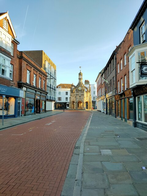
Portfield is a small village located in the district of Chichester, Sussex, England. Situated approximately 3 miles southeast of the city center, it is bordered by the A27 road to the north, which provides easy access to nearby towns and cities such as Brighton and Hove. The village is nestled in a picturesque countryside setting, surrounded by lush green fields and wooded areas.

Portfield is predominantly residential, with a mix of housing styles ranging from traditional cottages to modern developments. The village has a close-knit community, with a population of around 1,000 people. Amenities in Portfield include a local pub, a village hall, and a primary school, providing convenient facilities for the residents.

The village benefits from its close proximity to Chichester, a historic cathedral city known for its Roman influence and medieval architecture. Chichester offers a wide range of attractions, including the renowned Chichester Festival Theatre, Pallant House Gallery, and the beautiful Chichester Cathedral. Additionally, the city boasts a variety of shops, restaurants, and leisure facilities.

Portfield is also well-connected for transportation, with a regular bus service running through the village, linking it to Chichester and other nearby towns. The Chichester railway station is just a short distance away, providing direct train services to London, Portsmouth, and Southampton.

Overall, Portfield offers a peaceful and scenic setting, while still providing easy access to the amenities and attractions of nearby Chichester.

If you have any feedback on the listing, please let us know in the comments section below.

Portfield Images

Images are sourced within 2km of 50.835055/-0.75724 or Grid Reference SU8704. Thanks to Geograph Open Source API. All images are credited.

St John's Chapel, Chichester The chapel was built in 1813, to a rather austere classical design by James Elmes. It retains many of its original features, including a three decker pulpit and a gallery with box pews (not accessible to the public for safety reasons). It closed for public worship in 1973 and now belongs to the Churches Conservation Trust, which has restored it as an arts venue. On the evening this photo was taken, the Rose Consort of Viols was performing renaissance consort music there. See the chapel's website here <span class="nowrap"><a title="http://www.stjohnschapelchichester.co.uk/?page_id=2" rel="nofollow ugc noopener" href="http://www.stjohnschapelchichester.co.uk/?page_id=2">Link</a><img style="margin-left:2px;" alt="External link" title="External link - shift click to open in new window" src="https://s1.geograph.org.uk/img/external.png" width="10" height="10"/></span> .

St John's was originally a proprietary chapel, one built as a private initiative, but with the intention of holding public Church of England worship there. According to Andrew L Drummond, proprietary chapels flourished during this period "in Belgravia, Bath, and other fashionable resorts. They were extra-parochial [i.e. outside the parish system], and were often run on a commercial basis, supported by pew-rents and sometimes built over wine vaults... An ingratiating preacher, preferably an invalid..., a well-nourished verger, and genteel pew-openers did their best to attract the quality..." (quoted in Wikipedia <span class="nowrap"><a title="https://en.wikipedia.org/wiki/Proprietary_chapel" rel="nofollow ugc noopener" href="https://en.wikipedia.org/wiki/Proprietary_chapel">Link</a><img style="margin-left:2px;" alt="External link" title="External link - shift click to open in new window" src="https://s1.geograph.org.uk/img/external.png" width="10" height="10"/></span> )
St John's Chapel, Chichester
The chapel was built in 1813, to a rather austere classical design by James Elmes. It retains many of its original features, including a three decker pulpit and a gallery with box pews (not accessible to the public for safety reasons). It closed for public worship in 1973 and now belongs to the Churches Conservation Trust, which has restored it as an arts venue. On the evening this photo was taken, the Rose Consort of Viols was performing renaissance consort music there. See the chapel's website here LinkExternal link . St John's was originally a proprietary chapel, one built as a private initiative, but with the intention of holding public Church of England worship there. According to Andrew L Drummond, proprietary chapels flourished during this period "in Belgravia, Bath, and other fashionable resorts. They were extra-parochial [i.e. outside the parish system], and were often run on a commercial basis, supported by pew-rents and sometimes built over wine vaults... An ingratiating preacher, preferably an invalid..., a well-nourished verger, and genteel pew-openers did their best to attract the quality..." (quoted in Wikipedia LinkExternal link )
Chichester : war memorial, Litten Gardens Grade II listed war memorial. Architects: Unsworth & Triggs. Full description at this <span class="nowrap"><a title="https://historicengland.org.uk/listing/the-list/list-entry/1429864" rel="nofollow ugc noopener" href="https://historicengland.org.uk/listing/the-list/list-entry/1429864">Link</a><img style="margin-left:2px;" alt="External link" title="External link - shift click to open in new window" src="https://s1.geograph.org.uk/img/external.png" width="10" height="10"/></span>.
Chichester : war memorial, Litten Gardens
Grade II listed war memorial. Architects: Unsworth & Triggs. Full description at this LinkExternal link.
Heritage Antiques, St Pancreas, Chichester
Madgwick Lane towards the Goodwood attractions, 2012 The field on the right is now a housing estate.
Madgwick Lane towards the Goodwood attractions, 2012
The field on the right is now a housing estate.
Westhampnett Road nearing roundabout The bus stop and roundabout are named after a nearby hotel, but I am unsure what it was called in 2012.
Westhampnett Road nearing roundabout
The bus stop and roundabout are named after a nearby hotel, but I am unsure what it was called in 2012.
Old Boundary Marker on the A285 St Pancras, Chichester Municipal Boundary Marker called St James's Post and on the south side of the junction of the A285 St Pancras and Westhampnett Road. Chichester parish. At the time it was erected it marked the eastern boundary of Chichester. Grade II Listed details <span class="nowrap"><a title="https://historicengland.org.uk/listing/the-list/list-entry/1354344" rel="nofollow ugc noopener" href="https://historicengland.org.uk/listing/the-list/list-entry/1354344">Link</a><img style="margin-left:2px;" alt="External link" title="External link - shift click to open in new window" src="https://s1.geograph.org.uk/img/external.png" width="10" height="10"/></span>. See also <span class="nowrap"><a title="https://chichestercity.gov.uk/st-james-obelisk/" rel="nofollow ugc noopener" href="https://chichestercity.gov.uk/st-james-obelisk/">Link</a><img style="margin-left:2px;" alt="External link" title="External link - shift click to open in new window" src="https://s1.geograph.org.uk/img/external.png" width="10" height="10"/></span> , <a title="https://www.geograph.org.uk/photo/1760587" href="https://www.geograph.org.uk/photo/1760587">Link</a> and <a title="https://www.geograph.org.uk/photo/5653620" href="https://www.geograph.org.uk/photo/5653620">Link</a>.

Milestone Society National ID: SX_CHIC01pb
Old Boundary Marker on the A285 St Pancras, Chichester
Municipal Boundary Marker called St James's Post and on the south side of the junction of the A285 St Pancras and Westhampnett Road. Chichester parish. At the time it was erected it marked the eastern boundary of Chichester. Grade II Listed details LinkExternal link. See also LinkExternal link , Link and Link. Milestone Society National ID: SX_CHIC01pb
Chichester Cross Chichester Cross is a Perpendicular market cross in the centre of the city, standing at the intersection of the four principal streets. According to the inscription upon it, this cross was built by Edward Story, Bishop of Chichester from 1477 to 1503. It was built so that the poor people should have somewhere to sell their wares, and as a meeting point.
The Market Cross is constructed of Caen stone. The cross' form is octangular, surmounted with pinnacles.
Until the start of the nineteenth century the Cross was used as a market-place; but the increased population of the city requiring a more extensive area for that purpose.
Grade I listed. <span class="nowrap"><a title="http://www.britishlistedbuildings.co.uk/en-299793-the-market-cross-chichester-west-sussex#.VidniCskKpA" rel="nofollow ugc noopener" href="http://www.britishlistedbuildings.co.uk/en-299793-the-market-cross-chichester-west-sussex#.VidniCskKpA">Link</a><img style="margin-left:2px;" alt="External link" title="External link - shift click to open in new window" src="https://s1.geograph.org.uk/img/external.png" width="10" height="10"/></span>
Chichester Cross
Chichester Cross is a Perpendicular market cross in the centre of the city, standing at the intersection of the four principal streets. According to the inscription upon it, this cross was built by Edward Story, Bishop of Chichester from 1477 to 1503. It was built so that the poor people should have somewhere to sell their wares, and as a meeting point. The Market Cross is constructed of Caen stone. The cross' form is octangular, surmounted with pinnacles. Until the start of the nineteenth century the Cross was used as a market-place; but the increased population of the city requiring a more extensive area for that purpose. Grade I listed. LinkExternal link
St Pancras Church Chichester
Roundhill Picture Palace Caravan
Chichester : Morris dance musicians, East Street
Chichester : Morris dancers, East Street
Chichester : Morris dance musicians, East Street
Chichester : barrel organ and operator, East Street
Chichester Cathedral : candlesticks
Chichester : High Altar tapestry by John Piper "Installed in 1966, the Piper Tapestry consists of seven panels each 1 metre wide and 5 metres high and was woven by Pinton Freres at Felletin near Aubusson in France, where a few years earlier the Sutherland tapestry for Coventry Cathedral had been made ..." - <span class="nowrap"><a title="https://www.chichestercathedral.org.uk/visiting/cathedral-plan/delve-deeper-high-altar-john-piper-tapestry" rel="nofollow ugc noopener" href="https://www.chichestercathedral.org.uk/visiting/cathedral-plan/delve-deeper-high-altar-john-piper-tapestry">Link</a><img style="margin-left:2px;" alt="External link" title="External link - shift click to open in new window" src="https://s1.geograph.org.uk/img/external.png" width="10" height="10"/></span>
Chichester : High Altar tapestry by John Piper
"Installed in 1966, the Piper Tapestry consists of seven panels each 1 metre wide and 5 metres high and was woven by Pinton Freres at Felletin near Aubusson in France, where a few years earlier the Sutherland tapestry for Coventry Cathedral had been made ..." - LinkExternal link
Chichester : Guildhall, Priory Park Grade I listed former Franciscan Friary church extensively described at this <span class="nowrap"><a title="https://historicengland.org.uk/listing/the-list/list-entry/1005863?section=official-listing" rel="nofollow ugc noopener" href="https://historicengland.org.uk/listing/the-list/list-entry/1005863?section=official-listing">Link</a><img style="margin-left:2px;" alt="External link" title="External link - shift click to open in new window" src="https://s1.geograph.org.uk/img/external.png" width="10" height="10"/></span>.
Chichester : Guildhall, Priory Park
Grade I listed former Franciscan Friary church extensively described at this LinkExternal link.
Chichester Cathedral Grade I listed. More at this <span class="nowrap"><a title="https://historicengland.org.uk/listing/the-list/list-entry/1354261?section=official-listing" rel="nofollow ugc noopener" href="https://historicengland.org.uk/listing/the-list/list-entry/1354261?section=official-listing">Link</a><img style="margin-left:2px;" alt="External link" title="External link - shift click to open in new window" src="https://s1.geograph.org.uk/img/external.png" width="10" height="10"/></span>.
Chichester Cathedral
Grade I listed. More at this LinkExternal link.
Show me another place!

Portfield is located at Grid Ref: SU8704 (Lat: 50.835055, Lng: -0.75724)

Administrative County: West Sussex

District: Chichester

Police Authority: Sussex

What 3 Words

///minds.laser.same. Near Chichester, West Sussex

Nearby Locations

Portfield

Related Wikis

Greatest Hits Radio West Sussex

Greatest Hits Radio West Sussex is an Independent Local Radio station owned and operated by Bauer as part of the Greatest Hits Radio Network. It broadcasts...

Portfield F.C.

Portfield Football Club was a football club based in the Portfield area of Chichester, England. Established in 1896, they merged with Chichester City in...
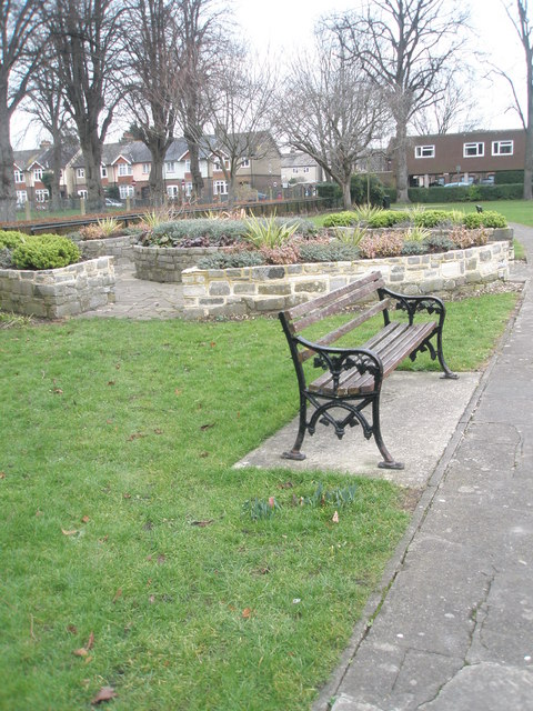
Litten Gardens

Litten Gardens is a public park in Chichester, West Sussex, England. The park is maintained by Chichester City Council. Chichester War Memorial is located...

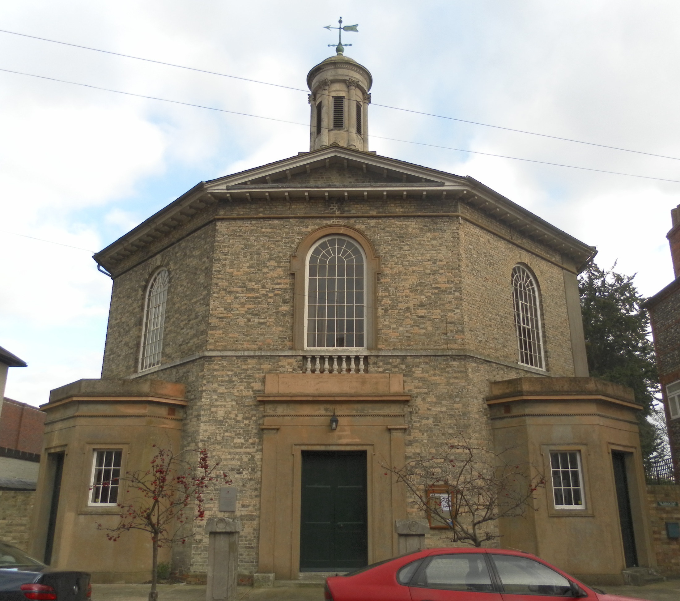
St John the Evangelist's Church, Chichester

St John the Evangelist's Church is a redundant Anglican church in the cathedral city of Chichester in West Sussex, England. Built in 1812 to the design...

Nearby Amenities

Located within 500m of 50.835055,-0.75724
Mini Roundabout
Direction: clockwise
Lat/Long: 50.8369474/-0.7615498
Kerb: no
Lat/Long: 50.8393796/-0.7563529
Bus Stop
York Road
Bus: yes
Naptan AtcoCode: 4400CH0326
Naptan Bearing: SE
Naptan CommonName: York Road
Naptan Indicator: o/s City Cycles
Naptan Landmark: York Road
Naptan NaptanCode: wsxagwaw
Naptan Street: Bognor Road
Naptan Verified: no
Public Transport: platform
Source: naptan_import
Lat/Long: 50.8340139/-0.7625012
Bus Stop
York Road
Bench: no
Bin: no
Bus: yes
Lit: yes
Naptan AtcoCode: 4400CH0327
Naptan Bearing: NW
Naptan CommonName: York Road
Naptan Indicator: adj York Road
Naptan Landmark: York Road
Naptan NaptanCode: wsxagwda
Naptan Street: Bognor Road
Naptan Verified: no
Public Transport: platform
Shelter: no
Source: naptan_import
Tactile Paving: no
Lat/Long: 50.8336782/-0.762226
Bus Stop
Florence Road
Bus: yes
Naptan AtcoCode: 4400CH0328
Naptan Bearing: SE
Naptan CommonName: Florence Road
Naptan Indicator: adj Florence Road
Naptan Landmark: Florence Road
Naptan NaptanCode: wsxagwdg
Naptan Street: Bognor Road
Naptan Verified: no
Public Transport: platform
Source: naptan_import
Lat/Long: 50.8328617/-0.7598619
Bus Stop
Florence Road
Bus: yes
Naptan AtcoCode: 4400CH0330
Naptan Bearing: NW
Naptan CommonName: Florence Road
Naptan Indicator: Opp Bartholmes Depot
Naptan Landmark: The Peacheries
Naptan NaptanCode: wsxagwdj
Naptan Street: Bognor Road
Naptan Verified: no
Public Transport: platform
Source: naptan_import
Lat/Long: 50.8326725/-0.7598243
Bus Stop
Florence Road
Bus: yes
Naptan AtcoCode: 4400CH0344
Naptan Bearing: N
Naptan CommonName: Florence Road
Naptan Indicator: adj Recreation Ground
Naptan Landmark: Pound Farm Road
Naptan NaptanCode: wsxagwjg
Naptan Street: Florence Road
Naptan Verified: no
Public Transport: platform
Source: naptan_import
Lat/Long: 50.8358361/-0.761331
Bus Stop
Victoria Road
Bus: yes
Naptan AtcoCode: 4400CH0345
Naptan Bearing: S
Naptan CommonName: Victoria Road
Naptan Indicator: adj Victoria Road
Naptan Landmark: Victoria Road
Naptan NaptanCode: wsxagwjm
Naptan Street: St James Road
Naptan Verified: no
Public Transport: platform
Source: naptan_import
Lat/Long: 50.8376494/-0.7618653
Bus Stop
Oving Road
Bus: yes
Naptan AtcoCode: 4400CH0347
Naptan Bearing: E
Naptan CommonName: Oving Road
Naptan Indicator: o/s 90
Naptan Landmark: Nr adj Leatherbottle Lane
Naptan NaptanCode: wsxagwjt
Naptan Street: Oving Road
Naptan Verified: no
Public Transport: platform
Source: naptan_import
Lat/Long: 50.8373448/-0.759752
Bus Stop
Oving Road
Bus: yes
Naptan AtcoCode: 4400CH0348
Naptan Bearing: W
Naptan CommonName: Oving Road
Naptan Indicator: adj Florence Road
Naptan Landmark: Florence Road
Naptan NaptanCode: wsxagwjw
Naptan Street: Oving Road
Naptan Verified: no
Public Transport: platform
Source: naptan_import
Lat/Long: 50.8370576/-0.7610992
Bus Stop
Pound Farm Road
Bus: yes
Naptan AtcoCode: 4400CH0350
Naptan Bearing: E
Naptan CommonName: Pound Farm Road
Naptan Indicator: adj Florence Road
Naptan Landmark: Florence Road
Naptan NaptanCode: wsxagwmd
Naptan Street: Pound Farm Road
Naptan Verified: no
Public Transport: platform
Source: naptan_import
Lat/Long: 50.8362812/-0.7617453
Bus Stop
Windsor Road
Bus: yes
Naptan AtcoCode: 4400CH0351
Naptan Bearing: W
Naptan CommonName: Windsor Road
Naptan Indicator: o/s 30
Naptan Landmark: Balmoral Close
Naptan NaptanCode: wsxagwmg
Naptan Street: Windsor Road
Naptan Verified: no
Public Transport: platform
Source: naptan_import
Lat/Long: 50.834261/-0.7569845
Bus Stop
Osborne Crescent
Bus: yes
Naptan AtcoCode: 4400CH0352
Naptan Bearing: S
Naptan CommonName: Osborne Crescent
Naptan Indicator: o/s 64
Naptan Landmark: Windsor Road
Naptan NaptanCode: wsxagwmj
Naptan Street: Osborne Crescent
Naptan Verified: no
Public Transport: platform
Source: naptan_import
Lat/Long: 50.8354106/-0.7551504
Bus Stop
Charles Avenue
Bus: yes
Naptan AtcoCode: 4400CH0353
Naptan Bearing: S
Naptan CommonName: Charles Avenue
Naptan Indicator: o/s 157
Naptan Landmark: Charles Avenue
Naptan NaptanCode: wsxagwmp
Naptan Street: Charles Avenue
Naptan Verified: no
Public Transport: platform
Source: naptan_import
Lat/Long: 50.8357019/-0.7580114
Bus Stop
Windsor Rd
Bus: yes
Naptan AtcoCode: 4400CH0604
Naptan Bearing: E
Naptan BusStopType: CUS
Naptan CommonName: Windsor Rd
Naptan Indicator: Opp No 30
Naptan Landmark: Balmoral Close
Naptan Street: Windsor Rd
Naptan Verified: no
Public Transport: platform
Source: naptan_import
Lat/Long: 50.8344041/-0.7569097
Fast Food
Harry's Fish and Chips
Addr City: Chichester
Addr Housenumber: 105A
Addr Postcode: PO19 7HZ
Addr Street: Victoria Road
Fhrs Authority: Chichester
Fhrs Id: 936558
Fhrs Local Authority Id: 16/00260/FOOD
Lat/Long: 50.8377327/-0.7610768
Noexit: yes
Lat/Long: 50.8326716/-0.7628074
Railway: switch
Lat/Long: 50.8322168/-0.7535648
Traffic Signals
Traffic Signals: pedestrian_crossing
Lat/Long: 50.8337179/-0.7603668
Pub
The Wickham Arms
Addr City: Chichester
Addr Housenumber: 102
Addr Postcode: PO19 7TW
Addr Street: Bognor Road
Brand: Fuller's
Brand Wikidata: Q5253950
Opening Hours: 12:00-23:00
Phone: +44 1243 784782
Website: https://www.wickhamarms.co.uk/
Lat/Long: 50.8334112/-0.7618827
Co-op Food
Addr City: Chichester
Addr Housenumber: 51-54
Addr Postcode: PO19 7TG
Addr Street: Bognor Road
Addr Unit: Unit 1
Brand: Co-op Food
Brand Wikidata: Q3277439
Brand Wikipedia: en:Co-op Food
Check Date Opening Hours: 2023-09-08
Fhrs Authority: Chichester
Fhrs Id: 587037
Fhrs Local Authority Id: 13/00136/FOOD
Opening Hours: Mo-Su 06:00-22:00
Operator: The Southern Co-operative
Operator Wikidata: Q7569773
Phone: +44 1243 527097
Shop: convenience
Website: https://stores.southern.coop/west-sussex/chichester/unit-51-54-bognor-road.html
Lat/Long: 50.8336336/-0.761506
Addr City: Chichester
Addr Street: Oving Road
Old Phone: +44 1243 530985
Removed Amenity: telephone
Lat/Long: 50.8372732/-0.7598858
Post Box
Brand: Royal Mail
Brand Wikidata: Q638098
Brand Wikipedia: en:Royal Mail
Collection Plate: CP1
Collection Times: Mo-Fr 16:30; Sa 12:15
Operator: Royal Mail
Operator Wikidata: Q638098
Post Box Type: pillar
Ref: PO19 96
Royal Cypher: EIIR
Royal Cypher Wikidata: Q33102113
Lat/Long: 50.8344172/-0.7582443
Post Box
Brand: Royal Mail
Brand Wikidata: Q638098
Brand Wikipedia: en:Royal Mail
Collection Plate: CP1D
Collection Times: Mo-Fr 09:00; Sa 07:00
Operator: Royal Mail
Operator Wikidata: Q638098
Post Box Type: wall
Ref: PO19 57D
Royal Cypher: EIIR
Royal Cypher Wikidata: Q33102113
Lat/Long: 50.8374392/-0.7597946
Post Box
Post Box Type: pillar
Ref: PO19 52D
Royal Cypher: EIIR
Royal Cypher Wikidata: Q33102113
Lat/Long: 50.8339221/-0.7623227
Bicycle Parking
Bicycle Parking: stands
Capacity: 4
Covered: no
Lat/Long: 50.8336028/-0.7616803
Waste Basket
Lat/Long: 50.8335452/-0.7615721
Traffic Calming: island
Lat/Long: 50.8330992/-0.7606681
Freestyle
Shop: bathroom_furnishing
Lat/Long: 50.8308475/-0.7554829
Pets Corner
Addr City: Chichester
Addr Housenumber: 51-54
Addr Postcode: PO19 7TG
Addr Street: Bognor Road
Brand: Pets Corner
Brand Wikidata: Q17018476
Brand Wikipedia: en:Pets Corner
Phone: +44 1243 779241
Shop: pet
Website: https://www.petscorner.co.uk/chichester
Lat/Long: 50.8337846/-0.7615615
Barrier: bollard
Bicycle: yes
Bollard: removable
Foot: yes
Motor Vehicle: no
Lat/Long: 50.8379399/-0.7578845
Barrier: bollard
Bicycle: yes
Bollard: removable
Foot: yes
Motor Vehicle: no
Lat/Long: 50.8378135/-0.7578123
Access: yes
Leisure: playground
Lat/Long: 50.836088/-0.7572144
Traffic Signals
Traffic Signals: pedestrian_crossing
Lat/Long: 50.8367185/-0.7614828
Barrier: bollard
Bicycle: yes
Bollard: removable
Foot: yes
Height: 1
Material: metal
Motor Vehicle: no
Lat/Long: 50.8351991/-0.7640589
Entrance: yes
Lat/Long: 50.8349858/-0.7627242
Entrance: yes
Lat/Long: 50.8352081/-0.7639408
Flag Type: local
Height: 4
Lit: no
Man Made: flagpole
Lat/Long: 50.8352344/-0.7633809
Railway: switch
Lat/Long: 50.832231/-0.7546327
Elford Sheds
Shop: trade
Trade: garden_sheds
Lat/Long: 50.8375706/-0.7558651
Traffic Signals
Traffic Signals: signal
Lat/Long: 50.8378054/-0.7550858
Traffic Signals
Traffic Signals: signal
Lat/Long: 50.8375361/-0.7549206
Crossing
Lat/Long: 50.8377037/-0.7546463
Barrier: bus gate
Bicycle: no
Bus: designated
Foot: no
Horse: no
Motor Vehicle: no
Lat/Long: 50.8377025/-0.7546991
Crossing
Crossing: traffic_signals
Lat/Long: 50.8377541/-0.7549935
Traffic Signals
Traffic Signals: signal
Lat/Long: 50.8378429/-0.7547955
Turning Circle
Turning Circle: square
Lat/Long: 50.8376714/-0.7545398
Give Way
Direction: forward
Lat/Long: 50.8385872/-0.7551625
Magnet
Brand: Magnet
Brand Wikidata: Q6731427
Shop: kitchen
Lat/Long: 50.8313565/-0.7548568
Barrier: bollard
Bollard: removable
Material: metal
Motor Vehicle: no
Lat/Long: 50.8325391/-0.7587202
Access: customers
Leisure: playground
Lat/Long: 50.8323879/-0.7569366
Noexit: yes
Lat/Long: 50.8369541/-0.7537854
Noexit: yes
Lat/Long: 50.8369756/-0.753791
Access: yes
Leisure: playground
Playground Theme: playground
Lat/Long: 50.8368569/-0.7516624
Julie’s Kiosk
Addr City: Chichester
Addr Postcode: PO19 7PX
Addr Street: Pound Farm Road
Fhrs Authority: Chichester
Fhrs Id: 1655407
Old Name: The Apuldram Centre Kiosk
Shop: kiosk
Lat/Long: 50.8356088/-0.762358
Traffic Signals
Lat/Long: 50.8377055/-0.754604
Noexit: yes
Lat/Long: 50.8328442/-0.7625818
The data included in this document is from www.openstreetmap.org. The data is made available under ODbL.

Have you been to Portfield?

Leave your review of Portfield below (or comments, questions and feedback).