Perranuthnoe

Settlement in Cornwall

England

Perranuthnoe

The Packet Inn, Rosudgeon
The Packet Inn, Rosudgeon Credit: Chris Morgan

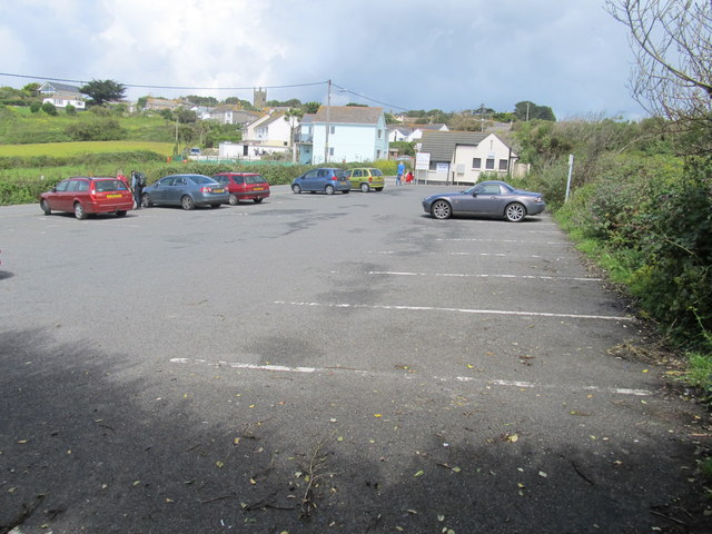
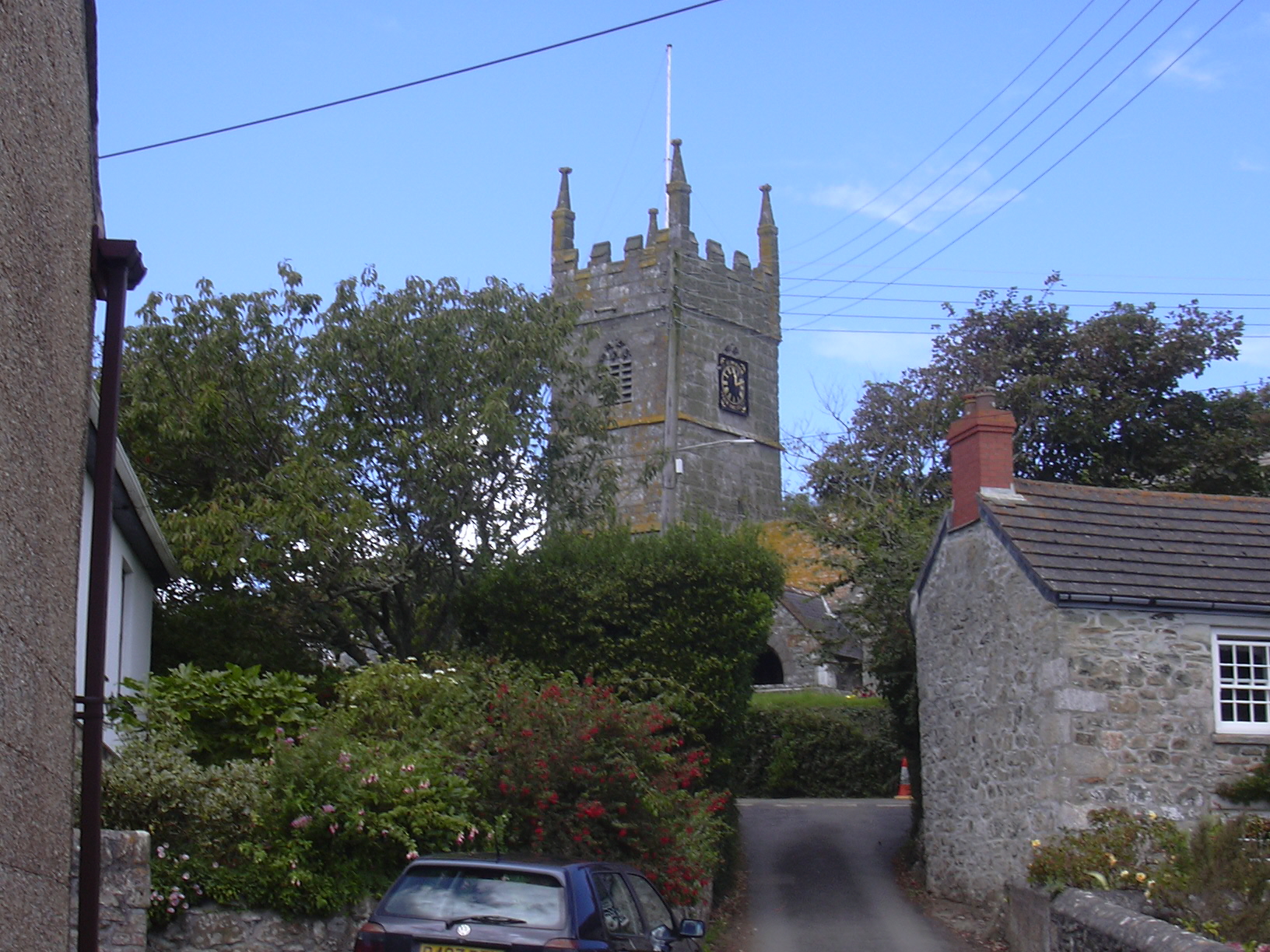
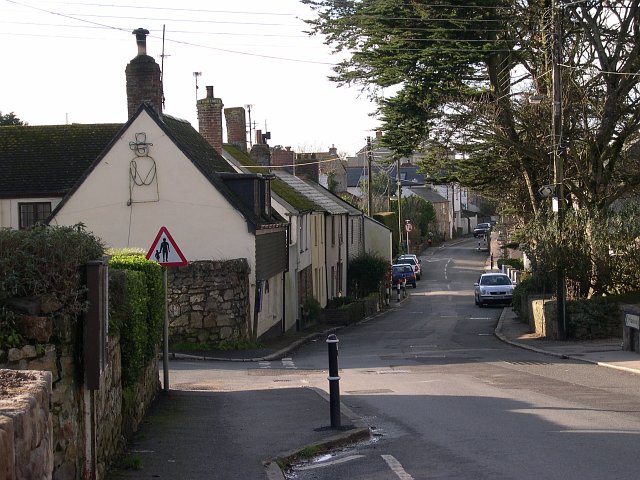
Perranuthnoe is a small coastal village located in the southwestern county of Cornwall, England. Situated about 6 miles southwest of the town of Penzance, Perranuthnoe offers a picturesque and tranquil setting.

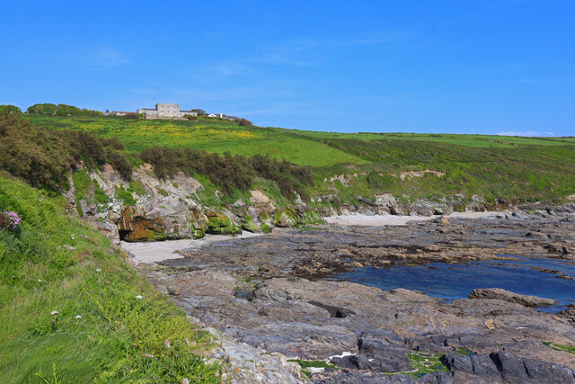
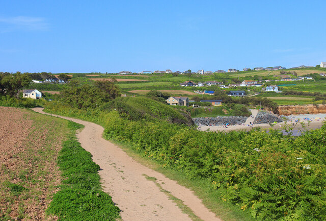
The village is nestled between rolling hills and overlooks the beautiful Mount's Bay, providing residents and visitors with stunning views of the surrounding landscape. The area is known for its unspoiled sandy beach, Perran Sands, which attracts both locals and tourists alike. The beach is popular for swimming, sunbathing, and water sports, and is backed by low cliffs and dunes that add to its natural charm.

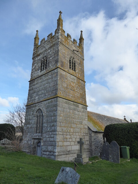
In addition to its natural beauty, Perranuthnoe boasts a rich history. The village is home to the historic St. Michael's Mount, a tidal island crowned by a medieval castle and accessed via a causeway during low tide. The mount is managed by the National Trust and offers guided tours, showcasing its fascinating past.

Perranuthnoe is also a great base for exploring the surrounding area. The nearby town of Marazion is just a short drive away and offers a range of shops, cafes, and galleries. Additionally, the South West Coast Path passes through the village, offering walkers and hikers breathtaking coastal routes to explore.

With its idyllic coastal setting, rich history, and access to stunning natural landscapes, Perranuthnoe is a hidden gem in Cornwall that offers a perfect blend of relaxation and exploration for visitors and residents alike.

If you have any feedback on the listing, please let us know in the comments section below.

Perranuthnoe Images

Images are sourced within 2km of 50.114572/-5.444191 or Grid Reference SW5329. Thanks to Geograph Open Source API. All images are credited.

The Packet Inn, Rosudgeon
Fore Street, Goldsithney
Telephone box, Goldsithney Badly faded paintwork but still with telephone
Telephone box, Goldsithney
Badly faded paintwork but still with telephone
Perranuthnoe, St Michael & St Piran
Former Wesleyan Chapel Built in 1858. Closed 1980 and converted into a studio and dwelling <span class="nowrap"><a title="http://cornishstory.com/2021/09/22/mapping-methodism-perranuthnoe-wesleyan-chapel/" rel="nofollow ugc noopener" href="http://cornishstory.com/2021/09/22/mapping-methodism-perranuthnoe-wesleyan-chapel/">Link</a><img style="margin-left:2px;" alt="External link" title="External link - shift click to open in new window" src="https://s1.geograph.org.uk/img/external.png" width="10" height="10"/></span>
Former Wesleyan Chapel
Built in 1858. Closed 1980 and converted into a studio and dwelling LinkExternal link
Former Wesleyan Methodist Chapel
A394 leaving Rosudgeon The A394 is a primary route running along the south coast of Cornwall linking Penzance to Falmouth via Helston and beyond. It is noteworthy for being the most southerly primary 'A' road in the UK.
A394 leaving Rosudgeon
The A394 is a primary route running along the south coast of Cornwall linking Penzance to Falmouth via Helston and beyond. It is noteworthy for being the most southerly primary 'A' road in the UK.
Stackhouse Cliffs View from the Coast Path towards Acton Castle.
Stackhouse Cliffs
View from the Coast Path towards Acton Castle.
Perranuthnoe Beach Perranuthnoe Beach from the South West Coast Path.
Perranuthnoe Beach
Perranuthnoe Beach from the South West Coast Path.
Perranuthnoe Shore Coastline at Perranuthnoe.
Perranuthnoe Shore
Coastline at Perranuthnoe.
Perranuthnoe Village Houses and holiday accommodation in Perranuthnoe.
.
Perranuthnoe Village
Houses and holiday accommodation in Perranuthnoe. .
A 'First' bus exits Red Lane, Rosudgeon, Cornwall
The Falmouth Packet Inn In the mid 1850s one of the last captains of the Falmouth Packet Service retired, bought this building and opened it as the Falmouth Packet Inn.
The Falmouth Packet Inn
In the mid 1850s one of the last captains of the Falmouth Packet Service retired, bought this building and opened it as the Falmouth Packet Inn.
Rosudgeon & Kenneggy Cricket Club - Pitch The pitch and scoreboard at Rosudgeon & Kenneggy CC.  Evidence of previous mining operations can be seen with the engine house in the background.
Rosudgeon & Kenneggy Cricket Club - Pitch
The pitch and scoreboard at Rosudgeon & Kenneggy CC. Evidence of previous mining operations can be seen with the engine house in the background.
 Perran Sands at Perranuthnoe
Perran Sands at Perranuthnoe
Car park at Perranuthnoe
View through field gate towards St. Michael's Mount
Church and house at Perranuthnoe
Show me another place!

Perranuthnoe is located at Grid Ref: SW5329 (Lat: 50.114572, Lng: -5.444191)

Unitary Authority: Cornwall

Police Authority: Devon and Cornwall

What 3 Words

///snake.scribbled.edges. Near Marazion, Cornwall

Related Wikis

Perranuthnoe

Perranuthnoe () is a civil parish and a village in southwest Cornwall, England, United Kingdom. The parish population at the 2011 census was 2,184. The...

Goldsithney

Goldsithney (Cornish: Golsydhni, meaning fair of St Sithney) is a village in west Cornwall, England, United Kingdom. It is on the B3280 at grid reference...

Mount Haven Hotel

Mount Haven Hotel is a hotel near the coast on the eastern side of the town of Marazion, Cornwall, England, UK, several miles east of Penzance. It is next...

Acton Castle

Acton Castle is a small castellated mansion near Perranuthnoe, Cornwall. It is a Grade II* listed building. It was built c. 1775, and according to some...

Nearby Amenities

Located within 500m of 50.114572,-5.444191
Perranuthnoe
Is In: Cornwall, England, UK
Name Kw: Peranudhnow
Place: village
Postal Code: TR20 9
Source: NPE
Lat/Long: 50.1155313/-5.4443092
Pub
Victoria Inn
Addr City: Penzance
Addr Country: GB
Addr Housename: Victoria Inn
Addr Place: Perranuthnoe
Addr Postcode: TR20 9NP
Fhrs Id: 740111
Lat/Long: 50.1151433/-5.4441351
Post Box
Brand: Royal Mail
Brand Wikidata: Q638098
Collection Times: Mo-Fr 09:00; Sa 09:00
Operator: Royal Mail
Operator Wikidata: Q638098
Ref: TR20 85
Royal Cypher: EIIR
Royal Cypher Wikidata: Q33102113
Lat/Long: 50.1153353/-5.4439682
Toilets
Check Date: 2022-07-17
Fee: no
Note: open all year
Wheelchair: no
Lat/Long: 50.1135479/-5.4427503
Bus Stop
St Pirans Way
Bench: yes
Bin: no
Bus: yes
Lit: no
Naptan AtcoCode: 0800COD40566
Naptan Bearing: NW
Naptan CommonName: St Pirans Way
Naptan NaptanCode: coragmwm
Naptan Street: Unclassified
Naptan Verified: no
Public Transport: platform
Shelter: no
Source: naptan_import
Tactile Paving: no
Lat/Long: 50.1152975/-5.4438225
Bus Stop
St Pirans Hall
Bus: yes
Naptan AtcoCode: 0800FWW38426
Naptan Bearing: W
Naptan CommonName: St Pirans Hall
Naptan NaptanCode: coragmwj
Naptan PlusbusZoneRef: PENZNCE
Naptan Street: Unclassified
Naptan Verified: no
Public Transport: platform
Source: naptan_import
Lat/Long: 50.1155686/-5.4443877
Barrier: stile
Bicycle: no
Foot: designated
Horse: no
Material: stone
Motor Vehicle: no
Stile: stepover
Lat/Long: 50.11314/-5.4433406
Ednovian Farm
Tourism: guest_house
Lat/Long: 50.1174773/-5.440384
Cafe
The Peppercorn Café
Addr City: Penzance
Addr Country: GB
Addr Housename: The Peppercorn Cafe
Addr Place: Perranuthnoe
Addr Postcode: TR20 9NE
Addr Street: Lynfield Yard
Contact Phone: +44 1736 719584
Fhrs Id: 871553
Lat/Long: 50.1141733/-5.4436058
Barrier: stile
Bicycle: no
Foot: yes
Stile: stepover
Lat/Long: 50.1137432/-5.4387297
Bench
Backrest: yes
Lat/Long: 50.1114803/-5.4477461
Motorcycle Parking
Fixme: Seeems to be on a house. Is this right?
Lat/Long: 50.1140195/-5.4465142
Barrier: stile
Bicycle: no
Foot: designated
Horse: no
Material: stone
Motor Vehicle: no
Stile: stepover
Lat/Long: 50.113205/-5.4427618
Bench
Backrest: no
Lat/Long: 50.1127419/-5.4399124
Bench
Backrest: yes
Lat/Long: 50.1116135/-5.4396801
Entrance: yes
Lat/Long: 50.1147754/-5.445867
Fire Hydrant
Emergency: fire_hydrant
Fire Hydrant Diameter: 75
Fire Hydrant Position: lane
Fire Hydrant Type: underground
Survey Date: 2022-07-09
Lat/Long: 50.1147421/-5.4456975
Waste Basket
Survey Date: 2022-07-09
Waste: dog_excrement
Lat/Long: 50.1142571/-5.4480603
Fire Hydrant
Emergency: fire_hydrant
Fire Hydrant Diameter Signed: no
Fire Hydrant Position: lane
Fire Hydrant Type: underground
Survey Date: 2022-07-09
Lat/Long: 50.1141407/-5.4472691
Barrier: kissing_gate
Lat/Long: 50.1166828/-5.4432574
Fire Hydrant
Emergency: fire_hydrant
Fire Hydrant Type: underground
Survey Date: 2022-07-17
Lat/Long: 50.1134444/-5.4427513
Defibrillator
Emergency: defibrillator
Survey Date: 2022-07-17
Lat/Long: 50.1127196/-5.4426032
Bench
Survey Date: 2022-07-17
Lat/Long: 50.1125655/-5.4425524
Waste Basket
Survey Date: 2022-07-17
Lat/Long: 50.1124765/-5.4425115
Lifeguard Tower
Emergency: lifeguard_tower
Survey Date: 2022-07-17
Lat/Long: 50.1124716/-5.4426805
Fire Hydrant
Emergency: fire_hydrant
Fire Hydrant Type: underground
Survey Date: 2022-07-17
Lat/Long: 50.1153196/-5.4438901
Fire Hydrant
Emergency: fire_hydrant
Fire Hydrant Type: underground
Survey Date: 2022-07-17
Lat/Long: 50.1143145/-5.4441105
Bench
Backrest: yes
Survey Date: 2022-07-17
Lat/Long: 50.1114962/-5.4478183
Bench
Survey Date: 2022-07-17
Lat/Long: 50.1127868/-5.4424485
Life Ring
Emergency: life_ring
Survey Date: 2022-07-17
Lat/Long: 50.112479/-5.4425601
Waste Basket
Survey Date: 2022-07-17
Lat/Long: 50.112463/-5.4425076
Phone
Emergency: phone
Survey Date: 2022-07-17
Lat/Long: 50.1124784/-5.4424927
Bench
Survey Date: 2022-07-17
Lat/Long: 50.1128223/-5.4424473
Power: pole
Transformer: distribution
Lat/Long: 50.1150608/-5.4434104
Location Transition: yes
Power: pole
Lat/Long: 50.11501/-5.4434882
Power: pole
Lat/Long: 50.1144149/-5.443448
Power: pole
Transformer: distribution
Lat/Long: 50.1140297/-5.443625
Power: pole
Lat/Long: 50.11603/-5.4507382
Power: pole
Lat/Long: 50.1158657/-5.4501227
Power: pole
Lat/Long: 50.1158864/-5.4490793
Power: pole
Lat/Long: 50.1158692/-5.4477811
Power: pole
Lat/Long: 50.1144605/-5.4466626
Power: pole
Lat/Long: 50.1149464/-5.4468624
Power: pole
Lat/Long: 50.1158692/-5.4465956
Power: pole
Lat/Long: 50.116116/-5.4463501
Power: pole
Lat/Long: 50.1168813/-5.4455173
Power: pole
Lat/Long: 50.1172502/-5.4442272
Location Transition: yes
Power: pole
Lat/Long: 50.1156507/-5.4432803
Power: pole
Lat/Long: 50.1165932/-5.4434815
Power: pole
Lat/Long: 50.1174102/-5.4437229
Power: pole
Lat/Long: 50.1183458/-5.4439563
The data included in this document is from www.openstreetmap.org. The data is made available under ODbL.

Have you been to Perranuthnoe?

Leave your review of Perranuthnoe below (or comments, questions and feedback).