Benington

Settlement in Hertfordshire East Hertfordshire

England

Benington

Walkern Hall I have no idea what this grand looking Hall is used for now. This photo was taken from the adjoining square because Walkern Hall is so close to the edge.
Walkern Hall Credit: Robin Hall

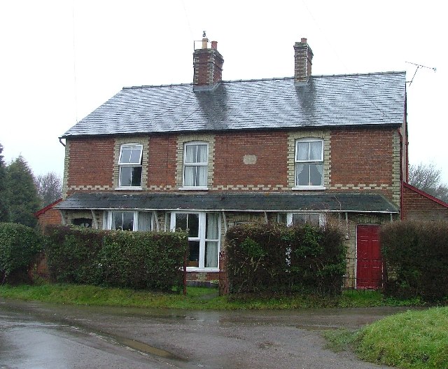
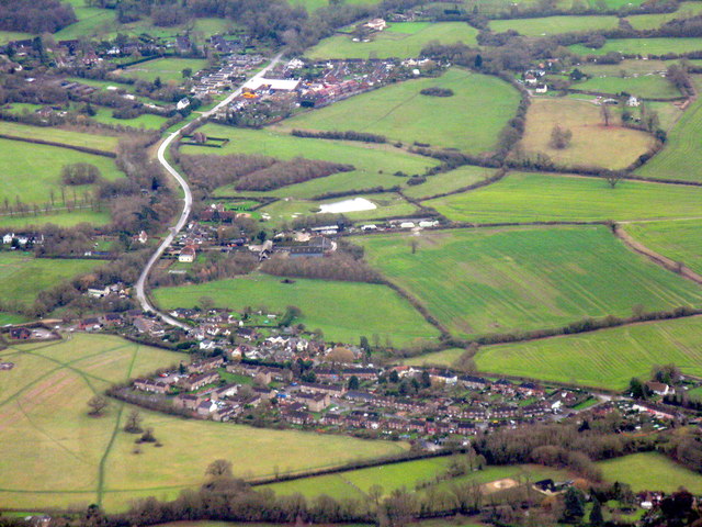
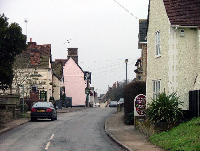
Benington is a small village located in the county of Hertfordshire, England. Situated approximately 6 miles southeast of the town of Stevenage, it lies on the eastern side of the A602 road. The village is rich in history, with its origins dating back to the medieval era.

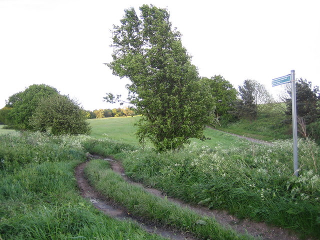
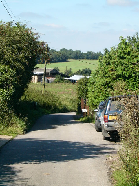
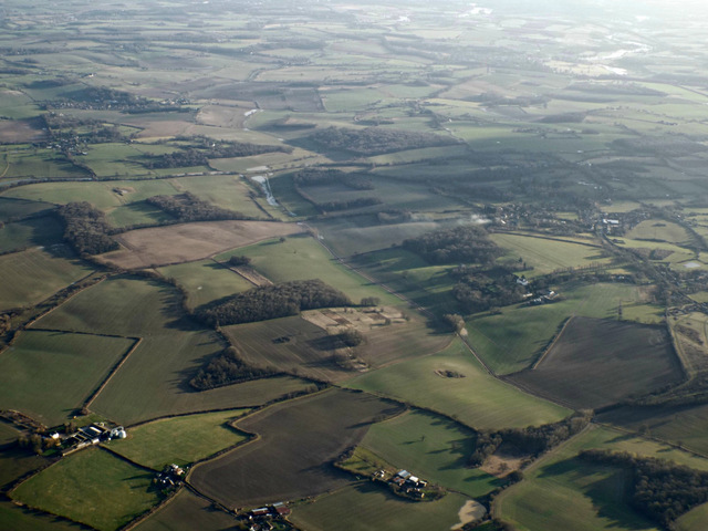
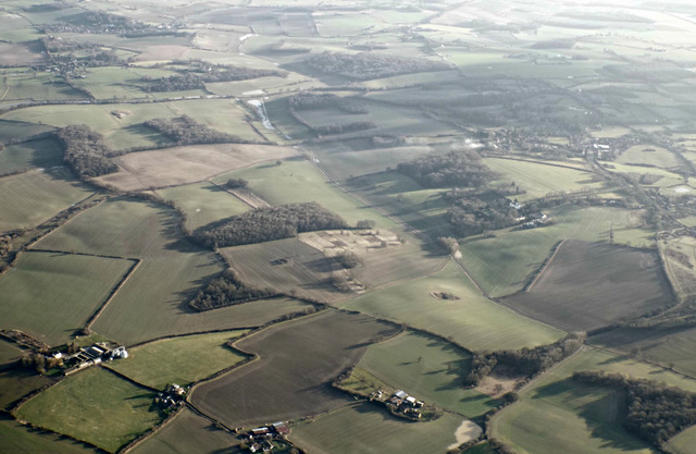
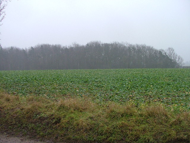
Benington is known for its picturesque countryside surroundings and charming rural atmosphere. The village is surrounded by open fields, farmland, and meadows, offering residents and visitors a peaceful and idyllic setting. The River Beane flows through the village, adding to its natural beauty.

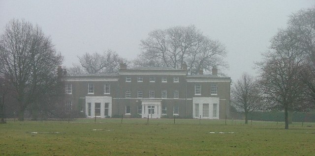
The heart of the village is dominated by the historic Benington Lordship, a Grade II listed manor house that dates back to the 17th century. The manor and its stunning gardens are open to the public during the summer months, attracting visitors from near and far.

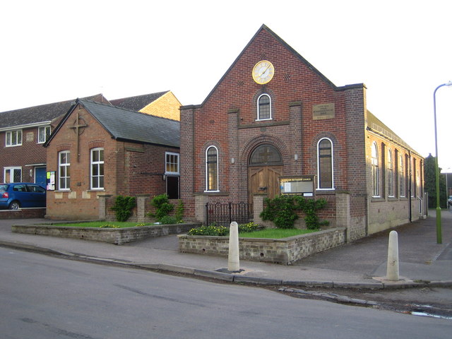
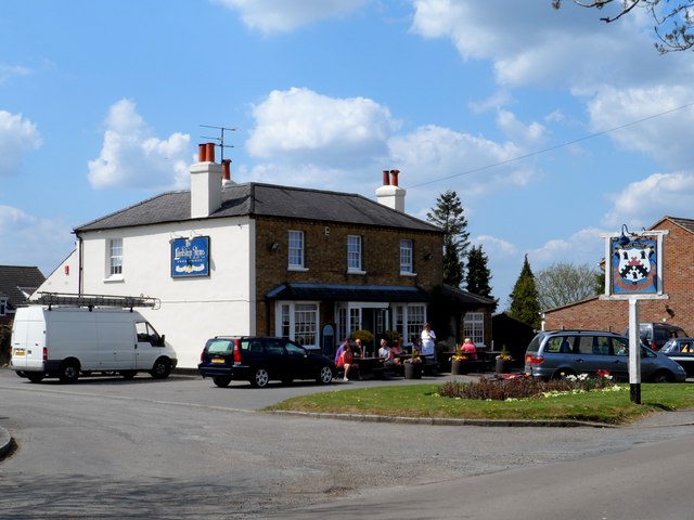
In addition to its rich history and natural beauty, Benington is home to a close-knit community. The village has a primary school, a local church, and a village hall, which hosts various community events and activities throughout the year. The annual Benington Chilli Festival, held in the grounds of the Benington Lordship, is a popular event that draws crowds from all over the region.

With its tranquil surroundings, historical landmarks, and strong community spirit, Benington offers a charming and peaceful escape for residents and visitors alike.

If you have any feedback on the listing, please let us know in the comments section below.
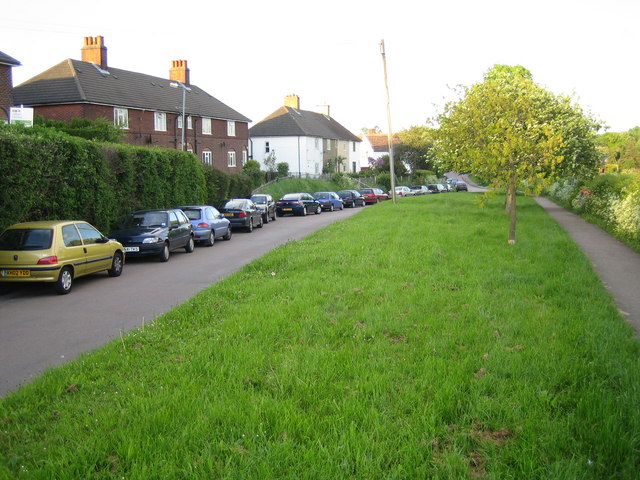
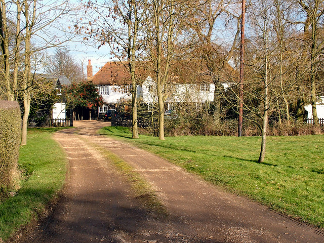
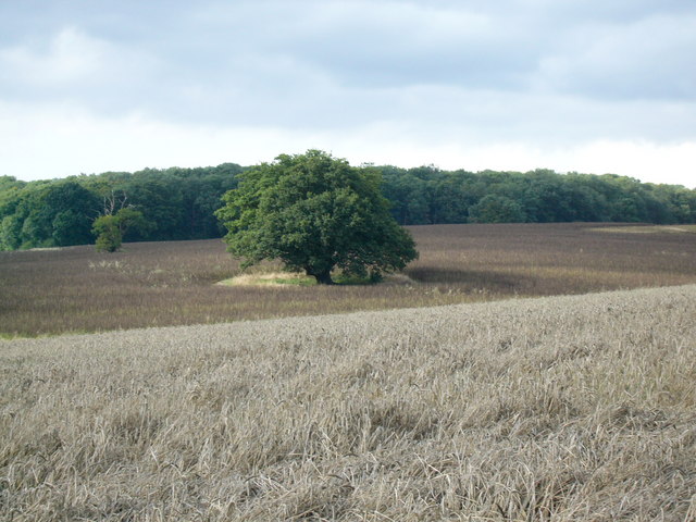
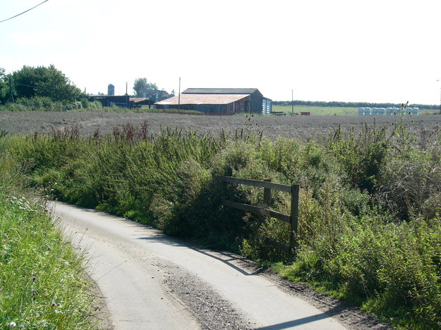
Benington Images

Images are sourced within 2km of 51.896384/-0.114175 or Grid Reference TL2923. Thanks to Geograph Open Source API. All images are credited.

Walkern Hall I have no idea what this grand looking Hall is used for now. This photo was taken from the adjoining square because Walkern Hall is so close to the edge.
Walkern Hall
I have no idea what this grand looking Hall is used for now. This photo was taken from the adjoining square because Walkern Hall is so close to the edge.
Cottages at Clay End Clay end is not very big.  This is about half of it.
Cottages at Clay End
Clay end is not very big. This is about half of it.
Benington: Road Used as a Public Path A Road Used as a Public Path (RUPP) leading from High Elms Lane to Burn's Green.
Benington: Road Used as a Public Path
A Road Used as a Public Path (RUPP) leading from High Elms Lane to Burn's Green.
Benington Methodist Church Built in 1862 and rebuilt in 1933, the church is on Whempstead Road in Burn's Green.
Benington Methodist Church
Built in 1862 and rebuilt in 1933, the church is on Whempstead Road in Burn's Green.
Benington: Town Lane Looking towards Burn's Green.
Benington: Town Lane
Looking towards Burn's Green.
Cutting Hill Farm
Cutting Hill Farm
Oak Tree Oak tree standing in the fields behind Benington Park. Photographed from the Chain Walk/bridleway starting at Hebing End
Oak Tree
Oak tree standing in the fields behind Benington Park. Photographed from the Chain Walk/bridleway starting at Hebing End
Holmes Farm
Holmes Farm
Country Lane
Country Lane
Roadside placard, Benington, Hertfordshire (1) While the country struggles to supplement its energy needs by tentatively developing alternative sources, voices of protest in rural areas raised by those affected by these proposed  installations. The village of Benington in Hertfordshire currently has a numerous placards along the roadside like the one in the image. A justified campaign <span class="nowrap"><a title="http://www.stopbeningtonwindfarm.co.uk/" rel="nofollow ugc noopener" href="http://www.stopbeningtonwindfarm.co.uk/">Link</a><img style="margin-left:2px;" alt="External link" title="External link - shift click to open in new window" src="https://s1.geograph.org.uk/img/external.png" width="10" height="10"/></span> ? or mere nimbyism <span class="nowrap"><a title="http://en.wikipedia.org/wiki/NIMBY" rel="nofollow ugc noopener" href="http://en.wikipedia.org/wiki/NIMBY">Link</a><img style="margin-left:2px;" alt="External link" title="External link - shift click to open in new window" src="https://s1.geograph.org.uk/img/external.png" width="10" height="10"/></span> ?
Roadside placard, Benington, Hertfordshire (1)
While the country struggles to supplement its energy needs by tentatively developing alternative sources, voices of protest in rural areas raised by those affected by these proposed installations. The village of Benington in Hertfordshire currently has a numerous placards along the roadside like the one in the image. A justified campaign LinkExternal link ? or mere nimbyism LinkExternal link ?
Roadside placard, Benington, Hertfordshire (2) <a href="https://www.geograph.org.uk/photo/2533338">TL3023 : Roadside placard, Benington, Hertfordshire (1)</a> ... and here an apparently lone voice of support for the project!
Roadside placard, Benington, Hertfordshire (2)
TL3023 : Roadside placard, Benington, Hertfordshire (1) ... and here an apparently lone voice of support for the project!
Pond near to Burn's Green One of several small ponds marked on the O.S. map.
Pond near to Burn's Green
One of several small ponds marked on the O.S. map.
The Lordship Arms, Bennington
The Bell pub, Bennington
Walkern Park Farm from the air The farms in the foreground are, from left to right, Walkern Park Farm, Holmes Farm and Bridge Farm. Some signs of flooding can be seen in the fields to the left of centre.
Walkern Park Farm from the air
The farms in the foreground are, from left to right, Walkern Park Farm, Holmes Farm and Bridge Farm. Some signs of flooding can be seen in the fields to the left of centre.
Walkern Park Farm from the air The farms in the foreground are, from left to right, Walkern Park Farm, Holmes Farm and Bridge Farm.
Walkern Park Farm from the air
The farms in the foreground are, from left to right, Walkern Park Farm, Holmes Farm and Bridge Farm.
Benington and Burn's Green Two villages surrounded by farmland east of Stevenage. Burn's Green is the more distant.
Benington and Burn's Green
Two villages surrounded by farmland east of Stevenage. Burn's Green is the more distant.
Baron's Grove. This photo taken from the bridleway.  The trees look as though they are shrouded in mist because they are.
Baron's Grove.
This photo taken from the bridleway. The trees look as though they are shrouded in mist because they are.
Show me another place!

Benington is located at Grid Ref: TL2923 (Lat: 51.896384, Lng: -0.114175)

Administrative County: Hertfordshire

District: East Hertfordshire

Police Authority: Hertfordshire

What 3 Words

///shadowing.serious.issued. Near Walkern, Hertfordshire

Related Wikis

Benington, Hertfordshire

Benington is a village and civil parish in the East Hertfordshire district of Hertfordshire, England, about four miles east of Stevenage and 35 miles north...

Benington Castle

Benington Castle is a ruined castle in the village of Benington, near Stevenage in Hertfordshire, England at grid reference TL296236. It has been protected...

Benington High Wood

Benington High Wood is a 20.7-hectare (51-acre) biological Site of Special Scientific Interest in Benington, Hertfordshire. The planning authority is East...

Aston End

Aston End is a hamlet in Hertfordshire, England. It is in the civil parish of Aston. It features a pub and a butchers, as well as a few houses. == References... ==

Aston, Hertfordshire

Aston is a village and civil parish in the East Hertfordshire district of Hertfordshire, England. According to the 2001 census it had a population of...

Walkern

Walkern is a village and civil parish in East Hertfordshire, England. It is about two miles (3 km) from Stevenage. The village has several shops, including...

Church of St Mary the Virgin, Walkern

The parish church of St Mary the Virgin in Walkern, Hertfordshire, dates from before the Norman Conquest and has been altered in the succeeding centuries...

Aston Bury

Aston Bury is a manor house near Aston, Hertfordshire, England. It is Grade I listed building.It was built in the mid 17th century, possibly by the Boteler...

Nearby Amenities

Located within 500m of 51.896384,-0.114175
Source: Estimated position from hertfordshire_county_council_prow_gis_data
Lat/Long: 51.8973799/-0.1120041
Barrier: kissing_gate
Bicycle: no
Foot: yes
Source: GPS, observation
Lat/Long: 51.8974003/-0.1146812
Benington
Place: village
Lat/Long: 51.8961123/-0.1117452
Pub
The Bell
Wikidata: Q17553529
Lat/Long: 51.8955238/-0.1132271
Church Green
Naptan AtcoCode: 210021305950
Naptan Bearing: NW
Naptan BusStopType: CUS
Naptan CommonName: Church Green
Naptan Crossing: Church Green
Naptan Indicator: opp
Naptan Landmark: Church Green
Naptan NaptanCode: hrtgtdpt
Naptan ShortCommonName: NA
Naptan Street: Town Lane
Naptan Verified: no
Source: naptan_import
Lat/Long: 51.8959191/-0.1137904
Bus Stop
Church Green
Bus: yes
Covered: yes
Naptan AtcoCode: 210021310740
Naptan Bearing: S
Naptan CommonName: Church Green
Naptan Crossing: Church Green
Naptan Indicator: adj
Naptan Landmark: Church Green
Naptan NaptanCode: hrtdpdap
Naptan ShortCommonName: NA
Naptan Street: Town Lane
Naptan Verified: no
Public Transport: platform
Source: naptan_import
Lat/Long: 51.8962796/-0.1140074
Bus Stop
Three Stiles
Bus: yes
Local Ref: NR
Naptan AtcoCode: 210021310760
Naptan Bearing: E
Naptan CommonName: Three Stiles
Naptan Crossing: Telephone Exchange
Naptan Indicator: nr
Naptan Landmark: Telephone Exchange
Naptan NaptanCode: hrtdpdat
Naptan ShortCommonName: NA
Naptan Street: Town Lane
Naptan Verified: no
Public Transport: platform
Source: naptan_import
Lat/Long: 51.8950262/-0.1080286
Barrier: kissing_gate
Foot: yes
Lat/Long: 51.8970175/-0.1139443
Man Made: water_tower
Lat/Long: 51.8991613/-0.1122031
Post Box
Collection Times: Mo-Fr 16:40; Sa 07:45
Post Box Type: lamp
Ref: SG2 324
Royal Cypher: EIIR
Royal Cypher Wikidata: Q33102113
Lat/Long: 51.8955914/-0.1109439
Bench
Backrest: yes
Colour: brown
Material: wood
Seats: 3
Lat/Long: 51.896282/-0.1142236
Power: pole
Lat/Long: 51.8936261/-0.1086401
Barrier: kissing_gate
Bicycle: no
Foot: yes
Source: GPS
Lat/Long: 51.8940262/-0.1082821
Barrier: kissing_gate
Foot: yes
Source: GPS
Lat/Long: 51.8975242/-0.1160605
Post Box
Collection Times: Mo-Fr 16:45; Sa 08:00
Post Box Type: lamp
Ref: SG2 255
Lat/Long: 51.8992267/-0.1128882
Bus Stop
Three Stiles
Bus: yes
Naptan AtcoCode: 210021305940
Naptan Bearing: W
Naptan CommonName: Three Stiles
Naptan Crossing: Telephone Exchange
Naptan Indicator: opp
Naptan Landmark: Telephone Exchange
Naptan NaptanCode: hrtdtapg
Naptan ShortCommonName: NA
Naptan Street: Town Lane
Naptan Verified: no
Public Transport: platform
Source: naptan_import
Lat/Long: 51.8949378/-0.1080214
Barrier: kissing_gate
Foot: yes
Source: observation, GPS
Lat/Long: 51.900192/-0.1104849
Noexit: yes
Lat/Long: 51.8950381/-0.1089041
The data included in this document is from www.openstreetmap.org. The data is made available under ODbL.

Have you been to Benington?

Leave your review of Benington below (or comments, questions and feedback).