Wambarrows

Heritage Site in Somerset Somerset West and Taunton

England

Wambarrows

Winsford : Ash Lane Looking along Ash Lane.
Winsford : Ash Lane Credit: Lewis Clarke

Wambarrows, located in Somerset, England, is a significant heritage site known for its historical and archaeological importance. This ancient monument is nestled within the beautiful landscape of the Mendip Hills, a designated Area of Outstanding Natural Beauty.

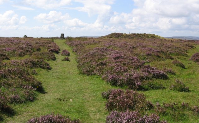
Wambarrows consists of a collection of Bronze Age round barrows, which are mounds of earth and stones, typically used as burial sites. These barrows date back to around 2000-1500 BC, making them over 4,000 years old. These structures bear witness to the region's prehistoric past and offer valuable insights into the burial practices and rituals of the Bronze Age inhabitants.

The site comprises several barrows of varying sizes and shapes, ranging from small and simple mounds to larger, more complex structures. Many of them have been partially excavated, revealing fascinating archaeological finds such as pottery, tools, and human remains. These discoveries have contributed to our understanding of the local Bronze Age society and their way of life.

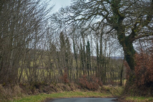
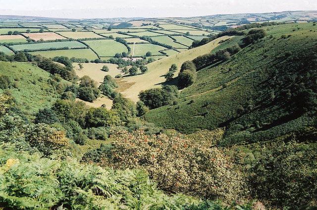
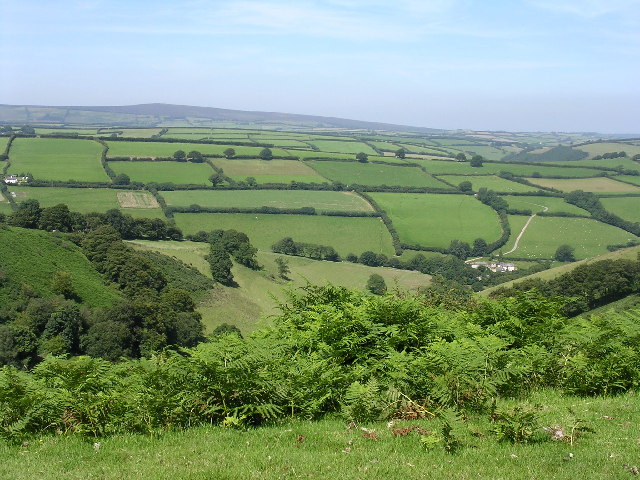
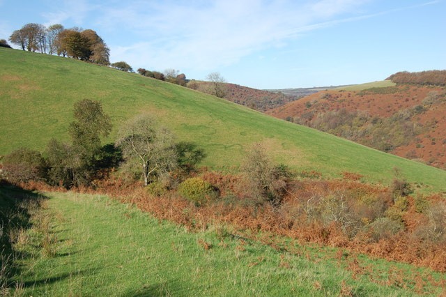
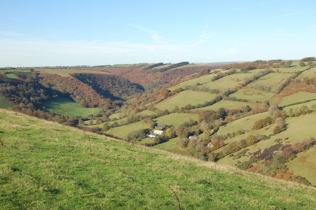
Wambarrows also offers visitors stunning panoramic views of the surrounding countryside, with rolling hills and picturesque vistas. The site is accessible via footpaths, allowing visitors to explore the area and appreciate the natural beauty of the landscape.

Due to its historical significance, Wambarrows is protected as a Scheduled Ancient Monument, ensuring its preservation for future generations. The site is managed and maintained by the local authorities, who provide information boards and interpretation materials to enhance visitors' understanding of the site's historical and archaeological significance.

Overall, Wambarrows in Somerset is a captivating heritage site that not only showcases the ancient burial practices of the Bronze Age but also offers a tranquil and scenic location for visitors to immerse themselves in the beauty of the Mendip Hills.

If you have any feedback on the listing, please let us know in the comments section below.
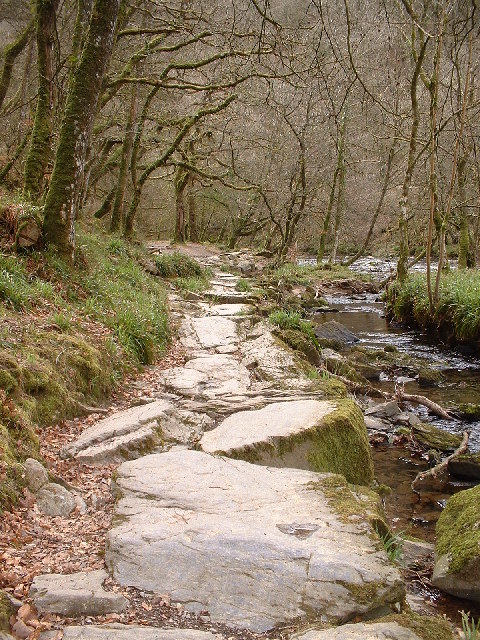
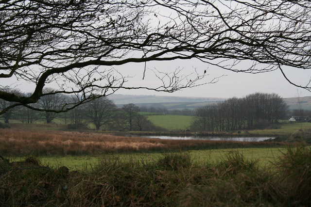
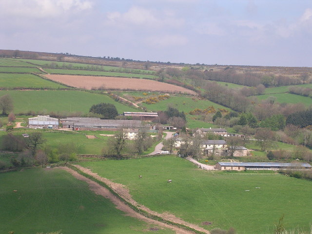
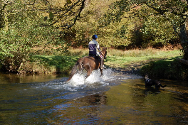
Wambarrows Images

Images are sourced within 2km of 51.098/-3.607 or Grid Reference SS8734. Thanks to Geograph Open Source API. All images are credited.

Winsford : Ash Lane Looking along Ash Lane.
Winsford : Ash Lane
Looking along Ash Lane.
Winsford: the Punchbowl from Winsford Hill Looking north-north-east to Withycombe Farm
Winsford: the Punchbowl from Winsford Hill
Looking north-north-east to Withycombe Farm
Trig Point, Winsford Hill Trig Point & one of the Wambarrows
Trig Point, Winsford Hill
Trig Point & one of the Wambarrows
Punchbowl from Winsford Hill
Path through Lea Wood On the Two Moors way beside the River Barle
Path through Lea Wood
On the Two Moors way beside the River Barle
Withypoole and Hawkridge: Bradley Pond The pond originally covered 5.5 acres and had a massive earth dam 220 yards long, since breached. It’s water once powered a 16’ diameter waterwheel at Great Bradley – at SS858341 – via an 850 yard long leat. The barns there have since been converted to homes
Withypoole and Hawkridge: Bradley Pond
The pond originally covered 5.5 acres and had a massive earth dam 220 yards long, since breached. It’s water once powered a 16’ diameter waterwheel at Great Bradley – at SS858341 – via an 850 yard long leat. The barns there have since been converted to homes
Liscombe farm and cottages
Crossing the Exe near West Nethercote The river can get quite deep at during the winter months.
Crossing the Exe near West Nethercote
The river can get quite deep at during the winter months.
Bridleway heading down to Neathercote The circular green markings on the hill are quite curious.
Bridleway heading down to Neathercote
The circular green markings on the hill are quite curious.
The River Exe valley from Bye Common looking N.W. The group of cottages are West and East Nethercote
The River Exe valley from Bye Common looking N.W.
The group of cottages are West and East Nethercote
Winsford: near Spire Cross Looking south-south-east towards Draydon Knap
Winsford: near Spire Cross
Looking south-south-east towards Draydon Knap
Dulverton: towards Higher Spire Looking south east. The farmhouse sits near the top of a valley, its stream running roughly west to join the Barle at Tarr Steps
Dulverton: towards Higher Spire
Looking south east. The farmhouse sits near the top of a valley, its stream running roughly west to join the Barle at Tarr Steps
Winsford: by Halse Lane Hedging in progress. Looking east by the lane to Winsford
Winsford: by Halse Lane
Hedging in progress. Looking east by the lane to Winsford
River Exe Log Bridge, Nr West Nethercote, Exmoor An alternative river crossing method for those who are agile - the two blue ropes for hand-holds are just visible.
River Exe Log Bridge, Nr West Nethercote, Exmoor
An alternative river crossing method for those who are agile - the two blue ropes for hand-holds are just visible.
Winsford Hill trig point The OS map gives the height at this location as 426 (428) referring in the first instance to the height of the base of the trig point (in metres) and secondly to the highest 'natural point of the hill' which I take to be the easternmost of the three 'Wambarrows' which looms that height over the trig point.  

Winsford Hill is notable for The Punchbowl at <a href="https://www.geograph.org.uk/gridref/SS8834">SS8834</a> which may be the only glacial cirque in south-west England - the snows which led to its creation during the Ice Age(s) having blown across the open top of Winsford Hill into the lee on its NE side.
Winsford Hill trig point
The OS map gives the height at this location as 426 (428) referring in the first instance to the height of the base of the trig point (in metres) and secondly to the highest 'natural point of the hill' which I take to be the easternmost of the three 'Wambarrows' which looms that height over the trig point. Winsford Hill is notable for The Punchbowl at SS8834 which may be the only glacial cirque in south-west England - the snows which led to its creation during the Ice Age(s) having blown across the open top of Winsford Hill into the lee on its NE side.
Comer's Cross Multi-fingered directional signs are characteristic of the area - this one can be readily located from the various destinations it carries.
Comer's Cross
Multi-fingered directional signs are characteristic of the area - this one can be readily located from the various destinations it carries.
Comer's Gate At the northwest corner of the open land comprising Winsford Hill where the B3223 leaves the moor.  Comer's Cross is seen in the middle distance.
Comer's Gate
At the northwest corner of the open land comprising Winsford Hill where the B3223 leaves the moor. Comer's Cross is seen in the middle distance.
Bridleway to Barle Valley A diminutive fingerposts marks the spot where this bridleway leaves the B3223 bound for the valley to the west of Winsford Hill.
Bridleway to Barle Valley
A diminutive fingerposts marks the spot where this bridleway leaves the B3223 bound for the valley to the west of Winsford Hill.
Show me another place!

Wambarrows is located at Grid Ref: SS8734 (Lat: 51.098, Lng: -3.607)

Administrative County: Somerset

District: Somerset West and Taunton

Police Authority: Avon and Somerset

What 3 Words

///assess.puffed.steadier. Near Dulverton, Somerset

Related Wikis

Exmoor

Exmoor is loosely defined as an area of hilly open moorland in west Somerset and north Devon in South West England. It is named after the River Exe, the...

South Exmoor SSSI

South Exmoor (grid reference SS880340) is a 3132.7 hectare (7742.3 acre) biological Site of Special Scientific Interest in Devon and Somerset, England...

Caratacus Stone

The Caratacus Stone, sometimes known as the Caractacus Stone, is an inscribed stone on Exmoor in Somerset, England. It is thought to date from the 6th...

Tarr Steps

The Tarr Steps is a clapper bridge across the River Barle in the Exmoor National Park, Somerset, England. They are located in a national nature reserve...

Nearby Amenities

Located within 500m of 51.098,-3.607
Winsford Hill
Ele: 426
Man Made: survey_point
Lat/Long: 51.0969282/-3.6054505
Archaeological Site: tumulus
Historic: archaeological_site
Lat/Long: 51.0968917/-3.6055308
Archaeological Site: tumulus
Historic: archaeological_site
Lat/Long: 51.0970371/-3.6064029
Archaeological Site: tumulus
Historic: archaeological_site
Lat/Long: 51.0971071/-3.6071834
Winsford Hill
Ele: 428
Natural: peak
Lat/Long: 51.0975194/-3.6056156
The data included in this document is from www.openstreetmap.org. The data is made available under ODbL.

Have you been to Wambarrows?

Leave your review of Wambarrows below (or comments, questions and feedback).