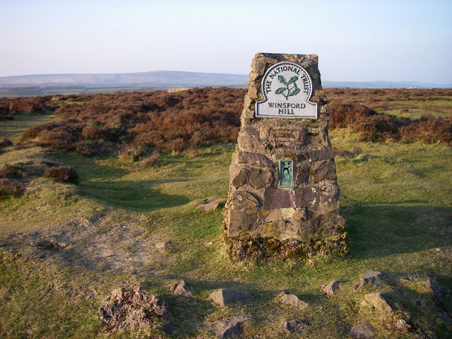
Winsford Hill

Hill, Mountain in Somerset Somerset West and Taunton

England

Winsford Hill

Winsford : Ash Lane Looking along Ash Lane.
Winsford : Ash Lane Credit: Lewis Clarke

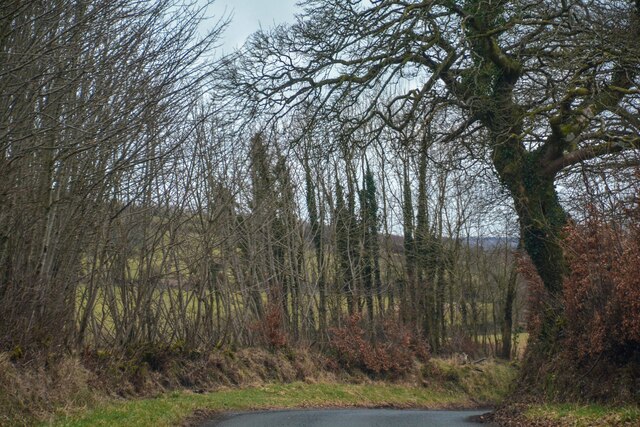
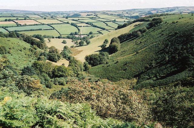
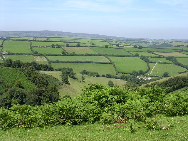
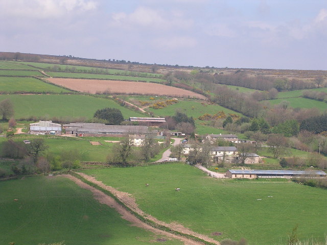
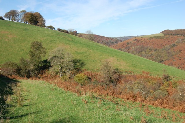
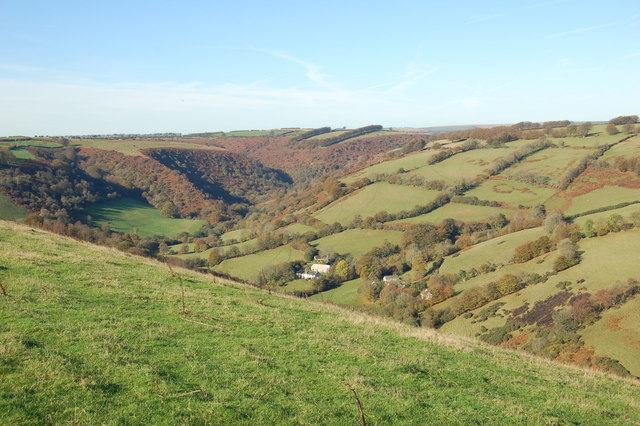
Winsford Hill is a prominent landmark located in Somerset, England. As part of the Exmoor National Park, it stands at an elevation of 402 meters (1,319 feet) above sea level, making it one of the highest points in the region. This hill offers captivating views of the surrounding countryside, including the picturesque valleys and rolling hills that define the area.

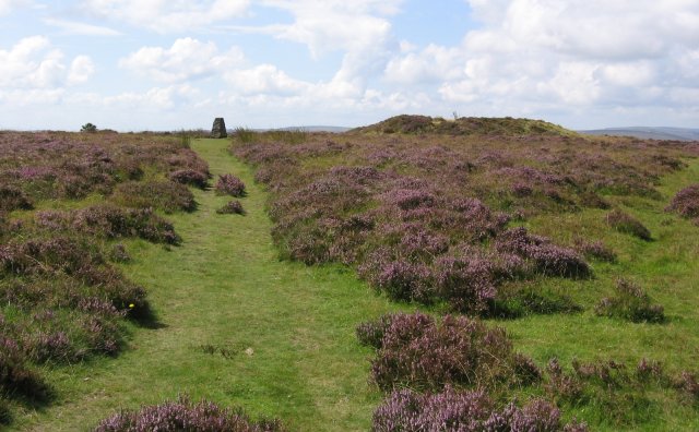
Covered in heather and gorse, Winsford Hill is renowned for its natural beauty and tranquil atmosphere. It is a popular destination for hikers, nature enthusiasts, and photographers seeking to immerse themselves in the stunning landscapes of Exmoor. The hill is home to a variety of wildlife, including red deer, Exmoor ponies, and numerous bird species, making it a haven for wildlife lovers.

At the summit of Winsford Hill, visitors can find a Bronze Age burial mound, known as a barrow, providing intriguing insight into the area's ancient history. The hill is also famous for its prehistoric remains, including the nearby Tarr Steps, an ancient clapper bridge that spans the River Barle. These historical features add a sense of mystique and heritage to the already captivating landscape.

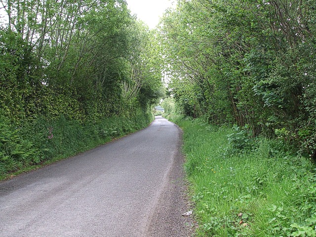
Winsford Hill is easily accessible to visitors, with designated footpaths and trails leading to its summit. The nearby village of Winsford offers amenities such as accommodations, cafes, and pubs, allowing visitors to fully explore and experience the charm of this rural area.

Overall, Winsford Hill in Somerset is a stunning natural landmark that offers breathtaking views, abundant wildlife, and historical intrigue. It is a must-visit destination for anyone seeking to connect with nature and explore the rich history of the Exmoor region.

If you have any feedback on the listing, please let us know in the comments section below.

Winsford Hill Images

Images are sourced within 2km of 51.096748/-3.6052634 or Grid Reference SS8734. Thanks to Geograph Open Source API. All images are credited.

Winsford : Ash Lane Looking along Ash Lane.
Winsford : Ash Lane
Looking along Ash Lane.
Winsford: the Punchbowl from Winsford Hill Looking north-north-east to Withycombe Farm
Winsford: the Punchbowl from Winsford Hill
Looking north-north-east to Withycombe Farm
Trig Point, Winsford Hill Trig Point & one of the Wambarrows
Trig Point, Winsford Hill
Trig Point & one of the Wambarrows
Punchbowl from Winsford Hill
Liscombe farm and cottages
Bridleway heading down to Neathercote The circular green markings on the hill are quite curious.
Bridleway heading down to Neathercote
The circular green markings on the hill are quite curious.
The River Exe valley from Bye Common looking N.W. The group of cottages are West and East Nethercote
The River Exe valley from Bye Common looking N.W.
The group of cottages are West and East Nethercote
Winsford: by Draydon Knap On Exmoor. Looking north-north-west towards Winsford Hill
Winsford: by Draydon Knap
On Exmoor. Looking north-north-west towards Winsford Hill
Winsford: near Spire Cross Looking south-south-east towards Draydon Knap
Winsford: near Spire Cross
Looking south-south-east towards Draydon Knap
Dulverton: towards Higher Spire Looking south east. The farmhouse sits near the top of a valley, its stream running roughly west to join the Barle at Tarr Steps
Dulverton: towards Higher Spire
Looking south east. The farmhouse sits near the top of a valley, its stream running roughly west to join the Barle at Tarr Steps
Winsford: by Halse Lane Hedging in progress. Looking east by the lane to Winsford
Winsford: by Halse Lane
Hedging in progress. Looking east by the lane to Winsford
Winsford Hill trig point The OS map gives the height at this location as 426 (428) referring in the first instance to the height of the base of the trig point (in metres) and secondly to the highest 'natural point of the hill' which I take to be the easternmost of the three 'Wambarrows' which looms that height over the trig point.  

Winsford Hill is notable for The Punchbowl at <a href="https://www.geograph.org.uk/gridref/SS8834">SS8834</a> which may be the only glacial cirque in south-west England - the snows which led to its creation during the Ice Age(s) having blown across the open top of Winsford Hill into the lee on its NE side.
Winsford Hill trig point
The OS map gives the height at this location as 426 (428) referring in the first instance to the height of the base of the trig point (in metres) and secondly to the highest 'natural point of the hill' which I take to be the easternmost of the three 'Wambarrows' which looms that height over the trig point. Winsford Hill is notable for The Punchbowl at SS8834 which may be the only glacial cirque in south-west England - the snows which led to its creation during the Ice Age(s) having blown across the open top of Winsford Hill into the lee on its NE side.
Comer's Gate At the northwest corner of the open land comprising Winsford Hill where the B3223 leaves the moor.  Comer's Cross is seen in the middle distance.
Comer's Gate
At the northwest corner of the open land comprising Winsford Hill where the B3223 leaves the moor. Comer's Cross is seen in the middle distance.
Bridleway to Barle Valley A diminutive fingerposts marks the spot where this bridleway leaves the B3223 bound for the valley to the west of Winsford Hill.
Bridleway to Barle Valley
A diminutive fingerposts marks the spot where this bridleway leaves the B3223 bound for the valley to the west of Winsford Hill.
Gated bridleway, Bye Common The 'Samaritans Way South West' follows this bridleway over Bye Common in the Exe Valley
Gated bridleway, Bye Common
The 'Samaritans Way South West' follows this bridleway over Bye Common in the Exe Valley
Panorama from Ash Lane Taken from Ash Lane looking southwards across Withy Combe with Winn Brook hidden in its valley. Winsford Hill on Exmoor rises in the distance with the depression "The Punchbowl" (in the adjacent square to the south) evident to left of centre.
Panorama from Ash Lane
Taken from Ash Lane looking southwards across Withy Combe with Winn Brook hidden in its valley. Winsford Hill on Exmoor rises in the distance with the depression "The Punchbowl" (in the adjacent square to the south) evident to left of centre.
Hedge and fields off Ash Lane This thick hedge strikes off southwards from Ash Lane. In the background sheep can be seen dotting the steeply sloping fields on the far side of Winn Brook's valley.
Hedge and fields off Ash Lane
This thick hedge strikes off southwards from Ash Lane. In the background sheep can be seen dotting the steeply sloping fields on the far side of Winn Brook's valley.
Ash Lane Ash Lane leads out of Winsford in a fairly straight westerly course towards the Exmoor village of Withypool. This photo was taken near to Springfield Cottages.
Ash Lane
Ash Lane leads out of Winsford in a fairly straight westerly course towards the Exmoor village of Withypool. This photo was taken near to Springfield Cottages.
Show me another place!

Winsford Hill is located at Grid Ref: SS8734 (Lat: 51.096748, Lng: -3.6052634)

Administrative County: Somerset

District: Somerset West and Taunton

Police Authority: Avon and Somerset

What 3 Words

///forklift.exporters.drips. Near Dulverton, Somerset

Related Wikis

South Exmoor SSSI

South Exmoor (grid reference SS880340) is a 3132.7 hectare (7742.3 acre) biological Site of Special Scientific Interest in Devon and Somerset, England...

Exmoor

Exmoor is loosely defined as an area of hilly open moorland in west Somerset and north Devon in South West England. It is named after the River Exe, the...

Caratacus Stone

The Caratacus Stone, sometimes known as the Caractacus Stone, is an inscribed stone on Exmoor in Somerset, England. It is thought to date from the 6th...

Tarr Steps

The Tarr Steps is a clapper bridge across the River Barle in the Exmoor National Park, Somerset, England. They are located in a national nature reserve...

Nearby Amenities

Located within 500m of 51.096748,-3.6052634
Winsford Hill
Ele: 426
Man Made: survey_point
Lat/Long: 51.0969282/-3.6054505
Archaeological Site: tumulus
Historic: archaeological_site
Lat/Long: 51.0968917/-3.6055308
Archaeological Site: tumulus
Historic: archaeological_site
Lat/Long: 51.0970371/-3.6064029
Archaeological Site: tumulus
Historic: archaeological_site
Lat/Long: 51.0971071/-3.6071834
Winsford Hill
Ele: 428
Natural: peak
Lat/Long: 51.0975194/-3.6056156
The data included in this document is from www.openstreetmap.org. The data is made available under ODbL.

Have you been to Winsford Hill?

Leave your review of Winsford Hill below (or comments, questions and feedback).