Riscombe Combe

Valley in Somerset Somerset West and Taunton

England

Riscombe Combe

Winsford : Winsford Hill Sign An information sign beside the Caratacus Stone.
Winsford : Winsford Hill Sign Credit: Lewis Clarke

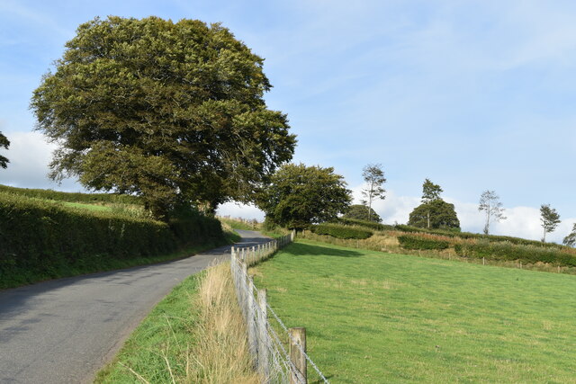
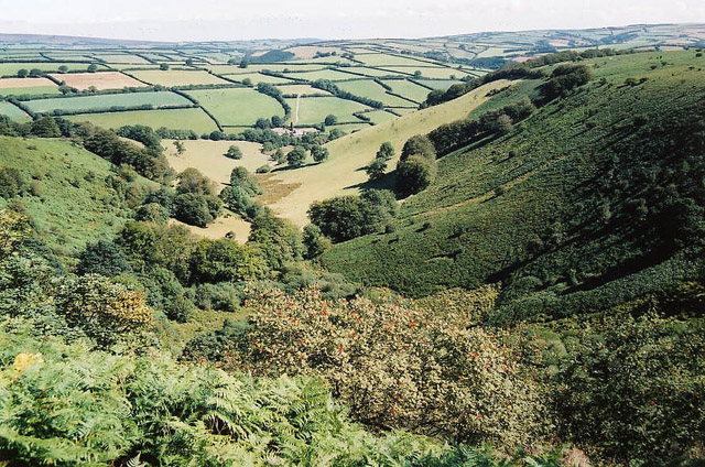
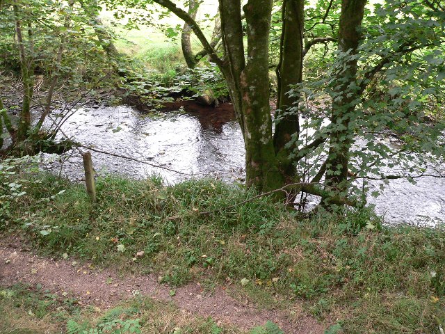
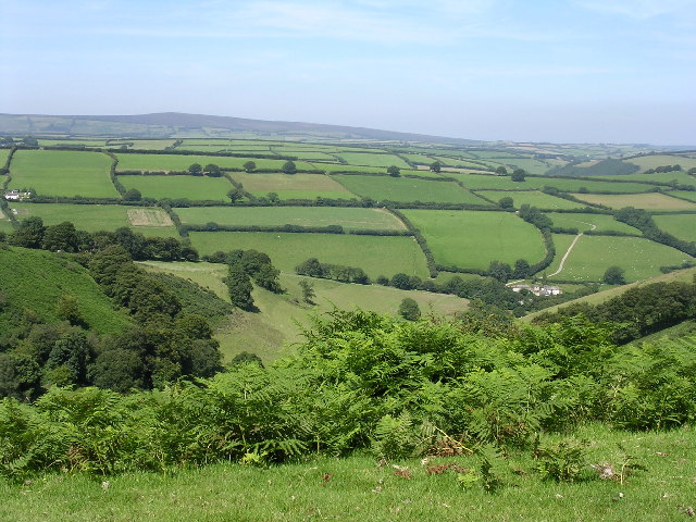
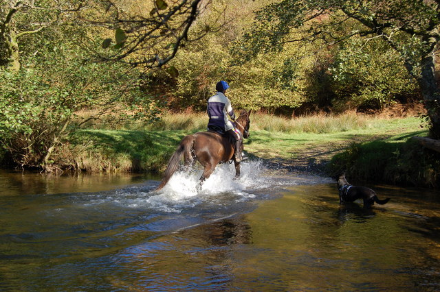
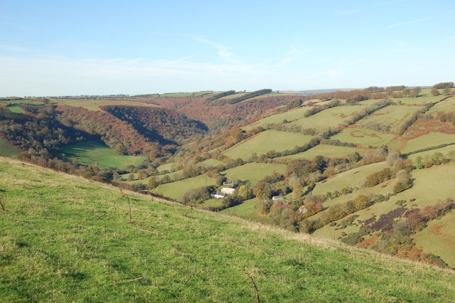
Riscombe Combe is a picturesque valley located in Somerset, England. Nestled within the Exmoor National Park, it offers breathtaking natural beauty and a serene environment for visitors to enjoy. The combe, or valley, is formed by the meandering of the River Avill, which flows through the heart of the landscape.

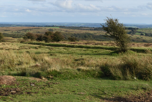
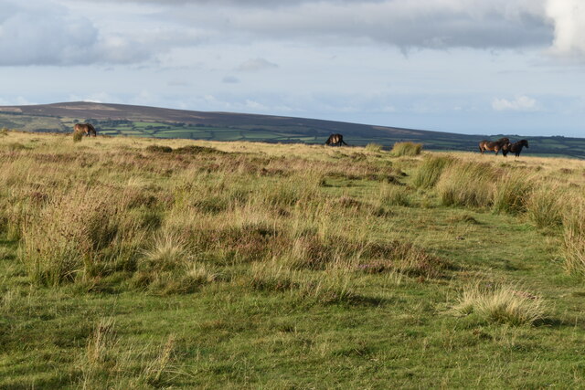
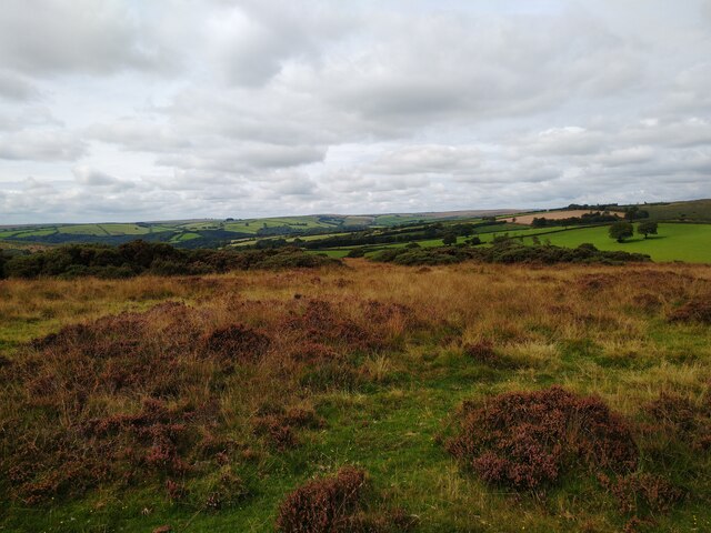
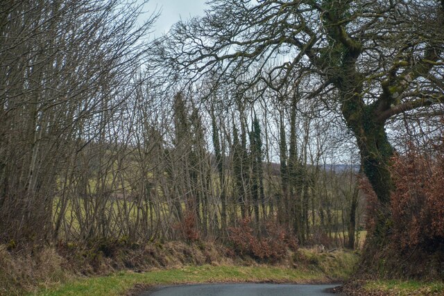
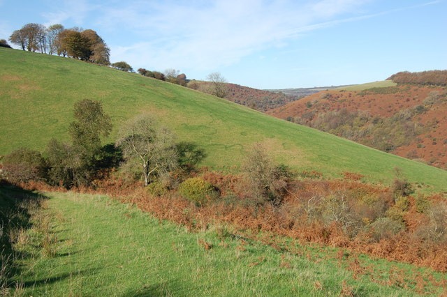
Surrounded by rolling hills and dense woodland, Riscombe Combe is a haven for nature enthusiasts and hikers. The valley is home to a diverse range of flora and fauna, including rare species such as the Exmoor pony and the red deer. The river, with its crystal-clear waters, provides a tranquil spot for picnicking and relaxation.

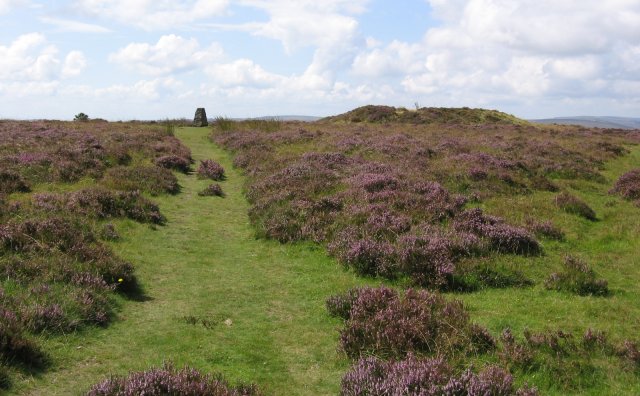
The combe is also dotted with ancient archaeological sites, including the remains of prehistoric settlements and burial mounds. These remnants offer a glimpse into the rich history of the area and its early inhabitants.

A network of footpaths and trails crisscrosses through Riscombe Combe, allowing visitors to explore the valley and its surroundings. The paths lead to stunning viewpoints, where one can marvel at the panoramic vistas of the surrounding countryside.

For those seeking a peaceful retreat, there are several holiday cottages and bed and breakfasts in the area, offering a comfortable stay amidst the natural beauty of Riscombe Combe. Additionally, a nearby village provides basic amenities such as shops and cafes for visitors' convenience.

In summary, Riscombe Combe is a hidden gem in Somerset, offering a tranquil escape into nature. With its stunning landscapes, rich history, and abundant wildlife, it is a must-visit destination for anyone seeking a serene and rejuvenating experience.

If you have any feedback on the listing, please let us know in the comments section below.

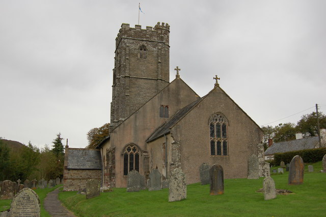
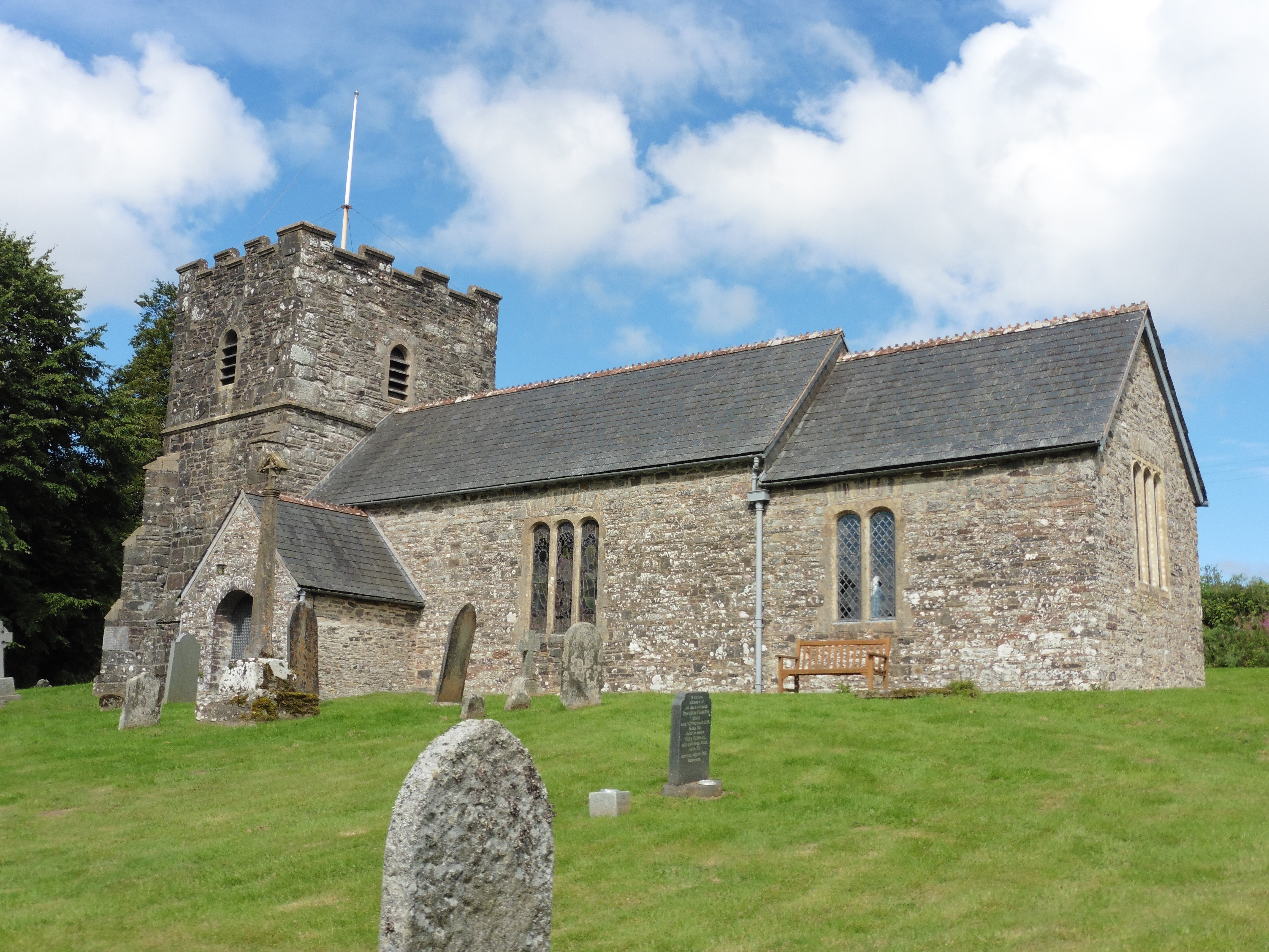
Riscombe Combe Images

Images are sourced within 2km of 51.102213/-3.6015534 or Grid Reference SS8734. Thanks to Geograph Open Source API. All images are credited.

Winsford : Winsford Hill Sign An information sign beside the Caratacus Stone.
Winsford : Winsford Hill Sign
An information sign beside the Caratacus Stone.
Winsford : Caratacus Stone The stone, which is of early medieval date, is free-standing and of local origin. It is an undressed, roughly wedged-shaped block, 1.2m high, 0.3m wide and 0.2m thick with up to 0.3m buried beneath the ground surface. <span class="nowrap"><a title="https://historicengland.org.uk/listing/the-list/list-entry/1021228" rel="nofollow ugc noopener" href="https://historicengland.org.uk/listing/the-list/list-entry/1021228">Link</a><img style="margin-left:2px;" alt="External link" title="External link - shift click to open in new window" src="https://s1.geograph.org.uk/img/external.png" width="10" height="10"/></span>
Winsford : Caratacus Stone
The stone, which is of early medieval date, is free-standing and of local origin. It is an undressed, roughly wedged-shaped block, 1.2m high, 0.3m wide and 0.2m thick with up to 0.3m buried beneath the ground surface. LinkExternal link
Winsford : Caratacus Stone Looking towards the Caratacus Stone on Exmoor.
Winsford : Caratacus Stone
Looking towards the Caratacus Stone on Exmoor.
Lane northeast from Liscombe
On Winsford Hill
On Winsford Hill
Near the summit of Winsford Hill
View over Exmoor near Liscombe Looking north west over Exmoor from the B3223 near Liscombe.
View over Exmoor near Liscombe
Looking north west over Exmoor from the B3223 near Liscombe.
View over Exmoor from Draydon Knapp Looking north along the B3223 by Draydon Knapp.
View over Exmoor from Draydon Knapp
Looking north along the B3223 by Draydon Knapp.
Winsford : Ash Lane Looking along Ash Lane.
Winsford : Ash Lane
Looking along Ash Lane.
Winsford: the Punchbowl from Winsford Hill Looking north-north-east to Withycombe Farm
Winsford: the Punchbowl from Winsford Hill
Looking north-north-east to Withycombe Farm
River Exe at Nethercote Taken on south side of the river.
River Exe at Nethercote
Taken on south side of the river.
Trig Point, Winsford Hill Trig Point & one of the Wambarrows
Trig Point, Winsford Hill
Trig Point & one of the Wambarrows
Punchbowl from Winsford Hill
Bridleway through newly planted woodland. Although the slopes were cleared for planting, a wide selection of new hardwood trees (oak, ash, sycamore, birch, and rowan) is in fierce competition with the local bracken.
Bridleway through newly planted woodland.
Although the slopes were cleared for planting, a wide selection of new hardwood trees (oak, ash, sycamore, birch, and rowan) is in fierce competition with the local bracken.
Bridge over River Exe at Larcombe Foot. This Bridge (in need of repair) now provides access to 2 bridleways 1 footpath and a private road. The photograph was taken from a spot which could have been a ford.
Bridge over River Exe at Larcombe Foot.
This Bridge (in need of repair) now provides access to 2 bridleways 1 footpath and a private road. The photograph was taken from a spot which could have been a ford.
Crossing the Exe near West Nethercote The river can get quite deep at during the winter months.
Crossing the Exe near West Nethercote
The river can get quite deep at during the winter months.
Bridleway heading down to Neathercote The circular green markings on the hill are quite curious.
Bridleway heading down to Neathercote
The circular green markings on the hill are quite curious.
The River Exe valley from Bye Common looking N.W. The group of cottages are West and East Nethercote
The River Exe valley from Bye Common looking N.W.
The group of cottages are West and East Nethercote
Show me another place!

Riscombe Combe is located at Grid Ref: SS8734 (Lat: 51.102213, Lng: -3.6015534)

Administrative County: Somerset

District: Somerset West and Taunton

Police Authority: Avon and Somerset

What 3 Words

///twists.camp.factoring. Near Dulverton, Somerset

Related Wikis

Exmoor

Exmoor is loosely defined as an area of hilly open moorland in west Somerset and north Devon in South West England. It is named after the River Exe, the...

South Exmoor SSSI

South Exmoor (grid reference SS880340) is a 3132.7 hectare (7742.3 acre) biological Site of Special Scientific Interest in Devon and Somerset, England...

Caratacus Stone

The Caratacus Stone, sometimes known as the Caractacus Stone, is an inscribed stone on Exmoor in Somerset, England. It is thought to date from the 6th...

Garratts Wood

Garratts Wood is a woodland in Somerset, England, near the village of Winsford. It covers a total area of 1.11 hectares (2.74 acres). It is owned and managed...

Winsford, Somerset

Winsford is a village and civil parish in Somerset, England, located about 5 miles (8 km) north-west of Dulverton. It is within the borders of the Exmoor...

Tarr Steps

The Tarr Steps is a clapper bridge across the River Barle in the Exmoor National Park, Somerset, England. They are located in a national nature reserve...

Road Castle

Road Castle is an Iron Age bank and ditch in the West Somerset district of Somerset, England. The hill fort is situated approximately 2 miles (3.2 km)...

Church of St Andrew, Withypool

The Anglican Church of St Andrew in Withypool, Somerset, England was built in late medieval period. It is a Grade II* listed building. == History == The...

Nearby Amenities

Located within 500m of 51.102213,-3.6015534
The data included in this document is from www.openstreetmap.org. The data is made available under ODbL.

Have you been to Riscombe Combe?

Leave your review of Riscombe Combe below (or comments, questions and feedback).