Thurstaston Common

Heritage Site in Cheshire

England

Thurstaston Common

Field, Irbyside
Field, Irbyside Credit: Richard Webb

Thurstaston Common, located in Cheshire, is a stunning heritage site that spans across approximately 250 acres of land. Situated on the Wirral Peninsula, this site offers visitors a unique and diverse range of natural habitats and breathtaking vistas.

The common is known for its rich history, dating back thousands of years. It was once a hunting ground for the local aristocracy and has seen various uses throughout the centuries. Today, it is managed by the local council and is open to the public, attracting nature enthusiasts, walkers, and families.

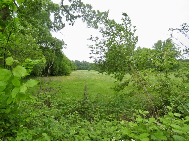
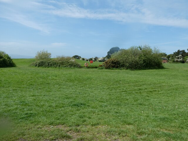
The common features a mix of heathland, grassland, woodland, and coastal habitats, making it a haven for a wide array of flora and fauna. Rare and protected species such as the sand lizard, natterjack toad, and red squirrel can be found here, making it an important conservation area.

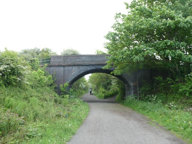
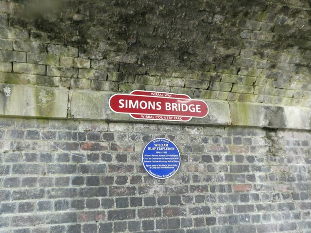
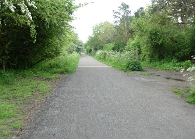
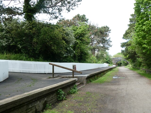
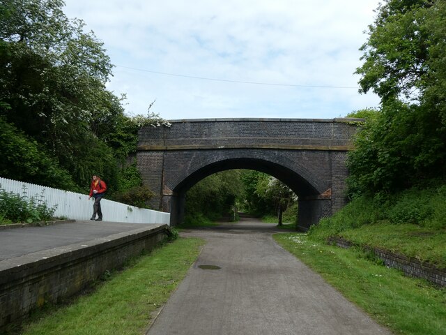
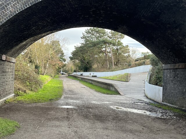
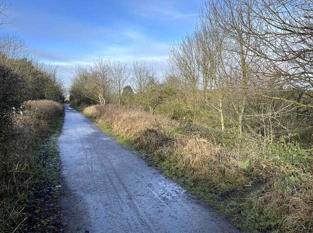
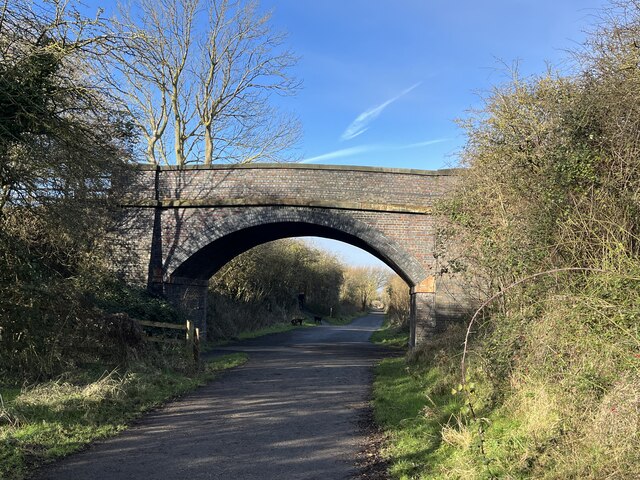
Visitors can explore the network of paths and trails that crisscross the common, providing access to its different areas. There are also designated picnic areas and benches for those looking to relax and enjoy the scenery. The elevated vantage points on the site offer stunning views of the Dee Estuary and the Welsh mountains beyond.

Thurstaston Common is not only a haven for wildlife but also a place of historical significance. The remnants of an Iron Age hill fort, known as Thor's Stone, can be found here, adding an additional layer of intrigue to this already captivating site.

Overall, Thurstaston Common is a cherished heritage site in Cheshire that showcases the region's natural beauty, wildlife diversity, and historical value. It offers a tranquil escape from the hustle and bustle of everyday life, allowing visitors to connect with nature and explore the area's fascinating past.

If you have any feedback on the listing, please let us know in the comments section below.

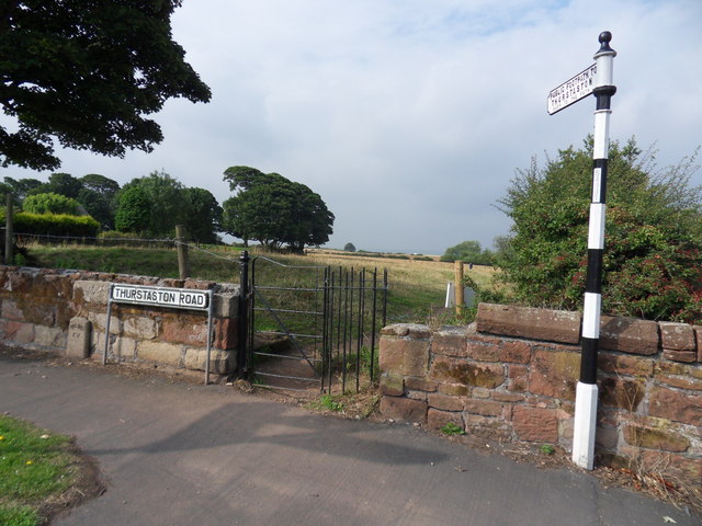
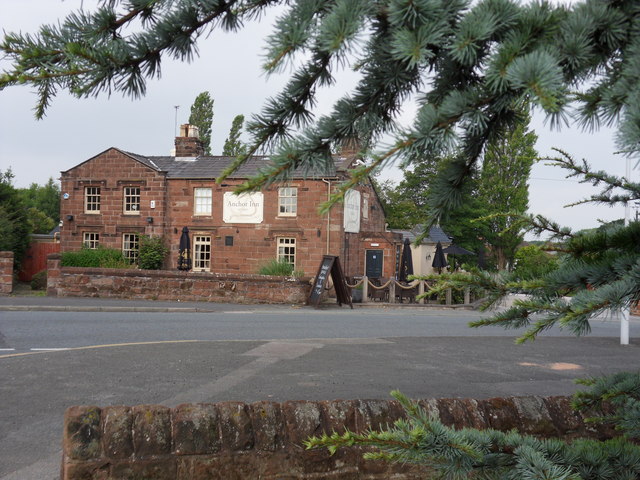
Thurstaston Common Images

Images are sourced within 2km of 53.359/-3.137 or Grid Reference SJ2485. Thanks to Geograph Open Source API. All images are credited.

Field, Irbyside
Field, Irbyside
Simons Bridge, Wirral Circular Trail The National Cycle Network is a network of cycle routes. It was created by the charity Sustrans <span class="nowrap"><a title="http://www.sustrans.org.uk/what-we-do/national-cycle-network" rel="nofollow ugc noopener" href="http://www.sustrans.org.uk/what-we-do/national-cycle-network">Link</a><img style="margin-left:2px;" alt="External link" title="External link - shift click to open in new window" src="https://s1.geograph.org.uk/img/external.png" width="10" height="10"/></span>  (Sustainable Transport), aided by a National Lottery grant.

Many routes aim to minimise contact with motor traffic, though 70% of them are on roads. In some cases the NCN uses pedestrian routes, disused railways, minor roads, canal towpaths, or traffic-calmed routes in towns and cities.
Simons Bridge, Wirral Circular Trail
The National Cycle Network is a network of cycle routes. It was created by the charity Sustrans LinkExternal link (Sustainable Transport), aided by a National Lottery grant. Many routes aim to minimise contact with motor traffic, though 70% of them are on roads. In some cases the NCN uses pedestrian routes, disused railways, minor roads, canal towpaths, or traffic-calmed routes in towns and cities.
Plaques under Simons Bridge, Wirral Circular Trail A commemorative plaque for the writer Olaf Stapledon
Plaques under Simons Bridge, Wirral Circular Trail
A commemorative plaque for the writer Olaf Stapledon
Wirral Circular Trail north of Thurstaston
Pool and grassland at Dawpool Nature Reserve, near Thurstaston
Former Thursaston railway station by Wirral Way The National Cycle Network is a network of cycle routes. It was created by the charity Sustrans <span class="nowrap"><a title="http://www.sustrans.org.uk/what-we-do/national-cycle-network" rel="nofollow ugc noopener" href="http://www.sustrans.org.uk/what-we-do/national-cycle-network">Link</a><img style="margin-left:2px;" alt="External link" title="External link - shift click to open in new window" src="https://s1.geograph.org.uk/img/external.png" width="10" height="10"/></span>  (Sustainable Transport), aided by a National Lottery grant.

Many routes aim to minimise contact with motor traffic, though 70% of them are on roads. In some cases the NCN uses pedestrian routes, disused railways, minor roads, canal towpaths, or traffic-calmed routes in towns and cities.
Former Thursaston railway station by Wirral Way
The National Cycle Network is a network of cycle routes. It was created by the charity Sustrans LinkExternal link (Sustainable Transport), aided by a National Lottery grant. Many routes aim to minimise contact with motor traffic, though 70% of them are on roads. In some cases the NCN uses pedestrian routes, disused railways, minor roads, canal towpaths, or traffic-calmed routes in towns and cities.
Part of the platform, Thursaston station and Station Road bridge Part of the Wirral Way
Part of the platform, Thursaston station and Station Road bridge
Part of the Wirral Way
The former Thurstaston station on the Wirral Way
Wirral Way Adjacent to Caldy Golf Club.
Wirral Way
Adjacent to Caldy Golf Club.
Links Bridge On the Wirral Way.
Links Bridge
On the Wirral Way.
Benchmark by the B5140, Montgomery Hill, Frankby Ordnance Survey benchmark by the southern, disused entrance to Frankby Cemetery off Montgomery Hill.
Benchmark by the B5140, Montgomery Hill, Frankby
Ordnance Survey benchmark by the southern, disused entrance to Frankby Cemetery off Montgomery Hill.
The former south entrance to Frankby Cemetery, Montgomery Hill The former south entrance to Frankby Cemetery from the B5140, Montgomery Hill. There is an Ordnance Survey benchmark on the wall just before the nearest sandstone post <a href="https://www.geograph.org.uk/photo/7756051">SJ2486 : Benchmark by the B5140, Montgomery Hill, Frankby</a>
The former south entrance to Frankby Cemetery, Montgomery Hill
The former south entrance to Frankby Cemetery from the B5140, Montgomery Hill. There is an Ordnance Survey benchmark on the wall just before the nearest sandstone post SJ2486 : Benchmark by the B5140, Montgomery Hill, Frankby
Farmer's Arms Hill Bark Road, Wirral
Farmer's Arms
Hill Bark Road, Wirral
Irby Village Stocks In the gardens of Irby Library, Thurstaston Road.
Irby Village Stocks
In the gardens of Irby Library, Thurstaston Road.
Irby Library A view of Irby Village stocks to the front of Irby library.
Irby Library
A view of Irby Village stocks to the front of Irby library.
Irby Hall Built in the 17th Century, Irby Hall is on the site of an ancient manor house. Apparently some reconstruction and restoration works took place in 1888.
Irby Hall
Built in the 17th Century, Irby Hall is on the site of an ancient manor house. Apparently some reconstruction and restoration works took place in 1888.
Thurstaston Road Public footpath kissing gate leading to Thurstaston via Dawlish Road, Irby.
Thurstaston Road
Public footpath kissing gate leading to Thurstaston via Dawlish Road, Irby.
Anchor Inn Thurstaston Road, Irby.
Anchor Inn
Thurstaston Road, Irby.
Show me another place!

Thurstaston Common is located at Grid Ref: SJ2485 (Lat: 53.359, Lng: -3.137)

Unitary Authority: Wirral

Police Authority: Merseyside

What 3 Words

///chins.origins.mistaking. Near Greasby, Merseyside

Related Wikis

Paton Field

Paton Field is located on Telegraph Road, in Thurstaston, Wirral Peninsula, England. The stadium is the home of Caldy RFC. == References == == External... ==

Thurstaston Common

Thurstaston Common is an area of almost 250 acres (100 ha) of parklands, wood and heath between Frankby and Thurstaston, on the Wirral Peninsula in North...

Caldy RFC

Caldy Rugby Club is an English rugby union club which play in the RFU Championship, the second tier of English rugby, following their promotion from National...

Hill Bark

Hill Bark (also known as Bidston Court) is a large country house to the south of the hamlet of Frankby, Wirral, Merseyside, England. It is recorded in...

Nearby Amenities

Located within 500m of 53.359,-3.137
Bus Stop
TELEGRAPH ROAD
Bus: yes
Naptan AtcoCode: 2800S30039A
Naptan Bearing: N
Naptan CommonName: TELEGRAPH ROAD
Naptan Indicator: TELEGRAPH ROAD
Naptan Landmark: O/S CALDY RUGBY CLUB
Naptan NaptanCode: mergmdpj
Naptan Notes: No Notes
Naptan ShortCommonName: Caldy Rugby Club
Naptan Street: TELEGRAPH ROAD
Naptan Verified: no
Public Transport: platform
Source: naptan_import
Lat/Long: 53.3579058/-3.1439361
Toilets
Fee: no
Lat/Long: 53.3599789/-3.1421589
Bench
Lat/Long: 53.3605944/-3.1407679
Bench
Backrest: no
Inscription: In Memory of Myfriend and Master TED Diead 31 December 2007 Aged 83 years. “PRINCE”
Lat/Long: 53.3615437/-3.1346417
Bench
Lat/Long: 53.3623215/-3.1382072
Bench
Lat/Long: 53.3624837/-3.1366851
Bench
Lat/Long: 53.3628139/-3.1397224
Thor's Rock
Tourism: viewpoint
Lat/Long: 53.3558839/-3.1361911
Bench
Lat/Long: 53.3630187/-3.1337097
Bench
Lat/Long: 53.3628962/-3.1338973
Bench
Lat/Long: 53.362797/-3.1336743
Bench
Lat/Long: 53.3628983/-3.1333452
Bench
Backrest: yes
Inscription: JOYCE MCGRATH Treasured Memories
Lat/Long: 53.3628356/-3.1383283
The data included in this document is from www.openstreetmap.org. The data is made available under ODbL.

Have you been to Thurstaston Common?

Leave your review of Thurstaston Common below (or comments, questions and feedback).