Tibbers Castle

Heritage Site in Dumfriesshire

Scotland

Tibbers Castle

A Cedar in Drumlanrig Woods In impressive woods by Drumlanrig Castle.
A Cedar in Drumlanrig Woods Credit: Russel Wills

Tibbers Castle, located in Dumfriesshire, Scotland, is a fascinating heritage site that holds a significant historical and archaeological value. This ancient castle stands as a testament to Scotland's rich past and offers visitors a glimpse into its medieval era.

Tibbers Castle dates back to the 12th century and is believed to have been built by the de Brus family. It was strategically positioned on a hilltop, providing a commanding view of the surrounding landscape. The castle was constructed using local red sandstone, and although it has suffered from centuries of decay and ruin, its imposing walls and remnants of its towers still evoke a sense of grandeur.

The castle's layout is rectangular, with a central courtyard and a range of buildings surrounding it. The remains of a great hall and a chapel can still be identified, showcasing the castle's former splendor. Additionally, traces of defensive features, such as a moat and a drawbridge, can be discerned, emphasizing its strategic importance.

Tibbers Castle has witnessed a turbulent history, including conflicts and power struggles between various Scottish clans. It is famously associated with Robert the Bruce, who reportedly spent time here during his campaigns against English rule in the early 14th century.

Today, Tibbers Castle stands as a protected heritage site, managed by Historic Environment Scotland. Visitors can explore the castle ruins, marvel at its architectural features, and imagine the lives of those who once inhabited its walls. The site offers a unique opportunity to immerse oneself in Scotland's medieval past and appreciate the enduring legacy of its ancient castles.

If you have any feedback on the listing, please let us know in the comments section below.

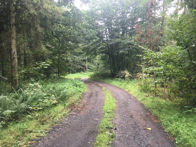
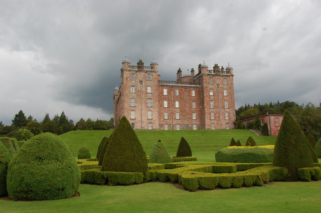
Tibbers Castle Images

Images are sourced within 2km of 55.267/-3.787 or Grid Reference NX8698. Thanks to Geograph Open Source API. All images are credited.

A Cedar in Drumlanrig Woods In impressive woods by Drumlanrig Castle.
A Cedar in Drumlanrig Woods
In impressive woods by Drumlanrig Castle.
Drumlanrig Bridge Cottage Beautifully adorned cottage on approach to Drumlanrig Castle.
Drumlanrig Bridge Cottage
Beautifully adorned cottage on approach to Drumlanrig Castle.
Drumlanrig Castle Drumlanrig Castle is situated on the Queensberry Estate in Dumfries and Galloway, Scotland. The category A listed castle is the Dumfriesshire home of the Duke and Duchess of Buccleuch and Queensberry.
Drumlanrig Castle
Drumlanrig Castle is situated on the Queensberry Estate in Dumfries and Galloway, Scotland. The category A listed castle is the Dumfriesshire home of the Duke and Duchess of Buccleuch and Queensberry.
View of Drumlanrig Castle From the Shawl.
View of Drumlanrig Castle
From the Shawl.
Drumlanrig Castle Viewed from the East Parterre.
Drumlanrig Castle
Viewed from the East Parterre.
Old Rifle-Range Somewhere in that new-ish plantation, about the middle of the photo, there was once a target butt for a rifle-range.   A quick search for any remains of the target butt was cut short, because the new trees are planted very close to each other and I was getting jagged everywhere with the needles.  Another search might happen, at another date when I have more time to spare.
This photo was taken on the 27th March 2022.
Old Rifle-Range
Somewhere in that new-ish plantation, about the middle of the photo, there was once a target butt for a rifle-range. A quick search for any remains of the target butt was cut short, because the new trees are planted very close to each other and I was getting jagged everywhere with the needles. Another search might happen, at another date when I have more time to spare. This photo was taken on the 27th March 2022.
Old Well Inside the stonework surrounding an old well.
Photo taken on the 27th March 2022.
Old Well
Inside the stonework surrounding an old well. Photo taken on the 27th March 2022.
Carronhill Glen Viaduct Railway viaduct over the Carronhill Glen.
Photo taken on the 27th March 2022.
Carronhill Glen Viaduct
Railway viaduct over the Carronhill Glen. Photo taken on the 27th March 2022.
Drumlanrig Castle in 1988 The west face and the mound of the castle
Drumlanrig Castle in 1988
The west face and the mound of the castle
Hillend Belt The corner of Hillend Belt.
This photo was taken on the 27th July 2022.
Hillend Belt
The corner of Hillend Belt. This photo was taken on the 27th July 2022.
Old Well An old well.
This photo was taken on the 27th July 2022.
Old Well
An old well. This photo was taken on the 27th July 2022.
Minor road near Burnhead
A702 near Carronbridge
A76 north of Thornhill
A76 in Carronbridge
A76 in Carronbridge
Derelict building near Drumlanrig
Gravel road near Drumlanrig
Drumlanrig Castle Stormy sky over Drumlanrig Castle, Dumfries and Galloway
Drumlanrig Castle
Stormy sky over Drumlanrig Castle, Dumfries and Galloway
Show me another place!

Tibbers Castle is located at Grid Ref: NX8698 (Lat: 55.267, Lng: -3.787)

Unitary Authority: Dumfries and Galloway

Police Authority: Dumfries and Galloway

What 3 Words

///drift.nightlife.guru. Near Thornhill, Dumfries & Galloway

Related Wikis

Tibbers Castle

Tibbers Castle is a motte-and-bailey castle overlooking a ford across the River Nith in Dumfries and Galloway, Scotland. To the east is the village of...

Carronbridge

Carronbridge is a village in the parish of Morton in Dumfries and Galloway, Scotland. The village is at the junction of the A76 and A702 roads approximately...

Carron Water, Dumfriesshire

The Carron Water (Scottish Gaelic: Carrann) is a tributary of the River Nith in southwest Scotland. It rises in the Dalveen Pass in the Lowther Hills as...

Drumlanrig

Drumlanrig (Scottish Gaelic: Druim Lannraig) is a settlement in Dumfries and Galloway, Scotland, which is best known for nearby Drumlanrig Castle. The...
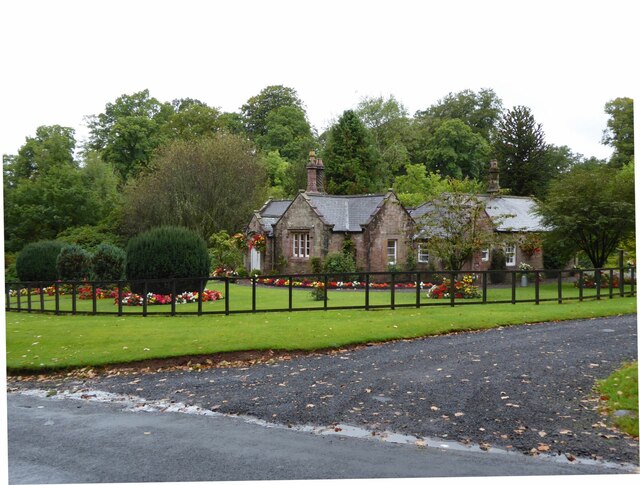
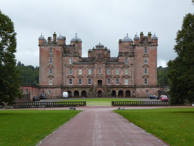
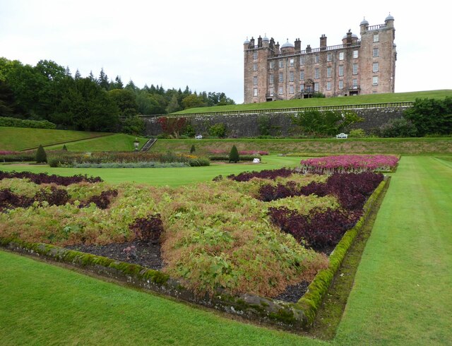
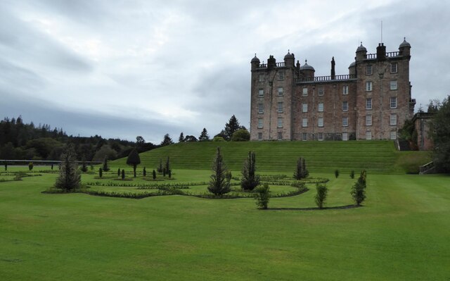
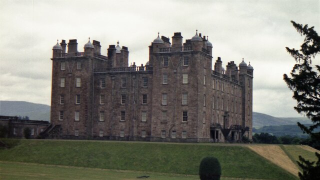
Drumlanrig Castle

Drumlanrig Castle is situated on the Queensberry Estate in Dumfries and Galloway, Scotland. The category A listed castle is the Dumfriesshire home of the...

Morton Castle

Morton Castle is located by an artificial loch in the hills above Nithsdale, in Dumfries and Galloway, south-west Scotland. It lies 2.5 miles (4 km) north...

Nith Bridge cross

The Nith Bridge cross (also known as the Boatford cross) is a sculptured Anglo-Saxon cross, near the village of Thornhill, Dumfries and Galloway. It is...

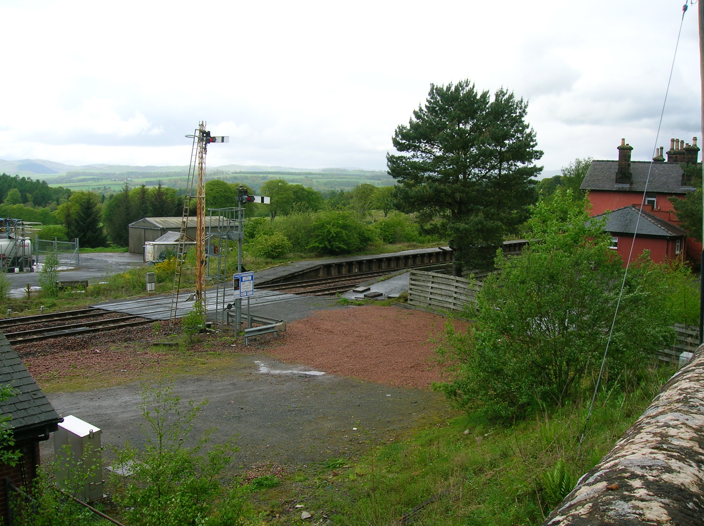
Thornhill (Dumfries) railway station

Thornhill is a closed station. It served the country town of Thornhill in Dumfries and Galloway. The station site is a mile or so from the town. Four...

Nearby Amenities

Located within 500m of 55.267,-3.787
Bus Stop
Village
Naptan AtcoCode: 680000102503
Naptan Bearing: NW
Naptan CommonName: Village
Naptan Indicator: opp Hall
Naptan Landmark: Hall
Naptan NaptanCode: 34232467
Naptan Notes: none
Naptan Street: A76
Naptan Verified: no
Source: naptan_import
Lat/Long: 55.2661892/-3.7816416
Bus Stop
Village
Naptan AtcoCode: 680000102504
Naptan Bearing: SE
Naptan CommonName: Village
Naptan Indicator: o/s Hall
Naptan Landmark: Hall
Naptan NaptanCode: 34232465
Naptan Notes: none
Naptan Street: A76
Naptan Verified: no
Source: naptan_import
Lat/Long: 55.2664426/-3.781527
Defibrillator
Defibrillator Location: Carronbridge Village Hall. Left hand side, interior wall of porch.
Emergency: defibrillator
Indoor: no
Ref GB The Circuit: 983A91FE-7970-4587-8105-6BDB93C5B502
Lat/Long: 55.2665444/-3.7813572
Power: pole
Lat/Long: 55.2660186/-3.787525
Power: pole
Lat/Long: 55.2660887/-3.7892031
Power: pole
Lat/Long: 55.2661322/-3.7904717
Power: pole
Lat/Long: 55.2661902/-3.7917679
Power: pole
Lat/Long: 55.2666689/-3.7933039
Power: pole
Lat/Long: 55.2670666/-3.7945788
Power: pole
Lat/Long: 55.2626971/-3.7864981
Power: pole
Lat/Long: 55.2633442/-3.7868027
Power: pole
Lat/Long: 55.264165/-3.787193
Power: pole
Lat/Long: 55.2650885/-3.7873606
Power: pole
Lat/Long: 55.2670164/-3.7876979
Power: pole
Lat/Long: 55.2679821/-3.7878825
Power: pole
Lat/Long: 55.2689164/-3.7880437
Power: pole
Lat/Long: 55.2699111/-3.7882644
Power: pole
Lat/Long: 55.2703607/-3.7886483
Power: pole
Lat/Long: 55.27093/-3.789166
Power: pole
Lat/Long: 55.262909/-3.785411
The data included in this document is from www.openstreetmap.org. The data is made available under ODbL.

Have you been to Tibbers Castle?

Leave your review of Tibbers Castle below (or comments, questions and feedback).