Middleham

Settlement in Yorkshire Richmondshire

England

Middleham

Middleham Castle The view northwards from Middleham Castle, which once belonged to Richard Duke of Gloucester, later King Richard III
Middleham Castle Credit: David Hatch

Middleham is a small market town located in Wensleydale, within the Richmondshire district of North Yorkshire, England. Nestled in the heart of the Yorkshire Dales National Park, Middleham is renowned for its breathtaking natural beauty, historic charm, and its strong connections to horse racing.

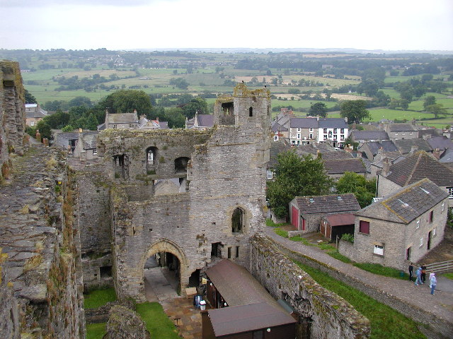
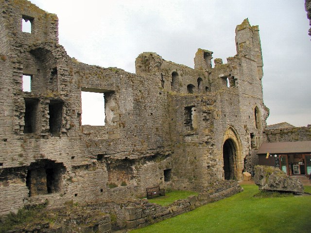
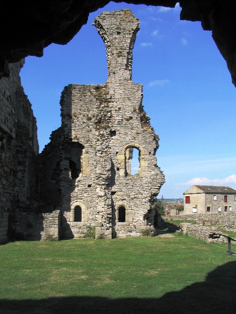
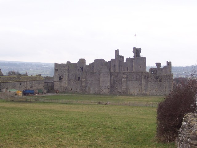
With a population of around 500 people, Middleham has a long and fascinating history. The town's most prominent feature is Middleham Castle, a magnificent 12th-century fortress that once served as the childhood home of Richard III. The castle's ruins stand proudly atop a hill, offering panoramic views of the surrounding countryside.

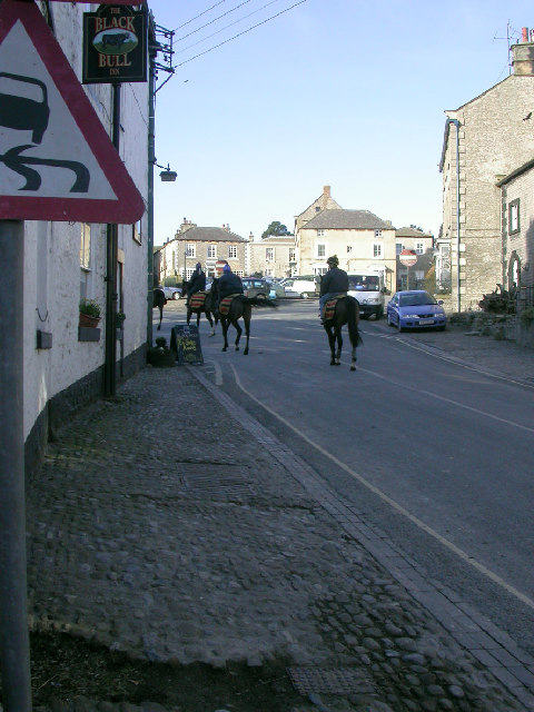
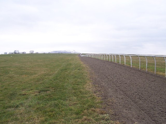
Middleham is also a significant center for horse racing. The town boasts several training stables, making it a hub for equestrian enthusiasts. Many renowned trainers and jockeys have called Middleham their home, and visitors can often spot racehorses being exercised on the nearby gallops.

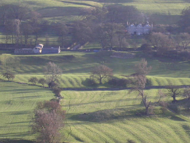
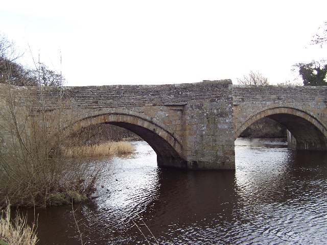
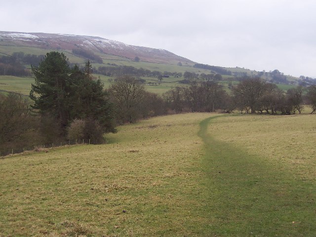
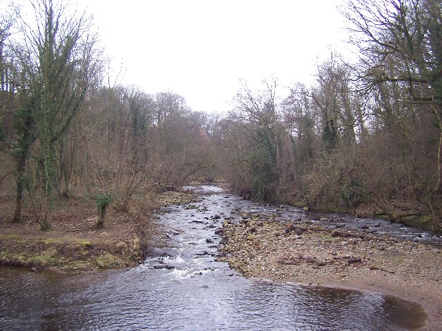
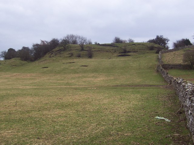
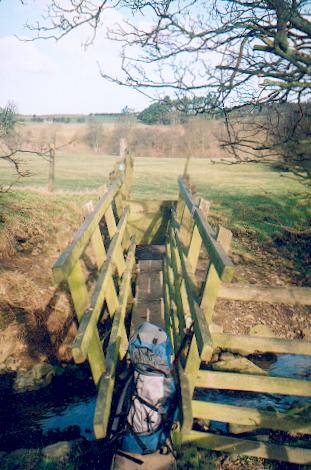
In addition to its historical and equestrian attractions, Middleham is a perfect base for exploring the Yorkshire Dales. The town is surrounded by rolling hills, picturesque valleys, and scenic walking trails, making it an ideal destination for outdoor enthusiasts. Visitors can enjoy hiking, cycling, and even caving in the nearby limestone caves.

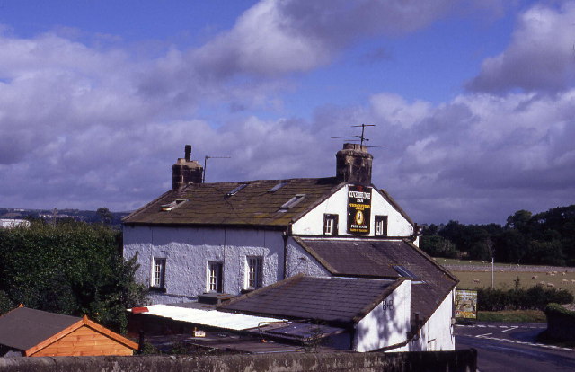
Middleham offers a range of amenities, including charming tea rooms, traditional pubs, and quaint shops selling local crafts and produce. The town's friendly and welcoming atmosphere, coupled with its rich history and stunning scenery, makes Middleham a truly captivating destination for locals and tourists alike.

If you have any feedback on the listing, please let us know in the comments section below.
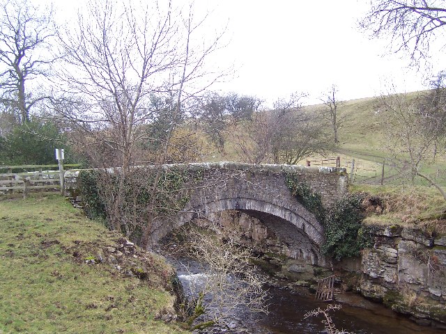
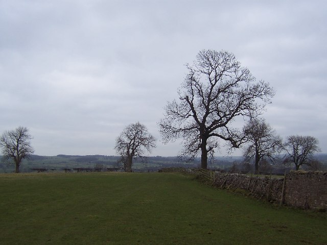
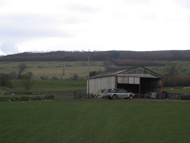
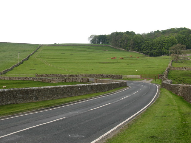
Middleham Images

Images are sourced within 2km of 54.2852/-1.8057952 or Grid Reference SE1287. Thanks to Geograph Open Source API. All images are credited.

Middleham Castle The view northwards from Middleham Castle, which once belonged to Richard Duke of Gloucester, later King Richard III
Middleham Castle
The view northwards from Middleham Castle, which once belonged to Richard Duke of Gloucester, later King Richard III
Middleham Castle Although ruined, substantial sections of the castle still remain
Middleham Castle
Although ruined, substantial sections of the castle still remain
Middleham Bridge
Middleham Bridge
Middleham Castle English Heritage site.
Middleham Castle
English Heritage site.
Cover Bridge Inn Located on the A6108 near Middleham, just short of the point where the River Cover enters the Ure
Cover Bridge Inn
Located on the A6108 near Middleham, just short of the point where the River Cover enters the Ure
Off to the gallops in Middleham Middleham is one of the great centres for the training of racehorses in Britain; here the horses are moving off in the early morning to the gallops on Middleham Low Moor.
Off to the gallops in Middleham
Middleham is one of the great centres for the training of racehorses in Britain; here the horses are moving off in the early morning to the gallops on Middleham Low Moor.
Ridge-and-furrow near Braithwaite Hall Medieval ridge-and-furrow is clearly shown in slanting winter sunlight; the 17th century farmhouse of Braithwaite hall is at upper right.
Ridge-and-furrow near Braithwaite Hall
Medieval ridge-and-furrow is clearly shown in slanting winter sunlight; the 17th century farmhouse of Braithwaite hall is at upper right.
Ulshaw Bridge Ancient bridge spanning the River Ure, between Middleham and Jervaulx
Ulshaw Bridge
Ancient bridge spanning the River Ure, between Middleham and Jervaulx
St Simon and St Jude Catholic Church, Ulshaw Bridge This isolated church struck me as unusual, by having a house joined onto it - the church almost looked like an annexe.
This dates to the time when it was still "risky" to be a Roman Catholic - around 1800 churches were often "disguised" as houses. This one is disguised by hiding it behind the priest's house. The RC Church at Knaresborough was disguised as a large Georgian house.
St Simon and St Jude Catholic Church, Ulshaw Bridge
This isolated church struck me as unusual, by having a house joined onto it - the church almost looked like an annexe. This dates to the time when it was still "risky" to be a Roman Catholic - around 1800 churches were often "disguised" as houses. This one is disguised by hiding it behind the priest's house. The RC Church at Knaresborough was disguised as a large Georgian house.
Hullo Bridge This charming little structure spans the River Cover about a mile south west of Middleham, and is only suitable for pedestrians and farm vehicles.
Hullo Bridge
This charming little structure spans the River Cover about a mile south west of Middleham, and is only suitable for pedestrians and farm vehicles.
Middleham Low Moor Middleham is famous not only for its connections with Good King Richard III, but also for its training of racehorses.  It is on this huge expanse of common to the west of the town that the stables exercise their charges
Middleham Low Moor
Middleham is famous not only for its connections with Good King Richard III, but also for its training of racehorses. It is on this huge expanse of common to the west of the town that the stables exercise their charges
Fields south east of Middleham Walking through fields between Middleham and the River Cover
Fields south east of Middleham
Walking through fields between Middleham and the River Cover
Path above Cover Banks Walking west above the River Cover, towards Hullo Bridge
Path above Cover Banks
Walking west above the River Cover, towards Hullo Bridge
River Cover This looks upstream in Woods at Cover Scar, about a mile south of Middleham
River Cover
This looks upstream in Woods at Cover Scar, about a mile south of Middleham
William's Hill Ring and Bailey earthworks, and site of the original Middleham Castle about a quarter of a mile south west of the present one
William's Hill
Ring and Bailey earthworks, and site of the original Middleham Castle about a quarter of a mile south west of the present one
Middleham Castle from the South Neville stronghold better known for its connections to Richard III - whose 2 year reign was tragically cut short on Redmire Plain (Bosworth) thus robbing England of one of its finest monarchs.
Middleham Castle from the South
Neville stronghold better known for its connections to Richard III - whose 2 year reign was tragically cut short on Redmire Plain (Bosworth) thus robbing England of one of its finest monarchs.
Footbridge, Red Beck Gill near Middleham. A footbridge constructed by the Yorkshire Dales National Park Authority on the path from Hullo Bridge to East Witton.
Footbridge, Red Beck Gill near Middleham.
A footbridge constructed by the Yorkshire Dales National Park Authority on the path from Hullo Bridge to East Witton.
Barn Footpath between East Witton and Cover bridge diverts around the barn
Barn
Footpath between East Witton and Cover bridge diverts around the barn
Show me another place!

Middleham is located at Grid Ref: SE1287 (Lat: 54.2852, Lng: -1.8057952)

Division: North Riding

Administrative County: North Yorkshire

District: Richmondshire

Police Authority: North Yorkshire

What 3 Words

///puts.tadpoles.turkey. Near Leyburn, North Yorkshire

Related Wikis

Middleham Castle

Middleham Castle is a ruined castle in Middleham in Wensleydale, in the county of North Yorkshire, England. It was built by Robert Fitzrandolph, 3rd Lord...

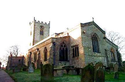
Church of St Mary and St Alkelda, Middleham

The Church of St Mary and St Alkelda is a Church of England parish church in Middleham, Richmondshire, North Yorkshire. The church is a grade I listed...

Middleham

Middleham is a market town and civil parish in the district and county of North Yorkshire, England. It lies in Wensleydale in the Yorkshire Dales, on...
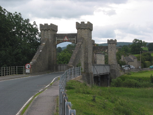
A6108 road

The A6108 road is an A road in North Yorkshire, England. It runs from the south of Scotch Corner to Ripon going via Richmond and Leyburn across the moors...

Nearby Amenities

Located within 500m of 54.2852,-1.8057952
Middleham
Place: town
Wikidata: Q2701121
Wikipedia: en:Middleham
Lat/Long: 54.286721/-1.8049483
Post Box
Brand: Royal Mail
Brand Wikidata: Q638098
Operator: Royal Mail
Operator Wikidata: Q638098
Post Box Mounting: wooden_post
Post Box Type: lamp
Lat/Long: 54.288259/-1.808634
Post Box
Lat/Long: 54.2849541/-1.8096275
Post Box
Image: https://www.geograph.org.uk/photo/6596566
Post Box Type: pillar
Ref: DL8 2
Lat/Long: 54.2855442/-1.805605
Bus Stop
Lat/Long: 54.2846339/-1.8079104
Barrier: stile
Lat/Long: 54.2824112/-1.8105278
Telephone
Booth: K6
Covered: booth
Image: https://www.geograph.org.uk/photo/818228
Listed Status: Grade II
Wikidata: Q26533514
Lat/Long: 54.2851651/-1.806148
Noexit: yes
Lat/Long: 54.2832578/-1.8044538
Richard III Statue
Artist Name: Linda Thompson
Artwork Type: statue
Image: https://www.geograph.org.uk/photo/6288555
Tourism: artwork
Lat/Long: 54.2842434/-1.8070103
Entrance: yes
Lat/Long: 54.2842632/-1.8066822
Entrance: yes
Lat/Long: 54.2843591/-1.8067328
Entrance: yes
Lat/Long: 54.2839322/-1.8069077
Entrance: yes
Lat/Long: 54.2840534/-1.806775
Entrance: main
Lat/Long: 54.285081/-1.8063667
Board Type: history
Information: board
Tourism: information
Lat/Long: 54.2840738/-1.806677
Board Type: history
Information: board
Tourism: information
Lat/Long: 54.2840742/-1.8067226
The South Range
Board Type: history
Information: board
Tourism: information
Lat/Long: 54.2838875/-1.8066361
Tne Great Hall
Board Type: history
Information: board
Level: 1
Tourism: information
Lat/Long: 54.2840346/-1.8068775
Parking
Access: yes
Parking: surface
Lat/Long: 54.2846755/-1.8079229
Swine Cross
Denomination: catholic
Historic: wayside_cross
Image: https://www.geograph.org.uk/photo/6503394
Religion: christian
Wikidata: Q17647457
Lat/Long: 54.2845977/-1.8078702
Bench
Backrest: yes
Lat/Long: 54.284605/-1.8078501
Fountain
Victoria Jubilee Fountain
Image: https://www.geograph.org.uk/photo/5569534
Wikidata: Q26589255
Lat/Long: 54.2847283/-1.8077029
Defibrillator
Defibrillator Location: On wall outside Central Stores on Coverham Lane near The Dante Arms
Emergency: defibrillator
Lat/Long: 54.2851079/-1.8062693
Restaurant
The Tack Room Restaurant
Website: https://www.thewensleydalehotel.com/restaurant.html
Lat/Long: 54.285589/-1.8056551
Power: substation
Lat/Long: 54.2859347/-1.8044259
The Red Armoury
Shop: equestrian
Lat/Long: 54.2849678/-1.8062425
Board Type: notice
Information: board
Tourism: information
Lat/Long: 54.2853021/-1.8056866
Welcome to Middleham
Board Type: history
Information: board
Tourism: information
Lat/Long: 54.2852591/-1.8057268
Bench
Backrest: yes
Lat/Long: 54.2852767/-1.8057302
Middleham Market Cross
Image: https://www.geograph.org.uk/photo/3441741
Man Made: cross
Wikidata: Q17647485
Lat/Long: 54.2852955/-1.8057382
Welcome to Middleham
Board Type: history
Information: board
Tourism: information
Lat/Long: 54.2847428/-1.8077526
Country Cupboard Antiques
Contact Instagram: countrycupboardantiques
Shop: antiques
Lat/Long: 54.2866545/-1.8055907
Barrier: bollard
Bollard: fixed
Image: https://www.geograph.org.uk/photo/818250
Vehicle: no
Lat/Long: 54.2846746/-1.8064844
Clock
Display: sundial
Image: https://www.geograph.org.uk/photo/6287245
Support: wall_mounted
Lat/Long: 54.2848875/-1.8073844
Power: pole
Lat/Long: 54.2847936/-1.8104388
Power: pole
Lat/Long: 54.284291/-1.8115519
Power: pole
Lat/Long: 54.2838424/-1.8126006
Entrance: main
Lat/Long: 54.2854062/-1.8064647
Entrance: main
Lat/Long: 54.2854956/-1.8065777
Cafe
The Castle Keep Tea Room
Lat/Long: 54.2847311/-1.8066033
Toilets
Access: yes
Female: yes
Male: yes
Toilets Disposal: flush
Lat/Long: 54.2848966/-1.805879
Waste Basket
Manufacturer: Broxap
Material: plastic
Waste: trash
Lat/Long: 54.2844801/-1.8073766
Grit Bin
Access: yes
Material: plastic
Lat/Long: 54.2845303/-1.8073868
Power: pole
Lat/Long: 54.2870988/-1.8110033
Power: pole
Lat/Long: 54.2876368/-1.8104877
Power: pole
Lat/Long: 54.288176/-1.8100269
Power: pole
Lat/Long: 54.2885835/-1.8099242
Power: pole
Lat/Long: 54.2893651/-1.8043513
Power: pole
Lat/Long: 54.2884665/-1.8044983
Power: pole
Lat/Long: 54.2875249/-1.8046524
Power: pole
Lat/Long: 54.2882147/-1.8035939
Power: pole
Lat/Long: 54.2879883/-1.8027362
Power: pole
Lat/Long: 54.287674/-1.8016253
Power: pole
Lat/Long: 54.2872106/-1.7999463
Power: pole
Lat/Long: 54.2864863/-1.7993737
Power: pole
Lat/Long: 54.2857086/-1.7988422
Power: pole
Lat/Long: 54.2848843/-1.7982605
The data included in this document is from www.openstreetmap.org. The data is made available under ODbL.

Have you been to Middleham?

Leave your review of Middleham below (or comments, questions and feedback).