Misarden Park

Heritage Site in Gloucestershire Stroud

England

Misarden Park

Stone Stile, Caudle Green Due South of the village green at the junction of Gloucestershire footpaths MMN23 & BBR25 in woodland. This point is also on the boundaries of: county constituency, civil parishes of Miserden and Brimsfield, and the county district. This is the view looking NE, the view SW is <a href="https://www.geograph.org.uk/photo/7104970">SO9410 : Stone Stile, Caudle Green</a>.
Stone Stile, Caudle Green Credit: Mr Red

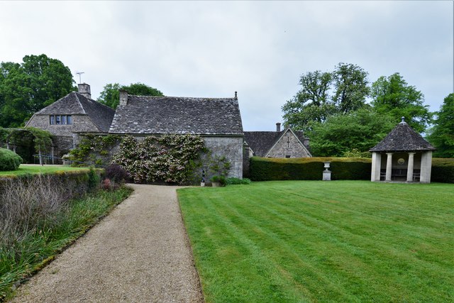
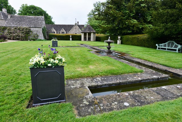
Misarden Park, located in Gloucestershire, England, is a renowned heritage site that offers visitors a glimpse into the history and natural beauty of the area. Spanning over 450 acres, this park is known for its stunning landscape, architectural marvels, and rich cultural significance.

The park's history can be traced back to the 17th century when it was originally designed by the renowned landscape architect, Sir John Vanbrugh. Over the years, it passed into the hands of notable families, including the Whitmore and Seale families, who made significant contributions to its development.

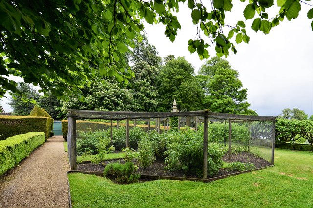
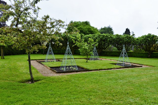
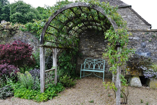
The park features a picturesque garden that showcases a blend of formal and informal planting styles. Visitors can explore a variety of plant species, including rare and exotic trees, shrubs, and flowers. The well-preserved garden structures, such as the ornate fountains and elegant statues, add to the park's charm and character.

One of the highlights of Misarden Park is the Grade I listed Misarden House, a stunning Georgian country house built in the early 18th century. With its grand architecture and beautiful interiors, the house offers a glimpse into the opulent lifestyle of the past. Visitors can take guided tours to learn about the history and stories associated with the house.

Additionally, Misarden Park hosts various events and activities throughout the year, including garden tours, art exhibitions, and outdoor concerts. The park's tranquil setting also makes it a popular spot for picnics, leisurely walks, and nature enthusiasts.

Misarden Park, with its combination of historical significance, captivating gardens, and cultural events, provides a unique and enriching experience for visitors seeking to immerse themselves in the beauty and heritage of Gloucestershire.

If you have any feedback on the listing, please let us know in the comments section below.

Misarden Park Images

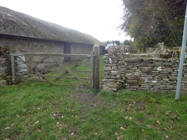
Images are sourced within 2km of 51.775/-2.08 or Grid Reference SO9408. Thanks to Geograph Open Source API. All images are credited.

Stone Stile, Caudle Green Due South of the village green at the junction of Gloucestershire footpaths MMN23 & BBR25 in woodland. This point is also on the boundaries of: county constituency, civil parishes of Miserden and Brimsfield, and the county district. This is the view looking NE, the view SW is <a href="https://www.geograph.org.uk/photo/7104970">SO9410 : Stone Stile, Caudle Green</a>.
Stone Stile, Caudle Green
Due South of the village green at the junction of Gloucestershire footpaths MMN23 & BBR25 in woodland. This point is also on the boundaries of: county constituency, civil parishes of Miserden and Brimsfield, and the county district. This is the view looking NE, the view SW is SO9410 : Stone Stile, Caudle Green.
Stone Stile, Caudle Green Due South of the village green at the junction of Gloucestershire footpaths MMN23 & BBR25 in woodland. This point is also on the boundaries of: county constituency, civil parishes of Miserden and Brimsfield, and the county district. This is the view looking SW, the view NE is <a href="https://www.geograph.org.uk/photo/7104969">SO9410 : Stone Stile, Caudle Green</a>.
Stone Stile, Caudle Green
Due South of the village green at the junction of Gloucestershire footpaths MMN23 & BBR25 in woodland. This point is also on the boundaries of: county constituency, civil parishes of Miserden and Brimsfield, and the county district. This is the view looking SW, the view NE is SO9410 : Stone Stile, Caudle Green.
Stone Stile, Caudle Green From a small field into a grazing field at the SE corner of the garden walls of 'Calley House'. This is looking SW away from the village, the view towards the village is <a href="https://www.geograph.org.uk/photo/7104983">SO9410 : Stone Stile, Caudle Green</a>.
Stone Stile, Caudle Green
From a small field into a grazing field at the SE corner of the garden walls of 'Calley House'. This is looking SW away from the village, the view towards the village is SO9410 : Stone Stile, Caudle Green.
Stone Stile, Caudle Green From a small field in to a grazing field at the SE corner of the garden wals of 'Calley House'. This is looking NE towards the village, the view towards the larger field is <a href="https://www.geograph.org.uk/photo/7104981">SO9410 : Stone Stile, Caudle Green</a>.
Stone Stile, Caudle Green
From a small field in to a grazing field at the SE corner of the garden wals of 'Calley House'. This is looking NE towards the village, the view towards the larger field is SO9410 : Stone Stile, Caudle Green.
Stone Stile, Caudle Green A step Stile off the Southern side of the village green on Gloucestershire footpath BBR25. This is looking to the village green, the view from the green is <a href="https://www.geograph.org.uk/photo/7104992">SO9410 : Stone Stile, Caudle Green</a>.
Stone Stile, Caudle Green
A step Stile off the Southern side of the village green on Gloucestershire footpath BBR25. This is looking to the village green, the view from the green is SO9410 : Stone Stile, Caudle Green.
Stone Stile, Caudle Green A step Stile off the Southern side of the village green on Gloucestershire footpath BBR25. This is looking from the village green, the view toward the green is <a href="https://www.geograph.org.uk/photo/7104990">SO9410 : Stone Stile, Caudle Green</a>.
Stone Stile, Caudle Green
A step Stile off the Southern side of the village green on Gloucestershire footpath BBR25. This is looking from the village green, the view toward the green is SO9410 : Stone Stile, Caudle Green.
The centre of Winstone The centre of this village of the high wolds is a three-way junction with a small sloping triangle and a pine tree.  Cottages crowd along the lane to the north without ceremony.
The centre of Winstone
The centre of this village of the high wolds is a three-way junction with a small sloping triangle and a pine tree. Cottages crowd along the lane to the north without ceremony.
School Hill, Winstone
The Garden at Miserden: Garden requisites defying gravity on the tearoom wall
The Garden at Miserden: Entrance to the walled garden
The Garden at Miserden: Mixed borders
The Garden at Miserden: Mixed borders and Edwin Lutyens part designed topiary beyond
The Garden at Miserden: The topiary, partly designed by Edwin Lutyens
The Garden at Miserden: Soft fruit cage and fruit trees
The Garden at Miserden: Fruit trees and vegetable pyramids
The Garden at Miserden: A cool, shady bower
The Garden at Miserden: The octagonal Millennium summerhouse
The Garden at Miserden: The octagonal Millennium summerhouse and fountain
Show me another place!

Misarden Park is located at Grid Ref: SO9408 (Lat: 51.775, Lng: -2.08)

Administrative County: Gloucestershire

District: Stroud

Police Authority: Gloucestershire

What 3 Words

///pixies.bins.lavished. Near Chalford, Gloucestershire

Related Wikis

Miserden Castle

Miserden Castle was a castle near the village of Miserden in Gloucestershire, England. The castle is a large motte and bailey Norman castle, built before...

Miserden War Memorial

Miserden War Memorial is a First World War memorial in the village of Miserden, near Stroud, in Gloucestershire, south-western England. The memorial, designed...

Miserden

Miserden is a village and civil parish in Stroud District, Gloucestershire, England, 4 miles north east of Stroud. The parish includes Whiteway Colony...

Winstone

Winstone is a village and civil parish in the English county of Gloucestershire. The population taken at the 2011 census was 270. Winstone forms part of...

Nearby Amenities

Located within 500m of 51.775,-2.08
Power: pole
Lat/Long: 51.7711803/-2.0762378
Power: pole
Lat/Long: 51.7712417/-2.0775225
Power: pole
Lat/Long: 51.7713537/-2.0792901
Power: pole
Lat/Long: 51.7714227/-2.0804689
Natural: spring
Lat/Long: 51.7715811/-2.0822054
Pillow mound
Archaeological Site: tumulus
Historic: archaeological_site
Lat/Long: 51.7760985/-2.0846909
The data included in this document is from www.openstreetmap.org. The data is made available under ODbL.

Have you been to Misarden Park?

Leave your review of Misarden Park below (or comments, questions and feedback).