Holme-Next-The-Sea

Heritage Site in Norfolk King's Lynn and West Norfolk

England

Holme-Next-The-Sea

Norfolk Coast Path: Flaxley to Brancaster (4) Looking out into The Wash <span class="nowrap"><a title="https://en.wikipedia.org/wiki/The_Wash" rel="nofollow ugc noopener" href="https://en.wikipedia.org/wiki/The_Wash">Link</a><img style="margin-left:2px;" alt="External link" title="External link - shift click to open in new window" src="https://s1.geograph.org.uk/img/external.png" width="10" height="10"/></span>
Norfolk Coast Path: Flaxley to Brancaster (4) Credit: Basher Eyre

Holme-Next-The-Sea is a small coastal village located in the county of Norfolk, England. Situated on the North Norfolk coast, it is renowned for its natural beauty and rich heritage. The village is designated as a heritage site due to its historical importance and unique features.

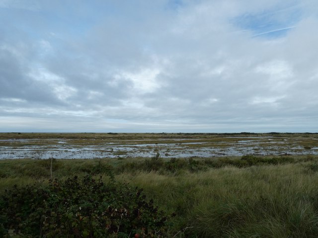
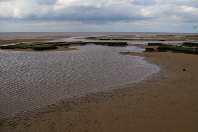
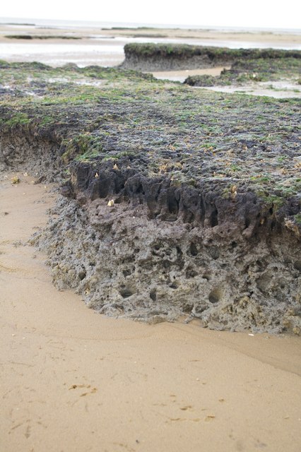
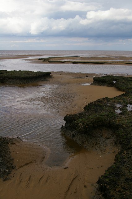
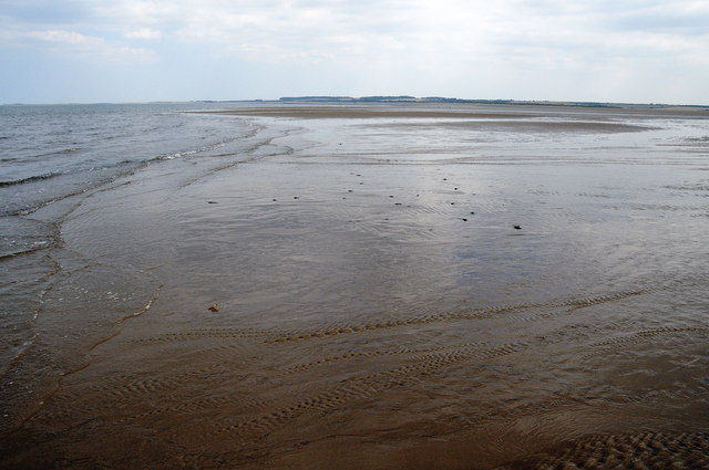
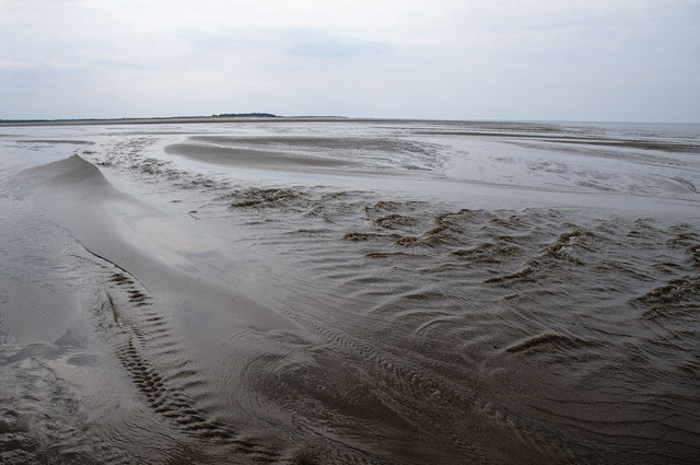
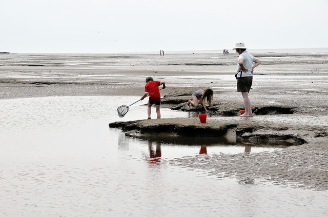
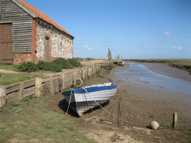
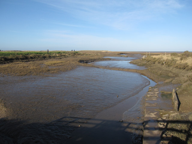
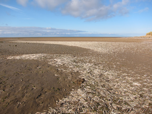
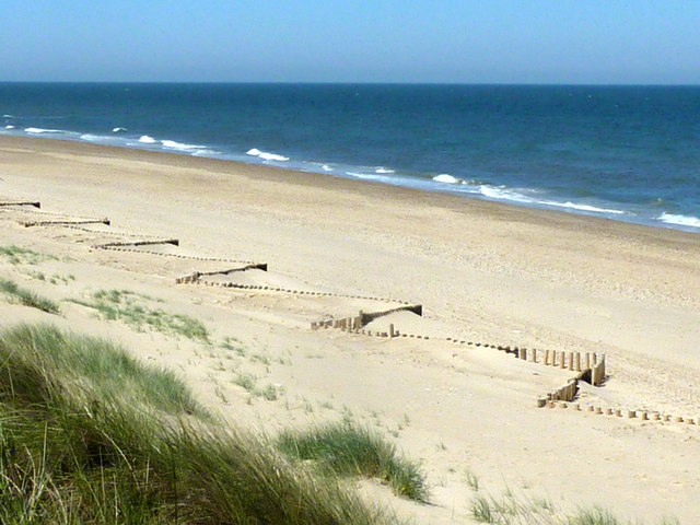
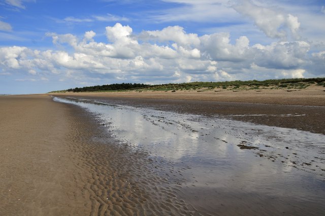
One of the main attractions of Holme-Next-The-Sea is its stunning beach, which stretches for miles and offers breathtaking views of the North Sea. The beach is backed by sand dunes and salt marshes, creating a diverse and ecologically important habitat for various bird species.

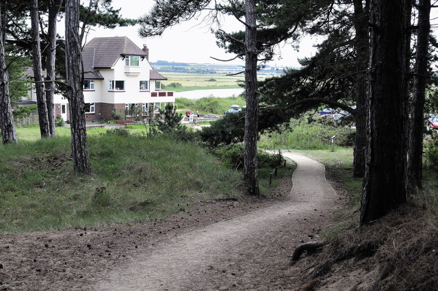
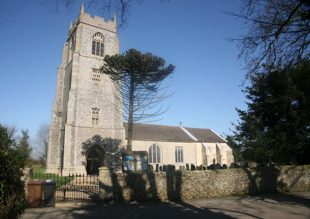
The village itself is a charming and traditional English village, with picturesque cottages and a peaceful atmosphere. It has a long history, dating back to the medieval period, and many of its buildings still retain their original character. The village church, St. Mary's, is a notable landmark, with its distinctive tower and beautiful stained glass windows.

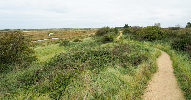
The surrounding area of Holme-Next-The-Sea is a haven for nature lovers and birdwatchers. The nearby Holme Dunes National Nature Reserve is home to a variety of rare and migratory birds, including avocets and pink-footed geese. The reserve also boasts a network of walking trails, allowing visitors to explore and appreciate the unique flora and fauna.

In addition to its natural beauty, Holme-Next-The-Sea offers a range of recreational activities. The village has a golf course, which is situated on the coastal dunes and provides stunning views as well as a challenging game. The area is also popular for sailing and windsurfing, with the wide expanse of the North Sea providing the ideal conditions.

Overall, Holme-Next-The-Sea is a hidden gem on the Norfolk coast, offering a combination of natural beauty, historical charm, and recreational opportunities. It is a must-visit destination for those seeking a tranquil and idyllic coastal experience.

If you have any feedback on the listing, please let us know in the comments section below.

Holme-Next-The-Sea Images

Images are sourced within 2km of 52.974/0.556 or Grid Reference TF7144. Thanks to Geograph Open Source API. All images are credited.

Norfolk Coast Path: Flaxley to Brancaster (4) Looking out into The Wash <span class="nowrap"><a title="https://en.wikipedia.org/wiki/The_Wash" rel="nofollow ugc noopener" href="https://en.wikipedia.org/wiki/The_Wash">Link</a><img style="margin-left:2px;" alt="External link" title="External link - shift click to open in new window" src="https://s1.geograph.org.uk/img/external.png" width="10" height="10"/></span>
Norfolk Coast Path: Flaxley to Brancaster (4)
Looking out into The Wash LinkExternal link
North Norfolk Coast Path and Peddars Way Here, the two trails use the same stretch of path through sand dunes close to Holme next the Sea.
North Norfolk Coast Path and Peddars Way
Here, the two trails use the same stretch of path through sand dunes close to Holme next the Sea.
Low water near Holme At low spring tide, the water retreats far enough to expose the sand in the corner of this gridsquare.
Low water near Holme
At low spring tide, the water retreats far enough to expose the sand in the corner of this gridsquare.
Strange spongy stuff After walking a mile or so across plain sand, I was rather surprised to find this black spongy substance on the edge of the (spring low) water.

According to Hugh Venables, it's peat formed in a freshwater environment during a period of lower (relative) sea levels between the end of the last glaciation (10000 years ago) and now. Sea levels rose after the ice melted and then the ground around here has been sinking since.
Strange spongy stuff
After walking a mile or so across plain sand, I was rather surprised to find this black spongy substance on the edge of the (spring low) water. According to Hugh Venables, it's peat formed in a freshwater environment during a period of lower (relative) sea levels between the end of the last glaciation (10000 years ago) and now. Sea levels rose after the ice melted and then the ground around here has been sinking since.
Peat, sea, and sand There's a large patch of old peat here just above the low water mark.  The sea can be seen a few tens of metres away.
Peat, sea, and sand
There's a large patch of old peat here just above the low water mark. The sea can be seen a few tens of metres away.
Harbour Channel, Near Thornham This was taken just about low tide. It was easily approached from the Holme NNR. It is looking towards Brancaster. This was a grid square I foolishly overlooked last year when I recorded one to the west of it.

The camera location was fixed using a Nikon GP-1 GPS unit attached to it.
Harbour Channel, Near Thornham
This was taken just about low tide. It was easily approached from the Holme NNR. It is looking towards Brancaster. This was a grid square I foolishly overlooked last year when I recorded one to the west of it. The camera location was fixed using a Nikon GP-1 GPS unit attached to it.
Harbour Channel, Near Thornham This was taken just about low tide. It was easily approached from the Holme NNR, from where I came.
 
The camera location was fixed using a Nikon GP-1 GPS unit attached to it.
Harbour Channel, Near Thornham
This was taken just about low tide. It was easily approached from the Holme NNR, from where I came. The camera location was fixed using a Nikon GP-1 GPS unit attached to it.
Exploring the beach, Holme next the Sea
Visitor Centre at Holme Dunes NNR This friendly visitor centre provides information for the national nature reserve at Holme Dunes - <span class="nowrap"><a title="http://www.norfolkwildlifetrust.org.uk/holme.aspx" rel="nofollow ugc noopener" href="http://www.norfolkwildlifetrust.org.uk/holme.aspx">Link</a><img style="margin-left:2px;" alt="External link" title="External link - shift click to open in new window" src="https://s1.geograph.org.uk/img/external.png" width="10" height="10"/></span>
Visitor Centre at Holme Dunes NNR
This friendly visitor centre provides information for the national nature reserve at Holme Dunes - LinkExternal link
Thornham Quay Leisure craft and a few fishing vessels use this creek, but access is only possible at or close to high water.
Thornham Quay
Leisure craft and a few fishing vessels use this creek, but access is only possible at or close to high water.
Wreck at Thornham This old boat is lying on marshland close to the quay at Thornham.
Wreck at Thornham
This old boat is lying on marshland close to the quay at Thornham.
The Yurt at Thornham - It's Gone !!! In true nomadic style the Yurt restaurant has been packed away and is currently awaiting erection elsewhere.  <a title="https://www.geograph.org.uk/photo/1912616" href="https://www.geograph.org.uk/photo/1912616">Link</a>
The Yurt at Thornham - It's Gone !!!
In true nomadic style the Yurt restaurant has been packed away and is currently awaiting erection elsewhere. Link
Saltmarsh creek, Thornham Looking from the sluice <a href="https://www.geograph.org.uk/photo/847507">TF7244 : Thornham Staithe</a>.
Saltmarsh creek, Thornham
Looking from the sluice TF7244 : Thornham Staithe.
Razor shells, Thornham Point Large deposit of shells.
Razor shells, Thornham Point
Large deposit of shells.
Holme next the sea church Gleaming in the afternoon spring sunshine
Holme next the sea church
Gleaming in the afternoon spring sunshine
The beach, Holme-next-the-Sea, Norfolk Viewed from the Norfolk Coast Path near Broadwater Road.
The beach, Holme-next-the-Sea, Norfolk
Viewed from the Norfolk Coast Path near Broadwater Road.
Beach, Holme Next the Sea
Thornham Tidal Road As with the neighbouring tidal road at Brancaster the road at Thornham down to the Coal Barn also floods at high tides.
Thornham Tidal Road
As with the neighbouring tidal road at Brancaster the road at Thornham down to the Coal Barn also floods at high tides.
Show me another place!

Holme-Next-The-Sea is located at Grid Ref: TF7144 (Lat: 52.974, Lng: 0.556)

Administrative County: Norfolk

District: King's Lynn and West Norfolk

Police Authority: Norfolk

What 3 Words

///wacky.blotchy.case. Near Hunstanton, Norfolk

Related Wikis

Holme Dunes

Holme Dunes is a 192-hectare (470-acre) nature reserve near Holme-next-the-Sea in Norfolk. It is managed by the Norfolk Wildlife Trust, and is a National...

River Hun

The River Hun is in the west of the county of Norfolk, in England. Its source is in the grounds of Hunstanton Park. Its mouth can be found on the North...

St Mary's Church, Holme-next-the-Sea

St Mary's Church is the parish church of Holme-next-the-Sea in the English county of Norfolk. It is dedicated to the Virgin Mary. The church is partly...

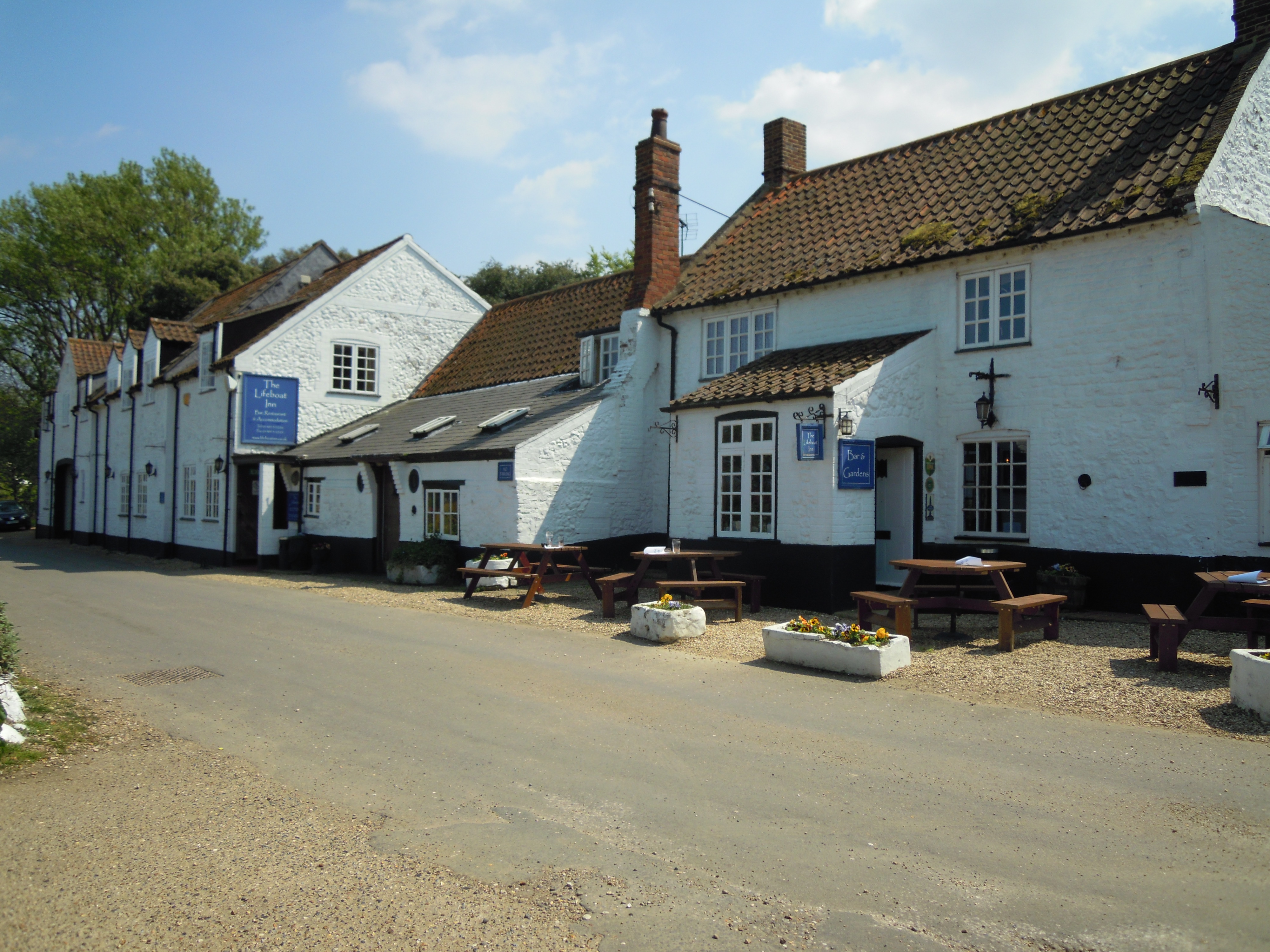
The Lifeboat Inn, Thornham

The Lifeboat Inn is a public house and inn in Ship Lane, Thornham, Norfolk, England. It lies near the wooded grounds of Thornham Manor. The white-painted...

Holme-next-the-Sea

Holme-next-the-Sea is a small village and civil parish in the English county of Norfolk. It is situated on the north Norfolk coast some 5 km north-east...

Thornham, Norfolk

Thornham is a village and civil parish in the English county of Norfolk. It is situated on the north Norfolk coast some 7 kilometres (4.3 mi) north-east...

Seahenge

Seahenge, also known as Holme I, was a prehistoric monument located in the village of Holme-next-the-Sea, near Old Hunstanton in the English county of...

Titchwell Marsh

Titchwell Marsh is an English nature reserve owned and managed by the Royal Society for the Protection of Birds (RSPB). Located on the north coast of the...

Nearby Amenities

Located within 500m of 52.974,0.556
Source: PGS
Lat/Long: 52.972241/0.5623986
Source: PGS
Lat/Long: 52.9727707/0.5629593
Source: PGS
Lat/Long: 52.9728193/0.5627857
Source: PGS
Lat/Long: 52.9722567/0.5625247
Source: PGS
Lat/Long: 52.9722567/0.5624564
Source: PGS
Lat/Long: 52.9722352/0.5625901
Source: PGS
Lat/Long: 52.9728039/0.5628122
Source: PGS
Lat/Long: 52.9728229/0.5627947
Source: Bing
Lat/Long: 52.9760883/0.5615851
Source: Bing
Lat/Long: 52.9760823/0.5608679
Source: Bing
Lat/Long: 52.9761039/0.559937
Source: Bing
Lat/Long: 52.9761054/0.5595515
Source: Bing
Lat/Long: 52.9760918/0.5589771
Source: Bing
Lat/Long: 52.9760579/0.5582703
Source: Bing
Lat/Long: 52.9759103/0.5559174
Source: Bing
Lat/Long: 52.9758866/0.5542959
Source: Bing
Lat/Long: 52.975863/0.5537854
Source: Bing
Lat/Long: 52.9758089/0.5530085
Source: Bing
Lat/Long: 52.9757948/0.5526956
Source: Bing
Lat/Long: 52.9757947/0.5519317
Source: Bing
Lat/Long: 52.9757778/0.550703
Source: Bing
Lat/Long: 52.9757627/0.5502915
Fixme: Where does FP 1 go from here?
Lat/Long: 52.9720284/0.5613242
Cafe
Outdoor Seating: yes
Lat/Long: 52.9741855/0.5525241
Information: visitor_centre
Operator: Norfolk Wildlife Trust
Tourism: information
Lat/Long: 52.9742348/0.5526019
The data included in this document is from www.openstreetmap.org. The data is made available under ODbL.

Have you been to Holme-Next-The-Sea?

Leave your review of Holme-Next-The-Sea below (or comments, questions and feedback).