Broad Water

Lake, Pool, Pond, Freshwater Marsh in Norfolk King's Lynn and West Norfolk

England

Broad Water

Norfolk Coast Path: Flaxley to Brancaster (4) Looking out into The Wash <span class="nowrap"><a title="https://en.wikipedia.org/wiki/The_Wash" rel="nofollow ugc noopener" href="https://en.wikipedia.org/wiki/The_Wash">Link</a><img style="margin-left:2px;" alt="External link" title="External link - shift click to open in new window" src="https://s1.geograph.org.uk/img/external.png" width="10" height="10"/></span>
Norfolk Coast Path: Flaxley to Brancaster (4) Credit: Basher Eyre

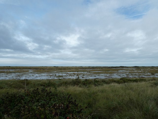
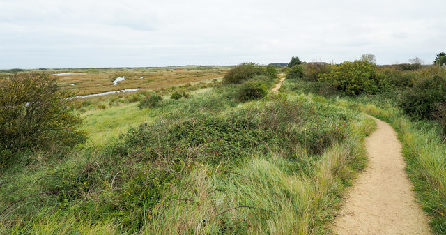
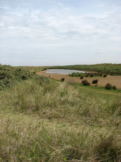
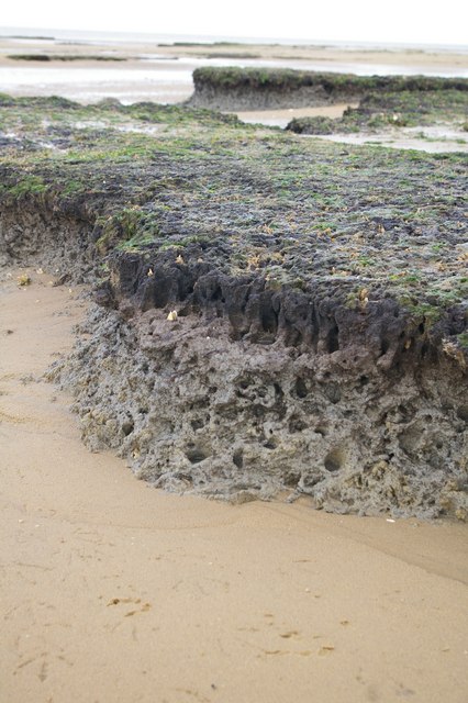
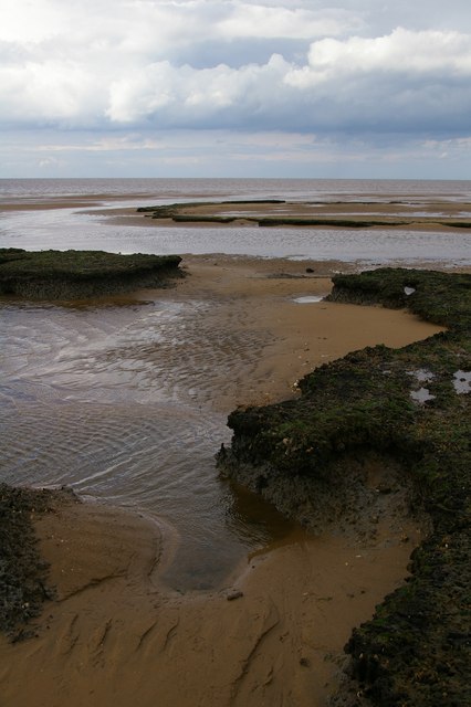
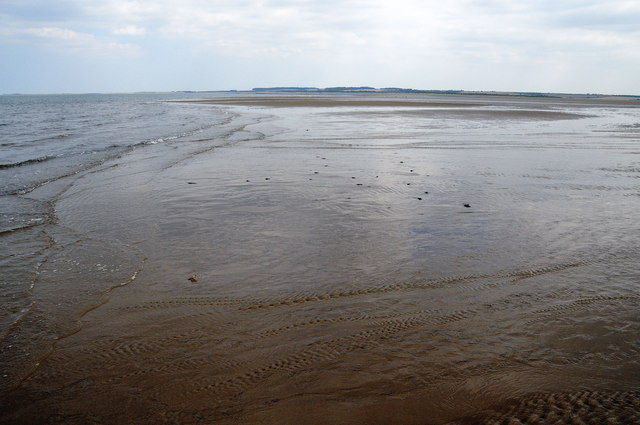
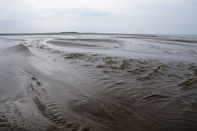
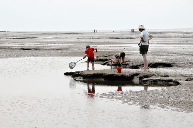
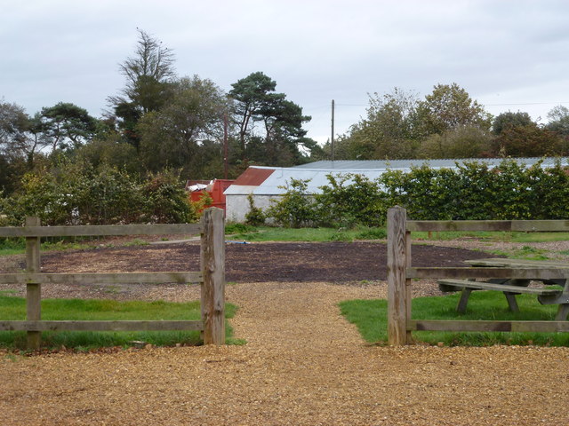
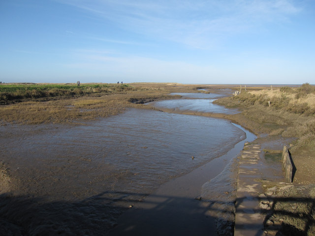
Broad Water is a picturesque body of water located in Norfolk, England. Known for its tranquil and idyllic setting, it comprises a combination of a lake, pool, pond, and freshwater marsh, creating a diverse and thriving ecosystem. The water body stretches over an area of approximately 20 hectares, making it a significant natural feature in the region.

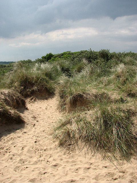
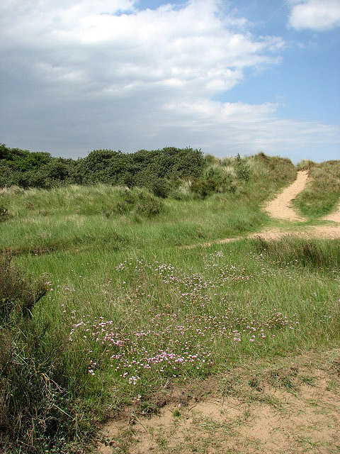
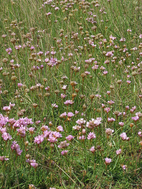
The lake itself is surrounded by lush vegetation, including reed beds, water lilies, and rushes, creating a haven for various species of birds, insects, and amphibians. This rich biodiversity attracts birdwatchers and nature enthusiasts from near and far. Visitors can often spot a wide range of waterfowl, such as swans, ducks, coots, and moorhens, as well as the occasional heron or kingfisher.

The pool and pond sections of Broad Water provide excellent opportunities for fishing, with a variety of fish species inhabiting the water, including carp, roach, perch, and tench. Anglers can enjoy a peaceful day casting their lines and trying to reel in a catch.

The freshwater marsh, located at the fringes of the water body, is a unique habitat that supports a variety of plants and animals adapted to wetland conditions. Common wetland flora, such as sedges, rushes, and willows, thrive here. This marshy area is a crucial breeding ground for amphibians, including frogs and toads, and provides essential foraging and nesting habitats for various bird species.

Overall, Broad Water offers a serene and natural setting for individuals seeking to immerse themselves in the beauty of the Norfolk countryside. Whether it's birdwatching, fishing, or simply enjoying the tranquility of the surroundings, this diverse water body provides an ideal spot for nature lovers and outdoor enthusiasts alike.

If you have any feedback on the listing, please let us know in the comments section below.
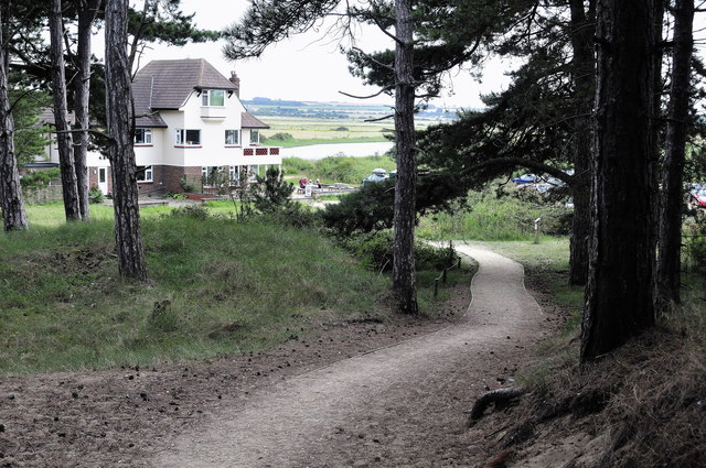
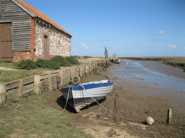
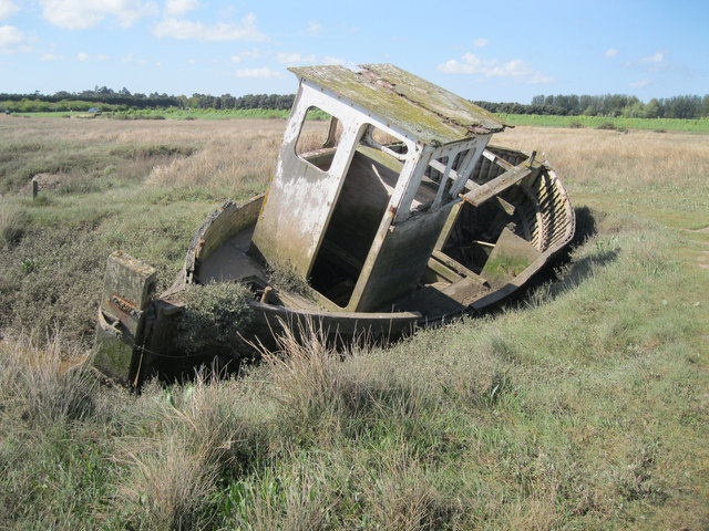
Broad Water Images

Images are sourced within 2km of 52.973876/0.55541416 or Grid Reference TF7144. Thanks to Geograph Open Source API. All images are credited.

Norfolk Coast Path: Flaxley to Brancaster (4) Looking out into The Wash <span class="nowrap"><a title="https://en.wikipedia.org/wiki/The_Wash" rel="nofollow ugc noopener" href="https://en.wikipedia.org/wiki/The_Wash">Link</a><img style="margin-left:2px;" alt="External link" title="External link - shift click to open in new window" src="https://s1.geograph.org.uk/img/external.png" width="10" height="10"/></span>
Norfolk Coast Path: Flaxley to Brancaster (4)
Looking out into The Wash LinkExternal link
North Norfolk Coast Path and Peddars Way Here, the two trails use the same stretch of path through sand dunes close to Holme next the Sea.
North Norfolk Coast Path and Peddars Way
Here, the two trails use the same stretch of path through sand dunes close to Holme next the Sea.
Blue tent On the beach near Holme next the Sea.
Blue tent
On the beach near Holme next the Sea.
Lake in a dip between two dunes In Holme Dunes National Nature Reserve.
Lake in a dip between two dunes
In Holme Dunes National Nature Reserve.
Path crossing ridge of dune In Holme Dunes National Nature Reserve.
Path crossing ridge of dune
In Holme Dunes National Nature Reserve.
Path through Holme Dunes National Nature Reserve The flowers seen in the foreground are sea thrift (Armeria maritima).
Path through Holme Dunes National Nature Reserve
The flowers seen in the foreground are sea thrift (Armeria maritima).
Sea thrift (Armeria maritima) Sea thrift occurs in the wild in coastal areas and is a common sight in British marshes, salt marshes and dune systems. The plant has a great copper-tolerance and thrives in soils with high copper concentrations. The British threepence coin issued between 1937 and 1952 had a design of thrift on the reverse.
Sea thrift (Armeria maritima)
Sea thrift occurs in the wild in coastal areas and is a common sight in British marshes, salt marshes and dune systems. The plant has a great copper-tolerance and thrives in soils with high copper concentrations. The British threepence coin issued between 1937 and 1952 had a design of thrift on the reverse.
Low water near Holme At low spring tide, the water retreats far enough to expose the sand in the corner of this gridsquare.
Low water near Holme
At low spring tide, the water retreats far enough to expose the sand in the corner of this gridsquare.
Strange spongy stuff After walking a mile or so across plain sand, I was rather surprised to find this black spongy substance on the edge of the (spring low) water.

According to Hugh Venables, it's peat formed in a freshwater environment during a period of lower (relative) sea levels between the end of the last glaciation (10000 years ago) and now. Sea levels rose after the ice melted and then the ground around here has been sinking since.
Strange spongy stuff
After walking a mile or so across plain sand, I was rather surprised to find this black spongy substance on the edge of the (spring low) water. According to Hugh Venables, it's peat formed in a freshwater environment during a period of lower (relative) sea levels between the end of the last glaciation (10000 years ago) and now. Sea levels rose after the ice melted and then the ground around here has been sinking since.
Peat, sea, and sand There's a large patch of old peat here just above the low water mark.  The sea can be seen a few tens of metres away.
Peat, sea, and sand
There's a large patch of old peat here just above the low water mark. The sea can be seen a few tens of metres away.
Harbour Channel, Near Thornham This was taken just about low tide. It was easily approached from the Holme NNR. It is looking towards Brancaster. This was a grid square I foolishly overlooked last year when I recorded one to the west of it.

The camera location was fixed using a Nikon GP-1 GPS unit attached to it.
Harbour Channel, Near Thornham
This was taken just about low tide. It was easily approached from the Holme NNR. It is looking towards Brancaster. This was a grid square I foolishly overlooked last year when I recorded one to the west of it. The camera location was fixed using a Nikon GP-1 GPS unit attached to it.
Harbour Channel, Near Thornham This was taken just about low tide. It was easily approached from the Holme NNR, from where I came.
 
The camera location was fixed using a Nikon GP-1 GPS unit attached to it.
Harbour Channel, Near Thornham
This was taken just about low tide. It was easily approached from the Holme NNR, from where I came. The camera location was fixed using a Nikon GP-1 GPS unit attached to it.
Exploring the beach, Holme next the Sea
Visitor Centre at Holme Dunes NNR This friendly visitor centre provides information for the national nature reserve at Holme Dunes - <span class="nowrap"><a title="http://www.norfolkwildlifetrust.org.uk/holme.aspx" rel="nofollow ugc noopener" href="http://www.norfolkwildlifetrust.org.uk/holme.aspx">Link</a><img style="margin-left:2px;" alt="External link" title="External link - shift click to open in new window" src="https://s1.geograph.org.uk/img/external.png" width="10" height="10"/></span>
Visitor Centre at Holme Dunes NNR
This friendly visitor centre provides information for the national nature reserve at Holme Dunes - LinkExternal link
Thornham Quay Leisure craft and a few fishing vessels use this creek, but access is only possible at or close to high water.
Thornham Quay
Leisure craft and a few fishing vessels use this creek, but access is only possible at or close to high water.
Wreck at Thornham This old boat is lying on marshland close to the quay at Thornham.
Wreck at Thornham
This old boat is lying on marshland close to the quay at Thornham.
The Yurt at Thornham - It's Gone !!! In true nomadic style the Yurt restaurant has been packed away and is currently awaiting erection elsewhere.  <a title="https://www.geograph.org.uk/photo/1912616" href="https://www.geograph.org.uk/photo/1912616">Link</a>
The Yurt at Thornham - It's Gone !!!
In true nomadic style the Yurt restaurant has been packed away and is currently awaiting erection elsewhere. Link
Saltmarsh creek, Thornham Looking from the sluice <a href="https://www.geograph.org.uk/photo/847507">TF7244 : Thornham Staithe</a>.
Saltmarsh creek, Thornham
Looking from the sluice TF7244 : Thornham Staithe.
Show me another place!

Broad Water is located at Grid Ref: TF7144 (Lat: 52.973876, Lng: 0.55541416)

Administrative County: Norfolk

District: King's Lynn and West Norfolk

Police Authority: Norfolk

What 3 Words

///coats.sailed.skim. Near Hunstanton, Norfolk

Related Wikis

Holme Dunes

Holme Dunes is a 192-hectare (470-acre) nature reserve near Holme-next-the-Sea in Norfolk. It is managed by the Norfolk Wildlife Trust, and is a National...

River Hun

The River Hun is in the west of the county of Norfolk, in England. Its source is in the grounds of Hunstanton Park. Its mouth can be found on the North...

St Mary's Church, Holme-next-the-Sea

St Mary's Church is the parish church of Holme-next-the-Sea in the English county of Norfolk. It is dedicated to the Virgin Mary. The church is partly...

Holme-next-the-Sea

Holme-next-the-Sea is a small village and civil parish in the English county of Norfolk. It is situated on the north Norfolk coast some 5 km north-east...

The Lifeboat Inn, Thornham

The Lifeboat Inn is a public house and inn in Ship Lane, Thornham, Norfolk, England. It lies near the wooded grounds of Thornham Manor. The white-painted...

Thornham, Norfolk

Thornham is a village and civil parish in the English county of Norfolk. It is situated on the north Norfolk coast some 7 kilometres (4.3 mi) north-east...

Seahenge

Seahenge, also known as Holme I, was a prehistoric monument located in the village of Holme-next-the-Sea, near Old Hunstanton in the English county of...

Titchwell Marsh

Titchwell Marsh is an English nature reserve owned and managed by the Royal Society for the Protection of Birds (RSPB). Located on the north coast of the...

Nearby Amenities

Located within 500m of 52.973876,0.55541416
Source: Bing
Lat/Long: 52.9760883/0.5615851
Source: Bing
Lat/Long: 52.9760823/0.5608679
Source: Bing
Lat/Long: 52.9761039/0.559937
Source: Bing
Lat/Long: 52.9761054/0.5595515
Source: Bing
Lat/Long: 52.9760918/0.5589771
Source: Bing
Lat/Long: 52.9760579/0.5582703
Source: Bing
Lat/Long: 52.9759103/0.5559174
Source: Bing
Lat/Long: 52.9758866/0.5542959
Source: Bing
Lat/Long: 52.975863/0.5537854
Source: Bing
Lat/Long: 52.9758089/0.5530085
Source: Bing
Lat/Long: 52.9757948/0.5526956
Source: Bing
Lat/Long: 52.9757947/0.5519317
Source: Bing
Lat/Long: 52.9757778/0.550703
Source: Bing
Lat/Long: 52.9757627/0.5502915
Source: Bing
Lat/Long: 52.9756808/0.5490517
Fixme: Where does FP 1 go from here?
Lat/Long: 52.9720284/0.5613242
Cafe
Outdoor Seating: yes
Lat/Long: 52.9741855/0.5525241
Information: visitor_centre
Operator: Norfolk Wildlife Trust
Tourism: information
Lat/Long: 52.9742348/0.5526019
The data included in this document is from www.openstreetmap.org. The data is made available under ODbL.

Have you been to Broad Water?

Leave your review of Broad Water below (or comments, questions and feedback).