Big Lake
Lake, Pool, Pond, Freshwater Marsh in Sussex Rother
England
Big Lake

Big Lake, Sussex, is a picturesque freshwater body located in the heart of Sussex County, England. Covering an area of approximately 50 acres, this natural gem offers a diverse range of aquatic habitats, including a lake, pool, pond, and freshwater marsh, making it a haven for various plant and animal species.
The main attraction of Big Lake is its expansive lake, which stretches for about 30 acres. The calm and crystal-clear waters of the lake provide an ideal environment for various water-based activities such as kayaking, paddleboarding, and fishing. Anglers can be seen casting their lines in search of prized catches like pike, perch, and carp.
Adjacent to the lake is a smaller pool, offering a more intimate and secluded setting. It is a perfect spot for those seeking tranquility and a chance to observe the local birdlife. The pool is a favorite among birdwatchers, as it attracts a wide variety of waterfowl and wading birds, including herons, swans, and ducks.
A smaller pond, nestled amidst lush vegetation, adds to the charm of Big Lake. It supports a rich aquatic ecosystem, with a plethora of aquatic plants and small fish. Visitors can witness dragonflies gracefully skimming the water's surface and observe frogs and newts inhabiting the pond's edges.
Lastly, the freshwater marsh surrounding the lake provides a vital habitat for many wetland species. Here, visitors can spot reed beds, sedge meadows, and other marshland vegetation. This habitat supports a range of wildlife, including marsh harriers, bearded tits, and various species of butterflies.
Overall, Big Lake, Sussex, is a diverse and thriving ecosystem, encompassing a lake, pool, pond, and freshwater marsh. It offers a unique opportunity for visitors to immerse themselves in nature, observe diverse wildlife, and engage in a variety of recreational activities.
If you have any feedback on the listing, please let us know in the comments section below.
Big Lake Images
Images are sourced within 2km of 50.899819/0.43891757 or Grid Reference TQ7113. Thanks to Geograph Open Source API. All images are credited.


Big Lake is located at Grid Ref: TQ7113 (Lat: 50.899819, Lng: 0.43891757)
Administrative County: East Sussex
District: Rother
Police Authority: Sussex
What 3 Words
///drew.chestnuts.schematic. Near Ninfield, East Sussex
Nearby Locations
Related Wikis

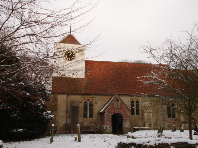
Catsfield
Catsfield is a village and civil parish in the Rother district of East Sussex, England. It is located six miles (9.7 km) north of Bexhill, and three miles...
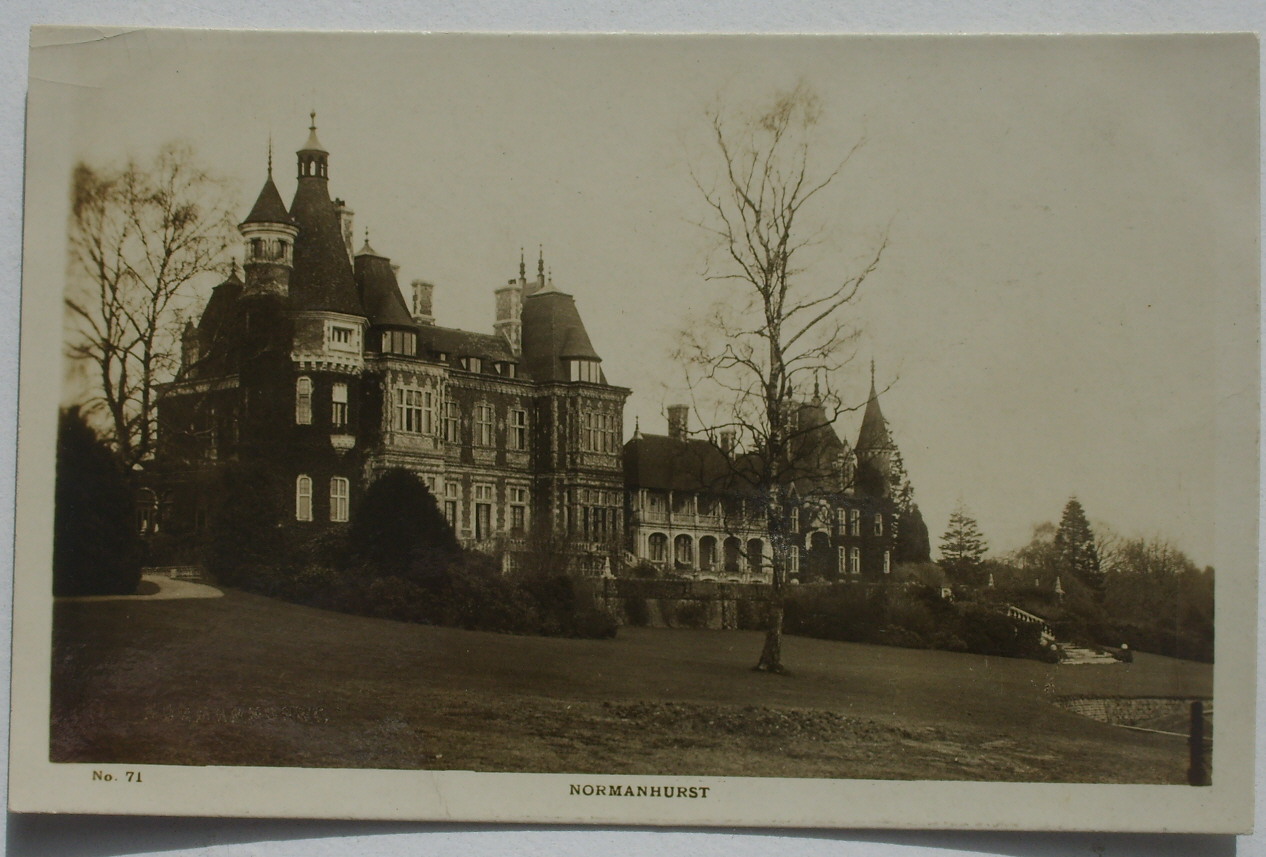
Normanhurst Court
Normanhurst Court was a large manor house in the village of Catsfield in East Sussex. == History == The building of the house was initiated by Thomas Brassey...

Ashburnham Park
Ashburnham Park is a 109.9-hectare (272-acre) biological Site of Special Scientific Interest north-west of Hastings in East Sussex. It is a Nature Conservation...
Ninfield
Ninfield is a village and civil parish in the Wealden District of East Sussex, England. The village is quite linear and centred 4 miles (6.4 km) north...

Bexhill and Battle (UK Parliament constituency)
Bexhill and Battle () is a constituency in East Sussex represented in the House of Commons of the UK Parliament since 2015 by Huw Merriman of the Conservative...

Claverham Community College
Claverham Community College is a comprehensive secondary school/community college in Battle, East Sussex, England. It has sports facilities such as a climbing...
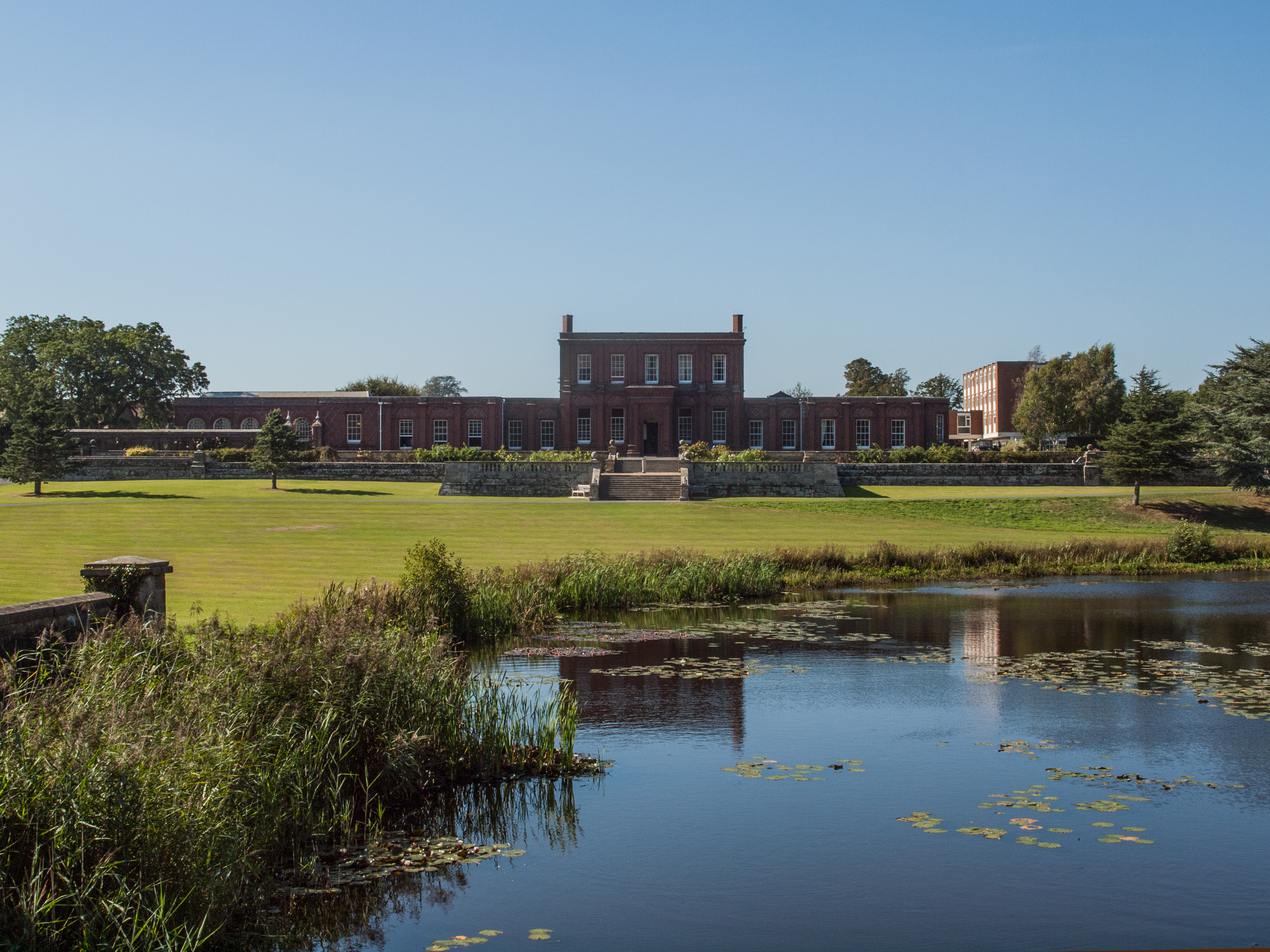
Ashburnham Place
Ashburnham Place is an English country house, now used as a Christian conference and prayer centre, five miles west of Battle, East Sussex. It was one...

Penhurst
Penhurst is a village and civil parish, sharing a parish council with neighbouring Ashburnham, in the Rother district of East Sussex, England. It is located...
Nearby Amenities
Located within 500m of 50.899819,0.43891757Have you been to Big Lake?
Leave your review of Big Lake below (or comments, questions and feedback).