Holmepark Fell

Heritage Site in Westmorland

England

Holmepark Fell

Cattle grazing near Holme Park Quarry
Cattle grazing near Holme Park Quarry Credit: Eirian Evans

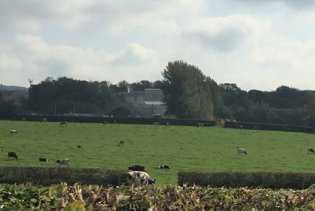
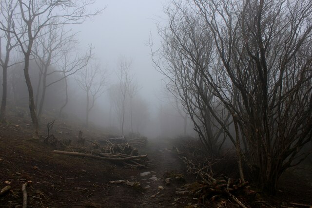
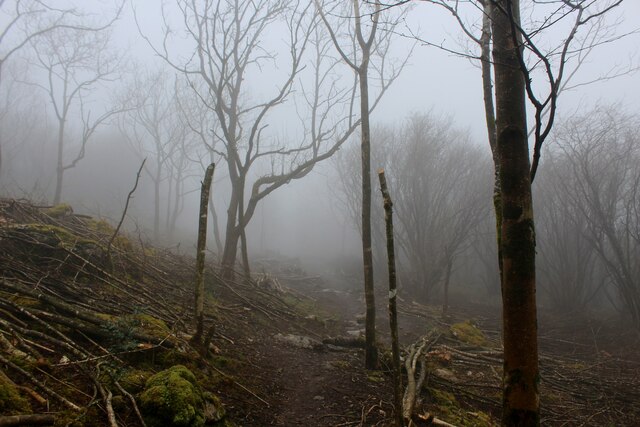
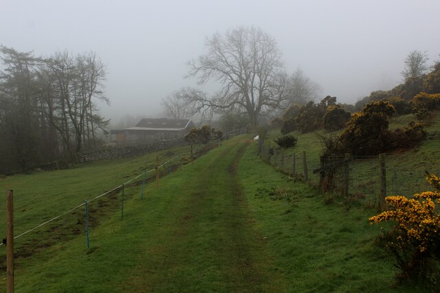
Holmepark Fell, located in Westmorland, is a significant heritage site with a rich history and natural beauty. This stunning fell is situated in the Lake District National Park in Cumbria, England. Spanning an area of approximately 120 hectares, it offers visitors a diverse range of landscapes, including woodlands, meadows, and rocky outcrops.

The fell is known for its exceptional views of the surrounding countryside, including the picturesque valleys of Borrowdale and the Langdale Pikes. Its elevated position also allows visitors to appreciate stunning vistas of Lake Windermere and the nearby fells of the Lake District.

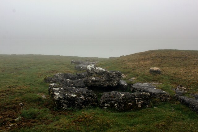
Holmepark Fell has a fascinating history that dates back centuries. The area was once utilized for grazing and farming, but it also played a significant role during the Industrial Revolution. The fell was home to several lead mines, with evidence of these operations still visible today. Visitors can explore the remnants of mine buildings and witness the historical impact of mining in this region.

In addition to its historical significance, Holmepark Fell is a haven for wildlife enthusiasts. The fell is home to a wide variety of flora and fauna, including rare and protected species. Visitors can spot red squirrels, deer, and a plethora of bird species, making it a hotspot for nature lovers.

With its combination of natural beauty, historical legacy, and diverse wildlife, Holmepark Fell is a must-visit destination for those seeking an immersive experience in the stunning Lake District.

If you have any feedback on the listing, please let us know in the comments section below.

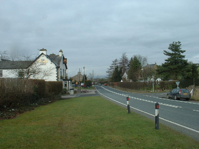
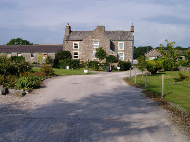
Holmepark Fell Images

Images are sourced within 2km of 54.209/-2.702 or Grid Reference SD5479. Thanks to Geograph Open Source API. All images are credited.

Cattle grazing near Holme Park Quarry
B6384 bridge  - M6 northbound
B6384 bridge - M6 northbound
Felled Forestry Operation on Misty Uberash Plain Thick mist gives an eerie edge to forestry operations on the northern edge of Hutton Roof Crags
Felled Forestry Operation on Misty Uberash Plain
Thick mist gives an eerie edge to forestry operations on the northern edge of Hutton Roof Crags
Thick Mist on Uberash Plain Forestry operations in motion on the northern edge of Hutton Roof Crags
Thick Mist on Uberash Plain
Forestry operations in motion on the northern edge of Hutton Roof Crags
Limestone Outcrops by Newbiggin Crags Swirling mist descended on the grassy slopes, interspersed with outcrops of limestone
Limestone Outcrops by Newbiggin Crags
Swirling mist descended on the grassy slopes, interspersed with outcrops of limestone
Faint Limestone Track on Newbiggin Crags The track quickly disappears into swirling mist
Faint Limestone Track on Newbiggin Crags
The track quickly disappears into swirling mist
Limestone Outcrops on Newbiggin Crags Swirling mist sweeps over a limestone landscape
Limestone Outcrops on Newbiggin Crags
Swirling mist sweeps over a limestone landscape
Whin Yeats Bridleway running through the dairy farm at Whin Yeats
Whin Yeats
Bridleway running through the dairy farm at Whin Yeats
Bridleway approaching Whin Yeats from the North Swirling mist almost obscures the approaching farm buildings
Bridleway approaching Whin Yeats from the North
Swirling mist almost obscures the approaching farm buildings
Newbiggin Hamlet nestling in the shadows of Newbiggin Crags
Newbiggin
Hamlet nestling in the shadows of Newbiggin Crags
Footpath through Curwen Woods The first part of the walk goes through open parkland with mature trees.
Footpath through Curwen Woods
The first part of the walk goes through open parkland with mature trees.
Holme 2010 A fine pictorial stone, supplied by the local quarry and presented by the village WI, welcomes visitors to Holme village.
Holme 2010
A fine pictorial stone, supplied by the local quarry and presented by the village WI, welcomes visitors to Holme village.
The M6 near Holme Looking northwards along this busy main route near Holme village.
The M6 near Holme
Looking northwards along this busy main route near Holme village.
Lancaster Canal view Looking northwards towards Holme Park Bridge. The canal is quite overgrown here, making it a useful wildlife site.
Lancaster Canal view
Looking northwards towards Holme Park Bridge. The canal is quite overgrown here, making it a useful wildlife site.
Holme Warehouse Bridge Bridge number 151 on the Lancaster Canal, viewed in late April with a showing of dandelions beside the towpath.
Holme Warehouse Bridge
Bridge number 151 on the Lancaster Canal, viewed in late April with a showing of dandelions beside the towpath.
Pear Tree Park Smart new housing on the north side of Holme village.
Pear Tree Park
Smart new housing on the north side of Holme village.
Old Milestone Marker 11-46 F (between bridges 151-150), Lancaster Canal Old Milestone located by the side of the Lancaster Canal.
This Milestone is 46 Miles from the centre of Preston and 11 Miles from Kendal.

Inscription reads:- 
16 :: 11 
(Miles from Lancaster and Kendal respectively)

Milestone Society National ID: LAN-46 

This is a Grade II Listed Milestone
<span class="nowrap"><a title="https://historicengland.org.uk/listing/the-list/list-entry/1281050?section=official-list-entry" rel="nofollow ugc noopener" href="https://historicengland.org.uk/listing/the-list/list-entry/1281050?section=official-list-entry">Link</a><img style="margin-left:2px;" alt="External link" title="External link - shift click to open in new window" src="https://s1.geograph.org.uk/img/external.png" width="10" height="10"/></span>
Old Milestone Marker 11-46 F (between bridges 151-150), Lancaster Canal
Old Milestone located by the side of the Lancaster Canal. This Milestone is 46 Miles from the centre of Preston and 11 Miles from Kendal. Inscription reads:- 16 :: 11 (Miles from Lancaster and Kendal respectively) Milestone Society National ID: LAN-46 This is a Grade II Listed Milestone LinkExternal link
Winch point between Milestones 11-46 and 12-45, Lancaster Canal Winch point by the side of the Lancaster Canal.

If you know of any others (see my profile for those I have seen) I would be very grateful to hear from you.
Winch point between Milestones 11-46 and 12-45, Lancaster Canal
Winch point by the side of the Lancaster Canal. If you know of any others (see my profile for those I have seen) I would be very grateful to hear from you.
Show me another place!

Holmepark Fell is located at Grid Ref: SD5479 (Lat: 54.209, Lng: -2.702)

Administrative County: Cumbria

Police Authority: Cumbria

What 3 Words

///feast.increment.fabricate. Near Milnthorpe, Cumbria

Nearby Locations

Holmepark Fell

Related Wikis

Farleton, Cumbria

Farleton is a village and former civil parish, now in the parish of Beetham, in the South Lakeland local government district, Cumbria, England. In 1931...

Holme, Cumbria

Holme is a village and civil parish in the South Lakeland district of Cumbria, England, about 2 miles (3.2 km) north of Burton-in-Kendal and 3 miles (4...

Lupton, Cumbria

Lupton is a linear village and civil parish in the South Lakeland district of Cumbria, England, along the main A65 road north west of Kirkby Lonsdale,...

Clawthorpe

Clawthorpe is a hamlet in the South Lakeland district, in the county of Cumbria, England. It is near the village of Burton-in-Kendal and the town of Kendal...

Related Videos

Solo Farleton fell run in Cumbria - Of treeless hills and the morden world without any saints

Farleton Fell, Cumbria, 5 miles, 1100 ft elevation solo trail run 13 August 2023, Sunday Strava route: ...

Scout Hill 50th Trig

Thanks again for joining us. This was the 50th trig in aid of 1st hoghton Scouts 50th anniversary. Unfortunately Trudi had a ...

Hike around Hutton Roof National Nature Reserve (Audio Description Version)

This is the first area from our trip to visit family in The Lake District (Cumbria), we visit Hutton Roof National Nature Reserve for an ...

Nearby Amenities

Located within 500m of 54.209,-2.702
Holmepark Fell
Place: locality
Lat/Long: 54.2082561/-2.702545
The data included in this document is from www.openstreetmap.org. The data is made available under ODbL.

Have you been to Holmepark Fell?

Leave your review of Holmepark Fell below (or comments, questions and feedback).